Illustrated guide · Sicily
One earthquake
two ways to rebuild
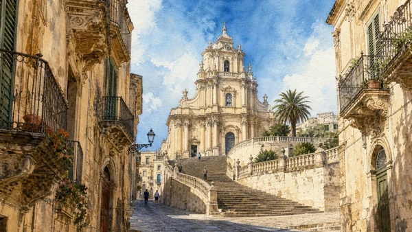
Ten places through which to read Ragusa as a divided and connected city: medieval Ibla, planned Superiore, Baroque churches and palaces, bridges, stairways and ravines.
Explore the placesA city that answered catastrophe twice
Ragusa cannot be understood from Ibla alone.
After the earthquake of 1693, part of the community rebuilt among the steep streets of the older promontory while another part established a more regular city on the plateau above. Parishes, families and institutions chose different ground, and the dispute became architecture.
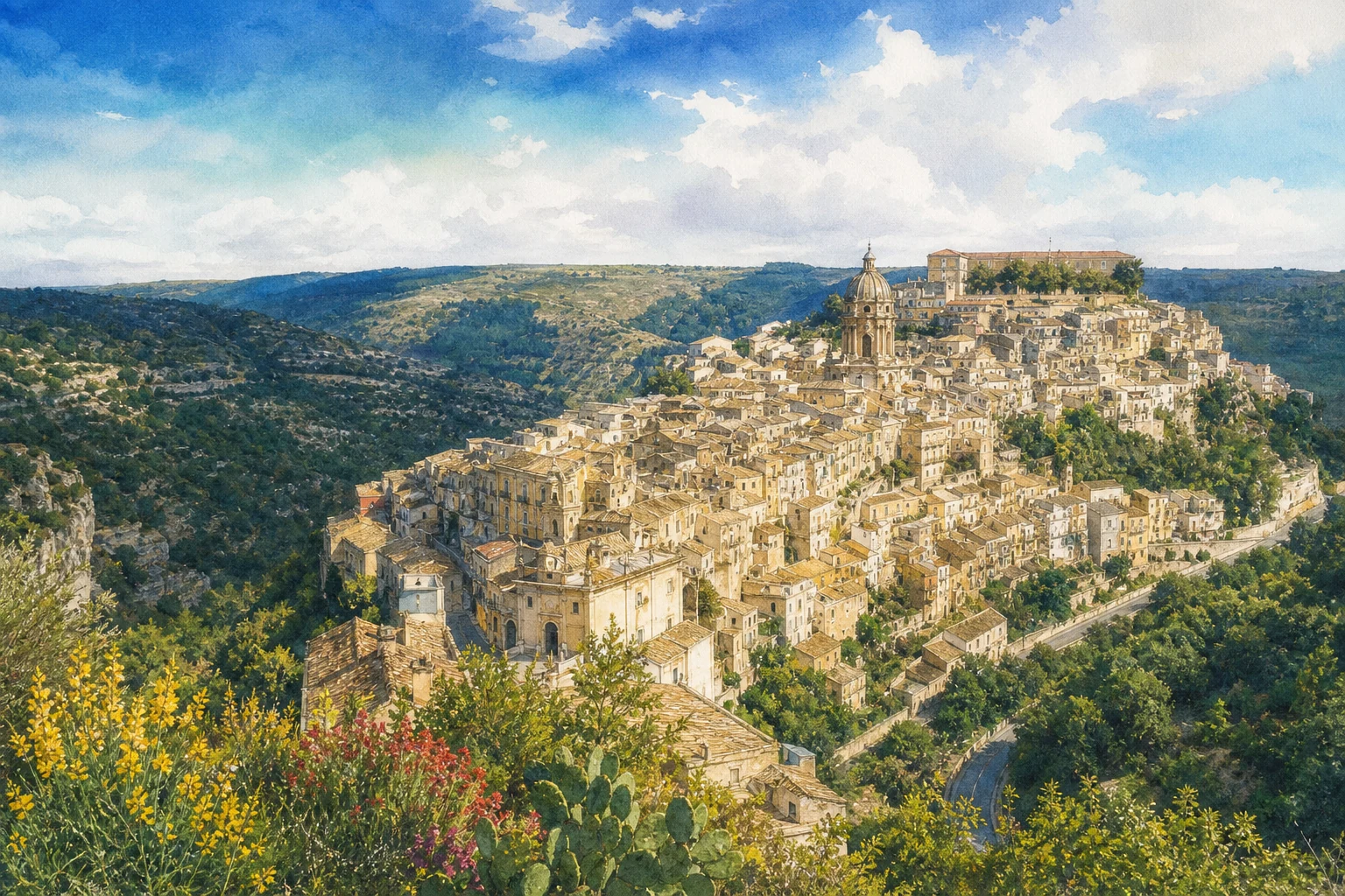
The result is not simply an old town below and a new town above. Stairways, churches, palaces and intermediate neighbourhoods occupy the slopes between them; bridges cross the quarries that constrained later growth; views continually reverse which centre appears dominant.
Ragusa's beauty lies in this difficult union: two reconstructions kept in tension by limestone ridges and daily movement.
One destination
Ragusa,
two centres in one landscape.
UNESCO recognises Ragusa within the serial property of the Late Baroque Towns of the Val di Noto. Its response to the 1693 earthquake differed from Noto's complete relocation: Ragusa combined reconstruction in and around the historic settlement with a new centre on higher ground. The whole urban relationship matters, even though the eighteen buildings traditionally presented by the Municipality provide the most concentrated Baroque evidence.
Ibla occupies a compact spur above the San Leonardo and Santa Domenica valleys. Ragusa Superiore extends across the plateau to the west. Between them, Santa Maria delle Scale, the Purgatorio, the Itria complex and a chain of aristocratic residences create a vertical hinge. A complete route must therefore include descent and ascent, not merely a circuit around Piazza Duomo.
The selection
Ten places,
two urban answers
The route starts at the belvedere between upper and lower Ragusa, enters the new plateau centre, crosses its palaces and bridges, descends through the intermediate Baroque quarter and follows Ibla's principal axis from the Duomo to the garden and the surviving portal of the medieval mother church.
- 01Santa Maria delle Scale and the Belvedere
- 02Ragusa Superiore and the Cathedral of San Giovanni Battista
- 03Palazzo Zacco, Palazzo Bertini and the Upper Baroque Streets
- 04The Santa Domenica Ravine and Ragusa's Bridges
- 05Piazza della Repubblica and the Anime Sante del Purgatorio
- 06Santa Maria dell'Itria, Palazzo Cosentini and the Cancelleria
- 07Palazzo La Rocca and the Ascent to Piazza Duomo
- 08The Duomo of San Giorgio
- 09San Giuseppe, Palazzo Battaglia and Ibla's Eastern Axis
- 10Giardino Ibleo and the Old San Giorgio Portal
The hinge from which both cities become visible
Santa Maria delle Scale and the Belvedere
A church rebuilt around medieval fragments stands above the stair route connecting Ragusa Superiore to Ibla.

The place today
Santa Maria delle Scale occupies the edge of the upper city where streets begin to descend toward Ibla. Its church preserves a Gothic-Catalan portal and other elements within a largely post-earthquake structure. Beside it, the stepped route and viewpoints reveal the tightly packed roofs of Ibla, the dome of San Giorgio, the quarry slopes and the elevation difference separating the two centres.
The historical chapter
A medieval church stood here before 1693 and retained substantial elements after the earthquake. Reconstruction altered its orientation and form while preserving older portals and chapels, making the building a physical record of continuity rather than a wholly new Baroque work. Its position gained new meaning once Ragusa Superiore expanded above and Ibla rebuilt below: the church and stair became a threshold between competing centres.
What to notice
- Gothic-Catalan carving embedded within later masonry
- The dome and façade of San Giorgio occupying different positions in the Ibla skyline
- Stairs, switchbacks and landings translating a major height difference into urban space
The new plateau city organised around another mother church
Ragusa Superiore and the Cathedral of San Giovanni Battista
San Giovanni anchors the post-earthquake centre created by the community that chose to build above Ibla.

The place today
The cathedral faces a broad elevated churchyard in the regular streets of Ragusa Superiore. Its richly carved façade is asymmetrical because only the left bell tower was completed; sundials and statues articulate the upper levels. Inside, dark pitchstone columns and pale stone details organise three naves, while nearby civic and ecclesiastical buildings make the piazza an institutional centre rather than an isolated monument.
The historical chapter
The parish of San Giovanni established a new settlement on the Patro plateau after 1693, crystallising the division from the community of San Giorgio in Ibla. The present church began in 1718 and was consecrated in 1778. When Ragusa became a diocesan seat in 1950, San Giovanni became the cathedral. The building therefore represents both the eighteenth-century rivalry of the two centres and their modern reorganisation within one city.
What to notice
- The single completed bell tower and the façade's resulting asymmetry
- Local black pitchstone used against pale limestone inside and around the churchyard
- The plateau grid allowing a different public scale from Ibla's steep piazzas
Aristocratic façades within the planned city
Palazzo Zacco, Palazzo Bertini and the Upper Baroque Streets
Balconies, masks and sculpted portals show that architectural display was not confined to Ragusa Ibla.

The place today
Palazzo Zacco stands out for corner balconies carried by fantastic figures, musicians and masks, while Palazzo Bertini is known for three carved heads traditionally read as representatives of different social types. Both belong to active upper-city streets rather than a preserved palace precinct. Traffic, later shopfronts and changed interiors place the Baroque stonework inside an evolving urban fabric.
The historical chapter
Noble families invested in the new plateau centre as it acquired administrative and commercial weight. Residences adapted the common language of projecting balconies, iron railings and carved limestone supports to particular family identities. Palazzo Bertini began in the late eighteenth century and was altered when street alignments changed; Palazzo Zacco also reflects later ownership and use. Their UNESCO recognition concerns surviving architectural quality, not the idea that every interior remains fixed in its first phase.
What to notice
- Human and fantastic heads placed beneath balconies at the pedestrian's eye line
- Corner compositions designed to be read while turning through the street
- Later doors, functions and road levels revealing the buildings' continued urban life

Modern engineering crosses the geology that shaped the city
The Santa Domenica Ravine and Ragusa's Bridges
Three urban bridges demonstrate how Ragusa expanded beyond the plateau while remaining defined by its deep quarries.

The place today
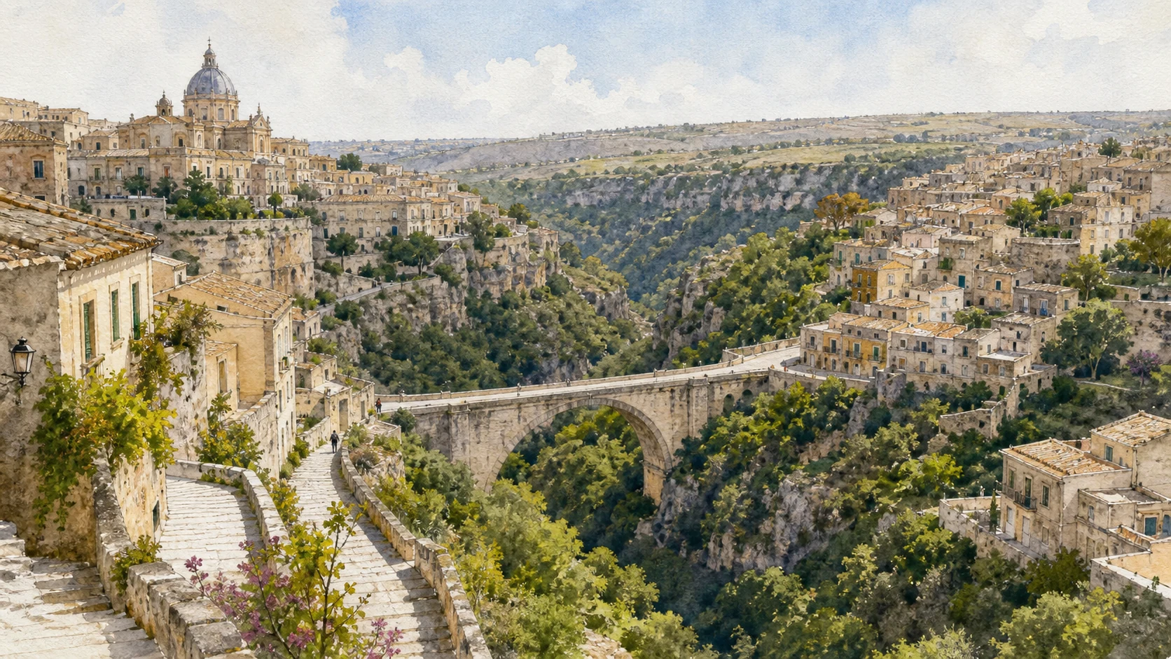
Ponte dei Cappuccini, Ponte Nuovo and Ponte Papa Giovanni XXIII cross the Santa Domenica ravine at different points and heights. From their approaches, roads, apartment blocks, gardens and exposed limestone reveal the twentieth-century city that surrounds the historic cores. The ravine is not an empty scenic gap: it contains paths, vegetation, retaining works and water-management structures.
The historical chapter
The Hyblaean plateau is cut by cave, the local name for deep valleys eroded through limestone. Those landforms protected and constrained older Ragusa but became obstacles as the upper city expanded. The first major bridge, known as Ponte Vecchio or Ponte dei Cappuccini, opened in the nineteenth century; later bridges carried growing traffic and new neighbourhoods. Their sequence records the transition from a two-centre Baroque city to a broader provincial capital.
What to notice
- Different arch, deck and pier systems corresponding to separate construction periods
- The quarry's exposed limestone and vegetation beneath ordinary urban movement
- How roads continue the plateau grid across terrain that once ended it
The lower threshold where descent becomes a Baroque composition
Piazza della Repubblica and the Anime Sante del Purgatorio
A church raised above the valley road marks the entry into the intermediate district between Superiore and Ibla.

The place today
The church of the Anime Sante del Purgatorio rises on a high stair above Piazza della Repubblica, traditionally called Piazza degli Archi. The valley road, supporting walls and the slope toward Ibla create a compressed setting quite different from Piazza Duomo. Its three-part façade and elevated position turn difficult ground into a formal entrance to the lower historic city.
The historical chapter
The church survived the earthquake better than many buildings and was then enlarged and reshaped during the eighteenth century. Its site became central as new circulation routes linked the upper settlement to reconstructed Ibla. The district around it gathered churches and palaces serving families who remained close to the older centre. The resulting Baroque landscape was not drawn on empty land; it inserted new façades into steep inherited streets and retaining structures.
What to notice
- The long stair separating the church entrance from moving traffic below
- Arches, walls and road levels revealing repeated adjustments to the valley crossing
- The first close views of Ibla appearing beyond a relatively enclosed piazza
A concentrated Baroque quarter on the connecting slope
Santa Maria dell'Itria, Palazzo Cosentini and the Cancelleria
A coloured bell tower and richly carved balconies transform the steep intermediary streets into one of Ragusa's densest ensembles.

The place today
The blue-patterned dome of the Itria bell tower rises above a church whose façade opens onto a confined slope. Nearby, Palazzo Cosentini projects balconies supported by musicians, grotesques and figures; Palazzo della Cancelleria adds another formal civic-residential front. Stairs and narrow turns mean the buildings are encountered as fragments before they can be assembled mentally into one quarter.
The historical chapter
The Itria church belonged to the Knights of Malta and was rebuilt after 1693 while preserving the importance of its pre-earthquake institution. From the 1740s, Palazzo Cosentini, the Purgatorio complex, the Cancelleria and later Palazzo Sortino Trono consolidated the zone between the two centres. This was a strategic social choice: aristocratic and religious patrons transformed a difficult slope into a prestigious connective district rather than abandoning it as leftover ground.
What to notice
- The Itria tower's coloured ceramic surface against otherwise pale limestone
- Narrative balcony corbels at Palazzo Cosentini viewed from steep low angles
- Short sightlines that make façades reveal themselves one bay at a time
Balconies and angled streets prepare the cathedral reveal
Palazzo La Rocca and the Ascent to Piazza Duomo
The approach to San Giorgio is choreographed through aristocratic architecture rather than a straight ceremonial avenue.

The place today
Via Capitano Bocchieri rises toward Piazza Duomo beside the long façade of Palazzo La Rocca. Its series of balconies rests on individually carved supports showing musicians, masks and fantastic figures. Because the street meets the piazza obliquely, the cathedral tower appears gradually above roofs and façades; the visitor does not receive a frontal view until entering the wider space.
The historical chapter
The La Rocca family commissioned the palace during Ibla's eighteenth-century rebuilding, close to the new site selected for San Giorgio. The residence participated in the creation of an aristocratic axis around the Duomo, where façades framed approach, procession and family status. Its decoration belongs to the same local culture of carved balcony corbels seen elsewhere in Ragusa, yet the long street placement gives it a specifically sequential role.
What to notice
- Different carved figures supporting balconies along one extended façade
- The cathedral appearing off-axis rather than at the end of a straight street
- Changes in paving and building line as the narrow approach opens into the piazza

Ibla's new mother church as tower, staircase and urban focus
The Duomo of San Giorgio
Rosario Gagliardi's façade transforms an oblique site into the dominant architectural image of rebuilt Ibla.

The place today
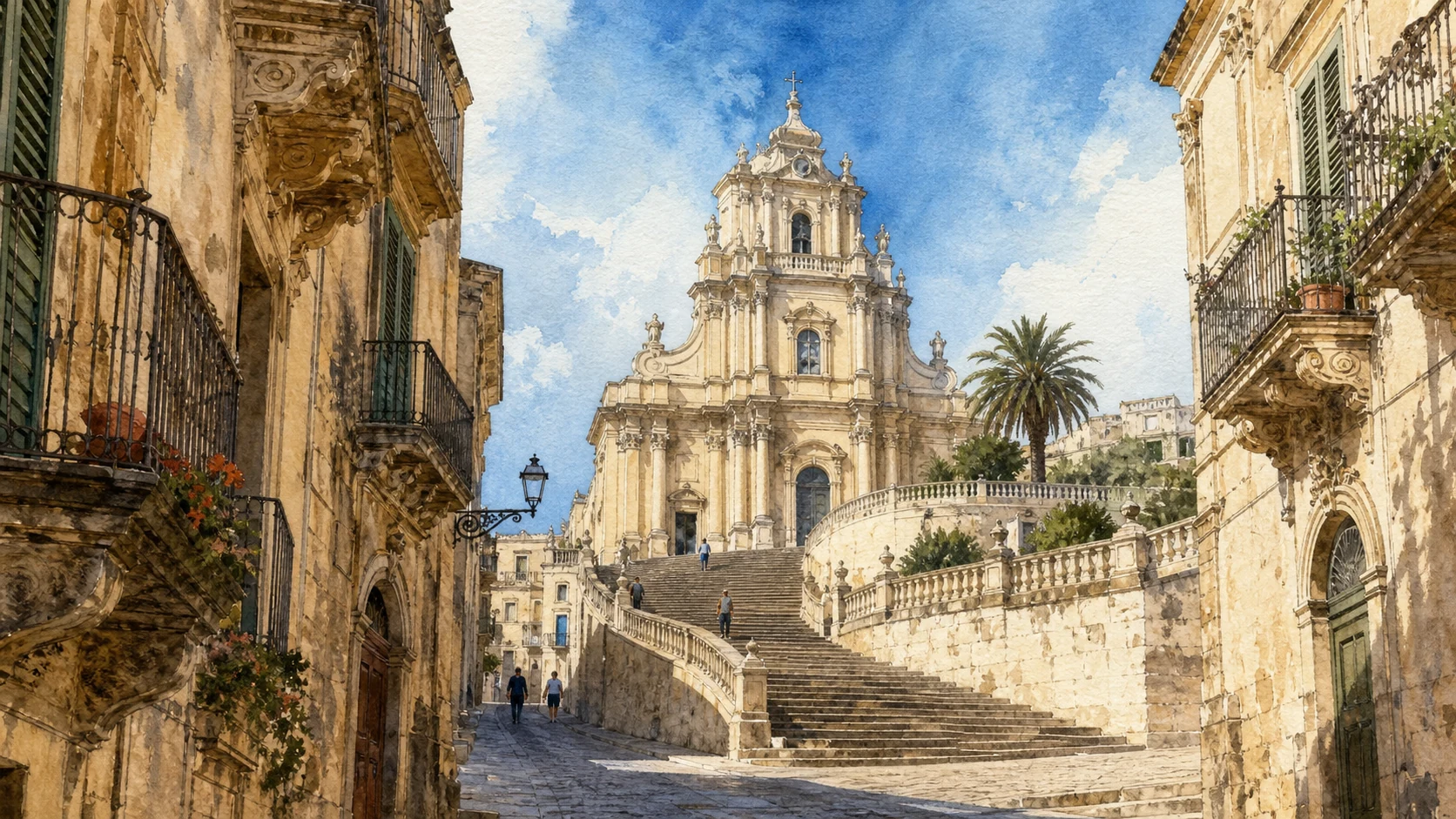
A broad flight of steps lifts the Duomo above Piazza Duomo. The façade rises as a convex central tower in three narrowing levels, joined by volutes and free columns; the neoclassical dome stands farther back above the crossing. Inside, three naves hold sculpture, paintings, a Serassi organ and works transferred or commissioned across several centuries. The façade and dome must be read as separate phases.
The historical chapter
The medieval mother church of San Giorgio stood near today's Giardino Ibleo and was largely destroyed in 1693. Its replacement moved to a more central site in Ibla. The first stone was laid in 1739 following Rosario Gagliardi's design; the façade was completed in 1775 and interior carving continued into the 1780s. Carmelo Cultraro's neoclassical dome was added in 1820. Moving the church re-centred the old city and expressed its independence from San Giovanni above.
What to notice
- The façade's slight convexity and free columns deepening shadow as it narrows upward
- Its deliberate oblique angle to the piazza and long approach
- The later dome rising behind rather than forming part of Gagliardi's façade-tower
Church and palace shape the route from the Duomo toward the garden
San Giuseppe, Palazzo Battaglia and Ibla's Eastern Axis
A second Gagliardi church and a severe noble residence show contrasting ways of controlling the same urban street.

The place today
San Giuseppe presents a compact tower façade on Piazza Pola, with a plan and vertical composition often compared to San Giorgio at a smaller scale. Farther along the eastern routes, Palazzo Battaglia uses a more restrained but powerful façade and angular siting. Houses, former market spaces and side lanes keep the route varied rather than forming a continuous monumental boulevard.
The historical chapter
The Benedictine church of San Giuseppe was rebuilt in the eighteenth century and is traditionally associated with Rosario Gagliardi's circle. Palazzo Battaglia developed through more than one campaign and is also linked to the region's leading designers. Together they occupied the principal line running from the Duomo toward the eastern edge of Ibla. The Municipality notes that this axis later terminated in the Giardino Ibleo, whose present form began only in the nineteenth century.
What to notice
- San Giuseppe's compressed façade-tower compared with the larger Duomo
- Palazzo Battaglia's mass and corner treatment rather than exuberant balcony sculpture
- Small domestic fronts interrupting and supporting the monumental sequence
A nineteenth-century garden beside the surviving door of medieval Ragusa
Giardino Ibleo and the Old San Giorgio Portal
The eastern end of Ibla joins public landscape design, older churches and the fragment that proves San Giorgio once stood elsewhere.

The place today
Giardino Ibleo occupies the eastern tip of the promontory with terraces, avenues, viewpoints and three churches. Its current layout results from expansions beginning in 1858. Just outside stands the large Gothic-Catalan portal of the old San Giorgio, with a pointed arch and a relief of the saint and dragon. It is not an ornamental garden folly but the principal surviving fragment of the pre-earthquake mother church.
The historical chapter
Before 1693, San Giorgio stood near this strategic entrance to the city. The earthquake destroyed most of the church and the parish later chose the new central site for its Duomo. Preserving the portal left an exceptional material link between medieval Ragusa and Baroque Ibla. The public garden developed much later, converting the former edge into a civic promenade. The two elements therefore represent separate responses to urban memory: fragment and designed landscape.
What to notice
- The portal's Gothic-Catalan pointed arch and surviving sculpted lunette
- Garden terraces looking into the Irminio and San Leonardo landscape
- The long reverse view toward the Duomo along Ibla's post-earthquake axis
The city through time
Ten dates for orientation
A chronology connecting ancient and medieval Ragusa, the earthquake, the division between Ibla and Superiore, major Baroque works, civic unification and World Heritage protection.
Settlement develops on defensible Hyblaean ridges; the later city preserves traces of Greek, Roman, Byzantine, Islamic, Norman and Catalan phases.
The earthquake devastates Ragusa and much of south-eastern Sicily, destroying churches, homes and the political assumptions of the old city.
Reconstruction divides: part of the population remains around Ibla while another part establishes a more regular centre on the upper plateau.
Work begins on the present Cathedral of San Giovanni Battista, anchoring the institutional centre of Ragusa Superiore.
The first stone of the new San Giorgio is laid in Ibla according to Rosario Gagliardi's design, moving the parish focus from the eastern edge.
The Purgatorio, Itria, Palazzo Cosentini, Cancelleria and related works consolidate the connecting slope between the two centres.
The façade of the Duomo di San Giorgio is completed; interior carving and decoration continue in the following decade.
A neoclassical dome is added to San Giorgio, giving the Ibla skyline its most recognisable later feature.
Ragusa Superiore and Ragusa Ibla are administratively reunited as one municipality; Ragusa soon becomes capital of the new province.
UNESCO inscribes the Late Baroque Towns of the Val di Noto, including Ragusa, for their architecture, planning and collective post-seismic achievement.
Before your visit
Practical information,
without turning it into promises
Plan the vertical route
Ibla and Superiore are not adjacent flat districts. Decide whether to descend on foot and return by bus, reverse the route, or divide the visit; stairs and heat change the real distance.
Keep both cathedrals
San Giorgio and San Giovanni express two post-earthquake communities and later phases. Visiting only the Duomo removes the central historical argument of Ragusa.
Watch streets and services
Churches, palaces, gardens and museums have separate hours, while traffic and restricted-access zones can change. Verify the exact building rather than relying on a generic Ibla timetable.
Respect fragile terrain
Ravine edges, limestone stairs and historic slopes involve steep or uneven surfaces. Follow local closures and do not leave marked routes for an unverified shortcut or viewpoint.
Sources
The guide uses UNESCO for the serial property's post-earthquake framework and Ragusa's combined old-and-new response; the Italian Ministry of Culture's Val di Noto study for settlement patterns and the intermediate Baroque quarter; and the Municipality of Ragusa for the eighteen recognised monuments, San Giorgio, San Giovanni, walking routes, historic-centre maps, the Giardino Ibleo and the surviving medieval portal. The two centres and later bridges are treated as one urban system without collapsing their different dates and identities.
- UNESCO World Heritage Centre · Late Baroque Towns of the Val di Noto ↗
- UNESCO / ICOMOS · Advisory evaluation 1024rev ↗
- Italian Ministry of Culture · Late Baroque towns study ↗
- Municipality of Ragusa · UNESCO monuments ↗
- Municipality of Ragusa · Hyblaean UNESCO routes ↗
- Municipality of Ragusa · Church of San Giorgio ↗
- Municipality of Ragusa · Tourist itineraries ↗
- Municipality of Ragusa · Historic centre map ↗
The hero image is an illustration, not a photograph or topographic survey. Churches remain places of worship; palace interiors, gardens, museums, roads, buses, stairs and viewpoint access can change. Check current municipal and institutional information shortly before visiting.