Illustrated guide · Sicily
Between two rivers,
colossal temples
and unfinished stone
Twenty-five substantial chapters follow a complete city from rivers, streets and sanctuaries to collapsed temples, Punic reuse, western cults and the unfinished quarry at Cave di Cusa.
Explore the placesSelinunte is a city, not a row of temples
Selinunte is often presented as a row of temple letters. The real city occupied plateaus between the Modione and Cottone, with streets, houses, craft areas, ports, gates, cemeteries and sanctuaries spread far beyond the standing colonnades.
Its monuments also tell different modern stories. Temple E stands after twentieth-century anastylosis, Temple G remains a colossal collapse, metopes and architectural fragments moved to museums, and Greek buildings were inhabited and reinterpreted under Punic rule.
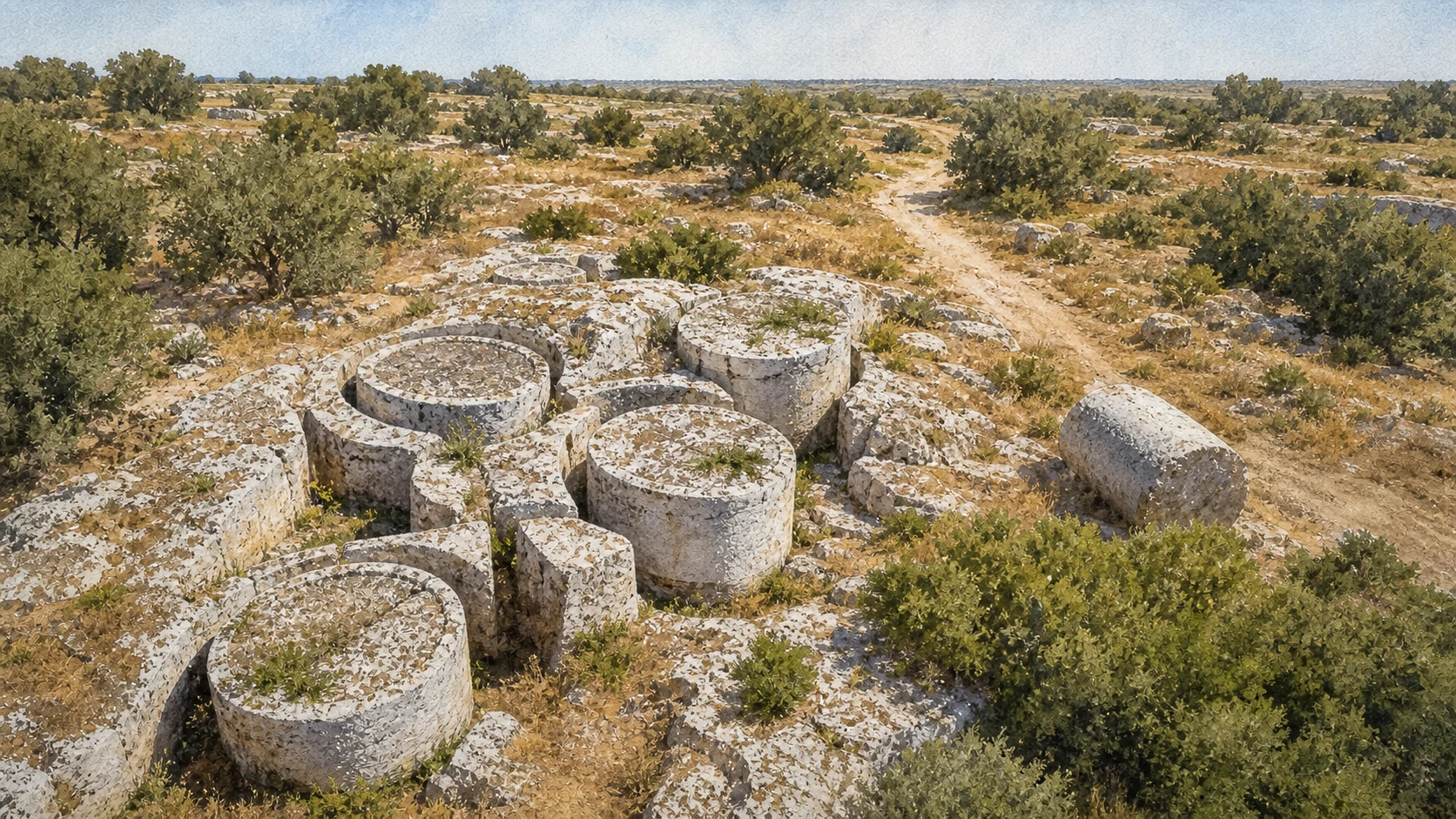
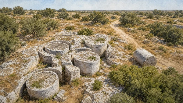
Cave di Cusa completes the account eleven kilometres away. Circular cuts, half-separated drums and abandoned capitals preserve quarrying as a chain of work rather than as scenery placed beside the temples.
One destination
Twenty-five chapters across city, sanctuaries and the quarry that supplied them
Megarian settlers founded Selinous in the seventh century BC on a western Sicilian frontier connected with Greek, Elymian and Punic territories. Rivers, coastal inlets and fertile land supported exchange as well as conflict.
Carthage captured the city in 409 BC. Later occupation, Hermocrates' fortifications and Punic houses reshaped the acropolis before settlement contracted, while earthquakes, quarrying, vegetation and excavation altered the ruins again.
A responsible visit therefore distinguishes original fabric from anastylosis, surviving dedications from conventional temple letters, and Selinunte from the separate Cave di Cusa quarries. The archaeological park requires long exposed walks and current access checks.
The selection
Twenty-five chapters between two rivers and unfinished stone
The route consolidates adjacent urban and ritual evidence while keeping acropolis, Eastern Hill, Gaggera and Cave di Cusa geographically distinct.
- 01The City between the Modione and Cottone
- 02Foundation, Megarian Memory and the Western Frontier
- 03The Urban Grid and the Agora
- 04Manuzza and the Northern Residential City
- 05The Archaic Wall and East Gate
- 06The Acropolis and Main Urban Sanctuary
- 07Temple C and the Archaic Metopes
- 08Temple D and the Athena Hypothesis
- 09Temples A and O beside the Southern Edge
- 10Temple R and the First Generations of the Colony
- 11Temple B, Architectural Colour and Greek-Punic Reuse
- 12Hermocrates, the North Gate and the Later Fortification
- 13Fazello, the Metopes and the Archaeological Rediscovery
- 14The Eastern Hill and its Three Monumental Temples
- 15Temple E, Hera and the Modern Anastylosis
- 16Temple F and the Screened Peristyle
- 17Temple G, the Unfinished Colossus
- 18Gorgo Cottone and the Craft Quarter
- 19The Gaggera, the Modione and the Western Sacred Belt
- 20The Sanctuary of Demeter Malophoros
- 21Zeus Meilichios, Hera Matronale and Temple M
- 22The Necropoleis beyond the Living City
- 23Baglio Florio, Temple Y and the Removed City
- 24The Baptistery and the Late-Antique Landscape
- 25Cave di Cusa: Quarry, Unfinished Drums and the Road to Selinunte
TWO RIVER ESTUARIES MADE THE COASTAL PROMONTORY A DEFENSIBLE CITY AND A MEDITERRANEAN PORT LANDSCAPE
The City between the Modione and Cottone
The temples make sense only after the river valleys, former harbours and three urban heights are placed on the same map.

The place today
From the Acropolis the Mediterranean lies directly south, while the Modione valley descends on the west and the Cottone valley on the east. Their modern courses and silting no longer reproduce the ancient shoreline, yet the depressions still separate the Acropolis from the Gaggera and Eastern Hill. Manuzza rises north beyond the Agora.
The historical chapter
Ancient Selinos took its name from the wild celery plant represented on its coinage. River mouths provided access for small craft and connected port facilities with streets climbing to the city, though the exact form and chronology of each harbour remain subjects of research. The western sanctuary belt faced the navigable Modione estuary, while shops, stairs and urban gates organised movement beside the Acropolis.
What to notice
- Do not draw the ancient ports as fixed modern marinas. Coastline, sediment and river channels changed, and archaeological reconstruction remains partial.
- Use the official park map and carry water. The 377-hectare system cannot be understood as one compact temple enclosure.
THE COLONY WAS CREATED BY PEOPLE FROM MEGARA HYBLAEA BUT GREW THROUGH CONTACT, CONFLICT AND MOVEMENT ACROSS WESTERN SICILY
Foundation, Megarian Memory and the Western Frontier
Selinunte was never an isolated Greek outpost facing an empty or culturally uniform territory.

The place today
There is no single foundation monument to visit. The first generations are read through early pottery, sanctuaries, streets and levels beneath later buildings, especially around Temple R and the main urban sanctuary. Looking west from the site points toward Elymian Segesta, Phoenician-Punic Motya and the wider routes of the Sicilian Channel.
The historical chapter
Thucydides says settlers from Megara Hyblaea founded Selinous under Pammilos one hundred years after their own city, a calculation commonly placed around 628 BC; Diodorus preserves a chronology that can imply an earlier foundation. Archaeology supports occupation in the later seventh century without resolving every literary calculation. Megarian institutions and cults shaped the colony, while later Rhodian, Dorian, Elymian and Punic contacts complicated its population.
What to notice
- State the foundation date as approximate and explain the ancient chronological disagreement rather than presenting 628 BC as an excavated day-zero.
- Avoid a Greek-versus-foreign binary. Trade, intermarriage, mobility, alliance and violence all operated across the western frontier.
STREETS, HUNDRED-FOOT BLOCKS AND CIVIC SPACE TURN MONUMENTS BACK INTO A WORKING CITY
The Urban Grid and the Agora
The grid and agora belong to one urban system whose scale survives even where buildings remain low or unexcavated.

The place today
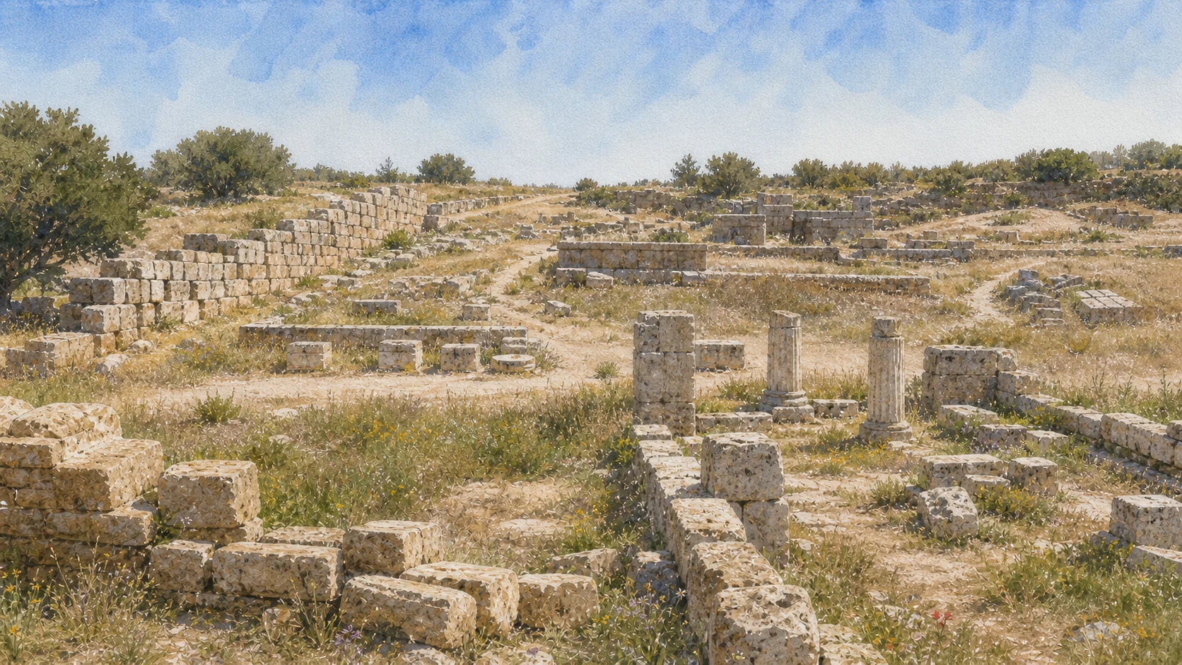
On the Acropolis broad principal streets intersect narrower lanes and define long building blocks. The Agora lies between the Acropolis and Manuzza.
The historical chapter
Planning began with the colony and was revised as the city expanded. The Park identifies the Agora as the city's political and social centre.
What to notice
- Low walls are not negligible ruins. Do not walk across them or use thresholds as seats simply because the street plan appears flat.
- Respect temporary fencing and research areas; an apparently empty trench or soil surface may contain active stratigraphic evidence.
HOUSES, COURTYARDS AND ROADS EXTENDED THE POLIS FAR BEYOND THE SACRED PROMONTORY
Manuzza and the Northern Residential City
Manuzza restores the population and domestic scale hidden by Selinunte's temple image.

The place today
North of the Agora, Manuzza preserves the lines of residential blocks across a broad plateau. Many structures remain low, partially excavated or covered, and the experience is more topographic than architectural. From this height the relation among Acropolis, Agora, countryside and eastern monuments becomes clearer.
The historical chapter
The settlement expanded over Manuzza through ordered streets and houses that accommodated families, storage, craft and exchange. Domestic architecture changed with prosperity, destruction and contraction. The Carthaginian siege of 409 BC devastated this extended city; the later population was concentrated more defensibly around the Acropolis.
What to notice
- Do not enter unmaintained or closed sectors to follow an old plan. Visibility and authorised routes change with excavation and vegetation management.
- House walls rarely preserve full room functions. Use terms such as courtyard, storage or workshop only where the archaeological interpretation supports them.
FORTIFICATION, ROAD AND RIVER-PORT MOVEMENT MET AT A MONUMENTAL ENTRANCE BESIDE THE COTTONE VALLEY
The Archaic Wall and East Gate
The early wall shows that urban measurement and defence developed together during the colony's first century.

The place today
Near Gorgo Cottone, sections of a substantial wall and the East Gate clarify the boundary between the urban plateau and eastern valley. The official guide records an investigated stretch approaching eight hundred metres and a wall roughly four and a half metres wide. The gate aligns with movement toward the Eastern Hill and river-port zone.
The historical chapter
The fortification was built in the early sixth century BC as Selinunte formalised its street network. Its scale required organised quarrying and labour before the city attempted Temple G's colossal programme. Gates regulated trade, processions and defence; they were interfaces rather than merely military apertures.
What to notice
- Do not confuse the archaic outer wall with the later Hellenistic-Punic fortifications concentrated around the Acropolis.
- Remain on the authorised path near slopes and fallen masonry; reconstructed lines on maps can extend beyond what is visible or accessible.

A SACRED PRECINCT, RESIDENTIAL BLOCKS AND LATER DEFENCES SHARE THE PROMONTORY ABOVE THE SEA
The Acropolis and Main Urban Sanctuary
The Acropolis is not one temple platform but a sequence of sacred, civic, domestic and military reorganisation.

The place today
The southern promontory contains Temples O, A, B, R, C and D, streets, houses, precinct walls and powerful northern fortifications. From the central road, the sea appears beyond fragments of columns while modern excavations reveal earlier floors beside later domestic walls. The standing columns of Temple C provide an orientation point, but most of the Acropolis must be understood through relationships among foundations and circulation.
The historical chapter
The urban sanctuary developed from the colony's first generations. Temples R and C monumentalised the sacred area, while later structures altered its internal approaches. Carthaginian destruction in 409 BC left burning and looting deposits documented by excavation.
What to notice
- The term Acropolis does not mean every visible wall is Greek-classical. Punic houses, later defences and modern restorations occupy the same ground.
- Do not climb column drums or reconstructed walls for the sea view. The masonry is both fragile evidence and a fall hazard.
A SIX-COLUMN DORIC TEMPLE DOMINATED THE ACROPOLIS WHILE ITS SCULPTURE TURNED MYTH INTO PUBLIC ARCHITECTURE
Temple C and the Archaic Metopes
Temple C is Selinunte's great standing silhouette, but its dedication remains uncertain and its present profile includes modern anastylosis.

The place today
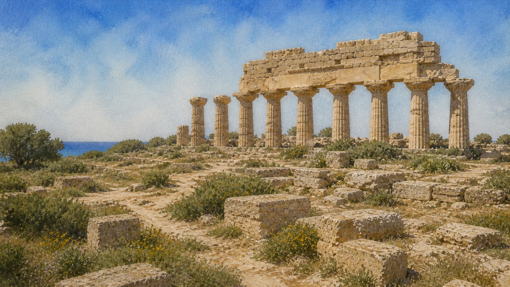
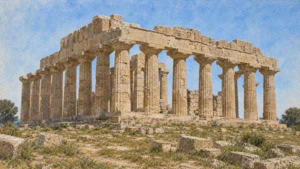
A row of tall columns and part of the entablature rise above the southern sanctuary, re-erected in the twentieth century from fallen ancient elements. Around them lie the long cella, pronaos, adyton and dense field of blocks. The view toward the sea is real; the apparently complete colonnade is not an untouched survival.
The historical chapter
Construction began around the middle of the sixth century BC, commonly about 560–540 BC. Temple C was a peripteral Doric building and among the earliest monumental temples of the city. Its archaic metopes represented scenes including Perseus and Medusa, Heracles and the Cercopes, and Apollo with Artemis.
What to notice
- Label any reconstructed view and do not present the standing north colonnade as the temple's unaltered ancient condition.
- Keep dedication and sculpture separate: identifiable myths on metopes do not by themselves prove which deity owned the temple.
A SECOND GREAT TEMPLE ORDERED THE NORTHERN PART OF THE ACROPOLIS SANCTUARY
Temple D and the Athena Hypothesis
Temple D demonstrates how architectural sequence can be secure while divine attribution remains provisional.

The place today
North of Temple C, Temple D survives as foundations, column drums and fallen architectural blocks aligned within the urban sanctuary. Its plan can be traced through the peristyle and cella even though no comparable standing colonnade rises above it. Nearby streets and precinct boundaries reveal that the temple faced an organised sacred approach rather than an empty hilltop.
The historical chapter
The building belongs to the later sixth century BC and followed Temple C in the development of the Acropolis. Its proportions reflect a maturing local Doric architecture. An inscription found nearby has encouraged association with Athena, but proximity is not an absolute dedication document.
What to notice
- Use 'possibly dedicated to Athena' rather than renaming the monument Temple of Athena without qualification.
- Plans often restore a complete peristyle; on site, distinguish the measured ancient footprint from hypothetical elevations.
TWIN-SCALE FOUNDATIONS SHOW A LATE CLASSICAL REORDERING CLOSE TO THE ACROPOLIS CLIFF
Temples A and O beside the Southern Edge
The neighbouring temples invite comparison, but their traditional divine names are less secure than their architecture.

The place today
South of the central sanctuary, the foundations of Temples A and O occupy terraces near the sea. Their parallel plans and fallen elements are best understood with a site map because later construction and collapse obscure entrances and internal divisions. A Punic cult installation was inserted in the pronaos of Temple A after the Greek city's destruction, making the monument especially important for the continuity and transformation of sacred space.
The historical chapter
Both buildings are generally placed in the fifth century BC, with Temple A more advanced before the interruption of major construction. Older guide traditions associated them with Dioscuri or Poseidon, but the evidence does not justify presenting those names as fact. Under Carthaginian rule, worshippers reused Temple A through a smaller installation fitted inside the older shell.
What to notice
- Do not describe Punic reuse as desecration by default. Archaeology documents continued sacred practice in a changed cultural and political setting.
- The similarity of the two footprints does not prove identical date, completion or dedication.
FOUNDATION DEPOSITS, SACRIFICES AND FLOORS PRESERVE RITUAL ACTION FROM THE EARLIEST DECADES OF SELINOUS
Temple R and the First Generations of the Colony
Temple R is one of the site's most important research areas precisely because its low remains preserve deep stratigraphy.

The place today
Beside Temple C, Temple R appears far less monumental above ground. Excavation trenches, walls of the cella and adyton, and protected deposits require guidance or careful use of published plans. The NYU and University of Milan mission has investigated the building block by block and layer by layer since 2006 in collaboration with the Park.
The historical chapter
The temple was constructed around 580–570 BC over earlier structures belonging to the colony's first fifty years. Beneath its floors archaeologists found burnt animal remains, vessels, loomweights, spearheads and other deposits connected with construction and ritual. The building is probably associated with Demeter Thesmophoros, but the wording remains probabilistic.
What to notice
- Do not enter active excavation sectors or interpret exposed soil without the mission's phase plan. Stratigraphy is the monument here.
- Use 'probably Demeter Thesmophoros' and identify new findings by campaign year; research is still refining the sanctuary.
A SMALL POLYCHROME BUILDING AND REUSED SANCTUARIES REVEAL LIFE AFTER THE CLASSICAL CITY
Temple B, Architectural Colour and Greek-Punic Reuse
Temple B's colour and the surrounding Greek-Punic houses are read together without treating cultural change as a clean break.

The place today
The compact foundations and architectural fragments of Temple B stand near the much larger archaic temples. Low domestic walls appear between temples and streets across the Acropolis.
The historical chapter
NYU research reconstructs Temple B as a Doric prostyle tetrastyle building on a podium, created around 300 BC during the later settlement. Carthage's capture killed, displaced and enslaved many inhabitants, but settlement later resumed under Carthaginian control.
What to notice
- Polychrome reconstructions are evidence-based interpretations, not surviving paint in the open air at full original intensity.
- A reused Greek block does not identify the ethnicity of a house's occupants; material, language and ritual evidence must be considered together.
RAPID MILITARY REBUILDING TURNED FALLEN ARCHITECTURE INTO WALLS, TOWERS AND DEFENSIBLE PASSAGES
Hermocrates, the North Gate and the Later Fortification
The northern defence preserves emergency construction, later reinforcement and modern restoration within one imposing complex.

The place today
At the north end of the Acropolis, walls, towers, gates and passage systems rise more substantially than most domestic structures. Reused column drums, metope fragments and architectural blocks are visible within the masonry. Some walls were raised or consolidated during modern restoration, so changes in material and finish matter.
The historical chapter
After the Carthaginian victory of 409 BC, the Syracusan exile Hermocrates used Selinunte as a base and fortified the Acropolis. Builders worked quickly with material available among the ruins. Later Greek-Punic occupation modified the defensive system, and subsequent phases added further repairs.
What to notice
- Do not label every tower 'the wall of Hermocrates'. Different construction and restoration phases overlap in the surviving system.
- Reused sculpture inside a defence is not a museum display. Do not touch, climb or attempt to isolate embedded fragments for photographs.
EARLY IDENTIFICATION, SCULPTURE HUNTS, EXCAVATION AND ANASTYLOSIS CREATED THE MODERN SELINUNTE VISITORS SEE
Fazello, the Metopes and the Archaeological Rediscovery
The archaeological park is also the product of five centuries of naming, removing, drawing and restoring ruins.

The place today
Interpretive signs, re-erected columns, relocated sculpture and the Park's modern service buildings shape the route as strongly as ancient collapse. The small building traditionally known as the Casa del Viaggiatore evokes the era when reaching the ruins required accommodation inside an isolated landscape. Baglio Florio and the paths created by excavators further demonstrate that today's experience is designed, not neutral.
The historical chapter
Tommaso Fazello identified the ruins as ancient Selinunte in the sixteenth century. In the early nineteenth century British architects William Harris and Samuel Angell recovered sculpted metopes, while Hittorff and Zanth studied architecture and colour. Sicilian archaeologists including Francesco Saverio Cavallari, Antonino Salinas and Ettore Gabrici developed systematic excavation and collections.
What to notice
- Historic excavation removed objects from their contexts by standards different from those of current archaeology. Present this as history, not as a heroic treasure hunt.
- A re-erected column is ancient material in a modern arrangement. Always distinguish original fabric from the intervention that made it stand.

TEMPLES E, F AND G FORMED A SACRED HORIZON OUTSIDE THE ACROPOLIS ACROSS THE COTTONE VALLEY
The Eastern Hill and its Three Monumental Temples
The Eastern Hill is a sequence of three different building programmes, not one monumental complex built at a single moment.

The place today
Temple E stands largely re-erected; Temple F survives as a dense low collapse; Temple G forms a colossal field of drums, capitals and entablature. Their proximity makes comparison unusually powerful, but appearance reverses historical certainty: the most complete-looking building is substantially reconstructed, while the enormous unfinished temple exposes ancient construction and later collapse. The open hill is highly exposed to sun and wind.
The historical chapter
Sacred construction began during the sixth century BC and continued into the fifth. Each temple has different dimensions, chronology, decoration and completion. Their placement east of the Cottone connected an extra-urban sanctuary zone with the city gates, workshops and probable port activity.
What to notice
- Do not describe all three as destroyed in the siege of 409 BC. Construction interruption, later use, earthquakes and modern restoration must be separated.
- There is little shade among the monuments. Plan the hill for cooler hours and check restrictions associated with events or conservation work.
AN EVIDENCE-BASED DEDICATION AND A DRAMATIC MODERN RE-ERECTION MAKE THIS THE PARK'S MOST LEGIBLE TEMPLE
Temple E, Hera and the Modern Anastylosis
Temple E is ancient architecture made visible through major twentieth-century intervention.

The place today
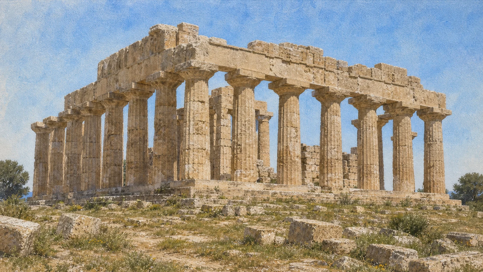
A complete peristyle, cella and high stepped base create the image many visitors associate with Selinunte. The present form results from anastylosis carried out mainly in the 1950s and 1960s using original blocks with necessary integration. The building's severe-style metopes, now in Palermo, represented divine and heroic encounters; local calcarenite was combined with marble for exposed female flesh, a refined material contrast absent from the bare restored exterior.
The historical chapter
The final temple was built around the middle of the fifth century BC over earlier sacred buildings. An inscription supports dedication to Hera more firmly than the proposed names of several other Selinuntine temples. Its six-column façade and elongated Doric plan show technical control after the experiments of the archaic period.
What to notice
- Do not use Temple E as an untouched model of how every Selinuntine temple looked. Its completeness is a conservation choice.
- The metopes belong to the temple but are museum objects; outdoor replicas, digital colour and the originals must be labelled separately.
AN UNUSUAL WALL BETWEEN THE OUTER COLUMNS TURNED A DORIC COLONNADE INTO A CONTROLLED SACRED BOUNDARY
Temple F and the Screened Peristyle
Temple F rewards close reading because its distinctive architecture is almost hidden within the collapse.

The place today
Between Temples E and G, Temple F appears as a low and compact field of drums and blocks. Its plan was peripteral, yet masonry screens joined the columns of the outer colonnade, limiting visibility and access. Interpretive plans are essential for recognising this feature.
The historical chapter
Temple F was constructed around the middle of the sixth century BC and therefore predates the final Temple E. The official guide records columns about 4.70 metres high and an unusual screened peristyle. Proposed dedication to Dionysus remains hypothetical.
What to notice
- Use the letter F and describe Dionysus only as a proposal. Architectural restriction does not prove a specific mystery cult.
- The dense collapse is not a path or climbing area. View screen-wall relationships from marked routes and published plans.
A BUILDING MORE THAN ONE HUNDRED METRES LONG EXPOSES AMBITION, DELAY, EARTHQUAKE AND MODERN CONSERVATION AT MONUMENTAL SCALE
Temple G, the Unfinished Colossus
Temple G was never a completed perfect giant; its incompletion is central to its history.

The place today
The ruin is an extraordinary landscape of giant column drums, capitals, wall blocks and entablature. One ancient column remains standing, while the rest preserve the direction and violence of collapse. The official guide gives dimensions of roughly 113 by 54 metres and columns over sixteen metres high.
The historical chapter
Construction began around 530 BC and continued for generations without reaching completion before 409 BC. Variation among drums and unfinished surfaces reveals changing design and interrupted work. A major inscription listing the city's divine protectors was found in the temple area; Zeus is a frequent attribution, but the dedication is not absolutely settled.
What to notice
- Do not generate images with three newly standing columns unless an official completed intervention can be verified. In 2026 the public record includes feasibility and funding steps.
- Avoid calling Temple G 'the largest Greek temple' without qualification; it is among the largest and its incomplete state complicates comparisons.
KILNS, WORK AREAS AND WATER MANAGEMENT PUT PRODUCTION BESIDE THE EASTERN GATE AND SACRED HILL
Gorgo Cottone and the Craft Quarter
The valley held the heat, clay and labour that monumental views usually crop out.

The place today
Along the eastern valley, excavated kilns and work areas form a newly emphasised part of the Park's archaeological picture. Their low circular or rectangular structures can be difficult to distinguish from later disturbance without interpretation. The terrain links the East Gate, possible port zone and Eastern Hill, showing that production was placed near transport and water while remaining outside dense residential blocks.
The historical chapter
Potters, terracotta workers and other craftspeople supplied roof tiles, architectural decoration, vessels and daily equipment. The Park describes numerous furnaces in the recently identified craft quarter. Production zones changed with the city's expansion and later contraction; a kiln's form and fill must therefore be dated individually.
What to notice
- Do not enter kiln interiors or collect ceramic fragments. Fired clay scatters are archaeological evidence even when they resemble ordinary rubble.
- The phrase 'recent discovery' refers to modern research history, not necessarily a single excavation season; use current Park interpretation.

SPRINGS, PROCESSIONAL ROUTES AND TEMENE EXTENDED CULT BEYOND THE CITY WALL TOWARD THE WESTERN ESTUARY
The Gaggera, the Modione and the Western Sacred Belt
Gaggera is a connected sacred landscape, not merely the location of one famous sanctuary.

The place today
West of the Acropolis, paths cross the Modione valley toward the Malophoros, Zeus Meilichios, Hera Matronale and Temple M. Vegetation, water channels, slopes and the distance from the central temples create a quieter setting. The official Park explains that these adjoining sacred precincts once stood close to the navigable estuary.
The historical chapter
The sanctuary belt developed along routes from the city toward cemeteries, countryside and western territories. Springs and controlled water were integrated with altars, precinct walls and processions. Orientations followed the broader urban system despite the extra-urban location.
What to notice
- Plan enough time for the western sector; it is separated from the Acropolis by a valley and is easily omitted from short itineraries.
- Seasonal vegetation can hide wall edges and channels. Stay on maintained paths rather than tracing a plan through closed ground.
AN OPEN-AIR CULT BECAME A WALLED SANCTUARY FILLED WITH ALTARS, WATER, OFFERINGS AND THE MEMORY OF FUNERARY PROCESSIONS
The Sanctuary of Demeter Malophoros
The Malophoros preserves the long institutional growth of Selinunte's oldest sacred place.

The place today
A monumental propylon leads into a walled precinct with portico, temple, great altar and water channel descending from the Gaggera spring. The temple is rectangular and without an outer colonnade; its modest elevation contrasts with the density of ritual deposits once found around it. Vast numbers of terracotta figurines, lamps, ceramics and other offerings are now conserved mainly in the Museo Salinas in Palermo, so the open sanctuary and museum collections should be read together.
The historical chapter
Cult began outdoors in the colony's early period. A sixth-century temple, altar and later fifth-century entrance monumentalised the precinct. Animal bones, ash and votives document repeated sacrifice and dedication.
What to notice
- Malophoros is an epithet of Demeter with several interpretive dimensions; avoid translating it into one fixed modern role without explanation.
- Do not place replicas or loose terracottas on walls for photographs. Original offerings were removed through excavation and remain protected collections.
SMALLER PRECINCTS, STELAE AND ALTARS REVEAL CULT THROUGH MATERIALS VERY DIFFERENT FROM THE GREAT DORIC TEMPLES
Zeus Meilichios, Hera Matronale and Temple M
The western sanctuaries replace monumental scale with intimate evidence for family, protection and repeated dedication.

The place today
Beside the Malophoros, foundations define a more compact precinct dedicated to Zeus Meilichios and a companion deity. Porticoes, an eastern propylon, a small two-column temple and divided altar frame groups of aniconic and anthropomorphic stelae. Farther across the Gaggera are the Hera Matronale sanctuary and Temple M near the valley.
The historical chapter
Zeus Meilichios received rites connected with protection, kin groups and potentially dangerous powers requiring appeasement. Stelae materialised individual or family dedications rather than decorating a monumental façade. The Hera sanctuary has been the subject of renewed excavation continuing the modern Malophoros mission, while Temple M's form and exact dedication remain debated.
What to notice
- Do not describe every stele as a portrait or every pair as a married couple; many are deliberately non-figural and their social meanings vary.
- Temple M is a lettered archaeological label. Keep it distinct from the nearby Hera sanctuary unless a specific publication supports a connection.
BURIAL GROUNDS SURROUNDED SELINUNTE AND CONNECTED FAMILY MEMORY WITH ROADS, SANCTUARIES AND TERRITORIAL BOUNDARIES
The Necropoleis beyond the Living City
The dead occupied several landscapes, not one cemetery detached from urban life.

The place today
Necropolis sectors lie outside the central monumental route and are not all maintained for ordinary independent access. Tomb cuts, sarcophagi, grave markers and excavated areas may be subtle or located beyond visitor paths. Finds such as pottery, jewellery and terracottas have moved into museums, leaving the spatial relation with roads and sanctuaries as the principal evidence on the ground.
The historical chapter
Burial areas including Manicalunga, Galera Bagliazzo and Buffa served different periods and groups. Funerary practice ranged from cremation to inhumation and used containers, markers and offerings that changed over centuries. Processions toward western cemeteries may help explain the Malophoros sanctuary's position.
What to notice
- Confirm public access before seeking a named necropolis; archaeological designation on a map does not mean an open visitor area.
- Do not enter tombs, move grave markers or treat human remains as spectacle. Collections and contexts require the same respect.
A MODERN COLLECTION CENTRE REUNITES ARCHITECTURAL FRAGMENTS THAT CAN NO LONGER BE READ SAFELY IN THEIR ORIGINAL COLLAPSE
Baglio Florio, Temple Y and the Removed City
Baglio Florio makes the distance between an excavated monument and its surviving objects explicit.

The place today
The restored Baglio Florio functions as the Park's museum and interpretation space, housing archaeological material and architectural elements. The remains assigned to Temple Y, an important example of early Doric architecture, are displayed within the complex rather than on a securely identified standing footprint. Exhibitions, opening arrangements and event use can change, so current Park information should be checked.
The historical chapter
Temple Y is a modern label applied to early architectural and sculptural fragments whose original location has been debated. Their forms document experimentation during Selinunte's archaic building history. Nineteenth- and twentieth-century excavation transferred many metopes and portable finds to Palermo, while the local antiquarium preserves another part of the material history.
What to notice
- Do not invent a freestanding Temple Y beside Baglio Florio. The label belongs to relocated architectural remains and a debated original setting.
- Check photography and temporary-exhibition rules inside the museum, especially during events or conservation work.

CHRISTIAN RITUAL RETURNED TO THE WESTERN RIVER MOUTH LONG AFTER THE ANCIENT POLIS HAD CONTRACTED AND DISAPPEARED
The Baptistery and the Late-Antique Landscape
The baptistery prevents Selinunte's timeline from ending with Greek and Punic urban life.

The place today
Near the mouth of the Modione, west of the Acropolis, remains identified as a baptistery occupy a late-antique or Byzantine building. Its modest walls and basin are visually fragile beside the better-known temples. Route conditions and visibility can vary with vegetation and archaeological protection.
The historical chapter
The Park identifies the structure as one of the symbols of Christianity within Selinunte and dates its setting broadly to late antiquity or the Byzantine period. Small communities reused the coastal landscape centuries after the Greek-Punic city ended. Elsewhere on the Acropolis, later occupation and fortification also modified ancient remains.
What to notice
- Use the Park's broad late-antique or Byzantine wording unless a specialist publication provides a narrower date.
- Do not claim a direct ritual succession from Demeter's sanctuary to Christian baptism solely because both stand west of the Acropolis.
CIRCULAR TRENCHES, ABANDONED ARCHITECTURAL PIECES AND TRANSPORT ROUTES PRESERVE THE WORK OF BUILDING
Cave di Cusa: Quarry, Unfinished Drums and the Road to Selinunte
The quarry landscape and its unfinished pieces form one production sequence located eleven kilometres from the temples they were intended to serve.

The place today
About eleven kilometres north-west of Selinunte, the quarry extends through fields and olive groves as a long exposed bank rather than a single pit. Some drums remain partly fused to the rock; others are detached but unfinished; farther along, completed cylinders and capital components lie where teams left them.
The historical chapter
Selinuntine builders used several quarry sources, but Cave di Cusa offered compact calcarenite capable of producing the largest elements required for Temple G. Workers reduced weight while retaining enough stone to protect surfaces during movement.
What to notice
- Do not step inside cutting trenches or climb unfinished drums. Edges, loose stone, heat and vegetation create real risks in an open rural site.
- Do not remove small chips as souvenirs. Even discarded flakes preserve tool sequence, quarry organisation and the material history of work.
The city through time
Ten passages from colonial foundation to an archaeological landscape still under research
The chronology keeps destruction, continued Punic occupation, modern excavation and current conservation in separate phases.
Colonists from Megara Hyblaea establish Selinous under Pammilos; the common date around 628 BC reflects Thucydides, while other ancient calculations differ.
The street grid, archaic wall, early sanctuaries, Temples R, C and F and organised quarrying turn the settlement into a monumental polis.
Temple G begins but remains unfinished; the final Temple E, later Acropolis temples, Agora and expanded residential city express wealth from land and trade.
Selinunte moves through alliances and conflicts among Greek, Elymian and Carthaginian powers; border tension with Segesta contributes to wider Sicilian war.
A Carthaginian army captures the city after a short siege. Destruction, killing, enslavement and displacement interrupt Temple G and the Cave di Cusa quarry programme.
Hermocrates fortifies the Acropolis; a reduced Greek-Punic population reuses sanctuaries, builds houses and workshops and reorganises ritual life under Carthaginian control.
Temple B and later domestic phases show continuing Hellenistic life before the inhabited city is abandoned amid changing warfare and western Sicilian power.
Christian communities use the Modione landscape and a baptistery; later settlement and fortification remain dispersed rather than recreating the ancient polis.
Fazello identifies Selinunte; travellers and archaeologists recover metopes and map the city; systematic excavation and the anastyloses of Temples C and E create the modern park image.
International missions deepen research into Temple R, the urban sanctuary, workshops and Gaggera, while the Park develops access and evaluates new conservation projects including Temple G.
Before your visit
Practical information,
without turning it into promises
Give Selinunte a full day and the quarries a separate movement
A serious park route must include Eastern Hill, Acropolis, Agora or Manuzza and Gaggera. Cave di Cusa lies about eleven kilometres away and follows its own opening rules; combining everything requires transport, an early start and realistic walking time.
Check the official hours, entrances and daily notices
Selinunte closes at sunset with seasonally changing ticket-office times. Triscina access, internal mobility, events, excavation areas and conservation works can alter routes. Cave di Cusa normally has shorter hours and special afternoon reservation conditions.
Plan for scale, heat and exposed archaeology
Carry water, sun protection and footwear for uneven ground. Use cooler hours for the Eastern Hill and longer western paths, never climb blocks, and keep children close around quarry cuts, slopes and reconstructed walls.
Use the park, Baglio Florio and Palermo as one distributed collection
The site preserves architecture and context; Baglio Florio explains local finds and Temple Y; the Museo Salinas holds major metopes, terracottas and sanctuary materials. Digital reconstructions should supplement, not replace, those different evidence settings.
Sources
This guide cross-checks the current Selinunte Archaeological Park, the Sicilian Region's official archaeological guide and conservation records, current regional hours and notices, and the Institute of Fine Arts at New York University's excavation reports produced with the Park and the University of Milan. It distinguishes the approximate foundation chronology from an exact date, a modern temple letter from an ancient divine name, the Greek city from its mixed Greek-Punic successor, the 409 BC destruction from later earthquake collapse, anastylosis from untouched survival, a proposed Temple G project from completed work, an ancient harbour hypothesis from the modern coast, and physical quarry evidence from reconstructed transport methods.
- Selinunte Archaeological Park · Official park and current news ↗
- Selinunte Archaeological Park · Current hours for Selinunte and Cave di Cusa ↗
- Selinunte Archaeological Park · Archaeological area of Selinunte ↗
- Selinunte Archaeological Park · Cave di Cusa ↗
- Selinunte Archaeological Park · Sanctuary of Demeter Malophoros ↗
- Sicilian Region · Illustrated archaeological guide to Selinunte ↗
- Sicilian Region · Doric architecture and Temple C conservation documentation ↗
- NYU Institute of Fine Arts · Selinunte excavations ↗
- NYU Institute of Fine Arts · 2024 excavation report ↗
- Sicilian Region · 2026 Temple G project administrative record ↗
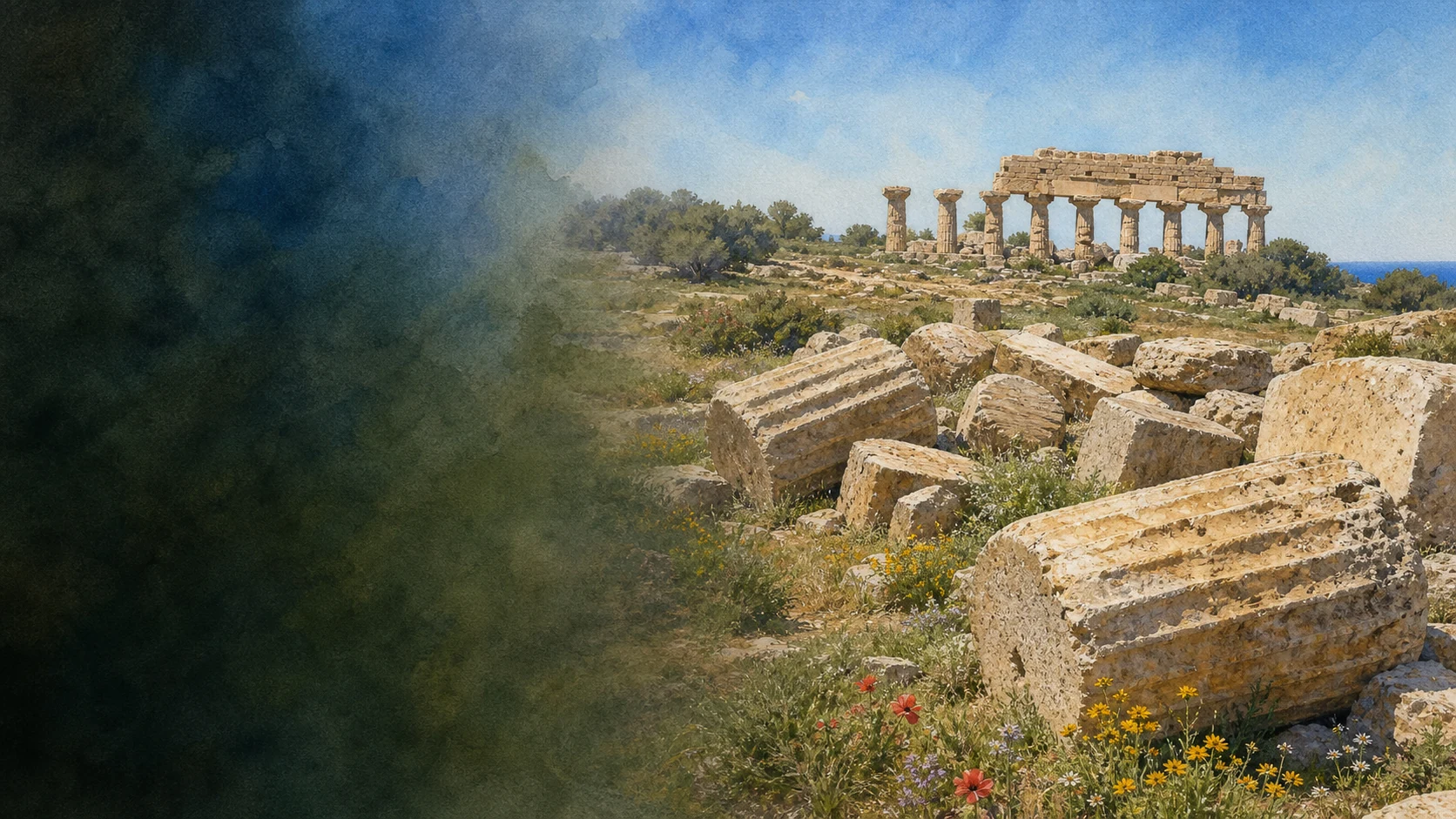
The hero image is an illustration, not a photograph. Official reference photographs remain archived locally for visual verification. Seasonal hours, ticket-office closure, Triscina entrance, internal mobility, Cave di Cusa road access, afternoon reservations, events, research trenches, conservation barriers, Baglio Florio exhibitions, Temple G project status, paths, heat precautions and public transport can change; consult the linked institutions before visiting.