Illustrated guide · Aosta Valley
A city built
where the Alps open
Sixteen chapters from a five-thousand-year-old ritual landscape to Augusta Praetoria, medieval Aosta and the Roman aqueduct bridge of Pont d’Aël.
Explore the placesA capital measured by its crossings
Aosta is not a Roman museum placed inside a mountain postcard.
The city occupies the broadest part of a valley that narrows towards passages to France and Switzerland. Long before Rome, communities used this ground for settlement, cultivation, ritual and burial. The colony founded in 25 BCE then turned the same geography into a controlled urban and military hinge.
Later centuries did not erase that plan. Churches entered Roman districts, towers reused the walls, civic streets crossed the ancient grid and the modern regional capital continued to face the same rivers and slopes.
This guide follows those layers on foot, then extends west to Pont d’Aël, where Roman engineering makes the relationship between water, agriculture and the road towards the Little Saint Bernard visible in one structure.

One destination
From ritual ground
to an Alpine capital.
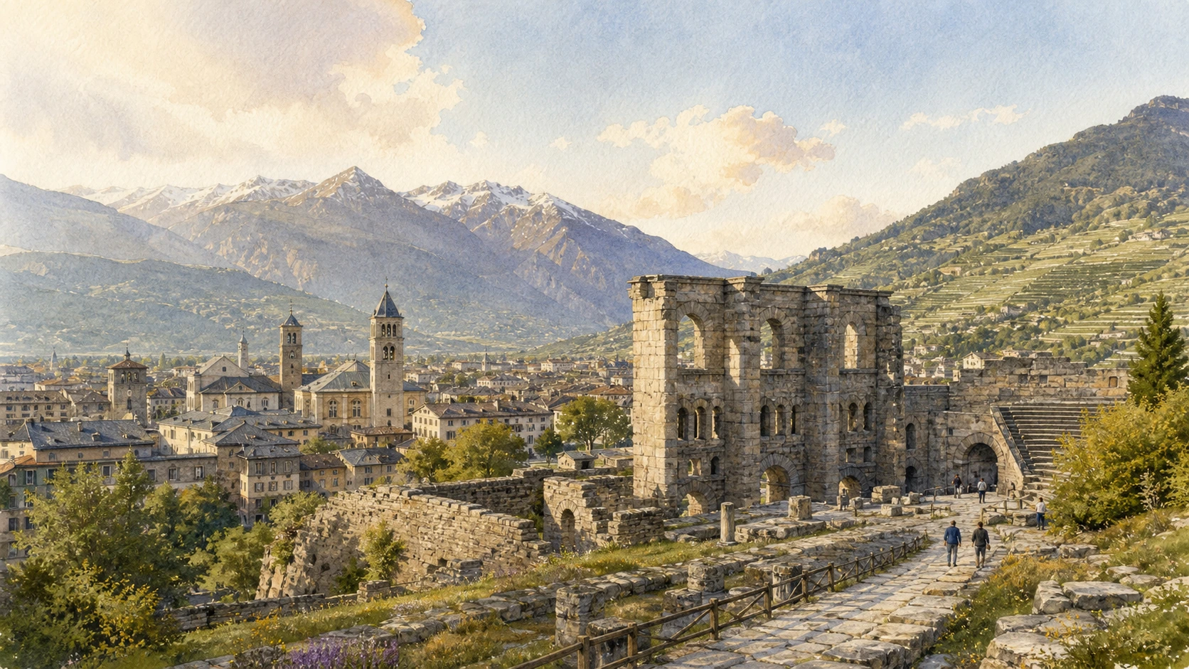
Aosta stands near the meeting of the Dora Baltea and the Buthier, below routes leading towards the Great and Little Saint Bernard passes. The natural basin offered cultivable land and movement across the Alps, but also required constant negotiation with water, slopes and winter.
The historic centre preserves an unusually legible sequence: the rectangular logic of Augusta Praetoria, early Christian buildings, Ottonian frescoes, Romanesque sculpture, medieval towers and a nineteenth-century civic square. Seeing it well means comparing alignments and reuse, not collecting isolated monuments.
The selection
Sixteen chapters,
one Alpine crossing
The route begins with the basin before Rome, enters the planned colony, follows its Christian and medieval reuse and ends at Pont d’Aël on the western road system.
- 01The Aosta Basin Before Rome
- 02Saint-Martin-de-Corléans and the Megalithic Ground
- 03The Foundation and Grid of Augusta Praetoria
- 04The Arch of Augustus and the Roman Bridge
- 05Porta Praetoria
- 06Walls, Towers and Centuries of Reuse
- 07The Roman Theatre and the Hidden Amphitheatre
- 08The Forum and Cryptoporticus
- 09Insulae, Houses and the Ordinary Roman City
- 10The Regional Archaeological Museum
- 11San Lorenzo and Early Christian Aosta
- 12Sant’Orso, the Cloister and Ottonian Frescoes
- 13The Cathedral Above the Roman Forum
- 14Medieval Towers, Palaces and the Reused Grid
- 15Piazza Chanoux and the Modern Regional Capital
- 16Pont d’Aël and the Aqueduct Bridge
Rivers, terraces and routes before a formal city
The Aosta Basin Before Rome
The basin was already a worked and meaningful landscape when Rome imposed an urban grid upon it.
The place today
From the edges of the historic centre, the enclosing slopes and the confluence of the Dora Baltea and Buthier remain legible. Modern roads and buildings obscure parts of the ancient terrain, but the width of the basin still explains why settlement concentrated here.
The historical chapter
Prehistoric and protohistoric evidence documents long use of the conca for agriculture, ritual, burial and movement. The Salassi controlled Alpine routes and resources before Roman conquest; they should be understood as communities with their own territorial systems, not simply as a preface to the colony.
What to notice
- The flat basin set between steep slopes
- The Buthier corridor east of the Roman centre
- Terraces and routes climbing towards the passes
Ritual ploughing, timber alignments, stelae and tombs
Saint-Martin-de-Corléans and the Megalithic Ground
The western quarter preserves a ceremonial and funerary sequence beginning near the end of the Neolithic.
The place today
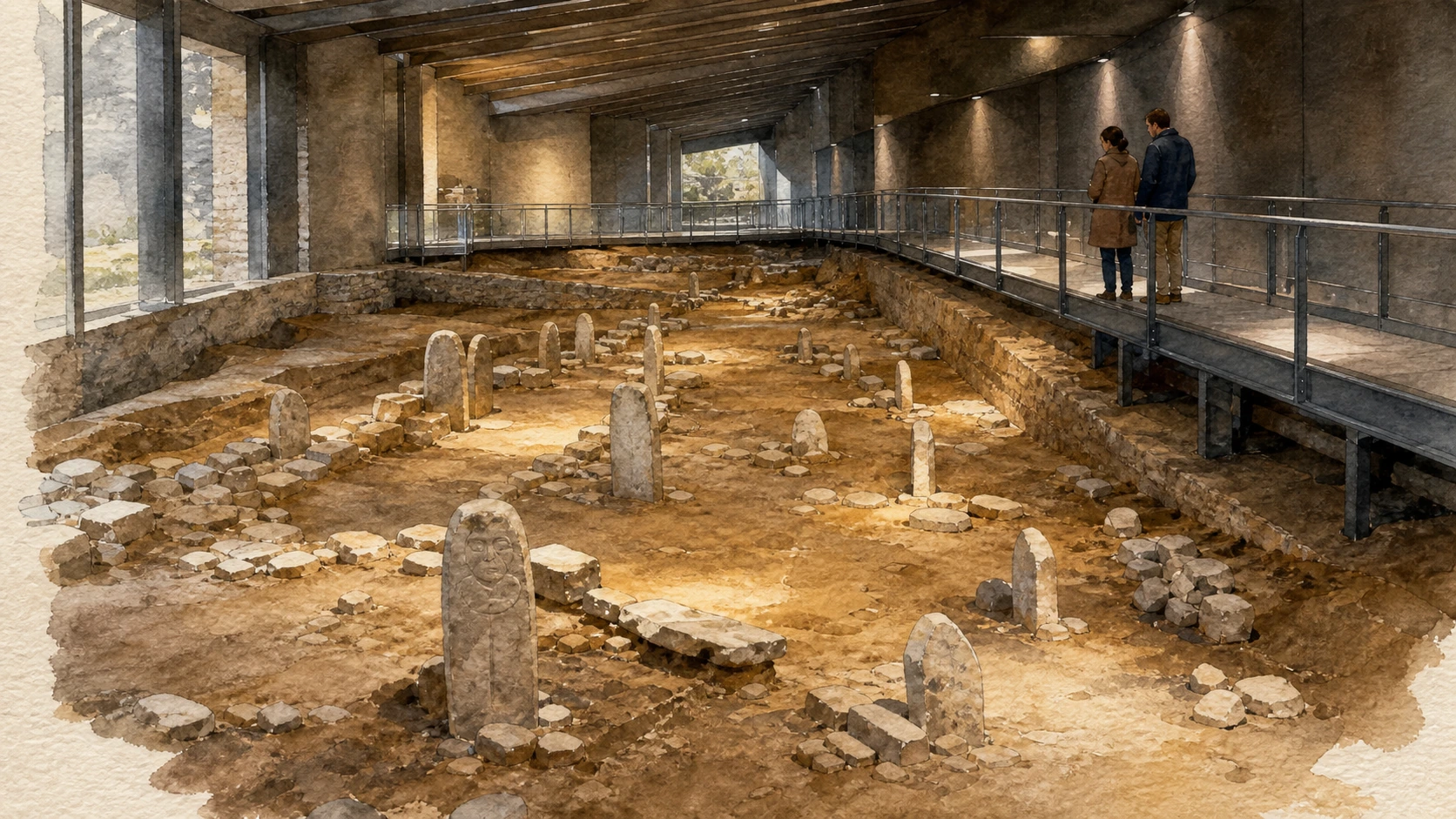
The MegaMuseo descends visitors to the archaeological level and controls light around the preserved structures. Stele, post alignments, ritual furrows and funerary monuments are read through excavation phases rather than presented as one frozen moment.
The historical chapter
The site was discovered during building work in 1969 and subsequently acquired and excavated by the regional administration. Its layers continue through the Copper and Bronze Ages into Roman agricultural and funerary use, showing that the western suburb of Augusta Praetoria inherited much older ground.
What to notice
- Changes in level between the modern street and ancient surfaces
- Anthropomorphic stelae displayed with their archaeological context
- Roman rural and funerary traces above earlier ritual phases

A veteran colony planned at the Alpine crossroads
The Foundation and Grid of Augusta Praetoria
The Roman rectangle organised defence, traffic, public life and private building after the conquest of 25 BCE.
The place today
The ancient plan is best reconstructed by walking between gates, wall fragments and streets rather than from one viewpoint. Later lanes sometimes preserve Roman alignments, while other sectors were altered by churches, palaces and modern traffic.
The historical chapter
Augusta Praetoria was founded for Praetorian veterans after Roman victory over the Salassi. Cardo and decumanus divided the walled area into insulae; forum, theatre, amphitheatre and infrastructure turned the colony into the administrative centre of a territory tied to the Gallic roads.
What to notice
- The rectangular relationship between surviving gates
- Street alignments that continue across later urban fabric
- The north-eastern concentration of entertainment buildings
A ceremonial entrance beside a river that later moved
The Arch of Augustus and the Roman Bridge
The eastern approach joins military commemoration to the changing course of the Buthier.
The place today
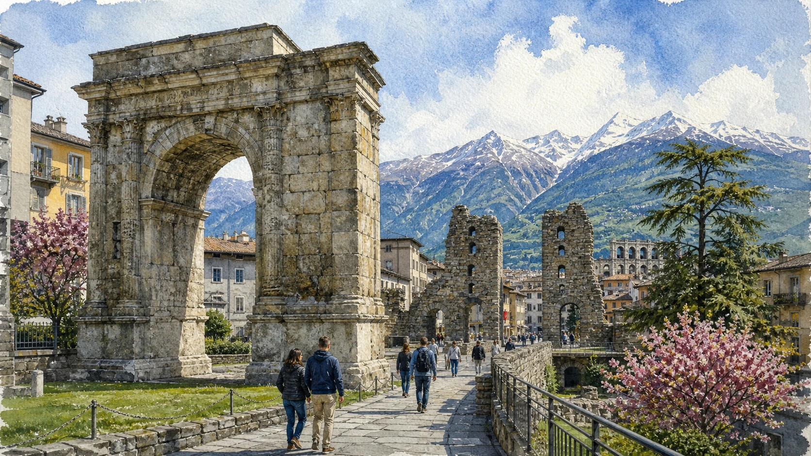
The Arch of Augustus stands in a busy urban space east of Porta Praetoria. Nearby, the Roman bridge now crosses dry ground because the Buthier changed course, making the gap between ancient infrastructure and present hydrology unusually clear.
The historical chapter
The honorific arch commemorated Augustus and the conquest in the foundation year of the colony. The bridge carried the road across the Buthier towards the gate; later Christian devotion, restoration and urban growth changed how both monuments were used and perceived.
What to notice
- The arch positioned outside the walled colony
- The bridge deck separated from the modern river
- Restoration layers distinct from Roman masonry
The principal eastern gate preserved inside the city
Porta Praetoria
Parallel gate façades and multiple passages reveal how movement was filtered through the Roman wall.
The place today
The gate is entered directly from the pedestrian centre, where Roman stone, conservation work and later buildings meet at close range. Its vehicle opening and flanking pedestrian passages remain visible between the outer and inner faces.
The historical chapter
Porta Praetoria connected the decumanus to the road from Eporedia and was the colony's most monumental gate. Medieval structures occupied and reused the defensive complex; modern restoration recovered its scale while necessarily selecting among later additions.
What to notice
- The distance between the two parallel gate fronts
- Separate central and pedestrian openings
- Dark original stone beside lighter restoration material
A Roman perimeter absorbed by medieval power
Walls, Towers and Centuries of Reuse
The wall survived because houses, towers and institutions repeatedly occupied it.
The place today
Fragments appear along streets, courtyards and towers such as the Tour du Bailliage and Tourneuve. Some stretches are freestanding; others can only be understood through changes in masonry or the alignment of later buildings.
The historical chapter
The Roman curtain and towers defined the colony, then became convenient foundations for medieval residences and defence. Feudal and civic authorities appropriated strategic corners, while demolition and restoration opened selected portions in the modern city.
What to notice
- Roman blockwork beneath later rubble masonry
- Towers positioned at corners or gates
- Private and institutional buildings fused with the perimeter
Public spectacle in the north-eastern quarter
The Roman Theatre and the Hidden Amphitheatre
One monumental wall dominates the skyline while the neighbouring amphitheatre survives inside later religious property.
The place today
The theatre site preserves the high southern façade, cavea remains and archaeological ground framed by Alpine peaks. The amphitheatre is less immediately visible because medieval construction incorporated it, making access and interpretation different from the open theatre.
The historical chapter
Both entertainment buildings belonged to the planned colony and were linked by a portico serving spectators. Their later dismantling supplied material and land for new uses; the theatre's surviving wall became the emblematic fragment of Roman Aosta.
What to notice
- Openings and buttresses in the surviving theatre façade
- The relationship between stage area and seating remains
- Later buildings occupying the amphitheatre sector
A terraced civic and sacred centre below the cathedral quarter
The Forum and Cryptoporticus
The underground gallery reveals how Roman builders managed slope while enclosing the forum's sacred terrace.
The place today
Visitors enter a cool, low-lit double gallery below the modern cathedral area. Above ground, the forum is difficult to imagine as a whole, so the surviving cryptoporticus, temple traces and city plan must be read together.
The historical chapter
The forum stood near the crossing of cardo and decumanus. A raised sacred area with twin temples was bordered by the cryptoporticus, while the lower platea accommodated civic, administrative and commercial functions on terrain that naturally descended southward.
What to notice
- The U-shaped rhythm of piers and vaults
- Light and ventilation openings towards the former terrace
- The vertical relationship with the cathedral precinct above

Domestic and working spaces beyond the monuments
Insulae, Houses and the Ordinary Roman City
Archaeological windows recover parts of the blocks where urban life continued between public buildings.
The place today
The Giardino dei Ragazzi preserves portions of insulae within a modern recreational area, while the Consolata villa and other excavations broaden the picture. These remains are low and fragmentary, requiring plans and careful attention to thresholds, drains and walls.
The historical chapter
The colony's orthogonal streets created building plots for houses, workshops and services. Rebuilding across Roman centuries altered room divisions and circulation; later construction buried much of this evidence without completely destroying the ancient grid.
What to notice
- Wall lines defining rooms rather than monumental façades
- Drainage and street edges between insulae
- Modern ground level above excavated Roman surfaces
Objects returning scale and chronology to the ruins
The Regional Archaeological Museum
The MAR connects material from across the valley to the urban sites visible outside.
The place today
Collections present prehistoric, Salassi, Roman and medieval evidence, including inscriptions, sculpture, funerary objects and domestic material. The museum is part of the regional archaeological ticket system, but displays and access arrangements should be checked before a visit.
The historical chapter
Regional collecting and excavation assembled evidence that cannot remain in situ or needs controlled conservation. Museum interpretation has shifted from isolated antiquities towards archaeological contexts, allowing the colony to be understood within a much longer valley history.
What to notice
- Everyday objects beside imperial sculpture
- Inscriptions naming people and institutions
- Models and plans that reconnect finds to excavated sites
Burials and sacred building outside the Roman gate
San Lorenzo and Early Christian Aosta
The excavated basilica shows Christian institutions taking shape in the late Roman suburb.
The place today
Below the church of San Lorenzo, a protected archaeological route reveals foundations, tombs and liturgical organisation. Its scale is quieter than the Roman monuments but essential for understanding the shift from civic colony to episcopal city.
The historical chapter
A funerary basilica developed in late antiquity near the eastern necropolis, associated with privileged burials and the cult of local saints. Rebuilding above preserved and transformed the sacred focus through medieval and modern centuries.
What to notice
- Tombs placed in relation to the basilica
- Changes between successive wall phases
- The location outside Porta Praetoria
A medieval complex built beside the eastern Roman quarter
Sant’Orso, the Cloister and Ottonian Frescoes
Church, crypt, bell tower, cloister and priory record several moments of Alpine religious culture.
The place today
The complex is approached across a broad square east of the Roman gate. The church and cloister have different visiting conditions; guided access may be required for the attic frescoes and priory spaces.
The historical chapter
Major rebuilding around the eleventh and twelfth centuries produced an important Romanesque ensemble. Darkened marble capitals in the cloister carry biblical, moral and fantastic imagery, while concealed Ottonian frescoes link Aosta to artistic networks across the Alps.
What to notice
- Narrative capitals on paired cloister columns
- The independent Romanesque bell tower
- Layered masonry and decoration inside the church
Episcopal power, Ottonian art and later façades
The Cathedral Above the Roman Forum
The cathedral quarter places Christian architecture directly over the civic and sacred centre of Augusta Praetoria.
The place today
The present façade, twin towers, interior, cloister and treasury belong to different periods. Roman remains below and around the precinct are not continuously visible, so the vertical sequence is understood through the cryptoporticus and museum interpretation.
The historical chapter
An early Christian complex developed within the former Roman city and was transformed substantially around the year 1000. Ottonian frescoes survive in the roof space; Gothic, Renaissance and later campaigns altered chapels, cloister, decoration and façade without erasing the medieval core.
What to notice
- Twin towers framing later architectural additions
- Frescoes and liturgical furnishings from distinct centuries
- The cathedral's position above the forum terrace
Private power inserted into Roman geometry
Medieval Towers, Palaces and the Reused Grid
Aosta's medieval city is visible in towers and residences that occupied strategic Roman lines.
The place today
Maison Lostan, the Tour du Bailliage, Tourneuve, Bramafam and other structures are dispersed through the centre. Some have institutional uses or limited interiors, so their urban position often matters more than entering every building.
The historical chapter
Bishops, lords, Savoy officers and urban families divided authority across the medieval city. Towers rose against gates and walls, residences absorbed ancient masonry and later administrations reshaped them, producing a network rather than a single castle-dominated centre.
What to notice
- Tower bases tied to Roman wall lines
- Courtyards hidden behind later street fronts
- Differences between defensive and residential masonry
Civic space, memory and autonomy beyond ancient Aosta
Piazza Chanoux and the Modern Regional Capital
The nineteenth-century square and later institutions show that the city did not end with its monuments.
The place today
The pedestrian piazza centres on the Hôtel de Ville and opens into the commercial streets of modern Aosta. Its name commemorates Émile Chanoux, connecting the public space to resistance, federalist thought and the region's autonomous identity.
The historical chapter
Urban redevelopment replaced the former Franciscan convent with a neoclassical civic complex and square. Twentieth-century conflict, liberation and the Special Statute made Aosta the political centre of an autonomous, officially bilingual region.
What to notice
- The civic axis distinct from the Roman forum
- Bilingual public language in the modern city
- Memorial names linking space to resistance and autonomy
Roman water engineering above the Grand Eyvia gorge
Pont d’Aël and the Aqueduct Bridge
The bridge carried water and a protected passage across a side valley west of Aosta.
The place today
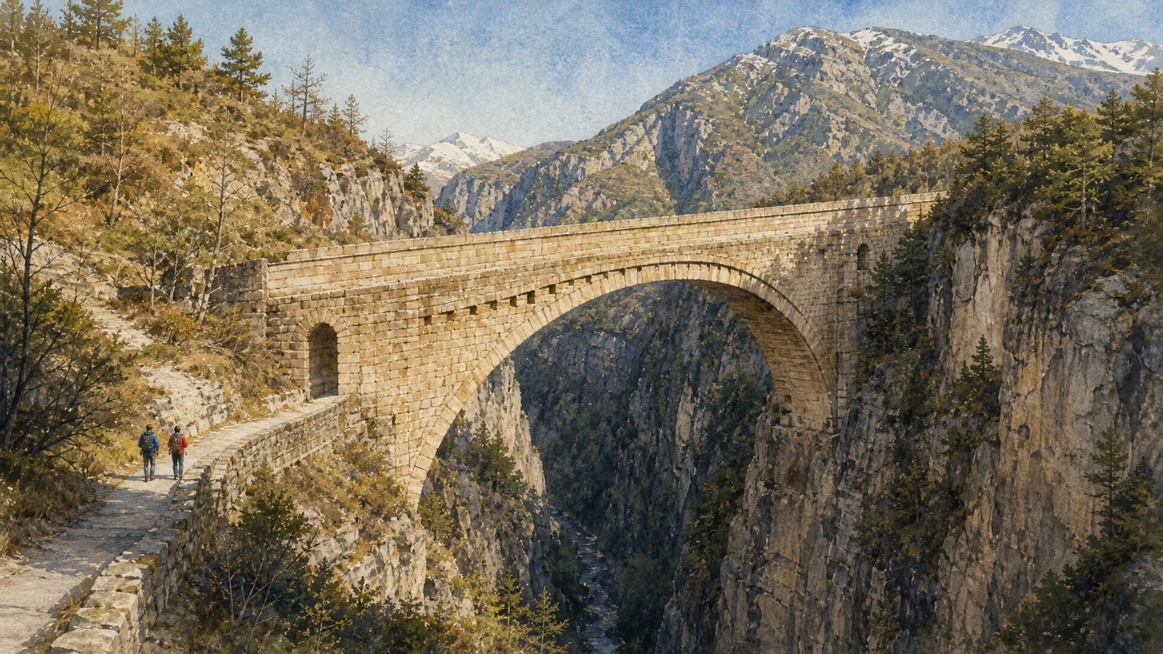
At Pont d’Aël near Aymavilles, the high masonry structure spans a wooded ravine. Access reveals the difference between the upper hydraulic channel and the covered pedestrian corridor; height, narrow interiors and seasonal conditions require attention.
The historical chapter
An inscription dates the work to 3 BCE and associates it with Caius Avillius Caimus. The aqueduct served agricultural or industrial activity on the opposite slope, demonstrating private investment and technical control of water along the wider corridor towards the western Alps.
What to notice
- The bridge's two functional levels
- The narrow covered passage inside the masonry
- The relationship between channel gradient and gorge crossing

The Alpine city through time
Ten thresholds
across five millennia
The chronology connects the ritual landscape, Roman colony, Christian city, medieval institutions and modern regional capital.
Ritual ploughing, timber alignments and anthropomorphic stelae mark the developing megalithic area at Saint-Martin-de-Corléans.
Rome defeats the Salassi and founds Augusta Praetoria for veterans at the meeting of Alpine roads.
The dated Pont d’Aël aqueduct bridge demonstrates ambitious water engineering west of the colony.
Forum, theatre, amphitheatre, houses and infrastructure express the mature Roman city.
Early Christian funerary and episcopal complexes reorganise sacred space within and outside the Roman walls.
The cathedral and Sant’Orso develop major Ottonian and Romanesque programmes, including frescoes and the cloister.
Towers, residences and religious institutions occupy and transform the inherited Roman grid.
Post-Napoleonic political restoration and civic rebuilding reshape the town within the Savoy state.
Resistance memory and the Special Statute frame the modern autonomous region with Aosta as its capital.
Discovery, excavation and museum construction at Saint-Martin-de-Corléans expand the city's public history beyond Rome.
Before your visit
Practical information,
without turning it into promises
Build the route by layers
Allow a full day for Roman and medieval Aosta and a separate excursion to Pont d’Aël. The MegaMuseo alone deserves unhurried time.
Check the combined ticket
Regional archaeology tickets, opening hours and guided-access spaces can change. Confirm the current arrangement with the official heritage service.
Walk before driving
The historic centre is compact and best read on foot. Pont d’Aël is outside Aosta and requires a separate transfer and attention to terrain.
Separate evidence from reconstruction
Use plans and museum models to understand lost structures, but keep them distinct from the fragmentary walls and foundations visible today.
Method and sources
Artistic in appearance.
Documentary in content.
The guide was written from the regional archaeological service, official cultural-heritage pages and the regional tourism authority. Dates and interpretations are attributed conservatively; modern opening hours, tickets, restoration works and access rules are not treated as permanent facts.
- Regione Valle d’Aosta · Augusta Praetoria ↗
- Regione Valle d’Aosta · Forum and cryptoporticus ↗
- Regione Valle d’Aosta · Roman gates ↗
- Regione Valle d’Aosta · Roman theatre ↗
- Regione Valle d’Aosta · MegaMuseo ↗
- Regione Valle d’Aosta · Saint-Martin archaeology ↗
- Turismo Valle d’Aosta · Roman architecture ↗
- Turismo Valle d’Aosta · Churches and sanctuaries ↗
- Turismo Valle d’Aosta · Sant’Orso ↗
- Turismo Valle d’Aosta · Cathedral ↗
- Turismo Valle d’Aosta · Museums ↗
- Regione Valle d’Aosta · Cultural heritage ↗
The images are documentary watercolours, not photographs or complete reconstructions. Archaeological sites, church interiors and Pont d’Aël have variable access conditions; consult the linked official pages shortly before visiting.