Illustrated guide · Aosta Valley
A valley guarded
stone by stone
Sixteen chapters along the Dora Baltea, from the Roman road at Donnas and the barrier fortress of Bard to Challant residences, painted courts and Savoy restoration.
Explore the placesPower arranged along a narrow route
The castles of the Aosta Valley are not a row of interchangeable silhouettes.
Bard blocks a gorge. Verrès is a compact military block. Issogne opens inward towards a painted court. Fénis gathers towers and walls around a residence in the agricultural plain. Each building answers a different problem of route, lordship, display or domestic life.
Their survival also tells a modern story. Some became barracks, some were romanticised, some were carefully restored and furnished to express a chosen image of the Middle Ages. The visitor therefore sees both medieval fabric and later ideas about preservation.
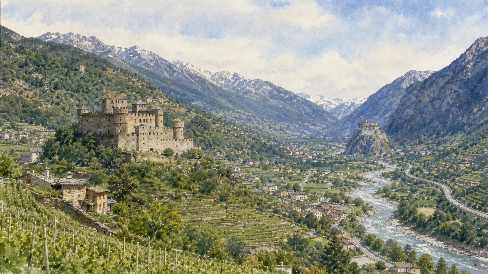
This guide moves west along the Dora Baltea and keeps the valley itself in view: Roman cuttings, vineyards, churches, railway, motorway and river all belong to the same corridor that the fortresses tried to command.

One destination
From a Roman cutting
to painted courts.
The lower Aosta Valley compresses movement between rock and river. At Bard and Donnas, ancient and modern transport lines almost touch; farther west the floor widens, allowing castles to govern estates, roads and villages rather than a single choke point.
The Challant family is central but not exclusive. Bishops, Savoy rulers, local communities, nineteenth-century restorers and the regional administration all changed the buildings. A responsible circuit distinguishes defensive geometry from later furnishing and avoids presenting restoration as untouched medieval survival.
The selection
Sixteen chapters,
one controlled corridor
The route begins where the valley narrows at Bard, follows Challant power through Verrès, Issogne and Fénis, then reaches the castle landscape west of Aosta.
- 01The Dora Baltea as a Fortified Corridor
- 02Bard, the Roman Road and the Historic Village
- 03The Fortress of Bard: Siege and Reconstruction
- 04Bard's Museums and the Idea of the Frontier
- 05Donnas: Roman Road, Arch and Terraced Vineyards
- 06Arnad and the Church of San Martino
- 07Verrès Castle: the Monoblock on the Rock
- 08Verrès, Saint-Gilles and the Ayas Junction
- 09Issogne: a Lordly Residence Turned Inward
- 10The Pomegranate Fountain and Painted Trades of Issogne
- 11Fénis: Towers and Double Enclosure on the Plain
- 12Fénis Courtyard, Chapel and Restoration
- 13Aymavilles Castle: Medieval Towers, Baroque Residence
- 14Saint-Pierre Castle and the Natural Science Museum
- 15Sarriod de La Tour and the Hall of Heads
- 16Châtel-Argent Above Villeneuve
River, road and authority compressed between slopes
The Dora Baltea as a Fortified Corridor
The castles make sense only when read against the changing width and routes of the main valley.
The place today
Railway, motorway, historic road, vineyards and settlements compete for the same narrow ground. From selected viewpoints, the sequence of rock spurs and valley-floor estates still explains why some sites became barriers while others became residential centres.
The historical chapter
Roman infrastructure established a durable transalpine axis. Medieval lordships divided control among towers, toll points and estates; Savoy consolidation, military engineering and modern transport repeatedly reorganised the corridor without replacing its underlying geography.
What to notice
- Where the river approaches the rock wall
- Castles placed on spurs versus those on the plain
- Terraced agriculture occupying marginal slopes
A compulsory passage below the fortress rock
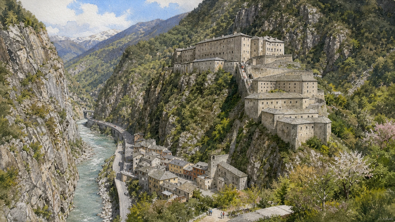
Bard, the Roman Road and the Historic Village
Before entering the fort, the village and Roman road reveal the continuity of movement through the gorge.
The place today
Bard's steep main street passes stone houses and links the parking area to lifts and paths serving the fortress. At the foot of the rock, remains of the Via delle Gallie and rock markings sit beside modern infrastructure.
The historical chapter
The gorge channelled the Roman road towards the Alpine passes and supported medieval control of transit. Settlement developed in the confined space below successive fortifications, adapting houses, workshops and passages to traffic and defence.
What to notice
- Road surfaces cut or supported against living rock
- Narrow plots aligned with the village street
- The fortress rock blocking the valley beyond the roofs
A medieval strongpoint remade as an early modern barrier
The Fortress of Bard: Siege and Reconstruction
The present complex is largely the product of nineteenth-century Savoy military engineering, not an intact medieval castle.
The place today
Three main defensive works rise between roughly 400 and 467 metres, connected by roads, stairs and panoramic lifts. Museums and exhibitions occupy many rooms, while the exterior circulation makes the geometry of the gorge and overlapping fire positions visible.
The historical chapter
Bard's earlier fortification resisted Napoleon's army in May 1800 and was demolished after the passage. The Savoy state rebuilt the fortress between the 1830s and 1838 as a system of separate works; restoration later converted the military complex into a cultural centre opened in 2006.
What to notice
- Opera Ferdinando, Vittorio and Carlo Alberto on separate levels
- Firing positions oriented along the valley
- Modern lifts inserted within the restored complex

Military rooms reused to interpret the Alps
Bard's Museums and the Idea of the Frontier
The fortress now explains mountain environments, fortification and borders rather than presenting empty barracks.
The place today
The Museum of the Alps, prison history route and Fortifications and Frontiers Museum occupy different works. Temporary exhibitions change independently, so tickets and open spaces should be checked rather than assumed from the exterior.
The historical chapter
The cultural conversion retained the massive structure while assigning new meanings to rooms designed for troops, artillery and supply. Interpretation now places the fort within changing ideas of the Alps as obstacle, habitat, national boundary and shared environment.
What to notice
- Original circulation adapted for museum access
- Views used as evidence in the fortification displays
- Differences between permanent museums and temporary galleries
Infrastructure cut into rock below a living wine landscape
Donnas: Roman Road, Arch and Terraced Vineyards
Donnas joins one of the valley's clearest Roman road cuttings to steep cultivated terraces.
The place today
A surviving stretch of the Via delle Gallie passes beneath a rock-cut arch near the historic settlement. Vineyards rise above the lower valley on walls and narrow ledges, while modern transport continues close to the ancient route.
The historical chapter
Roman engineers cut and supported the road through the lower valley after the conquest. Later communities maintained transit while specialising in slope agriculture; stonework for vines expresses another form of long-term engineering adapted to the same terrain.
What to notice
- Tool marks and wheel-worn surfaces in the Roman cutting
- The arch left within the living rock
- Dry-stone vineyard walls above the transport corridor
Romanesque architecture beside the lower-valley road
Arnad and the Church of San Martino
Arnad shifts the circuit from military control to the sacred and agricultural landscape of the corridor.
The place today
The church stands outside the compact village, with a Romanesque exterior, bell tower and layered interior. Nearby slopes support vineyards and chestnut woods; access to frescoed spaces may require current regional arrangements.
The historical chapter
The church developed from early medieval foundations and took its principal Romanesque form in the eleventh and twelfth centuries. Later Gothic frescoes, vaults and furnishings demonstrate continued patronage rather than a single stylistic moment.
What to notice
- Stone masonry and blind-arch decoration
- Fifteenth-century painting against the older structure
- The church's position within cultivated ground
A severe residence organised inside one compact volume
Verrès Castle: the Monoblock on the Rock
Verrès concentrates defence and ceremonial life within a nearly cubic stone block.
The place today
The castle is reached by an uphill path from the town. Inside, a central courtyard, monumental stair and large halls organise circulation within thick walls; guided visits control access and interpretation.
The historical chapter
Ibleto di Challant transformed the site around the late fourteenth century into an unusually unified fortress-residence. Its geometry expressed lordship over the Ayas junction and main valley, while later military use and restoration preserved its austere character.
What to notice
- The almost cubic exterior with limited openings
- The stone stair rising around the courtyard
- Large fireplaces and service routes inside the block
Town, collegiate church and roads below the fortress
Verrès, Saint-Gilles and the Ayas Junction
The castle's power depended on a settlement controlling movement between the Dora Baltea and Val d'Ayas.
The place today
The historic centre, collegiate complex of Saint-Gilles and bridge approaches can be walked separately from the castle climb. Urban buildings reveal later commercial and industrial phases that the isolated fortress view omits.
The historical chapter
Religious institutions and market activity developed at the valley junction under Challant and Savoy authority. Roads towards Ayas connected high pastures, mines and passes to the main corridor, making Verrès a node rather than merely a castle village.
What to notice
- The visual axis from town roofs to the castle
- Medieval and later fabric at Saint-Gilles
- Roads dividing towards Ayas and the central valley
Domestic display behind a restrained exterior
Issogne: a Lordly Residence Turned Inward
Issogne replaces the image of exposed fortress walls with connected rooms around an intimate court.
The place today
Visitors move through furnished rooms, chapel, service spaces and the central courtyard on a guided route. Much of the atmosphere comes from late Gothic decoration together with the historical reconstruction assembled by Vittorio Avondo.
The historical chapter
Georges de Challant transformed the older complex for Marguerite de La Chambre and Philibert de Challant around the turn of the sixteenth century. The residence expressed cultivated seigneurial life; Avondo's nineteenth-century acquisition and restoration shaped its later museum identity.
What to notice
- Covered passages linking rooms around the court
- Furniture distinguished from fixed medieval fabric
- Heraldry connecting the residence to Challant family networks
Courtly symbolism beside images of everyday work
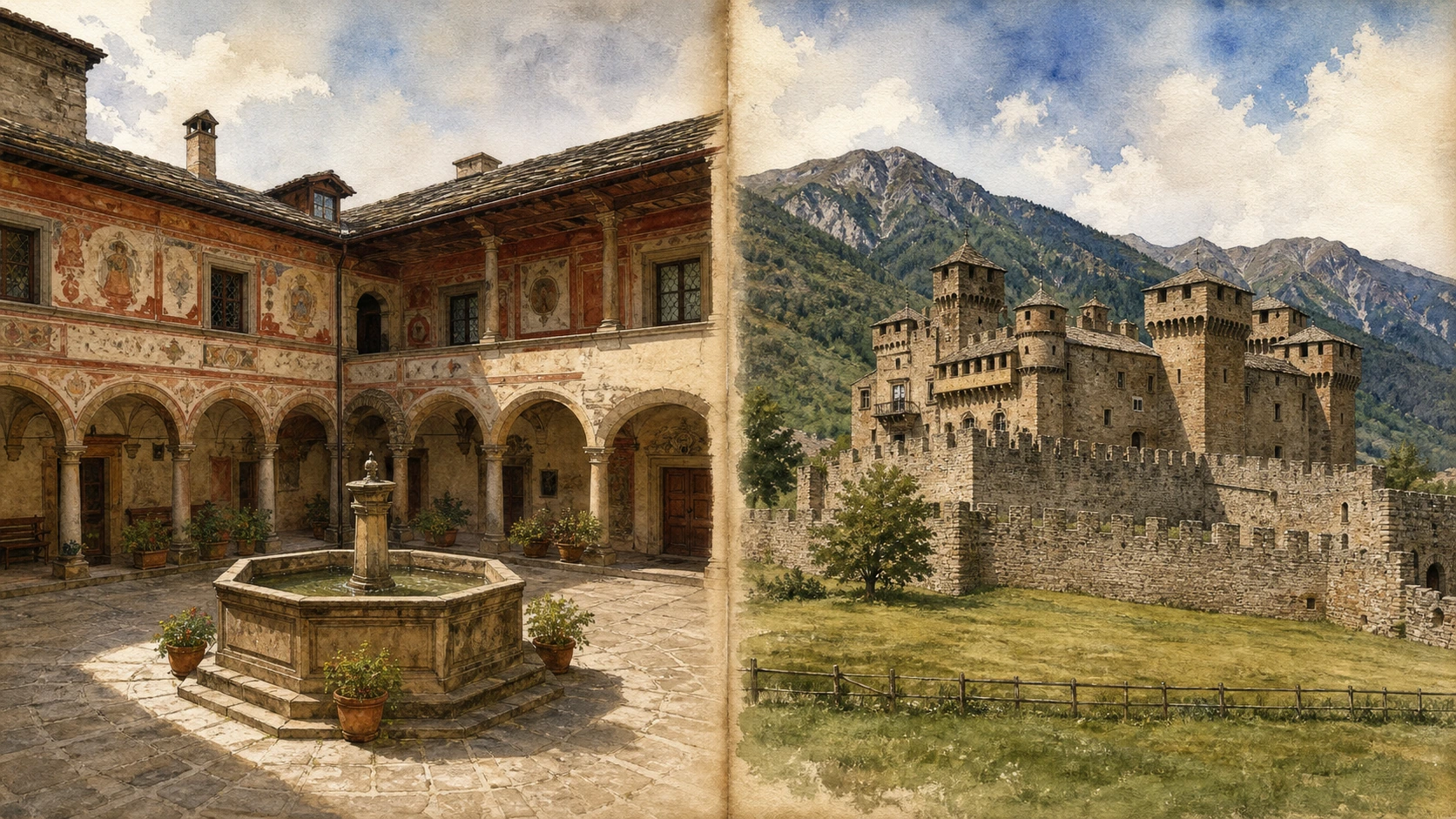
The Pomegranate Fountain and Painted Trades of Issogne
The courtyard stages lineage and prosperity while its lunettes depict workshops, markets and guardrooms.
The place today
The iron pomegranate tree stands at the centre of the court beneath painted heraldry. Around it, frescoed lunettes reward close viewing of clothing, tools, goods and gestures; controlled light and conservation barriers protect fragile surfaces.
The historical chapter
The fountain symbolised fertility and alliance, while the late fifteenth-century paintings presented an ordered seigneurial world populated by workers and exchange. They are constructed courtly images, not neutral snapshots, but preserve exceptional material detail.
What to notice
- Iron branches and fruit above the stone basin
- Specific tools and merchandise in the lunettes
- Graffiti left by later occupants and visitors

A fortified image surrounding a residential core
Fénis: Towers and Double Enclosure on the Plain
Fénis looks martial, yet its location and interior reveal a lordly residence rather than a barrier fortress.
The place today
The castle rises from agricultural ground with crenellated walls and multiple towers visible before entry. The guided route moves through courtyard, stairs, chapel and rooms; the exterior walk explains the double enclosure better than a single frontal view.
The historical chapter
The Challant family enlarged the residence principally in the fourteenth and early fifteenth centuries. Its towers projected status and protected domestic life, while later abandonment and nineteenth-century restoration helped create the emblematic medieval appearance seen today.
What to notice
- Irregular towers responding to the residential plan
- The space between outer and inner walls
- Agricultural land rather than a commanding gorge
Painted devotion and the making of a national monument
Fénis Courtyard, Chapel and Restoration
The interior joins late medieval art to a modern history of rescue, selection and reconstruction.
The place today
A semicircular stair, wooden galleries and painted figures animate the courtyard. The chapel and reception room preserve an important fresco cycle; furnishings and reconstructed elements require interpretation rather than being assumed original to one date.
The historical chapter
Bonifacio I of Challant commissioned major decorative work associated with the international Gothic world. After decline, Alfredo d'Andrade and public institutions promoted acquisition and restoration, making Fénis central to the modern image of Valle d'Aosta heritage.
What to notice
- Saint George above the courtyard stair
- Sages and moral inscriptions along the gallery
- Restored woodwork distinguished from medieval masonry and paint
A vertical stronghold reshaped for display and comfort
Aymavilles Castle: Medieval Towers, Baroque Residence
Four medieval corner towers frame a residence whose present form records substantial early modern transformation.
The place today
The restored castle stands above vineyards near the entrance to the Cogne valley. Museum rooms explain construction phases and collections, while the exterior terraces reveal its relationship to the Dora Baltea and western road.
The historical chapter
A medieval Challant stronghold was progressively transformed, especially during the eighteenth century, when loggias and residential spaces altered its defensive character. Recent restoration made the layered architecture rather than a single ideal period central to the visit.
What to notice
- Four cylindrical towers surviving within later façades
- Open loggias contrasting with defensive masonry
- Vineyards and roads below the castle terrace
A romanticised silhouette housing regional environments
Saint-Pierre Castle and the Natural Science Museum
The castle's picturesque towers belong partly to nineteenth-century remodelling, while its museum turns attention to the living Alps.
The place today
The building crowns a rocky rise among orchards and vines. Inside, the regional natural science museum interprets geology, habitats and species; the restored route may have timed or capacity-controlled access.
The historical chapter
A medieval residence was altered repeatedly and given a more overtly castellated profile during nineteenth-century restoration. Its museum use creates a productive contrast: a building shaped by heritage imagination now presents evidence about the region's physical and biological landscapes.
What to notice
- Small corner turrets added to the historic mass
- Museum displays connecting altitude to habitat
- Orchards and vineyards around the rocky base
A residence expanded around an older tower
Sarriod de La Tour and the Hall of Heads
Sarriod de La Tour preserves the irregular growth of a family complex and one of the valley's most unusual carved ceilings.
The place today
The castle stands close to the Dora Baltea below Saint-Pierre. Its route moves through chapel, rooms and the Hall of Heads, where carved corbels show human, animal and fantastic figures beneath the ceiling.
The historical chapter
Successive Sarriod building campaigns surrounded the original tower with residential wings and service spaces. Fifteenth-century sculpture and painting expressed lineage and courtly culture, while the irregular plan records adaptation rather than a single architectural project.
What to notice
- Different wall phases around the central tower
- Carved corbels supporting the Hall of Heads ceiling
- The low position near river and agricultural land
A military enclosure controlling the western road
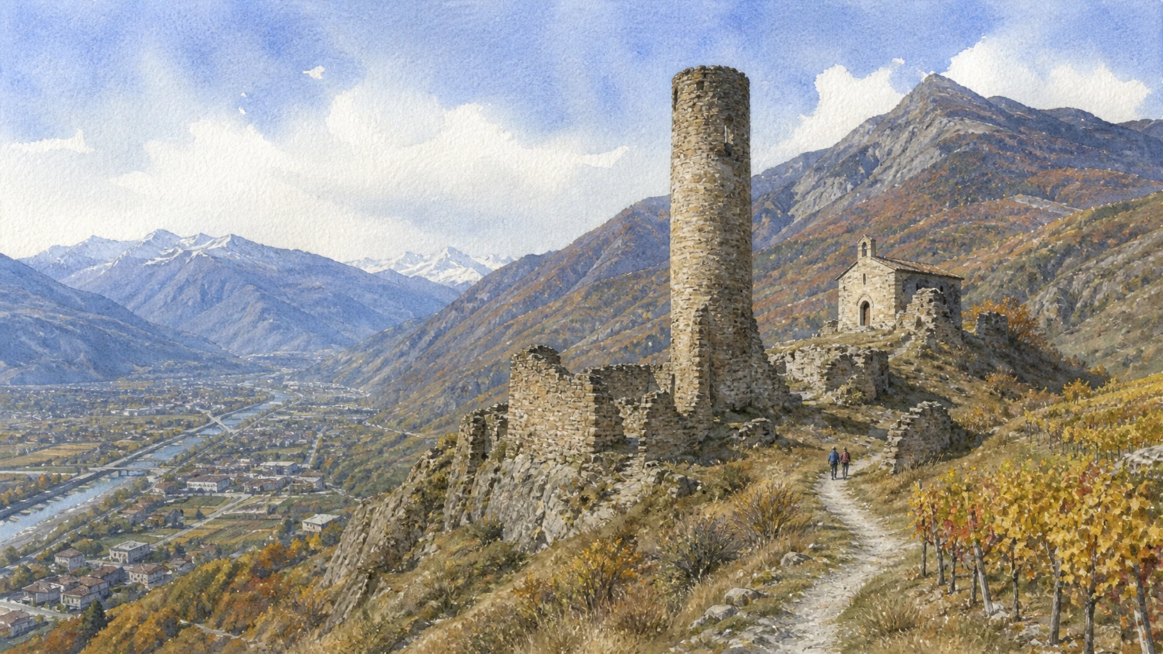
Châtel-Argent Above Villeneuve
The ruined curtain, circular tower and chapel make strategic geometry clearer than a fully furnished castle could.
The place today
A path climbs from Villeneuve to the rocky terrace. The enclosure is fragmentary and exposed, with broad views over the Dora Baltea and routes towards the Little Saint Bernard and Cogne; footwear and weather matter more than ticketing.
The historical chapter
The site has earlier occupation, but the present military complex was probably rebuilt around 1275 for Count Peter II of Savoy by engineers linked to Jacques de Saint-Georges. Its name has been associated with minting, and its direct Savoy ownership distinguished it from Challant residences.
What to notice
- The circular keep on the highest point
- The chapel as the oldest standing component
- Sightlines over Villeneuve and the western corridor

The fortified valley through time
Ten moments
in a fortified valley
The sequence follows Roman infrastructure, medieval lordship, Savoy defence, restoration and contemporary public use.
The Via delle Gallie establishes the durable road corridor visible at Bard and Donnas.
Romanesque churches and early strongholds organise sacred and military points along the lower valley.
Châtel-Argent is probably rebuilt for Peter II of Savoy as a direct military enclosure.
Ibleto di Challant gives Verrès its compact fortress-residence form.
Fénis develops its towered enclosure, courtyard and major painted programme.
Georges de Challant transforms Issogne into a refined residence with painted court and pomegranate fountain.
Aymavilles is reshaped as a more open baroque residence around its medieval towers.
The earlier fortress of Bard delays Napoleon's army and is demolished after the passage.
The Savoy state constructs the present multi-level fortress at Bard.
Acquisition, restoration and museum conversion turn castles and the fortress into public heritage while reshaping their appearance.
Before your visit
Practical information,
without turning it into promises
Use two or three bases
Bard and the lower valley, Verrès–Issogne, and the western castle group are more intelligible as separate days than as a rushed single drive.
Reserve guided entries
Several regional castles use timed guided visits. Check the official heritage schedule and do not assume that exterior opening means interior availability.
Include the villages
Walk Bard, Verrès, Issogne and Villeneuve instead of treating each castle as an isolated car stop. Their streets explain the economic geography below the walls.
Name restoration honestly
Nineteenth- and twentieth-century interventions are part of the story. Distinguish reconstructed roofs, furnishings and galleries from surviving medieval fabric.
Method and sources
Artistic in appearance.
Documentary in content.
The guide combines the regional cultural-heritage catalogue, monument-specific regional pages and the Forte di Bard's institutional documentation. Architectural dates are stated conservatively, and restoration is treated as historical evidence rather than hidden behind the language of authenticity.
- Regione Valle d’Aosta · Cultural heritage ↗
- Regione Valle d’Aosta · Cultural catalogue ↗
- Forte di Bard · Monumental complex ↗
- Forte di Bard · Museums ↗
- Forte di Bard · Visitor information ↗
- Regione Valle d’Aosta · Issogne ↗
- Regione Valle d’Aosta · Fénis ↗
- Regione Valle d’Aosta · Châtel-Argent ↗
- Regione Valle d’Aosta · Via delle Gallie ↗
- Turismo Valle d’Aosta · Churches ↗
- Turismo Valle d’Aosta · Museums ↗
The illustrations are documentary watercolours, not photographs. Castle routes, museum displays, lifts, tickets and accessibility conditions change; consult the linked institutional pages shortly before travelling.