Illustrated guide · Aosta Valley
Beneath the massif,
a landscape of passage
Sixteen chapters from Courmayeur and the first Italian guide society to Val Ferret, Val Veny, high vineyards, La Thuile and the archaeology of the Little Saint Bernard.
Explore the placesA massif that changed the work below it
Mont Blanc should not be reduced to a summit measurement or a cable-car view.
Below the massif, Courmayeur became a meeting place between valley knowledge and international mountaineering. Val Ferret and Val Veny developed different landscapes and uses; Morgex cultivated vines at unusual altitude; La Thuile linked mining, war, snow and the Little Saint Bernard passage.
The modern tourism economy is powerful but not timeless. Hotels, lifts, the tunnel and ski infrastructure belong to a long sequence of technical interventions in an already inhabited and worked territory.
This guide stays mostly on the ground. It treats glaciers and high routes as changing environments that demand current information, not as scenery guaranteed to every visitor.
One destination
From Roman bridges
to the age of guides.
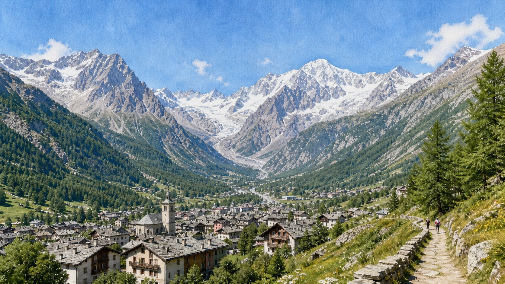
The Valdigne occupies the north-western end of the Aosta Valley, where the Dora Baltea begins from waters descending through Val Ferret and Val Veny. Courmayeur, La Salle, Morgex, Pré-Saint-Didier and La Thuile form distinct communities tied to the massif and the roads beyond it.
A complete circuit moves between town, valley floor, museum, archaeological pass and high-mountain threshold. The guide does not prescribe ascents: glaciers, rockfall, snow, transport and access rules change faster than an editorial page can be updated.
The selection
Sixteen chapters,
one western threshold
The route begins in the inhabited Valdigne, follows the two valleys at the foot of Mont Blanc and reaches La Thuile and the archaeological pass.
- 01The Valdigne and the Beginning of the Dora Baltea
- 02Courmayeur and Dolonne
- 03The Guide Society and the Duca degli Abruzzi Alpine Museum
- 04Entrèves at the Meeting of Two Valleys
- 05Skyway and Punta Helbronner
- 06Val Ferret from Planpincieux to Arnouva
- 07Mont de La Saxe and the Tour du Mont-Blanc
- 08Val Veny, Peuterey and Notre-Dame de Guérison
- 09Combal, Lake Miage and the Debris-Covered Glacier
- 10Pré-Saint-Didier, the Gorge and Thermal Culture
- 11Morgex and the High Vineyards
- 12La Thuile: Village, Coal and the Road to the Pass
- 13Roman Bridges on the Climb to Alpis Graia
- 14The Cromlech of the Little Saint Bernard
- 15The Roman Mansiones and Road Across Alpis Graia
- 16The Pass as a Seasonal Border Landscape
Five communities below the western Alpine wall
The Valdigne and the Beginning of the Dora Baltea
The Mont Blanc territory is a system of settlements and waters before it is a view of the summit.
The place today
La Salle, Morgex, Pré-Saint-Didier, Courmayeur and La Thuile occupy different levels and junctions. Roads, vines, woods and tourist infrastructure make the area continuous, but each valley has its own orientation and seasonal access.
The historical chapter
Routes towards the Little Saint Bernard and across the massif connected the upper valley to Gaul and later transalpine economies. Agriculture, herding, mineral work, hospitality and transport gradually diversified into the modern tourism region called Valdigne–Mont Blanc.
What to notice
- Where the Dora branches towards Val Ferret and Val Veny
- Settlements on fans and terraces above the river
- The separate road climbing from Pré-Saint-Didier to La Thuile
An Alpine town and its older village fabric
Courmayeur and Dolonne
Courmayeur combines an international resort centre with lanes, churches and hamlets shaped before mass tourism.
The place today
The pedestrian Via Roma, parish area and historic hotels form the active centre. Across the Dora, Dolonne retains dense stone-and-wood buildings below ski infrastructure; walking between them shows the scale of the older settlement better than driving.
The historical chapter
Thermal visitors, alpinists, guides and hotels transformed Courmayeur during the nineteenth and twentieth centuries. Dolonne and surrounding hamlets preserve evidence of agriculture and local building practice within a municipality increasingly organised around mountain tourism.
What to notice
- Historic façades behind the resort shopfronts
- Stone bases and timber upper structures in Dolonne
- The changing relationship between village lanes and lift access
Professional memory inside the Casa delle Guide
The Guide Society and the Duca degli Abruzzi Alpine Museum
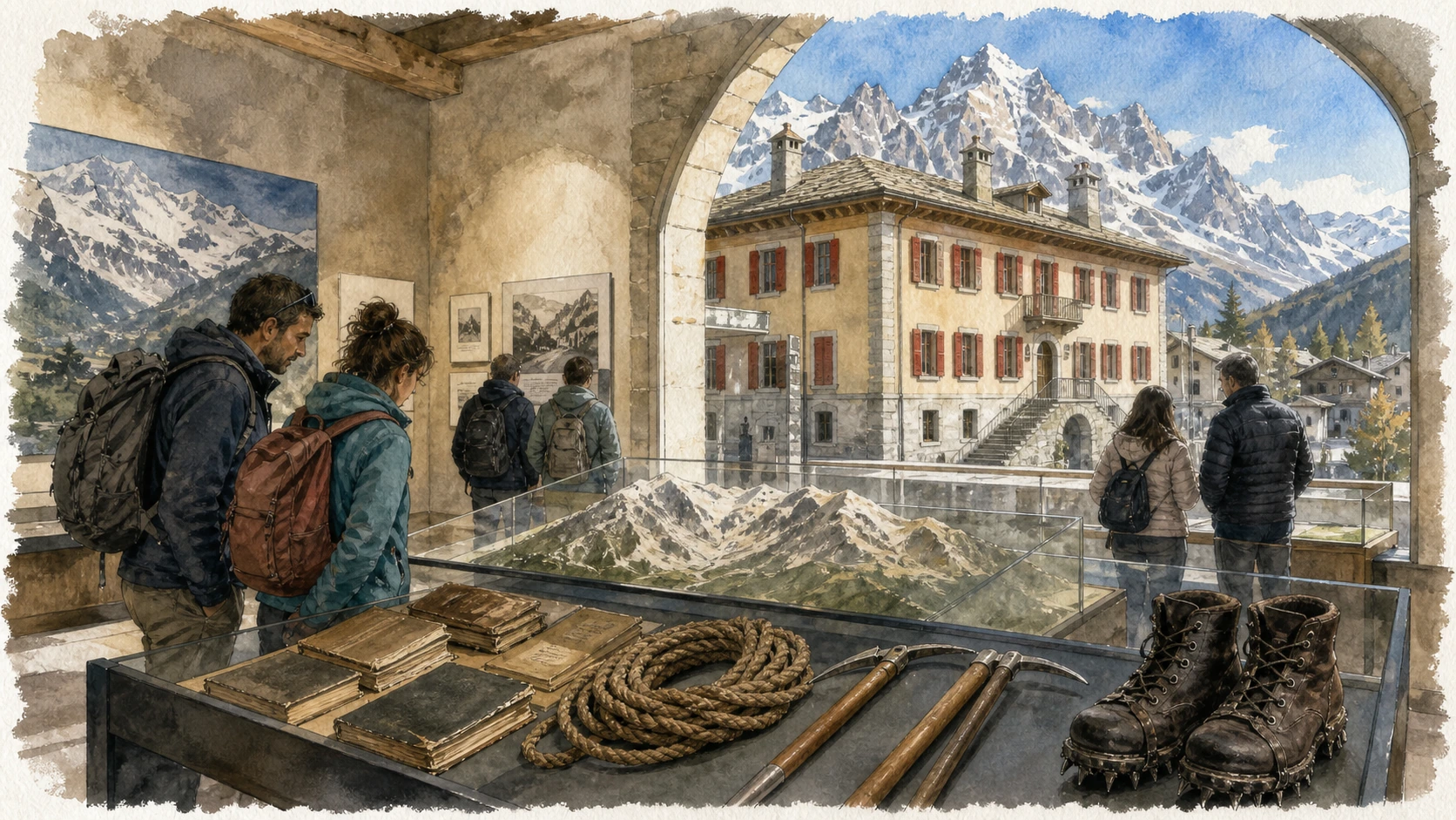
Guide books, equipment and expedition objects document how local knowledge became a regulated profession.
The place today
The museum occupies the historic guide house in Courmayeur and presents objects, photographs, models and clients' guide books. Its opening hours vary by season and should be confirmed directly with the society.
The historical chapter
The Courmayeur guide society was founded in 1850, the first formally constituted in Italy. The museum, inaugurated in 1929 and later renewed, connects local ascents to polar, Himalayan and African expeditions without separating international achievement from the labour of guiding.
What to notice
- Guide books carrying clients' written assessments
- Changes in ropes, boots and ice equipment
- Relief models used to teach complex mountain form

A village beneath roads, cableways and glaciers
Entrèves at the Meeting of Two Valleys
Entrèves marks the practical junction between Courmayeur, Val Ferret, Val Veny, the tunnel and Skyway.
The place today
The compact village sits below major transport infrastructure but retains stone houses, lanes and views towards the massif. Traffic, parking and cableway access can obscure its older scale; walking the village separately restores that perspective.
The historical chapter
Entrèves developed where waters and routes from the two side valleys converge. Twentieth-century road, tunnel and lift construction turned it into an international gateway, increasing pressure on a settlement whose architecture originated in local rural and transit economies.
What to notice
- Dense houses protected from open valley exposure
- Roads layered above the older street network
- Separate openings towards Val Ferret and Val Veny
Mechanical access to a high-mountain threshold
Skyway and Punta Helbronner
The cableway offers observation at altitude but does not turn glaciated terrain into an ordinary promenade.
The place today
The staged ascent reaches Pavillon du Mont Fréty and Punta Helbronner at 3,466 metres. Weather, altitude, lift operation and visibility change quickly; leaving managed terraces for glacier travel requires appropriate expertise and current professional guidance.
The historical chapter
Cableways altered access to the massif across the twentieth and twenty-first centuries, culminating in the present rotating cabins and stations. They belong to the history of Alpine engineering and tourism, distinct from the techniques and risks of alpinism beyond the facilities.
What to notice
- Vegetation changing between valley and Pavillon
- Glacier surfaces observed from protected terraces
- Infrastructure anchored within exposed rock and ice terrain
A long inhabited valley beneath the Grandes Jorasses
Val Ferret from Planpincieux to Arnouva
Val Ferret combines pasture, seasonal settlement and trail access under an exceptionally steep mountain wall.
The place today
A road and seasonal transport serve Planpincieux, Lavachey and Arnouva, while paths climb towards refuges and the Grand Col Ferret. Access restrictions and transport arrangements vary during busy or hazardous periods.
The historical chapter
Pasture and cross-border movement preceded the valley's recreational economy. Refuges, guide services and the Tour du Mont-Blanc later expanded use, while glacier hazards and traffic management made the valley a focus of contemporary risk planning.
What to notice
- The contrast between Mont de La Saxe and the massif wall
- Seasonal settlements and pasture boundaries
- Debris channels descending from glaciers and steep gullies
A balcony path within an international circuit
Mont de La Saxe and the Tour du Mont-Blanc
The slope opposite the massif gives geographic clarity to a route crossing three countries.
The place today
Paths above Courmayeur and Val Ferret lead towards Rifugio Bertone, Rifugio Bonatti and the Grand Col Ferret. Distances, weather exposure and accommodation capacity require planning; the famous circuit is not a single casual day walk.
The historical chapter
Local paths connected pastures and settlements before they became part of the Tour du Mont-Blanc. Modern waymarking and refuges made the circuit internationally legible, while continued pastoral work and erosion management keep it from being only a tourism product.
What to notice
- The massif read as a continuous wall across the valley
- Dry-stone and pasture traces beside the trail
- International route signs layered over local paths
A narrow entrance opening into a broad glacial basin
Val Veny, Peuterey and Notre-Dame de Guérison
Val Veny changes character repeatedly beneath the south-western side of Mont Blanc.
The place today
From Entrèves, the valley passes the sanctuary, wooded Peuterey sector and open Plan Veny towards La Visaille. Seasonal traffic limits, bus services and path closures shape access; the valley cannot be understood from a single roadside stop.
The historical chapter
Pasture, pilgrimage and travel to high crossings structured the valley before modern recreation. Notre-Dame de Guérison became a place of devotion associated with mountain communities and alpinists, while camps, refuges and roads expanded twentieth-century use.
What to notice
- The sharp transition from gorge to open basin
- The sanctuary positioned below active mountain terrain
- Larch and pasture changing with altitude and exposure
Wetland, moraine and ice in rapid transformation
Combal, Lake Miage and the Debris-Covered Glacier
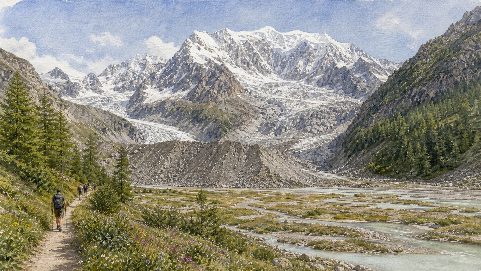
The upper valley makes glacial processes visible without offering safe access to every feature.
The place today
Paths from La Visaille approach the Combal plain, moraine and routes towards Rifugio Elisabetta. Lake and glacier margins can change, and unstable ice or debris must be observed only from authorised routes and current safe viewpoints.
The historical chapter
Glacial advance and retreat created moraines, water bodies and outwash surfaces repeatedly occupied by vegetation and pasture. Scientific monitoring and risk management now document a landscape whose famous forms cannot be assumed permanent from older photographs.
What to notice
- Braided water and wet ground across the Combal plain
- Debris masking ice on the Miage glacier
- Moraine ridges separating present and former glacier positions

A junction where hot water and roads meet
Pré-Saint-Didier, the Gorge and Thermal Culture
The town links the Mont Blanc road to La Thuile while its thermal history developed beside a deep gorge.
The place today
Pré-Saint-Didier is crossed by traffic towards Courmayeur and the La Thuile branch. Thermal buildings, the Dora di Verney gorge and panoramic structures offer different experiences; the latter are subject to weather and maintenance.
The historical chapter
Thermal use gained prominence during the nineteenth-century development of Alpine travel. Roads and bridges reorganised the junction repeatedly, while spa culture turned mineral water and mountain air into a modern visitor economy before skiing dominated the upper valleys.
What to notice
- The road division between Courmayeur and La Thuile
- Historic spa architecture beside later facilities
- The depth of the gorge below the settlement terrace
Prié Blanc cultivated close to the upper limit of viticulture
Morgex and the High Vineyards
Low pergolas and stone walls express agricultural adaptation within the cold upper valley.
The place today
Vineyards occupy sunny slopes and fans around Morgex and La Salle, often trained close to the ground. Cellar visits and active plots require respect for private work; the landscape is best read from public paths and roads.
The historical chapter
Local selection and cultivation of Prié Blanc adapted vines to altitude, frost and a short growing season. Cooperative production and modern wine tourism helped sustain a difficult agricultural system that might otherwise disappear beneath residential and visitor pressure.
What to notice
- Low pergolas using warmth retained near stone and soil
- Dry-stone walls controlling slope and drainage
- Small fragmented plots among modern development
A high settlement shaped by extraction and border mobility
La Thuile: Village, Coal and the Road to the Pass
La Thuile's ski identity sits above an older mining and transit landscape.
The place today
The village spreads around the Dora di Verney below lift infrastructure and roads to the pass. Mining remains, workers' spaces and interpretive routes are less visually dominant than ski facilities but essential to the town's twentieth-century history.
The historical chapter
Coal extraction expanded industrially in the modern period and connected La Thuile to transport and energy networks. Closure forced economic restructuring towards tourism, while the road to France retained military, commercial and seasonal importance.
What to notice
- Industrial traces distinct from rural stone buildings
- The river organising the settlement floor
- Road and lifts climbing in different directions from the village
Surviving abutments beneath later roads
Roman Bridges on the Climb to Alpis Graia
Fragments at La Balme and Pont Serrand show the engineering behind the approach to the Little Saint Bernard.
The place today
The Roman remains sit beside or beneath modern bridge structures and can be difficult to distinguish without the regional archaeological description. Traffic and roadside conditions make careful legal stopping essential.
The historical chapter
The Via delle Gallie crossed torrents repeatedly as it climbed from Pré-Saint-Didier towards the pass. Squared blocks, rock foundations and portions of bridge masonry document a road system designed for durable transalpine movement.
What to notice
- Squared abutment blocks founded on living rock
- Sockets associated with ancient construction
- Modern bridge fabric obscuring portions of Roman masonry
Low stones marking a much-debated prehistoric place
The Cromlech of the Little Saint Bernard
The stone circle is significant precisely because it remains low, open and difficult to date simply.
The place today
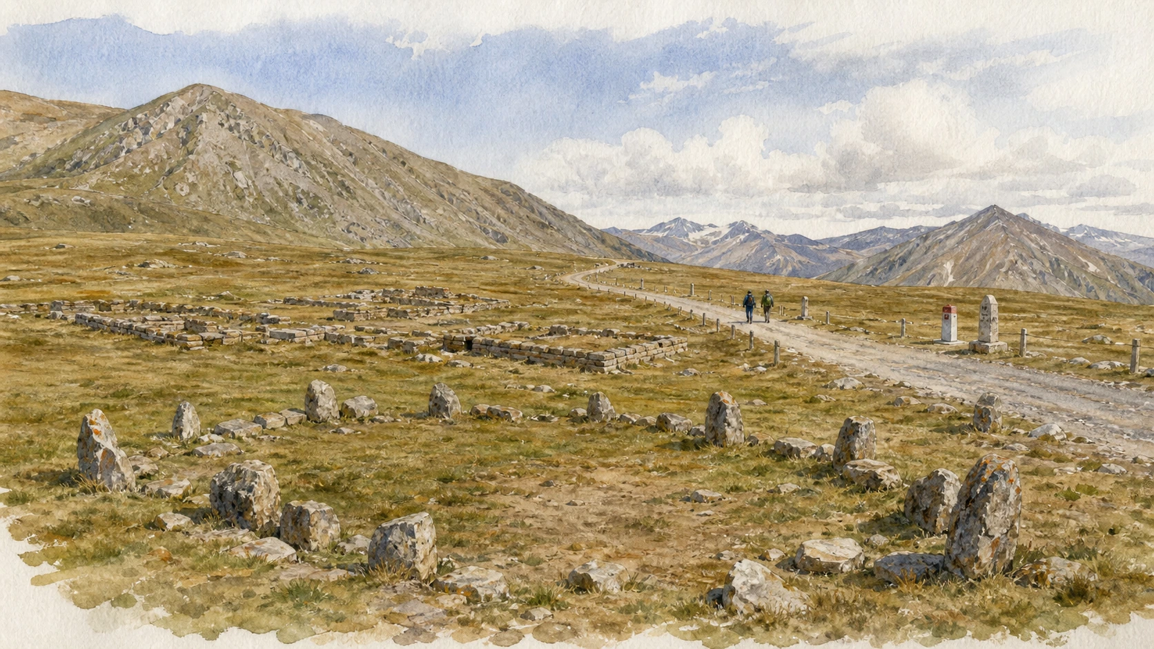
Stones form a broad, interrupted circle on the pass plateau close to road and border installations. Snow covers the site in winter, and visitors should stay on public surfaces without moving or adding stones.
The historical chapter
The feature has attracted antiquarian and archaeological interpretation for centuries. Research places it within a long prehistoric use of the pass area, but its exact chronology and function require caution; later roads and buildings altered the setting.
What to notice
- The wide diameter and low profile of the stones
- Interruptions caused by later routes
- The open plateau rather than a sheltered ritual enclosure
Shelter, worship and administration at high altitude
The Roman Mansiones and Road Across Alpis Graia
Low foundations reveal that a mountain pass required buildings and maintenance, not only a road line.
The place today
Archaeological remains of stopping places and a sacred building lie across the plateau on both sides of the modern border. They are exposed to severe weather and may be partly obscured even outside winter.
The historical chapter
Rome formalised the pass as Alpis Graia within the road towards Gaul. Mansiones supported travellers and official traffic, while a fanum expressed ritual protection at the crossing; medieval hospice traditions later continued the need for high-altitude hospitality.
What to notice
- Foundation plans rather than standing rooms
- Relationship to the gentlest line across the plateau
- Later hospice and border features reusing the crossing
A road that disappears under snow and reopens into shared territory
The Pass as a Seasonal Border Landscape
The pass remains a living route whose accessibility and meaning change with the season.
The place today
The road generally closes through the snowy season, making the archaeological area inaccessible by ordinary travel. In summer, walkers, cyclists and drivers share a plateau with weather, livestock and cross-border monuments; current road information takes priority over fixed dates.
The historical chapter
Prehistoric movement, Roman administration, medieval hospitality, Savoy and French frontiers, wartime defence and modern tourism all used the same broad saddle differently. Political lines changed, but the need to negotiate altitude and weather remained.
What to notice
- Road engineering adapted to snow and wind exposure
- Italian and French markers across one plateau
- Low archaeological features embedded in active pasture

The western Alps through time
Ten passages
through the western Alps
The chronology connects Roman roads, medieval hospitality, early alpinism, industrial mining and modern high-mountain access.
Communities use the Little Saint Bernard plateau long before the Roman road; the cromlech remains the most visible and debated trace.
The Via delle Gallie, bridges and high-pass stations formalise movement across Alpis Graia.
Hospices, parishes and local escorts support pilgrims, merchants and officials crossing the western Alps.
Balmat and Paccard reach the summit of Mont Blanc from Chamonix, accelerating European interest in ascent.
Courmayeur establishes the first formally constituted Alpine guide society in Italy.
Hotels, guide work, spa travel and improved roads expand the visitor economy of Courmayeur and Pré-Saint-Didier.
The Duca degli Abruzzi Alpine Museum opens in the Casa delle Guide.
Coal mining at La Thuile, cableways, roads and winter tourism reorganise employment and settlement.
The Mont Blanc Tunnel opens a permanent motor route through the massif, transforming Entrèves and international traffic.
New cableway infrastructure, glacier retreat and risk monitoring reshape access and interpretation across the massif.
Before your visit
Practical information,
without turning it into promises
Separate the two valleys
Give Val Ferret and Val Veny different days or half-days. Their roads, landforms, transport rules and trail systems are not interchangeable.
Treat altitude as a condition
Skyway does not remove the effects of altitude, cold or rapid weather. Glacier travel requires current information and qualified professional guidance.
Check seasonal transport
Road closures, buses, parking controls and pass opening change through the year. Use current regional and municipal notices before setting out.
Balance mountain and town
Include Courmayeur's guide museum, Morgex vineyards, La Thuile's mining memory and the archaeological pass so the massif is not reduced to panoramic consumption.
Method and sources
Artistic in appearance.
Documentary in content.
The guide uses the official regional tourism service, regional archaeology pages, the Courmayeur Guide Society and institutional mountain-safety material. It avoids prescribing technical routes or presenting lift operation, glacier form and seasonal road access as stable.
- Turismo Valle d’Aosta · Mont Blanc ↗
- Turismo Valle d’Aosta · Mont Blanc area ↗
- Turismo Valle d’Aosta · Val Veny ↗
- Turismo Valle d’Aosta · Val Ferret ↗
- Turismo Valle d’Aosta · Tour du Mont-Blanc ↗
- Società Guide Alpine Courmayeur · Guides ↗
- Società Guide Alpine Courmayeur · Alpine Museum ↗
- Regione Valle d’Aosta · Little Saint Bernard ↗
- Regione Valle d’Aosta · Road to the passes ↗
- Fondazione Montagna Sicura ↗
- Turismo Valle d’Aosta · Courmayeur ↗
The illustrations are documentary watercolours, not photographs or safety information. Mountain conditions, glaciers, roads, paths, refuges, lifts and archaeological access can change rapidly; consult official bulletins and qualified professionals shortly before travel.