Original documentary watercolour joining the Circus Maximus, Aventine hill and Baths of Caracalla

Rome Guide 13 · Public spectacle, hilltop worship and an imperial machine

The Aventine,
Circus Maximus
and Caracalla

A full-day route from the vast but fragmentary Circus Maximus up the Aventine’s churches, gardens and layered sanctuaries, then through the architecture, surfaces and underground labour of the Baths of Caracalla.

Plan the route
Circus Valley · Aventine · Caracalla10 chapters · 10 route points

Why this district matters

This route joins three different forms of public space: a valley shaped by mass spectacle, a hill of worship and retreat, and a bath complex powered by hidden infrastructure.

The Circus Maximus is easy to underestimate because its greatest surviving evidence is topographical. The grassy valley between Palatine and Aventine preserves the dimensions and curvature of an entertainment building once framed by tiered seating, shops, ceremonial entrances and a central barrier. Much of the fabric visible at the southeastern end belongs to the Trajanic and later phases, while the apparently natural banks and open field also reflect post-antique agriculture, industrial occupation and twentieth-century clearance. Read the ground plan before imagining a complete arena.

The Aventine above is not a single preserved ancient quarter. Santa Sabina gives rare access to the spatial clarity of a fifth-century basilica, yet medieval Dominican occupation and twentieth-century restoration are equally visible. The Orange Garden was designed in 1932 inside the walls of a medieval fortress; the Rose Garden opened on its present site in 1950 and carries the memory of the Jewish cemetery formerly occupying the slope. Piranesi’s Malta square belongs to the eighteenth century, while Santa Prisca joins an active church to Roman substructures and a Mithraic sanctuary.

The Baths of Caracalla were both monumental public architecture and a working system. Their axial pools, halls, palaestrae, libraries and gardens offered bathing, exercise, study and social encounter. Marble surfaces, mosaics and colossal sculpture converted engineering into imperial display, but most decoration is fragmentary or dispersed. Below, long carriage tunnels, furnaces, boilers, water management and storage depended on difficult labour. The underground Mithraeum adds a cult space to that service world without proving that every worker or visitor shared one religious identity.

Move from outline to structure to labour: the visible monument becomes more truthful when missing seating, restored church fabric, displaced decoration and underground work remain part of the story.

The route

Plan your visit

Start by reading the Circus Maximus from the Aventine edge, then enter the southeastern archaeological sector to see galleries and Torre della Moletta. Climb through the Rose Garden to Santa Sabina and Parco Savello, continue to the Malta gate and Santa Prisca, and descend toward the Baths of Caracalla. Inside the baths, follow the central bathing axis before examining surfaces and the underground service network.

Morning I

Valley and surviving structure

Read the circus as an elongated building footprint, then use the excavated curve, galleries and medieval tower to recover its vertical and post-antique history.

Morning II

Aventine gardens and basilica

Climb through the Rose Garden, compare ancient-spolia construction and modern restoration at Santa Sabina, and pause at the Orange Garden’s designed belvedere.

Afternoon I

Piranesi and the underground cult

Treat the Malta square as eighteenth-century architecture, then visit Santa Prisca as a layered church-and-archaeology site rather than a free-standing Mithraic temple.

Afternoon II

Caracalla above and below

Follow the dry bathing sequence, inspect mosaics and stripped walls, and finish with the service tunnels and Mithraeum that sustained or occupied the monumental block.

Ten chapters

Explore the places

The order follows the physical climb from the circus valley to the Aventine, then the descent to Caracalla. Use the index to revisit one chapter without separating monumental form from later reuse, restoration and hidden labour.

  1. 01Circus Maximus: reading the valley
  2. 02The excavated curve and Torre della Moletta
  3. 03The Rose Garden and Aventine slope
  4. 04Santa Sabina: basilica, doors and restoration
  5. 05Parco Savello, the Orange Garden
  6. 06Piazza dei Cavalieri di Malta and the Priory gate
  7. 07Santa Prisca and the Mithraeum
  8. 08Baths of Caracalla: the central axis
  9. 09Mosaics, marbles and displaced sculpture
  10. 10Underground services and the Mithraeum
01

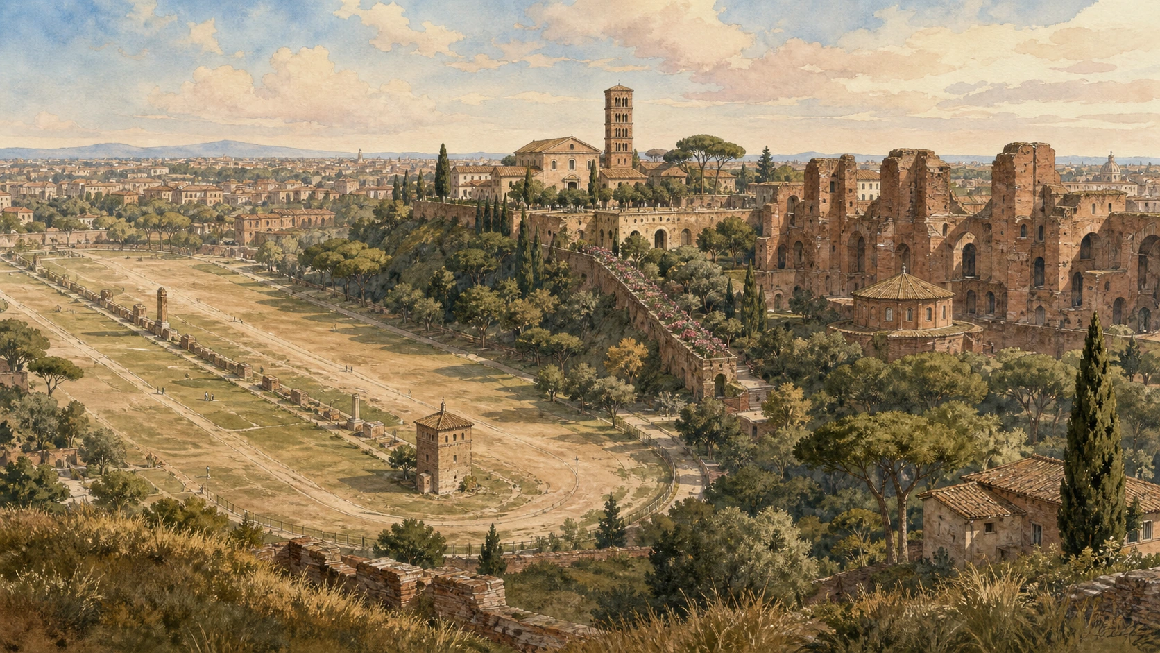
The largest surviving fact is the valley itself: scale, curvature and relation to two hills

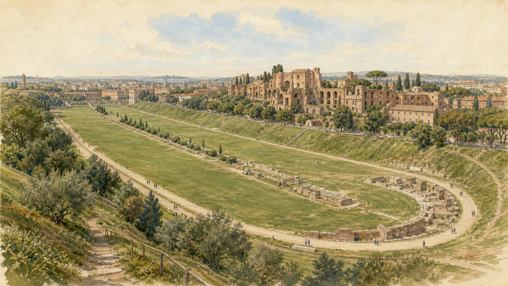
Circus Maximus: reading the valley

Modern grass follows an ancient entertainment footprint whose missing architecture must be reconstructed from topography and excavated edges.

Today

From the Aventine side, the Circus Maximus appears as a long sunken field between the Palatine and Aventine, roughly six hundred metres long and about one hundred and forty metres wide. Grassy slopes suggest the seating banks, an earth path follows the racing circuit and a low central strip evokes the former spina, but almost none of this is an intact ancient surface. The southeastern curve preserves the most substantial excavated masonry. Across the valley, the Palatine palace fronts help explain why imperial residence and public spectacle were visually connected.

History

Tradition attached the valley to Rome’s earliest festivals and the episode of the Sabine women. Permanent development occurred over centuries. Julius Caesar enlarged and regularised the circus, while fire and rebuilding repeatedly altered it; much of the surviving masonry belongs to the great Trajanic reconstruction and later repairs. Obelisks and monuments once stood on the central barrier, but the two obelisks associated with the circus were removed in the sixteenth century and now stand at the Lateran and Piazza del Popolo. Racing continued into the early sixth century.

How to read this place

The present field follows the circus’s broad form, but its ground levels and surfaces have changed. Soil levels, banks, paths and lawns are modern, even where they preserve the overall form. The circus accommodated races but also processions and other civic or religious events; it was not simply a Roman stadium in the modern sporting sense. Use the long axis to understand controlled movement: competitors circled the spina, spectators entered through a vast circulation system and ceremonies linked the valley to the city around it.

What to notice

  • The elongated valley and rounded southeastern end rather than a free-standing oval
  • Low traces of the central barrier contrasted with obelisks now elsewhere in Rome
  • Palatine palace fronts overlooking the public venue from the opposite slope
Roma Capitale Tourism · Circus Maximus
Original documentary watercolour of the immense grassy Circus Maximus valley between Aventine and Palatine
Circus Maximus: reading the valleyOriginal Merlintravel documentary watercolour · 2026
02

Brick galleries, street rooms and a medieval tower recover the vertical structure missing from the open field

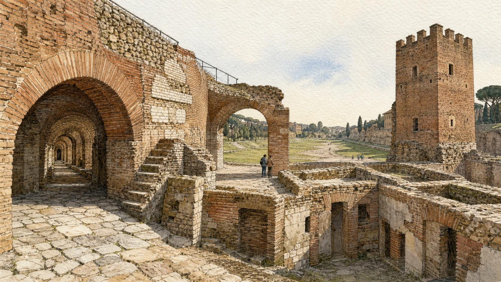
The excavated curve and Torre della Moletta

At the circus’s southeastern end, Roman circulation and commerce survive beside a tower from an entirely different urban world.

Today

The archaeological entrance near the curved end reveals brick-vaulted passages that once channelled movement beneath the cavea, along with stairs, paved areas and rooms opening outward toward the ancient street. These spaces have been interpreted as shops, inns or service offices rather than seating chambers alone. The square Torre della Moletta rises among the remains and provides a panoramic viewpoint when accessible. Its plain medieval brickwork is easy to distinguish from the larger Roman substructures below and around it.

History

The surviving galleries largely reflect imperial rebuilding, especially the Trajanic phase, followed by ancient repair and adaptation. After racing ended, the valley became agricultural land and watercourses powered mills. The Frangipane family controlled the area in the Middle Ages, and the tower known as della Moletta formed part of a fortified complex associated with a mill. In the nineteenth century the valley accumulated gasworks, workshops, warehouses and dwellings before twentieth-century clearance created the archaeological landscape seen today.

How to read this place

The tower is not an ancient race official’s post, and the Roman rooms were not all shops. Their functions changed and individual identifications remain interpretive. Read construction joints, floor levels and blocked openings before assigning a label. The combination of masonry and valley view also corrects two illusions: the circus had built height and complex circulation, while its post-antique life was productive and inhabited rather than a millennium of picturesque abandonment.

What to notice

  • Repeated brick vaults once supporting routes and seating above
  • Rooms facing outward toward urban commerce and service activity
  • Torre della Moletta’s later square fabric set against imperial masonry
Sovrintendenza Capitolina · Circus Maximus
Original documentary watercolour of Circus Maximus galleries, street rooms and Torre della Moletta
The excavated curve and Torre della MolettaOriginal Merlintravel documentary watercolour · 2026
03

A municipal garden overlays ancient flower associations and the memory of Rome’s Jewish cemetery

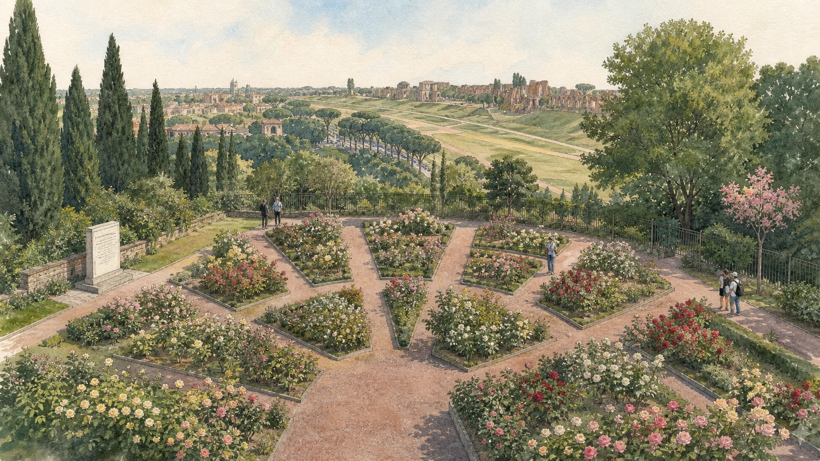
The Rose Garden and Aventine slope

Botanical display, city panorama and memorial ground meet in a park that is modern without being historically empty.

Today

The Municipal Rose Garden occupies two sloping sectors above the Circus Maximus. The collection area contains more than a thousand botanical, old and modern rose varieties, while the lower area is associated with the Premio Roma competition. Porphyry paths organise the beds and, in the upper sector, recall the form of a seven-branched menorah. The panorama extends across the circus toward the Palatine and catches other landmarks at the edges, but the garden’s seasonal opening means that its flowers and access cannot be assumed year-round.

History

Ancient literary tradition associated the Aventine slope and Circus valley with Flora and spring festivals, though the present beds do not preserve an ancient garden. The land later held vineyards and gardens. A Jewish community cemetery occupied the site from the seventeenth century until the graves were transferred to Verano in the 1930s. Rome’s first municipal rose garden had opened on Colle Oppio in 1931; after its wartime destruction, the current garden was established here in 1950 with the agreement of the Jewish community.

How to read this place

The menorah-inspired paths and remembrance stele should not be treated as decorative exotica. They acknowledge a sacred use displaced by modern planning. Equally, the ancient festival association does not make the current roses descendants of a Roman flower sanctuary. Read three separate layers—ancient literary memory, Jewish burial ground and modern municipal collection—while respecting the garden as a managed botanical site whose bloom and access are seasonal.

What to notice

  • Path geometry recalling a menorah without becoming a monumental object
  • The remembrance marker for the former Jewish cemetery
  • The garden’s controlled terraces facing the much larger circus valley
Roma Capitale Tourism · Municipal Rose Garden
Original documentary watercolour of the Aventine Rose Garden with memorial paths and the Circus Maximus beyond
The Rose Garden and Aventine slopeOriginal Merlintravel documentary watercolour · 2026
04

An early Christian spatial system survives through medieval use and assertive modern restoration

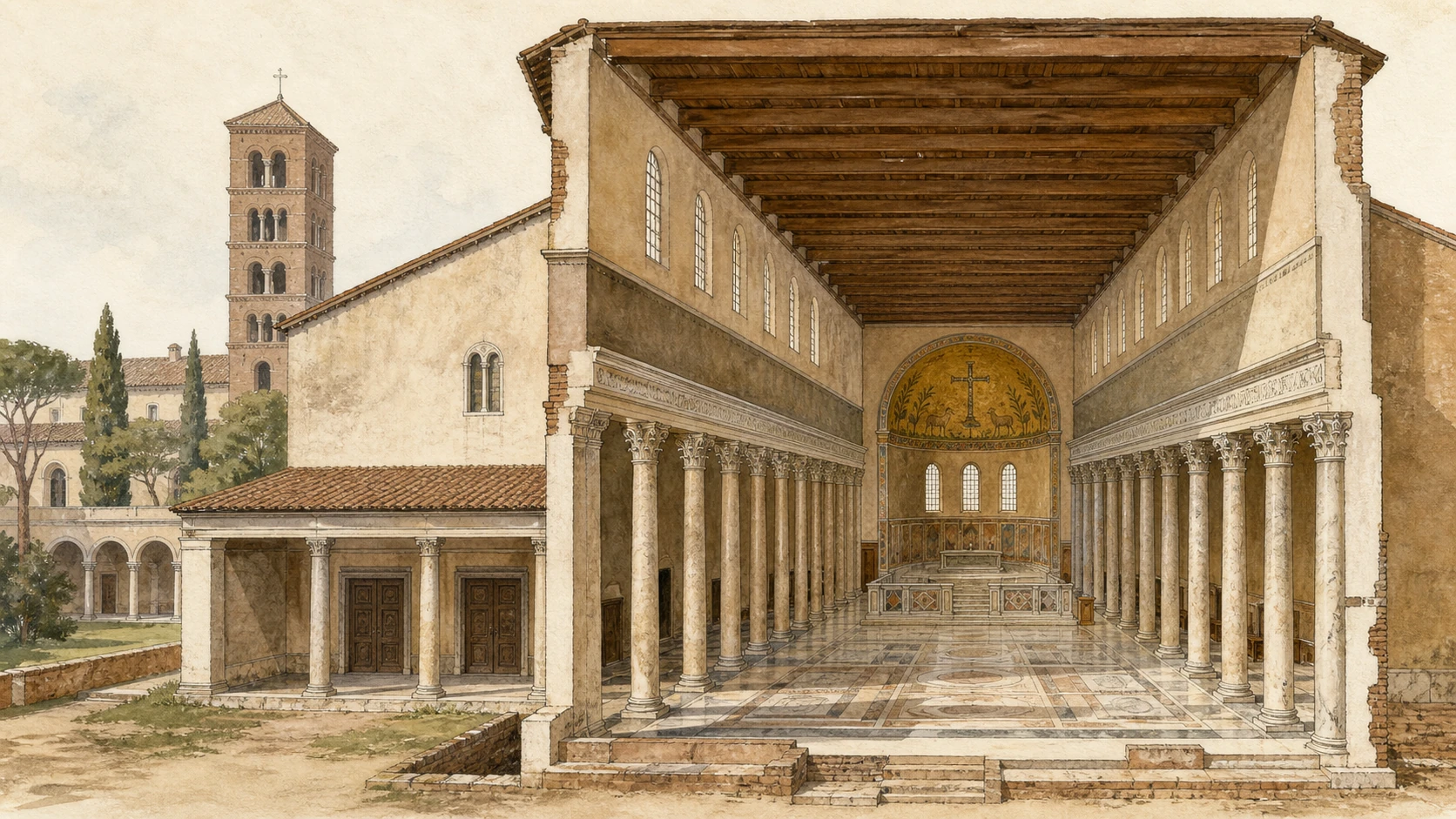
Santa Sabina: basilica, doors and restoration

Columns carrying straight entablatures make the fifth-century nave unusually legible, but the apparent purity of the interior is partly modern.

Today

Santa Sabina’s long nave is divided from the aisles by two rows of reused Corinthian columns carrying continuous horizontal entablatures rather than arcades. High windows illuminate the timber-roofed space with unusual clarity. Near the entrance, dark wooden doors preserve an exceptional group of fifth-century carved panels, including one of the earliest monumental representations of the Crucifixion, though not every original panel survives in its first arrangement. Medieval Dominican spaces, bell tower and cloister remain attached to the basilica.

History

An inscription names Peter of Illyria as founder during the pontificate of Celestine I, placing construction in the first half of the fifth century. The church rose above earlier Roman occupation and reused ancient architectural elements. It was restored in the early Middle Ages, became connected with fortified noble occupation on the Aventine and passed to the Dominicans in the thirteenth century. Domenico Fontana transformed the interior for Sixtus V in the late sixteenth century. Antonio Muñoz’s twentieth-century campaigns removed much later fabric to recover an idealised early Christian appearance.

How to read this place

Santa Sabina is invaluable, but it is not a sealed fifth-century interior. Ancient columns and spatial proportions, medieval additions, early-modern interventions and modern archaeological restoration coexist. The straight entablatures are a crucial visual clue; do not redraw the nave as a medieval arcade. Treat the carved doors as a complex surviving object, not an illustrated Bible in perfect original order, and avoid photographing services or the Dominican community without permission.

What to notice

  • Straight entablatures above reused Corinthian columns
  • High nave windows producing the basilica’s clear lateral light
  • Dark carved door panels viewed as an ancient object with later history
Roma Capitale Tourism · Santa Sabina
Original documentary watercolour cutaway of Santa Sabina with columns, entablatures, timber roof and entrance doors
Santa Sabina: basilica, doors and restorationOriginal Merlintravel documentary watercolour · 2026
05

A twentieth-century belvedere occupies the walls of a medieval fortress beside an ancient basilica

Parco Savello, the Orange Garden

The famous avenue and panorama are a designed modern landscape framed by genuine medieval defensive remains.

Today

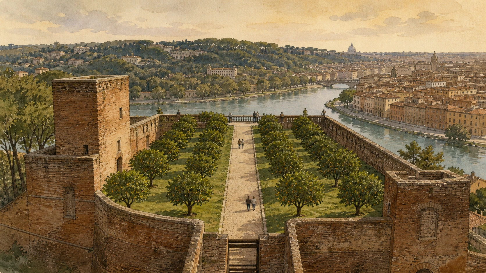
Parco Savello is a small rectangular garden enclosed by heavy brick walls. A straight central avenue of bitter-orange trees leads from the entrance toward a broad terrace above the Tiber. The view opens over river bends, Trastevere and the Janiculum, with distant landmarks held on the horizon. Masonry interruptions, blocked openings and tower traces belong to the fortress enclosure rather than to a Roman terrace. The garden’s controlled symmetry and modest scale are clearer early or late in the day, outside peak visitor pressure.

History

The Savelli family built a fortress here in the late thirteenth century over an earlier stronghold associated with the Crescenzi. Later modification included work in the period of Sixtus V, while much of the fortified residence was demolished in the early seventeenth century. Raffaele De Vico designed the present public garden in 1932, using the old walls and an axial path to create a civic belvedere. The orange trees also recall the Dominican presence beside Santa Sabina and traditions attached to Dominic.

How to read this place

The Orange Garden is not an ancient Roman orchard and not the preserved garden of a medieval castle. Its power comes from a modern landscape architect’s reuse of old enclosure and topography. Separate the designed avenue from the irregular fortress fabric and the long city view. Because the belvedere can be crowded, avoid blocking the axis for portraits and do not climb or sit on the historic masonry.

What to notice

  • The straight avenue aligned precisely with the river-facing belvedere
  • Irregular fortress walls contrasting with the symmetrical 1932 garden
  • Low orange trees used for shade, rhythm and Dominican memory
Roma Capitale Tourism · Parco Savello
Original documentary watercolour of the rectangular Orange Garden within Savelli fortress walls above the Tiber
Parco Savello, the Orange GardenOriginal Merlintravel documentary watercolour · 2026
06

Piranesi turned antiquarian symbols into a controlled eighteenth-century urban room

Piazza dei Cavalieri di Malta and the Priory gate

The keyhole view is a small optical event inside a much larger architectural composition of walls, trophies and authority.

Today

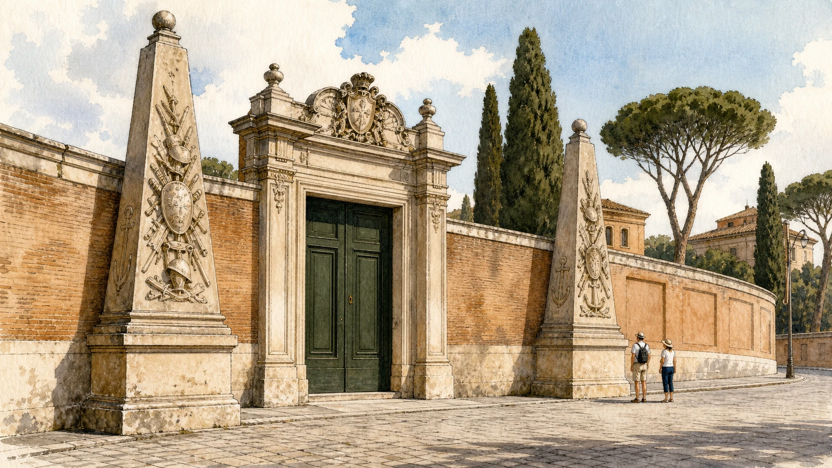
Piazza dei Cavalieri di Malta is enclosed by low walls articulated with obelisk-like stelae and reliefs of military and naval trophies. At the centre of the composition, a decorated portal holds the closed gate of the Magistral Villa. Its ordinary-sized keyhole aligns with a clipped garden avenue and the distant dome of St Peter’s, visible only from a single position close to the door. The villa is the historic seat of the Order’s Grand Priory of Rome and houses an embassy; the famous view does not turn the property into unrestricted public space.

History

The site passed from a fortified Benedictine monastery to the Templars and then to the Hospitallers, predecessors of the Sovereign Order of Malta. In 1765 Cardinal Giovanni Battista Rezzonico commissioned Giovanni Battista Piranesi to redesign the square, entrance and Santa Maria del Priorato. Piranesi drew on Roman military, maritime and funerary motifs without copying one ancient monument. The villa has enjoyed extraterritorial status since 1869, adding a modern diplomatic layer to its long institutional history.

How to read this place

Do not reduce the square to a novelty photograph through a door. Walk its perimeter first: repeated trophies, stelae and heraldic signs stage the Order’s past and Piranesi’s antiquarian imagination. The framed dome depends on designed alignment, hedge maintenance and a tiny aperture, not a supernatural optical trick. Keep the entrance clear, avoid photographing security and follow any current visiting arrangements for the church or gardens.

What to notice

  • Paired trophy stelae creating rhythm along the low walls
  • The solid closed gate and genuinely tiny keyhole
  • Piranesi’s symbolic language mixing antiquity, heraldry and naval memory
Roma Capitale Tourism · Magistral Villa of the Order of Malta
Original documentary watercolour of Piranesi's Malta square with trophy stelae and the closed Priory gate
Piazza dei Cavalieri di Malta and the Priory gateOriginal Merlintravel documentary watercolour · 2026
07

A Mithraic sanctuary occupies reused Roman rooms beneath an active Christian church

Santa Prisca and the Mithraeum

The layered site demands separate histories: domestic or service structures, a third-century cult room and later church fabric.

Today

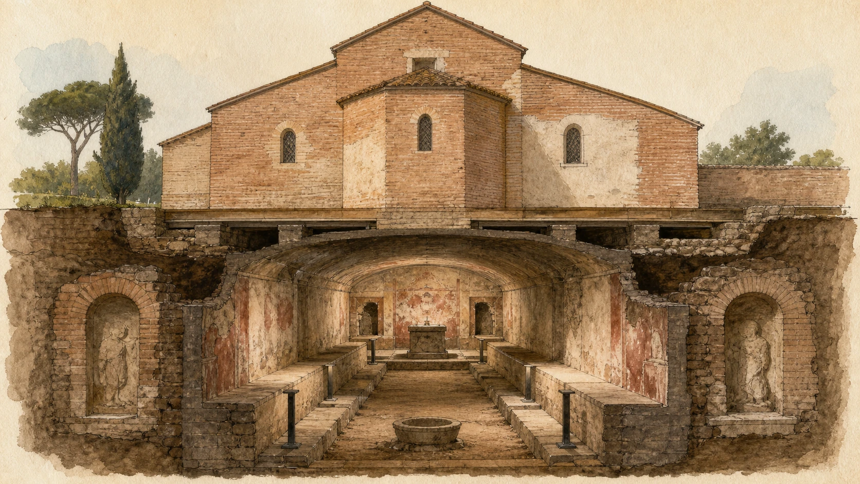
The Mithraeum beneath Santa Prisca is a long, narrow underground hall with a central aisle and raised benches along both sides. Entrance niches preserve representations associated with Cautes and Cautopates, the torch-bearing attendants of Mithras. Painted fragments and inscriptions survive in controlled conditions, while an altar zone and ritual features help identify the room’s function. Above, the church and convent remain active; access to the archaeology is limited, guided or subject to institutional scheduling rather than casual entry.

History

Roman buildings occupied the Aventine site before the sanctuary was installed, probably in the later second or third century. The Mithraeum was adapted within existing structures and altered during its use. Mithraic communities organised restricted initiatory worship, but modern claims about exact membership, rites or universal meanings often exceed the archaeological evidence. Christian occupation developed separately above, and the church of Santa Prisca acquired its own medieval and early-modern building history. Excavation in the twentieth century revealed the underground complex.

How to read this place

A cutaway is helpful but can falsely imply that church and sanctuary were designed together. They belong to different phases and only share ground. The surviving features do not establish the sensational rituals sometimes associated with the sanctuary. Painted names, reliefs, benches and circulation offer firmer evidence than sensational reconstructions. Respect conservation lighting, narrow spaces and the rules of an active religious institution.

What to notice

  • Raised side benches framing a narrow central aisle
  • Weathered entrance niches associated with Cautes and Cautopates
  • Roman masonry reused beneath later church foundations
Roma Capitale Tourism · Mithraeum of Santa Prisca
Original documentary watercolour cutaway of Santa Prisca above the narrow bench-lined Mithraeum
Santa Prisca and the MithraeumOriginal Merlintravel documentary watercolour · 2026
08

A symmetrical sequence of dry pools and roofless halls still makes the imperial bathing programme legible

Baths of Caracalla: the central axis

Natatio, frigidarium, tepidarium and caldarium formed a controlled environmental sequence inside a larger social complex.

Today

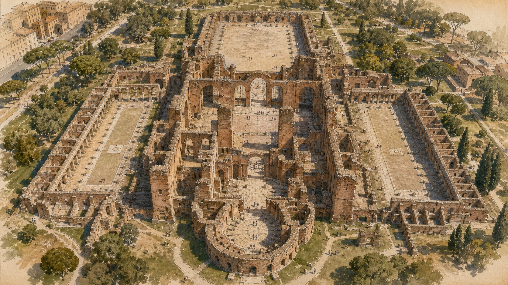
The roofless central block remains exceptionally legible. The open natatio occupies the northern end as a broad dry basin; behind it, enormous brick piers define the frigidarium, whose vaults once covered the principal cold hall. A smaller tepidarium mediated temperature before the circular projecting caldarium, oriented to receive solar heat. Symmetrical palaestrae and changing rooms flank the axis. The outer enclosure held libraries, gardens, cisterns, latrines and service spaces, so the baths cannot be reduced to four pools.

History

Caracalla, formally Marcus Aurelius Antoninus, initiated the complex and inaugurated its central block in AD 216. Work continued under Elagabalus and Alexander Severus. The baths stood on terraced ground, received water through the specially developed Aqua Antoniniana and were approached from the Via Nova. Later emperors restored the complex. Operation ended after the aqueducts were cut during the Gothic siege of AD 537, though parts of the site found later uses and the immense walls remained a source of materials and inspiration.

How to read this place

The surviving brick was once largely concealed by marble, stucco and mosaics. Do not imagine today’s dry openness as the intended aesthetic. At the same time, avoid rebuilding every wall and vault mentally: the present ruin reveals structural loads and circulation more directly than an intact surface would. Use symmetry to orient yourself, then watch for deliberate asymmetry in sunlight, heating and access. The circular caldarium is a thermal and solar device, not an arena.

What to notice

  • Dry natatio basin at the open northern end
  • Giant frigidarium piers that once carried high cross vaults
  • Circular caldarium projection aligned for heat and sunlight
Special Superintendency of Rome · Baths of Caracalla
Original documentary watercolour aerial view of the dry central bathing axis at the Baths of Caracalla
Baths of Caracalla: the central axisOriginal Merlintravel documentary watercolour · 2026
09

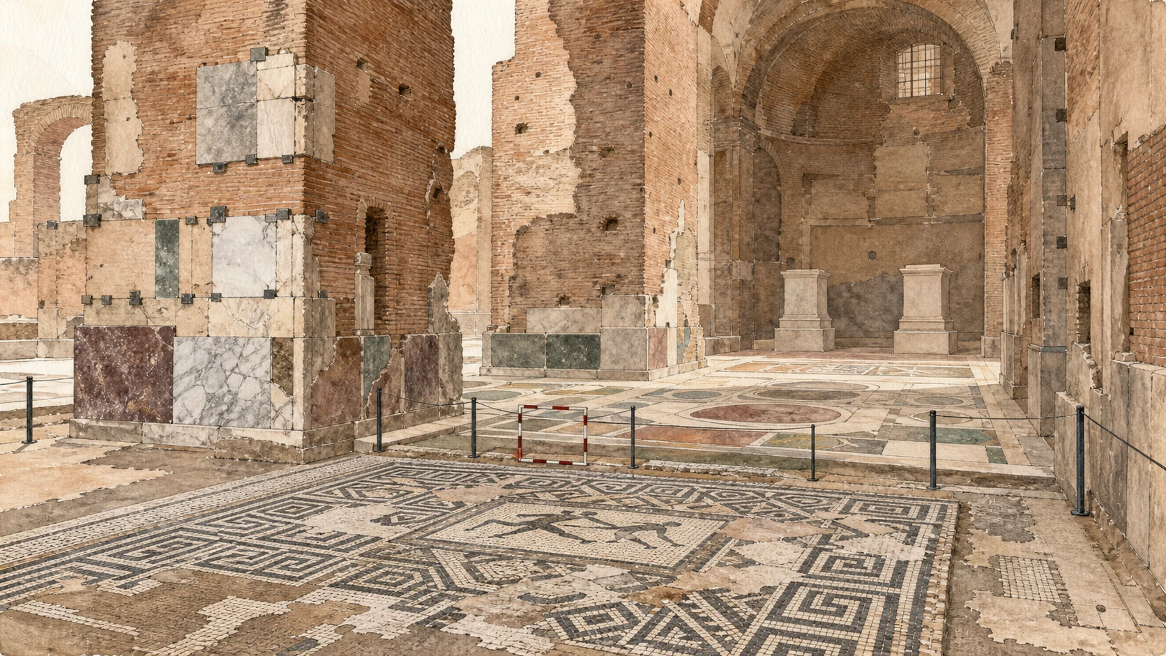
Bare brick, mosaic islands and empty settings reveal the difference between structure and imperial display

Mosaics, marbles and displaced sculpture

Decoration survives in fragments and museums; the stripped walls should not be mistaken for the visual character of the functioning baths.

Today

Black-and-white mosaics survive especially in athletic and geometric compositions associated with the palaestra areas, while coloured floor patterns and fragments of marble revetment mark more sumptuous halls. Rows of clamp holes and irregular scars show where wall veneers were attached. Colossal works recovered from the complex, including the Farnese Bull and Farnese Hercules, are now in Naples rather than restored to the ruins. Empty niches and plinths therefore belong to the site’s modern truth as much as surviving tesserae.

History

The baths concentrated materials, images and craftsmanship from across the empire. Marble columns and veneers, mosaic floors, stuccoed vaults, fountains and sculpture transformed practical rooms into a dynastic public statement. After the complex ceased functioning, valuable materials were removed in many phases. Excavation and collecting in the sixteenth century brought major sculptures into the Farnese collection; later museum transfer changed how visitors encounter them, separating object from architecture while preserving them in new institutional contexts.

How to read this place

Do not describe every figure mosaic as a direct portrait of an athlete who used the baths, and do not place the Farnese sculptures back in exact rooms unless the evidence warrants it. Surface scars, fragments and collection histories are evidence of both ancient design and later extraction. Compare one square metre of mosaic with the height of the brick pier behind it: the contrast explains how much coloured material once mediated the monumental structure.

What to notice

  • Broken edges and repairs around surviving mosaic panels
  • Clamp holes and isolated marble sheets on stripped brick walls
  • Empty architectural settings pointing toward sculptures now in museums
Special Superintendency of Rome · Caracalla visitor site
Original documentary watercolour of Caracalla mosaics, marble remnants, stripped walls and empty sculpture settings
Mosaics, marbles and displaced sculptureOriginal Merlintravel documentary watercolour · 2026
10

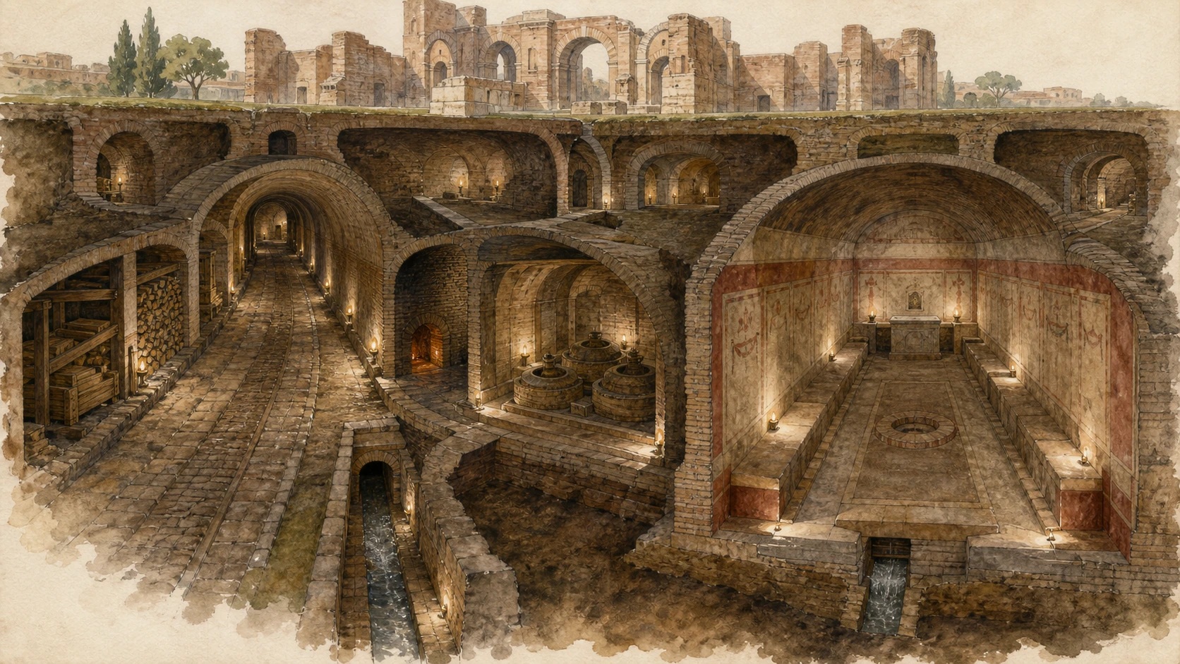
The monumental baths depended on a hidden transport, heating, water and labour network

Underground services and the Mithraeum

Nearly two kilometres of tunnels converted fuel, water and labour into the thermal experience above, while one sector housed a large Mithraic sanctuary.

Today

The underground network preserves broad brick-vaulted galleries large enough for carts, along with storage areas, furnace and boiler settings, water channels and service connections. These routes kept fuel, waste and workers away from the principal visitor halls. A large Mithraeum formed within the subterranean complex has side benches, an altar zone and a distinctive central ritual feature. Underground access is often limited to specific routes or special openings, and the visible configuration reflects excavation and conservation as well as ancient function.

History

Hundreds of enslaved people and specialised workers are thought to have sustained the enormous thermal plant, feeding furnaces, moving timber and maintaining water and heat. The galleries extended for about two kilometres. The Mithraeum belongs to the Severan-period religious landscape but does not mean the entire service population followed Mithras. Official interpretation has traditionally described the central feature as a fossa sanguinis, yet the exact use of ritual installations deserves caution and should not be expanded into a cinematic sacrifice narrative.

How to read this place

The tunnels are not catacombs and the Mithraeum is not the bath complex’s engine room. One system served heat, water and movement; the other created a restricted cult setting within the underground environment. Read their adjacency without making them identical. Because access, lighting and conservation conditions change, confirm the official route immediately before visiting and never enter closed galleries.

What to notice

  • Cart-scale vaulted tunnels with storage and service branches
  • Furnace mouths, boiler bases and channels beneath the bathing rooms
  • Bench-lined Mithraeum kept distinct from the engineering network
Special Superintendency of Rome · Caracalla undergrounds
Original documentary watercolour cutaway of Caracalla service tunnels, furnaces, water channels and underground Mithraeum
Underground services and the MithraeumOriginal Merlintravel documentary watercolour · 2026

The district through time

A short chronology

From early circus development and late-antique worship to Piranesi, municipal gardens and modern archaeology, these dates keep public spectacle, sacred space and infrastructure in one layered chronology.

  1. The Circus valley develops from festival and racing ground into increasingly monumental public architecture.

  2. Julius Caesar’s enlargement helps regularise the Circus Maximus as a monumental building.

  3. Imperial fires, rebuilding and the Trajanic phase shape much of the circus fabric visible today.

  4. A Mithraic sanctuary is installed within Roman structures beneath the later church of Santa Prisca.

  5. Caracalla’s bath project rises on terraced ground; the central block is inaugurated in 216.

  6. Work at the baths continues under later Severan emperors Elagabalus and Alexander Severus.

  7. Peter of Illyria founds Santa Sabina during the pontificate of Celestine I.

  8. Aqueduct cuts during the Gothic siege end regular operation of the Baths of Caracalla.

  9. Recorded racing at the Circus Maximus comes to an end.

  10. Dominican occupation develops at Santa Sabina; Savelli fortification reshapes the nearby hill edge.

  11. Circus obelisks are moved to new papal settings; major Caracalla sculptures enter the Farnese collection.

  12. Piranesi redesigns the Malta square, Priory entrance and Santa Maria del Priorato.

  13. Raffaele De Vico creates the Orange Garden within the Savelli walls.

  14. The Jewish cemetery on the Aventine slope is transferred; the land later supports a new civic garden.

  15. Rome’s Municipal Rose Garden opens on its present Aventine site.

  16. Completion of major Circus Maximus archaeological works expands public understanding of the southeastern sector.

Before your visit

Practical information

01

Start with the whole valley

Use the Aventine edge before entering the excavated circus sector; scale is easier to understand before detail.

02

Treat garden hours as seasonal

The Rose Garden’s bloom and public access change; verify the current municipal notice rather than relying on a general guide.

03

Respect active churches

Santa Sabina and Santa Prisca may close for services; dress and photograph with restraint.

04

Keep the Malta gate clear

The keyhole is in a diplomatic-religious property entrance; do not photograph security or obstruct the square.

05

Orient at Caracalla before details

Identify natatio, frigidarium, tepidarium and caldarium on the plan, then compare mosaics and stripped walls.

06

Never assume underground access

Both Mithraea and Caracalla’s tunnels use controlled routes; confirm official booking and accessibility information.

Method and sources

Sources and image credits

The guide uses Roma Capitale Tourism, Sovrintendenza Capitolina and the Special Superintendency of Rome material current to 27 August 2026. It distinguishes the circus footprint from modern lawns; racing from the site’s wider ceremonial uses; Trajanic and later masonry from Torre della Moletta; ancient flower associations from the 1950 Rose Garden; Jewish cemetery memory from botanical display; fifth-century Santa Sabina fabric from Muñoz restoration; Savelli fortress walls from De Vico’s 1932 garden; Piranesi’s piazza from earlier Malta-site occupation; the keyhole view from unrestricted access; Santa Prisca church from the earlier Mithraeum; Caracalla’s dry present ruins from an intact reconstruction; in-situ decoration from displaced museum sculpture; and service engineering from the underground cult room.

All ten images are original Merlintravel editorial watercolours based on documented present-day conditions. They are illustrations, not substitutes for archaeological plans. Opening hours, tickets, accessible routes, temporary exhibitions and conservation work can change; consult the linked official pages shortly before visiting.