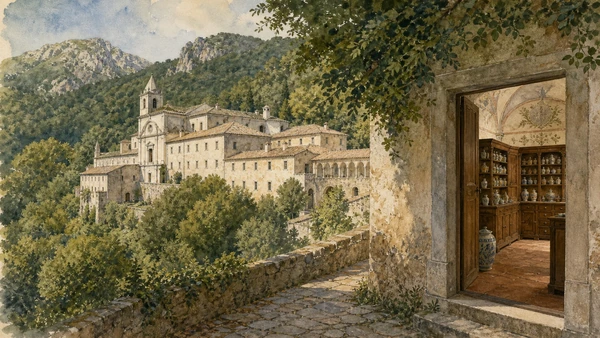
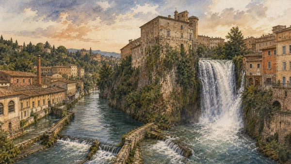
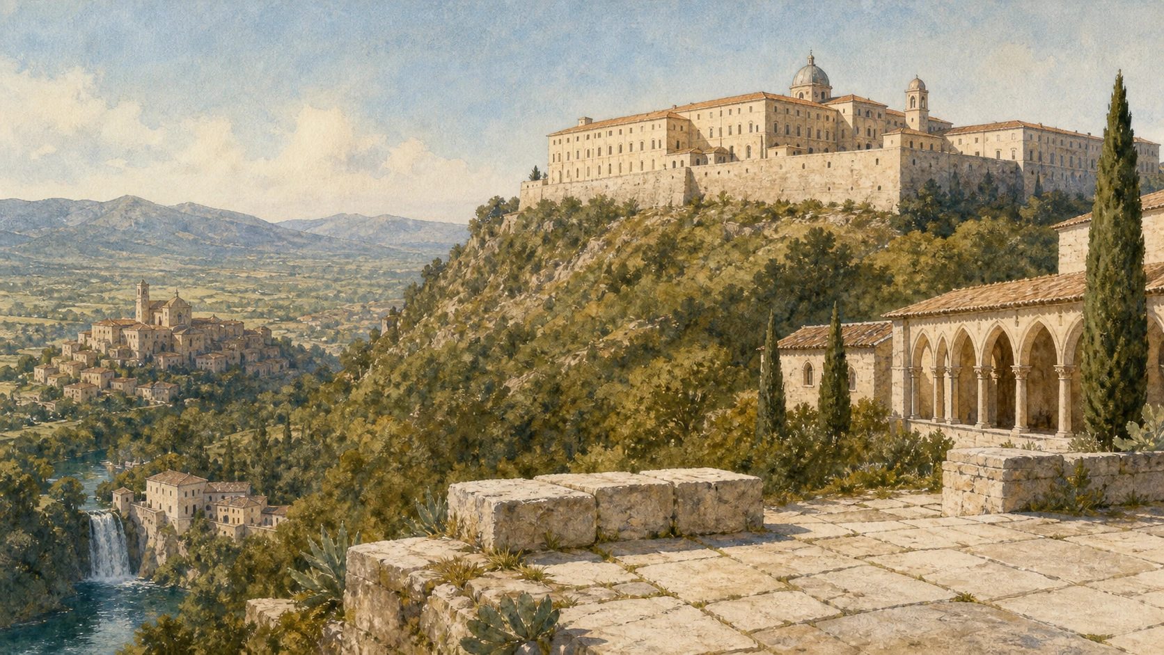
Original documentary watercolour panorama of Monte Cassino and Ciociaria joining the rebuilt abbey, Liri valley, polygonal walls, medieval monasteries and the waterfall at Isola del Liri

Lazio Guide 08 · Benedictine landscapes, polygonal walls and reconstructed memory

Monte Cassino
& Ciociaria

A documented route through southern Lazio, where monasteries, pre-Roman hill towns, river industries and the rebuilt landscapes of 1944 must be read together.

Plan the route
Cassino · Anagni · Alatri · Arpino10 chapters · four to six days

Why this territory matters

Ciociaria is not one historical province and Monte Cassino is not only one battle: this route follows overlapping landscapes rather than a single label.

Ciociaria is a cultural and geographical name whose boundaries have never been perfectly fixed. It is commonly centred on the modern province of Frosinone, yet older usage reached across parts of southern Lazio and the former Terra di Lavoro. The name is connected with the cioce, traditional pastoral footwear, but a costume label cannot explain the territory. The Sacco and Liri valleys, the Monti Ernici and the approaches to the Abruzzo and Molise mountains created several corridors and local worlds rather than one uniform district.

Those corridors carry a remarkable sequence of institutions. The acropolises of Alatri and Arpino preserve polygonal masonry from pre-Roman and Romanising communities. Anagni became a papal city whose cathedral crypt condensed medieval theology into painted cycles. Casamari and Trisulti organised work, worship and landscape in different monastic forms. Montecassino joined the Benedictine tradition to a strategic mountain position, then became one of the most contested and reconstructed monuments of the Second World War.

The modern route must resist two shortcuts. The first is to describe every large stone wall as mysterious or Cyclopean, erasing archaeology and the uncertainty of dating. The second is to reduce Cassino to military manoeuvres while civilians, displaced collections, cemeteries and post-war rebuilding disappear. Current access adds another layer: the National Archaeological Museum and area of Casinum are closed through 31 August 2026 for works, while abbeys, crypts and the Historiale use schedules, reservations or liturgical pauses that require a fresh check before travel.

Move from valley to summit and back again: stone, water, institutions and reconstruction reveal a territory made by repeated crossings.

The route

Plan your visit

Use Cassino as the southern base, then divide the northern and central chapters into compact circuits. The sequence keeps sites with fixed or guided access at the centre of each day and leaves river landscapes available when interiors close.

Days one and two

Montecassino, war memory and ancient Casinum

Begin at the abbey with its current visitor route, then separate the battle landscape through the Historiale and cemeteries. Add Casinum only after checking the museum’s post-work reopening; until then, keep the archaeological chapter as context rather than an entry promise.

Day three

Anagni and Alatri

Reserve the Cathedral of Anagni and the Crypt of San Magno, respecting celebrations, then walk Alatri’s acropolis and polygonal circuit in daylight. The pairing contrasts painted medieval interior with exposed pre-Roman masonry.

Day four

Arpino and Isola del Liri

Climb to Civitavecchia and the pointed gate before descending to the Liri. At Isola del Liri, read the two waterfalls, castle and former mills as one hydraulic and industrial landscape.

Days five and six

Casamari, Trisulti and the Ernici

Visit Casamari within the published monastic hours, then give Trisulti a separate half-day because it requires its own mountain approach. Use the remaining time for valley viewpoints rather than compressing both complexes into hurried interiors.

Ten chapters

Explore the places

The chapters connect valleys, fortified summits, monasteries, river industry and post-war reconstruction. Use the index without collapsing different historical institutions into one Ciociaria label.

  1. 01Ciociaria: a territory whose edges move
  2. 02Montecassino Abbey: continuity through reconstruction
  3. 03The battles of Monte Cassino and the work of memory
  4. 04Casinum: the ancient city beneath the modern route
  5. 05Anagni Cathedral and the Crypt of San Magno
  6. 06Alatri: the acropolis without the Cyclopean myth
  7. 07Arpino: Civitavecchia, the pointed gate and Cicero’s shadow
  8. 08Casamari Abbey: Cistercian order in local stone
  9. 09The Charterhouse of Trisulti: monastery, pharmacy and mountain
  10. 10Isola del Liri: waterfall, castle and industrial river
01

A cultural name with variable boundaries overlays the Sacco, Liri and Comino valleys, the Monti Ernici and older administrative histories

Ciociaria: a territory whose edges move

Ciociaria is best used as a cultural geography centred on the Frosinone area, not as the name of an ancient people or an unchanged province.

Today

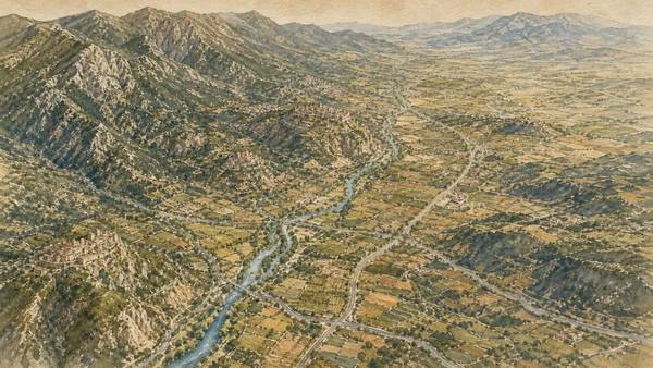
The route crosses the limestone ridges of the Monti Ernici, the broad Sacco corridor, the Liri basin and the approaches to the Valle di Comino. Modern roads can make these places look close, but mountain approaches and historic centres create distinct travel times. Frosinone is the provincial centre; Anagni and Alatri anchor the north, while Cassino, Arpino and Isola del Liri structure the southern circuit. Regional tourism planning treats Ciociaria as a territorial destination, yet local identity also follows valleys, towns and former political borders.

History

The term derives from the cioce, simple leather footwear associated with shepherds and rural communities in a wider area of central and southern Italy. Its use as a regional label grew especially in the nineteenth and twentieth centuries. Before the Province of Frosinone was established in 1927, much of the southern area belonged to Terra di Lavoro, while northern centres followed different Papal-State histories. Ancient Hernican, Volscian, Samnite and Roman territories likewise never formed one unit corresponding to today’s popular map.

How to read this place

Treat the name as a useful invitation, then ask which valley and historical layer a place belongs to. The Liri explains water power and industrialisation; the Ernici frame monastic and fortified settlements; the Via Latina and later railway and road corridors explain movement toward Rome and Naples. This method avoids folkloric shorthand. A traditional object can carry real memory without proving fixed ethnic boundaries, and a modern tourism district can organise a journey without being projected backwards into antiquity.

What to notice

  • Sacco and Liri corridors connecting mountain and plain
  • Monti Ernici ridges behind Anagni, Alatri and Trisulti
  • Town identities that predate the Province of Frosinone
Regione Lazio · Ciociaria territory and the cioce
Original documentary watercolour map-like landscape of Ciociaria showing the Sacco and Liri valleys, Monti Ernici, hill towns, cultivated plains and roads without fixed historical borders
Ciociaria: a territory whose edges moveOriginal Merlintravel documentary watercolour · 2026
02

A Benedictine foundation repeatedly rebuilt on a mountain summit now presents an intentionally reconstructed post-war monument rather than an untouched medieval complex

Montecassino Abbey: continuity through reconstruction

The abbey’s significance lies in the continuity of Benedictine life, manuscripts and rebuilding, not in the false claim that its visible fabric survived 1944 intact.

Today

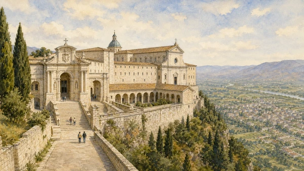
The road climbs from Cassino to a monumental complex arranged around cloisters, basilica, library, archive and museum. The present architecture follows historic forms but is overwhelmingly the result of post-war reconstruction after the bombing of 15 February 1944. The official visitor information states that much of the abbey can be visited, while liturgy and community life take precedence over tourism. From 1 April to 31 October the published daily visiting window is 09:30–18:30; winter hours vary and celebrations may suspend access.

History

Tradition places Benedict of Nursia’s foundation around 529 on the site of ancient Casinum’s acropolis. The community helped shape Western monastic culture through the Rule of Benedict, study, agriculture, hospitality and the copying and preservation of texts. Destruction and rebuilding occurred repeatedly: Lombard attack, earthquake and later warfare all altered the complex. Before the 1944 bombing, major archival and artistic holdings were evacuated to safety. The post-war project, led under Abbot Ildefonso Rea, rebuilt the abbey ‘where it was, as it was’ while incorporating modern structure and surviving fragments.

How to read this place

Look for the decisions of reconstruction rather than searching only for original stones. The sequence of entrance cloisters, the Bramante cloister, basilica and museum shows how a community restored a historical image after catastrophe. Surviving doors, manuscripts, portable works and spolia carry different kinds of authenticity from reconstructed walls. Verify access to the museum separately and dress for a functioning monastery. The panorama toward the Liri valley also explains why a spiritual centre could become entangled with military geography.

What to notice

  • Successive cloisters organising the rebuilt summit complex
  • Reconstructed basilica incorporating recovered and newly made elements
  • Liri valley and road corridors visible below the mountain
Abbazia di Montecassino · official visitor information
Original documentary watercolour of the reconstructed Montecassino Abbey on its summit showing the entrance cloisters, basilica mass and Liri valley below without presenting the fabric as untouched medieval work
Montecassino Abbey: continuity through reconstructionOriginal Merlintravel documentary watercolour · 2026
03

Four Allied battles, the destruction of Cassino and the abbey, military cemeteries and civilian testimony form a landscape of loss that cannot be reduced to one date

The battles of Monte Cassino and the work of memory

The 1944 campaign must be read through military decisions, destroyed places, displaced people and the different national cemeteries that surround Cassino.

Today

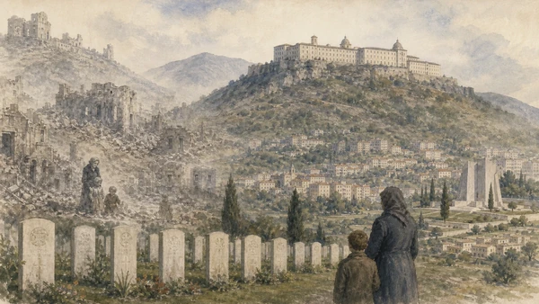
Cassino’s post-war city gives little immediate sense of the former urban fabric. The municipal Historiale uses multimedia rooms to interpret the Gustav Line, the bombing, soldiers, civilians and reconstruction. The Cassino War Cemetery and Memorial commemorate Commonwealth dead and missing; Polish, German and Italian cemeteries occupy separate sites in the wider landscape. Their different forms and positions are not interchangeable. Visiting them requires quiet conduct and enough time to read names, units and dates rather than using them as panoramic stops.

History

Between January and May 1944, four major battles were fought as the Allies attempted to break the Gustav Line and advance toward Rome. The abbey was bombed on 15 February amid an Allied belief that it might be used as a German observation position; historical and official accounts state that German troops were not occupying the monastery before the destruction, though the ruins became militarily useful afterward. Cassino town was devastated in March. Forces from many nations fought and died, while civilians endured bombardment, displacement, hunger and violence.

How to read this place

Avoid a single heroic narrative. Use the abbey’s own battle history, cemetery records and the Historiale’s civilian material to compare perspectives. The campaign’s international composition explains the surrounding memorial map, but national labels should not erase colonial troops, medical services and local residents. Separate the evacuation of selected cultural objects before the bombing from the survival of the building itself. The correct final chapter is reconstruction: the modern city, restored abbey and commemorative institutions are active choices made after ruin.

What to notice

  • Rebuilt Cassino urban grid below the destroyed wartime landscape
  • Separate Commonwealth, Polish, German and Italian memorial sites
  • Archive and museum testimony connecting military operations with civilian experience
Abbazia di Montecassino · the four battles
Original documentary watercolour memorial landscape of Monte Cassino showing restrained traces of the ruined abbey and town, cemetery markers and the rebuilt city without depicting combat spectacle
The battles of Monte Cassino and the work of memoryOriginal Merlintravel documentary watercolour · 2026
04

An amphitheatre, Roman road and monumental tomb connect the mountain of Montecassino with the lower city that preceded modern Cassino

Casinum: the ancient city beneath the modern route

The archaeological area restores the Roman city to a landscape often narrated only through the monastery and the Second World War.

Today

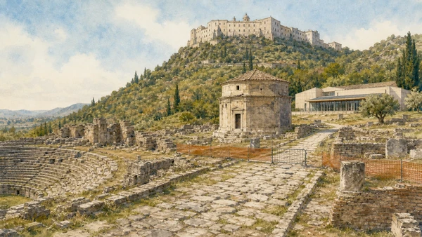
The National Archaeological Museum G. Carettoni stands beside the archaeological area on the slopes below the abbey. The managed circuit includes the amphitheatre, a paved road and the mausoleum traditionally associated with Ummidia Quadratilla, while museum collections explain Casinum and its territory. Current official information warns that the complex is closed for PNRR works from 3 February through 31 August 2026 and reports limited accessibility for visitors with reduced mobility. Do not travel on the assumption that a listed monument is presently open; verify the new notice after that date.

History

Casinum occupied a strategic position on routes through the Liri valley and developed from a pre-Roman centre into a Roman town. Monumental construction included an amphitheatre, theatre, roads, sanctuaries and elite funerary architecture. The wealthy benefactor Ummidia Quadratilla, known through an inscription and Pliny the Younger, is linked with the amphitheatre and mausoleum complex, although each attribution must follow archaeological evidence rather than later storytelling. The medieval abbey rose above a landscape already shaped by terraces, roads and sacred occupation.

How to read this place

When access resumes, begin with the slope. The relationship between Roman road, amphitheatre, tomb and summit explains more than isolated objects in a display case. Compare masonry phases and the way later routes reuse ancient alignments. Until official reopening, use exterior viewpoints and the museum authority’s documentation instead of seeking informal entry around a worksite. The temporary closure is itself part of responsible publication: cultural access changes, and an accurate guide must distinguish historical availability from a current visit.

What to notice

  • Amphitheatre terraces adapted to the lower mountain slope
  • Roman paved road connecting monuments within Casinum
  • Mausoleum and museum collections associated with Ummidia Quadratilla
Direzione regionale Musei Lazio · Casinum current access
Original documentary watercolour of the quiet Casinum archaeological area showing the amphitheatre, Roman road, mausoleum and museum work closure with no visitors inside restricted zones
Casinum: the ancient city beneath the modern routeOriginal Merlintravel documentary watercolour · 2026
05

A cathedral above a medieval papal town contains a crypt whose painted cycles turn architecture into an encyclopaedia of salvation, science and saints

Anagni Cathedral and the Crypt of San Magno

The crypt is not merely a painted basement but a carefully organised medieval visual programme beneath a cathedral shaped by papal power.

Today

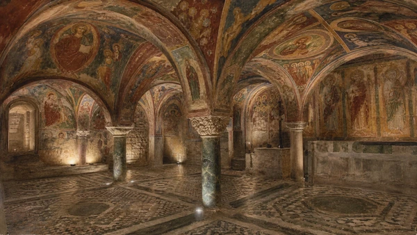
Anagni’s cathedral rises at the upper edge of the historic centre, reached through steep streets and civic spaces connected with the city’s papal history. The museum route includes the Crypt of San Magno, the Oratory of Saint Thomas Becket, treasury and other cathedral spaces. For 2026 the official site publishes daily seasonal hours, requires reservation and warns that religious celebrations can suspend visits; on Sunday morning the ticket office closes early. Light levels and visitor flow protect the paintings, so photography and guided movement follow current staff instructions.

History

The Romanesque cathedral was built between the late eleventh and early twelfth centuries and later transformed, while Anagni became closely associated with medieval popes. The crypt, constructed from 1072 to 1104, was decorated by several workshops during the twelfth and thirteenth centuries. Its frescoes combine Old and New Testament scenes, saints, the martyrdom and translation of San Magno, natural philosophy and a vision of cosmic order. The Cosmatesque floor and dense painted vaults make the room an integrated ensemble rather than a collection of separate panels.

How to read this place

Reserve enough time to follow the cycles in their architectural sequence. A famous single image cannot explain how bays, altars, saints and scientific themes construct meaning. Compare the darker crypt with the cathedral above and the surrounding papal town, but do not confuse later stories about the ‘Slap of Anagni’ with the fabric of every room. Confirm the reservation and celebration calendar on the day of travel. The site’s controlled access is conservation practice, not an inconvenience to bypass.

What to notice

  • Painted vaults divided into coordinated narrative bays
  • Cosmatesque floor linking liturgical movement with the fresco programme
  • Cathedral platform overlooking the layered papal town
Cathedral of Anagni · Crypt of San Magno
Original documentary watercolour inside the Crypt of San Magno in Anagni showing the low painted vaults, medieval fresco cycles and Cosmatesque floor with subdued conservation lighting
Anagni Cathedral and the Crypt of San MagnoOriginal Merlintravel documentary watercolour · 2026
06

Massive polygonal blocks define a fortified acropolis whose technique is visible but whose precise chronology and builders require archaeological restraint

Alatri: the acropolis without the Cyclopean myth

Alatri’s walls are extraordinary human engineering; calling them mysterious work of giants replaces evidence with a legend.

Today

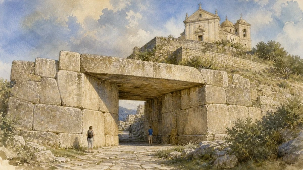
The acropolis occupies the summit of Alatri within a living historic centre. A polygonal circuit more than four hundred metres long encloses the platform, entered most dramatically through Porta Maggiore beneath a huge monolithic lintel. Porta Minore uses a different, smaller passage. The Cathedral of San Paolo stands on the upper terrace where an ancient sacred area is generally located. Streets and stairs make the circuit free to observe, but surfaces can be slippery and the most useful comparison requires walking both lower wall faces and the summit.

History

Alatri was an important centre of the Hernici before and during Rome’s expansion. The walls use carefully selected and fitted limestone blocks without mortar, a technique shared by several central Italian sites and developed across a broad chronological range. Official local interpretation deliberately presents dating and construction questions rather than assigning one mythical origin. Roman, medieval and modern buildings reused the defended hill, so the visible acropolis combines ancient retaining and fortification work with later religious and urban occupation.

How to read this place

Study joints, block faces and changes in course instead of measuring monumentality through superlatives. The massive lintel at Porta Maggiore demonstrates quarrying, transport and collective labour; it does not require lost technology. At the summit, relate the cathedral to the long sacred use of the platform without claiming that every foundation is visible. Morning or late-afternoon light reveals the stone fitting. Keep vehicles and wide lenses from flattening the scale: include people carefully, where permitted, to show human workmanship.

What to notice

  • Polygonal limestone courses fitted without mortar
  • Porta Maggiore and its exceptionally large monolithic lintel
  • Upper sacred platform reused by the Cathedral of San Paolo
Comune di Alatri · Museo diffuso and acropolis
Original documentary watercolour of Alatri's Porta Maggiore and polygonal walls showing fitted limestone blocks, the monolithic lintel and the cathedral terrace above without mythical giants
Alatri: the acropolis without the Cyclopean mythOriginal Merlintravel documentary watercolour · 2026
07

A pointed gate in polygonal walls and a medieval tower crown Arpino’s upper settlement, where traditional names must be separated from secure dates

Arpino: Civitavecchia, the pointed gate and Cicero’s shadow

Arpino’s upper town joins ancient fortification with medieval reuse, while the Torre di Cicerone is a traditional name rather than evidence of the orator’s ownership.

Today

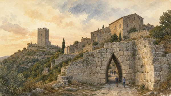
Civitavecchia rises above modern Arpino in a compact hilltop settlement encircled by stretches of polygonal wall. The pointed or ogival gate is the defining passage, formed by courses that lean inward rather than a true curved arch. Higher on the ridge, the so-called Torre di Cicerone commands the valley. The regional museum authority currently opens the tower on Saturdays and Sundays in two sessions, with weekday visits by reservation; it also notes that the building is not accessible to visitors with reduced mobility. The outdoor gate remains the essential first reading.

History

The fortification is generally connected with the ancient centre and placed around the fourth century BC, though the wall circuit contains later interventions. Arpinum entered Roman citizenship and became associated with Gaius Marius and Marcus Tullius Cicero. The standing tower, however, belongs to the late medieval defensive landscape, often described as Norman-Swabian in phase or tradition. Its modern name reflects Arpino’s powerful Ciceronian identity; the official record explicitly warns that no direct relationship between Cicero and the tower is established.

How to read this place

Keep three layers separate: ancient polygonal walls, the geometric solution of the pointed gate and the medieval tower. This makes the site more interesting than a single ‘Cicero monument.’ Walk through the gate and look back to understand how stones create the narrowing opening. From the tower area, map the valleys that made Arpino strategic. Quote the traditional name, then immediately explain its evidentiary limit. Check opening and booking again before making the climb.

What to notice

  • Inward-stepping courses forming the pointed gate
  • Polygonal wall stretches around the Civitavecchia settlement
  • Medieval tower overlooking routes through the Liri landscape
Direzione regionale Musei Lazio · Torre di Cicerone
Original documentary watercolour of Arpino Civitavecchia showing the pointed gate within polygonal walls and the separate medieval Torre di Cicerone on the ridge
Arpino: Civitavecchia, the pointed gate and Cicero’s shadowOriginal Merlintravel documentary watercolour · 2026
08

A Cistercian church, cloister, chapter house and working monastery translate an international reform movement into the stone and agriculture of the Liri valley

Casamari Abbey: Cistercian order in local stone

Casamari’s power comes from the relationship among restrained architecture, liturgical movement, labour and the continuing monastic community.

Today

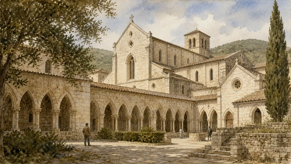
The abbey stands near Veroli as a coherent complex of church, cloister, chapter house, refectory, library, museum and monastic spaces. The approach opens gradually rather than presenting a single façade from the road. Current Ministry of Culture information, updated in June 2026, lists daily visiting hours of 09:00–12:00 and 15:00–18:00. Worship and community needs can still alter tourist access, and not every working room belongs to the visitor route. Quiet behaviour and modest clothing are appropriate.

History

A Benedictine settlement preceded the adoption of Cistercian observance in the twelfth century. The major Gothic complex developed through the late twelfth and early thirteenth centuries and the church was consecrated in 1217. Pointed vaults, disciplined proportions and the organisation around the cloister connected Casamari with wider Cistercian networks while local limestone and craft made it specific to this valley. The abbey survived suppression, violence and political change, later becoming the centre of its own Cistercian congregation.

How to read this place

Simplicity here is a deliberate architectural choice. Follow the route from gate to church, cloister, chapter house and refectory, noting how thresholds regulate speech, work and prayer. Light on dressed stone replaces much pictorial decoration, but later furnishings and collections record continuing life. Compare Casamari with Montecassino: both are active monasteries, yet their visible architectural languages and histories of reconstruction differ radically. Use the official hours as a planning frame, not a guarantee that liturgy will yield to a camera.

What to notice

  • Pointed church interior articulated by local limestone
  • Cloister organising circulation among communal rooms
  • Chapter house and refectory expressing Cistercian daily order
Ministero della Cultura · Abbey of Casamari
Original documentary watercolour of Casamari Abbey showing the Cistercian cloister, pointed limestone church and chapter-house openings in restrained natural light
Casamari Abbey: Cistercian order in local stoneOriginal Merlintravel documentary watercolour · 2026
09

A former Carthusian complex in the Monti Ernici combines enclosure, woodland water, a richly fitted pharmacy and a changing history of custodianship

The Charterhouse of Trisulti: monastery, pharmacy and mountain

Trisulti must be read as a secluded working landscape, not only as the photogenic shelves of its eighteenth-century pharmacy.

Today

The Certosa occupies a wooded slope above Collepardo and is realistically reached by private transport. Its public route includes courtyards, church, pharmacy and selected monastic spaces, while steep surfaces and historic thresholds affect accessibility. The regional museum authority lists summer hours from 15 April to 15 October, 10:00–13:30 and 14:30–18:00, with winter 10:00–16:00. Since 3 August 2026 it closes on Mondays; weekend guided visits require booking. The official page also warns that the telephone is temporarily unavailable and directs enquiries to email.

History

A Benedictine foundation in the area preceded the charterhouse established in the early thirteenth century. Carthusian organisation shaped cells, communal worship, service buildings, woodland and water use. Later rebuilding changed the church and courtyards, while the eighteenth-century pharmacy gained painted decoration, fitted cabinetry and vessels associated with medicinal preparations from local plants. Custodianship changed in the modern period and the complex is now managed as a state cultural site, with access and conservation continuing to evolve.

How to read this place

Place the pharmacy back inside the monastery. Its herbs, storage and imagery belonged to a system of knowledge and care connected with the Ernici environment, not to a free-standing antique shop. In the courtyards, identify the boundary between communal routes and eremitic enclosure. Seasonal hours, Monday closure and limited transport make Trisulti a planned half-day. Avoid promising full cell access or treating a temporary exhibition as permanent. The forest approach is part of the chapter and deserves time before the interiors.

What to notice

  • Mountain enclosure embedded in the wooded Monti Ernici
  • Church and courtyards separating communal from secluded space
  • Historic pharmacy cabinetry, vessels and painted decoration
Direzione regionale Musei Lazio · Trisulti current access
Original documentary watercolour of the Charterhouse of Trisulti in the Monti Ernici combining the wooded monastery exterior with an accurate restrained view of the historic pharmacy cabinetry
The Charterhouse of Trisulti: monastery, pharmacy and mountainOriginal Merlintravel documentary watercolour · 2026
10

The Liri divides beneath a castle and falls through the historic centre, where water spectacle and the remains of paper and textile industry share one system

Isola del Liri: waterfall, castle and industrial river

The central waterfall is not detached scenery; it is the visible force that shaped settlement, mills, factories and modern civic identity.

Today

At the travertine threshold beneath the Boncompagni Viscogliosi castle, the Liri separates into two branches. The Cascata Grande or Verticale drops beside the historic centre, while the Valcatoio branch forms the second cascade. Public viewpoints reveal the relationship among water, streets, castle and former industrial structures without requiring entry to the privately held monument. Regional information describes a fall of about twenty-seven metres. Water volume changes with season and management, so the experience is dynamic rather than a fixed postcard.

History

The fortified site above the river is documented from the Middle Ages and later became a residence of the Boncompagni, dukes of Sora, before passing to the Viscogliosi family in the twentieth century. The Liri’s power supported fulling, wool, paper and other industries; during the nineteenth century Isola became a significant manufacturing centre. Canals, mills and factory buildings altered the banks while depending on the same drop that now attracts visitors. Industrial decline left a landscape of reused and surviving structures rather than returning the river to a purely natural state.

How to read this place

Begin upstream of the split, then compare the two branches and walk the public viewpoints below. This sequence makes the castle a hydraulic hinge rather than an isolated monument. Look for channels, retaining walls, factory windows and changes in bank level. Do not repeat claims of global uniqueness that cannot be demonstrated; the well-supported fact is that a major waterfall descends within the historic centre. Castle access should be checked through its current booking channel and never assumed from an old tourism listing.

What to notice

  • Liri dividing at the travertine threshold beneath the castle
  • Cascata Grande dropping beside the historic centre
  • Channels and former mills recording the city’s industrial use of water
Visit Lazio · Isola del Liri
Original documentary watercolour of Isola del Liri showing the Cascata Grande, Boncompagni Viscogliosi castle, river branches and former industrial mills within the historic centre
Isola del Liri: waterfall, castle and industrial riverOriginal Merlintravel documentary watercolour · 2026

Monte Cassino and Ciociaria through time

A short chronology

From pre-Roman polygonal walls and Benedictine foundations to industrial water power, the four battles of 1944 and deliberate post-war reconstruction.

  1. Major phases of polygonal fortification at centres including Arpino and Alatri belong to the pre-Roman and Romanising landscape.

  2. Casinum develops within the expanding Roman road and settlement system of the Liri valley.

  3. Elite benefaction associated with Ummidia Quadratilla monumentalises Casinum’s amphitheatre and funerary landscape.

  4. Tradition places Benedict’s foundation of Montecassino on the summit above ancient Casinum.

  5. The Cathedral of Anagni and its Crypt of San Magno take shape during a major Romanesque building campaign.

  6. Several workshops paint the interconnected fresco cycles of the Crypt of San Magno.

  7. The Carthusian foundation of Trisulti is established in the Monti Ernici.

  8. The major Cistercian church at Casamari is consecrated.

  9. The tower later known as Torre di Cicerone becomes part of Arpino’s medieval defensive landscape.

  10. The Boncompagni transform the fortified river site at Isola del Liri into a ducal residence.

  11. Trisulti’s historic pharmacy receives much of the fitted and painted character seen today.

  12. Water-powered paper, textile and related industries reshape Isola del Liri and the valley economy.

  13. The Province of Frosinone is created, reorganising territories previously divided among different administrative histories.

  14. Four battles around Monte Cassino inflict enormous military and civilian losses along the Gustav Line.

  15. Allied bombing destroys the historic fabric of Montecassino Abbey; the ruins are later occupied militarily.

  16. The abbey and Cassino are rebuilt, making reconstruction central to the modern identity of the landscape.

Before your visit

Practical information

01

Base the south in Cassino

Give the abbey, Historiale, cemeteries and Casinum two days rather than compressing military, monastic and ancient history into one ascent.

02

Check Casinum after 31 August

The official closure runs through 31 August 2026; reopening must be confirmed from a new notice before travel.

03

Reserve Anagni

The cathedral museum and Crypt of San Magno require booking and can suspend visits during celebrations.

04

Separate Casamari and Trisulti

They have different monastic histories, access calendars and approaches; each deserves its own half-day.

05

Walk walls in daylight

Alatri and Arpino are best read when low light reveals joints, but avoid wet stone, midday heat and rushed evening descents.

06

Read water beyond the waterfall

At Isola del Liri, follow public viewpoints, channels and former industrial buildings; castle access is a separate, current booking question.

Method and sources

Sources and image credits

The guide uses current official or institutional information from the Abbey of Montecassino, the Italian Ministry of Culture and Direzione regionale Musei Lazio, the Comune di Cassino, the Commonwealth War Graves Commission, the Cathedral of Anagni, the Comune di Alatri, Casamari Abbey, Visit Lazio and regional authorities, checked on 28 August 2026. It distinguishes cultural geography from an ancient province; polygonal masonry from Cyclopean legend; a traditional tower name from secure attribution; Roman Casinum from modern Cassino; monastery continuity from untouched fabric; cultural-object evacuation from building survival; the abbey bombing from later military use of its ruins; military narratives from civilian experience; permanent monuments from temporary 2026 access; and a public waterfall viewpoint from assumed entry to a privately held castle.

All ten images are original Merlintravel editorial watercolours based on documented present-day conditions. They are illustrations, not substitutes for archaeological plans. Opening hours, tickets, accessible routes, temporary exhibitions and conservation work can change; consult the linked official pages shortly before visiting.