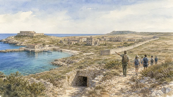
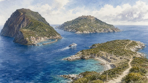
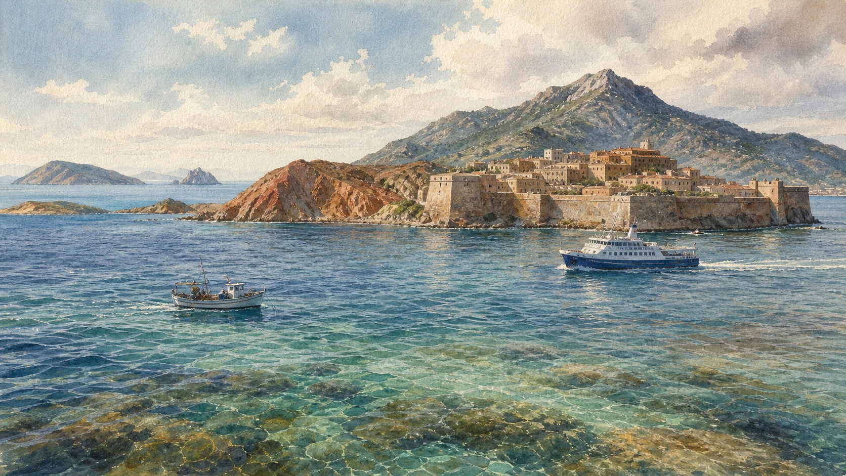
Original documentary watercolour of fortified Portoferraio, Monte Capanne, iron-red coast, clear sea, ferry and distant Tuscan islands

Tuscany Guide 07 · Fortified harbour, island exile, mineral coasts, granite summit and protected sea

Elba & the Archipelago:
Seven Islands, Different Rules

A documented journey from Portoferraio and Napoleon’s two residences to Rio’s iron landscape, Monte Capanne, lived villages and marine habitats—then outward to the distinct geology, memory and controlled access of the other Tuscan islands.

Plan the route
Piombino to Elba · Pianosa and the wider archipelago10 chapters · four days plus island crossings

Why seven islands need seven expectations

Elba is not only Napoleon and the Tuscan Archipelago is not one scattered beach resort: geology, extraction, fortification, prison history, island communities and different protection zones make seven unequal worlds.

Portoferraio was planned as Cosmopoli under Cosimo I de’ Medici in 1548, using headlands, harbour and connected forts as a defensive machine. Napoleon governed Elba from May 1814 to February 1815 and occupied two very different residences, but his nine months sit inside a much longer island history. Linguella archaeology, Roman villas, Pisan and Spanish strongholds, fishing, ferries and ordinary streets prevent the capital from becoming a single-person museum.

Eastern Elba exposes iron-rich ground worked across ancient and industrial periods. Rio Marina’s mines and collections connect mineral beauty to labour, transport and altered slopes. Western Elba is dominated by Monte Capanne granite, chestnut woods, exposed ridges and villages built around terraces, paths and scarce water. Beaches change with geology; Posidonia meadows and their dried leaves are habitat and coastal protection, not dirt to be automatically removed.

The National Park, established in 1996, includes portions of land and sea across seven principal islands. The UNESCO biosphere reserve recognised the archipelago in 2003. Protection does not create one rule: Pianosa beyond its village requires authorised guidance, Giannutri combines a freely accessible central corridor with guided sectors, Montecristo is strictly limited, and Gorgona remains tied to a prison and specific organised visits. Transport, weather, water and resident capacity are part of every ethical itinerary.

Base on Elba for at least four nights and divide fortified Portoferraio, mineral east and granite west into separate days. Add only one regulated island crossing after checking the current park and carrier conditions; do not treat all seven islands as a collectible circuit.

The route

Plan your visit

Elba is large enough to punish improvised zigzags, while the other islands depend on boats, weather and permits. This sequence protects historical depth and prevents the sea timetable from swallowing the guide.

Day one

Portoferraio as a complete city

Arrive by ferry, read the harbour fortification system, choose one civic museum and visit Palazzina dei Mulini if current access permits.

Day two

Iron east

Use Rio’s museum and one authorised mining excursion; add Volterraio or Porto Azzurro only with a timed, safe route.

Day three

Granite west

Link Marciana, one Capanne route or cableway and a village or terrace walk; wind and heat decide the summit, not ambition.

Separate day

One protected-island crossing

Pianosa is the most direct extension from Elba. Capraia, Giglio, Giannutri and Montecristo require different ports, schedules and permissions.

Ten chapters

Explore the places

The guide uses Elba as the principal base but reads its fortified capital, Napoleonic residences, mining east, granite west, villages, trails and marine habitats before distinguishing the history, geology and regulated access of Pianosa, Capraia, Giglio, Giannutri, Montecristo and Gorgona.

  1. 01Portoferraio: read Cosmopoli from water to rampart
  2. 02Napoleon on Elba: two residences, nine months, many afterlives
  3. 03Rio: iron landscape, labour and transport
  4. 04Elba’s geology: three landscapes, not one rocky coast
  5. 05Monte Capanne: summit view is conditional, not guaranteed
  6. 06Villages and trails: Elba is inhabited between the beaches
  7. 07Beach is geology; dried seagrass is not rubbish
  8. 08Marine protection: learn the zone before launching
  9. 09Pianosa: beyond the village, access is interpretation
  10. 10Beyond Elba: choose one island and learn its limits
01

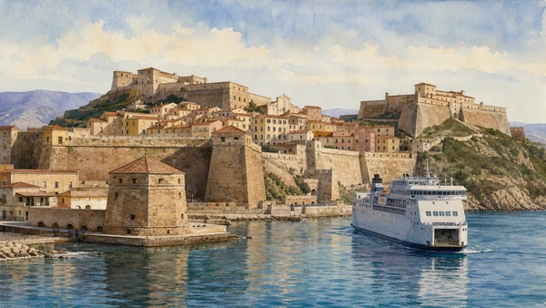
Forte Falcone, Forte Stella, Linguella and connecting walls turn two headlands and a natural harbour into a Renaissance defensive system

Portoferraio: read Cosmopoli from water to rampart

The fortified city is not a picturesque wall around a port; it is a coordinated 1548 project that still structures ferries, streets, museums and lived neighbourhoods.

Today

The ferry approach is the first viewpoint and the working port is part of the evidence. Walk upward from the dock, allowing for steep steps, heat and museum schedules. Fort access and wall sections can vary; a visible bastion is not automatically open. Ferry traffic, resident vehicles and deliveries continue inside the historic fabric. The Linguella area combines tower, archaeological museum and Roman remains but follows separate current access.

History

Cosimo I de’ Medici ordered the fortified city in 1548 and renamed it Cosmopoli. Giovanni Battista Bellucci, Giovanni Camerini and later Bernardo Buontalenti adapted walls and strongholds to Portoferraio’s harbour topography. Forte Falcone occupied the highest western ridge, Forte Stella the eastern headland and Linguella controlled the harbour entrance. Earlier settlement and Roman maritime villas reveal that Medici foundation reorganised an existing island crossroads rather than creating history from nothing.

How to read this place

Begin with lines of fire and sight: track how forts watch both open sea and inner harbour. Compare military terraces with inhabited houses inside the walls. At Linguella, distinguish the octagonal defensive tower from adjacent salt warehouses and Roman villa remains. A ferry entering the bay demonstrates the same sheltered geometry that made the site strategic.

What to notice

  • Connected rather than isolated forts
  • Harbour entrance controlled from several elevations
  • Civilian streets compressed inside military geometry
Visit Tuscany · Portoferraio
Original documentary watercolour of Portoferraio's Falcone, Stella and Linguella fortifications with a ferry entering the working harbour
Portoferraio: read Cosmopoli from water to rampartOriginal Merlintravel documentary watercolour · 2026
02

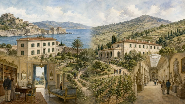
Palazzina dei Mulini was the urban seat of government; San Martino was a rural residence later joined to Demidoff’s grand nineteenth-century gallery

Napoleon on Elba: two residences, nine months, many afterlives

The museums document island government, domestic presentation and later Napoleonic collecting; they should not be collapsed into one intact imperial time capsule.

Today

Check both national-museum residences independently: opening days, rooms and ticket arrangements can differ. Palazzina dei Mulini requires a climb through Portoferraio; San Martino lies outside the centre and combines Napoleon’s smaller villa with the later Demidoff gallery. Furnishings and displays have museum histories. Quiet interior conduct and image rules apply even when rooms appear domestic.

History

Napoleon arrived on 4 May 1814 under the Treaty of Fontainebleau and governed Elba until departing on 26 February 1815. At Mulini he joined and adapted existing grand-ducal buildings for administration and residence, adding garden and reception spaces. He purchased San Martino in June 1814 as a rural retreat and commissioned symbolic painted rooms. After his departure, Anatoly Demidoff acquired the property and built the monumental gallery for a Napoleonic collection, changing the site’s scale and meaning.

How to read this place

At Mulini compare work rooms, library, garden and strategic sea views. At San Martino distinguish Napoleon’s modest core from Demidoff’s architecture and collecting. Treat Empire imagery as political self-presentation, not transparent biography. Nine months mattered for roads, administration and mining, but island society did not begin or end with exile.

What to notice

  • Urban government seat versus rural retreat
  • Original 1814 rooms versus later museum arrangement
  • Demidoff gallery as a separate commemorative project
Visit Tuscany · Palazzina dei Mulini
Original documentary watercolour comparing Palazzina dei Mulini and Villa San Martino with the later Demidoff gallery
Napoleon on Elba: two residences, nine months, many afterlivesOriginal Merlintravel documentary watercolour · 2026
03

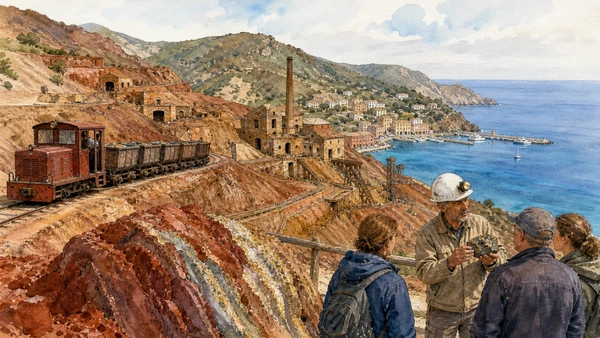
Eastern Elba’s red and ochre slopes contain hematite, pyrite and industrial structures that linked extraction directly to Rio Marina’s harbour

Rio: iron landscape, labour and transport

The mining park is not a crystal hunt; it is an altered coast where geology, ancient exchange, industrial work, village growth and heritage interpretation remain physically connected.

Today

Use the official mining museum and book the appropriate excursion—train, guided walk or authorised vehicle—rather than entering pits or galleries independently. Collection rules belong to the operator and the specific route; a loose mineral outside an authorised activity is not a souvenir entitlement. Heat, unstable ground and exposed metal structures require boundaries. Rio Marina and Rio nell’Elba hold different collections and should not be confused.

History

Iron ores from Elba were known and exploited in ancient Mediterranean networks, with eastern deposits sustaining long extraction histories. Modern mining expanded open cuts, rail, loading and harbour infrastructure around Rio Marina. Napoleon reorganised parts of the economy during his rule, but industrial change continued far beyond 1815. Twentieth-century closure left a visually powerful landscape whose red slopes also record dangerous labour, removed material and economic dependency.

How to read this place

Follow the production chain from ore face to rail, processing building and quay. Compare mineral colour with vegetation recovery instead of calling the ground naturally barren. Museum tools and photographs put bodies back into a landscape easily aestheticised. A heritage train explains access; it does not recreate every historical working condition.

What to notice

  • Terraces cut by extraction rather than natural erosion alone
  • Rail and harbour connecting mine to export
  • Vegetation returning unevenly across mineral substrates
Elba Mining Park · official site
Original documentary watercolour of Rio Marina mines, mineral slopes, heritage train, guide and harbour
Rio: iron landscape, labour and transportOriginal Merlintravel documentary watercolour · 2026
04

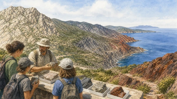
Granite in the west, metamorphic complexes through the centre and iron-rich eastern formations compress a remarkable geological transect into one island

Elba’s geology: three landscapes, not one rocky coast

The island’s variety explains summit shape, mine colour, beach material, settlement and vegetation; mineral display becomes meaningful only when returned to its formation and location.

Today

Join an official geo-experience, mining interpretation or museum collection when possible. Do not hammer outcrops, remove specimens from protected or archaeological land, or climb unstable quarry faces. Beach pebbles also belong to the shore system. A hand specimen in a legal display can teach texture and composition without encouraging extraction.

History

Elba’s present rocks record complex tectonic assembly, metamorphism, magmatism and mineralising fluids. The Monte Capanne pluton forms the western granite massif and exposes conspicuous feldspar crystals in places such as Sant’Andrea. Eastern iron deposits created a radically different surface and economic history. Geological diversity influenced ancient resource movement, defensive positions, quarrying, agriculture and the colours by which modern visitors often divide the coast.

How to read this place

Move west to east as a field question. Observe grain and jointing in granite, darker or layered rocks in the centre and iron oxidation around Rio. Relate beach colour to source cliffs without assuming every white shore is sand or every red rock contains collectible ore. Geology sets possibilities; human use creates the cultural landscape.

What to notice

  • Large feldspar crystals within western granite
  • Contrasting central rock textures
  • Iron oxidation marking eastern extraction landscapes
Info Park Arcipelago Toscano · Elba
Original documentary watercolour of an interpreted Elba geological transect from Monte Capanne granite to eastern iron-rich coast
Elba’s geology: three landscapes, not one rocky coastOriginal Merlintravel documentary watercolour · 2026
05

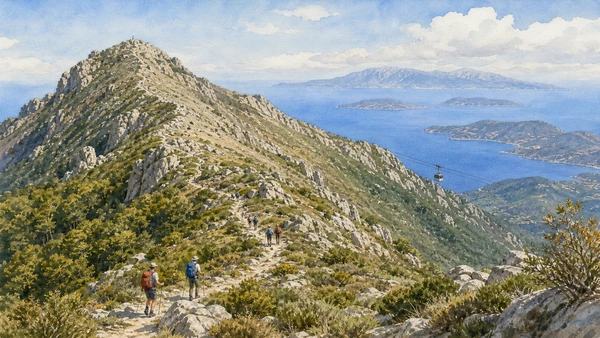
At 1,019 metres Monte Capanne rises abruptly above the sea, moving from inhabited slopes and chestnut woodland to exposed granite ridge

Monte Capanne: summit view is conditional, not guaranteed

The archipelago panorama depends on weather, fitness and safe operation; the mountain’s vegetation, granite and route history matter even when cloud cancels the horizon.

Today

Choose a marked trail or confirm the cableway’s current operation, wind limits, ticketing and accessibility. The basket system is exposed and does not remove the final rough walking near the summit. Carry water and layers even when beaches are hot. Turn back for wind, cloud, heat or fatigue. Do not leave marked routes through protected summit zones.

History

The granite massif shaped western Elba’s steep relief, springs, chestnut cultivation and building stone. Marciana developed below the mountain with paths connecting terraces, sanctuaries and settlements. Modern hiking and the cableway made the summit a major viewpoint, while national-park zoning protects sensitive high ground. Visibility toward Corsica and other islands remains a meteorological event, not a permanent scenic fixture.

How to read this place

Track vegetation change with altitude and exposure. Granite blocks, joints and tors shape route difficulty. Look down at settlement and terraces to understand how the massif stores and releases water. If visibility opens, identify islands by orientation rather than treating every silhouette as Corsica.

What to notice

  • Chestnut and woodland giving way to exposed scrub
  • Granite structure controlling the ridge
  • Cableway and footpath offering different risks, not different mountains
Info Park Arcipelago Toscano · Elba trekking
Original documentary watercolour of hikers and cableway on Monte Capanne's granite ridge above the Tuscan Archipelago
Monte Capanne: summit view is conditional, not guaranteedOriginal Merlintravel documentary watercolour · 2026
06

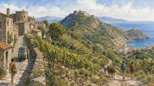
Marciana, Rio, Porto Azzurro and smaller settlements connect fortresses, terraces, sanctuaries, chestnut woods and mule paths to present island services

Villages and trails: Elba is inhabited between the beaches

The island’s interior is a working network of steep streets, water, delivery, agriculture and paths; walking through it requires attention to resident life and seasonal limits.

Today

Use one village as a real walking base rather than parking briefly in several cores. Marciana’s stone lanes are steep; Volterraio requires a planned trail and current park access; Porto Azzurro mixes harbour, service economy and nearby Spanish-period sites. Public paths cross land with different ownership and protection. Close gates, avoid terraces under cultivation and never convert a narrow lane into a photo set that blocks residents.

History

Pisan and later lordship networks fortified high points such as Volterraio and Marciana. Spanish control shaped Porto Azzurro and Forte San Giacomo from the early seventeenth century. Terraces supported vines, chestnuts and mixed cultivation while mule paths connected upland communities to ports. Twentieth-century road building, mining closure and seasonal tourism shifted settlement economies without erasing older path and parcel structures.

How to read this place

Observe where stone lanes become farm paths and where terraces retain or lose walls. Fortresses answer different political geographies: Volterraio watches the Portoferraio gulf while Spanish works face eastern sea routes. Delivery vehicles, school schedules and shaded benches reveal present use more honestly than an empty dawn photograph.

What to notice

  • Terrace walls managing slope and soil
  • Fortress sightlines tied to separate harbours
  • Historic paths still serving residents, farms and hikers
Visit Tuscany · Rio
Original documentary watercolour of Marciana lanes, terraces, Volterraio fortress, trail and Porto Azzurro harbour
Villages and trails: Elba is inhabited between the beachesOriginal Merlintravel documentary watercolour · 2026
07

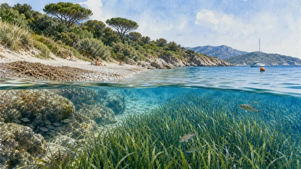
Granite sand, white pebbles, dark mineral grains, dunes and rocky coves change around Elba; below them Posidonia meadows stabilise a living marine landscape

Beach is geology; dried seagrass is not rubbish

A clear cove is an ecological edge, not a swimming product: shore material, Posidonia, anchoring, dune vegetation and visitor density determine what survives the season.

Today

Choose a beach by wind, access and carrying capacity rather than a ranked photograph. Leave pebbles, minerals and shells. Dried Posidonia leaves can protect shorelines and indicate a nearby meadow; do not assume every natural deposit should be mechanically cleared. Swimmers and boats share limited coves. Use established moorings where provided and never anchor into visible seagrass.

History

Elba’s contrasting rocks feed different shore materials, while roads and tourism opened coves at unequal speeds. Posidonia oceanica is a flowering marine plant whose meadows create habitat, store carbon and reduce wave energy. Detached leaves accumulate on beaches as natural deposits. Coastal construction, anchoring, water warming, pollution and intensive seasonal use pressure both underwater meadow and shoreline resilience.

How to read this place

Match pebble or sand colour to the surrounding cliff without collecting it. Underwater, distinguish seagrass blades from algae attached to rock. On shore, observe dune roots and dried leaf banks before choosing a place to sit. Clear water does not prove ecological health; intact habitat and low disturbance are better evidence.

What to notice

  • Shore material changing with local bedrock
  • Living meadow underwater and detached leaves ashore
  • Buoys and boat position revealing anchoring practice
UNESCO MAB · Tuscan Islands Biosphere Reserve
Original documentary watercolour above and below an Elba cove showing Posidonia meadow, dried leaves, fish, dune edge and safe mooring
Beach is geology; dried seagrass is not rubbishOriginal Merlintravel documentary watercolour · 2026
08

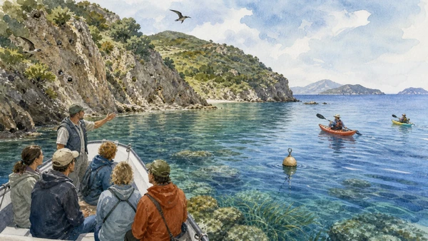
The national park protects about 79,000 hectares across land and sea, but zones range from inhabited landscapes to areas where navigation, anchoring, fishing or entry are restricted

Marine protection: learn the zone before launching

The archipelago is a national park with protected marine sectors, not one uniform marine reserve; permissions change by island, zone and activity.

Today

Consult current park maps and rules before boating, kayaking, fishing, diving or anchoring. The park’s official FAQ distinguishes highly protected sea zones from sectors where navigation or mooring may be allowed but fishing is not. A motor-free craft is still a craft in a no-entry zone. Wildlife encounters require distance; feeding, chasing and drone approaches are not interpretation.

History

The Tuscan Archipelago National Park was instituted on 22 July 1996 and later expanded protection around Pianosa. It includes seven main islands and important marine sectors within the Pelagos Sanctuary context. The Tuscan Islands joined UNESCO’s biosphere network in 2003. Zoning evolved to reconcile strict conservation, scientific work, permanent communities and regulated visitor use rather than treating every shore with one prohibition.

How to read this place

Begin with jurisdiction: locate the park boundary and zone, then match the activity. At sea, a buoy, guide boat and empty cove may reflect management rather than absence of interest. Cliffs are nesting habitat; underwater rock and Posidonia form different communities. The best wildlife observation often leaves no visible approach.

What to notice

  • Mooring and anchoring are not interchangeable
  • Cliff nesting space extending beyond the rock face
  • Allowed recreation changing at invisible mapped boundaries
Tuscan Archipelago National Park · official FAQ
Original documentary watercolour of a park guide, mooring buoy, kayaks, seabirds and protected marine habitats in the Tuscan Archipelago
Marine protection: learn the zone before launchingOriginal Merlintravel documentary watercolour · 2026
09

A nearly flat limestone island holds Roman and early Christian archaeology, an agricultural penal colony, a twentieth-century prison wall and intensely protected land and sea

Pianosa: beyond the village, access is interpretation

Pianosa’s beauty and prison history cannot be separated from controlled movement; the authorised guide is not an optional storytelling extra but part of how the protected island is entered.

Today

As checked on 28 August 2026, scheduled links operate from Marina di Campo and seasonally from Piombino, with a separate weekly service via Rio; times must be reconfirmed with the carriers. The village area and specific facilities have their own access, while routes beyond the Dalla Chiesa wall are guided. Park activities include walking, bicycle, carriage, bus, kayak and snorkelling under defined programmes. Carry water and protection against sun, insects and ticks.

History

Pianosa preserves Roman remains and fourth-century catacombs. An agricultural penal colony was founded in the nineteenth century; prison landscapes, farm branches and buildings reshaped much of the island. The concrete wall built in 1970 under Carlo Alberto Dalla Chiesa divided the settlement zone from the prison territory. After the prison’s closure in 1997, public use expanded only through strong environmental controls, allowing habitats and marine life to recover while difficult institutional memory remained.

How to read this place

The island’s flatness exposes long lines of wall, field and horizon. At the village, distinguish Napoleonic-period Forte Teglia, later buildings and prison infrastructure. Beyond the wall, follow the guide rather than searching for forbidden ruins. Cala Giovanna is both beach and evidence of what restricted marine pressure can preserve.

What to notice

  • Flat limestone terrain unlike mountainous Elba
  • Dalla Chiesa wall organising modern memory and access
  • Abandoned agricultural branches within recovering habitat
Info Park Arcipelago Toscano · Pianosa
Original documentary watercolour of Pianosa's harbour, Forte Teglia, prison village, concrete wall, catacomb entrance and guided visitors
Pianosa: beyond the village, access is interpretationOriginal Merlintravel documentary watercolour · 2026
10

Volcanic Capraia, granite Giglio and limestone Giannutri differ in relief, settlement and access; Montecristo and Gorgona require still stricter expectations

Beyond Elba: choose one island and learn its limits

The other islands are not interchangeable day trips. Each has a different departure port, geology, permanent community, protected sector and margin for weather disruption.

Today

Capraia is reached primarily from Livorno and supports demanding volcanic hiking. Giglio and Giannutri connect from Porto Santo Stefano; Giannutri requires a park ticket and guided access beyond the central corridor or for specified archaeological and natural routes. Montecristo’s 2026 calendar is strictly limited, guided and pre-booked, with no bathing; Gorgona access follows organised conditions tied to the prison. Never build a trip around an unconfirmed private-boat assumption.

History

Capraia’s volcanic relief shaped one harbour community and a large protected interior. Giglio’s granite supported terraced settlement and fortified Giglio Castello. Giannutri’s low limestone carries Roman villa remains and limited paths. Montecristo’s isolation generated monastic, literary and conservation histories before strict reserve management. Gorgona remains inhabited through a prison and small civil presence. The national park unites them administratively without erasing those differences.

How to read this place

Compare profiles before ports: volcanic cliffs, granite ridge and low limestone each organise water, agriculture and walking. On inhabited islands, residents and supply chains come before visitor circulation. On regulated islands, the absence of free movement is evidence of ecological capacity and institutional history, not a service failure.

What to notice

  • Island profile revealing underlying geology
  • One harbour concentrating settlement and supply
  • Guide boundaries and tickets expressing different protection levels
Info Park Arcipelago Toscano · Capraia
Original documentary watercolour comparing volcanic Capraia, granite Giglio and limestone Giannutri with a scheduled passenger boat
Beyond Elba: choose one island and learn its limitsOriginal Merlintravel documentary watercolour · 2026

Elba and the archipelago through iron, defence, exile and protection

A short chronology

From ancient extraction and Roman villas to Medici Cosmopoli, Spanish defence, Napoleon’s island government, penal landscapes, national-park zoning and the UNESCO biosphere reserve.

  1. Eastern Elba’s iron enters Etruscan and wider Mediterranean production and exchange networks.

  2. Roman maritime villas develop around Elba and other islands, including the Portoferraio gulf.

  3. Pisan power fortifies island routes; Volterraio emerges as a commanding stronghold above the gulf.

  4. Cosimo I orders the fortified city of Cosmopoli, reorganising present Portoferraio.

  5. Spanish authority establishes the Monserrato sanctuary near Longone, now Porto Azzurro.

  6. Napoleon arrives on Elba and begins a short sovereign government centred on Portoferraio.

  7. Napoleon purchases San Martino as a rural residence outside the fortified capital.

  8. Napoleon leaves Elba for France, ending nine months of island rule.

  9. The Demidoff gallery opens a new commemorative and collecting phase at San Martino.

  10. Pianosa develops as an agricultural penal colony, beginning a major transformation of island land use.

  11. The Dalla Chiesa wall divides Pianosa’s village sector from the high-security prison territory.

  12. The Tuscan Archipelago National Park is formally established across the seven principal islands.

  13. Pianosa’s prison closes and the island enters a new phase of controlled public access and conservation.

  14. The Tuscan Islands are recognised within UNESCO’s World Network of Biosphere Reserves.

  15. The national park marks thirty years while continuing island-specific visitor, research and marine-management programmes.

Before your visit

Practical information

01

Book the sea before the room

Choose the arrival port, vehicle policy and island crossing first; summer accommodation does not guarantee a feasible ferry or regulated excursion.

02

Give Elba three full territories

Portoferraio, mining east and granite west deserve separate days; winding roads and parking make same-day zigzags costly.

03

Check wind at two scales

A calm beach can coexist with unsafe summit or crossing conditions. Recheck both land route and carrier, not one generic forecast.

04

Treat zoning as navigation data

Before boating, fishing, diving or kayaking, consult current park maps; coastline visibility does not reveal the legal or ecological zone.

05

Leave geology in place

Do not remove ore, crystals, pebbles, shells or plants outside an explicitly authorised interpretation activity.

06

Carry island independence

Water, sun and wind layers, sturdy footwear, medication, waste capacity and offline tickets matter more where services and return boats are limited.

Method and sources

Sources and image credits

This guide uses current official material from the Tuscan Archipelago National Park and Info Park, UNESCO’s Man and the Biosphere Programme, Visit Tuscany and the Elba Mining Park checked on 28 August 2026. It distinguishes Elba from the complete archipelago; working port from scenic arrival; Medici fort from generic castle; Napoleon’s 1814 residence from later Demidoff architecture; island government from biographical legend; ancient iron extraction from modern industrial mine; mineral display from collection permission; geology from beach colour alone; summit access from guaranteed view; historic path from unrestricted land; resident village from seasonal resort; seagrass from seaweed waste; national-park marine sector from one uniform marine reserve; mooring from anchoring; mapped zone from visible boundary; Pianosa village from guided territory beyond the wall; penal history from abandoned-island romance; scheduled connection from guaranteed sailing; and administrative unity from geological or cultural sameness across seven islands.

All ten images are original Merlintravel editorial watercolours based on documented present-day conditions. They are illustrations, not substitutes for archaeological plans. Opening hours, tickets, accessible routes, temporary exhibitions and conservation work can change; consult the linked official pages shortly before visiting.