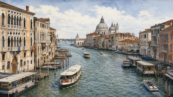
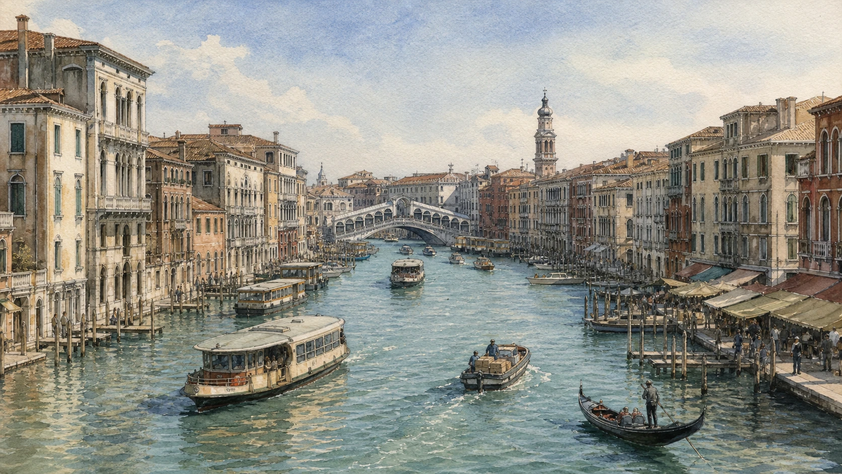
Original documentary watercolour panorama of the Grand Canal at Rialto Bridge with public and working boats

Venice Guide 03 · Transport, exchange, palaces and the working waterway

Grand Canal
& Rialto

A documented route through Venice’s principal water street, from merchant warehouses and palace landings to Rialto’s bridge, markets, public transport, ceremony and the conservation of a canal that still works.

Plan the route
Ferrovia to San Marco · Venice10 chapters · one full day

Why the canal must be read as infrastructure

The Grand Canal is not a decorative foreground for palaces: it is the main street that made their architecture, trade and daily operation possible.

The canal’s reverse-S course joins the railway and road gateways to the basin of San Marco. For most of its length there is no continuous pavement. Façades face the water because boats once delivered people, grain, spices, textiles, fuel, building material and news directly to warehouses and household landings. Public waterbuses, taxis, ambulances, refuse craft, freight boats, gondolas and private vessels still share that constrained channel.

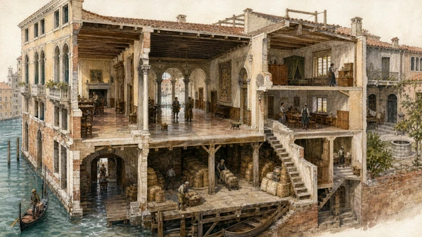
Rialto developed around the deepest concentration of exchange. Markets occupied both land and water edges; merchant communities were housed and regulated in fondachi; banks, insurance, magistracies and the bridge connected commercial functions. Palaces were not simply elite display. Their water gates, ground-floor storage, central portego and upper rooms combined business, representation and residence in one vertical system.

A useful visit therefore alternates boat and foot. The vaporetto reveals the long sequence and the relationship between both banks. Walking exposes loading points, side passages, market rhythms and bridge approaches. Neither viewpoint is sufficient alone. The canal must also be treated as living infrastructure: timetables change, commercial deliveries have priority, wakes affect foundations, and exceptional events can close or reroute normal navigation.

Read the water first, then the buildings it served: movement explains the façades, and working use explains why conservation cannot turn the Grand Canal into a static museum corridor.

The route

Plan your visit

Take a full Line 1 journey early or late, then walk the San Polo and Rialto banks. Use traghetto crossings only where operating and never build a route around a service that can pause without notice.

Early morning

Ferrovia to Accademia by water

Board a stopping vaporetto and remain attentive to both banks. The slower sequence makes warehouses, palace types, side canals and bridge crossings legible.

Late morning

Rialto markets and San Polo bank

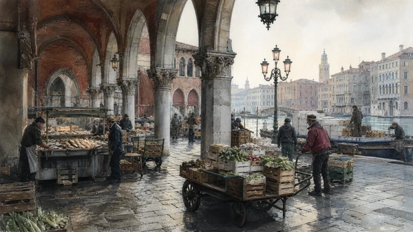
Walk the produce and fish-market district while trade is still visible. Keep passageways clear and treat stalls as workplaces rather than scenery.

Midday

Bridge, fondaco and merchant streets

Cross Rialto Bridge slowly, study the shop spine and approaches, then compare the Fondaco dei Tedeschi with the smaller streets of regulated exchange.

Afternoon

Palace landings to the basin

Return to the water for Ca’ d’Oro, the merchant-house sequence and the final opening toward Salute and San Marco; finish by observing service traffic, not just monuments.

Ten chapters

Explore the places

The route follows transport, exchange, palace architecture, markets, ceremony and conservation. Use the index to move between stops without reducing the Grand Canal to a sequence of façades.

  1. 01The Grand Canal as Venice’s urban main street
  2. 02Vaporetto, traghetto and working traffic
  3. 03Fondaco dei Turchi: commerce, residence and regulation
  4. 04Ca’ d’Oro: palace façade, collection and restoration
  5. 05Rialto markets: food infrastructure before spectacle
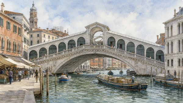
  6. 06Rialto Bridge: engineering, shops and urban pressure
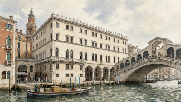
  7. 07Fondaco dei Tedeschi: the regulated gateway beside Rialto
  8. 08Merchant palaces: the household as an economic institution
  9. 09Regata Storica: ceremony, sport and the inhabited canal
  10. 10Wakes and conservation: keeping a working canal alive
01

A tidal waterway carries the functions that another city would distribute between boulevard, service road, ceremonial avenue and address system

The Grand Canal as Venice’s urban main street

Its scale and curved sequence organise arrival, prestige, exchange and orientation, while the absence of a continuous bank keeps water transport structurally necessary.

Today

The canal runs for roughly four kilometres between the Santa Lucia railway area and the basin of San Marco. Four principal pedestrian bridges now cross it, supplemented by public transport and several traditional traghetti when operating. Vaporetto stops occupy floating landings; service craft use palace doors and small quays; side canals distribute traffic into the sestieri. Water level, congestion and events continually alter the apparent width and calmness of the route.

History

Settlement developed along higher ground beside the ancient channel, and the Rialto area became a durable commercial centre. Byzantine, Gothic, Renaissance, Baroque and later façades accumulated without one regulating plan. Families rebuilt or combined properties, while public authorities managed bridges, navigation and market access. The nineteenth-century railway and twentieth-century road terminal changed the western arrival point but reinforced the canal as the main visual and transport approach to the historic city.

How to read this place

On a stopping boat, map each bank rather than chasing isolated names. Look for a repeated sequence: water door, low service level, central opening or portego, noble floor and attic. Side canals interrupt the frontage like cross streets. Church façades and civic buildings act as landmarks within a predominantly residential-commercial edge. At the Accademia bend, the view toward Salute shows how the canal expands from working street into ceremonial basin without ceasing to carry ordinary traffic.

What to notice

  • Water entrances positioned as primary doors
  • Side canals functioning as distributor streets
  • Different architectural periods held together by one water line
UNESCO World Heritage Centre · Venice and its Lagoon
Original documentary watercolour of the Grand Canal bend between palace fronts, Accademia and Salute
The Grand Canal as Venice’s urban main streetOriginal Merlintravel documentary watercolour · 2026
02

Public boats, standing-oars crossings and service vessels share a regulated channel whose traffic cannot be read as tourist theatre

Vaporetto, traghetto and working traffic

Movement on the canal follows different speeds, routes and responsibilities; the safest and most revealing visitor position is an observant passenger, not an obstacle.

Today

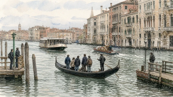
ACTV waterborne services connect the canal with the wider lagoon network. Current tickets must be bought and validated according to official rules, including a new validation when changing service. The Line 1 stopping service is usually the most legible canal overview, but timetables and boarding points can change. A traghetto uses a larger gondola to cross at selected points; service is local, inexpensive and not guaranteed at every historic station or hour. Ambulances, firefighters, refuse boats and deliveries need unobstructed access.

History

For centuries boats supplied a city without wheeled street transport. Ferries connected banks before fixed crossings multiplied, and specialised craft served different goods, occupations and depths of water. Steam navigation began in the nineteenth century and became part of a modern public network. Motorisation increased speed and carrying capacity but also introduced wakes, noise and new rules into a fragile channel whose masonry edges had developed for slower traffic.

How to read this place

At a floating stop, observe traffic lanes before boarding. A vaporetto needs space to approach and swing; small freight craft often hold a practical line toward a landing; gondolas may cross rather than follow the full channel. On a traghetto, follow the boatman’s directions and avoid copying the traditional standing posture unless invited and stable. The mix of craft is evidence of a functioning city, so photographing a delivery or emergency movement must never interfere with it.

What to notice

  • Floating stops that move with the tide
  • Different boat profiles matched to distinct urban tasks
  • Cross-channel traghetto routes rather than scenic circuits
ACTV · Venice urban and waterborne services
Original documentary watercolour of a traghetto crossing between a vaporetto and working boats on the Grand Canal
Vaporetto, traghetto and working trafficOriginal Merlintravel documentary watercolour · 2026
03

A palazzo converted into a regulated merchant residence records both long-distance exchange and the controls Venice imposed on foreign communities

Fondaco dei Turchi: commerce, residence and regulation

The building’s current medieval appearance includes major nineteenth-century reconstruction, while its historical use joined warehousing, accommodation, worship and surveillance.

Today

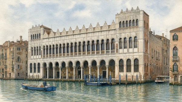
The Fondaco dei Turchi stands near San Stae and houses the Natural History Museum of Venice. Its broad canal front, twin towers and double loggia make it one of the most recognisable early palace forms, but those features must be read through restoration history. The museum includes interpretation of the building and a tactile model at ground level. Current opening, ticket and accessibility information belongs to the official MUVE museum pages.

History

The Pesaro family built the palace in the first half of the thirteenth century. The Republic acquired it, used it for distinguished guests and in 1621 assigned it to Ottoman merchants. Regulations divided accommodation, controlled loading and enclosed parts of the complex; warehouses, a prayer space and ritual facilities supported a supervised trading community. After this use ended in 1838, severe deterioration led to extensive reconstruction from the 1860s. The building housed the Correr collections before becoming the Natural History Museum in 1923.

How to read this place

Compare the open loggias and symmetrical towers with later Gothic palace fronts. Then resist calling every visible element untouched medieval fabric: the reconstructed roofline and towers derive partly from historic images and nineteenth-century ideas of restoration. The water landing explains the building more clearly than its picturesque outline. Goods and people arrived together, while walls and internal divisions materialised the Republic’s combination of international dependence and social control.

What to notice

  • Broad landing aligned with a warehouse-residence
  • Double loggia associated with an early canal-palace type
  • Restored towers that make conservation history visible
Natural History Museum of Venice · The Fontego dei Turchi
Original documentary watercolour of the Fondaco dei Turchi façade and landing on the Grand Canal
Fondaco dei Turchi: commerce, residence and regulationOriginal Merlintravel documentary watercolour · 2026
04

A celebrated Gothic façade is also a record of family ambition, lost surface colour, changed ownership and a collector’s selective restoration

Ca’ d’Oro: palace façade, collection and restoration

The building deserves close reading as architecture and museum history, not a single claim that it is Venice’s most beautiful house.

Today

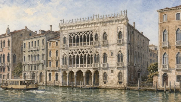
Ca’ d’Oro faces the Grand Canal in Cannaregio and houses the Galleria Giorgio Franchetti. Its asymmetrical façade combines open loggias, tracery, carved stone and a lower water entrance. The internal courtyard contains Franchetti’s mosaic pavement and a reconstructed well setting. Opening conditions can change with conservation works, so entry must be checked on the official Direzione regionale Musei nazionali Veneto page rather than inferred from the visible façade.

History

Marino Contarini commissioned the palace in the early fifteenth century, drawing on Venetian and Lombard workshops. Gilding and painted colour contributed to the name Golden House but largely disappeared. The building was altered repeatedly after leaving the Contarini family. Baron Giorgio Franchetti acquired it in 1894, restored selected features, installed his collection and donated house and works to the state. The museum therefore joins a fifteenth-century palace with a late-nineteenth- and early-twentieth-century collecting project.

How to read this place

From the opposite bank or boat, compare the open left side with the more solid right bays. The imbalance follows plot, circulation and rebuilding rather than failed symmetry. Tracery frames depth; it is not surface lace pasted onto a wall. Inside, distinguish original fabric, salvaged material and Franchetti’s interventions. The museum collection, courtyard and canal façade form one historical argument only when their different dates remain visible.

What to notice

  • Asymmetrical balance between loggias and solid window bays
  • Carved stone once combined with colour and gilding
  • Collector-restorer layer superimposed on the Gothic palace
Direzione regionale Musei nazionali Veneto · Ca’ d’Oro
Original documentary watercolour of Ca' d'Oro showing the Gothic loggias, water entrance and asymmetrical façade
Ca’ d’Oro: palace façade, collection and restorationOriginal Merlintravel documentary watercolour · 2026
05

The market district shows how lagoon, mainland and overseas supply were converted into everyday urban food rather than abstract mercantile wealth

Rialto markets: food infrastructure before spectacle

Produce stalls, the Pescheria and delivery edges remain workplaces whose value lies in active use as much as historic architecture.

Today

The market area spreads around Campo della Pescheria and Campo San Giacomo di Rialto on the San Polo bank. The neo-Gothic fish-market loggia faces the canal beside loading space; produce trading occupies adjacent lanes and squares according to current market schedules. Activity is strongest in the morning and quieter after cleaning. Visitors should keep access routes open, request permission before close photographs of workers and never handle displayed food.

History

Rialto became the Republic’s principal commercial zone and a food-distribution centre supplied by lagoon fishermen, island gardens and mainland agriculture. Magistracies supervised weights, measures, quality and taxation. Fire devastated the district in 1514, after which rebuilding reorganised shops and public offices around retained commercial functions. The present Pescheria building dates from the early twentieth century, demonstrating that historic continuity can depend on new architecture rather than the survival of one medieval structure.

How to read this place

Arrive from the canal and identify the direct relationship between boat landing, covered market and narrow distribution streets. Stone tables, drains and washable surfaces show practical requirements. At San Giacomo, arcades and the public clock belong to a civic-commercial setting, not a detached church square. The most responsible visit is early enough to see work but not so intrusive that a functioning market becomes a stage set.

What to notice

  • Canal edge designed for unloading food
  • Covered loggia providing shade, ventilation and washable work space
  • Narrow streets distributing goods toward the city
Comune di Venezia · Public-market administration
Original documentary watercolour of the Rialto Pescheria, produce stalls and delivery boats during morning market work
Rialto markets: food infrastructure before spectacleOriginal Merlintravel documentary watercolour · 2026
06

The stone bridge solved a transport and rental problem at the canal’s busiest crossing while preserving a commercial spine above the arch

Rialto Bridge: engineering, shops and urban pressure

Its single arch is inseparable from the stepped approaches, shop rows and water traffic that converge at the same narrow point.

Today

Rialto Bridge carries pedestrians between San Marco and San Polo on three parallel passages divided by two rows of shops. The outer stairs provide canal views; the central passage is a working shopping route. Below, public and private boats negotiate the arch and adjacent stops. Congestion is severe at peak hours. Pausing in the middle of a stair or shop entrance blocks local circulation, so extended looking is better from the lower banks or a less crowded outer landing.

History

Earlier crossings included boats and successive wooden bridges, one of which collapsed in 1444 under a crowd. After repeated damage and debate, Antonio da Ponte’s stone bridge was constructed between 1588 and 1591. A broad single arch kept the principal navigation channel open, while superstructure and shops helped organise and finance the crossing. The solution was conservative in function and bold in masonry: a commercial bridge replaced a commercial bridge rather than imposing an empty monument.

How to read this place

Approach from both banks. On the San Marco side, streets funnel toward the bridge; on the San Polo side, the crossing opens toward markets. From below, study the springing of the arch and the relation between foundations and water. From above, compare central and outer passages. The shop rows conceal much of the structure but are not later clutter: they belong to the bridge’s operating logic and its historic connection to Rialto trade.

What to notice

  • Single navigation arch spanning the principal channel
  • Three pedestrian passages divided by shop rows
  • Stepped approaches channelling several districts into one crossing
Venezia Unica · Rialto Bridge
Original documentary watercolour of Rialto Bridge showing its single arch, shop rows, steps and passing boats
Rialto Bridge: engineering, shops and urban pressureOriginal Merlintravel documentary watercolour · 2026
07

A vast merchant warehouse beside the bridge concentrated lodging, storage, accounting and regulation at the centre of European exchange

Fondaco dei Tedeschi: the regulated gateway beside Rialto

Its present retail interior and restored roof cannot erase the building’s earlier role as an institution that contained foreign trade within Venetian rules.

Today

The large square block stands directly beside Rialto Bridge on the San Marco bank. A central courtyard organises the interior, while the canal façade retains the scale of a warehouse-palace. The building is privately operated as a retail destination and access conditions, events and terrace reservations can change. Visitors should treat the current use as one phase and avoid presenting modern branding as evidence for Renaissance mercantile life.

History

A fondaco for merchants from German-speaking lands occupied the site by the Middle Ages. Fire destroyed the earlier building in 1505; rapid reconstruction created the present block around a courtyard. Merchants lived, stored goods and conducted business under institutional supervision, while exterior frescoes by Giorgione and Titian advertised civic splendour but largely vanished. After the Republic the building served as a customs house and later a post office before twenty-first-century commercial conversion.

How to read this place

From the bridge, look at mass rather than decoration: the building’s footprint and repetitive windows reflect collective accommodation and storage. The water door links directly to the busiest trade zone. Inside, the courtyard preserves the organising void even though surfaces and circulation have changed. Compare this purpose-built community warehouse with the more palatial Fondaco dei Turchi and with individual merchant houses along the canal.

What to notice

  • Large courtyard block beside bridge and market
  • Canal access suited to bulk unloading and control
  • Modern reuse layered over warehouse, customs and postal phases
Comune di Venezia · Rialto market district and merchant buildings
Original documentary watercolour of the Fondaco dei Tedeschi beside Rialto with its courtyard and canal landing
Fondaco dei Tedeschi: the regulated gateway beside RialtoOriginal Merlintravel documentary watercolour · 2026
08

The canal palace combined warehouse, office, reception hall, family residence and service space within one narrow waterfront plot

Merchant palaces: the household as an economic institution

Repeated façade patterns become meaningful when matched to movement of goods below, clients through the portego and family life on upper floors.

Today

Many Grand Canal palaces remain private, institutional or hotel properties and cannot be entered casually. Their façades can nevertheless be read from public boats and bridges. Water doors may still receive service deliveries, while ground floors face periodic high water. Interior uses have changed, partitions have moved and façades have been restored at different dates, so no single visible building should stand for an unchanged Venetian domestic type.

History

Patrician wealth came from varied combinations of trade, land, office and investment. Canal houses offered direct water access and concentrated storage, accounting and representation. The central portego often linked water and land doors, with rooms opening to either side; principal floors displayed family status and supported large gatherings. Over centuries marriage, inheritance, subdivision, fire and changes in commerce transformed this flexible framework.

How to read this place

Choose three adjacent façades and compare rather than ranking them. Locate the broad water opening, vertical stair position, central window group and narrower side rooms. A grand piano nobile does not mean the lower level was unimportant: warehouse and landing enabled the household above. Look for combined plots or misaligned bays that record growth. The palace is best understood as an operating building whose elegant front condensed logistics and identity into one canal address.

What to notice

  • Water gate aligned with a central internal passage
  • Principal-floor window groups marking the portego
  • Narrow side rooms fitted to constrained urban plots
UNESCO World Heritage Centre · Venice and its Lagoon
Original documentary watercolour cutaway of a Venetian merchant palace from water gate and warehouse to portego and upper residence
Merchant palaces: the household as an economic institutionOriginal Merlintravel documentary watercolour · 2026
09

The canal becomes a civic stage through a modern annual programme that combines historical procession, competitive rowing and living rowing associations

Regata Storica: ceremony, sport and the inhabited canal

The event is not timeless costume spectacle; its historical references and modern organisation belong to different layers that should be named clearly.

Today

The Comune di Venezia organises the annual Regata Storica with a historical water procession and races in several categories. In 2026 the main event is scheduled for 6 September, subject to the official municipal programme. Large crowds and navigation restrictions change access along the canal. Viewers should use authorised areas, protect residential entrances and verify transport diversions instead of assuming normal vaporetto service.

History

Organised Venetian regattas are documented from the later thirteenth century, while competitive rowing also emerged from everyday lagoon work. The modern form developed through nineteenth-century events and became an annual municipal appointment from 1922, with wartime interruptions. The ceremonial procession recalls the 1489 reception of Caterina Cornaro after her abdication as Queen of Cyprus. That historical reference is represented through twentieth- and twenty-first-century revival, not an unbroken surviving pageant.

How to read this place

Separate the three systems on the water: the formal procession, races using distinct traditional boats and the safety-service perimeter. Venetian standing rowing faces forward and depends on the forcola and local technique. Club colours, turning points and finish arrangements make the competition intelligible. The event temporarily intensifies the canal’s ceremonial role, but its strongest continuity lies in active rowing communities and municipal organisation.

What to notice

  • Standing Venetian rowing with the oar working in a forcola
  • Distinct racing categories and traditional boat forms
  • Modern safety and traffic control surrounding the historic procession
Comune di Venezia · Municipal regattas
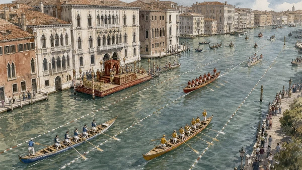
Original documentary watercolour of ceremonial boats and traditional rowing races during the Regata Storica
Regata Storica: ceremony, sport and the inhabited canalOriginal Merlintravel documentary watercolour · 2026
10

Every preserved façade depends on a working water edge where speed, wakes, deliveries, maintenance and climate pressures meet

Wakes and conservation: keeping a working canal alive

Conservation cannot exclude ordinary urban movement, but movement must be managed because repeated physical pressure acts directly on historic foundations and masonry.

Today

Freight, waste collection, emergency response, maintenance and passenger transport all require canal access. Boat speed and wake rules protect navigation and building edges, while palace owners and public bodies maintain stone waterlines, timber elements and moorings. UNESCO continues to identify the lagoon system and pressure from tourism, environmental change and navigation as interdependent management issues. Temporary barriers or work platforms should be read as care, not visual failure.

History

Venetian buildings rest on complex foundations and masonry adapted to lagoon conditions, but they were never immune to decay. Historic maintenance replaced stone, timber and plaster continuously. Motorised traffic changed the energy and frequency of wakes in the twentieth century, while industrial and environmental transformations affected the lagoon. Major flood events intensified attention to barriers and resilience, yet local building conservation still depends on repeated inspection and small-scale work at the waterline.

How to read this place

Watch a service boat approach a landing: speed drops, the hull is controlled by lines and crew, and unloading occupies scarce edge space. Compare that movement with a fast craft’s wake against exposed stone. Look for replaced blocks, repaired joints and mooring wear without diagnosing damage from a distance. Responsible looking recognises a negotiation—Venice needs deliveries and public transport, while the same water that enables them transmits force to the city.

What to notice

  • Stone waterlines showing replacement and biological growth
  • Low-wake manoeuvres near landings and public stops
  • Maintenance platforms documenting continual rather than exceptional care
UNESCO World Heritage Centre · Venice and its Lagoon
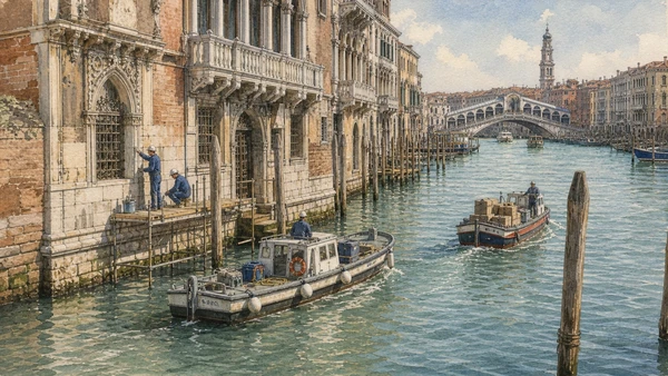
Original documentary watercolour of slow freight and municipal boats beside workers conserving a Grand Canal palace waterline
Wakes and conservation: keeping a working canal aliveOriginal Merlintravel documentary watercolour · 2026

The canal and Rialto through time

A short chronology

From early settlement and mercantile expansion to bridge rebuilding, museum conversions, public transport and the present conservation challenge.

  1. Settlement consolidates on higher ground around the Rivoalto area and along the main tidal channel.

  2. Large canal residences and fondachi develop as Venetian exchange expands across the Mediterranean.

  3. The Pesaro family builds the palace later known as the Fondaco dei Turchi.

  4. Organised regattas are documented alongside the practical rowing culture of the lagoon.

  5. Ca’ d’Oro and numerous Gothic palaces reshape the canal as a display of household and mercantile status.

  6. A wooden Rialto bridge collapses under a crowd, one episode in the crossing’s repeated rebuilding.

  7. After fire, the Fondaco dei Tedeschi is rapidly reconstructed beside Rialto.

  8. Fire devastates the Rialto district and prompts rebuilding around retained commercial functions.

  9. Antonio da Ponte’s stone Rialto Bridge replaces the wooden commercial crossing.

  10. The Republic assigns the former Pesaro palace to Ottoman merchants as the Fondaco dei Turchi.

  11. A nineteenth-century regatta helps establish the form later associated with the modern civic event.

  12. The degraded Fondaco dei Turchi undergoes extensive reconstruction for civic museum use.

  13. Giorgio Franchetti acquires Ca’ d’Oro and begins the restoration and collection project later donated to the state.

  14. The Regata becomes an annual municipal event and the Natural History Museum opens in the Fondaco dei Turchi.

  15. Public transport, markets, freight, tourism and conservation continue to negotiate the same constrained waterway.

Before your visit

Practical information

01

Use a stopping vaporetto for the first reading

A full Line 1 journey usually reveals both banks better than a faster service, but verify the same-day route and stop.

02

Validate every required leg

Follow current ACTV instructions at first boarding and whenever changing service; a purchased but unvalidated ticket is not sufficient.

03

Visit Rialto market in working hours

Morning makes its logistics legible. Keep aisles, counters, loading points and residential doors free.

04

Treat traghetti as local transport

Use them for a crossing when operating, follow the boatman’s directions and never assume a published historic station is active.

05

Check museums independently

Ca’ d’Oro and the Natural History Museum have their own official opening, access and restoration notices.

06

Do not block the canal edge

Floating stops, quays and landings are transport infrastructure; extended photography must yield to passengers, crews and deliveries.

Method and sources

Sources and image credits

This guide uses current official information from UNESCO, ACTV/AVM, the Comune di Venezia, Fondazione Musei Civici di Venezia, Venezia Unica and the Direzione regionale Musei nazionali Veneto, checked on 28 August 2026. It distinguishes canal from monument; working traffic from visitor transport; public vaporetto from private services; traghetto crossing from gondola tour; original palace fabric from later restoration; merchant residence from regulated fondaco; historic market continuity from the twentieth-century Pescheria building; the Renaissance bridge from its earlier crossings; historical regattas from the modern annual programme; and necessary urban movement from the physical pressures that responsible canal management must control.

All ten images are original Merlintravel editorial watercolours based on documented present-day conditions. They are illustrations, not substitutes for archaeological plans. Opening hours, tickets, accessible routes, temporary exhibitions and conservation work can change; consult the linked official pages shortly before visiting.