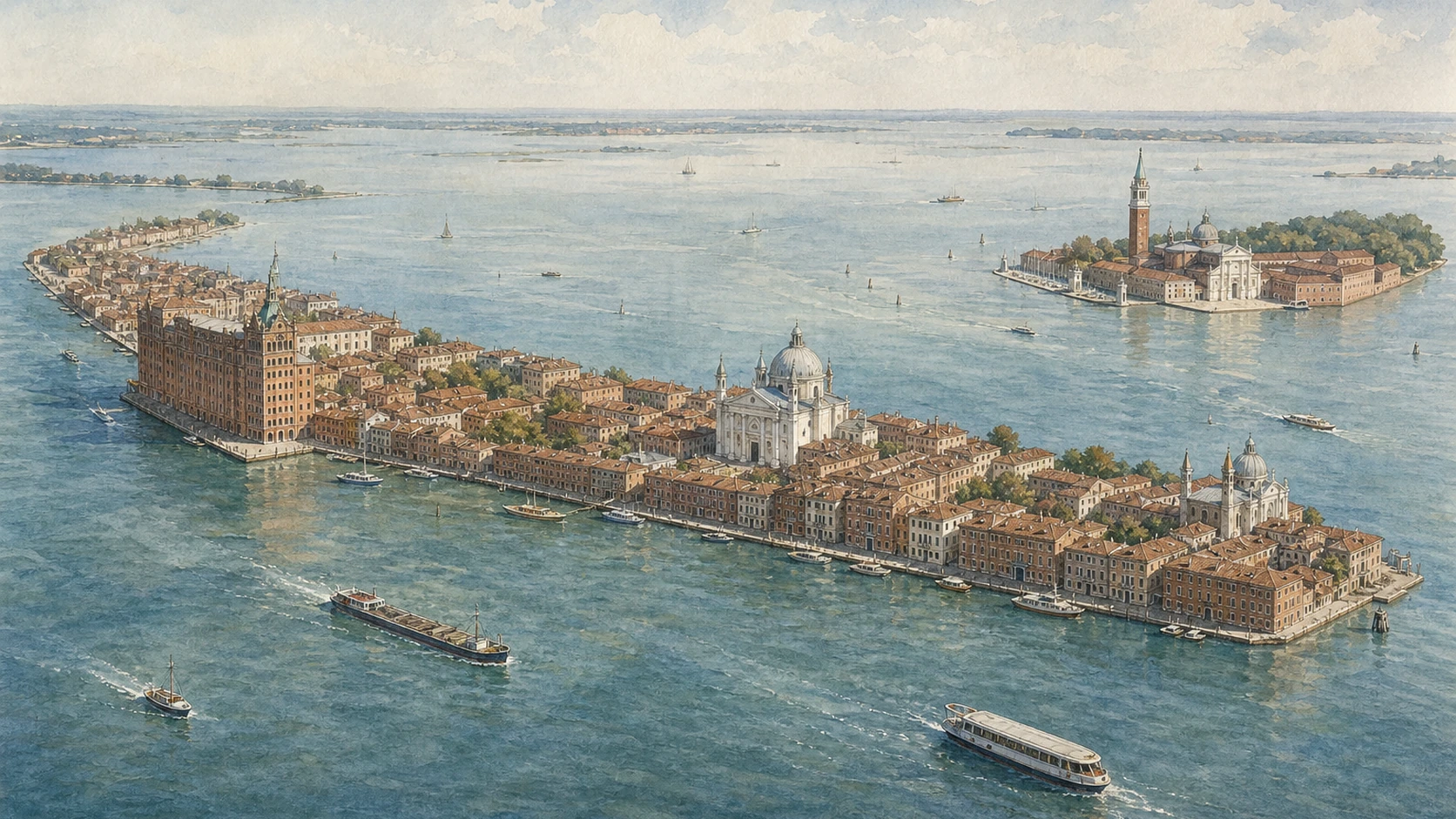
Original documentary watercolour panorama of continuous Giudecca, separate San Giorgio Maggiore and the southern Venetian lagoon

Venice Guide 10 · Resident island, votive architecture, industry, research and open water

Giudecca
& San Giorgio

A documented route along Giudecca’s inhabited and industrial waterfront, through Palladian churches and civic housing, then across to San Giorgio Maggiore’s basilica, research foundation and southern-lagoon edge.

Plan the route
Giudecca · San Giorgio Maggiore10 chapters · one full day

Why the southern waterline completes Venice

The southern side of Venice is not a decorative backdrop to Piazza San Marco: it is a resident water city shaped by monasteries, plague vows, factories, housing, research institutions and the open lagoon.

Giudecca faces the historic centre across one of Venice’s broadest working canals but differs from a central-city itinerary. Its continuous northern fondamenta connects vaporetto stops, homes, groceries, churches, former factories, student spaces and hotels. Behind that public edge, calli and canals reach gardens, social housing and the exposed southern shore. The island’s name has competing explanations; repeating one confident derivation from a supposed Jewish settlement obscures the lack of decisive documentary proof.

Two white churches organise the eastern skyline but emerged from different institutions. The Redentore was the Republic’s votive response to the plague of 1575–77 and remains the destination of a living annual procession. Le Zitelle belonged to a residential and educational institution for vulnerable young women. Palladian design matters in both, yet architecture should not erase the Capuchins, women, administrators, artists and worshippers who used the buildings.

Farther west, Molino Stucky, Fortuny and the ex-Junghans area record several kinds of industrial production and afterlife: monumental grain processing converted to hospitality, textile manufacture that continues privately, and a factory precinct reused for housing, culture and education. Sacca Fisola then makes civic housing and ordinary services impossible to omit. San Giorgio Maggiore adds a Benedictine church, postwar foundation, archives and exhibitions — not an empty island built only to complete the view from the Riva.

Move by public boat, give resident and freight movement priority, and compare who can enter, work in and benefit from each historic conversion.

The route

Plan your visit

Begin on Giudecca’s eastern waterfront, enter the Redentore during published access, then move west through industrial and civic landscapes. Cross to San Giorgio only after leaving enough time for a booked Cini route and the basilica’s separate conditions.

Early morning

Zitelle and Giudecca waterfront

Read institutional and resident fabric before the first major church visit.

Late morning

Redentore and island interior

Follow Palladio’s ceremonial sequence, then cross through calli toward ordinary housing and gardens.

Early afternoon

Junghans, Molino, Fortuny and Sacca Fisola

Compare civic, private and still-working industrial afterlives without entering controlled spaces.

Late afternoon

San Giorgio Maggiore

Use line 2 for the basilica and a pre-booked foundation route, ending with the southern lagoon as infrastructure and habitat.

Ten chapters

Explore the places

The route follows Giudecca’s inhabited waterfront, votive architecture, industrial conversion and civic housing before crossing to San Giorgio’s basilica, research foundation and lagoon edge.

  1. 01Giudecca waterfront: begin with resident movement
  2. 02The Redentore: move from façade to ceremonial sequence
  3. 03Le Zitelle: architecture, welfare and controlled access
  4. 04Molino Stucky: read the factory inside the hotel
  5. 05Fortuny: continuous making behind a private threshold
  6. 06Ex-Junghans: industrial blocks become a neighbourhood
  7. 07Sacca Fisola: ordinary civic Venice belongs on the map
  8. 08San Giorgio Maggiore: enter the church behind the skyline
  9. 09Fondazione Giorgio Cini: visit a working knowledge complex
  10. 10Southern edge: finish with maintenance and open water
01

A continuous fondamenta reveals the island through commuting, groceries and freight before it reveals a sequence of landmarks

Giudecca waterfront: begin with resident movement

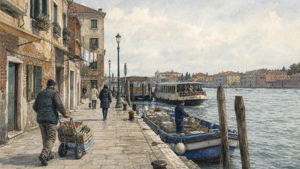
Vaporetto stops, homes, shops, schools and service boats share one long public edge facing the Zattere across a working canal.

Today

Giudecca is reached only by boat and has several stops serving different parts of the island. The northern waterfront is broad in places but narrows at landings, bridges and deliveries. Public benches and views do not convert residential doors or moorings into visitor space. Cruise traffic patterns have changed, yet freight, public transport, waste collection and emergency access still depend on the canal.

History

The island supported monasteries, gardens, villas, crafts and later large industrial plants. Its current name developed from earlier forms whose etymology remains disputed. Waterfront building intensified across different periods while the south retained more open and productive land. Modern housing and conversion inserted new populations and uses without creating one uniform urban fabric.

How to read this place

Walk one stop beyond your first destination and count the systems sharing the edge: passenger shelter, grocery cart, service boat, domestic doorway, ramp, bridge and mooring. Look through side calli toward the quieter south. Compare the monumental façades across the canal with the scale of occupied Giudecca houses. The island is clearest when the skyline and the delivery route appear together.

What to notice

  • Several vaporetto stops serving one long island
  • Freight and domestic access sharing the fondamenta
  • Side calli connecting monumental north edge to the south
Comune di Venezia · Giudecca urban context
Original documentary watercolour of Giudecca residents, groceries, vaporetto and freight on the northern waterfront
Giudecca waterfront: begin with resident movementOriginal Merlintravel documentary watercolour · 2026
02

A plague vow became architecture, procession and an annual temporary bridge rather than a monument detached from civic memory

The Redentore: move from façade to ceremonial sequence

Palladio’s layered front and luminous connected interior spaces serve a church still governed by Capuchin worship and the city’s votive feast.

Today

The church offers published artistic-visit hours and remains active for Mass. The sacristy has a separate contribution under current Chorus information. The adjacent convent includes private Capuchin areas; its restored garden follows separate access and booking. Each July the temporary votive bridge and Festa del Redentore transform movement around the church, so ordinary access assumptions do not apply during the event.

History

The Senate vowed a church during the plague of 1575–77 and selected Andrea Palladio’s project. The first stone was laid in 1577, and a boat bridge carried the first great thanksgiving procession. After Palladio’s death in 1580, Antonio da Ponte directed completion. The building and feast institutionalised public remembrance while the Capuchins sustained daily religious use.

How to read this place

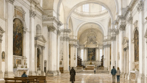
Read the façade from across the canal before approaching: overlapping temple fronts reconcile high nave and lower chapels. Inside, do not stop at white symmetry. Follow the sequence from nave through crossing and presbytery to the friars’ choir, noting how light, columns and thresholds distinguish stages. Paintings by Venetian masters occupy that structure rather than forming a detached gallery.

What to notice

  • Overlapping classical fronts scaled to nave and chapels
  • Connected interior spaces organising a civic-religious procession
  • Capuchin choir and convent life continuing behind the public visit
Chorus Venezia · Church of the Santissimo Redentore
Original documentary watercolour of the luminous Palladian interior and Capuchin use of the Redentore
The Redentore: move from façade to ceremonial sequenceOriginal Merlintravel documentary watercolour · 2026
03

A compact church is inseparable from the residential institution built around it for young women at risk of exploitation

Le Zitelle: architecture, welfare and controlled access

Santa Maria della Presentazione belongs to a larger institutional frontage whose history complicates a simple Palladian attribution.

Today

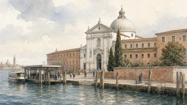
The church and former institutional wings stand beside the Zitelle vaporetto stop. Access is less regular than at the Redentore and should be confirmed through the managing organisation; the exterior ensemble remains legible from public space. Present accommodation and cultural uses do not erase the historic institution, but visitors must not enter residential or managed areas without permission.

History

Benedetto Palmi and Venetian patrons developed a house intended to shelter and educate young women considered vulnerable to prostitution. Construction of the church began after Palladio’s death, and its attribution and execution require caution rather than an absolute single-author story. Church, dormitories, work and discipline formed one institutional project whose benevolent language also involved social control.

How to read this place

Stand back far enough to keep the church between its wings. Compare the central façade and dome with the repetitive windows of the residence. Ask how circulation separated worship, education, work and outside contact. Avoid reducing the women to a picturesque name: the building records gender, poverty, patronage and regulation as much as Renaissance design.

What to notice

  • Church embedded within a long residential institution
  • Palladian attribution qualified by posthumous construction
  • Welfare and discipline occupying the same architectural system
Città di Venezia tourism portal · Giudecca and Le Zitelle
Original documentary watercolour of Le Zitelle church, institutional wings, vaporetto stop and active waterfront
Le Zitelle: architecture, welfare and controlled accessOriginal Merlintravel documentary watercolour · 2026
04

The largest brick mass on Giudecca records grain, machinery and labour before it records hotel conversion or skyline character

Molino Stucky: read the factory inside the hotel

Repetitive bays, tower and waterside scale reveal a modern industrial system whose adaptive reuse redistributed access and value.

Today

The former mill is now a hotel and residence complex. Public waterfront views allow close architectural reading, while interiors and terraces are controlled commercial spaces. A visitor should distinguish genuine retained fabric from reconstruction and new fit-out. The working-class history of the site is not adequately represented by entering only for a rooftop view.

History

Giovanni Stucky developed the steam-powered mill from the 1880s, and later expansion adopted a conspicuous neo-Gothic industrial architecture associated with Ernst Wullekopf. Grain arrived by water and flour and pasta production employed a large workforce. Competition, wars and financial crisis contributed to decline; the mill closed in 1955. Conversion followed decades of abandonment and included major reconstruction after the 2003 fire before the hotel opened in 2007.

How to read this place

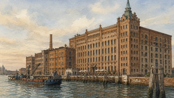
Trace the building from low production ranges to the tall tower and repeated window grid. Look for former loading edges, chimneys and changes in brick. Ask which industrial volumes remain legible and which have been internally divided. Compare this privately managed conversion with the more civic reuse at Junghans and the still-working Fortuny factory.

What to notice

  • Repetitive factory windows revealing production floors
  • Waterside loading scale beneath the neo-Gothic tower
  • Historic fabric, post-fire reconstruction and new hotel use distinguished
Venezia 1600 · Stucky family, mill and labour history
Original documentary watercolour of Molino Stucky's industrial brick complex, freight edge and adaptive hotel reuse
Molino Stucky: read the factory inside the hotelOriginal Merlintravel documentary watercolour · 2026
05

A historic factory that still produces textiles demands a different visit ethic from an abandoned plant or public museum

Fortuny: continuous making behind a private threshold

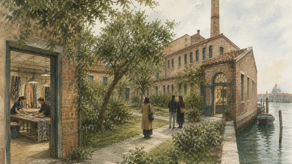
Mariano Fortuny and Henriette Negrin’s Giudecca factory remains active; showroom and garden access do not imply an open production tour.

Today

Fortuny’s official information states that production studios are not open to the public, while the showroom and gardens at the historic property welcome visitors under current arrangements. Respect that line. Fabric displays can introduce colour, pattern and material, but protected processes and ordinary work should not be pursued through doors or photographed without explicit permission.

History

Mariano Fortuny y Madrazo and Henriette Negrin developed fabrics, garments, lighting and theatrical technologies through experimentation in Venice. Growing demand led them to open the Giudecca factory in 1922. The site joined artistic design to industrial organisation and continued under later ownership, making continuity itself part of its significance rather than converting the plant into a static memorial.

How to read this place

From allowed areas, relate long workshop buildings, garden, canal access and showroom. Examine a textile for weave, dye, printed layer, metallic effect and repeat, while avoiding unsupported claims about a secret single formula. Attribute Negrin’s collaboration and later makers as well as Fortuny. A living factory has intellectual property, safety and production rhythms absent from a conventional museum.

What to notice

  • Showroom and garden separated from private studios
  • Industrial buildings supporting craft continuity
  • Textile attribution extending beyond one celebrated founder
Fortuny · Official company and factory history
Original documentary watercolour of Fortuny's Giudecca factory, garden, showroom visitors and private textile work
Fortuny: continuous making behind a private thresholdOriginal Merlintravel documentary watercolour · 2026
06

Clock and wartime production gave way to housing, a theatre and student plans through a conversion whose public value remains measurable

Ex-Junghans: industrial blocks become a neighbourhood

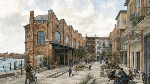
Retained factory fabric, contemporary housing and cultural space show adaptive reuse as an urban project rather than one private building.

Today

The ex-Junghans area combines residences, public routes and cultural uses with buildings still subject to maintenance and redevelopment. Municipal plans have addressed former blocks as student housing with accessibility and energy work. Not every courtyard or doorway is public. Visitors should follow recognised paths and avoid treating residents’ balconies as evidence for an architecture tour.

History

Industrial activity on this part of Giudecca included watch components and wartime production. Decline left a large precinct whose late-twentieth-century redevelopment inserted social housing and new public spaces while retaining industrial traces. The residential projects of the late 1990s and early 2000s deliberately negotiated between dense Venetian fabric and the larger scale of the former factory enclosure.

How to read this place

Compare old brick, steel windows and roof profiles with new residential openings, passages and the long shared court. Identify where the conversion preserves a production volume and where it creates a street or home. Evaluate reuse through housing quality, access and public life, not only visual contrast between old and new materials.

What to notice

  • Factory walls and windows retained within new circulation
  • Contemporary housing defining public courts
  • Cultural and student uses negotiated with resident access
Italian Ministry of Culture · Ex-Junghans residential architecture record
Original documentary watercolour of ex-Junghans factory fabric, contemporary housing, residents and theatre use
Ex-Junghans: industrial blocks become a neighbourhoodOriginal Merlintravel documentary watercolour · 2026
07

The western neighbourhood makes housing maintenance, green space and public service part of Venice’s heritage conversation

Sacca Fisola: ordinary civic Venice belongs on the map

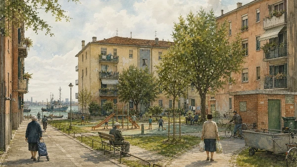
Twentieth-century housing, playgrounds, shops and lagoon access counter the idea that Giudecca ends where monumental façades stop.

Today

Sacca Fisola is primarily residential. Municipal housing repairs, sports facilities and public-space maintenance affect everyday quality of life. Its open areas and southern views are not invitations to enter apartment courts or photograph residents closely. Shops and services deserve normal patronage rather than being treated as discoveries in an allegedly untouched district.

History

The sacca was formed and developed in the modern period as Venice addressed housing and service needs beyond the dense historic core. Municipal blocks and community facilities created a different urban scale from the older Giudecca fondamenta. Later infill, maintenance campaigns and connections to adjacent industrial areas show that public housing is an evolving system rather than a completed design episode.

How to read this place

Look at shade, seating, ramps, play space, waste collection and boat access before judging façades. Compare building repair cycles and balcony use. Trace how paths reach the lagoon and other parts of Giudecca. A resident neighbourhood can be architecturally modest and still reveal more about Venice’s future than a perfectly preserved ceremonial room.

What to notice

  • Municipal housing surrounding shared green space
  • Everyday services and mobility shaping public life
  • Maintenance quality visible in plaster, ramps and planting
Comune di Venezia · Current Giudecca and Sacca Fisola housing repairs
Original documentary watercolour of Sacca Fisola housing, playground, residents, bicycles and lagoon services
Sacca Fisola: ordinary civic Venice belongs on the mapOriginal Merlintravel documentary watercolour · 2026
08

Palladio’s white façade and interior geometry belong to a Benedictine island whose worship and art continue beyond the famous view

San Giorgio Maggiore: enter the church behind the skyline

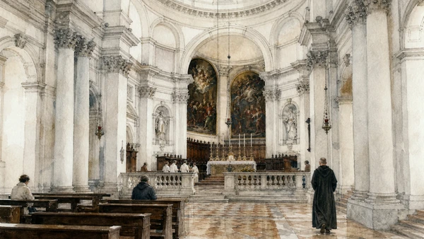
Basilica, campanile, choir and Tintoretto paintings form an active monastic ensemble with access conditions distinct from the Cini Foundation.

Today

Actv line 2 serves the San Giorgio stop. The basilica is managed with the Benedictine community and is not simply an exhibition hall; services and current opening information take priority. The campanile has separate access. Fondazione Cini’s accessibility information notes seven entrance steps at the church and recommends advance contact for assistance.

History

A Benedictine presence on San Giorgio dates to the early medieval period. Andrea Palladio designed the refectory and later the church, whose construction continued after his death and whose façade was completed in the early seventeenth century. The campanile visible today is a later rebuilding. Tintoretto’s late paintings in the presbytery belong to the church’s liturgical programme rather than an imported gallery display.

How to read this place

From the landing, compare façade, campanile and monastic ranges. Inside, follow the white giant order toward the crossing and choir. The Last Supper and Gathering of the Manna should be read from their architectural positions and oblique viewpoints. If climbing the tower, use the view to identify water systems and island geography rather than only Piazza San Marco.

What to notice

  • White giant order giving scale to the nave
  • Tintoretto paintings positioned within the presbytery
  • Basilica and campanile governed separately from Cini tours
Abbey of San Giorgio Maggiore · Official basilica and monastic information
Original documentary watercolour of San Giorgio Maggiore's Palladian interior, Benedictine worship and sanctuary paintings
San Giorgio Maggiore: enter the church behind the skylineOriginal Merlintravel documentary watercolour · 2026
09

Postwar restoration turned a damaged monastery into a research and cultural institution whose archives matter as much as its event spaces

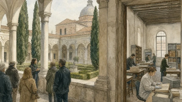
Fondazione Giorgio Cini: visit a working knowledge complex

Cloisters, libraries, archives, gardens and exhibitions are accessed through distinct programmes rather than one freely open historic interior.

Today

The foundation publishes guided tours of the monumental complex and separate access for exhibitions, the Borges Labyrinth, Vatican Chapels and other programmes. Booking, hours and accessibility should be checked for the chosen route. Researchers and staff use libraries and archives not included in an ordinary tour. The island’s polished event identity should not obscure that continuing scholarly work.

History

Vittorio Cini established the foundation in 1951 in memory of his son Giorgio. Restoration transformed former monastic buildings damaged by suppression, military and institutional uses into research institutes, libraries, performance and exhibition spaces. Palladio’s cloister and refectory, Longhena’s library and later landscape and art interventions now coexist within that postwar cultural project.

How to read this place

On a tour, distinguish monastic phase, later damage, postwar reconstruction and contemporary installation. Ask which library, archive or institute uses each space. Compare the calm proportions of the cloister with the controlled handling of documents. A successful restoration does not return a building to one pure date; it makes several histories usable and legible.

What to notice

  • Historic cloisters connected to working research institutes
  • Restoration phases distinguished from original fabric
  • Tours, exhibitions and archives operating under different access rules
Fondazione Giorgio Cini · Official island, sites and visitor orientation
Original documentary watercolour of a Fondazione Cini cloister, guided visitors and archivists working with collections
Fondazione Giorgio Cini: visit a working knowledge complexOriginal Merlintravel documentary watercolour · 2026
10

Behind the celebrated northern façades, boatyards, embankments and low marsh horizons expose the material systems that keep an island city functioning

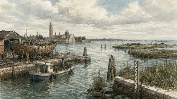
Southern edge: finish with maintenance and open water

Working boats, repaired walls, channels and wetland margins connect Giudecca and San Giorgio to climate, navigation and lagoon ecology.

Today

Southern shores are less monumental and access varies around private yards, gardens and institutional land. Stay on public paths and never enter a squero or work quay without permission. High water, wave action, heat and salinity accelerate maintenance. Utility boats and channel markers belong to safety and service networks, not scenic clutter to be removed from photographs.

History

Gardens, religious land, boat work and productive edges long occupied the islands’ south. Embankment and channel maintenance continually altered the boundary between land and water. Twentieth-century infill and new uses changed shorelines further. The present lagoon is neither untouched nature nor a fully engineered basin: habitat, settlement and infrastructure remain entangled.

How to read this place

Find a legal public view toward low southern islands and connect five elements: ground level, wall repair, boat draft, channel marker and wetland vegetation. Watch how wind and wakes reach the shore. Compare the material cost of maintaining this edge with the immaculate white façades seen earlier. The final view should explain vulnerability rather than merely offer sunset space.

What to notice

  • Boat repair and utility work at the lagoon edge
  • Embankment patches and tide marks recording exposure
  • Channels and wetland margins continuing beyond the built island
UNESCO World Heritage Centre · Venice and its Lagoon
Original documentary watercolour of a working boatyard, repaired embankment, channel markers and southern-lagoon wetlands
Southern edge: finish with maintenance and open waterOriginal Merlintravel documentary watercolour · 2026

Giudecca and San Giorgio through time

A short chronology

From Benedictine settlement and Palladian churches to plague memory, industrialisation, social housing, postwar restoration and the cultural island of today.

  1. A Benedictine community is established on San Giorgio Maggiore within a growing lagoon city.

  2. Giudecca combines religious houses, gardens, residences and productive land along its waterfronts.

  3. The institution and church of Le Zitelle develop for young women under Venetian patronage.

  4. A devastating plague prompts the Republic’s vow and the first Redentore procession.

  5. Palladio’s Redentore is built and completed after his death under Antonio da Ponte.

  6. Palladio’s work at San Giorgio includes refectory, church design and a new monumental relationship to the basin.

  7. The fall of the Republic and suppressions transform religious property and institutions across the islands.

  8. Molino Stucky expands industrial grain and pasta production on western Giudecca.

  9. Junghans-related production adds another major industrial precinct to the island.

  10. Mariano Fortuny and Henriette Negrin open their Giudecca textile factory, still used for production.

  11. Fondazione Giorgio Cini is established and begins restoring the San Giorgio monastery for research and culture.

  12. Molino Stucky closes, beginning decades of abandonment and debate over industrial reuse.

  13. Sacca Fisola and ex-industrial areas receive housing, services and new public-space projects.

  14. The converted Molino Stucky opens as a hotel after reconstruction and the major 2003 fire.

  15. Resident housing work, active factories, foundation exhibitions and climate maintenance coexist along the southern waterline.

Before your visit

Practical information

01

Choose stops by chapter, not by one Giudecca label

The island is long; check current Actv routes for Zitelle, Redentore, Palanca, Sacca Fisola and San Giorgio.

02

Separate worship from artistic access

Redentore and San Giorgio are active churches. Confirm hours, services, clothing and photography at the entrance.

03

Book the Cini route you actually want

Monumental complex, exhibitions, labyrinth, chapels and research facilities do not share one universal ticket or access condition.

04

Workshop access

Molino interiors are commercial, Fortuny studios are private and parts of Junghans are residential or managed.

05

Respect housing as housing

Sacca Fisola, Junghans and the Giudecca waterfront are resident neighbourhoods; keep thresholds and courtyards private unless clearly public.

06

Check mobility conditions in advance

Boat boarding, bridges, church steps and individual tour routes differ; the Cini accessibility page provides specific assistance information.

Method and sources

Sources and image credits

This guide uses current official information from Chorus Venezia, the Redentore convent, Comune di Venezia, the Italian Ministry of Culture, Fortuny, the Abbey of San Giorgio Maggiore, Fondazione Giorgio Cini and UNESCO, checked on 28 August 2026. It distinguishes resident island from scenic backdrop; plague vow from architectural celebrity; church from adjoining institution; factory history from hospitality conversion; active private production from museum access; civic housing from tourist discovery; Benedictine basilica from foundation exhibition; and open lagoon habitat from empty water.

All ten images are original Merlintravel editorial watercolours based on documented present-day conditions. They are illustrations, not substitutes for archaeological plans. Opening hours, tickets, accessible routes, temporary exhibitions and conservation work can change; consult the linked official pages shortly before visiting.