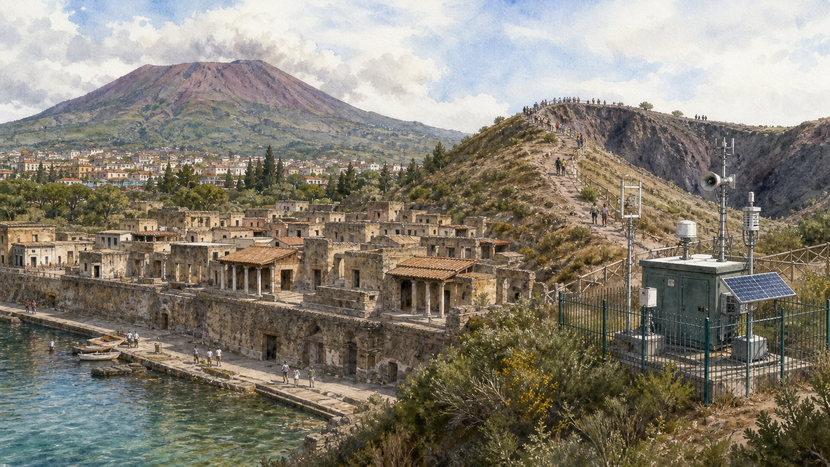
Original documentary watercolour panorama for Herculaneum, Vesuvius and Volcanic Risk: Complete Guide, showing landscape, heritage and present-day use

Campania Guide 03 · Buried town, ancient beach, carbonised wood, volcano monitoring and protected crater

Herculaneum, Vesuvius
& Volcanic Risk

A two-day guide connecting Herculaneum’s exceptionally preserved urban fabric and ancient shoreline to the Vesuvius National Park, crater access, scientific monitoring and the present responsibilities of living beside an active volcano.

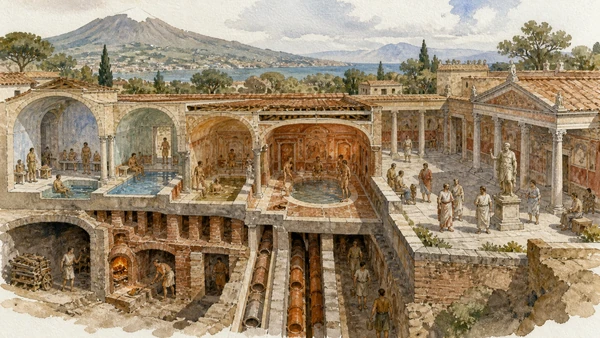
Plan the route
Campania · Italy10 chapters · one to three days

Why this Campania landscape must be read in layers

Herculaneum and Vesuvius must be read together but never collapsed into a disaster attraction: one preserves an ancient town through destructive processes, the other is an active monitored volcanic system and protected landscape.

Herculaneum was buried differently from Pompeii. Hot pyroclastic currents preserved upper floors, timber, food and other organic materials while shifting the ancient shoreline under many metres of deposits.

The archaeological park is a deep excavation beside the modern town of Ercolano. Drainage, groundwater, retaining structures and gradual conservation determine what opens; the ancient beach reopening adds vital evidence about victims and coastline.

Vesuvius access is controlled by the National Park and authorised ticket system. Weather, fire risk, trail conditions and volcanic monitoring can change. The guide does not predict eruptions and directs current risk questions to INGV and Civil Protection.

Give Herculaneum a full day and the volcano a separate weather-dependent day, using official tickets and monitoring sources rather than combining both as a rushed excursion.

The route

Plan your visit

Read the ancient town from its high modern entrance down to streets and beach, then approach Vesuvius on another day through the authorised park route, visitor rules and scientific observatory context.

Early morning

Herculaneum from above · Streets and houses · Carbonised wood

Follow the documented sequence: Herculaneum from above: ancient town below modern Ercolano; then Streets and houses: a compact coastal town; then Carbonised wood: doors, roofs and furniture. Recheck current access, transport and weather before departure.

Late morning

House of the Relief of Telephus · Baths and Augustales · The ancient beach

Follow the documented sequence: House of the Relief of Telephus: elite architecture at the coast; then Baths and Augustales: public service and civic status; then The ancient beach: shoreline, shelters and victims. Recheck current access, transport and weather before departure.

Afternoon

Villa of the Papyri · Vesuvius National Park · Gran Cono

Follow the documented sequence: Villa of the Papyri: an elite estate still partly underground; then Vesuvius National Park: volcano as protected landscape; then Gran Cono: authorised crater access. Recheck current access, transport and weather before departure.

Late afternoon

Monitoring and risk

Follow the documented sequence: Monitoring and risk: living beside an active volcano. Recheck current access, transport and weather before departure.

Ten chapters

Explore the places

The order follows terrain, chronology and current movement. Use the index without detaching monuments from the living landscape and infrastructure that sustain them.

  1. 01Herculaneum from above: ancient town below modern Ercolano
  2. 02Streets and houses: a compact coastal town
  3. 03Carbonised wood: doors, roofs and furniture
  4. 04House of the Relief of Telephus: elite architecture at the coast
  5. 05Baths and Augustales: public service and civic status
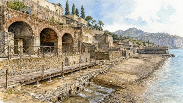
  6. 06The ancient beach: shoreline, shelters and victims
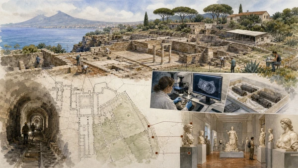
  7. 07Villa of the Papyri: an elite estate still partly underground
  8. 08Vesuvius National Park: volcano as protected landscape
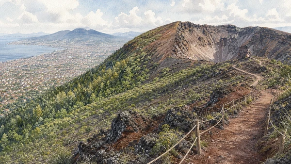
  9. 09Gran Cono: authorised crater access
  10. 10Monitoring and risk: living beside an active volcano
01

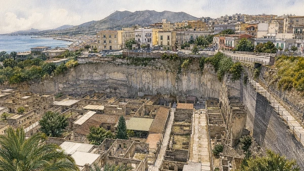
The entrance overlook reveals both deep burial and the continuity of settlement around the excavation

Herculaneum from above: ancient town below modern Ercolano

The sharp level difference is geological and urban evidence.

Today

Use marked viewpoints and ramps; edges and active conservation zones are protected. Accessible routes should be checked with the park.

History

Pyroclastic deposits sealed the Roman town and later settlements developed far above and beside it. Tunnelling and open excavation created the present archaeological void.

How to read this place

Before descending, map streets, ancient beach and modern buildings. The excavation boundary is a historical condition, not the ancient city limit.

What to notice

  • Deep deposit visible in section
  • Modern town pressing against excavation edges
  • Ancient street grid legible from above
Herculaneum Archaeological Park · Official site
Original documentary watercolour of Herculaneum from above: ancient town below modern Ercolano in Campania, showing accurate heritage, terrain and present-day use
Herculaneum from above: ancient town below modern ErcolanoOriginal Merlintravel documentary watercolour · 2026
02

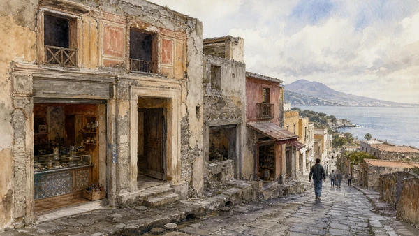
Dense blocks preserve shops, houses, upper levels and public buildings within a shorter route than Pompeii

Streets and houses: a compact coastal town

Material survival allows unusually close reading of construction and domestic systems.

Today

Open houses rotate and narrow interiors use capacity controls. Stay behind barriers and avoid touching carbonised or painted surfaces.

History

Herculaneum developed from earlier settlement into a Roman municipium with elite coastal residences and ordinary urban properties. The 79 CE burial preserved structures at several levels.

How to read this place

Follow street slope toward the former sea and compare shopfront, doorway, balcony evidence and drainage.

What to notice

  • Compact street blocks descending toward the shore
  • Upper-storey evidence surviving above entrances
  • Shops and residences sharing walls
Herculaneum Archaeological Park · Official site
Original documentary watercolour of Streets and houses: a compact coastal town in Campania, showing accurate heritage, terrain and present-day use
Streets and houses: a compact coastal townOriginal Merlintravel documentary watercolour · 2026
03

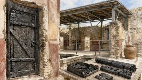
Heat transformed organic material that usually disappears archaeologically

Carbonised wood: doors, roofs and furniture

Exceptional survival demands exceptional restraint and controlled climate care.

Today

Do not touch darkened beams, shutters or display cases. Some elements are replicas or protective substitutions and should be identified from labels.

History

Pyroclastic conditions carbonised wood and food while later excavation exposed them to oxygen and moisture. Conservation developed specialised consolidation and support methods.

How to read this place

Compare joints, grain and position. Ask whether an element is original in situ, moved, restored or reconstructed.

What to notice

  • Timber doors preserving construction detail
  • Upper structures supported by modern conservation
  • Organic material changing the account of Roman houses
Herculaneum Archaeological Park · Official site
Original documentary watercolour of Carbonised wood: doors, roofs and furniture in Campania, showing accurate heritage, terrain and present-day use
Carbonised wood: doors, roofs and furnitureOriginal Merlintravel documentary watercolour · 2026
04

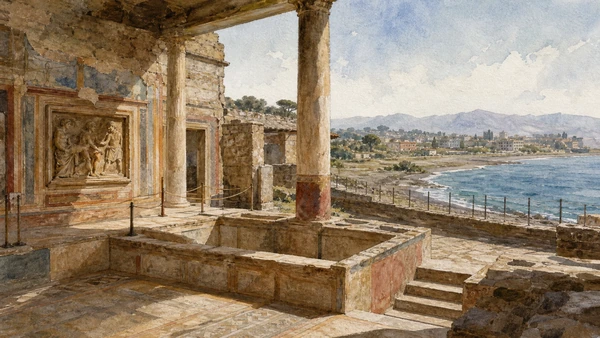
A large residence combines atrium, decorated rooms and a controlled view toward the ancient sea

House of the Relief of Telephus: elite architecture at the coast

Its partial excavation and conservation make the lost coastal setting essential.

Today

Room access changes with works and group flow. Use the park’s current open-building information.

History

The house belonged to an elite property complex and preserves distinctive architectural and sculptural evidence. Burial moved the shoreline and separated the building from its former maritime relation.

How to read this place

Follow the line of terraces and windows toward the ancient beach. The sea view was part of domestic status and design.

What to notice

  • Elite rooms stepping toward the ancient shore
  • Relief and decoration marking patronage
  • Modern land beyond the displaced coastline
Herculaneum Archaeological Park · Official site
Original documentary watercolour of House of the Relief of Telephus: elite architecture at the coast in Campania, showing accurate heritage, terrain and present-day use
House of the Relief of Telephus: elite architecture at the coastOriginal Merlintravel documentary watercolour · 2026
05

Bath complexes and a meeting building show institutions beyond private villas

Baths and Augustales: public service and civic status

Heating, imagery and patronage reveal labour and hierarchy.

Today

Interiors can be narrow and dim. Follow one-way routes and do not enter service passages closed to visitors.

History

Public baths required water, fuel and staff; the College of the Augustales was linked to imperial cult and social advancement. Both were altered before the eruption.

How to read this place

Trace hot-room service systems and compare civic imagery with donor inscriptions. Keep function and later names distinct.

What to notice

  • Bath rooms arranged by temperature
  • Service corridors sustaining public comfort
  • Civic meeting space expressing imperial loyalty
Herculaneum Archaeological Park · Official site
Original documentary watercolour of Baths and Augustales: public service and civic status in Campania, showing accurate heritage, terrain and present-day use
Baths and Augustales: public service and civic statusOriginal Merlintravel documentary watercolour · 2026
06

The reopened shore restores the geography of attempted escape and the force that transformed the coast

The ancient beach: shoreline, shelters and victims

Human remains require memorial restraint and precise scientific interpretation.

Today

Access follows a managed path and can close for conservation or weather. Do not pose with remains or treat the area as a disaster tableau.

History

People gathered in seafront chambers and on the beach during the eruption. Research on skeletons, boats and deposits continues, while the 2024 reopening followed conservation and drainage work.

How to read this place

Compare chamber position, ancient sea level and modern land beyond. Use current archaeological interpretation for sequence and cause of death.

What to notice

  • Shore chambers aligned along the ancient beach
  • Deep deposits separating old and modern coastlines
  • Human remains presented under ethical controls
Ministero della Cultura · Ancient beach reopening
Original documentary watercolour of The ancient beach: shoreline, shelters and victims in Campania, showing accurate heritage, terrain and present-day use
The ancient beach: shoreline, shelters and victimsOriginal Merlintravel documentary watercolour · 2026
07

Sculptures and carbonised scrolls came from a vast seaside villa first explored largely through tunnels

Villa of the Papyri: an elite estate still partly underground

Its incomplete exposure and dispersed finds must remain explicit.

Today

The villa itself is not part of the ordinary open city route. Use park notices and the MANN collections rather than seeking unauthorised access.

History

Bourbon tunnelling recovered a unique papyrus library, bronzes and marble sculpture from a large residence. Modern investigation continues to debate extent, ownership and texts.

How to read this place

Use plans to connect MANN objects to courts and terraces. Distinguish tunnel records from open excavation.

What to notice

  • Large villa plan extending beyond exposed site
  • Carbonised scrolls requiring specialised imaging
  • Sculpture collection distributed to Naples
Herculaneum Archaeological Park · Official site
Original documentary watercolour of Villa of the Papyri: an elite estate still partly underground in Campania, showing accurate heritage, terrain and present-day use
Villa of the Papyri: an elite estate still partly undergroundOriginal Merlintravel documentary watercolour · 2026
08

Woodland, lava surfaces, farms and settlements surround the summit system

Vesuvius National Park: volcano as protected landscape

The crater is one destination within a larger managed park.

Today

Use only open paths and authorised access. Fire risk, heat, wind and maintenance can close routes; collecting rock is prohibited.

History

Repeated eruptions, cultivation, forestry and settlement created a mosaic around Somma-Vesuvius. The national park was established to protect natural and cultural systems under intense urban pressure.

How to read this place

Notice vegetation succession, lava texture and views toward populated slopes. Do not describe the cone as isolated wilderness.

What to notice

  • Lava and woodland forming successive surfaces
  • Dense settlements visible around the volcanic base
  • Marked routes protecting fragile terrain
Vesuvius National Park · Official site
Original documentary watercolour of Vesuvius National Park: volcano as protected landscape in Campania, showing accurate heritage, terrain and present-day use
Vesuvius National Park: volcano as protected landscapeOriginal Merlintravel documentary watercolour · 2026
09

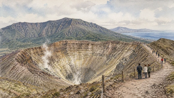
The summit route offers a view into the crater but remains an exposed managed trail

Gran Cono: authorised crater access

A ticket is permission for a defined path, not for unrestricted volcano exploration.

Today

Buy only through the official park channel, arrive within the stated slot and follow guide and weather instructions. There is little shade and loose surface.

History

The present cone reflects eruptive activity within the older Monte Somma structure. Historic eruptions and twentieth-century change reshaped its profile and access.

How to read this place

Look at crater walls, fumarolic alteration where visible and the encircling Somma rim. Never interpret ordinary vapour as a forecast.

What to notice

  • Crater walls exposed along a controlled rim path
  • Monte Somma framing the younger cone
  • Visitor limits managing an exposed summit
Vesuvius National Park · Tickets
Original documentary watercolour of Gran Cono: authorised crater access in Campania, showing accurate heritage, terrain and present-day use
Gran Cono: authorised crater accessOriginal Merlintravel documentary watercolour · 2026
10

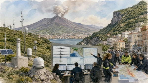
Seismic, deformation, geochemical and visual networks inform scientific assessment and civil-protection planning

Monitoring and risk: living beside an active volcano

No single instrument or social-media image predicts an eruption.

Today

For current status use INGV Osservatorio Vesuviano and Italian Civil Protection. Follow official alerts and local plans, not rumours.

History

The Observatory has a long history of Vesuvian science, while modern monitoring integrates instruments across Vesuvius, Campi Flegrei and Ischia. Civil planning distinguishes hazard, exposure and response.

How to read this place

Identify instruments and data categories without overinterpreting daily variation. Keep scientific monitoring separate from emergency authority.

What to notice

  • Seismic and deformation stations across the volcano
  • Observatory translating measurements into research
  • Civil-protection plans addressing dense exposure
INGV Osservatorio Vesuviano · Vesuvius monitoring
Original documentary watercolour of Monitoring and risk: living beside an active volcano in Campania, showing accurate heritage, terrain and present-day use
Monitoring and risk: living beside an active volcanoOriginal Merlintravel documentary watercolour · 2026

The landscape through time

A short chronology

A documented sequence from ancient settlement and environmental formation to modern conservation, mobility and resident life.

  1. Pyroclastic currents bury Herculaneum and transform its coastline.

  2. Well digging leads to early discoveries above the ancient theatre.

  3. Bourbon tunnelling begins systematic exploration at Herculaneum.

  4. The Villa of the Papyri yields sculpture and carbonised scrolls.

  5. The Royal Vesuvian Observatory tradition begins to develop through systematic interest in the volcano.

  6. An eruption destroys Torre del Greco and demonstrates repeated settlement risk.

  7. The Vesuvius Observatory is founded on the volcano’s western slope.

  8. A major eruption is studied with increasingly instrumental methods.

  9. A powerful eruption causes extensive damage around Vesuvius.

  10. The most recent Vesuvius eruption damages nearby communities during wartime.

  11. Amedeo Maiuri directs large open-air excavation campaigns at Herculaneum.

  12. Vesuvius National Park is established.

  13. Herculaneum is inscribed with Pompeii and Torre Annunziata on the UNESCO List.

  14. Drainage, conservation and research support reopening of the ancient beach.

  15. Continuous INGV monitoring and civil-protection planning remain essential for the densely populated volcanic area.

Before your visit

Practical information

01

Use only official tickets

Avoid resellers and verify timed-entry, named-ticket or same-day rules on the managing institution’s current site.

02

Keep a weather alternative

Heat, wind, sea state, volcanic conditions and heavy rain can change exposed archaeological, coastal and mountain routes.

03

Respect protected land

Stay on open paths, do not remove stone, plants or archaeological material and follow marine or park zoning.

04

Plan realistic transport

Rail, bus, ferry and road congestion vary sharply by season; do not combine distant chapters without a live connection check.

05

Protect resident access

Homes, farms, markets and working harbours are not sets; keep gates, lanes and deliveries clear and photograph people only with consent.

06

Separate fact from tradition

Legends and local narratives are identified as cultural evidence and are not substituted for archaeological, geological or archival proof.

Method and sources

Sources and image credits

This guide uses current documentation from the managing archaeological park, museum, ministry, UNESCO property, civil-protection authority, protected-area body or transport institution, checked on 29 August 2026. Claims are cross-checked against at least one second primary or institutional source where available. The guide separates current access from durable history and distinguishes surviving fabric from reconstruction, restoration, legend and promotional simplification.

All ten images are original Merlintravel editorial watercolours based on documented present-day conditions. They are illustrations, not substitutes for archaeological plans. Opening hours, tickets, accessible routes, temporary exhibitions and conservation work can change; consult the linked official pages shortly before visiting.