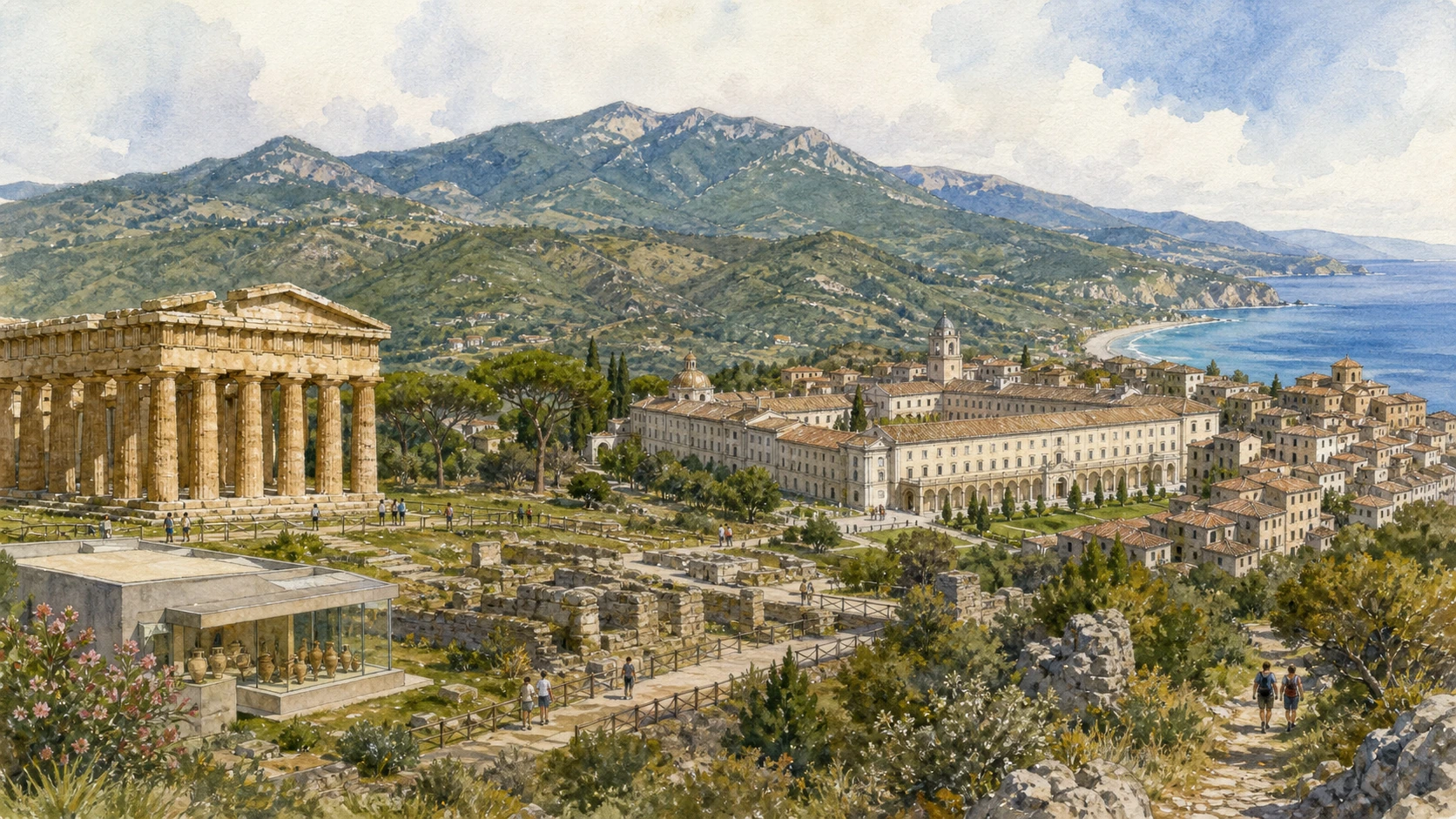
Original documentary watercolour panorama for Paestum, Velia, Padula and Cilento National Park: Complete Guide, showing landscape, heritage and present-day use

Campania Guide 05 · Greek cities, Lucanian and Roman layers, monastic landscape, villages and protected coast

Paestum, Velia
& the Cilento Landscape

A multi-day guide linking Paestum’s temples and museum to Velia, the Certosa di Padula, Cilento villages, coastal protected areas, inland mountains and the institutions that manage a vast UNESCO cultural landscape.

Plan the route
Campania · Italy10 chapters · one to three days

Why this Campania landscape must be read in layers

Paestum is the monumental gateway, not the whole Cilento: Greek and Roman cities, monastic estates, farms, forests, karst mountains, villages and marine reserves form one long landscape of routes and adaptation.

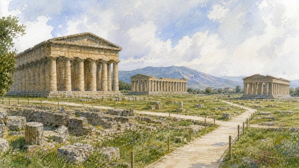
Paestum preserves three major Doric temples within an urban system of walls, streets, forum, housing and sanctuary. Names changed as scholarship improved; the temples should be tied to archaeological evidence rather than inherited romantic labels.

Velia and the Certosa di Padula extend the UNESCO property across coast and inland. One records a Greek and Roman city associated with Eleatic philosophy; the other a Carthusian institution whose enormous courts, service spaces and land relations evolved over centuries.

The National Park protects biodiversity and a cultural landscape still used by communities. Marine zoning, trail status, wildfire risk and village access are live conditions. Responsible travel slows down and avoids treating protected territory as an unlimited scenic reserve.

Give Paestum a full day, Velia and Padula separate days and choose one coastal and one inland Cilento chapter according to current park conditions rather than trying to circle the entire territory.

The route

Plan your visit

Begin with Paestum as a complete city, then move south to Velia, inland to Padula and into one carefully chosen park landscape where archaeology, settlement and ecology remain connected.

Early morning

Paestum’s temples · Paestum beyond the temples · Paestum Museum

Follow the documented sequence: Paestum’s temples: three monuments, different cult histories; then Paestum beyond the temples: walls, forum and houses; then Paestum Museum: tomb paintings, sanctuary finds and context. Recheck current access, transport and weather before departure.

Late morning

Heraion at the Sele · Velia · Certosa di Padula

Follow the documented sequence: Heraion at the Sele: sanctuary beyond the city; then Velia: Greek city, philosophy and a moving shoreline; then Certosa di Padula: monastery as a complete economy. Recheck current access, transport and weather before departure.

Afternoon

Cilento villages · Palinuro and Camerota coast · Marine protected areas

Follow the documented sequence: Cilento villages: ridges, stone and changing population; then Palinuro and Camerota coast: cliffs, caves and controlled sea access; then Marine protected areas: biodiversity under zoning. Recheck current access, transport and weather before departure.

Late afternoon

Cilento biodiversity

Follow the documented sequence: Cilento biodiversity: coast, rivers, forests and mountains. Recheck current access, transport and weather before departure.

Ten chapters

Explore the places

The order follows terrain, chronology and current movement. Use the index without detaching monuments from the living landscape and infrastructure that sustain them.

  1. 01Paestum’s temples: three monuments, different cult histories
  2. 02Paestum beyond the temples: walls, forum and houses
  3. 03Paestum Museum: tomb paintings, sanctuary finds and context
  4. 04Heraion at the Sele: sanctuary beyond the city
  5. 05Velia: Greek city, philosophy and a moving shoreline
  6. 06Certosa di Padula: monastery as a complete economy
  7. 07Cilento villages: ridges, stone and changing population
  8. 08Palinuro and Camerota coast: cliffs, caves and controlled sea access
  9. 09Marine protected areas: biodiversity under zoning
  10. 10Cilento biodiversity: coast, rivers, forests and mountains
01

Exceptionally preserved Doric buildings dominate the plain but belonged to distinct sanctuaries and phases

Paestum’s temples: three monuments, different cult histories

Traditional names are not all secure identifications.

Today

The site is exposed to heat and weather. Use official tickets, stay off stylobates unless the current route explicitly permits access and respect barriers.

History

Greek colonists founded Poseidonia, and major temples were built between the sixth and fifth centuries BCE. Lucanian and Roman communities reused the city while sanctuary meanings changed.

How to read this place

Compare column proportions, plans and orientation. Use current archaeological names and state uncertainty where dedication remains debated.

What to notice

  • Three major Doric monuments across the plain
  • Different proportions marking separate campaigns
  • Modern paths protecting sanctuary surfaces
Paestum and Velia Archaeological Park · Official museum
Original documentary watercolour of Paestum's temples: three monuments, different cult histories in Campania, showing accurate heritage, terrain and present-day use
Paestum’s temples: three monuments, different cult historiesOriginal Merlintravel documentary watercolour · 2026
02

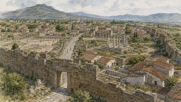
A complete circuit reveals gates, streets, assembly spaces, baths and residential change

Paestum beyond the temples: walls, forum and houses

The monumental silhouettes should not erase the inhabited city.

Today

Distances are substantial and shade is limited. Follow open paths and check the combined site map before setting out.

History

The Greek polis was reorganised under Lucanian control and again after Roman colonisation. The forum, amphitheatre, roads and houses record new institutions over earlier space.

How to read this place

Walk one gate-to-centre axis and distinguish agora evidence from Roman forum. Compare wall circuit with the later city inside.

What to notice

  • Long fortification circuit enclosing urban land
  • Greek and Roman civic spaces partly overlapping
  • Housing and roads revealing daily occupation
Paestum and Velia Archaeological Park · Official museum
Original documentary watercolour of Paestum beyond the temples: walls, forum and houses in Campania, showing accurate heritage, terrain and present-day use
Paestum beyond the temples: walls, forum and housesOriginal Merlintravel documentary watercolour · 2026
03

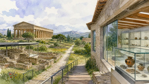
The museum restores objects and images to cemeteries, temples and regional communities

Paestum Museum: tomb paintings, sanctuary finds and context

The Tomb of the Diver is one chapter, not a summary of the entire site.

Today

Galleries and individual works can close or rotate. Check the park’s current route and allow time for labels.

History

Excavation and chance finds produced collections from Greek, Lucanian and Roman phases, including painted tombs and the Heraion at Foce del Sele.

How to read this place

Group objects by findspot and ritual use. Compare tomb painting traditions without treating them as direct illustrations of one unified belief.

What to notice

  • Painted tomb slabs reconstructed as chambers
  • Sanctuary sculpture tied to river landscape
  • Museum context correcting temple-only visits
Paestum and Velia Archaeological Park · Official museum
Original documentary watercolour of Paestum Museum: tomb paintings, sanctuary finds and context in Campania, showing accurate heritage, terrain and present-day use
Paestum Museum: tomb paintings, sanctuary finds and contextOriginal Merlintravel documentary watercolour · 2026
04

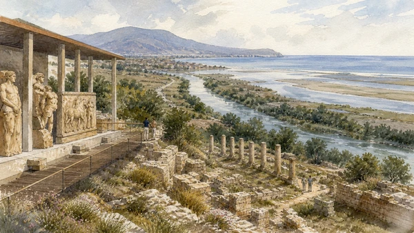
A river-mouth sacred landscape connected Poseidonia to territory, travel and myth

Heraion at the Sele: sanctuary beyond the city

Museum and archaeological remains must be read together.

Today

Access and opening can be limited; verify the park’s live information and do not enter agricultural land outside the site.

History

A major sanctuary of Hera developed north of the city near the Sele. Metopes and other finds illuminate architecture, cult and narratives while the environment shifted.

How to read this place

Use river, route and city distance to understand location. The sanctuary was not a detached rural temple.

What to notice

  • River landscape defining a territorial sanctuary
  • Architectural sculpture preserving narrative programmes
  • Changed coastline complicating ancient geography
Paestum and Velia Archaeological Park · Official museum
Original documentary watercolour of Heraion at the Sele: sanctuary beyond the city in Campania, showing accurate heritage, terrain and present-day use
Heraion at the Sele: sanctuary beyond the cityOriginal Merlintravel documentary watercolour · 2026
05

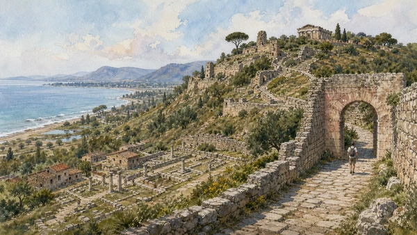
Terraces, gates and public buildings preserve ancient Elea above a coast altered by sediment and settlement

Velia: Greek city, philosophy and a moving shoreline

Philosophical fame must remain connected to urban archaeology.

Today

The site involves slopes, sun and uneven paths; upper sectors can close for fire risk or maintenance. Verify live access.

History

Phocaean settlers founded Elea in the sixth century BCE. The city became associated with Parmenides and Zeno, continued under Roman rule as Velia and adapted to changing coastal conditions.

How to read this place

Climb from lower city to Porta Rosa and the acropolis, noting retaining walls and sight lines. The buildings had different functions; only specific evidence connects them with the philosophers.

What to notice

  • Terraced city rising from an altered coast
  • Porta Rosa integrated into defensive routes
  • Acropolis and lower quarters requiring one complete climb
Paestum and Velia Archaeological Park · Official museum
Original documentary watercolour of Velia: Greek city, philosophy and a moving shoreline in Campania, showing accurate heritage, terrain and present-day use
Velia: Greek city, philosophy and a moving shorelineOriginal Merlintravel documentary watercolour · 2026
06

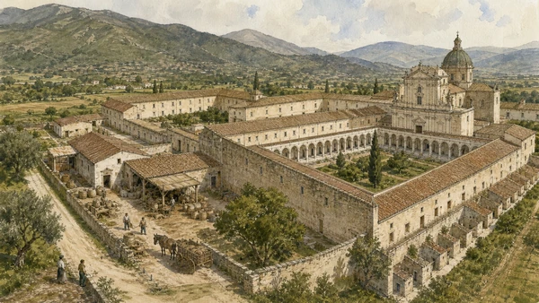
Church, cloisters, kitchens, cells, gardens and service courts organised Carthusian life on monumental scale

Certosa di Padula: monastery as a complete economy

The complex joins enclosure to regional land and labour.

Today

The state museum is extensive and hours can change; wear suitable shoes and check which sections are open.

History

Founded in the fourteenth century, the charterhouse expanded through Baroque campaigns and large landed resources. Suppression, military uses and restoration changed the institution.

How to read this place

Move from public and service zones toward increasing enclosure. The great cloister’s scale only makes sense beside kitchens, storage and cells.

What to notice

  • Great cloister organising solitary cells
  • Service courts sustaining a large estate
  • Baroque church embedded within strict enclosure
Direzione regionale Musei nazionali Campania · Certosa di Padula
Original documentary watercolour of Certosa di Padula: monastery as a complete economy in Campania, showing accurate heritage, terrain and present-day use
Certosa di Padula: monastery as a complete economyOriginal Merlintravel documentary watercolour · 2026
07

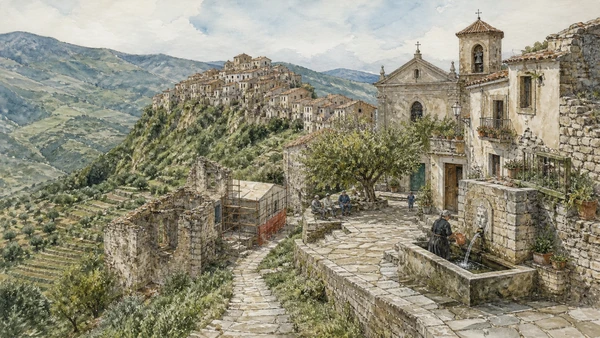
Hill settlements concentrate homes, churches and defensive memory above agricultural valleys

Cilento villages: ridges, stone and changing population

They remain communities rather than scenic shells.

Today

Roads and services can be limited; park only where permitted and avoid private courtyards or abandoned unsafe buildings.

History

Settlement patterns reflect security, water, farming, routes and later emigration. Earthquakes, depopulation and tourism affected villages unevenly.

How to read this place

Read fountain, church, communal space and path to fields. Distinguish maintained residence from ruin and staged restoration.

What to notice

  • Compact ridge settlement above cultivated land
  • Fountains and lanes revealing water systems
  • Inhabited and abandoned buildings requiring different ethics
Cilento, Vallo di Diano and Alburni National Park · Official site
Original documentary watercolour of Cilento villages: ridges, stone and changing population in Campania, showing accurate heritage, terrain and present-day use
Cilento villages: ridges, stone and changing populationOriginal Merlintravel documentary watercolour · 2026
08

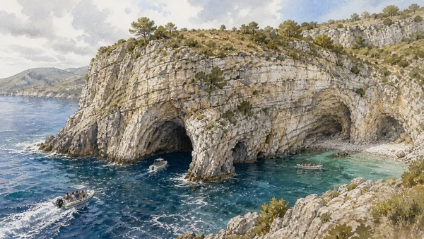
Karst, marine erosion and clear water create a complex coast whose caves are weather-dependent environments

Palinuro and Camerota coast: cliffs, caves and controlled sea access

Boat access is never guaranteed by a calm photograph.

Today

Use authorised operators, life jackets and marine notices. Sea state, wind and protected-area rules can cancel landings or cave entry.

History

Limestone headlands, caves and coves developed through geology and sea action while fishing and navigation created local knowledge. Tourism later intensified seasonal pressure.

How to read this place

Observe cliff bedding, cave opening and boat route from a safe position. Avoid claims about colour or access that depend on one moment.

What to notice

  • Limestone headland cut by marine caves
  • Small authorised boats adapting to sea state
  • Protected coves limiting landing and anchoring
Cilento, Vallo di Diano and Alburni National Park · Official site
Original documentary watercolour of Palinuro and Camerota coast: cliffs, caves and controlled sea access in Campania, showing accurate heritage, terrain and present-day use
Palinuro and Camerota coast: cliffs, caves and controlled sea accessOriginal Merlintravel documentary watercolour · 2026
09

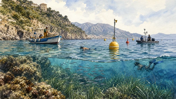
Santa Maria di Castellabate and Costa degli Infreschi e della Masseta protect coastal and marine habitats through differentiated rules

Marine protected areas: biodiversity under zoning

Protection changes what boats, fishers, divers and swimmers may do.

Today

Check the official zoning and permits before anchoring, fishing or diving. Never collect organisms or enter restricted zones.

History

Marine protection was established within a coast long used for fishing, navigation and settlement. Management balances habitat, research, community and controlled recreation.

How to read this place

Look for buoys, seagrass, rocky habitat and human activity from permitted areas. Absence of visible barriers does not mean unrestricted use.

What to notice

  • Zoned waters connecting coast and seabed
  • Small-scale maritime work continuing under rules
  • Monitoring and buoys making protection operational
Cilento National Park · Santa Maria di Castellabate MPA
Original documentary watercolour of Marine protected areas: biodiversity under zoning in Campania, showing accurate heritage, terrain and present-day use
Marine protected areas: biodiversity under zoningOriginal Merlintravel documentary watercolour · 2026
10

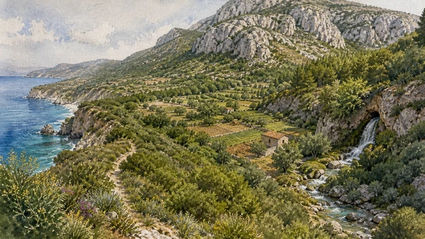
Rapid changes in geology, altitude and land use support exceptional habitat diversity

Cilento biodiversity: coast, rivers, forests and mountains

The park is not one uniformly wild landscape.

Today

Use official trails, fire restrictions and wildlife guidance. Do not reveal sensitive locations or leave marked routes.

History

The protected territory includes long-settled agricultural land, forests, karst massifs and river systems. National park, biosphere and geopark designations recognise different values.

How to read this place

Choose one ecosystem and follow changes in vegetation, water and human management. Avoid a checklist approach to wildlife.

What to notice

  • Coastal scrub transitioning toward inland forest
  • Karst mountains storing and releasing water
  • Agriculture and habitat forming a mosaic
Cilento National Park · Biodiversity
Original documentary watercolour of Cilento biodiversity: coast, rivers, forests and mountains in Campania, showing accurate heritage, terrain and present-day use
Cilento biodiversity: coast, rivers, forests and mountainsOriginal Merlintravel documentary watercolour · 2026

The landscape through time

A short chronology

A documented sequence from ancient settlement and environmental formation to modern conservation, mobility and resident life.

  1. Greek settlers found Poseidonia and Elea on different parts of the Campanian coast.

  2. Major Doric temples and sanctuaries are built at Poseidonia.

  3. Parmenides and Zeno shape the philosophical tradition associated with Elea.

  4. Lucanian control changes Poseidonia while Greek institutions persist and adapt.

  5. Rome establishes the colony of Paestum.

  6. Paestum and Velia continue as urban and maritime centres within changing regional networks.

  7. Settlement at Paestum declines as population and institutions move elsewhere.

  8. The Certosa di San Lorenzo at Padula is founded.

  9. The charterhouse expands and Cilento towns, estates and religious institutions develop.

  10. Paestum’s temples become major destinations for artists, antiquarians and travellers.

  11. Archaeological research and tourism intensify across Paestum, Velia and the coast.

  12. Cilento, Vallo di Diano and Alburni National Park is established.

  13. The park is recognised as a UNESCO Biosphere Reserve.

  14. Paestum, Velia, the Certosa di Padula and the cultural landscape enter the World Heritage List.

  15. Archaeological conservation, marine zoning, biodiversity plans and resident services remain interdependent.

Before your visit

Practical information

01

Use only official tickets

Avoid resellers and verify timed-entry, named-ticket or same-day rules on the managing institution’s current site.

02

Keep a weather alternative

Heat, wind, sea state, volcanic conditions and heavy rain can change exposed archaeological, coastal and mountain routes.

03

Respect protected land

Stay on open paths, do not remove stone, plants or archaeological material and follow marine or park zoning.

04

Plan realistic transport

Rail, bus, ferry and road congestion vary sharply by season; do not combine distant chapters without a live connection check.

05

Protect resident access

Homes, farms, markets and working harbours are not sets; keep gates, lanes and deliveries clear and photograph people only with consent.

06

Separate fact from tradition

Legends and local narratives are identified as cultural evidence and are not substituted for archaeological, geological or archival proof.

Method and sources

Sources and image credits

This guide uses current documentation from the managing archaeological park, museum, ministry, UNESCO property, civil-protection authority, protected-area body or transport institution, checked on 29 August 2026. Claims are cross-checked against at least one second primary or institutional source where available. The guide separates current access from durable history and distinguishes surviving fabric from reconstruction, restoration, legend and promotional simplification.

All ten images are original Merlintravel editorial watercolours based on documented present-day conditions. They are illustrations, not substitutes for archaeological plans. Opening hours, tickets, accessible routes, temporary exhibitions and conservation work can change; consult the linked official pages shortly before visiting.