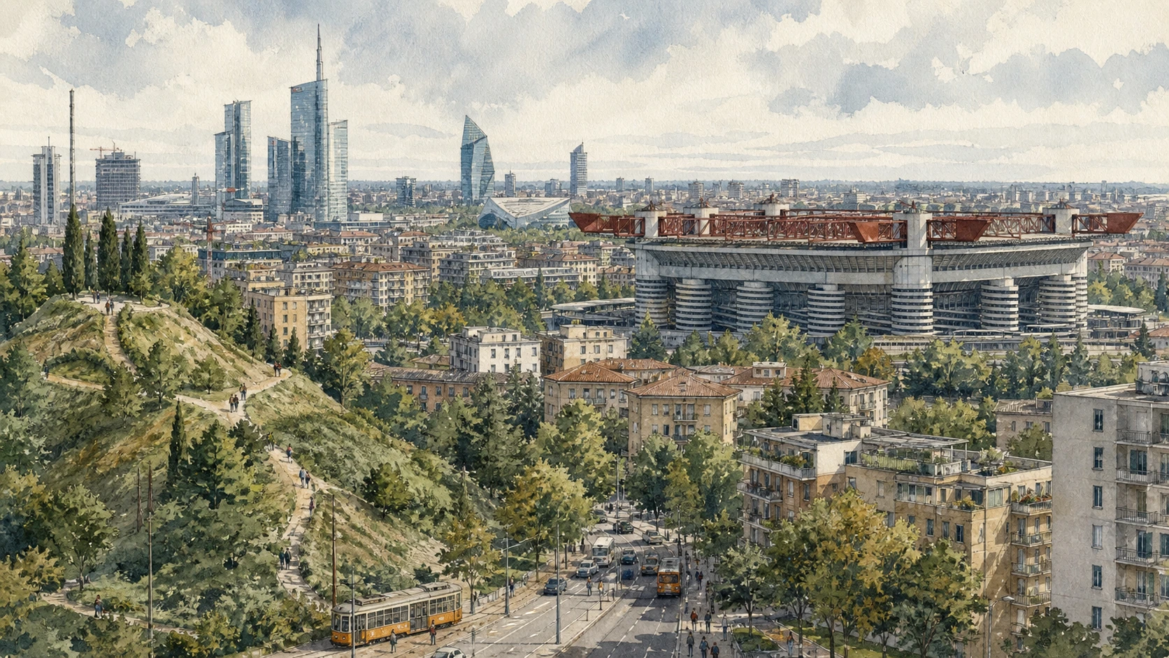
Original documentary watercolour panorama for Milan CityLife, QT8, San Siro and Western City: Complete Guide, with accurate Lombardy architecture, landscape and lived context

Milan Guide 10 · Former fair, new towers, experimental planning, memorial landscape, stadium, racecourse and contested redevelopment

CityLife, QT8, San Siro
& Western Milan

A complete route across the former trade-fair grounds, CityLife towers and park, the experimental QT8 district, Monte Stella and the Garden of the Righteous, then the stadium and racecourse landscapes of San Siro.

Plan the route
Milan · Lombardy10 chapters · one complete route

Why this route must be read in layers

Western Milan compresses several planning eras: exhibition infrastructure, high-value redevelopment, post-war experimental housing, a hill made from reconstruction debris, memorial space and a major sports district facing uncertain transformation.

The old Fiera turned Milan’s industrial and commercial ambition into recurring large-scale exhibitions. Its relocation released a strategic site later transformed through CityLife’s towers, housing, park and metro connection.

QT8 pursued a different model through the post-war Triennale: mixed housing experiments, community services, green structure and Monte Stella. The district remains inhabited evidence, not an open-air catalogue of architectural objects.

San Siro combines football, concerts, racing, stables, housing and transport. Debate over the stadium’s future changes quickly, so the guide records the present ensemble without predicting an unapproved outcome.

Read the former fair and new development first, then compare QT8’s public-planning experiment before ending at a sports landscape whose current access and future require live verification.

The route

Plan your visit

Begin on the CityLife redevelopment, continue through QT8, Monte Stella and its memorial garden, then reach San Siro by the official pedestrian and metro routes.

Early morning

The former Fiera · CityLife towers · CityLife park and housing

Move in the documented order: The former Fiera: exhibition city beneath CityLife; then CityLife towers: three corporate landmarks, three structural languages; then CityLife park and housing: public routes through managed development. Recheck live access and transport before entering a controlled site.

Late morning

Tre Torri metro · QT8 · Monte Stella

Move in the documented order: Tre Torri metro: transport built into the new centre; then QT8: post-war experimental district; then Monte Stella: reconstruction debris shaped into urban landscape. Recheck live access and transport before entering a controlled site.

Afternoon

Garden of the Righteous · San Siro stadium · The stadium debate

Move in the documented order: Garden of the Righteous: names, trees and civic remembrance; then San Siro stadium: football monument and working event infrastructure; then The stadium debate: heritage, ownership and an unresolved future. Recheck live access and transport before entering a controlled site.

Late afternoon

San Siro racecourse

Move in the documented order: San Siro racecourse: sport, landscape and stables. Recheck live access and transport before entering a controlled site.

Ten chapters

Explore the places

The order follows terrain, institutions and present-day movement. Use the index to return to a chapter without reducing the route to isolated monuments.

  1. 01The former Fiera: exhibition city beneath CityLife
  2. 02CityLife towers: three corporate landmarks, three structural languages
  3. 03CityLife park and housing: public routes through managed development
  4. 04Tre Torri metro: transport built into the new centre
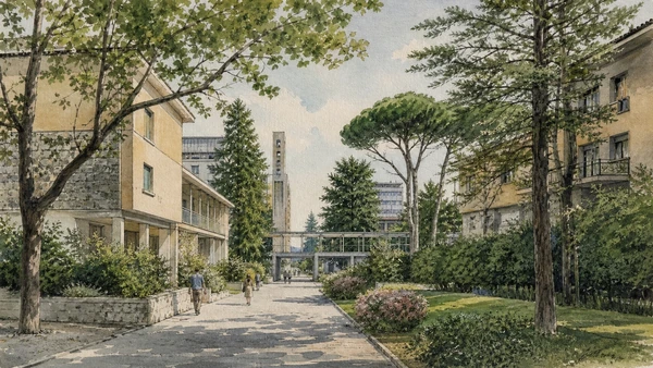
  5. 05QT8: post-war experimental district
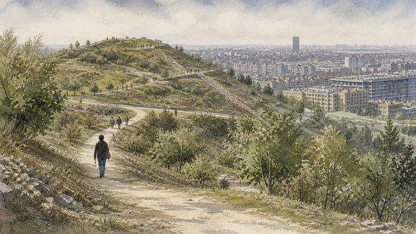
  6. 06Monte Stella: reconstruction debris shaped into urban landscape
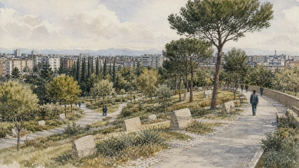
  7. 07Garden of the Righteous: names, trees and civic remembrance
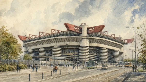
  8. 08San Siro stadium: football monument and working event infrastructure
  9. 09The stadium debate: heritage, ownership and an unresolved future
  10. 10San Siro racecourse: sport, landscape and stables
01

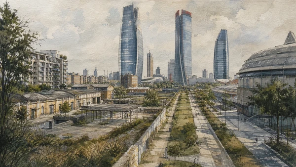
The redevelopment footprint preserves the scale of a trade-fair complex that once connected Milanese industry to international markets.

The former Fiera: exhibition city beneath CityLife

The redevelopment footprint preserves the scale of a trade-fair complex that once connected Milanese industry to international markets. The site becomes clearer when its surviving fabric, later alterations and present use are read together.

Today

The area is inhabited and worked, not staged for visitors. Keep doorways, pavements, cycle lanes and deliveries clear, ask before photographing people and use current municipal mobility information.

History

The Fiera occupied the area through much of the twentieth century before major exhibitions moved to Rho and the central site was cleared and re-planned.

How to read this place

Begin with the large perimeter of the former grounds. Then compare surviving street alignments with new buildings placed within the cleared site; the differences are evidence, not visual noise.

What to notice

  • the large perimeter of the former grounds
  • surviving street alignments
  • new buildings placed within the cleared site
Comune di Milano · Official city portal
Original documentary watercolour of The former Fiera: exhibition city beneath CityLife in Milan · Lombardy, showing accurate architecture, landscape, people and present-day use
The former Fiera: exhibition city beneath CityLifeOriginal Merlintravel documentary watercolour · 2026
02

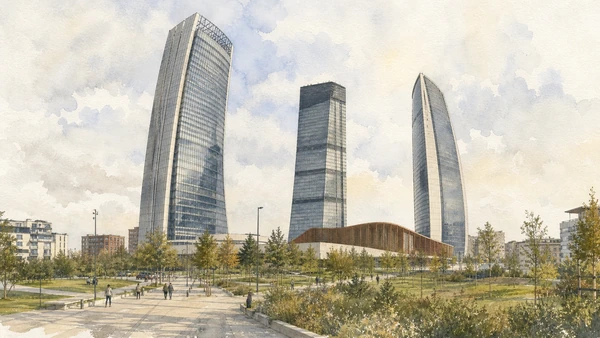
High-rise forms by different international designers organise a new business centre above metro and commercial infrastructure.

CityLife towers: three corporate landmarks, three structural languages

High-rise forms by different international designers organise a new business centre above metro and commercial infrastructure. The site becomes clearer when its surviving fabric, later alterations and present use are read together.

Today

The exterior can usually be read from public space, but events, works and crowd management may change circulation. Keep access routes open and verify any interior visit with the responsible institution.

History

The towers were completed in phases within the redevelopment masterplan, expressing changing tenants, engineering solutions and corporate identity.

How to read this place

Begin with each tower’s distinct silhouette. Then compare podium and underground connections with the skyline from surrounding residential streets; the differences are evidence, not visual noise.

What to notice

  • each tower’s distinct silhouette
  • podium and underground connections
  • the skyline from surrounding residential streets
CityLife Milano · Official site
Original documentary watercolour of CityLife towers: three corporate landmarks, three structural languages in Milan · Lombardy, showing accurate architecture, landscape, people and present-day use
CityLife towers: three corporate landmarks, three structural languagesOriginal Merlintravel documentary watercolour · 2026
03

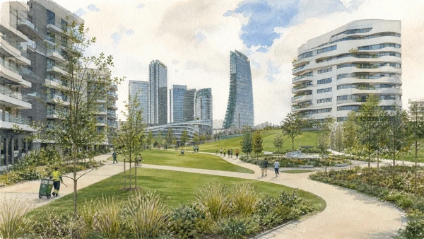
Planting, paths, residences, shops and art create accessible space whose design and maintenance are tied to the redevelopment.

CityLife park and housing: public routes through managed development

Planting, paths, residences, shops and art create accessible space whose design and maintenance are tied to the redevelopment. The site becomes clearer when its surviving fabric, later alterations and present use are read together.

Today

The area is inhabited and worked, not staged for visitors. Keep doorways, pavements, cycle lanes and deliveries clear, ask before photographing people and use current municipal mobility information.

History

The park expanded in phases as offices and housing were completed, turning sealed exhibition plots into new pedestrian connections while retaining managed boundaries.

How to read this place

Begin with connections to older neighbourhood streets. Then compare planting and drainage across the park with the interface between public path and private residence; the differences are evidence, not visual noise.

What to notice

  • connections to older neighbourhood streets
  • planting and drainage across the park
  • the interface between public path and private residence
CityLife Milano · Official site
Original documentary watercolour of CityLife park and housing: public routes through managed development in Milan · Lombardy, showing accurate architecture, landscape, people and present-day use
CityLife park and housing: public routes through managed developmentOriginal Merlintravel documentary watercolour · 2026
04

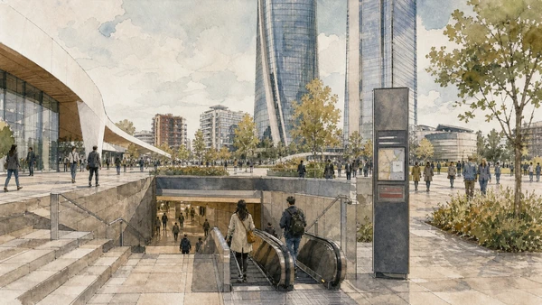
A station directly below the redevelopment makes public transport part of the district’s design rather than an external service.

Tre Torri metro: transport built into the new centre

A station directly below the redevelopment makes public transport part of the district’s design rather than an external service. The site becomes clearer when its surviving fabric, later alterations and present use are read together.

Today

Timetables, engineering works, capacity and accessibility arrangements can change. Check the operator on the day, leave a realistic connection margin and never enter tracks, depots or restricted infrastructure.

History

The M5 line and Tre Torri station opened during the wider western expansion of Milan’s automated metro network and supported the new district’s accessibility.

How to read this place

Begin with station exits aligned with towers. Then compare barrier-free and passenger routes with the change from underground platform to open park; the differences are evidence, not visual noise.

What to notice

  • station exits aligned with towers
  • barrier-free and passenger routes
  • the change from underground platform to open park
ATM Milano · Official network
Original documentary watercolour of Tre Torri metro: transport built into the new centre in Milan · Lombardy, showing accurate architecture, landscape, people and present-day use
Tre Torri metro: transport built into the new centreOriginal Merlintravel documentary watercolour · 2026
05

Housing types, green space and community planning emerged from a Triennale-led laboratory for reconstruction-era urbanism.

QT8: post-war experimental district

Housing types, green space and community planning emerged from a Triennale-led laboratory for reconstruction-era urbanism. The site becomes clearer when its surviving fabric, later alterations and present use are read together.

Today

The area is inhabited and worked, not staged for visitors. Keep doorways, pavements, cycle lanes and deliveries clear, ask before photographing people and use current municipal mobility information.

History

The Quartiere Triennale Ottava developed from the late 1940s through plans associated with Piero Bottoni and multiple architects, testing varied housing and landscape ideas.

How to read this place

Begin with differences among housing types. Then compare pedestrian and green-space structure with later resident adaptations; the differences are evidence, not visual noise.

What to notice

  • differences among housing types
  • pedestrian and green-space structure
  • later resident adaptations
Triennale Milano · Plan your visit
Original documentary watercolour of QT8: post-war experimental district in Milan · Lombardy, showing accurate architecture, landscape, people and present-day use
QT8: post-war experimental districtOriginal Merlintravel documentary watercolour · 2026
06

A large artificial hill turns wartime destruction and excavation material into park topography and metropolitan viewpoint.

Monte Stella: reconstruction debris shaped into urban landscape

A large artificial hill turns wartime destruction and excavation material into park topography and metropolitan viewpoint. The site becomes clearer when its surviving fabric, later alterations and present use are read together.

Today

Weather, water levels, trail conditions and seasonal services can alter the route. Use official transport and park information, remain on authorised paths and do not enter farms, vineyards or private gardens without permission.

History

Conceived within the QT8 plan, the hill accumulated material over phases and was planted as public landscape, gaining the popular name Montagnetta di San Siro.

How to read this place

Begin with the hill’s constructed slopes. Then compare paths and vegetation over deposited material with views toward changing western milan; the differences are evidence, not visual noise.

What to notice

  • the hill’s constructed slopes
  • paths and vegetation over deposited material
  • views toward changing western Milan
Comune di Milano · Official city portal
Original documentary watercolour of Monte Stella: reconstruction debris shaped into urban landscape in Milan · Lombardy, showing accurate architecture, landscape, people and present-day use
Monte Stella: reconstruction debris shaped into urban landscapeOriginal Merlintravel documentary watercolour · 2026
07

A memorial landscape on Monte Stella honours people who resisted genocide and crimes against humanity through an evolving programme.

Garden of the Righteous: names, trees and civic remembrance

A memorial landscape on Monte Stella honours people who resisted genocide and crimes against humanity through an evolving programme. The site becomes clearer when its surviving fabric, later alterations and present use are read together.

Today

The exterior can usually be read from public space, but events, works and crowd management may change circulation. Keep access routes open and verify any interior visit with the responsible institution.

History

Established in the early 2000s and later redesigned, the garden links Milan to an international network of commemoration while adding names through public ceremonies.

How to read this place

Begin with named stones and trees. Then compare the amphitheatre and path sequence with the criteria explained for commemoration; the differences are evidence, not visual noise.

What to notice

  • named stones and trees
  • the amphitheatre and path sequence
  • the criteria explained for commemoration
Gariwo · Garden of the Righteous in Milan
Original documentary watercolour of Garden of the Righteous: names, trees and civic remembrance in Milan · Lombardy, showing accurate architecture, landscape, people and present-day use
Garden of the Righteous: names, trees and civic remembranceOriginal Merlintravel documentary watercolour · 2026
08

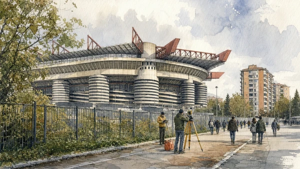
Concrete tiers, ramps, later towers and roof record successive expansions for two clubs, major matches and concerts.

San Siro stadium: football monument and working event infrastructure

Concrete tiers, ramps, later towers and roof record successive expansions for two clubs, major matches and concerts. The site becomes clearer when its surviving fabric, later alterations and present use are read together.

Today

Opening, ticketing, room access and temporary displays can change. Check the institution’s official notice shortly before visiting, use the designated entrance and allow for security or conservation controls.

History

Opened in the 1920s, the stadium expanded through several campaigns, including the third ring and roof for the 1990 World Cup.

How to read this place

Begin with the external ramp and tower system. Then compare successive structural rings with event security and neighbourhood circulation; the differences are evidence, not visual noise.

What to notice

  • the external ramp and tower system
  • successive structural rings
  • event security and neighbourhood circulation
San Siro Stadium · Official tickets and tours
Original documentary watercolour of San Siro stadium: football monument and working event infrastructure in Milan · Lombardy, showing accurate architecture, landscape, people and present-day use
San Siro stadium: football monument and working event infrastructureOriginal Merlintravel documentary watercolour · 2026
09

Proposals for replacement, retention or transformation affect the district but must be separated from legally completed decisions.

The stadium debate: heritage, ownership and an unresolved future

Proposals for replacement, retention or transformation affect the district but must be separated from legally completed decisions. The site becomes clearer when its surviving fabric, later alterations and present use are read together.

Today

The exterior can usually be read from public space, but events, works and crowd management may change circulation. Keep access routes open and verify any interior visit with the responsible institution.

History

Clubs, municipality, heritage bodies and residents have debated scenarios over years. Each proposal belongs to a dated planning process rather than established future fact.

How to read this place

Begin with the existing stadium and public land. Then compare officially posted planning documents with temporary media renderings labelled as proposals; the differences are evidence, not visual noise.

What to notice

  • the existing stadium and public land
  • officially posted planning documents
  • temporary media renderings labelled as proposals
Comune di Milano · Official city portal
Original documentary watercolour of The stadium debate: heritage, ownership and an unresolved future in Milan · Lombardy, showing accurate architecture, landscape, people and present-day use
The stadium debate: heritage, ownership and an unresolved futureOriginal Merlintravel documentary watercolour · 2026
10

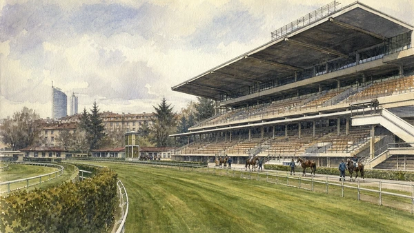
Grandstands, track, paddock and equestrian sculpture form a second major sports system beside the football stadium.

San Siro racecourse: sport, landscape and stables

Grandstands, track, paddock and equestrian sculpture form a second major sports system beside the football stadium. The site becomes clearer when its surviving fabric, later alterations and present use are read together.

Today

The exterior can usually be read from public space, but events, works and crowd management may change circulation. Keep access routes open and verify any interior visit with the responsible institution.

History

The present racecourse developed in the early twentieth century and retains architecture and landscape tied to Milanese horse racing and breeding culture.

How to read this place

Begin with the track’s broad oval landscape. Then compare historic grandstand structures with working equestrian areas with controlled access; the differences are evidence, not visual noise.

What to notice

  • the track’s broad oval landscape
  • historic grandstand structures
  • working equestrian areas with controlled access
Ippodromo Snai San Siro · Official site
Original documentary watercolour of San Siro racecourse: sport, landscape and stables in Milan · Lombardy, showing accurate architecture, landscape, people and present-day use
San Siro racecourse: sport, landscape and stablesOriginal Merlintravel documentary watercolour · 2026

Milan through time

A short chronology

From Insubrian settlement and imperial Mediolanum to the ducal court, industrial metropolis, wartime rupture and contemporary redevelopment.

  1. An Insubrian settlement develops on the plain at the crossing of routes later absorbed by Roman Mediolanum.

  2. Roman forces take Mediolanum, which grows into a major Cisalpine administrative and commercial centre.

  3. Milan becomes an imperial residence in the western Roman Empire and gains palace, circus, baths and monumental infrastructure.

  4. The agreement associated with Constantine and Licinius establishes religious toleration and becomes inseparable from Milan’s Christian memory.

  5. Ambrose serves as bishop; basilicas, burial places and episcopal authority reshape the late-antique city.

  6. Frederick Barbarossa’s forces destroy much of Milan; reconstruction and communal institutions subsequently re-form the city.

  7. Visconti power becomes dominant, beginning a long phase of ducal patronage, fortification and territorial government.

  8. Construction of the Duomo begins, creating a building site and civic-religious institution that continue across centuries.

  9. Sforza rule renews the castle and court while artists, engineers and scholars, including Leonardo, work within ducal networks.

  10. Spanish Habsburg administration reshapes government, defence, religion and the social geography of the city.

  11. French and Napoleonic rule reorganises institutions, collections, ceremonial space and Milan’s role in northern Italy.

  12. Austrian rule ends and Milan enters the Kingdom of Italy, accelerating railway, industrial and civic expansion.

  13. The present Milano Centrale opens as a monumental transport complex within a rapidly expanding metropolis.

  14. Bombing, occupation, resistance and liberation damage monuments, housing and industry and leave a difficult memorial landscape.

  15. Post-war migration, design and manufacturing, deindustrialisation, Expo 2015 and metropolitan redevelopment repeatedly transform the city.

Before your visit

Practical information

01

Check the live page

Opening hours, reservation systems, restoration, exhibitions and transport can change. Recheck the linked official institution shortly before departure.

02

Separate worship and tourism

Churches and sanctuaries remain religious spaces. Services, funerals and community use take priority over visitor itineraries.

03

Plan real distances

Milan · Lombardy combines dense urban routes with lakes, valleys and dispersed towns. Do not compress distant chapters into an unsafe or superficial day.

04

Keep thresholds open

Arcades, station halls, markets, courtyards, workshops and residential streets must continue to function while you observe or photograph them.

05

Use current mobility data

Check the responsible rail, navigation, bus, road or park operator on the day; replacement services and weather can change an otherwise sound route.

06

Read change honestly

Restoration, reconstruction, adaptive reuse and new development have all shaped the landscape visible today.

Method and sources

Sources and image credits

This guide uses official museum, ministry, municipal, transport, park and UNESCO documentation checked on 29 August 2026. It separates durable historical interpretation from access details that can change, distinguishes surviving fabric from restoration or reconstruction, and treats worship, work, residence and public movement as part of the evidence. Every chapter links its principal institutional source; tickets, closures, weather and transport must always be verified again on the day of the visit.

All ten images are original Merlintravel editorial watercolours based on documented present-day conditions. They are illustrations, not substitutes for archaeological plans. Opening hours, tickets, accessible routes, temporary exhibitions and conservation work can change; consult the linked official pages shortly before visiting.