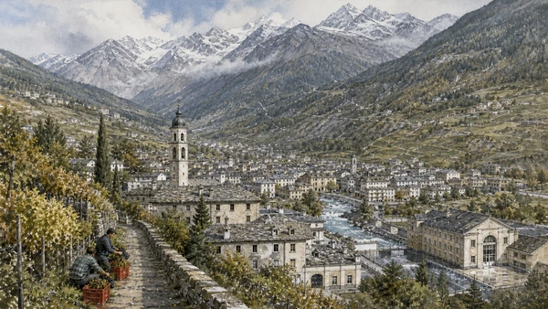
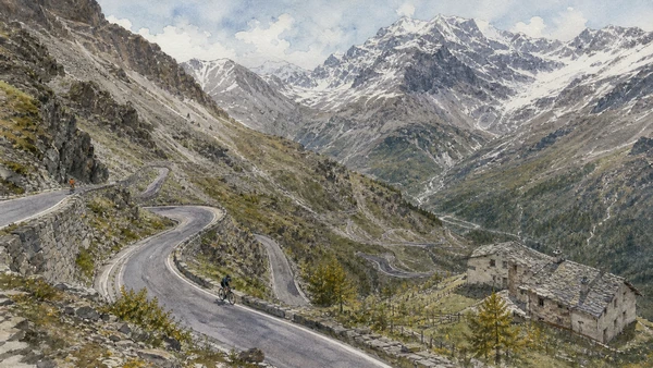
Original documentary watercolour panorama for Valtellina, Tirano and the Stelvio Landscapes: Complete Guide, with accurate Lombardy architecture, landscape and lived context

Lombardy Guide 08 · Adda valley, dry-stone terraces, sanctuaries, Alpine railway, rock art, thermal towns and climate-sensitive passes

Valtellina, Tirano
& the Stelvio Landscapes

A multi-day Alpine guide connecting Sondrio and the Adda valley to dry-stone vineyard terraces, Teglio, Tirano, the Bernina railway, Grosio rock art, Bormio and the high landscapes of Stelvio National Park.

Plan the route
Valtellina, Tirano and Stelvio · Lombardy10 chapters · one complete route

Why this route must be read in layers

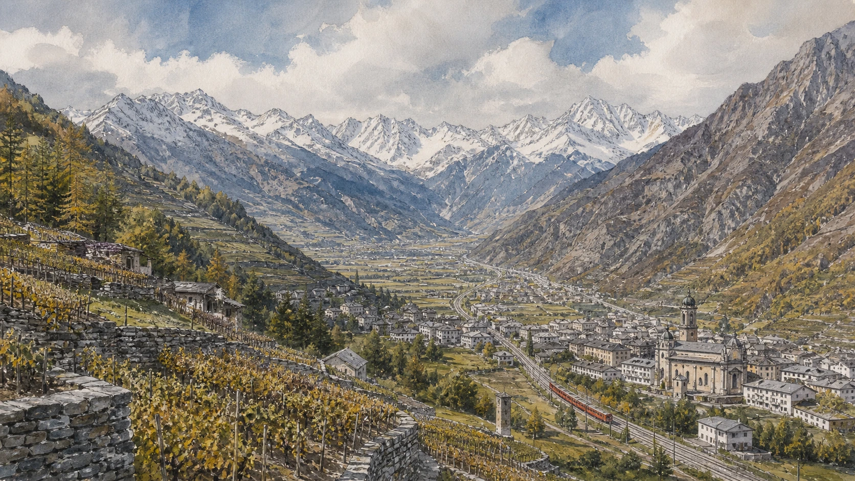
Valtellina is a long inhabited corridor rather than one mountain resort: agriculture, transalpine routes, religious boundaries, rail engineering, hydropower and tourism occupy steep terrain whose accessibility changes with season and climate.

The Adda valley links distinct towns and side valleys. Sondrio provides civic orientation, while terraced viticulture makes generations of retaining walls, paths and labour visible above the valley floor.

Tirano is both sanctuary town and railway interchange. The Bernina route is working international transport and UNESCO infrastructure, not a guaranteed scenic ride independent of weather and operations.

Bormio and Stelvio combine thermal history, mountain settlement, roads, protected habitat and high-altitude risk. Pass openings and trail conditions must be treated as live facts, never evergreen promises.

Choose a valley base, travel by rail where possible and never plan the Stelvio as a fixed final chapter; weather, snow, road works and protected-area rules decide whether the high route is responsible.

The route

Plan your visit

Begin in Sondrio and the terraces, continue east through Teglio and Tirano, then assign separate days to the Bernina line, Grosio and the Bormio-Stelvio high landscape.

Early morning

Sondrio · Dry-stone vineyard terraces · Valtellina wine route

Move in the documented order: Sondrio: civic centre within the Adda corridor; then Dry-stone vineyard terraces: constructed mountain agriculture; then Valtellina wine route: grapes, altitude and regulated origin. Recheck live access and transport before entering a controlled site.

Late morning

Teglio · Tirano historic centre · Sanctuary of Madonna di Tirano

Move in the documented order: Teglio: palace, parish and agricultural plateau; then Tirano historic centre: walls, palaces and border-route memory; then Sanctuary of Madonna di Tirano: pilgrimage at a transalpine junction. Recheck live access and transport before entering a controlled site.

Afternoon

Bernina railway · Grosio rock art and castles · Bormio

Move in the documented order: Bernina railway: engineering through Alpine landscape; then Grosio rock art and castles: long occupation on one ridge; then Bormio: thermal town, passes and Alpine community. Recheck live access and transport before entering a controlled site.

Late afternoon

Stelvio National Park and pass

Move in the documented order: Stelvio National Park and pass: protected high landscape under change. Recheck live access and transport before entering a controlled site.

Ten chapters

Explore the places

The order follows terrain, institutions and present-day movement. Use the index to return to a chapter without reducing the route to isolated monuments.

  1. 01Sondrio: civic centre within the Adda corridor
  2. 02Dry-stone vineyard terraces: constructed mountain agriculture
  3. 03Valtellina wine route: grapes, altitude and regulated origin
  4. 04Teglio: palace, parish and agricultural plateau
  5. 05Tirano historic centre: walls, palaces and border-route memory
  6. 06Sanctuary of Madonna di Tirano: pilgrimage at a transalpine junction
  7. 07Bernina railway: engineering through Alpine landscape
  8. 08Grosio rock art and castles: long occupation on one ridge
  9. 09Bormio: thermal town, passes and Alpine community
  10. 10Stelvio National Park and pass: protected high landscape under change
01

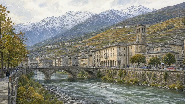
Palaces, museum collections and terraced slopes frame a small capital whose role depends on valley administration and routes.

Sondrio: civic centre within the Adda corridor

Palaces, museum collections and terraced slopes frame a small capital whose role depends on valley administration and routes. The site becomes clearer when its surviving fabric, later alterations and present use are read together.

Today

The area is inhabited and worked, not staged for visitors. Keep doorways, pavements, cycle lanes and deliveries clear, ask before photographing people and use current municipal mobility information.

History

The town developed at the meeting of valleys and changed under Alpine political powers, Graubünden rule, Napoleonic reform and modern provincial government.

How to read this place

Begin with the relation between centre and mountain slopes. Then compare palazzo sassi and civic collections with rail and road infrastructure along the valley floor; the differences are evidence, not visual noise.

What to notice

  • the relation between centre and mountain slopes
  • Palazzo Sassi and civic collections
  • rail and road infrastructure along the valley floor
Valtellina · Official destination site
Original documentary watercolour of Sondrio: civic centre within the Adda corridor in Valtellina, Tirano and Stelvio · Lombardy, showing accurate architecture, landscape, people and present-day use
Sondrio: civic centre within the Adda corridorOriginal Merlintravel documentary watercolour · 2026
02

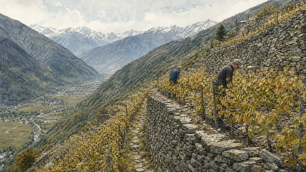
Retaining walls, paths and small plots transform steep sunny slopes into a continuous productive landscape.

Dry-stone vineyard terraces: constructed mountain agriculture

Retaining walls, paths and small plots transform steep sunny slopes into a continuous productive landscape. The site becomes clearer when its surviving fabric, later alterations and present use are read together.

Today

Weather, water levels, trail conditions and seasonal services can alter the route. Use official transport and park information, remain on authorised paths and do not enter farms, vineyards or private gardens without permission.

History

Generations of growers built and maintained terraces for viticulture; current appellations, mechanisation limits and depopulation place pressure on this labour-intensive system.

How to read this place

Begin with wall construction without mortar. Then compare vertical links between narrow plots with working vines and maintenance access; the differences are evidence, not visual noise.

What to notice

  • wall construction without mortar
  • vertical links between narrow plots
  • working vines and maintenance access
Consorzio Vini di Valtellina · Vineyard terraces
Original documentary watercolour of Dry-stone vineyard terraces: constructed mountain agriculture in Valtellina, Tirano and Stelvio · Lombardy, showing accurate architecture, landscape, people and present-day use
Dry-stone vineyard terraces: constructed mountain agricultureOriginal Merlintravel documentary watercolour · 2026
03

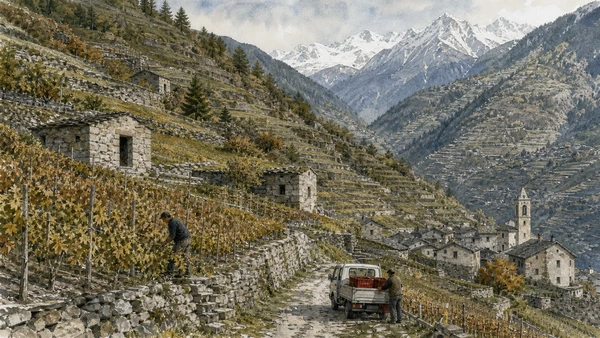
Nebbiolo-based wines emerge from distinct subzones, exposures and cellar practices rather than one uniform valley product.

Valtellina wine route: grapes, altitude and regulated origin

Nebbiolo-based wines emerge from distinct subzones, exposures and cellar practices rather than one uniform valley product. The site becomes clearer when its surviving fabric, later alterations and present use are read together.

Today

Weather, water levels, trail conditions and seasonal services can alter the route. Use official transport and park information, remain on authorised paths and do not enter farms, vineyards or private gardens without permission.

History

Historic cultivation and trade were reorganised through modern denominations and producer networks, while climate and labour affect harvest and style.

How to read this place

Begin with slope orientation and elevation. Then compare named subzone landscapes with cellars connected to working rather than staged production; the differences are evidence, not visual noise.

What to notice

  • slope orientation and elevation
  • named subzone landscapes
  • cellars connected to working rather than staged production
Strada del Vino di Valtellina · Official route
Original documentary watercolour of Valtellina wine route: grapes, altitude and regulated origin in Valtellina, Tirano and Stelvio · Lombardy, showing accurate architecture, landscape, people and present-day use
Valtellina wine route: grapes, altitude and regulated originOriginal Merlintravel documentary watercolour · 2026
04

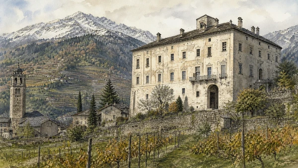
A historic centre above the valley connects Palazzo Besta, church institutions and the grain-and-vine landscapes behind regional food identity.

Teglio: palace, parish and agricultural plateau

A historic centre above the valley connects Palazzo Besta, church institutions and the grain-and-vine landscapes behind regional food identity. The site becomes clearer when its surviving fabric, later alterations and present use are read together.

Today

Opening, ticketing, room access and temporary displays can change. Check the institution’s official notice shortly before visiting, use the designated entrance and allow for security or conservation controls.

History

Teglio occupied a strategic and productive position, with Renaissance elite patronage visible at Palazzo Besta and long agricultural traditions across the plateau.

How to read this place

Begin with palazzo besta’s courtyard and painted rooms. Then compare settlement overlooking the valley with fields and terraces tied to local production; the differences are evidence, not visual noise.

What to notice

  • Palazzo Besta’s courtyard and painted rooms
  • settlement overlooking the valley
  • fields and terraces tied to local production
Direzione regionale Musei Lombardia · Palazzo Besta
Original documentary watercolour of Teglio: palace, parish and agricultural plateau in Valtellina, Tirano and Stelvio · Lombardy, showing accurate architecture, landscape, people and present-day use
Teglio: palace, parish and agricultural plateauOriginal Merlintravel documentary watercolour · 2026
05

Gates, streets and residences preserve a town shaped by valley traffic and changing political-religious frontiers.

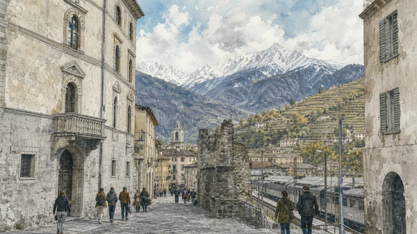
Tirano historic centre: walls, palaces and border-route memory

Gates, streets and residences preserve a town shaped by valley traffic and changing political-religious frontiers. The site becomes clearer when its surviving fabric, later alterations and present use are read together.

Today

The area is inhabited and worked, not staged for visitors. Keep doorways, pavements, cycle lanes and deliveries clear, ask before photographing people and use current municipal mobility information.

History

Tirano grew as a strategic settlement under the Three Leagues and as a meeting point for trade, Catholic institutions and routes toward the Bernina.

How to read this place

Begin with surviving gate and street alignments. Then compare palace courtyards with the link between old centre and railway district; the differences are evidence, not visual noise.

What to notice

  • surviving gate and street alignments
  • palace courtyards
  • the link between old centre and railway district
Visit Tirano · Official site
Original documentary watercolour of Tirano historic centre: walls, palaces and border-route memory in Valtellina, Tirano and Stelvio · Lombardy, showing accurate architecture, landscape, people and present-day use
Tirano historic centre: walls, palaces and border-route memoryOriginal Merlintravel documentary watercolour · 2026
06

A richly decorated Renaissance church stands where local devotion and long-distance movement meet.

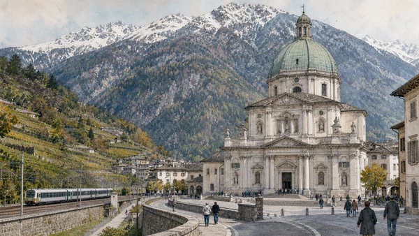
Sanctuary of Madonna di Tirano: pilgrimage at a transalpine junction

A richly decorated Renaissance church stands where local devotion and long-distance movement meet. The site becomes clearer when its surviving fabric, later alterations and present use are read together.

Today

This is an active religious place as well as a historic building. Services, ceremonies and conservation can interrupt tourist access; dress appropriately, remain quiet and never treat a booked visit as priority over worship.

History

Built after a reported Marian apparition in the early sixteenth century, the sanctuary became an important pilgrimage institution in a contested religious borderland.

How to read this place

Begin with the sanctuary’s exterior and forecourt. Then compare interior carving and organ with pilgrim circulation distinct from tourist viewing; the differences are evidence, not visual noise.

What to notice

  • the sanctuary’s exterior and forecourt
  • interior carving and organ
  • pilgrim circulation distinct from tourist viewing
Visit Tirano · Official site
Original documentary watercolour of Sanctuary of Madonna di Tirano: pilgrimage at a transalpine junction in Valtellina, Tirano and Stelvio · Lombardy, showing accurate architecture, landscape, people and present-day use
Sanctuary of Madonna di Tirano: pilgrimage at a transalpine junctionOriginal Merlintravel documentary watercolour · 2026
07

Meters-gauge rail, spirals, gradients and open mountain sections connect Tirano to the Engadin as working international transport.

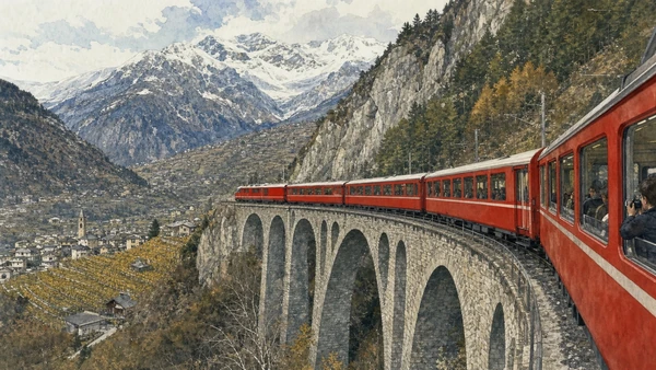
Bernina railway: engineering through Alpine landscape

Meters-gauge rail, spirals, gradients and open mountain sections connect Tirano to the Engadin as working international transport. The site becomes clearer when its surviving fabric, later alterations and present use are read together.

Today

Timetables, engineering works, capacity and accessibility arrangements can change. Check the operator on the day, leave a realistic connection margin and never enter tracks, depots or restricted infrastructure.

History

The line opened in the early twentieth century and later entered the UNESCO property with the Albula route for its technical and landscape integration.

How to read this place

Begin with track geometry negotiating gradients. Then compare stations and engineering structures with settlements and glaciers viewed from a moving public service; the differences are evidence, not visual noise.

What to notice

  • track geometry negotiating gradients
  • stations and engineering structures
  • settlements and glaciers viewed from a moving public service
UNESCO · Rhaetian Railway in the Albula/Bernina Landscapes
Original documentary watercolour of Bernina railway: engineering through Alpine landscape in Valtellina, Tirano and Stelvio · Lombardy, showing accurate architecture, landscape, people and present-day use
Bernina railway: engineering through Alpine landscapeOriginal Merlintravel documentary watercolour · 2026
08

Engraved rocks, medieval fortifications and valley routes overlap within a protected archaeological landscape.

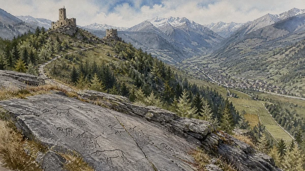
Grosio rock art and castles: long occupation on one ridge

Engraved rocks, medieval fortifications and valley routes overlap within a protected archaeological landscape. The site becomes clearer when its surviving fabric, later alterations and present use are read together.

Today

Weather, water levels, trail conditions and seasonal services can alter the route. Use official transport and park information, remain on authorised paths and do not enter farms, vineyards or private gardens without permission.

History

Prehistoric and later engravings occupy rock surfaces near castles built in medieval territorial systems; research and conservation continue to refine interpretation.

How to read this place

Begin with engraved figures in natural light. Then compare rock surfaces within their terrain with castle walls belonging to a much later chronology; the differences are evidence, not visual noise.

What to notice

  • engraved figures in natural light
  • rock surfaces within their terrain
  • castle walls belonging to a much later chronology
Parco delle Incisioni Rupestri di Grosio
Original documentary watercolour of Grosio rock art and castles: long occupation on one ridge in Valtellina, Tirano and Stelvio · Lombardy, showing accurate architecture, landscape, people and present-day use
Grosio rock art and castles: long occupation on one ridgeOriginal Merlintravel documentary watercolour · 2026
09

Historic centre, baths, churches and road junctions reveal a settlement serving trade, local government, health travel and mountain access.

Bormio: thermal town, passes and Alpine community

Historic centre, baths, churches and road junctions reveal a settlement serving trade, local government, health travel and mountain access. The site becomes clearer when its surviving fabric, later alterations and present use are read together.

Today

The area is inhabited and worked, not staged for visitors. Keep doorways, pavements, cycle lanes and deliveries clear, ask before photographing people and use current municipal mobility information.

History

Bormio held strategic privileges on routes toward Alpine passes. Thermal waters and later sport tourism expanded its economy without erasing older civic fabric.

How to read this place

Begin with historic centre and civic tower. Then compare thermal-water institutions with roads climbing toward distinct passes; the differences are evidence, not visual noise.

What to notice

  • historic centre and civic tower
  • thermal-water institutions
  • roads climbing toward distinct passes
Valtellina · Official destination site
Original documentary watercolour of Bormio: thermal town, passes and Alpine community in Valtellina, Tirano and Stelvio · Lombardy, showing accurate architecture, landscape, people and present-day use
Bormio: thermal town, passes and Alpine communityOriginal Merlintravel documentary watercolour · 2026
10

Road engineering, glaciers, habitat, seasonal work and mass visitation converge at one of Italy’s highest road corridors.

Stelvio National Park and pass: protected high landscape under change

Road engineering, glaciers, habitat, seasonal work and mass visitation converge at one of Italy’s highest road corridors. The site becomes clearer when its surviving fabric, later alterations and present use are read together.

Today

Weather, water levels, trail conditions and seasonal services can alter the route. Use official transport and park information, remain on authorised paths and do not enter farms, vineyards or private gardens without permission.

History

The pass road was built under Austrian rule in the nineteenth century; the national park was established in the twentieth century across a large Alpine territory.

How to read this place

Begin with road switchbacks and engineered slopes. Then compare glacial and high-altitude landforms with wildlife habitat and visitor pressure; the differences are evidence, not visual noise.

What to notice

  • road switchbacks and engineered slopes
  • glacial and high-altitude landforms
  • wildlife habitat and visitor pressure
Stelvio National Park · Lombardy official site
Original documentary watercolour of Stelvio National Park and pass: protected high landscape under change in Valtellina, Tirano and Stelvio · Lombardy, showing accurate architecture, landscape, people and present-day use
Stelvio National Park and pass: protected high landscape under changeOriginal Merlintravel documentary watercolour · 2026

Lombardy through time

A short chronology

From prehistoric settlement and Roman routes to communes, regional states, industrial transformation, heritage protection and climate-sensitive mobility.

  1. Settlements, ritual places and rock imagery document long human occupation from Alpine valleys to the Po plain.

  2. Camuni, Celts, Etruscan networks and other communities develop distinct territories before Roman expansion.

  3. Roman roads, colonies and municipia integrate the region while retaining different local settlement patterns.

  4. Cities, villas, farms, sanctuaries and Alpine routes connect the Po basin to transalpine and imperial systems.

  5. Christian institutions, new burial landscapes and political change reshape Roman urban centres.

  6. Lombard rule establishes courts, duchies and monasteries whose material traces survive unevenly across the region.

  7. Castles, monasteries, parishes and landed powers organise countryside, lakes and mountain routes.

  8. Communal cities expand public buildings, cathedrals, walls, trade and conflict across the Lombard plain.

  9. Visconti and then Sforza power links Milan to fortified towns, courts, canals and agricultural territories.

  10. Venetian expansion incorporates much of eastern Lombardy, creating a durable political and architectural frontier.

  11. The Peace of Lodi stabilises a territorial balance whose borders continue to shape cities and landscapes.

  12. Spanish and Austrian governments reorganise defence, taxation, institutions and infrastructure in different parts of Lombardy.

  13. Napoleonic and Austrian administrations alter civic institutions, roads, collections and territorial government before unification.

  14. Railways, factories, hydropower, migration, tourism, war and resistance transform urban and Alpine societies.

  15. Reconstruction, industrial growth, deindustrialisation, heritage protection, mass mobility and climate pressure repeatedly reshape the region.

Before your visit

Practical information

01

Check the live page

Opening hours, reservation systems, restoration, exhibitions and transport can change. Recheck the linked official institution shortly before departure.

02

Separate worship and tourism

Churches and sanctuaries remain religious spaces. Services, funerals and community use take priority over visitor itineraries.

03

Plan real distances

Valtellina, Tirano and Stelvio · Lombardy combines dense urban routes with lakes, valleys and dispersed towns. Do not compress distant chapters into an unsafe or superficial day.

04

Keep thresholds open

Arcades, station halls, markets, courtyards, workshops and residential streets must continue to function while you observe or photograph them.

05

Use current mobility data

Check the responsible rail, navigation, bus, road or park operator on the day; replacement services and weather can change an otherwise sound route.

06

Read change honestly

Restoration, reconstruction, adaptive reuse and new development have all shaped the landscape visible today.

Method and sources

Sources and image credits

This guide uses official museum, ministry, municipal, transport, park and UNESCO documentation checked on 29 August 2026. It separates durable historical interpretation from access details that can change, distinguishes surviving fabric from restoration or reconstruction, and treats worship, work, residence and public movement as part of the evidence. Every chapter links its principal institutional source; tickets, closures, weather and transport must always be verified again on the day of the visit.

All ten images are original Merlintravel editorial watercolours based on documented present-day conditions. They are illustrations, not substitutes for archaeological plans. Opening hours, tickets, accessible routes, temporary exhibitions and conservation work can change; consult the linked official pages shortly before visiting.