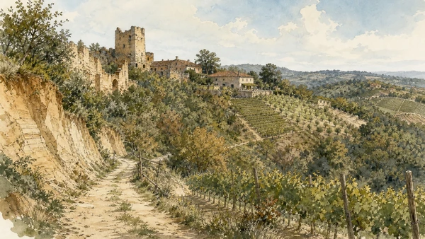
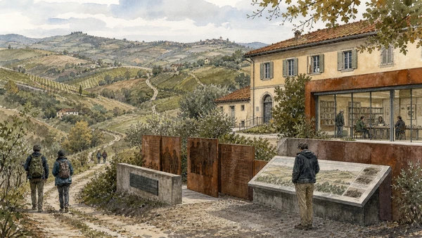
Original documentary watercolour panorama for Langhe, Roero and Alba: Complete Guide, with accurate Piedmont architecture, landscape and lived context

Piedmont Guide 02 · Roman Alba, medieval towers, vineyard ridges, castles, Pollenzo, working agriculture and literary memory

Langhe, Roero
& Alba

A multi-day guide from Alba’s Roman and medieval centre across the Barolo and Barbaresco hills, Grinzane Cavour, Bra and Pollenzo, then into the Roero’s distinct soils, settlements and working agricultural landscape.

Plan the route
Langhe, Roero and Alba · Piedmont10 chapters · one complete route

Why this route must be read in layers

The famous hills are neither one uniform wine region nor a decorative countryside. Towns, vineyard parcels, cellars, farm roads, woods and seasonal labour create several productive landscapes with different histories and access rules.

Alba connects Roman archaeology, medieval towers, cathedral institutions, food processing and regional markets. The truffle fair is a seasonal event, not a complete account of the city.

The UNESCO property is serial: five vineyard areas and Grinzane Cavour Castle were selected for their relationship among cultivation, settlement and winemaking. It does not cover every attractive hill.

Roero’s sandy geology, woods and mixed cultivation differ from the Langhe’s most publicised vineyard ridges. Private farms and cellar appointments require consent rather than scenic trespass.

Choose one hill system per day, verify cellar and castle access directly, and use public roads and marked paths without entering vineyard rows or blocking agricultural work.

The route

Plan your visit

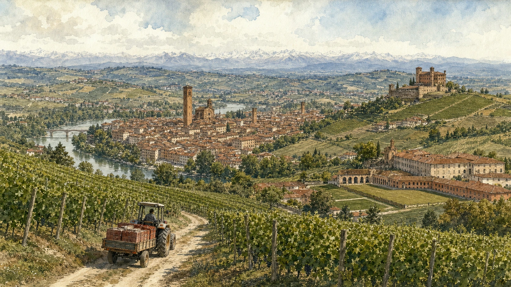
Begin in Alba, move through one controlled Barbaresco or Barolo sequence, then give Bra-Pollenzo and the Roero separate days so that distance and production remain legible.

Early morning

Alba Pompeia · Alba Cathedral and Piazza Risorgimento · Alba’s towers

Move in the documented order: Alba Pompeia: the Roman town beneath modern streets; then Alba Cathedral and Piazza Risorgimento: sacred and civic centre; then Alba’s towers: fragments of communal competition. Recheck live access and transport before entering a controlled site.

Late morning

Grinzane Cavour Castle · The Langa of Barolo · Barbaresco hills

Move in the documented order: Grinzane Cavour Castle: government, agriculture and UNESCO landscape; then The Langa of Barolo: villages within a regulated vineyard system; then Barbaresco hills: a separate landscape and market town. Recheck live access and transport before entering a controlled site.

Afternoon

Bra · Pollenzo · Roero

Move in the documented order: Bra: Baroque town, market institutions and food culture; then Pollenzo: Roman site, Savoy estate and contemporary university; then Roero: sandy hills, woods and mixed cultivation. Recheck live access and transport before entering a controlled site.

Late afternoon

Fenoglio and the resistance landscape

Move in the documented order: Fenoglio and the resistance landscape: literature anchored to difficult history. Recheck live access and transport before entering a controlled site.

Ten chapters

Explore the places

The order follows terrain, institutions and present-day movement. Use the index to return to a chapter without reducing the route to isolated monuments.

  1. 01Alba Pompeia: the Roman town beneath modern streets
  2. 02Alba Cathedral and Piazza Risorgimento: sacred and civic centre
  3. 03Alba’s towers: fragments of communal competition
  4. 04Grinzane Cavour Castle: government, agriculture and UNESCO landscape
  5. 05The Langa of Barolo: villages within a regulated vineyard system
  6. 06Barbaresco hills: a separate landscape and market town
  7. 07Bra: Baroque town, market institutions and food culture
  8. 08Pollenzo: Roman site, Savoy estate and contemporary university
  9. 09Roero: sandy hills, woods and mixed cultivation
  10. 10Fenoglio and the resistance landscape: literature anchored to difficult history
01

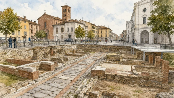
Archaeological remains and the street pattern connect a Roman municipium to later houses, churches and public spaces.

Alba Pompeia: the Roman town beneath modern streets

Archaeological remains and the street pattern connect a Roman municipium to later houses, churches and public spaces. The site becomes clearer when its surviving fabric, later alterations and present use are read together.

Today

Archaeological access may be limited to protected viewpoints, scheduled openings or guided routes. Stay outside barriers, distinguish original material from supports and reconstruction, and verify the official opening notice.

History

The settlement became Alba Pompeia under Roman rule and occupied a strategic Tanaro corridor; excavated walls, pavements and structures survive in dispersed protected sites.

How to read this place

Begin with documented remains below current level. Then compare street alignments crossing later blocks with reconstruction kept distinct from original material; the differences are evidence, not visual noise.

What to notice

  • documented remains below current level
  • street alignments crossing later blocks
  • reconstruction kept distinct from original material
Comune di Alba · Official tourism portal
Original documentary watercolour of Alba Pompeia: the Roman town beneath modern streets in Langhe, Roero and Alba · Piedmont, showing accurate architecture, landscape, people and present-day use
Alba Pompeia: the Roman town beneath modern streetsOriginal Merlintravel documentary watercolour · 2026
02

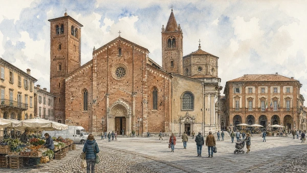
Brick towers, cathedral fabric and municipal fronts compress medieval authority and later rebuilding into the city’s principal square.

Alba Cathedral and Piazza Risorgimento: sacred and civic centre

Brick towers, cathedral fabric and municipal fronts compress medieval authority and later rebuilding into the city’s principal square. The site becomes clearer when its surviving fabric, later alterations and present use are read together.

Today

This is an active religious place as well as a historic building. Services, ceremonies and conservation can interrupt tourist access; dress appropriately, remain quiet and never treat a booked visit as priority over worship.

History

San Lorenzo Cathedral developed on an older religious site and was repeatedly altered, including major nineteenth-century restoration, while the square retained market and civic functions.

How to read this place

Begin with brick façade and bell towers. Then compare different construction campaigns inside with daily circulation across the square; the differences are evidence, not visual noise.

What to notice

  • brick façade and bell towers
  • different construction campaigns inside
  • daily circulation across the square
Comune di Alba · Official tourism portal
Original documentary watercolour of Alba Cathedral and Piazza Risorgimento: sacred and civic centre in Langhe, Roero and Alba · Piedmont, showing accurate architecture, landscape, people and present-day use
Alba Cathedral and Piazza Risorgimento: sacred and civic centreOriginal Merlintravel documentary watercolour · 2026
03

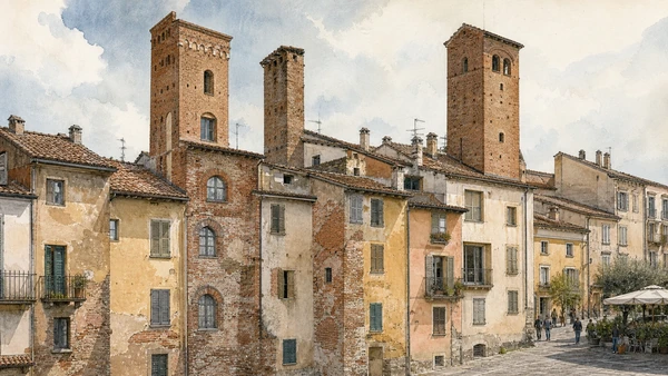
Surviving brick towers rise among later roofs and façades, recording elite residence without preserving a complete medieval skyline.

Alba’s towers: fragments of communal competition

Surviving brick towers rise among later roofs and façades, recording elite residence without preserving a complete medieval skyline. The site becomes clearer when its surviving fabric, later alterations and present use are read together.

Today

The area is inhabited and worked, not staged for visitors. Keep doorways, pavements, cycle lanes and deliveries clear, ask before photographing people and use current municipal mobility information.

History

Powerful families built fortified residences in the medieval commune; many towers were lowered, absorbed or lost as property and urban needs changed.

How to read this place

Begin with tower masonry embedded in later buildings. Then compare original openings versus restored surfaces with narrow parcels beneath the skyline; the differences are evidence, not visual noise.

What to notice

  • tower masonry embedded in later buildings
  • original openings versus restored surfaces
  • narrow parcels beneath the skyline
Comune di Alba · Official tourism portal
Original documentary watercolour of Alba's towers: fragments of communal competition in Langhe, Roero and Alba · Piedmont, showing accurate architecture, landscape, people and present-day use
Alba’s towers: fragments of communal competitionOriginal Merlintravel documentary watercolour · 2026
04

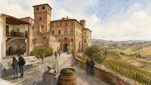
A fortified residence overlooks vineyards while museum displays connect estate management, wine culture and Cavour’s political biography.

Grinzane Cavour Castle: government, agriculture and UNESCO landscape

A fortified residence overlooks vineyards while museum displays connect estate management, wine culture and Cavour’s political biography. The site becomes clearer when its surviving fabric, later alterations and present use are read together.

Today

Opening, ticketing, room access and temporary displays can change. Check the institution’s official notice shortly before visiting, use the designated entrance and allow for security or conservation controls.

History

The castle developed through medieval and later phases; Camillo Cavour administered the estate and served as mayor in the nineteenth century before the site became a museum and UNESCO component.

How to read this place

Begin with castle phases and courtyard. Then compare view tied to cultivated parcels with museum narrative separated from political legend; the differences are evidence, not visual noise.

What to notice

  • castle phases and courtyard
  • view tied to cultivated parcels
  • museum narrative separated from political legend
UNESCO · Vineyard Landscape of Piedmont
Original documentary watercolour of Grinzane Cavour Castle: government, agriculture and UNESCO landscape in Langhe, Roero and Alba · Piedmont, showing accurate architecture, landscape, people and present-day use
Grinzane Cavour Castle: government, agriculture and UNESCO landscapeOriginal Merlintravel documentary watercolour · 2026
05

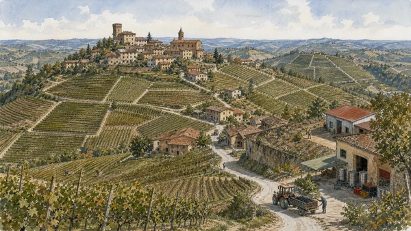
Hilltop settlements, parcels, roads and cellars form a dense productive landscape shaped by Nebbiolo cultivation and appellation rules.

The Langa of Barolo: villages within a regulated vineyard system

Hilltop settlements, parcels, roads and cellars form a dense productive landscape shaped by Nebbiolo cultivation and appellation rules. The site becomes clearer when its surviving fabric, later alterations and present use are read together.

Today

Weather, water levels, trail conditions and seasonal services can alter the route. Use official transport and park information, remain on authorised paths and do not enter farms, vineyards or private gardens without permission.

History

Wine production has long roots but modern Barolo identity emerged through nineteenth- and twentieth-century technical, commercial and regulatory change.

How to read this place

Begin with parcel orientation and slope. Then compare villages connected to cellars and farms with working access kept clear during the season; the differences are evidence, not visual noise.

What to notice

  • parcel orientation and slope
  • villages connected to cellars and farms
  • working access kept clear during the season
UNESCO · Vineyard Landscape of Piedmont
Original documentary watercolour of The Langa of Barolo: villages within a regulated vineyard system in Langhe, Roero and Alba · Piedmont, showing accurate architecture, landscape, people and present-day use
The Langa of Barolo: villages within a regulated vineyard systemOriginal Merlintravel documentary watercolour · 2026
06

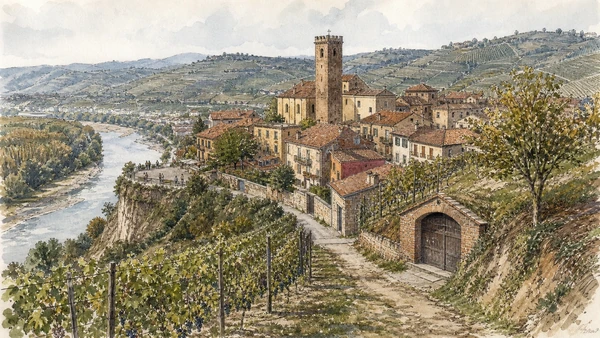
The Tanaro edge, village tower and surrounding vineyards create a smaller system with its own production history.

Barbaresco hills: a separate landscape and market town

The Tanaro edge, village tower and surrounding vineyards create a smaller system with its own production history. The site becomes clearer when its surviving fabric, later alterations and present use are read together.

Today

Weather, water levels, trail conditions and seasonal services can alter the route. Use official transport and park information, remain on authorised paths and do not enter farms, vineyards or private gardens without permission.

History

Viticulture around Barbaresco was consolidated through local growers, cooperative organisation and modern denomination rather than simply copied from Barolo.

How to read this place

Begin with village relationship to the river valley. Then compare vineyard plots around roads and homes with cellar access distinguished from public viewpoint; the differences are evidence, not visual noise.

What to notice

  • village relationship to the river valley
  • vineyard plots around roads and homes
  • cellar access distinguished from public viewpoint
UNESCO · Vineyard Landscape of Piedmont
Original documentary watercolour of Barbaresco hills: a separate landscape and market town in Langhe, Roero and Alba · Piedmont, showing accurate architecture, landscape, people and present-day use
Barbaresco hills: a separate landscape and market townOriginal Merlintravel documentary watercolour · 2026
07

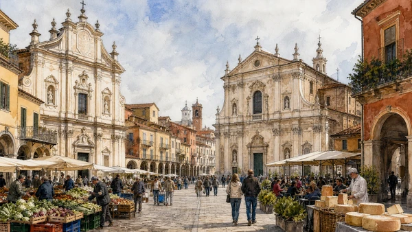
Churches, arcaded streets, civic palaces and food organisations connect an inland market town to the wider agricultural district.

Bra: Baroque town, market institutions and food culture

Churches, arcaded streets, civic palaces and food organisations connect an inland market town to the wider agricultural district. The site becomes clearer when its surviving fabric, later alterations and present use are read together.

Today

The area is inhabited and worked, not staged for visitors. Keep doorways, pavements, cycle lanes and deliveries clear, ask before photographing people and use current municipal mobility information.

History

Bra expanded through early modern trade and later rail and industrial connections; contemporary food institutions added a global layer to local markets and production.

How to read this place

Begin with santa chiara and sant’andrea façades. Then compare courtyards and market streets with living commerce beyond festival branding; the differences are evidence, not visual noise.

What to notice

  • Santa Chiara and Sant’Andrea façades
  • courtyards and market streets
  • living commerce beyond festival branding
Ente Turismo Langhe Monferrato Roero · Official site
Original documentary watercolour of Bra: Baroque town, market institutions and food culture in Langhe, Roero and Alba · Piedmont, showing accurate architecture, landscape, people and present-day use
Bra: Baroque town, market institutions and food cultureOriginal Merlintravel documentary watercolour · 2026
08

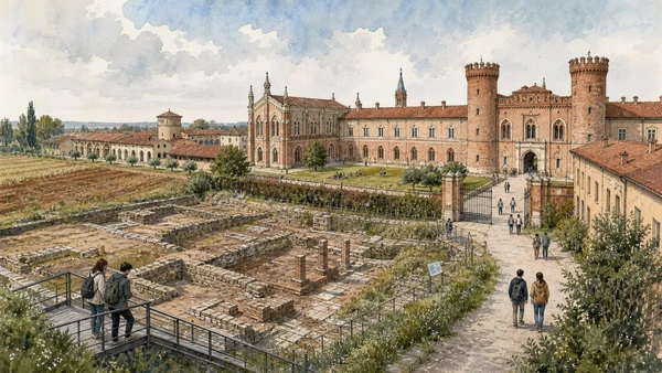
Archaeology, neo-medieval court architecture, farmland and educational reuse occupy one settlement with sharply different chronologies.

Pollenzo: Roman site, Savoy estate and contemporary university

Archaeology, neo-medieval court architecture, farmland and educational reuse occupy one settlement with sharply different chronologies. The site becomes clearer when its surviving fabric, later alterations and present use are read together.

Today

The area is inhabited and worked, not staged for visitors. Keep doorways, pavements, cycle lanes and deliveries clear, ask before photographing people and use current municipal mobility information.

History

Roman Pollentia was followed by medieval settlement and a nineteenth-century Savoy estate project; restored buildings now house the University of Gastronomic Sciences and related institutions.

How to read this place

Begin with archaeological traces versus nineteenth-century design. Then compare estate buildings and agricultural land with university areas with controlled access; the differences are evidence, not visual noise.

What to notice

  • archaeological traces versus nineteenth-century design
  • estate buildings and agricultural land
  • university areas with controlled access
Università di Scienze Gastronomiche · Pollenzo
Original documentary watercolour of Pollenzo: Roman site, Savoy estate and contemporary university in Langhe, Roero and Alba · Piedmont, showing accurate architecture, landscape, people and present-day use
Pollenzo: Roman site, Savoy estate and contemporary universityOriginal Merlintravel documentary watercolour · 2026
09

Eroded rocche, orchards, woods and vineyards distinguish the left bank of the Tanaro from better-known Langhe ridges.

Roero: sandy hills, woods and mixed cultivation

Eroded rocche, orchards, woods and vineyards distinguish the left bank of the Tanaro from better-known Langhe ridges. The site becomes clearer when its surviving fabric, later alterations and present use are read together.

Today

Weather, water levels, trail conditions and seasonal services can alter the route. Use official transport and park information, remain on authorised paths and do not enter farms, vineyards or private gardens without permission.

History

Agriculture adapted to marine-origin soils and varied slopes, producing mixed land use and settlements whose economy later entered broader wine and tourism networks.

How to read this place

Begin with exposed sandy geology. Then compare vineyards beside woodland and orchards with marked paths avoiding unstable edges; the differences are evidence, not visual noise.

What to notice

  • exposed sandy geology
  • vineyards beside woodland and orchards
  • marked paths avoiding unstable edges
Ente Turismo Langhe Monferrato Roero · Official site
Original documentary watercolour of Roero: sandy hills, woods and mixed cultivation in Langhe, Roero and Alba · Piedmont, showing accurate architecture, landscape, people and present-day use
Roero: sandy hills, woods and mixed cultivationOriginal Merlintravel documentary watercolour · 2026
10

Hills, farm roads and Alba’s institutions connect Beppe Fenoglio’s writing to partisan war without turning fiction into a literal map.

Fenoglio and the resistance landscape: literature anchored to difficult history

Hills, farm roads and Alba’s institutions connect Beppe Fenoglio’s writing to partisan war without turning fiction into a literal map. The site becomes clearer when its surviving fabric, later alterations and present use are read together.

Today

Weather, water levels, trail conditions and seasonal services can alter the route. Use official transport and park information, remain on authorised paths and do not enter farms, vineyards or private gardens without permission.

History

The Langhe were a major theatre of resistance and civil conflict during 1943–1945; Fenoglio’s work drew on experience while transforming people and places through literature.

How to read this place

Begin with documented memorials and archives. Then compare terrain affecting movement and refuge with literary place names distinguished from proven events; the differences are evidence, not visual noise.

What to notice

  • documented memorials and archives
  • terrain affecting movement and refuge
  • literary place names distinguished from proven events
Comune di Alba · Official tourism portal
Original documentary watercolour of Fenoglio and the resistance landscape: literature anchored to difficult history in Langhe, Roero and Alba · Piedmont, showing accurate architecture, landscape, people and present-day use
Fenoglio and the resistance landscape: literature anchored to difficult historyOriginal Merlintravel documentary watercolour · 2026

Piedmont through time

A short chronology

From pre-Roman routes and Roman towns to communes, marquisates, Savoy government, industrialisation, heritage protection and climate-sensitive access.

  1. Alpine, lake, hill and plain communities leave settlements, tools, rock art and long-lived route systems.

  2. Ligurians, Celts, Salassi and other communities organise territories later drawn into Roman expansion.

  3. Roman colonies, municipia and roads connect the Po plain to Alpine passes and Ligurian approaches.

  4. Cities, farms, river transport and mountain routes integrate the region into imperial networks.

  5. Christian institutions, Lombard and Frankish powers, monasteries and fortified sites reshape late-Roman territories.

  6. Communes, bishoprics and marquisates develop distinct cities, markets, castles and religious landscapes.

  7. Savoy, Monferrato, Saluzzo, Milanese and local powers contest routes while towns expand civic institutions.

  8. The transfer of the Savoy capital to Turin accelerates centralisation, court construction and territorial administration.

  9. Baroque residences, sanctuaries, planned roads and fortified frontiers reorganise cities and countryside.

  10. French and Napoleonic rule suppresses institutions, reforms government and changes military and transport systems.

  11. Constitutional politics and wars led from Piedmont-Sardinia contribute decisively to Italian unification.

  12. Railways, canals, factories, wine markets and Alpine tourism connect previously separated economies.

  13. World wars, Fascism, resistance and civilian loss leave difficult evidence across towns, hills and valleys.

  14. Industrial expansion, migration, mechanised agriculture and mass tourism transform cities and working landscapes.

  15. Deindustrialisation, heritage recognition, rural reinvestment and climate pressure repeatedly alter access and identity.

Before your visit

Practical information

01

Check the live page

Opening hours, reservation systems, restoration, exhibitions and transport can change. Recheck the linked official institution shortly before departure.

02

Separate worship and tourism

Churches and sanctuaries remain religious spaces. Services, funerals and community use take priority over visitor itineraries.

03

Plan real distances

Langhe, Roero and Alba · Piedmont combines dense urban routes with lakes, valleys and dispersed towns. Do not compress distant chapters into an unsafe or superficial day.

04

Keep thresholds open

Arcades, station halls, markets, courtyards, workshops and residential streets must continue to function while you observe or photograph them.

05

Use current mobility data

Check the responsible rail, navigation, bus, road or park operator on the day; replacement services and weather can change an otherwise sound route.

06

Read change honestly

Restoration, reconstruction, adaptive reuse and new development have all shaped the landscape visible today.

Method and sources

Sources and image credits

This guide uses official museum, ministry, municipal, transport, park and UNESCO documentation checked on 29 August 2026. It separates durable historical interpretation from access details that can change, distinguishes surviving fabric from restoration or reconstruction, and treats worship, work, residence and public movement as part of the evidence. Every chapter links its principal institutional source; tickets, closures, weather and transport must always be verified again on the day of the visit.

All ten images are original Merlintravel editorial watercolours based on documented present-day conditions. They are illustrations, not substitutes for archaeological plans. Opening hours, tickets, accessible routes, temporary exhibitions and conservation work can change; consult the linked official pages shortly before visiting.