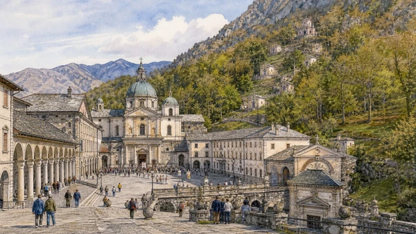
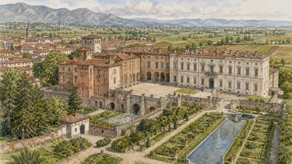
Original documentary watercolour panorama for Ivrea, Biella and the Canavese: Complete Guide, with accurate Piedmont architecture, landscape and lived context

Piedmont Guide 06 · Roman Eporedia, Olivetti industrial city, morainic terrain, textile production, Oropa and Savoy residence

Ivrea, Biella
& the Canavese

A multi-day guide from Ivrea’s Roman and medieval hill to the complete Olivetti industrial city, then through morainic Canavese to Biella’s upper town and textile system, Oropa’s sanctuary landscape and Agliè’s Savoy estate.

Plan the route
Ivrea, Biella and the Canavese · Piedmont10 chapters · one complete route

Why this route must be read in layers

This is a territory of designed work and difficult terrain. Olivetti offices and housing, Biella mills and water power, pilgrimage institutions and court landscapes show different ways architecture organised community, production and welfare.

Ivrea’s UNESCO property consists of industrial, administrative, social and residential buildings created around Olivetti’s twentieth-century project. It is an inhabited urban area rather than a factory museum.

Biella’s textile identity depends on streams, mills, technical skill and international markets. Creative-city branding must remain connected to labour, pollution and changing manufacture.

Oropa combines active sanctuary, Sacro Monte, mountain basin and transport limits. Agliè introduces a court and estate landscape that cannot be understood from interiors alone.

Assign one day to historic Ivrea, one to the industrial city and separate days to Biella-Oropa and Agliè; verify building access because many Olivetti sites remain offices or private property.

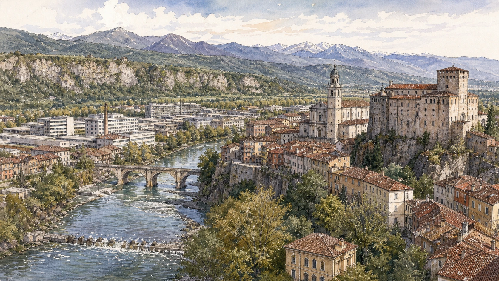
The route

Plan your visit

Begin with Ivrea’s historical terrain, walk the public industrial-city route, continue to Biella and its water-powered fabric, then visit Oropa and Agliè through official access.

Early morning

Ivrea’s historic hill · Dora Baltea and Ivrea’s water geography · Olivetti factory complex

Move in the documented order: Ivrea’s historic hill: Eporedia, cathedral and castle; then Dora Baltea and Ivrea’s water geography; then Olivetti factory complex: transparent production along Via Jervis. Recheck live access and transport before entering a controlled site.

Late morning

Olivetti offices and research · Olivetti housing and social services · The Serra and morainic Canavese

Move in the documented order: Olivetti offices and research: administration as design; then Olivetti housing and social services: welfare, planning and limits; then The Serra and morainic Canavese: glacial landform as territorial structure. Recheck live access and transport before entering a controlled site.

Afternoon

Biella Piazzo · Biella textile system · Oropa sanctuary and Sacro Monte

Move in the documented order: Biella Piazzo: upper town of palaces, arcades and funicular; then Biella textile system: water, mills and global markets; then Oropa sanctuary and Sacro Monte: pilgrimage in a mountain basin. Recheck live access and transport before entering a controlled site.

Late afternoon

Agliè Castle

Move in the documented order: Agliè Castle: Savoy residence within a Canavese estate. Recheck live access and transport before entering a controlled site.

Ten chapters

Explore the places

The order follows terrain, institutions and present-day movement. Use the index to return to a chapter without reducing the route to isolated monuments.

  1. 01Ivrea’s historic hill: Eporedia, cathedral and castle
  2. 02Dora Baltea and Ivrea’s water geography
  3. 03Olivetti factory complex: transparent production along Via Jervis
  4. 04Olivetti offices and research: administration as design
  5. 05Olivetti housing and social services: welfare, planning and limits
  6. 06The Serra and morainic Canavese: glacial landform as territorial structure
  7. 07Biella Piazzo: upper town of palaces, arcades and funicular
  8. 08Biella textile system: water, mills and global markets
  9. 09Oropa sanctuary and Sacro Monte: pilgrimage in a mountain basin
  10. 10Agliè Castle: Savoy residence within a Canavese estate
01

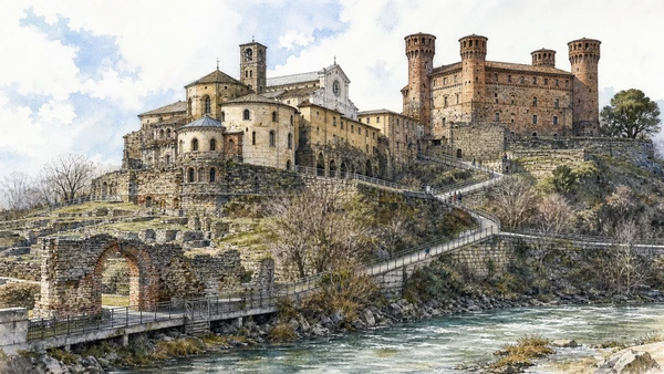
Roman traces, medieval cathedral fabric and the four-towered castle occupy steep ground above the Dora Baltea.

Ivrea’s historic hill: Eporedia, cathedral and castle

Roman traces, medieval cathedral fabric and the four-towered castle occupy steep ground above the Dora Baltea. The site becomes clearer when its surviving fabric, later alterations and present use are read together.

Today

The area is inhabited and worked, not staged for visitors. Keep doorways, pavements, cycle lanes and deliveries clear, ask before photographing people and use current municipal mobility information.

History

Roman Eporedia controlled a route toward Alpine passes; bishopric and medieval powers later reorganised the hill before Savoy and modern civic use.

How to read this place

Begin with terrain between river and hill. Then compare cathedral phases and crypt with castle exterior and controlled public access; the differences are evidence, not visual noise.

What to notice

  • terrain between river and hill
  • cathedral phases and crypt
  • castle exterior and controlled public access
Comune di Ivrea · Official tourist portal
Original documentary watercolour of Ivrea's historic hill: Eporedia, cathedral and castle in Ivrea, Biella and the Canavese · Piedmont, showing accurate architecture, landscape, people and present-day use
Ivrea’s historic hill: Eporedia, cathedral and castleOriginal Merlintravel documentary watercolour · 2026
02

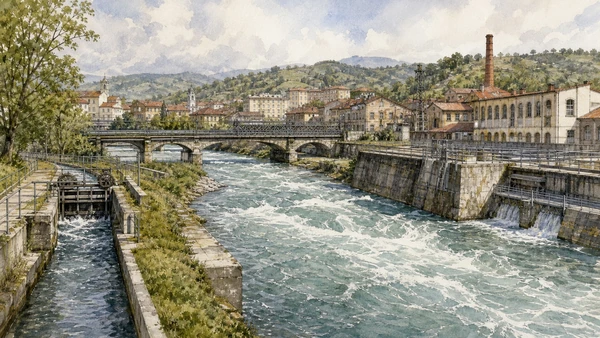
Fast river flow, canals, bridges and industrial channels explain settlement, energy and flood management.

Dora Baltea and Ivrea’s water geography

Fast river flow, canals, bridges and industrial channels explain settlement, energy and flood management. The site becomes clearer when its surviving fabric, later alterations and present use are read together.

Today

Weather, water levels, trail conditions and seasonal services can alter the route. Use official transport and park information, remain on authorised paths and do not enter farms, vineyards or private gardens without permission.

History

The Dora connected the Aosta corridor to the Po while local channels powered craft and industry; modern embankments and hydropower altered access and ecology.

How to read this place

Begin with river current and engineered banks. Then compare canal intakes and bridges with industrial buildings positioned near water; the differences are evidence, not visual noise.

What to notice

  • river current and engineered banks
  • canal intakes and bridges
  • industrial buildings positioned near water
Comune di Ivrea · Official tourist portal
Original documentary watercolour of Dora Baltea and Ivrea's water geography in Ivrea, Biella and the Canavese · Piedmont, showing accurate architecture, landscape, people and present-day use
Dora Baltea and Ivrea’s water geographyOriginal Merlintravel documentary watercolour · 2026
03

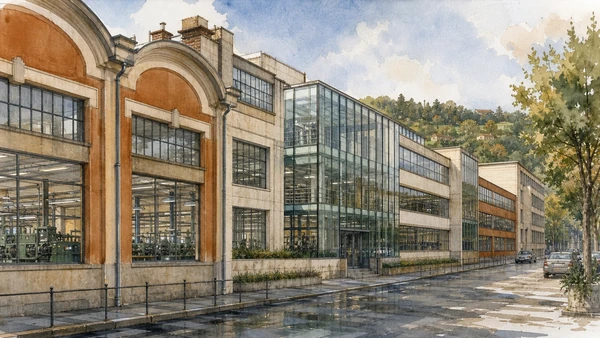
Repeated factory extensions use glass, concrete and careful street frontage to express changing models of work.

Olivetti factory complex: transparent production along Via Jervis

Repeated factory extensions use glass, concrete and careful street frontage to express changing models of work. The site becomes clearer when its surviving fabric, later alterations and present use are read together.

Today

The area is inhabited and worked, not staged for visitors. Keep doorways, pavements, cycle lanes and deliveries clear, ask before photographing people and use current municipal mobility information.

History

Camillo Olivetti founded the company in 1908; architects including Figini and Pollini expanded production buildings through the mid-twentieth century under Adriano Olivetti.

How to read this place

Begin with construction phases along one street. Then compare daylight and production-floor geometry with active or adapted interiors kept private unless open; the differences are evidence, not visual noise.

What to notice

  • construction phases along one street
  • daylight and production-floor geometry
  • active or adapted interiors kept private unless open
UNESCO · Ivrea, industrial city of the 20th century
Original documentary watercolour of Olivetti factory complex: transparent production along Via Jervis in Ivrea, Biella and the Canavese · Piedmont, showing accurate architecture, landscape, people and present-day use
Olivetti factory complex: transparent production along Via JervisOriginal Merlintravel documentary watercolour · 2026
04

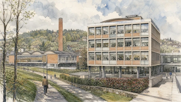
Office blocks, research spaces and services made management and technical innovation visible within the industrial city.

Olivetti offices and research: administration as design

Office blocks, research spaces and services made management and technical innovation visible within the industrial city. The site becomes clearer when its surviving fabric, later alterations and present use are read together.

Today

The area is inhabited and worked, not staged for visitors. Keep doorways, pavements, cycle lanes and deliveries clear, ask before photographing people and use current municipal mobility information.

History

Olivetti commissioned architects and designers to develop buildings, products and communications as an integrated corporate and social project.

How to read this place

Begin with office façades and internal planning evidence. Then compare relationship to factory buildings with landscape and employee routes between functions; the differences are evidence, not visual noise.

What to notice

  • office façades and internal planning evidence
  • relationship to factory buildings
  • landscape and employee routes between functions
UNESCO · Ivrea, industrial city of the 20th century
Original documentary watercolour of Olivetti offices and research: administration as design in Ivrea, Biella and the Canavese · Piedmont, showing accurate architecture, landscape, people and present-day use
Olivetti offices and research: administration as designOriginal Merlintravel documentary watercolour · 2026
05

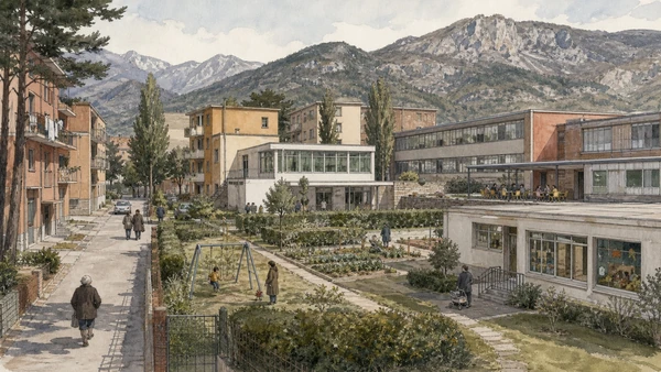
Residences, nurseries, canteens and community buildings test different architectural responses to industrial welfare.

Olivetti housing and social services: welfare, planning and limits

Residences, nurseries, canteens and community buildings test different architectural responses to industrial welfare. The site becomes clearer when its surviving fabric, later alterations and present use are read together.

Today

The area is inhabited and worked, not staged for visitors. Keep doorways, pavements, cycle lanes and deliveries clear, ask before photographing people and use current municipal mobility information.

History

Company and associated institutions built housing and services especially from the 1930s to 1960s, linking Adriano Olivetti’s community ideas to daily life without eliminating employer power or social hierarchy.

How to read this place

Begin with different housing types and occupants. Then compare shared green and service spaces with present residential privacy respected; the differences are evidence, not visual noise.

What to notice

  • different housing types and occupants
  • shared green and service spaces
  • present residential privacy respected
UNESCO · Ivrea, industrial city of the 20th century
Original documentary watercolour of Olivetti housing and social services: welfare, planning and limits in Ivrea, Biella and the Canavese · Piedmont, showing accurate architecture, landscape, people and present-day use
Olivetti housing and social services: welfare, planning and limitsOriginal Merlintravel documentary watercolour · 2026
06

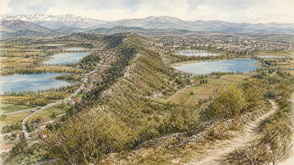
A long moraine ridge, lakes and terraces direct roads, settlements, agriculture and views around Ivrea.

The Serra and morainic Canavese: glacial landform as territorial structure

A long moraine ridge, lakes and terraces direct roads, settlements, agriculture and views around Ivrea. The site becomes clearer when its surviving fabric, later alterations and present use are read together.

Today

Weather, water levels, trail conditions and seasonal services can alter the route. Use official transport and park information, remain on authorised paths and do not enter farms, vineyards or private gardens without permission.

History

Pleistocene glaciers formed the amphitheatre; later communities adapted slopes, wetlands and passes for farming, defence and movement.

How to read this place

Begin with ridge line and lake basins. Then compare settlements positioned on terraces with marked paths avoiding unstable or private land; the differences are evidence, not visual noise.

What to notice

  • ridge line and lake basins
  • settlements positioned on terraces
  • marked paths avoiding unstable or private land
Comune di Ivrea · Official tourist portal
Original documentary watercolour of The Serra and morainic Canavese: glacial landform as territorial structure in Ivrea, Biella and the Canavese · Piedmont, showing accurate architecture, landscape, people and present-day use
The Serra and morainic Canavese: glacial landform as territorial structureOriginal Merlintravel documentary watercolour · 2026
07

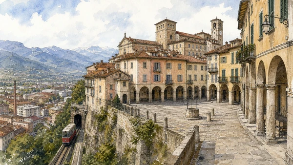
A medieval and early-modern borough stands above Biella Piano, preserving a different civic scale from the industrial valley below.

Biella Piazzo: upper town of palaces, arcades and funicular

A medieval and early-modern borough stands above Biella Piano, preserving a different civic scale from the industrial valley below. The site becomes clearer when its surviving fabric, later alterations and present use are read together.

Today

The area is inhabited and worked, not staged for visitors. Keep doorways, pavements, cycle lanes and deliveries clear, ask before photographing people and use current municipal mobility information.

History

The upper settlement developed around bishop and elite power before modern expansion concentrated administration, rail and manufacturing on lower ground.

How to read this place

Begin with arcaded piazza cisterna. Then compare palace fronts and narrow access with funicular or road connection to the lower city; the differences are evidence, not visual noise.

What to notice

  • arcaded Piazza Cisterna
  • palace fronts and narrow access
  • funicular or road connection to the lower city
Visit Biella · Official destination site
Original documentary watercolour of Biella Piazzo: upper town of palaces, arcades and funicular in Ivrea, Biella and the Canavese · Piedmont, showing accurate architecture, landscape, people and present-day use
Biella Piazzo: upper town of palaces, arcades and funicularOriginal Merlintravel documentary watercolour · 2026
08

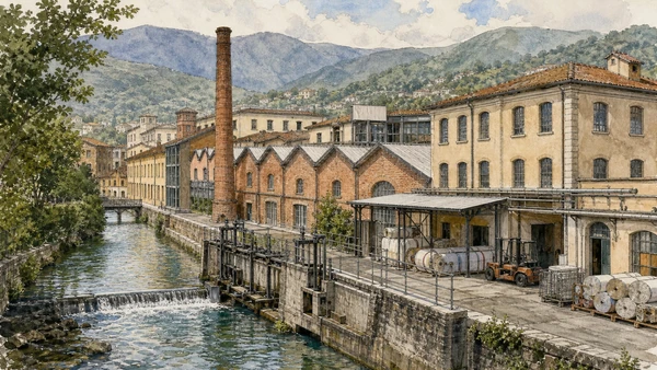
Former and active factories line streams whose flow supported processing before electricity and modern logistics expanded production.

Biella textile system: water, mills and global markets

Former and active factories line streams whose flow supported processing before electricity and modern logistics expanded production. The site becomes clearer when its surviving fabric, later alterations and present use are read together.

Today

The area is inhabited and worked, not staged for visitors. Keep doorways, pavements, cycle lanes and deliveries clear, ask before photographing people and use current municipal mobility information.

History

Wool working grew from domestic and workshop traditions into an industrial district connected to rail, machinery, global fibre supply and specialised labour.

How to read this place

Begin with mill buildings beside water. Then compare saw-tooth roofs and service yards with current production versus cultural reuse; the differences are evidence, not visual noise.

What to notice

  • mill buildings beside water
  • saw-tooth roofs and service yards
  • current production versus cultural reuse
Visit Biella · Official destination site
Original documentary watercolour of Biella textile system: water, mills and global markets in Ivrea, Biella and the Canavese · Piedmont, showing accurate architecture, landscape, people and present-day use
Biella textile system: water, mills and global marketsOriginal Merlintravel documentary watercolour · 2026
09

Basilicas, courtyards, lodging and chapels occupy a high enclosed landscape used for worship, walking and seasonal events.

Oropa sanctuary and Sacro Monte: pilgrimage in a mountain basin

Basilicas, courtyards, lodging and chapels occupy a high enclosed landscape used for worship, walking and seasonal events. The site becomes clearer when its surviving fabric, later alterations and present use are read together.

Today

This is an active religious place as well as a historic building. Services, ceremonies and conservation can interrupt tourist access; dress appropriately, remain quiet and never treat a booked visit as priority over worship.

History

An older Marian devotion developed into a large early-modern sanctuary complex; the nearby Sacro Monte’s chapels belong to the UNESCO serial property.

How to read this place

Begin with progression through monumental courtyards. Then compare active devotion around the black madonna with chapels integrated into woodland slope; the differences are evidence, not visual noise.

What to notice

  • progression through monumental courtyards
  • active devotion around the Black Madonna
  • chapels integrated into woodland slope
Santuario e Sacro Monte di Oropa · Official site
Original documentary watercolour of Oropa sanctuary and Sacro Monte: pilgrimage in a mountain basin in Ivrea, Biella and the Canavese · Piedmont, showing accurate architecture, landscape, people and present-day use
Oropa sanctuary and Sacro Monte: pilgrimage in a mountain basinOriginal Merlintravel documentary watercolour · 2026
10

Courtyards, apartments, gardens and service land connect ducal representation to a small town and agricultural landscape.

Agliè Castle: Savoy residence within a Canavese estate

Courtyards, apartments, gardens and service land connect ducal representation to a small town and agricultural landscape. The site becomes clearer when its surviving fabric, later alterations and present use are read together.

Today

Opening, ticketing, room access and temporary displays can change. Check the institution’s official notice shortly before visiting, use the designated entrance and allow for security or conservation controls.

History

An older castle was transformed through ducal and Savoy campaigns, especially from the seventeenth to nineteenth centuries, before state museum use.

How to read this place

Begin with different façade and courtyard phases. Then compare garden axis and water with town, estate and palace read together; the differences are evidence, not visual noise.

What to notice

  • different façade and courtyard phases
  • garden axis and water
  • town, estate and palace read together
Regional Directorate National Museums Piedmont · Agliè Castle
Original documentary watercolour of Agliè Castle: Savoy residence within a Canavese estate in Ivrea, Biella and the Canavese · Piedmont, showing accurate architecture, landscape, people and present-day use
Agliè Castle: Savoy residence within a Canavese estateOriginal Merlintravel documentary watercolour · 2026

Piedmont through time

A short chronology

From pre-Roman routes and Roman towns to communes, marquisates, Savoy government, industrialisation, heritage protection and climate-sensitive access.

  1. Alpine, lake, hill and plain communities leave settlements, tools, rock art and long-lived route systems.

  2. Ligurians, Celts, Salassi and other communities organise territories later drawn into Roman expansion.

  3. Roman colonies, municipia and roads connect the Po plain to Alpine passes and Ligurian approaches.

  4. Cities, farms, river transport and mountain routes integrate the region into imperial networks.

  5. Christian institutions, Lombard and Frankish powers, monasteries and fortified sites reshape late-Roman territories.

  6. Communes, bishoprics and marquisates develop distinct cities, markets, castles and religious landscapes.

  7. Savoy, Monferrato, Saluzzo, Milanese and local powers contest routes while towns expand civic institutions.

  8. The transfer of the Savoy capital to Turin accelerates centralisation, court construction and territorial administration.

  9. Baroque residences, sanctuaries, planned roads and fortified frontiers reorganise cities and countryside.

  10. French and Napoleonic rule suppresses institutions, reforms government and changes military and transport systems.

  11. Constitutional politics and wars led from Piedmont-Sardinia contribute decisively to Italian unification.

  12. Railways, canals, factories, wine markets and Alpine tourism connect previously separated economies.

  13. World wars, Fascism, resistance and civilian loss leave difficult evidence across towns, hills and valleys.

  14. Industrial expansion, migration, mechanised agriculture and mass tourism transform cities and working landscapes.

  15. Deindustrialisation, heritage recognition, rural reinvestment and climate pressure repeatedly alter access and identity.

Before your visit

Practical information

01

Check the live page

Opening hours, reservation systems, restoration, exhibitions and transport can change. Recheck the linked official institution shortly before departure.

02

Separate worship and tourism

Churches and sanctuaries remain religious spaces. Services, funerals and community use take priority over visitor itineraries.

03

Plan real distances

Ivrea, Biella and the Canavese · Piedmont combines dense urban routes with lakes, valleys and dispersed towns. Do not compress distant chapters into an unsafe or superficial day.

04

Keep thresholds open

Arcades, station halls, markets, courtyards, workshops and residential streets must continue to function while you observe or photograph them.

05

Use current mobility data

Check the responsible rail, navigation, bus, road or park operator on the day; replacement services and weather can change an otherwise sound route.

06

Read change honestly

Restoration, reconstruction, adaptive reuse and new development have all shaped the landscape visible today.

Method and sources

Sources and image credits

This guide uses official museum, ministry, municipal, transport, park and UNESCO documentation checked on 29 August 2026. It separates durable historical interpretation from access details that can change, distinguishes surviving fabric from restoration or reconstruction, and treats worship, work, residence and public movement as part of the evidence. Every chapter links its principal institutional source; tickets, closures, weather and transport must always be verified again on the day of the visit.

All ten images are original Merlintravel editorial watercolours based on documented present-day conditions. They are illustrations, not substitutes for archaeological plans. Opening hours, tickets, accessible routes, temporary exhibitions and conservation work can change; consult the linked official pages shortly before visiting.