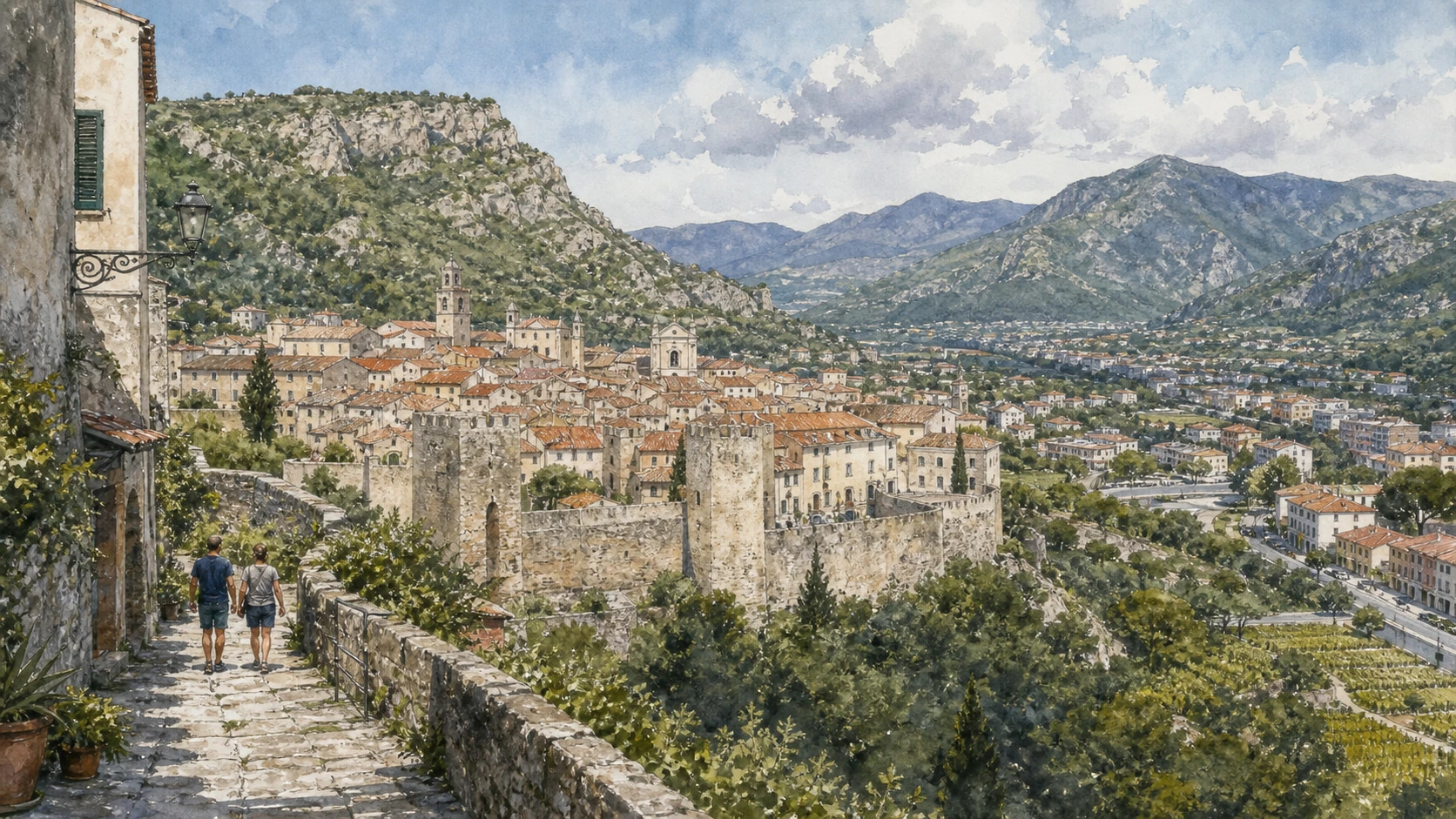
Original documentary watercolour panorama for Finalborgo and the Finalese: Complete Guide, with accurate Ligurian architecture, landscape and lived context

Liguria Guide 07 · Walled marquisate, archaeology, caves, castles, Varigotti, Manie plateau and outdoor landscape

Finalborgo
and the stone country

A two-day guide connecting a walled inland capital to one of Liguria’s richest prehistoric, medieval and geological landscapes.

Plan the route
Finalborgo and the Finalese · Liguria10 chapters · one complete route

Why this route must be read in layers

Finalborgo is the civic centre of a larger archaeological territory shaped by limestone, routes and the Del Carretto marquisate.

The walls, gates, palaces and San Biagio preserve the political image of a small state contested between larger powers. Castel Gavone and Perti extend that history onto the surrounding ridges.

The museum at Santa Caterina places medieval Finale within a human sequence reaching back hundreds of thousands of years. Caves and finds require archaeological context rather than adventure mythology.

Varigotti, the Manie plateau and climbing landscape are inhabited and ecologically sensitive. Trails, crags and caves need current official access and respect for farms, rescue rules and conservation closures.

Use one full day for Finalborgo and museum collections, then a second day for an officially open archaeological, hill or coastal route.

The route

Plan your visit

Enter through the gates, read civic and religious centres, climb only authorised castle routes, then let the museum guide any exploration of caves, Roman roads and the coastal plateau.

Early morning

Walls and gates · San Biagio · Santa Caterina

Move in the documented order: Walls and gates: the boundary of Burgum Finarii; then San Biagio: Baroque church within medieval fabric; then Santa Caterina: convent, cloisters and cultural complex. Recheck live access and transport before entering a controlled site.

Late morning

Archaeological Museum · Castel Gavone and Perti · Val Ponci

Move in the documented order: Archaeological Museum: 350,000 years in territorial context; then Castel Gavone and Perti: marquisate above the valley; then Val Ponci: Roman bridges and Via Iulia Augusta. Recheck live access and transport before entering a controlled site.

Afternoon

Arene Candide · Varigotti and Punta Crena · Manie plateau

Move in the documented order: Arene Candide: cave archaeology and limits of access; then Varigotti and Punta Crena: coastal village and defended headland; then Manie plateau: caves, farms and Mediterranean habitat. Recheck live access and transport before entering a controlled site.

Late afternoon

Finale outdoor landscape

Move in the documented order: Finale outdoor landscape: climbing within a lived territory. Recheck live access and transport before entering a controlled site.

Ten chapters

Explore the places

The order follows terrain, institutions and present-day movement. Use the index to return to a chapter without reducing the route to isolated monuments.

  1. 01Walls and gates: the boundary of Burgum Finarii
  2. 02San Biagio: Baroque church within medieval fabric
  3. 03Santa Caterina: convent, cloisters and cultural complex
  4. 04Archaeological Museum: 350,000 years in territorial context
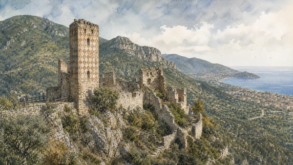
  5. 05Castel Gavone and Perti: marquisate above the valley
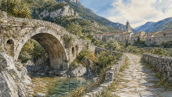
  6. 06Val Ponci: Roman bridges and Via Iulia Augusta
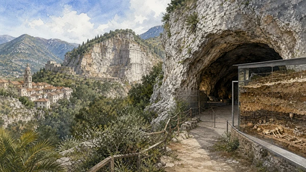
  7. 07Arene Candide: cave archaeology and limits of access
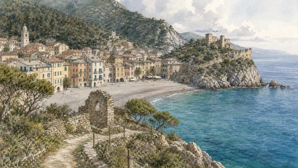
  8. 08Varigotti and Punta Crena: coastal village and defended headland
  9. 09Manie plateau: caves, farms and Mediterranean habitat
  10. 10Finale outdoor landscape: climbing within a lived territory
01

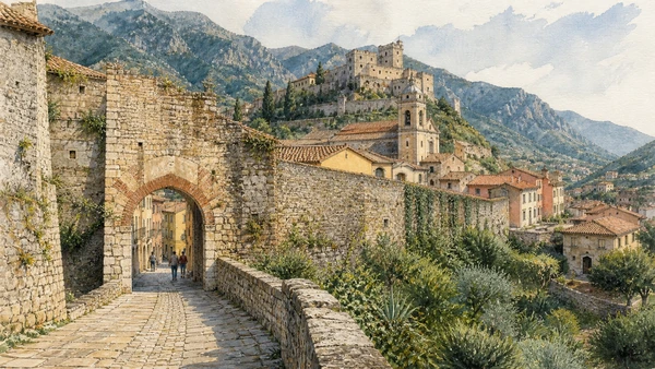
Defensive circuits, Porta Testa and street alignments define an inland capital close to but separate from the coast.

Walls and gates: the boundary of Burgum Finarii

Defensive circuits, Porta Testa and street alignments define an inland capital close to but separate from the coast. The site becomes clearer when its surviving fabric, later alterations and present use are read together.

Today

The area is inhabited and worked, not staged for visitors. Keep doorways, pavements, cycle lanes and deliveries clear, ask before photographing people and use current municipal mobility information.

History

The Del Carretto marquisate and later rulers strengthened the settlement as regional rivalry changed fortification and administration.

How to read this place

Begin with gate passages. Then compare wall masonry phases with streets aligned toward civic centres; the differences are evidence, not visual noise.

What to notice

  • gate passages
  • wall masonry phases
  • streets aligned toward civic centres
Visit Finale Ligure · Official destination site
Original documentary watercolour of Walls and gates: the boundary of Burgum Finarii in Finalborgo and the Finalese · Liguria, showing accurate architecture, landscape, people and present-day use
Walls and gates: the boundary of Burgum FinariiOriginal Merlintravel documentary watercolour · 2026
02

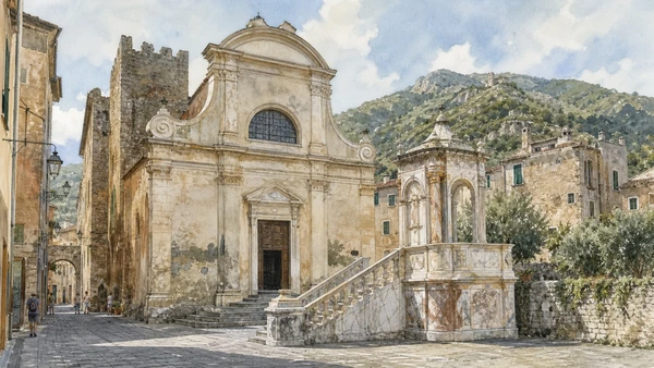
A large church and ornate interior occupy the civic centre without erasing older settlement lines.

San Biagio: Baroque church within medieval fabric

A large church and ornate interior occupy the civic centre without erasing older settlement lines. The site becomes clearer when its surviving fabric, later alterations and present use are read together.

Today

This is an active religious place as well as a historic building. Services, ceremonies and conservation can interrupt tourist access; dress appropriately, remain quiet and never treat a booked visit as priority over worship.

History

A medieval church was replaced and transformed in the seventeenth century; later decoration and restoration created the present layered interior.

How to read this place

Begin with unfinished façade. Then compare marble pulpit and balustrade with scale relative to surrounding lanes; the differences are evidence, not visual noise.

What to notice

  • unfinished façade
  • marble pulpit and balustrade
  • scale relative to surrounding lanes
Visit Finale Ligure · Official destination site
Original documentary watercolour of San Biagio: Baroque church within medieval fabric in Finalborgo and the Finalese · Liguria, showing accurate architecture, landscape, people and present-day use
San Biagio: Baroque church within medieval fabricOriginal Merlintravel documentary watercolour · 2026
03

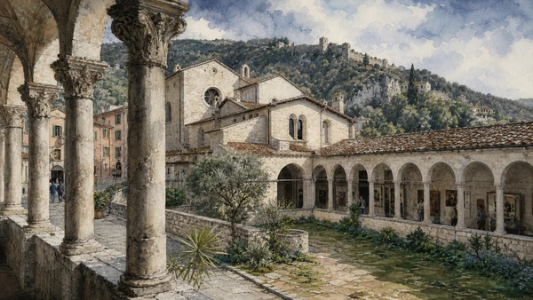
Two fifteenth-century cloisters now support museums, exhibitions and civic use inside the walled town.

Santa Caterina: convent, cloisters and cultural complex

Two fifteenth-century cloisters now support museums, exhibitions and civic use inside the walled town. The site becomes clearer when its surviving fabric, later alterations and present use are read together.

Today

Opening, ticketing, room access and temporary displays can change. Check the institution’s official notice shortly before visiting, use the designated entrance and allow for security or conservation controls.

History

Del Carretto patronage created a Dominican complex later adapted after suppression and modern restoration.

How to read this place

Begin with finale-stone columns. Then compare cloister sequence with museum and community uses sharing the complex; the differences are evidence, not visual noise.

What to notice

  • Finale-stone columns
  • cloister sequence
  • museum and community uses sharing the complex
Visit Finale Ligure · Official destination site
Original documentary watercolour of Santa Caterina: convent, cloisters and cultural complex in Finalborgo and the Finalese · Liguria, showing accurate architecture, landscape, people and present-day use
Santa Caterina: convent, cloisters and cultural complexOriginal Merlintravel documentary watercolour · 2026
04

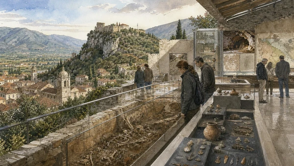
Collections connect Palaeolithic caves, Neolithic change, Roman roads and medieval power to sites across the Finalese.

Archaeological Museum: 350,000 years in territorial context

Collections connect Palaeolithic caves, Neolithic change, Roman roads and medieval power to sites across the Finalese. The site becomes clearer when its surviving fabric, later alterations and present use are read together.

Today

Opening, ticketing, room access and temporary displays can change. Check the institution’s official notice shortly before visiting, use the designated entrance and allow for security or conservation controls.

History

More than a century of research produced an exceptional sequence; displays must be read with excavation history and changing interpretation.

How to read this place

Begin with stratigraphic displays. Then compare arene candide burial context with maps linking objects to caves and routes; the differences are evidence, not visual noise.

What to notice

  • stratigraphic displays
  • Arene Candide burial context
  • maps linking objects to caves and routes
Archaeological Museum of Finale · Official site
Original documentary watercolour of Archaeological Museum: 350,000 years in territorial context in Finalborgo and the Finalese · Liguria, showing accurate architecture, landscape, people and present-day use
Archaeological Museum: 350,000 years in territorial contextOriginal Merlintravel documentary watercolour · 2026
05

Ruins, surviving tower and ridge settlement show territorial power beyond the town walls.

Castel Gavone and Perti: marquisate above the valley

Ruins, surviving tower and ridge settlement show territorial power beyond the town walls. The site becomes clearer when its surviving fabric, later alterations and present use are read together.

Today

Archaeological access may be limited to protected viewpoints, scheduled openings or guided routes. Stay outside barriers, distinguish original material from supports and reconstruction, and verify the official opening notice.

History

The Del Carretto castle was repeatedly altered and damaged as Genoa, Spain and local powers contested Finale.

How to read this place

Begin with surviving diamond-pattern tower. Then compare ruin phases with visual control of valleys and coast; the differences are evidence, not visual noise.

What to notice

  • surviving diamond-pattern tower
  • ruin phases
  • visual control of valleys and coast
Visit Finale Ligure · Official destination site
Original documentary watercolour of Castel Gavone and Perti: marquisate above the valley in Finalborgo and the Finalese · Liguria, showing accurate architecture, landscape, people and present-day use
Castel Gavone and Perti: marquisate above the valleyOriginal Merlintravel documentary watercolour · 2026
06

Stone bridges and road traces cross a karst valley used long before modern coastal transport.

Val Ponci: Roman bridges and Via Iulia Augusta

Stone bridges and road traces cross a karst valley used long before modern coastal transport. The site becomes clearer when its surviving fabric, later alterations and present use are read together.

Today

Archaeological access may be limited to protected viewpoints, scheduled openings or guided routes. Stay outside barriers, distinguish original material from supports and reconstruction, and verify the official opening notice.

History

Roman engineering carried the road through the Finalese; preservation varies and the route now overlaps hiking and rural land.

How to read this place

Begin with bridge arches and masonry. Then compare road alignment with watercourse and limestone setting; the differences are evidence, not visual noise.

What to notice

  • bridge arches and masonry
  • road alignment
  • watercourse and limestone setting
Ministry of Culture · Archaeological Museum of Finale
Original documentary watercolour of Val Ponci: Roman bridges and Via Iulia Augusta in Finalborgo and the Finalese · Liguria, showing accurate architecture, landscape, people and present-day use
Val Ponci: Roman bridges and Via Iulia AugustaOriginal Merlintravel documentary watercolour · 2026
07

One of Europe’s major prehistoric sites preserves deep deposits and a celebrated Upper Palaeolithic burial.

Arene Candide: cave archaeology and limits of access

One of Europe’s major prehistoric sites preserves deep deposits and a celebrated Upper Palaeolithic burial. The site becomes clearer when its surviving fabric, later alterations and present use are read together.

Today

Archaeological access may be limited to protected viewpoints, scheduled openings or guided routes. Stay outside barriers, distinguish original material from supports and reconstruction, and verify the official opening notice.

History

Excavation from the nineteenth century onward transformed knowledge of human occupation, but quarrying and research history also affected the site.

How to read this place

Begin with cave entrance from authorised ground. Then compare museum reconstruction of stratigraphy with quarry context around the site; the differences are evidence, not visual noise.

What to notice

  • cave entrance from authorised ground
  • museum reconstruction of stratigraphy
  • quarry context around the site
Archaeological Museum of Finale · Official site
Original documentary watercolour of Arene Candide: cave archaeology and limits of access in Finalborgo and the Finalese · Liguria, showing accurate architecture, landscape, people and present-day use
Arene Candide: cave archaeology and limits of accessOriginal Merlintravel documentary watercolour · 2026
08

Beach houses, narrow lanes, church remains and promontory paths reveal settlement between harbour and cultivated plateau.

Varigotti and Punta Crena: coastal village and defended headland

Beach houses, narrow lanes, church remains and promontory paths reveal settlement between harbour and cultivated plateau. The site becomes clearer when its surviving fabric, later alterations and present use are read together.

Today

The area is inhabited and worked, not staged for visitors. Keep doorways, pavements, cycle lanes and deliveries clear, ask before photographing people and use current municipal mobility information.

History

Roman and Byzantine connections, medieval defence and later fishing or resort use left distinct traces around the bay.

How to read this place

Begin with village depth behind beach façades. Then compare headland ruins with official path boundaries; the differences are evidence, not visual noise.

What to notice

  • village depth behind beach façades
  • headland ruins
  • official path boundaries
Visit Finale Ligure · Official destination site
Original documentary watercolour of Varigotti and Punta Crena: coastal village and defended headland in Finalborgo and the Finalese · Liguria, showing accurate architecture, landscape, people and present-day use
Varigotti and Punta Crena: coastal village and defended headlandOriginal Merlintravel documentary watercolour · 2026
09

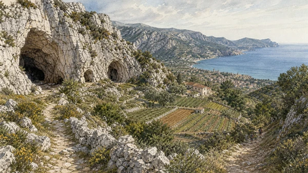
Woodland, cultivated clearings, paths and archaeological sites form a high landscape behind the shore.

Manie plateau: caves, farms and Mediterranean habitat

Woodland, cultivated clearings, paths and archaeological sites form a high landscape behind the shore. The site becomes clearer when its surviving fabric, later alterations and present use are read together.

Today

Weather, water levels, trail conditions and seasonal services can alter the route. Use official transport and park information, remain on authorised paths and do not enter farms, vineyards or private gardens without permission.

History

Karst geology supported long occupation and rural use; modern outdoor recreation adds pressure to farms and sensitive sites.

How to read this place

Begin with limestone and cave openings. Then compare active fields with signed routes compared with informal tracks; the differences are evidence, not visual noise.

What to notice

  • limestone and cave openings
  • active fields
  • signed routes compared with informal tracks
Visit Finale Ligure · Official destination site
Original documentary watercolour of Manie plateau: caves, farms and Mediterranean habitat in Finalborgo and the Finalese · Liguria, showing accurate architecture, landscape, people and present-day use
Manie plateau: caves, farms and Mediterranean habitatOriginal Merlintravel documentary watercolour · 2026
10

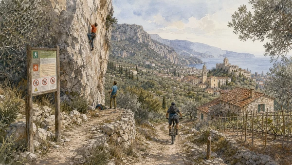
Crags and trails coexist with rescue systems, wildlife, villages and private land.

Finale outdoor landscape: climbing within a lived territory

Crags and trails coexist with rescue systems, wildlife, villages and private land. The site becomes clearer when its surviving fabric, later alterations and present use are read together.

Today

Weather, water levels, trail conditions and seasonal services can alter the route. Use official transport and park information, remain on authorised paths and do not enter farms, vineyards or private gardens without permission.

History

International climbing and mountain biking expanded from late twentieth-century local use, creating economic opportunity and conservation challenges.

How to read this place

Begin with official access signs. Then compare erosion at popular sectors with relationships among trail, farm and settlement; the differences are evidence, not visual noise.

What to notice

  • official access signs
  • erosion at popular sectors
  • relationships among trail, farm and settlement
Visit Finale Ligure · Official destination site
Original documentary watercolour of Finale outdoor landscape: climbing within a lived territory in Finalborgo and the Finalese · Liguria, showing accurate architecture, landscape, people and present-day use
Finale outdoor landscape: climbing within a lived territoryOriginal Merlintravel documentary watercolour · 2026

Liguria through time

A short chronology

From prehistoric caves and Roman roads to the maritime republic, railways, port industry, protected landscapes and climate-sensitive travel.

  1. Caves and open sites in western Liguria preserve exceptionally long evidence of human occupation and environmental change.

  2. Ligurian communities occupy coastal and inland territories connected to Etruscan, Greek and Celtic exchange networks.

  3. Roman conquest and road building integrate ports, plains and passes into wider Mediterranean and Po-basin systems.

  4. Albingaunum, Genua, Luna and smaller centres develop through harbours, agriculture, Christianity and regional roads.

  5. Byzantine, Lombard and Carolingian powers reorganise settlements, bishoprics, monasteries and coastal defence.

  6. Genoa grows as a maritime commune while castles, churches and village territories consolidate along both Rivieras.

  7. Commercial expansion, crusading routes, colonies and banking enrich Genoa while factional conflict reshapes its government.

  8. Doge government, foreign interventions and powerful families contest control of the republic and its maritime system.

  9. The aristocratic Republic of Genoa develops the Rolli palace system, finance, naval infrastructure and territorial fortifications.

  10. Coastal defence, olive and wine landscapes, ports and inland routes continue to connect specialised local economies.

  11. French and Napoleonic rule ends the old republic before Liguria is incorporated into the Kingdom of Sardinia.

  12. Roads, railways, port works and unification transform mobility; the Genoa–La Spezia railway changes the eastern coast.

  13. Industry, emigration, resort culture, naval bases, war and resistance create sharply different modern landscapes.

  14. Port expansion, reconstruction, mass tourism, motorway infrastructure and deindustrialisation alter coast and cities.

  15. UNESCO recognition, park management, climate risk and overtourism intensify the need to maintain terraces, paths and living communities.

Before your visit

Practical information

01

Check the live page

Opening hours, reservation systems, restoration, exhibitions and transport can change. Recheck the linked official institution shortly before departure.

02

Separate worship and tourism

Churches and sanctuaries remain religious spaces. Services, funerals and community use take priority over visitor itineraries.

03

Plan real distances

Finalborgo and the Finalese · Liguria combines dense urban routes with lakes, valleys and dispersed towns. Do not compress distant chapters into an unsafe or superficial day.

04

Keep thresholds open

Arcades, station halls, markets, courtyards, workshops and residential streets must continue to function while you observe or photograph them.

05

Use current mobility data

Check the responsible rail, navigation, bus, road or park operator on the day; replacement services and weather can change an otherwise sound route.

06

Read change honestly

Restoration, reconstruction, adaptive reuse and new development have all shaped the landscape visible today.

Method and sources

Sources and image credits

This guide uses official museum, ministry, municipal, transport, park and UNESCO documentation checked on 31 August 2026. It separates durable historical interpretation from access details that can change, distinguishes surviving fabric from restoration or reconstruction, and treats worship, port work, residence, farming, fishing and public movement as part of the evidence. Every chapter links its principal institutional source; tickets, closures, weather, sea conditions, trails and transport must always be verified again on the day of the visit.

All ten images are original Merlintravel editorial watercolours based on documented present-day conditions. They are illustrations, not substitutes for archaeological plans. Opening hours, tickets, accessible routes, temporary exhibitions and conservation work can change; consult the linked official pages shortly before visiting.