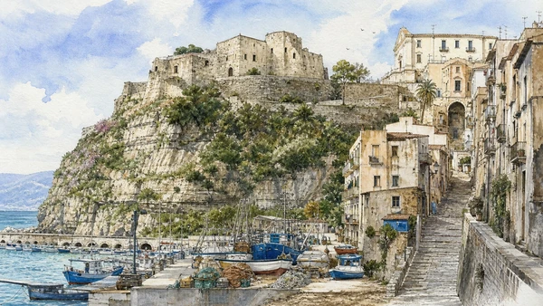
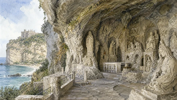
Original documentary watercolour panorama for Tropea and the Costa degli Dei: Complete Guide, with accurate Calabrian architecture, landscape and lived context

Calabria Guide 03 · Cliff town, Norman church, cultivated coast, rock settlements, archaeology, Tyrrhenian ports and inhabited promontories

Tropea above
the Tyrrhenian

A three-day route that moves beyond the belvedere to churches, farms, coastal geology, Vibo’s collections, Mileto’s Norman memory and Pizzo’s working waterfront.

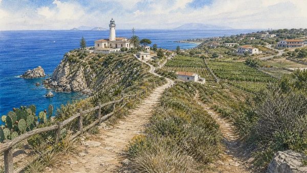
Plan the route
Tropea and the Costa degli Dei · Calabria10 chapters · one complete route

Why this route must be read in layers

The Costa degli Dei is an inhabited agricultural and historical landscape before it is a chain of famous beaches.

Tropea’s old town occupies a cliff whose geology, drainage and building maintenance are inseparable from the view. Churches, noble houses and lanes belong to a living settlement under heavy seasonal pressure.

Ricadi and Capo Vaticano combine farming, villages, railway stops and exposed coastal paths. Access to coves and viewpoints changes with weather, erosion and private property; a map image never guarantees a safe path.

The circuit continues inland and north because Vibo Valentia, Zungri, Mileto and Pizzo explain archaeological collections, Norman institutions, post-earthquake change and maritime life omitted by a beach-only itinerary.

Divide the route across at least three days: Tropea on foot, Ricadi and Zungri as a separate circuit, then Vibo, Mileto and Pizzo with realistic road time.

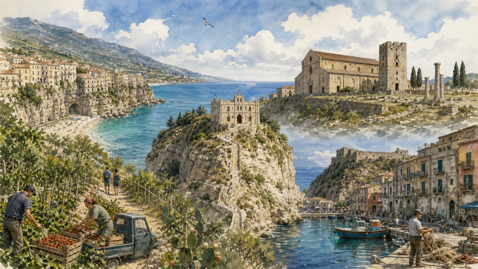
The route

Plan your visit

Read Tropea from cathedral to shore, continue through the cultivated promontory, then move inland to rock settlement and museums before closing at Pizzo’s waterfront.

Early morning

Tropea old town · Santa Maria dell’Isola · Tropea’s cliff

Move in the documented order: Tropea old town: cathedral, lanes and inhabited palaces; then Santa Maria dell’Isola: sanctuary on a changing rock; then Tropea’s cliff: urban geology and water management. Recheck live access and transport before entering a controlled site.

Late morning

Parghelia and Michelino · Capo Vaticano and Ricadi · Zungri rock settlement

Move in the documented order: Parghelia and Michelino: coves beneath cultivated slopes; then Capo Vaticano and Ricadi: headland, farms and exposed paths; then Zungri rock settlement: excavated rooms and a rural museum. Recheck live access and transport before entering a controlled site.

Afternoon

Vibo Valentia · Mileto · Pizzo

Move in the documented order: Vibo Valentia: castle and the Vito Capialbi Museum; then Mileto: Norman institutions and a town rebuilt elsewhere; then Pizzo: castle, lanes and working marina. Recheck live access and transport before entering a controlled site.

Late afternoon

Piedigrotta

Move in the documented order: Piedigrotta: devotion and sculpture inside coastal rock. Recheck live access and transport before entering a controlled site.

Ten chapters

Explore the places

The order follows terrain, institutions and present-day movement. Use the index to return to a chapter without reducing the route to isolated monuments.

  1. 01Tropea old town: cathedral, lanes and inhabited palaces
  2. 02Santa Maria dell’Isola: sanctuary on a changing rock
  3. 03Tropea’s cliff: urban geology and water management
  4. 04Parghelia and Michelino: coves beneath cultivated slopes
  5. 05Capo Vaticano and Ricadi: headland, farms and exposed paths
  6. 06Zungri rock settlement: excavated rooms and a rural museum
  7. 07Vibo Valentia: castle and the Vito Capialbi Museum
  8. 08Mileto: Norman institutions and a town rebuilt elsewhere
  9. 09Pizzo: castle, lanes and working marina
  10. 10Piedigrotta: devotion and sculpture inside coastal rock
01

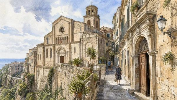
Norman church fabric, later rebuilding, noble façades and everyday commerce occupy a compact plateau above the sea.

Tropea old town: cathedral, lanes and inhabited palaces

Norman church fabric, later rebuilding, noble façades and everyday commerce occupy a compact plateau above the sea. The site becomes clearer when its surviving fabric, later alterations and present use are read together.

Today

The area is inhabited and worked, not staged for visitors. Keep doorways, pavements, cycle lanes and deliveries clear, ask before photographing people and use current municipal mobility information.

History

The town developed through medieval and early-modern phases; earthquakes and repeated repairs changed many buildings without erasing the older street pattern.

How to read this place

Begin with cathedral masonry and later additions. Then compare narrow lanes and palace portals with resident movement through visitor-heavy streets; the differences are evidence, not visual noise.

What to notice

  • cathedral masonry and later additions
  • narrow lanes and palace portals
  • resident movement through visitor-heavy streets
Regione Calabria · Tropea
Original documentary watercolour of Tropea old town: cathedral, lanes and inhabited palaces in Tropea and the Costa degli Dei · Calabria, showing accurate architecture, landscape, people and present-day use
Tropea old town: cathedral, lanes and inhabited palacesOriginal Merlintravel documentary watercolour · 2026
02

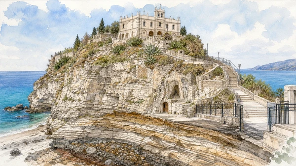
Church, gardens, stairs and the eroding coastal pedestal create a landmark whose conservation and access are active processes.

Santa Maria dell’Isola: sanctuary on a changing rock

Church, gardens, stairs and the eroding coastal pedestal create a landmark whose conservation and access are active processes. The site becomes clearer when its surviving fabric, later alterations and present use are read together.

Today

This is an active religious place as well as a historic building. Services, ceremonies and conservation can interrupt tourist access; dress appropriately, remain quiet and never treat a booked visit as priority over worship.

History

Religious use and successive rebuilding produced the present complex; the famous silhouette does not represent one untouched medieval phase.

How to read this place

Begin with rock geology beneath the sanctuary. Then compare church and garden terraces with stairs, barriers and current access arrangements; the differences are evidence, not visual noise.

What to notice

  • rock geology beneath the sanctuary
  • church and garden terraces
  • stairs, barriers and current access arrangements
Regione Calabria · Tropea
Original documentary watercolour of Santa Maria dell'Isola: sanctuary on a changing rock in Tropea and the Costa degli Dei · Calabria, showing accurate architecture, landscape, people and present-day use
Santa Maria dell’Isola: sanctuary on a changing rockOriginal Merlintravel documentary watercolour · 2026
03

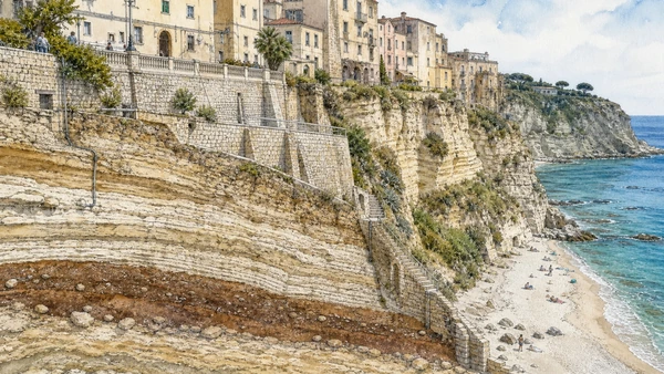
Belvederes reveal how buildings, drainage, paths and beach access depend on a fragile vertical edge.

Tropea’s cliff: urban geology and water management

Belvederes reveal how buildings, drainage, paths and beach access depend on a fragile vertical edge. The site becomes clearer when its surviving fabric, later alterations and present use are read together.

Today

Weather, water levels, trail conditions and seasonal services can alter the route. Use official transport and park information, remain on authorised paths and do not enter farms, vineyards or private gardens without permission.

History

Settlement exploited a defensible plateau, but erosion, earthquakes and modern infrastructure repeatedly altered the relationship between town and shore.

How to read this place

Begin with rock layers below the buildings. Then compare drainage and retaining structures with public viewpoints compared with restricted edges; the differences are evidence, not visual noise.

What to notice

  • rock layers below the buildings
  • drainage and retaining structures
  • public viewpoints compared with restricted edges
Regione Calabria · Tropea
Original documentary watercolour of Tropea's cliff: urban geology and water management in Tropea and the Costa degli Dei · Calabria, showing accurate architecture, landscape, people and present-day use
Tropea’s cliff: urban geology and water managementOriginal Merlintravel documentary watercolour · 2026
04

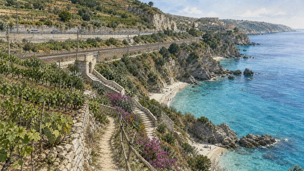
Beach access, rail corridor, small settlements and fields show a coast structured by more than resort frontage.

Parghelia and Michelino: coves beneath cultivated slopes

Beach access, rail corridor, small settlements and fields show a coast structured by more than resort frontage. The site becomes clearer when its surviving fabric, later alterations and present use are read together.

Today

Weather, water levels, trail conditions and seasonal services can alter the route. Use official transport and park information, remain on authorised paths and do not enter farms, vineyards or private gardens without permission.

History

Agriculture and local paths long preceded mass tourism; later rail, road and accommodation development concentrated pressure on limited coastal ground.

How to read this place

Begin with cultivated land above the coves. Then compare formal stairs and safe access points with rail and road lines behind the shore; the differences are evidence, not visual noise.

What to notice

  • cultivated land above the coves
  • formal stairs and safe access points
  • rail and road lines behind the shore
Regione Calabria · Official tourism
Original documentary watercolour of Parghelia and Michelino: coves beneath cultivated slopes in Tropea and the Costa degli Dei · Calabria, showing accurate architecture, landscape, people and present-day use
Parghelia and Michelino: coves beneath cultivated slopesOriginal Merlintravel documentary watercolour · 2026
05

Granite cliffs, viewpoints, villages and onion-growing landscapes occupy one promontory with uneven access.

Capo Vaticano and Ricadi: headland, farms and exposed paths

Granite cliffs, viewpoints, villages and onion-growing landscapes occupy one promontory with uneven access. The site becomes clearer when its surviving fabric, later alterations and present use are read together.

Today

Weather, water levels, trail conditions and seasonal services can alter the route. Use official transport and park information, remain on authorised paths and do not enter farms, vineyards or private gardens without permission.

History

Coastal farming and scattered settlements adapted to thin soils and maritime exposure; tourism introduced new roads and buildings without replacing agricultural use.

How to read this place

Begin with headland geology and offshore view. Then compare fields and village fabric with authorised paths compared with unstable shortcuts; the differences are evidence, not visual noise.

What to notice

  • headland geology and offshore view
  • fields and village fabric
  • authorised paths compared with unstable shortcuts
Regione Calabria · Official tourism
Original documentary watercolour of Capo Vaticano and Ricadi: headland, farms and exposed paths in Tropea and the Costa degli Dei · Calabria, showing accurate architecture, landscape, people and present-day use
Capo Vaticano and Ricadi: headland, farms and exposed pathsOriginal Merlintravel documentary watercolour · 2026
06

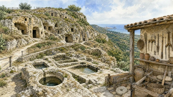
Rock-cut spaces, water systems and collections require careful separation between evidence, hypothesis and later reuse.

Zungri rock settlement: excavated rooms and a rural museum

Rock-cut spaces, water systems and collections require careful separation between evidence, hypothesis and later reuse. The site becomes clearer when its surviving fabric, later alterations and present use are read together.

Today

Archaeological access may be limited to protected viewpoints, scheduled openings or guided routes. Stay outside barriers, distinguish original material from supports and reconstruction, and verify the official opening notice.

History

The settlement’s chronology and function remain subjects of study; interpretation connects medieval occupation and pastoral life without presenting every cavity as one simultaneous village.

How to read this place

Begin with cutting marks and room connections. Then compare water collection systems with museum objects linked to rural practice; the differences are evidence, not visual noise.

What to notice

  • cutting marks and room connections
  • water collection systems
  • museum objects linked to rural practice
Regione Calabria · Official tourism
Original documentary watercolour of Zungri rock settlement: excavated rooms and a rural museum in Tropea and the Costa degli Dei · Calabria, showing accurate architecture, landscape, people and present-day use
Zungri rock settlement: excavated rooms and a rural museumOriginal Merlintravel documentary watercolour · 2026
07

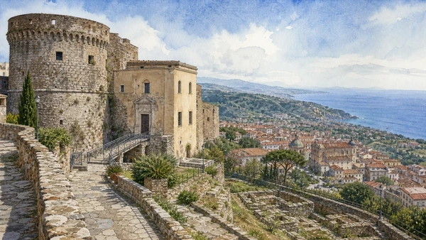
The Norman-Swabian castle houses archaeology from Hipponion, Roman Valentia and the surrounding territory.

Vibo Valentia: castle and the Vito Capialbi Museum

The Norman-Swabian castle houses archaeology from Hipponion, Roman Valentia and the surrounding territory. The site becomes clearer when its surviving fabric, later alterations and present use are read together.

Today

Opening, ticketing, room access and temporary displays can change. Check the institution’s official notice shortly before visiting, use the designated entrance and allow for security or conservation controls.

History

A Greek city, Roman colony, medieval stronghold and later provincial centre occupied related but changing sites; museum collections preserve those differences.

How to read this place

Begin with castle fabric and later alterations. Then compare objects grouped by excavated context with the view over the tyrrhenian landscape; the differences are evidence, not visual noise.

What to notice

  • castle fabric and later alterations
  • objects grouped by excavated context
  • the view over the Tyrrhenian landscape
Ministero della Cultura · Museo archeologico nazionale Vito Capialbi
Original documentary watercolour of Vibo Valentia: castle and the Vito Capialbi Museum in Tropea and the Costa degli Dei · Calabria, showing accurate architecture, landscape, people and present-day use
Vibo Valentia: castle and the Vito Capialbi MuseumOriginal Merlintravel documentary watercolour · 2026
08

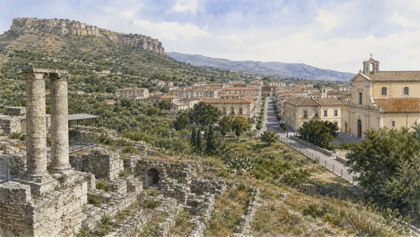
Museum collections and cathedral memory explain a powerful Norman centre destroyed and relocated after the 1783 earthquakes.

Mileto: Norman institutions and a town rebuilt elsewhere

Museum collections and cathedral memory explain a powerful Norman centre destroyed and relocated after the 1783 earthquakes. The site becomes clearer when its surviving fabric, later alterations and present use are read together.

Today

Opening, ticketing, room access and temporary displays can change. Check the institution’s official notice shortly before visiting, use the designated entrance and allow for security or conservation controls.

History

Roger I made Mileto an important political and ecclesiastical centre; the old settlement’s destruction and the planned new town created two distinct landscapes.

How to read this place

Begin with objects from the norman complex. Then compare archaeological remains of old mileto with the grid and institutions of the relocated town; the differences are evidence, not visual noise.

What to notice

  • objects from the Norman complex
  • archaeological remains of old Mileto
  • the grid and institutions of the relocated town
MArRC · Magna Graecia and Middle Ages institutional itinerary
Original documentary watercolour of Mileto: Norman institutions and a town rebuilt elsewhere in Tropea and the Costa degli Dei · Calabria, showing accurate architecture, landscape, people and present-day use
Mileto: Norman institutions and a town rebuilt elsewhereOriginal Merlintravel documentary watercolour · 2026
09

The Murat Castle, old town, tuna traditions and shore connect political memory with maritime labour.

Pizzo: castle, lanes and working marina

The Murat Castle, old town, tuna traditions and shore connect political memory with maritime labour. The site becomes clearer when its surviving fabric, later alterations and present use are read together.

Today

The area is inhabited and worked, not staged for visitors. Keep doorways, pavements, cycle lanes and deliveries clear, ask before photographing people and use current municipal mobility information.

History

The fortified coastal centre accumulated medieval and early-modern fabric; Joachim Murat’s imprisonment and execution in 1815 became one later layer of its public history.

How to read this place

Begin with castle position above the shore. Then compare lanes descending from the main square with boats and commercial use at the marina; the differences are evidence, not visual noise.

What to notice

  • castle position above the shore
  • lanes descending from the main square
  • boats and commercial use at the marina
Regione Calabria · Official tourism
Original documentary watercolour of Pizzo: castle, lanes and working marina in Tropea and the Costa degli Dei · Calabria, showing accurate architecture, landscape, people and present-day use
Pizzo: castle, lanes and working marinaOriginal Merlintravel documentary watercolour · 2026
10

A cave church filled with later carved figures combines local devotion, material decay and a heavily visited shoreline.

Piedigrotta: devotion and sculpture inside coastal rock

A cave church filled with later carved figures combines local devotion, material decay and a heavily visited shoreline. The site becomes clearer when its surviving fabric, later alterations and present use are read together.

Today

This is an active religious place as well as a historic building. Services, ceremonies and conservation can interrupt tourist access; dress appropriately, remain quiet and never treat a booked visit as priority over worship.

History

The sanctuary’s origin stories mix documentation and legend; much visible sculpture belongs to nineteenth- and twentieth-century interventions by local makers.

How to read this place

Begin with natural cave surfaces. Then compare different generations of carved figures with shore access and conservation limits; the differences are evidence, not visual noise.

What to notice

  • natural cave surfaces
  • different generations of carved figures
  • shore access and conservation limits
Regione Calabria · Official tourism
Original documentary watercolour of Piedigrotta: devotion and sculpture inside coastal rock in Tropea and the Costa degli Dei · Calabria, showing accurate architecture, landscape, people and present-day use
Piedigrotta: devotion and sculpture inside coastal rockOriginal Merlintravel documentary watercolour · 2026

Calabria through time

A short chronology

From Indigenous and Greek landscapes to Byzantine continuity, Norman institutions, earthquakes, migration, protected parks and contemporary cultural recovery.

  1. Caves, shelters and river valleys preserve evidence of long human occupation before permanent coastal cities.

  2. Indigenous Oenotrian landscapes encounter Greek settlement; Rhegion, Sybaris, Kroton and Locri develop as distinct poleis.

  3. Coastal cities establish sanctuaries, workshops, farms and exchange systems while maintaining different relations with inland communities.

  4. Bruttian power expands across the interior and contests Greek territories before Roman intervention.

  5. Roman roads, colonies, estates and ports reorganise older urban and rural systems across the peninsula.

  6. Byzantine administration, monastic networks and Greek liturgy remain especially influential in southern and Ionian Calabria.

  7. Norman conquest reshapes bishoprics, castles and monasteries while incorporating Greek and Latin institutions.

  8. Swabian, Angevin and Aragonese rule modifies fortifications, towns and routes; Albanian-speaking communities settle in several northern districts.

  9. Coastal towers and inland refuges respond to maritime raids while feudal estates and religious houses organise land and labour.

  10. A devastating earthquake sequence transforms settlements throughout central and southern Calabria and prompts new planning and reconstruction.

  11. French rule suppresses feudal institutions and many religious houses before Bourbon restoration.

  12. Italian unification is followed by administrative change, conflict over land and accelerating migration.

  13. The Messina Strait earthquake and tsunami destroy much of Reggio Calabria and neighbouring communities, shaping modern reconstruction.

  14. Land reform, roads, dams, tourism, internal migration and emigration transform cities, plateaux and both coastlines.

  15. National parks, archaeological networks, minority-language initiatives and cultural recovery operate alongside fire, erosion, depopulation and climate risk.

Before your visit

Practical information

01

Check the live page

Opening hours, reservation systems, restoration, exhibitions and transport can change. Recheck the linked official institution shortly before departure.

02

Separate worship and tourism

Churches and sanctuaries remain religious spaces. Services, funerals and community use take priority over visitor itineraries.

03

Plan real distances

Tropea and the Costa degli Dei · Calabria combines dense urban routes with lakes, valleys and dispersed towns. Do not compress distant chapters into an unsafe or superficial day.

04

Keep thresholds open

Arcades, station halls, markets, courtyards, workshops and residential streets must continue to function while you observe or photograph them.

05

Use current mobility data

Check the responsible rail, navigation, bus, road or park operator on the day; replacement services and weather can change an otherwise sound route.

06

Read change honestly

Restoration, reconstruction, adaptive reuse and new development have all shaped the landscape visible today.

Method and sources

Sources and image credits

This guide uses official museum, ministry, regional-tourism, park and UNESCO documentation checked on 1 September 2026. It separates Greek, Indigenous, Roman, Byzantine and later phases instead of using Magna Graecia as a generic label, distinguishes surviving fabric from post-earthquake reconstruction, and treats worship, minority languages, farming, fishing, residence and public movement as part of the evidence. Every chapter links its principal institutional source; tickets, closures, weather, fire risk, sea conditions, trails and transport must always be verified again on the day of the visit.

All ten images are original Merlintravel editorial watercolours based on documented present-day conditions. They are illustrations, not substitutes for archaeological plans. Opening hours, tickets, accessible routes, temporary exhibitions and conservation work can change; consult the linked official pages shortly before visiting.