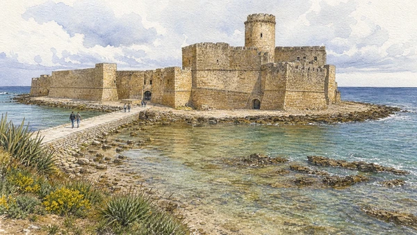
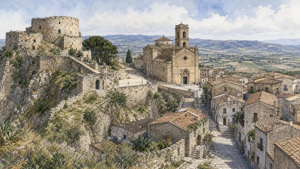
Original documentary watercolour panorama for Crotone and Capo Colonna: Complete Guide, with accurate Calabrian architecture, landscape and lived context

Calabria Guide 07 · Kroton, museum collections, urban archaeology, Hera sanctuary, marine reserve, fortified coast and inland hill town

Kroton and
Hera’s headland

A three-day route from the modern city and its fragmentary ancient ground to Capo Colonna, protected marine landscapes, Le Castella and Santa Severina.

Plan the route
Crotone and Capo Colonna · Calabria10 chapters · one complete route

Why this route must be read in layers

Crotone’s ancient fame survives through museums, excavation and a wider territory, not through an intact classical city centre.

The National Archaeological Museum and urban finds establish the sequence from Indigenous contacts to Greek Kroton and later Roman settlement. Pythagorean associations require careful distinction between documented objects, later texts and civic memory.

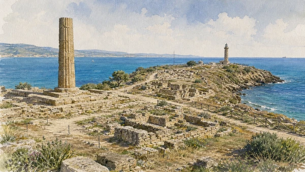
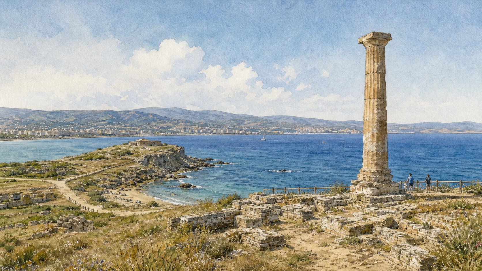
Capo Colonna preserves the extra-urban sanctuary of Hera Lacinia, Roman occupation, early-modern tower and later church within a protected coastal landscape. The single standing column is an entry point, not the whole site.

The route continues through the Capo Rizzuto marine area, Le Castella and Santa Severina to connect seafaring, fortification, ecology and inland power. Road distances and summer pressure demand separate days.

Give Crotone and its museum a full day, Capo Colonna another, and use a third for the marine area, Le Castella and Santa Severina rather than racing between coast and interior.

The route

Plan your visit

Begin with collections and the modern city, follow the archaeological evidence to Hera’s sanctuary, then extend the route through protected sea and fortified settlements.

Early morning

National Archaeological Museum of Crotone · Crotone old town and Charles V Castle · Crotone Cathedral and civic memory

Move in the documented order: National Archaeological Museum of Crotone: Kroton in context; then Crotone old town and Charles V Castle; then Crotone Cathedral and civic memory. Recheck live access and transport before entering a controlled site.

Late morning

Urban Kroton · Hera Lacinia sanctuary · Capo Colonna Museum

Move in the documented order: Urban Kroton: archaeology beneath a modern city; then Hera Lacinia sanctuary: the sacred landscape of Capo Colonna; then Capo Colonna Museum: architecture, offerings and underwater finds. Recheck live access and transport before entering a controlled site.

Afternoon

Torre Nao, church and Roman colony · Capo Rizzuto Marine Protected Area · Le Castella

Move in the documented order: Torre Nao, church and Roman colony: a layered promontory; then Capo Rizzuto Marine Protected Area: habitat and regulated use; then Le Castella: fortress between land and shallow sea. Recheck live access and transport before entering a controlled site.

Late afternoon

Santa Severina

Move in the documented order: Santa Severina: inland fortress and cathedral town. Recheck live access and transport before entering a controlled site.

Ten chapters

Explore the places

The order follows terrain, institutions and present-day movement. Use the index to return to a chapter without reducing the route to isolated monuments.

  1. 01National Archaeological Museum of Crotone: Kroton in context
  2. 02Crotone old town and Charles V Castle
  3. 03Crotone Cathedral and civic memory
  4. 04Urban Kroton: archaeology beneath a modern city
  5. 05Hera Lacinia sanctuary: the sacred landscape of Capo Colonna
  6. 06Capo Colonna Museum: architecture, offerings and underwater finds
  7. 07Torre Nao, church and Roman colony: a layered promontory
  8. 08Capo Rizzuto Marine Protected Area: habitat and regulated use
  9. 09Le Castella: fortress between land and shallow sea
  10. 10Santa Severina: inland fortress and cathedral town
01

Collections connect the Greek city to Indigenous communities, sanctuaries, burials and the wider Ionian territory.

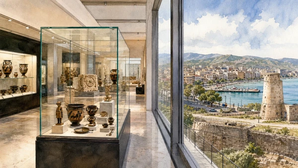
National Archaeological Museum of Crotone: Kroton in context

Collections connect the Greek city to Indigenous communities, sanctuaries, burials and the wider Ionian territory. The site becomes clearer when its surviving fabric, later alterations and present use are read together.

Today

Opening, ticketing, room access and temporary displays can change. Check the institution’s official notice shortly before visiting, use the designated entrance and allow for security or conservation controls.

History

The state museum developed from earlier civic collections and excavations; its displays distinguish urban Kroton, nearby settlements and recovered objects.

How to read this place

Begin with chronological sequence on the ground floor. Then compare sanctuary material and provenance with current opening notices before planning the visit; the differences are evidence, not visual noise.

What to notice

  • chronological sequence on the ground floor
  • sanctuary material and provenance
  • current opening notices before planning the visit
Ministero della Cultura · National Archaeological Museum of Crotone
Original documentary watercolour of National Archaeological Museum of Crotone: Kroton in context in Crotone and Capo Colonna · Calabria, showing accurate architecture, landscape, people and present-day use
National Archaeological Museum of Crotone: Kroton in contextOriginal Merlintravel documentary watercolour · 2026
02

Fortified walls, cathedral streets and later housing occupy the high ground above port and modern city.

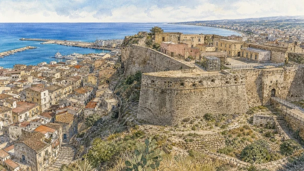
Crotone old town and Charles V Castle

Fortified walls, cathedral streets and later housing occupy the high ground above port and modern city. The site becomes clearer when its surviving fabric, later alterations and present use are read together.

Today

The area is inhabited and worked, not staged for visitors. Keep doorways, pavements, cycle lanes and deliveries clear, ask before photographing people and use current municipal mobility information.

History

Medieval fortification was transformed under Spanish rule; later military and civic uses altered the castle and surrounding quarters.

How to read this place

Begin with bastions and surviving walls. Then compare street fabric descending toward the port with later occupation within the fortified area; the differences are evidence, not visual noise.

What to notice

  • bastions and surviving walls
  • street fabric descending toward the port
  • later occupation within the fortified area
Regione Calabria · Official tourism
Original documentary watercolour of Crotone old town and Charles V Castle in Crotone and Capo Colonna · Calabria, showing accurate architecture, landscape, people and present-day use
Crotone old town and Charles V CastleOriginal Merlintravel documentary watercolour · 2026
03

The principal church and nearby streets preserve religious continuity through rebuilding and changing urban scale.

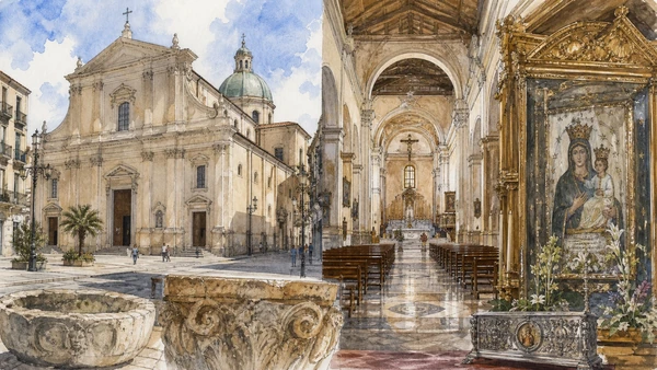
Crotone Cathedral and civic memory

The principal church and nearby streets preserve religious continuity through rebuilding and changing urban scale. The site becomes clearer when its surviving fabric, later alterations and present use are read together.

Today

This is an active religious place as well as a historic building. Services, ceremonies and conservation can interrupt tourist access; dress appropriately, remain quiet and never treat a booked visit as priority over worship.

History

Earlier sacred phases were repeatedly altered by earthquakes, repairs and modern expansion; the present building contains materials from different periods.

How to read this place

Begin with façade and basilican interior. Then compare older devotional objects with the church’s relation to commercial streets; the differences are evidence, not visual noise.

What to notice

  • façade and basilican interior
  • older devotional objects
  • the church’s relation to commercial streets
Regione Calabria · Official tourism
Original documentary watercolour of Crotone Cathedral and civic memory in Crotone and Capo Colonna · Calabria, showing accurate architecture, landscape, people and present-day use
Crotone Cathedral and civic memoryOriginal Merlintravel documentary watercolour · 2026
04

Scattered protected areas and museum evidence reconstruct a polis whose full plan is not visible in one place.

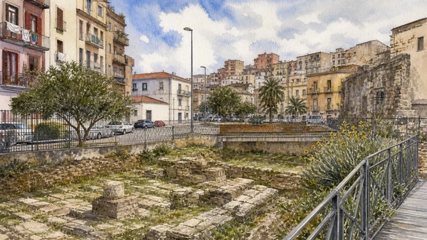
Urban Kroton: archaeology beneath a modern city

Scattered protected areas and museum evidence reconstruct a polis whose full plan is not visible in one place. The site becomes clearer when its surviving fabric, later alterations and present use are read together.

Today

Archaeological access may be limited to protected viewpoints, scheduled openings or guided routes. Stay outside barriers, distinguish original material from supports and reconstruction, and verify the official opening notice.

History

Greek streets, houses and public spaces were overlain by Roman and later settlement; modern urbanisation makes archaeological knowledge necessarily fragmentary.

How to read this place

Begin with excavated alignments where publicly visible. Then compare museum plans and objects with modern construction around protected traces; the differences are evidence, not visual noise.

What to notice

  • excavated alignments where publicly visible
  • museum plans and objects
  • modern construction around protected traces
Ministero della Cultura · National Archaeological Museum of Crotone
Original documentary watercolour of Urban Kroton: archaeology beneath a modern city in Crotone and Capo Colonna · Calabria, showing accurate architecture, landscape, people and present-day use
Urban Kroton: archaeology beneath a modern cityOriginal Merlintravel documentary watercolour · 2026
05

Temple foundations, one standing column, subsidiary buildings and the sea reveal the scale of an extra-urban sanctuary.

Hera Lacinia sanctuary: the sacred landscape of Capo Colonna

Temple foundations, one standing column, subsidiary buildings and the sea reveal the scale of an extra-urban sanctuary. The site becomes clearer when its surviving fabric, later alterations and present use are read together.

Today

Archaeological access may be limited to protected viewpoints, scheduled openings or guided routes. Stay outside barriers, distinguish original material from supports and reconstruction, and verify the official opening notice.

History

The sanctuary served Greek Kroton and later communities; the main Doric temple was built in the fifth century BCE and remained a major landmark across political change.

How to read this place

Begin with the stylobate and surviving column. Then compare banquet and hospitality buildings with the headland’s navigation role; the differences are evidence, not visual noise.

What to notice

  • the stylobate and surviving column
  • banquet and hospitality buildings
  • the headland’s navigation role
Ministero della Cultura · Capo Colonna Archaeological Park
Original documentary watercolour of Hera Lacinia sanctuary: the sacred landscape of Capo Colonna in Crotone and Capo Colonna · Calabria, showing accurate architecture, landscape, people and present-day use
Hera Lacinia sanctuary: the sacred landscape of Capo ColonnaOriginal Merlintravel documentary watercolour · 2026
06

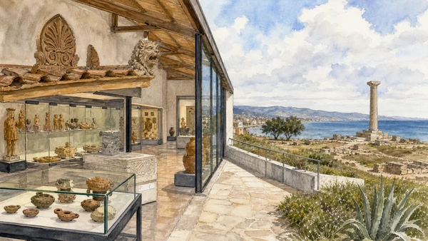
Displays reconnect objects to sanctuary buildings, Roman occupation and shipwreck material from the coast.

Capo Colonna Museum: architecture, offerings and underwater finds

Displays reconnect objects to sanctuary buildings, Roman occupation and shipwreck material from the coast. The site becomes clearer when its surviving fabric, later alterations and present use are read together.

Today

Opening, ticketing, room access and temporary displays can change. Check the institution’s official notice shortly before visiting, use the designated entrance and allow for security or conservation controls.

History

The museum opened in the twenty-first century and was renewed to improve access and interpretation; its collections extend beyond the iconic column.

How to read this place

Begin with reconstructed roof elements. Then compare votive material and documented context with underwater archaeology tied to local waters; the differences are evidence, not visual noise.

What to notice

  • reconstructed roof elements
  • votive material and documented context
  • underwater archaeology tied to local waters
Ministero della Cultura · Capo Colonna Archaeological Park
Original documentary watercolour of Capo Colonna Museum: architecture, offerings and underwater finds in Crotone and Capo Colonna · Calabria, showing accurate architecture, landscape, people and present-day use
Capo Colonna Museum: architecture, offerings and underwater findsOriginal Merlintravel documentary watercolour · 2026
07

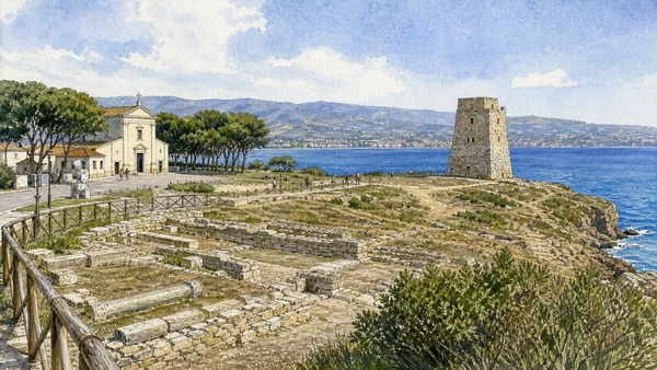
An early-modern watchtower and small church stand among remains of Roman Croto and later estates.

Torre Nao, church and Roman colony: a layered promontory

An early-modern watchtower and small church stand among remains of Roman Croto and later estates. The site becomes clearer when its surviving fabric, later alterations and present use are read together.

Today

The exterior can usually be read from public space, but events, works and crowd management may change circulation. Keep access routes open and verify any interior visit with the responsible institution.

History

Roman settlement occupied part of the sanctuary zone after the Greek period; coastal defence and devotional buildings added new uses in later centuries.

How to read this place

Begin with tower geometry and sea surveillance. Then compare church forecourt and pilgrimage use with roman walls beneath later landscape; the differences are evidence, not visual noise.

What to notice

  • tower geometry and sea surveillance
  • church forecourt and pilgrimage use
  • Roman walls beneath later landscape
Ministero della Cultura · Capo Colonna Archaeological Park
Original documentary watercolour of Torre Nao, church and Roman colony: a layered promontory in Crotone and Capo Colonna · Calabria, showing accurate architecture, landscape, people and present-day use
Torre Nao, church and Roman colony: a layered promontoryOriginal Merlintravel documentary watercolour · 2026
08

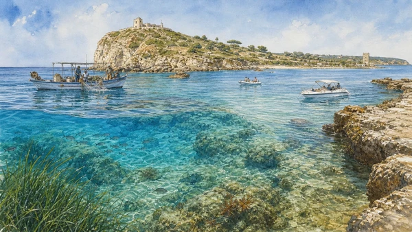
Rocky shore, seagrass, fishing, diving and boat traffic operate under zoning that must be checked before entering the water.

Capo Rizzuto Marine Protected Area: habitat and regulated use

Rocky shore, seagrass, fishing, diving and boat traffic operate under zoning that must be checked before entering the water. The site becomes clearer when its surviving fabric, later alterations and present use are read together.

Today

Weather, water levels, trail conditions and seasonal services can alter the route. Use official transport and park information, remain on authorised paths and do not enter farms, vineyards or private gardens without permission.

History

Marine protection responds to ecological value and human pressure; regulations vary by zone and season rather than applying as one simple ban.

How to read this place

Begin with official zone information. Then compare rocky coast and underwater habitat with working and visitor boats using the same waters; the differences are evidence, not visual noise.

What to notice

  • official zone information
  • rocky coast and underwater habitat
  • working and visitor boats using the same waters
Regione Calabria · Official tourism
Original documentary watercolour of Capo Rizzuto Marine Protected Area: habitat and regulated use in Crotone and Capo Colonna · Calabria, showing accurate architecture, landscape, people and present-day use
Capo Rizzuto Marine Protected Area: habitat and regulated useOriginal Merlintravel documentary watercolour · 2026
09

The fortified complex, harbour and modern resort settlement show changing defence and coastal use.

Le Castella: fortress between land and shallow sea

The fortified complex, harbour and modern resort settlement show changing defence and coastal use. The site becomes clearer when its surviving fabric, later alterations and present use are read together.

Today

The exterior can usually be read from public space, but events, works and crowd management may change circulation. Keep access routes open and verify any interior visit with the responsible institution.

History

Successive medieval and early-modern works transformed an older strategic site; the visible fortress is not a single construction phase.

How to read this place

Begin with causeway and water level. Then compare towers and wall campaigns with harbour and visitor circulation around the monument; the differences are evidence, not visual noise.

What to notice

  • causeway and water level
  • towers and wall campaigns
  • harbour and visitor circulation around the monument
Ministero della Cultura · National museums in Calabria
Original documentary watercolour of Le Castella: fortress between land and shallow sea in Crotone and Capo Colonna · Calabria, showing accurate architecture, landscape, people and present-day use
Le Castella: fortress between land and shallow seaOriginal Merlintravel documentary watercolour · 2026
10

Castle, baptistery, cathedral and dense hill settlement connect Byzantine, Norman and later authority above the Neto valley.

Santa Severina: inland fortress and cathedral town

Castle, baptistery, cathedral and dense hill settlement connect Byzantine, Norman and later authority above the Neto valley. The site becomes clearer when its surviving fabric, later alterations and present use are read together.

Today

The area is inhabited and worked, not staged for visitors. Keep doorways, pavements, cycle lanes and deliveries clear, ask before photographing people and use current municipal mobility information.

History

The town’s institutions developed through Byzantine and Latin phases; later fortification and restoration preserved a complex rather than a pure medieval snapshot.

How to read this place

Begin with hilltop command of the valley. Then compare castle and ecclesiastical precinct with inhabited streets linking the monuments; the differences are evidence, not visual noise.

What to notice

  • hilltop command of the valley
  • castle and ecclesiastical precinct
  • inhabited streets linking the monuments
Regione Calabria · Official tourism
Original documentary watercolour of Santa Severina: inland fortress and cathedral town in Crotone and Capo Colonna · Calabria, showing accurate architecture, landscape, people and present-day use
Santa Severina: inland fortress and cathedral townOriginal Merlintravel documentary watercolour · 2026

Calabria through time

A short chronology

From Indigenous and Greek landscapes to Byzantine continuity, Norman institutions, earthquakes, migration, protected parks and contemporary cultural recovery.

  1. Caves, shelters and river valleys preserve evidence of long human occupation before permanent coastal cities.

  2. Indigenous Oenotrian landscapes encounter Greek settlement; Rhegion, Sybaris, Kroton and Locri develop as distinct poleis.

  3. Coastal cities establish sanctuaries, workshops, farms and exchange systems while maintaining different relations with inland communities.

  4. Bruttian power expands across the interior and contests Greek territories before Roman intervention.

  5. Roman roads, colonies, estates and ports reorganise older urban and rural systems across the peninsula.

  6. Byzantine administration, monastic networks and Greek liturgy remain especially influential in southern and Ionian Calabria.

  7. Norman conquest reshapes bishoprics, castles and monasteries while incorporating Greek and Latin institutions.

  8. Swabian, Angevin and Aragonese rule modifies fortifications, towns and routes; Albanian-speaking communities settle in several northern districts.

  9. Coastal towers and inland refuges respond to maritime raids while feudal estates and religious houses organise land and labour.

  10. A devastating earthquake sequence transforms settlements throughout central and southern Calabria and prompts new planning and reconstruction.

  11. French rule suppresses feudal institutions and many religious houses before Bourbon restoration.

  12. Italian unification is followed by administrative change, conflict over land and accelerating migration.

  13. The Messina Strait earthquake and tsunami destroy much of Reggio Calabria and neighbouring communities, shaping modern reconstruction.

  14. Land reform, roads, dams, tourism, internal migration and emigration transform cities, plateaux and both coastlines.

  15. National parks, archaeological networks, minority-language initiatives and cultural recovery operate alongside fire, erosion, depopulation and climate risk.

Before your visit

Practical information

01

Check the live page

Opening hours, reservation systems, restoration, exhibitions and transport can change. Recheck the linked official institution shortly before departure.

02

Separate worship and tourism

Churches and sanctuaries remain religious spaces. Services, funerals and community use take priority over visitor itineraries.

03

Plan real distances

Crotone and Capo Colonna · Calabria combines dense urban routes with lakes, valleys and dispersed towns. Do not compress distant chapters into an unsafe or superficial day.

04

Keep thresholds open

Arcades, station halls, markets, courtyards, workshops and residential streets must continue to function while you observe or photograph them.

05

Use current mobility data

Check the responsible rail, navigation, bus, road or park operator on the day; replacement services and weather can change an otherwise sound route.

06

Read change honestly

Restoration, reconstruction, adaptive reuse and new development have all shaped the landscape visible today.

Method and sources

Sources and image credits

This guide uses official museum, ministry, regional-tourism, park and UNESCO documentation checked on 1 September 2026. It separates Greek, Indigenous, Roman, Byzantine and later phases instead of using Magna Graecia as a generic label, distinguishes surviving fabric from post-earthquake reconstruction, and treats worship, minority languages, farming, fishing, residence and public movement as part of the evidence. Every chapter links its principal institutional source; tickets, closures, weather, fire risk, sea conditions, trails and transport must always be verified again on the day of the visit.

All ten images are original Merlintravel editorial watercolours based on documented present-day conditions. They are illustrations, not substitutes for archaeological plans. Opening hours, tickets, accessible routes, temporary exhibitions and conservation work can change; consult the linked official pages shortly before visiting.