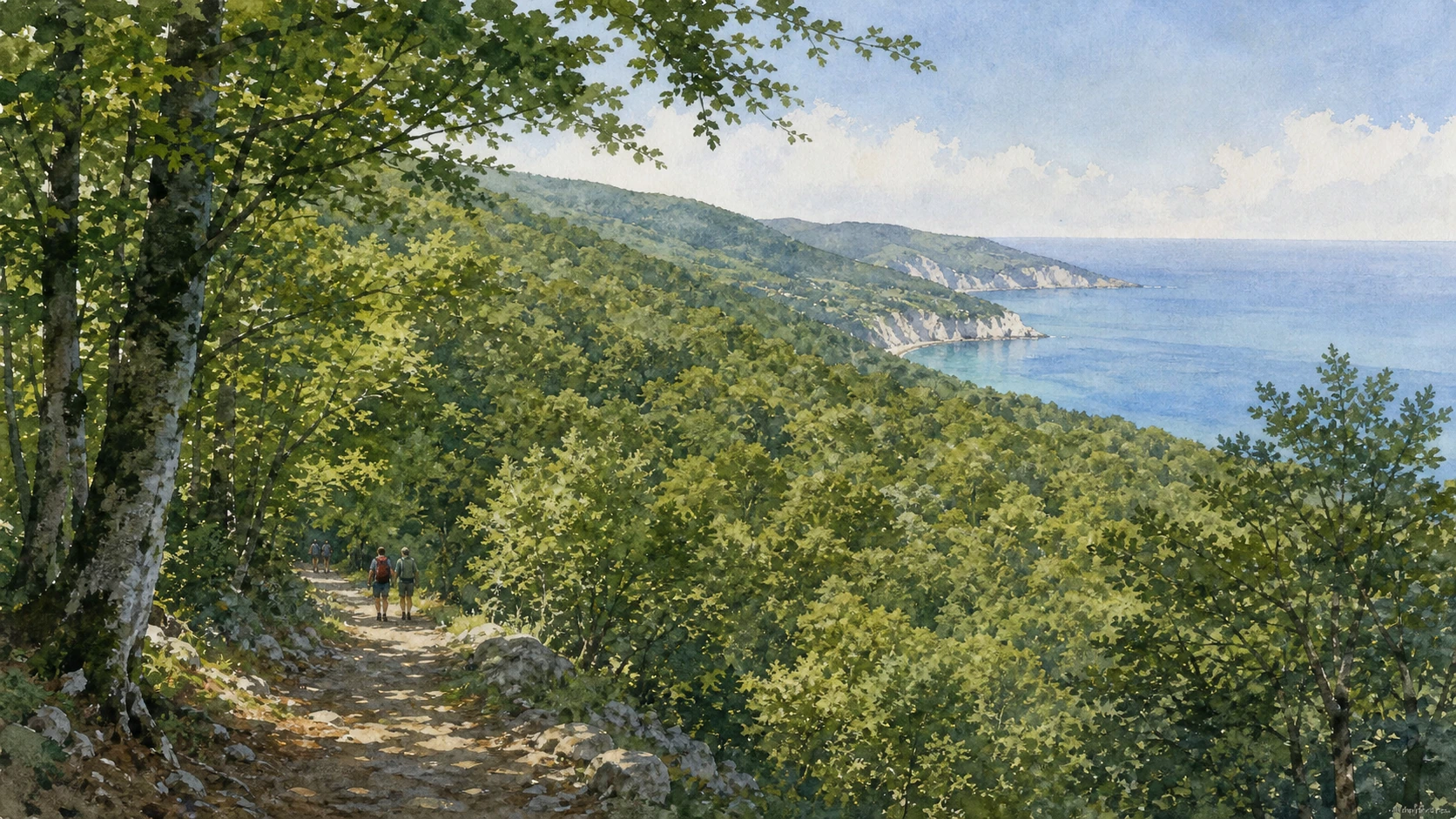
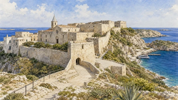
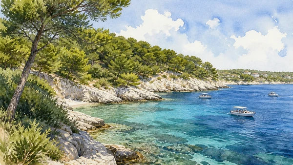
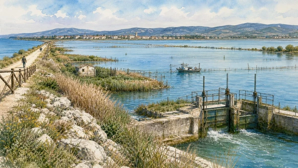
Original documentary watercolour panorama for Gargano and Tremiti Islands: Complete Guide, with accurate Puglian architecture, landscape and lived context

Puglia Guide 05 · Archaeology, architecture, working landscapes and contemporary access

The
spur holds forest and sea

A multi-day route through pilgrimage, beech forest, karst coast, lagoons, Daunian archaeology and an island marine reserve.

Plan the route
Gargano and Tremiti · Puglia10 chapters · one complete route

Why this route must be read in layers

Gargano is a mountain and forest peninsula as much as a beach destination, and the Tremiti are inhabited islands inside a protected sea.

The route begins with documented fabric and institutional collections rather than a list of photogenic surfaces. Each chapter separates what survives, what was rebuilt and what remains in use.

Puglia’s ports, pilgrimage sites, farms, forests, archaeological parks and inhabited centres operate under different access conditions. Current notices therefore belong to the route rather than an appendix.

Each chapter includes an illustration of the place described. The images are watercolours rather than photographs.

A multi-day route through pilgrimage, beech forest, karst coast, lagoons, Daunian archaeology and an island marine reserve.

The route

Plan your visit

A multi-day route through pilgrimage, beech forest, karst coast, lagoons, Daunian archaeology and an island marine reserve.

Early morning

Monte Sant’Angelo · Foresta Umbra · Vieste

Move in the documented order: Monte Sant’Angelo: the sanctuary and the sacred cave; then Foresta Umbra: ancient beech woods within the promontory; then Vieste: old town, harbour and limestone coast. Recheck live access and transport before entering a controlled site.

Late morning

Peschici · Mattinata and Monte Saraceno · Manfredonia Castle and the Daunian stelae

Move in the documented order: Peschici: cliff settlement and trabucchi coast; then Mattinata and Monte Saraceno: Daunian landscape above the sea; then Manfredonia Castle and the Daunian stelae. Recheck live access and transport before entering a controlled site.

Afternoon

Siponto · San Nicola in the Tremiti · San Domino and the marine reserve

Move in the documented order: Siponto: basilicas, archaeology and contemporary wire volume; then San Nicola in the Tremiti: abbey and fortified island; then San Domino and the marine reserve. Recheck live access and transport before entering a controlled site.

Late afternoon

Lesina and Varano

Move in the documented order: Lesina and Varano: lagoons, fishing and wetland change. Recheck live access and transport before entering a controlled site.

Ten chapters

Explore the places

The order follows terrain, institutions and present-day movement. Use the index to return to a chapter without reducing the route to isolated monuments.

  1. 01Monte Sant’Angelo: the sanctuary and the sacred cave
  2. 02Foresta Umbra: ancient beech woods within the promontory
  3. 03Vieste: old town, harbour and limestone coast
  4. 04Peschici: cliff settlement and trabucchi coast
  5. 05Mattinata and Monte Saraceno: Daunian landscape above the sea
  6. 06Manfredonia Castle and the Daunian stelae
  7. 07Siponto: basilicas, archaeology and contemporary wire volume
  8. 08San Nicola in the Tremiti: abbey and fortified island
  9. 09San Domino and the marine reserve
  10. 10Lesina and Varano: lagoons, fishing and wetland change
01

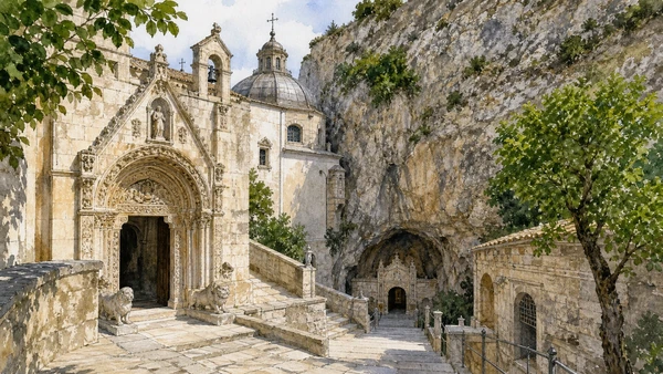
The sanctuary of Saint Michael joins a natural cave, medieval pilgrimage and a living hill town.

Monte Sant’Angelo: the sanctuary and the sacred cave

The sanctuary of Saint Michael joins a natural cave, medieval pilgrimage and a living hill town. The place becomes clearer when surviving fabric, later change and present use are read together.

Today

This is an active religious place. Services, ceremonies and conservation can interrupt tourist access; dress appropriately, remain quiet and verify the official notice.

History

The cult developed from late antiquity and the early Middle Ages; the sanctuary forms part of the UNESCO Longobards serial property.

How to read this place

Descend through the architectural approach to the cave, respecting worship; compare carved portals and later structures with the natural rock.

What to notice

  • the relationship between worship and visitor circulation
  • older fabric and later rebuilding
  • objects still used in liturgy
UNESCO · Longobards in Italy
Original documentary watercolour of Monte Sant'Angelo: the sanctuary and the sacred cave in Gargano and Tremiti · Puglia, showing accurate architecture, landscape and present-day use
Monte Sant’Angelo: the sanctuary and the sacred caveOriginal Merlintravel documentary watercolour · 2026
02

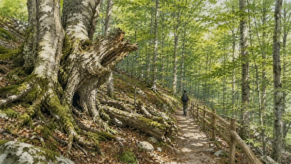
Dense beech, oak and yew woodland survives at unexpectedly low altitude inside the Gargano massif.

Foresta Umbra: ancient beech woods within the promontory

Dense beech, oak and yew woodland survives at unexpectedly low altitude inside the Gargano massif. The place becomes clearer when surviving fabric, later change and present use are read together.

Today

Weather, heat, fire risk, sea state and seasonal restrictions can alter access. Use official park or reserve information and remain on authorised routes.

History

Protected reserves and long management histories preserve habitats now recognised within the Ancient and Primeval Beech Forests UNESCO property.

How to read this place

Use marked trails and visitor-centre guidance; read forest structure, dead wood and changing altitude rather than expecting open mountain panoramas.

What to notice

  • geology and native vegetation
  • authorised paths and protected habitats
  • working land or water beside conservation zones
Ente Parco Nazionale del Gargano · Foresta Umbra
Original documentary watercolour of Foresta Umbra: ancient beech woods within the promontory in Gargano and Tremiti · Puglia, showing accurate architecture, landscape and present-day use
Foresta Umbra: ancient beech woods within the promontoryOriginal Merlintravel documentary watercolour · 2026
03

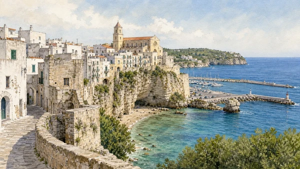
A compact white historic centre rises above working harbour, beaches and karst cliffs.

Vieste: old town, harbour and limestone coast

A compact white historic centre rises above working harbour, beaches and karst cliffs. The place becomes clearer when surviving fabric, later change and present use are read together.

Today

This is an inhabited place, not a visitor set. Keep doorways, pavements and deliveries clear, and use current municipal mobility information.

History

Medieval and early modern fabric accumulated around an older settlement exposed to Adriatic trade and attack.

How to read this place

Compare residential lanes, cathedral and defensive edges with the modern port and seasonal coastal economy.

What to notice

  • street width and building materials
  • residential use behind historic facades
  • later infrastructure and adaptation
Ente Parco Nazionale del Gargano
Original documentary watercolour of Vieste: old town, harbour and limestone coast in Gargano and Tremiti · Puglia, showing accurate architecture, landscape and present-day use
Vieste: old town, harbour and limestone coastOriginal Merlintravel documentary watercolour · 2026
04

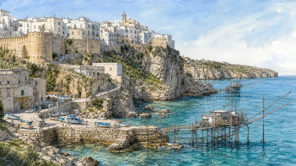
The town and nearby wooden fishing structures show different adaptations to a steep Adriatic shore.

Peschici: cliff settlement and trabucchi coast

The town and nearby wooden fishing structures show different adaptations to a steep Adriatic shore. The place becomes clearer when surviving fabric, later change and present use are read together.

Today

This is an inhabited place, not a visitor set. Keep doorways, pavements and deliveries clear, and use current municipal mobility information.

History

Fortified settlement, port activity and traditional fishing systems changed over centuries and now coexist with tourism.

How to read this place

Keep private trabucchi and working areas respected; read timber structures, cliff geology and modern access separately.

What to notice

  • street width and building materials
  • residential use behind historic facades
  • later infrastructure and adaptation
Ente Parco Nazionale del Gargano
Original documentary watercolour of Peschici: cliff settlement and trabucchi coast in Gargano and Tremiti · Puglia, showing accurate architecture, landscape and present-day use
Peschici: cliff settlement and trabucchi coastOriginal Merlintravel documentary watercolour · 2026
05

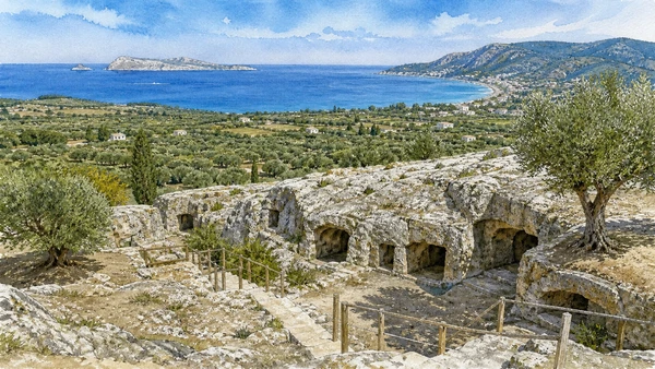
A modern town, olive plain and high necropolis occupy distinct levels between mountains and coast.

Mattinata and Monte Saraceno: Daunian landscape above the sea

A modern town, olive plain and high necropolis occupy distinct levels between mountains and coast. The place becomes clearer when surviving fabric, later change and present use are read together.

Today

Archaeological access can change because of conservation, excavation, weather or staffing. Stay outside barriers and verify the official opening notice.

History

The Monte Saraceno necropolis belongs to Daunian culture; later settlement and agriculture reorganised the surrounding slopes and plain.

How to read this place

Use authorised archaeological routes and distinguish excavated tombs from natural rock, contemporary olive land and coastal development.

What to notice

  • original masonry and later support work
  • the relation between excavation and modern surroundings
  • areas intentionally left unexcavated
Direzione regionale Musei Puglia · Mattinata
Original documentary watercolour of Mattinata and Monte Saraceno: Daunian landscape above the sea in Gargano and Tremiti · Puglia, showing accurate architecture, landscape and present-day use
Mattinata and Monte Saraceno: Daunian landscape above the seaOriginal Merlintravel documentary watercolour · 2026
06

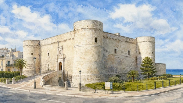
A coastal fortress houses archaeological collections centred on a distinctive corpus of carved Daunian stone.

Manfredonia Castle and the Daunian stelae

A coastal fortress houses archaeological collections centred on a distinctive corpus of carved Daunian stone. The place becomes clearer when surviving fabric, later change and present use are read together.

Today

Opening, ticketing, room access and temporary displays can change. Check the museum’s official notice shortly before visiting and allow for security or conservation controls.

History

The castle developed from the Swabian-Angevin foundation of Manfredonia and received later defensive changes; the museum interprets regional archaeology.

How to read this place

Compare the stelae as objects from documented territories with the fortress rooms now used to display them.

What to notice

  • the chronological order of the displays
  • finds tied to documented excavation contexts
  • modern conservation and interpretation
Direzione regionale Musei Puglia · Manfredonia
Original documentary watercolour of Manfredonia Castle and the Daunian stelae in Gargano and Tremiti · Puglia, showing accurate architecture, landscape and present-day use
Manfredonia Castle and the Daunian stelaeOriginal Merlintravel documentary watercolour · 2026
07

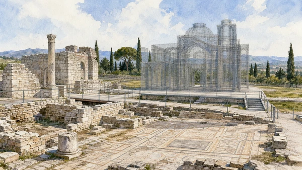
Early Christian remains stand beside a modern metal installation that marks the absent scale of a basilica without pretending to rebuild it.

Siponto: basilicas, archaeology and contemporary wire volume

Early Christian remains stand beside a modern metal installation that marks the absent scale of a basilica without pretending to rebuild it. The place becomes clearer when surviving fabric, later change and present use are read together.

Today

Archaeological access can change because of conservation, excavation, weather or staffing. Stay outside barriers and verify the official opening notice.

History

Roman and late antique Sipontum preceded medieval relocation toward Manfredonia; basilica phases and surrounding archaeology survive in the park.

How to read this place

Distinguish original masonry, conservation supports and Edoardo Tresoldi’s contemporary installation; the latter is interpretation, not reconstruction.

What to notice

  • original masonry and later support work
  • the relation between excavation and modern surroundings
  • areas intentionally left unexcavated
Direzione regionale Musei Puglia · Siponto
Original documentary watercolour of Siponto: basilicas, archaeology and contemporary wire volume in Gargano and Tremiti · Puglia, showing accurate architecture, landscape and present-day use
Siponto: basilicas, archaeology and contemporary wire volumeOriginal Merlintravel documentary watercolour · 2026
08

Walls, monastery and harbour occupy a small rocky island shaped by religion, defence, confinement and residence.

San Nicola in the Tremiti: abbey and fortified island

Walls, monastery and harbour occupy a small rocky island shaped by religion, defence, confinement and residence. The place becomes clearer when surviving fabric, later change and present use are read together.

Today

Interior routes, exhibitions and controlled areas can change. Check the managing institution, respect barriers and distinguish surviving fabric from restoration.

History

The abbey complex developed through medieval phases and later fortification; the archipelago also carries histories of exile and penal use.

How to read this place

Follow controlled paths through gates and terraces; keep the inhabited island and boat operations distinct from the monument.

What to notice

  • defensive geometry and controlled approaches
  • different masonry phases
  • present cultural or civic use
Ente Parco Nazionale del Gargano · Tremiti
Original documentary watercolour of San Nicola in the Tremiti: abbey and fortified island in Gargano and Tremiti · Puglia, showing accurate architecture, landscape and present-day use
San Nicola in the Tremiti: abbey and fortified islandOriginal Merlintravel documentary watercolour · 2026
09

Pine-covered slopes, coves and protected waters form the largest island’s lived and seasonal landscape.

San Domino and the marine reserve

Pine-covered slopes, coves and protected waters form the largest island’s lived and seasonal landscape. The place becomes clearer when surviving fabric, later change and present use are read together.

Today

Weather, heat, fire risk, sea state and seasonal restrictions can alter access. Use official park or reserve information and remain on authorised routes.

History

The marine reserve protects habitats around an archipelago long used for fishing, navigation, settlement and tourism.

How to read this place

Use authorised boats and moorings, avoid seagrass damage and distinguish marine protection from unrestricted resort access.

What to notice

  • geology and native vegetation
  • authorised paths and protected habitats
  • working land or water beside conservation zones
Ente Parco Nazionale del Gargano
Original documentary watercolour of San Domino and the marine reserve in Gargano and Tremiti · Puglia, showing accurate architecture, landscape and present-day use
San Domino and the marine reserveOriginal Merlintravel documentary watercolour · 2026
10

Shallow coastal waters, channels, fishing structures and bird habitat form a northern Gargano landscape unlike the cliff coast.

Lesina and Varano: lagoons, fishing and wetland change

Shallow coastal waters, channels, fishing structures and bird habitat form a northern Gargano landscape unlike the cliff coast. The place becomes clearer when surviving fabric, later change and present use are read together.

Today

Weather, heat, fire risk, sea state and seasonal restrictions can alter access. Use official park or reserve information and remain on authorised routes.

History

Sand barriers and human management shaped lagoon fisheries and settlements while water exchange and ecological conditions continue to change.

How to read this place

Observe from public paths and authorised facilities; notice working fisheries, reed margins and modern water-control infrastructure.

What to notice

  • geology and native vegetation
  • authorised paths and protected habitats
  • working land or water beside conservation zones
Ente Parco Nazionale del Gargano
Original documentary watercolour of Lesina and Varano: lagoons, fishing and wetland change in Gargano and Tremiti · Puglia, showing accurate architecture, landscape and present-day use
Lesina and Varano: lagoons, fishing and wetland changeOriginal Merlintravel documentary watercolour · 2026

Puglia through time

A short chronology

From Daunian, Peucetian and Messapian landscapes to Greek Taras, Roman roads, medieval ports, modern cities, protected parks and contemporary cultural recovery.

  1. Coastal landings, cave occupation and Bronze Age communities connect Adriatic, Ionian and inland routes.

  2. Daunian, Peucetian and Messapian societies develop distinct settlements, funerary customs and material cultures.

  3. Greek Taras expands on the Ionian coast while Indigenous centres negotiate trade and conflict across the region.

  4. Fortified towns, sanctuaries and rural systems change under pressure from Taranto, neighbouring peoples and Roman expansion.

  5. Roman colonies, estates, ports and the Via Appia and Via Traiana reorganise Apulia’s movement and production.

  6. Byzantine, Lombard and local powers contest a frontier shaped by ports, cave settlements, bishoprics and monastic networks.

  7. Norman rule, pilgrimage and maritime commerce support cathedrals, castles and new Latin institutions.

  8. Frederick II and his administration reshape castles, towns and royal landscapes across the region.

  9. Angevin and Aragonese power changes fortified towns, estates and relations with the Adriatic and Balkan coasts.

  10. The Ottoman capture of Otranto and its aftermath become a lasting element of Salento’s civic and religious memory.

  11. Coastal towers, masserie, olive estates and urban rebuilding respond to insecurity, trade and landholding systems.

  12. Feudal abolition, Bourbon reforms and Italian unification alter institutions without resolving rural inequality.

  13. Ports, railways, industry, war and migration transform cities while archaeology and heritage protection acquire new public roles.

  14. Land reform, industrial development, tourism and mass mobility reshape plains, coastlines and historic centres.

  15. UNESCO sites, national parks and museum networks expand while overtourism, industrial transition, olive disease and climate risk demand new care.

Before your visit

Practical information

01

Check the live page

Opening hours, reservations, restoration, worship and seasonal services can change. Recheck the linked institution shortly before departure.

02

Plan the long geography

Puglia is a long region. Do not compress distant cities, headlands and archaeological parks into an unsafe or superficial day.

03

Separate worship and tourism

Basilicas, cathedrals, sanctuaries and chapels remain religious places. Services and community use take priority.

04

Protect inhabited centres

Old towns, trulli districts, fishing quarters and working ports are not stage sets. Keep access, homes and deliveries clear.

05

Use current environmental notices

Heat, fire risk, sea state, coastal erosion, forest restrictions and protected habitats can alter a route at short notice.

06

Read reconstruction honestly

Restoration, adaptive reuse, modern infrastructure and contemporary art are part of the documented landscape, not defects to hide.

Method and sources

Sources and image credits

This guide uses official museum, ministry, municipal, park, UNESCO and regional-tourism documentation checked on 1 September 2026. It distinguishes Daunian, Peucetian, Messapian, Greek, Roman, Byzantine, Lombard, Norman, Swabian and later phases rather than treating Puglia as one timeless Mediterranean image. Every chapter links its principal institutional source; tickets, services, worship, closures, heat, fire risk, sea conditions and transport must always be verified again on the day of the visit.

All ten images are original Merlintravel editorial watercolours based on documented present-day conditions. They are illustrations, not substitutes for archaeological plans. Opening hours, tickets, accessible routes, temporary exhibitions and conservation work can change; consult the linked official pages shortly before visiting.