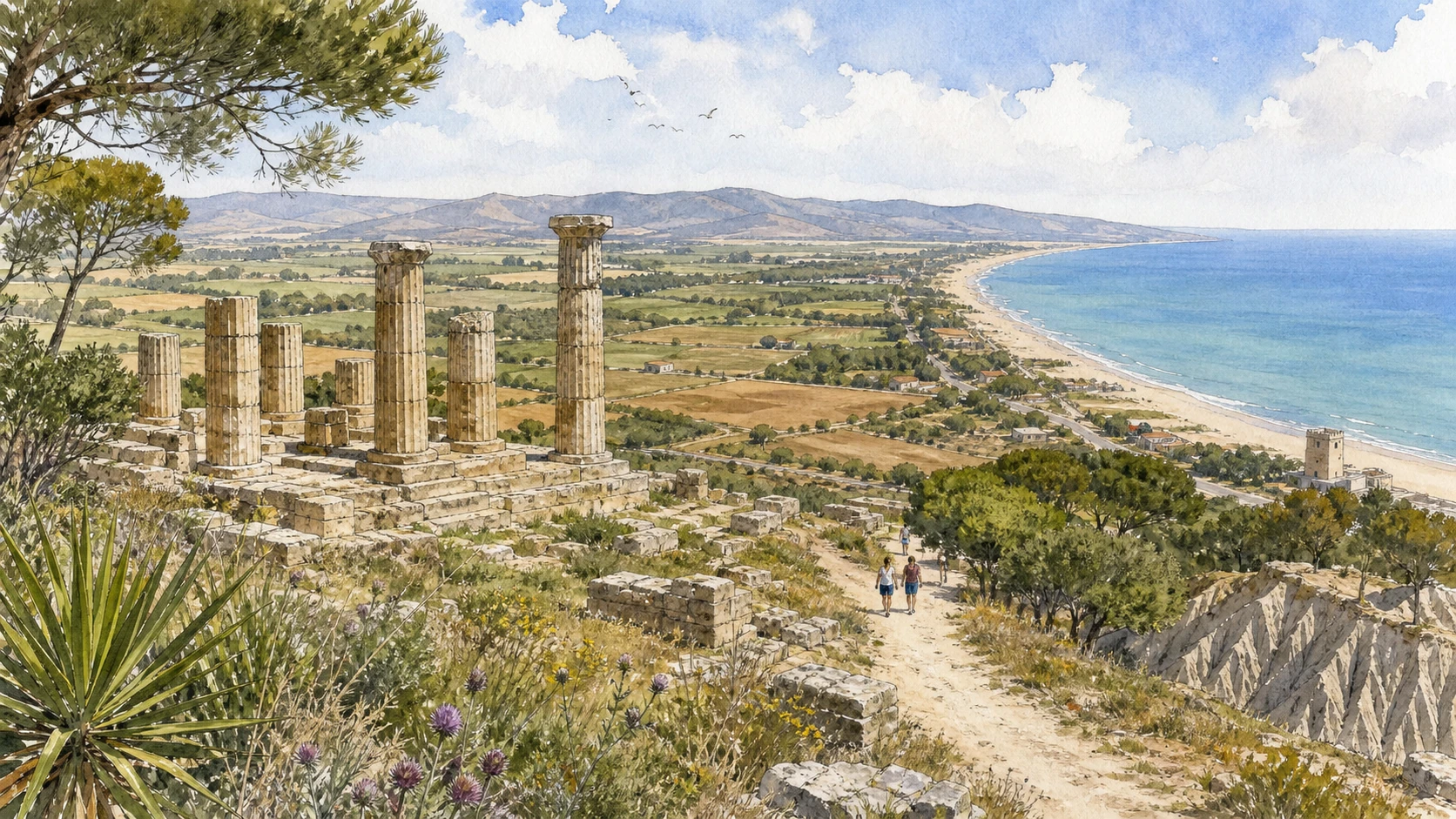
Original documentary watercolour panorama for Metaponto and the Ionian Coast: Complete Guide, with accurate Lucanian architecture, landscape and lived context

Basilicata Guide 05 · Archaeology, architecture, working landscapes and contemporary access

The
Ionian plain remembers many cities

A three-day route through Greek colonies, Indigenous landscapes, museums, temples, calanchi, hill towns, agricultural plains and protected coastal habitats.

Plan the route
Metaponto and the Ionian coast · Basilicata10 chapters · one complete route

Why this route must be read in layers

The Ionian coast is not a line of beaches behind isolated Greek ruins: rivers, colonial cities, Indigenous communities, farms, wetlands and inland clay hills form one territory.

The route begins with documented fabric and institutional collections rather than a list of photogenic surfaces. Each chapter separates what survives, what was rebuilt and what remains in use.

Basilicata’s ravines, archaeological parks, forests, villages, religious sites and two coastlines operate under different access conditions. Current notices therefore belong to the route rather than an appendix.

Each chapter includes an illustration of the place described. The images are watercolours rather than photographs.

A three-day route through Greek colonies, Indigenous landscapes, museums, temples, calanchi, hill towns, agricultural plains and protected coastal habitats.

The route

Plan your visit

A three-day route through Greek colonies, Indigenous landscapes, museums, temples, calanchi, hill towns, agricultural plains and protected coastal habitats.

Early morning

Metaponto Museum · Metaponto Archaeological Park · Tavole Palatine

Move in the documented order: Metaponto Museum: territory before the temple photograph; then Metaponto Archaeological Park: streets, sanctuaries and an agricultural city; then Tavole Palatine: surviving columns in a changed river plain. Recheck live access, weather and transport before entering a controlled place.

Late morning

Bernalda · Pisticci · Craco

Move in the documented order: Bernalda: a later hill town above ancient Metaponto; then Pisticci: white houses above unstable clay; then Craco: abandonment, safety and the limits of access. Recheck live access, weather and transport before entering a controlled place.

Afternoon

Museo della Siritide · Siris-Herakleia Archaeological Park · Tursi, the Rabatana and Anglona

Move in the documented order: Museo della Siritide: Indigenous and Greek worlds around Policoro; then Siris-Herakleia Archaeological Park: two cities and later fields; then Tursi, the Rabatana and Anglona. Recheck live access, weather and transport before entering a controlled place.

Late afternoon

Aliano and the calanchi

Move in the documented order: Aliano and the calanchi: political exile, literature and residence. Recheck live access, weather and transport before entering a controlled place.

Ten chapters

Explore the places

The order follows terrain, institutions and present-day movement. Use the index to return to a chapter without reducing the route to isolated monuments.

  1. 01Metaponto Museum: territory before the temple photograph
  2. 02Metaponto Archaeological Park: streets, sanctuaries and an agricultural city
  3. 03Tavole Palatine: surviving columns in a changed river plain
  4. 04Bernalda: a later hill town above ancient Metaponto
  5. 05Pisticci: white houses above unstable clay
  6. 06Craco: abandonment, safety and the limits of access
  7. 07Museo della Siritide: Indigenous and Greek worlds around Policoro
  8. 08Siris-Herakleia Archaeological Park: two cities and later fields
  9. 09Tursi, the Rabatana and Anglona
  10. 10Aliano and the calanchi: political exile, literature and residence
01

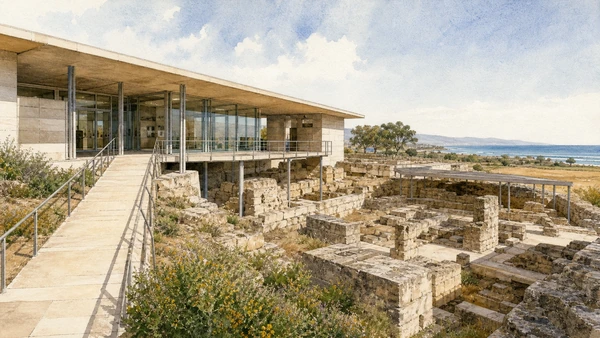
The national museum connects prehistoric communities, Greek colonisation, rural sanctuaries and later occupation across the Metapontine plain.

Metaponto Museum: territory before the temple photograph

The national museum connects prehistoric communities, Greek colonisation, rural sanctuaries and later occupation across the Metapontine plain. The place becomes clearer when surviving fabric, later change and present use are read together.

Today

Opening, ticketing, room access and temporary displays can change. Check the museum’s official notice shortly before visiting and allow for security or conservation controls.

History

Collections come from the city, cemeteries, sanctuaries and countryside, allowing archaeology to reconstruct systems rather than collect detached sculpture.

How to read this place

Follow provenance and chronology before visiting the outdoor sites, and verify which rooms or temporary exhibitions are open.

What to notice

  • the chronological order of the displays
  • finds tied to documented excavation contexts
  • modern conservation and interpretation
Ministero della Cultura · museums in Basilicata
Original documentary watercolour of Metaponto Museum: territory before the temple photograph in Metaponto and the Ionian coast · Basilicata, showing accurate architecture, landscape and present-day use
Metaponto Museum: territory before the temple photographOriginal Merlintravel documentary watercolour · 2026
02

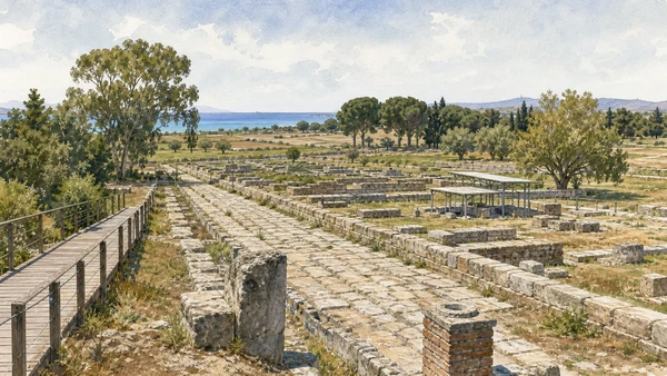
Foundations and public spaces expose only part of a planned Greek and later urban landscape embedded in the modern plain.

Metaponto Archaeological Park: streets, sanctuaries and an agricultural city

Foundations and public spaces expose only part of a planned Greek and later urban landscape embedded in the modern plain. The place becomes clearer when surviving fabric, later change and present use are read together.

Today

Archaeological access can change because of conservation, excavation, weather or staffing. Stay outside barriers and verify the official opening notice.

History

Metapontum developed from the seventh century BCE and was transformed through Greek, Lucanian, Roman and late antique phases.

How to read this place

Read road alignments, temple foundations and drainage with cultivated surroundings, avoiding a complete white-marble reconstruction.

What to notice

  • original masonry and later support work
  • the relation between excavation and modern surroundings
  • areas intentionally left unexcavated
Ministero della Cultura · Metaponto
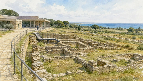
Original documentary watercolour of Metaponto Archaeological Park: streets, sanctuaries and an agricultural city in Metaponto and the Ionian coast · Basilicata, showing accurate architecture, landscape and present-day use
Metaponto Archaeological Park: streets, sanctuaries and an agricultural cityOriginal Merlintravel documentary watercolour · 2026
03

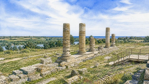
Fifteen Doric columns preserve part of a sanctuary of Hera outside the ancient urban centre.

Tavole Palatine: surviving columns in a changed river plain

Fifteen Doric columns preserve part of a sanctuary of Hera outside the ancient urban centre. The place becomes clearer when surviving fabric, later change and present use are read together.

Today

Archaeological access can change because of conservation, excavation, weather or staffing. Stay outside barriers and verify the official opening notice.

History

The temple belonged to the Greek colonial landscape and survived through spoliation, agricultural change and modern conservation near the Bradano.

How to read this place

Observe column spacing, stylobate and surrounding land, distinguishing the sanctuary from the separate city site and museum.

What to notice

  • original masonry and later support work
  • the relation between excavation and modern surroundings
  • areas intentionally left unexcavated
Ministero della Cultura · Tavole Palatine
Original documentary watercolour of Tavole Palatine: surviving columns in a changed river plain in Metaponto and the Ionian coast · Basilicata, showing accurate architecture, landscape and present-day use
Tavole Palatine: surviving columns in a changed river plainOriginal Merlintravel documentary watercolour · 2026
04

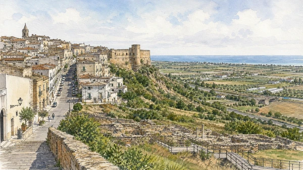
A fifteenth-century urban centre and castle overlook the plain where older settlements and modern coastal development meet.

Bernalda: a later hill town above ancient Metaponto

A fifteenth-century urban centre and castle overlook the plain where older settlements and modern coastal development meet. The place becomes clearer when surviving fabric, later change and present use are read together.

Today

This is an inhabited place, not a visitor set. Keep doorways, pavements and deliveries clear, and use current municipal mobility information.

History

Bernalda grew from the relocation and consolidation of communities under late medieval and early modern lordship, while Metaponto became its coastal frazione.

How to read this place

Read the long main street, castle edge and views toward the Ionian plain without claiming Bernalda is the direct intact continuation of the Greek city.

What to notice

  • street width and building materials
  • residential use behind historic facades
  • later infrastructure and adaptation
Basilicata Turistica · Bernalda
Original documentary watercolour of Bernalda: a later hill town above ancient Metaponto in Metaponto and the Ionian coast · Basilicata, showing accurate architecture, landscape and present-day use
Bernalda: a later hill town above ancient MetapontoOriginal Merlintravel documentary watercolour · 2026
05

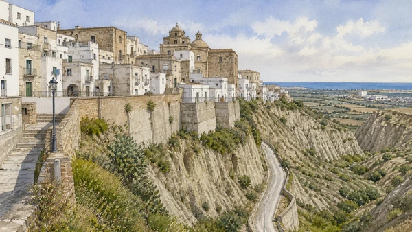
A dense hill town sits within the calanchi, where building, landslide risk and modern expansion are visibly connected.

Pisticci: white houses above unstable clay

A dense hill town sits within the calanchi, where building, landslide risk and modern expansion are visibly connected. The place becomes clearer when surviving fabric, later change and present use are read together.

Today

This is an inhabited place, not a visitor set. Keep doorways, pavements and deliveries clear, and use current municipal mobility information.

History

The settlement preserves medieval and later districts but has repeatedly faced earth movement, relocation and twentieth-century industrial change on the plain below.

How to read this place

Notice retaining structures, drainage, inhabited lanes and the clay landscape; do not frame instability as a decorative backdrop.

What to notice

  • street width and building materials
  • residential use behind historic facades
  • later infrastructure and adaptation
Basilicata Turistica · Pisticci
Original documentary watercolour of Pisticci: white houses above unstable clay in Metaponto and the Ionian coast · Basilicata, showing accurate architecture, landscape and present-day use
Pisticci: white houses above unstable clayOriginal Merlintravel documentary watercolour · 2026
06

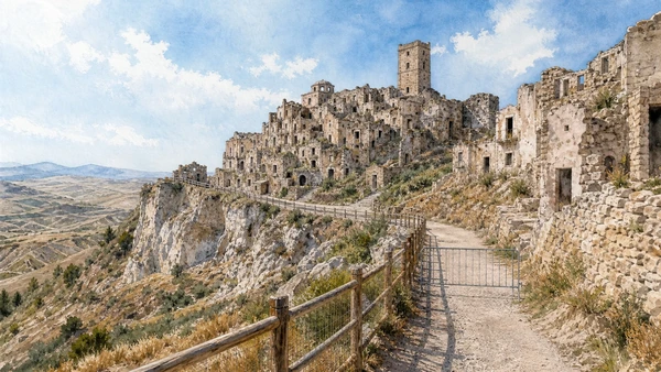
The evacuated hill town preserves damaged buildings and a dramatic relationship with unstable clay terrain.

Craco: abandonment, safety and the limits of access

The evacuated hill town preserves damaged buildings and a dramatic relationship with unstable clay terrain. The place becomes clearer when surviving fabric, later change and present use are read together.

Today

This is an inhabited place, not a visitor set. Keep doorways, pavements and deliveries clear, and use current municipal mobility information.

History

Landslides, infrastructure problems and relocation led to progressive abandonment in the twentieth century, while controlled cultural use followed later.

How to read this place

Enter only through authorised arrangements, respect barriers and avoid presenting roofless homes as an untouched medieval film set.

What to notice

  • street width and building materials
  • residential use behind historic facades
  • later infrastructure and adaptation
Basilicata Turistica · Craco
Original documentary watercolour of Craco: abandonment, safety and the limits of access in Metaponto and the Ionian coast · Basilicata, showing accurate architecture, landscape and present-day use
Craco: abandonment, safety and the limits of accessOriginal Merlintravel documentary watercolour · 2026
07

The national museum presents Enotrian, Greek and Lucanian evidence from Siris, Herakleia and the lower Agri and Sinni territories.

Museo della Siritide: Indigenous and Greek worlds around Policoro

The national museum presents Enotrian, Greek and Lucanian evidence from Siris, Herakleia and the lower Agri and Sinni territories. The place becomes clearer when surviving fabric, later change and present use are read together.

Today

Opening, ticketing, room access and temporary displays can change. Check the museum’s official notice shortly before visiting and allow for security or conservation controls.

History

Excavations and regional research built collections that reveal changing settlements, sanctuaries, burials and exchange rather than one colonial story.

How to read this place

Follow labels for provenance and cultural attribution, keeping ancient identities and modern municipal boundaries distinct.

What to notice

  • the chronological order of the displays
  • finds tied to documented excavation contexts
  • modern conservation and interpretation
Ministero della Cultura · museums in Basilicata
Original documentary watercolour of Museo della Siritide: Indigenous and Greek worlds around Policoro in Metaponto and the Ionian coast · Basilicata, showing accurate architecture, landscape and present-day use
Museo della Siritide: Indigenous and Greek worlds around PolicoroOriginal Merlintravel documentary watercolour · 2026
08

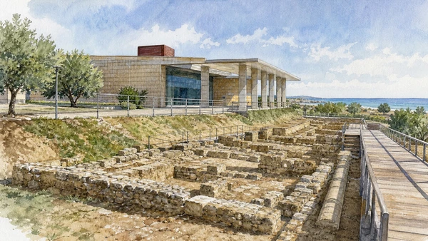
Urban and sanctuary remains near Policoro record Greek foundations, rebuilding and a landscape still shaped by agriculture.

Siris-Herakleia Archaeological Park: two cities and later fields

Urban and sanctuary remains near Policoro record Greek foundations, rebuilding and a landscape still shaped by agriculture. The place becomes clearer when surviving fabric, later change and present use are read together.

Today

Archaeological access can change because of conservation, excavation, weather or staffing. Stay outside barriers and verify the official opening notice.

History

Siris and later Herakleia occupied related but changing territories before Roman control altered the city’s role and settlement pattern.

How to read this place

Use the museum first, then read exposed foundations without merging Siris and Herakleia into one simultaneous reconstructed city.

What to notice

  • original masonry and later support work
  • the relation between excavation and modern surroundings
  • areas intentionally left unexcavated
Basilicata Turistica · Policoro
Original documentary watercolour of Siris-Herakleia Archaeological Park: two cities and later fields in Metaponto and the Ionian coast · Basilicata, showing accurate architecture, landscape and present-day use
Siris-Herakleia Archaeological Park: two cities and later fieldsOriginal Merlintravel documentary watercolour · 2026
09

A steep historic quarter, later town and hilltop sanctuary preserve different chapters above the Agri and Sinni routes.

Tursi, the Rabatana and Anglona

A steep historic quarter, later town and hilltop sanctuary preserve different chapters above the Agri and Sinni routes. The place becomes clearer when surviving fabric, later change and present use are read together.

Today

This is an inhabited place, not a visitor set. Keep doorways, pavements and deliveries clear, and use current municipal mobility information.

History

The Rabatana reflects medieval fortified settlement and later reuse, while the sanctuary of Anglona preserves its own religious and architectural history.

How to read this place

Keep the inhabited town and separate sanctuary distinct, using safe streets and current worship access rather than compressing both into one monument.

What to notice

  • street width and building materials
  • residential use behind historic facades
  • later infrastructure and adaptation
Basilicata Turistica · Tursi
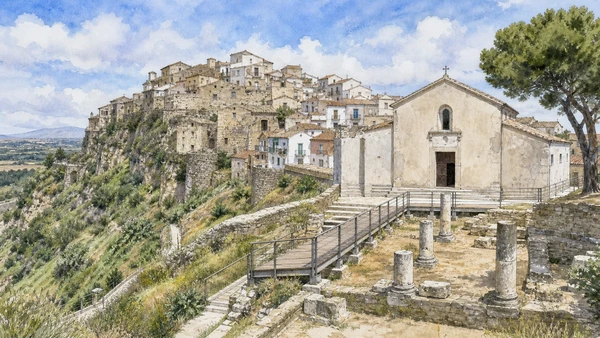
Original documentary watercolour of Tursi, the Rabatana and Anglona in Metaponto and the Ionian coast · Basilicata, showing accurate architecture, landscape and present-day use
Tursi, the Rabatana and AnglonaOriginal Merlintravel documentary watercolour · 2026
10

A small inhabited town in an eroded clay landscape is closely associated with Carlo Levi’s confinement and later cultural memory.

Aliano and the calanchi: political exile, literature and residence

A small inhabited town in an eroded clay landscape is closely associated with Carlo Levi’s confinement and later cultural memory. The place becomes clearer when surviving fabric, later change and present use are read together.

Today

This is an inhabited place, not a visitor set. Keep doorways, pavements and deliveries clear, and use current municipal mobility information.

History

The modern history of internal exile and representation added a powerful literary layer to a community with much longer rural and religious histories.

How to read this place

Read museum interpretation, cemetery, streets and landscape separately, avoiding the idea that present residents exist inside a frozen literary scene.

What to notice

  • street width and building materials
  • residential use behind historic facades
  • later infrastructure and adaptation
Basilicata Turistica · Aliano
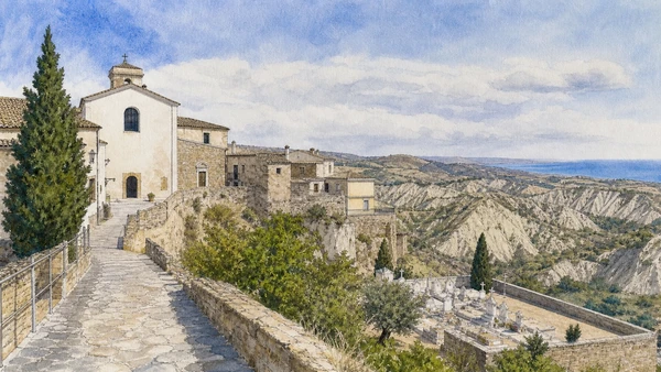
Original documentary watercolour of Aliano and the calanchi: political exile, literature and residence in Metaponto and the Ionian coast · Basilicata, showing accurate architecture, landscape and present-day use
Aliano and the calanchi: political exile, literature and residenceOriginal Merlintravel documentary watercolour · 2026

Basilicata through time

A short chronology

From Palaeolithic evidence and Greek cities to Roman roads, Norman government, Arbëreshë communities, modern displacement, protected parks and contemporary cultural recovery.

  1. Sites including Notarchirico document very early human presence and changing environments in inland Basilicata.

  2. Neolithic villages, cave use and exchange networks develop across the Matera plateau, valleys and Ionian approaches.

  3. Oenotrian and other Indigenous communities organise hill settlements, burial grounds and routes before and during Greek colonisation.

  4. Siris and Metapontum connect the Ionian plain to the Greek world while maintaining complex relations with inland societies.

  5. Lucanian communities, Greek cities and regional elites reshape fortified settlements, sanctuaries and agricultural territories.

  6. Rome establishes a colony at Venusia, strengthening control of routes between Apulia, Lucania and Campania.

  7. Roman towns, estates, roads and production systems link Venusia, Grumentum and the Ionian coast to wider imperial networks.

  8. Gothic, Byzantine, Lombard and local powers contest frontiers marked by bishoprics, monasteries and rock-cut religious places.

  9. Melfi becomes central to Norman rule while castles, dioceses and monastic complexes reorganise the region.

  10. The Constitutions of Melfi express Frederick II’s programme of royal government in the Kingdom of Sicily.

  11. Aragonese and seigneurial rule, Arbëreshë settlement and changing religious institutions add new layers to towns and valleys.

  12. Feudal abolition, Bourbon reform and Italian unification alter institutions without resolving land inequality.

  13. Civil conflict labelled brigandage reveals contested state formation, rural hardship and violence across inland Basilicata.

  14. Emigration, poverty, malaria, land reform and the compulsory displacement of residents from the Sassi define a difficult modern transition.

  15. Earthquake reconstruction, the 1993 UNESCO inscription, Matera 2019, park systems and museum renewal expand access while depopulation and climate risk continue.

Before your visit

Practical information

01

Check the live institution

Opening hours, guided routes, restoration, worship and seasonal services can change. Recheck the linked official page shortly before departure.

02

Respect long distances

Mountain roads, valley crossings and the two coasts make travel slower than the map suggests. Do not compress distant territories into one superficial day.

03

Keep living places liveable

The Sassi, hill towns, Arbëreshë villages, farms and port districts remain inhabited. Keep homes, doorways, work and local movement clear.

04

Treat archaeology as evidence

Stay behind barriers. Surviving remains, excavated foundations and later reconstructions reveal different stages of the sites’ histories.

05

Use current park notices

Heat, fire risk, snow, storms, river conditions and protected habitats can alter access. Follow the responsible park or reserve authority.

06

Read modern intervention honestly

Displacement, reconstruction, industrial change, adaptive reuse and contemporary art belong to Basilicata’s documented history rather than sitting outside it.

Method and sources

Sources and image credits

This guide uses official museum, ministry, municipal, park, UNESCO and regional-tourism documentation checked on 1 September 2026. It distinguishes prehistoric, Oenotrian, Greek, Lucanian, Roman, Byzantine, Lombard, Norman, Swabian and later phases rather than treating Basilicata as one timeless southern landscape. Every chapter links its principal institutional source; tickets, worship, closures, heat, fire risk, snow, sea conditions and transport must always be verified again on the day of the visit.

All ten images are original Merlintravel editorial watercolours based on documented present-day conditions. They are illustrations, not substitutes for archaeological plans. Opening hours, tickets, accessible routes, temporary exhibitions and conservation work can change; consult the linked official pages shortly before visiting.