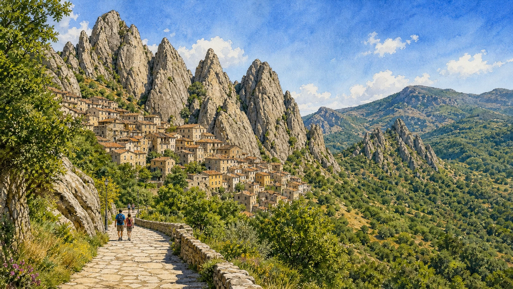
Original documentary watercolour panorama for Lucanian Dolomites and Gallipoli Cognato: Complete Guide, with accurate Lucanian architecture, landscape and lived context

Basilicata Guide 06 · Archaeology, architecture, working landscapes and contemporary access

Villages
hold to the sandstone peaks

A two-day route through rock-built villages, forests, Lucanian archaeology, walking paths, tree rituals and a former feudal landscape in the middle Basento country.

Plan the route
Lucanian Dolomites and Gallipoli Cognato · Basilicata10 chapters · one complete route

Why this route must be read in layers

The Lucanian Dolomites are not alpine scenery transplanted south: sandstone geology, forest ecology, village life and ritual practice create a specifically Lucanian mountain landscape.

The route begins with documented fabric and institutional collections rather than a list of photogenic surfaces. Each chapter separates what survives, what was rebuilt and what remains in use.

Basilicata’s ravines, archaeological parks, forests, villages, religious sites and two coastlines operate under different access conditions. Current notices therefore belong to the route rather than an appendix.

Each chapter includes an illustration of the place described. The images are watercolours rather than photographs.

A two-day route through rock-built villages, forests, Lucanian archaeology, walking paths, tree rituals and a former feudal landscape in the middle Basento country.

The route

Plan your visit

A two-day route through rock-built villages, forests, Lucanian archaeology, walking paths, tree rituals and a former feudal landscape in the middle Basento country.

Early morning

Castelmezzano · Pietrapertosa and the Arabata · Pietrapertosa Castle

Move in the documented order: Castelmezzano: streets fitted to the rock; then Pietrapertosa and the Arabata: a high settlement with many layers; then Pietrapertosa Castle: a fortification carved into the summit. Recheck live access, weather and transport before entering a controlled place.

Late morning

The Seven Stones path · Gallipoli Cognato forest · Monte Croccia

Move in the documented order: The Seven Stones path: a modern narrative on an old route; then Gallipoli Cognato forest: managed woodland and habitat; then Monte Croccia: Lucanian walls above the forest. Recheck live access, weather and transport before entering a controlled place.

Afternoon

Accettura · Oliveto Lucano · Calciano

Move in the documented order: Accettura: tree ritual inside a living community; then Oliveto Lucano: stone portals and another tree marriage; then Calciano: the Basento edge and fortified remains. Recheck live access, weather and transport before entering a controlled place.

Late afternoon

Brindisi Montagna and the Grancia

Move in the documented order: Brindisi Montagna and the Grancia: castle landscape and modern performance. Recheck live access, weather and transport before entering a controlled place.

Ten chapters

Explore the places

The order follows terrain, institutions and present-day movement. Use the index to return to a chapter without reducing the route to isolated monuments.

  1. 01Castelmezzano: streets fitted to the rock
  2. 02Pietrapertosa and the Arabata: a high settlement with many layers
  3. 03Pietrapertosa Castle: a fortification carved into the summit
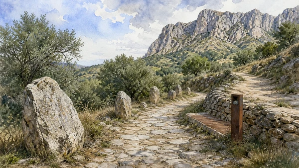
  4. 04The Seven Stones path: a modern narrative on an old route
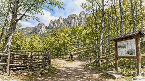
  5. 05Gallipoli Cognato forest: managed woodland and habitat
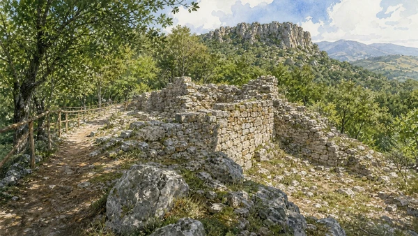
  6. 06Monte Croccia: Lucanian walls above the forest
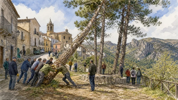
  7. 07Accettura: tree ritual inside a living community
  8. 08Oliveto Lucano: stone portals and another tree marriage
  9. 09Calciano: the Basento edge and fortified remains
  10. 10Brindisi Montagna and the Grancia: castle landscape and modern performance
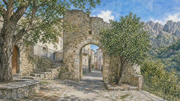
01

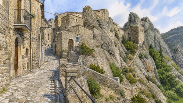
Houses, stairs and a compact centre occupy a narrow basin beneath sharp sandstone forms.

Castelmezzano: streets fitted to the rock

Houses, stairs and a compact centre occupy a narrow basin beneath sharp sandstone forms. The place becomes clearer when surviving fabric, later change and present use are read together.

Today

This is an inhabited place, not a visitor set. Keep doorways, pavements and deliveries clear, and use current municipal mobility information.

History

The fortified settlement changed through Lombard, Norman and later rule while modern roads and tourism altered access to the village.

How to read this place

Walk the inhabited streets before climbing authorised paths, noticing retaining walls, drainage and modern services beside older stone.

What to notice

  • street width and building materials
  • residential use behind historic facades
  • later infrastructure and adaptation
Basilicata Turistica · Lucanian Dolomites
Original documentary watercolour of Castelmezzano: streets fitted to the rock in Lucanian Dolomites and Gallipoli Cognato · Basilicata, showing accurate architecture, landscape and present-day use
Castelmezzano: streets fitted to the rockOriginal Merlintravel documentary watercolour · 2026
02

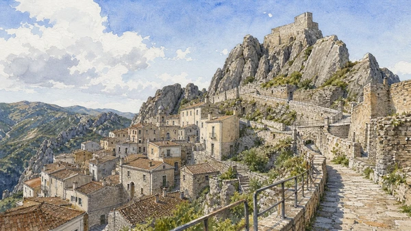
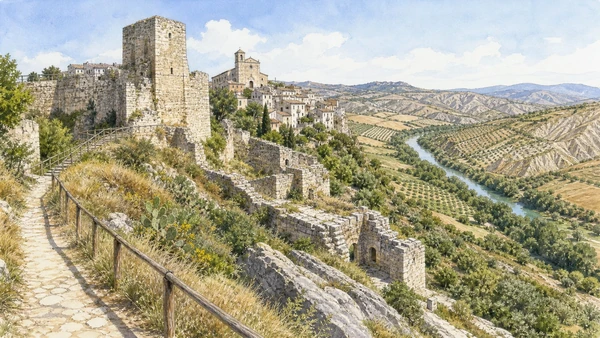
The village climbs toward a rock-cut fortress while the Arabata quarter preserves a dense pattern of houses and stairs.

Pietrapertosa and the Arabata: a high settlement with many layers

The village climbs toward a rock-cut fortress while the Arabata quarter preserves a dense pattern of houses and stairs. The place becomes clearer when surviving fabric, later change and present use are read together.

Today

This is an inhabited place, not a visitor set. Keep doorways, pavements and deliveries clear, and use current municipal mobility information.

History

Medieval powers reused an older strategic site, and later domestic building absorbed the mountain slope beneath the castle.

How to read this place

Separate the inhabited Arabata, later churches and high fortress route; do not reduce the quarter to an unchanging ‘Arab village’.

What to notice

  • street width and building materials
  • residential use behind historic facades
  • later infrastructure and adaptation
Basilicata Turistica · Pietrapertosa
Original documentary watercolour of Pietrapertosa and the Arabata: a high settlement with many layers in Lucanian Dolomites and Gallipoli Cognato · Basilicata, showing accurate architecture, landscape and present-day use
Pietrapertosa and the Arabata: a high settlement with many layersOriginal Merlintravel documentary watercolour · 2026
03

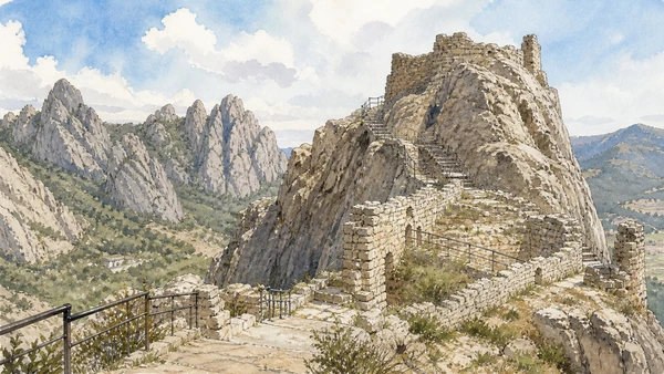
Walls, steps and rock-cut features occupy the village’s highest ridge with long views across the valley.

Pietrapertosa Castle: a fortification carved into the summit

Walls, steps and rock-cut features occupy the village’s highest ridge with long views across the valley. The place becomes clearer when surviving fabric, later change and present use are read together.

Today

Interior routes, exhibitions and controlled areas can change. Check the managing institution, respect barriers and distinguish surviving fabric from restoration.

History

The site served changing defensive systems under medieval rulers and survives in fragmentary form after excavation and stabilisation.

How to read this place

Climb only in suitable weather, distinguish bedrock from masonry and avoid reconstructing complete towers beyond the evidence.

What to notice

  • defensive geometry and controlled approaches
  • different masonry phases
  • present cultural or civic use
Basilicata Turistica · Pietrapertosa
Original documentary watercolour of Pietrapertosa Castle: a fortification carved into the summit in Lucanian Dolomites and Gallipoli Cognato · Basilicata, showing accurate architecture, landscape and present-day use
Pietrapertosa Castle: a fortification carved into the summitOriginal Merlintravel documentary watercolour · 2026
04

A walking trail between Castelmezzano and Pietrapertosa uses contemporary installations to interpret oral tradition and landscape.

The Seven Stones path: a modern narrative on an old route

A walking trail between Castelmezzano and Pietrapertosa uses contemporary installations to interpret oral tradition and landscape. The place becomes clearer when surviving fabric, later change and present use are read together.

Today

Weather, heat, fire risk, snow, sea state and seasonal restrictions can alter access. Use official park or reserve information and remain on authorised routes.

History

The path follows a rural connection, while its seven staged sections were created as a modern cultural work inspired by local storytelling.

How to read this place

Treat surfaces, gradient and weather seriously, separating the historic path from the contemporary narrative installation.

What to notice

  • geology and native vegetation
  • authorised paths and protected habitats
  • working land or water beside conservation zones
Basilicata Turistica · Pietrapertosa
Original documentary watercolour of The Seven Stones path: a modern narrative on an old route in Lucanian Dolomites and Gallipoli Cognato · Basilicata, showing accurate architecture, landscape and present-day use
The Seven Stones path: a modern narrative on an old routeOriginal Merlintravel documentary watercolour · 2026
05

Oak woods, streams and open areas form the ecological core of the regional park beyond the famous village skyline.

Gallipoli Cognato forest: managed woodland and habitat

Oak woods, streams and open areas form the ecological core of the regional park beyond the famous village skyline. The place becomes clearer when surviving fabric, later change and present use are read together.

Today

Weather, heat, fire risk, snow, sea state and seasonal restrictions can alter access. Use official park or reserve information and remain on authorised routes.

History

Long use for timber, grazing and seasonal practice preceded modern protection, which now manages biodiversity and visitor routes.

How to read this place

Use marked paths and park notices, reading forestry, habitat and recreation together rather than describing the woodland as untouched.

What to notice

  • geology and native vegetation
  • authorised paths and protected habitats
  • working land or water beside conservation zones
Parco Gallipoli Cognato Piccole Dolomiti Lucane
Original documentary watercolour of Gallipoli Cognato forest: managed woodland and habitat in Lucanian Dolomites and Gallipoli Cognato · Basilicata, showing accurate architecture, landscape and present-day use
Gallipoli Cognato forest: managed woodland and habitatOriginal Merlintravel documentary watercolour · 2026
06

Fortification remains on the high ground reveal an Indigenous settlement controlling routes through the interior.

Monte Croccia: Lucanian walls above the forest

Fortification remains on the high ground reveal an Indigenous settlement controlling routes through the interior. The place becomes clearer when surviving fabric, later change and present use are read together.

Today

Archaeological access can change because of conservation, excavation, weather or staffing. Stay outside barriers and verify the official opening notice.

History

The site developed before Roman conquest and survives as walls and archaeological traces embedded in protected woodland.

How to read this place

Follow authorised archaeological paths, distinguish fallen stone from standing courses and leave unexcavated ground undisturbed.

What to notice

  • original masonry and later support work
  • the relation between excavation and modern surroundings
  • areas intentionally left unexcavated
Parco Gallipoli Cognato Piccole Dolomiti Lucane
Original documentary watercolour of Monte Croccia: Lucanian walls above the forest in Lucanian Dolomites and Gallipoli Cognato · Basilicata, showing accurate architecture, landscape and present-day use
Monte Croccia: Lucanian walls above the forestOriginal Merlintravel documentary watercolour · 2026
07

The Maggio di Accettura joins forest selection, transport, craft, devotion and communal participation rather than functioning as a staged folklore show.

Accettura: tree ritual inside a living community

The Maggio di Accettura joins forest selection, transport, craft, devotion and communal participation rather than functioning as a staged folklore show. The place becomes clearer when surviving fabric, later change and present use are read together.

Today

This is an inhabited place, not a visitor set. Keep doorways, pavements and deliveries clear, and use current municipal mobility information.

History

The ritual has deep local continuity but has also changed with forestry rules, vehicles, institutions and contemporary participation.

How to read this place

Use official event and park guidance, ask before photographing participants closely and understand the separate roles of the chosen trees.

What to notice

  • street width and building materials
  • residential use behind historic facades
  • later infrastructure and adaptation
Basilicata Turistica · Accettura
Original documentary watercolour of Accettura: tree ritual inside a living community in Lucanian Dolomites and Gallipoli Cognato · Basilicata, showing accurate architecture, landscape and present-day use
Accettura: tree ritual inside a living communityOriginal Merlintravel documentary watercolour · 2026
08

A small hill town preserves carved portals, domestic fabric and its own arboreal ritual connected to nearby forests.

Oliveto Lucano: stone portals and another tree marriage

A small hill town preserves carved portals, domestic fabric and its own arboreal ritual connected to nearby forests. The place becomes clearer when surviving fabric, later change and present use are read together.

Today

This is an inhabited place, not a visitor set. Keep doorways, pavements and deliveries clear, and use current municipal mobility information.

History

Settlement and ritual life developed within agricultural and woodland economies, later affected by migration and changing access.

How to read this place

Read ordinary houses and public space without treating the village only as an event location, and verify ritual dates locally.

What to notice

  • street width and building materials
  • residential use behind historic facades
  • later infrastructure and adaptation
Basilicata Turistica · Oliveto Lucano
Original documentary watercolour of Oliveto Lucano: stone portals and another tree marriage in Lucanian Dolomites and Gallipoli Cognato · Basilicata, showing accurate architecture, landscape and present-day use
Oliveto Lucano: stone portals and another tree marriageOriginal Merlintravel documentary watercolour · 2026
09

The village and older hilltop remains overlook the river corridor at the northern margin of the park.

Calciano: the Basento edge and fortified remains

The village and older hilltop remains overlook the river corridor at the northern margin of the park. The place becomes clearer when surviving fabric, later change and present use are read together.

Today

This is an inhabited place, not a visitor set. Keep doorways, pavements and deliveries clear, and use current municipal mobility information.

History

Medieval settlement patterns changed as communities moved and rebuilt, leaving religious and fortified traces above later inhabited areas.

How to read this place

Use designated paths and distinguish ruins from the present town, connecting both to the Basento route and cultivated slopes.

What to notice

  • street width and building materials
  • residential use behind historic facades
  • later infrastructure and adaptation
Basilicata Turistica · Calciano
Original documentary watercolour of Calciano: the Basento edge and fortified remains in Lucanian Dolomites and Gallipoli Cognato · Basilicata, showing accurate architecture, landscape and present-day use
Calciano: the Basento edge and fortified remainsOriginal Merlintravel documentary watercolour · 2026
10

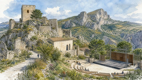
A hilltop castle, village and former monastic estate frame a landscape now also used for large-scale historical performance.

Brindisi Montagna and the Grancia: castle landscape and modern performance

A hilltop castle, village and former monastic estate frame a landscape now also used for large-scale historical performance. The place becomes clearer when surviving fabric, later change and present use are read together.

Today

Interior routes, exhibitions and controlled areas can change. Check the managing institution, respect barriers and distinguish surviving fabric from restoration.

History

Feudal, religious and agricultural institutions shaped the site before modern cultural projects reused parts of the Grancia landscape.

How to read this place

Separate surviving architecture, later restoration and theatrical interpretation; a historical spectacle is not primary evidence for the events it depicts.

What to notice

  • defensive geometry and controlled approaches
  • different masonry phases
  • present cultural or civic use
Basilicata Turistica · Brindisi Montagna
Original documentary watercolour of Brindisi Montagna and the Grancia: castle landscape and modern performance in Lucanian Dolomites and Gallipoli Cognato · Basilicata, showing accurate architecture, landscape and present-day use
Brindisi Montagna and the Grancia: castle landscape and modern performanceOriginal Merlintravel documentary watercolour · 2026

Basilicata through time

A short chronology

From Palaeolithic evidence and Greek cities to Roman roads, Norman government, Arbëreshë communities, modern displacement, protected parks and contemporary cultural recovery.

  1. Sites including Notarchirico document very early human presence and changing environments in inland Basilicata.

  2. Neolithic villages, cave use and exchange networks develop across the Matera plateau, valleys and Ionian approaches.

  3. Oenotrian and other Indigenous communities organise hill settlements, burial grounds and routes before and during Greek colonisation.

  4. Siris and Metapontum connect the Ionian plain to the Greek world while maintaining complex relations with inland societies.

  5. Lucanian communities, Greek cities and regional elites reshape fortified settlements, sanctuaries and agricultural territories.

  6. Rome establishes a colony at Venusia, strengthening control of routes between Apulia, Lucania and Campania.

  7. Roman towns, estates, roads and production systems link Venusia, Grumentum and the Ionian coast to wider imperial networks.

  8. Gothic, Byzantine, Lombard and local powers contest frontiers marked by bishoprics, monasteries and rock-cut religious places.

  9. Melfi becomes central to Norman rule while castles, dioceses and monastic complexes reorganise the region.

  10. The Constitutions of Melfi express Frederick II’s programme of royal government in the Kingdom of Sicily.

  11. Aragonese and seigneurial rule, Arbëreshë settlement and changing religious institutions add new layers to towns and valleys.

  12. Feudal abolition, Bourbon reform and Italian unification alter institutions without resolving land inequality.

  13. Civil conflict labelled brigandage reveals contested state formation, rural hardship and violence across inland Basilicata.

  14. Emigration, poverty, malaria, land reform and the compulsory displacement of residents from the Sassi define a difficult modern transition.

  15. Earthquake reconstruction, the 1993 UNESCO inscription, Matera 2019, park systems and museum renewal expand access while depopulation and climate risk continue.

Before your visit

Practical information

01

Check the live institution

Opening hours, guided routes, restoration, worship and seasonal services can change. Recheck the linked official page shortly before departure.

02

Respect long distances

Mountain roads, valley crossings and the two coasts make travel slower than the map suggests. Do not compress distant territories into one superficial day.

03

Keep living places liveable

The Sassi, hill towns, Arbëreshë villages, farms and port districts remain inhabited. Keep homes, doorways, work and local movement clear.

04

Treat archaeology as evidence

Stay behind barriers. Surviving remains, excavated foundations and later reconstructions reveal different stages of the sites’ histories.

05

Use current park notices

Heat, fire risk, snow, storms, river conditions and protected habitats can alter access. Follow the responsible park or reserve authority.

06

Read modern intervention honestly

Displacement, reconstruction, industrial change, adaptive reuse and contemporary art belong to Basilicata’s documented history rather than sitting outside it.

Method and sources

Sources and image credits

This guide uses official museum, ministry, municipal, park, UNESCO and regional-tourism documentation checked on 1 September 2026. It distinguishes prehistoric, Oenotrian, Greek, Lucanian, Roman, Byzantine, Lombard, Norman, Swabian and later phases rather than treating Basilicata as one timeless southern landscape. Every chapter links its principal institutional source; tickets, worship, closures, heat, fire risk, snow, sea conditions and transport must always be verified again on the day of the visit.

All ten images are original Merlintravel editorial watercolours based on documented present-day conditions. They are illustrations, not substitutes for archaeological plans. Opening hours, tickets, accessible routes, temporary exhibitions and conservation work can change; consult the linked official pages shortly before visiting.