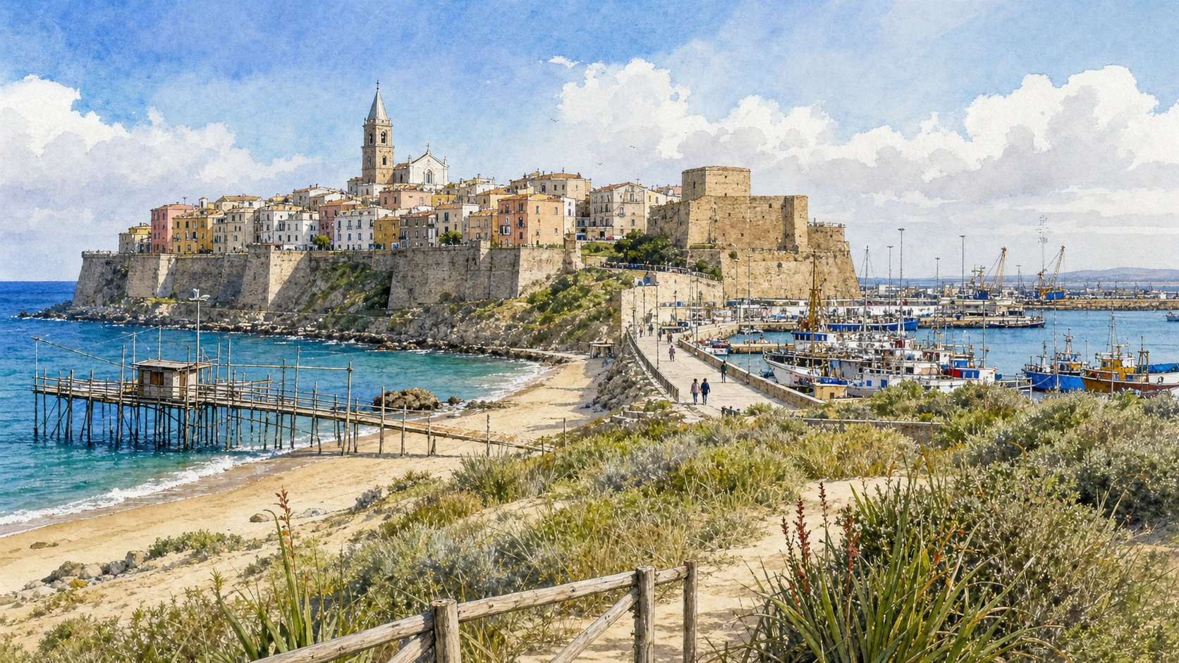
Original documentary watercolour panorama for Termoli and the Adriatic Coast: Complete Guide, with accurate Molisian architecture, landscape and lived context

Molise Guide 05 · Archaeology, architecture, working landscapes and contemporary access

Termoli
holds the sea line

A two-day route through the fortified headland, cathedral, castle, fishing structures, working port, beaches, dunes and Arbëreshë settlements along Molise’s short coast.

Plan the route
Termoli and the Adriatic coast · Molise10 chapters · one complete route

Why this route must be read in layers

Molise’s coast is compact but not simple: defensive architecture, worship, fishing, port logistics, railways, bathing, dunes, river mouths and seasonal crowds occupy the same narrow strip.

The route begins with documented fabric and institutional collections rather than a list of photogenic surfaces. Each chapter separates what survives, what was rebuilt and what remains in use.

Molise’s archaeological parks, forests, villages, religious sites, mountain roads and short coast operate under different access conditions. Current notices therefore belong to the route rather than an appendix.

Each chapter includes an illustration of the place described. The images are watercolours rather than photographs.

A two-day route through the fortified headland, cathedral, castle, fishing structures, working port, beaches, dunes and Arbëreshë settlements along Molise’s short coast.

The route

Plan your visit

A two-day route through the fortified headland, cathedral, castle, fishing structures, working port, beaches, dunes and Arbëreshë settlements along Molise’s short coast.

Early morning

Termoli’s walled borgo · San Basso Cathedral · The Swabian Castle

Move in the documented order: Termoli’s walled borgo: an inhabited promontory; then San Basso Cathedral: Romanesque layers near the cliff; then The Swabian Castle: a compact machine at the town edge. Recheck live access, weather and transport before entering a controlled place.

Late morning

The trabucco · Termoli port · Rio Vivo and Sant’Antonio

Move in the documented order: The trabucco: fishing architecture under weather; then Termoli port: ferries, fishing and logistics; then Rio Vivo and Sant’Antonio: two urban beaches. Recheck live access, weather and transport before entering a controlled place.

Afternoon

Petacciato Marina · Campomarino · Ramitelli wood and the Biferno mouth

Move in the documented order: Petacciato Marina: dune edge below the hill town; then Campomarino: Arbëreshë memory between vines and sea; then Ramitelli wood and the Biferno mouth: a fragile coastal margin. Recheck live access, weather and transport before entering a controlled place.

Late afternoon

Montenero di Bisaccia

Move in the documented order: Montenero di Bisaccia: clay hills above the northern shore. Recheck live access, weather and transport before entering a controlled place.

Ten chapters

Explore the places

The order follows terrain, institutions and present-day movement. Use the index to return to a chapter without reducing the route to isolated monuments.

  1. 01Termoli’s walled borgo: an inhabited promontory
  2. 02San Basso Cathedral: Romanesque layers near the cliff
  3. 03The Swabian Castle: a compact machine at the town edge
  4. 04The trabucco: fishing architecture under weather
  5. 05Termoli port: ferries, fishing and logistics
  6. 06Rio Vivo and Sant’Antonio: two urban beaches
  7. 07Petacciato Marina: dune edge below the hill town
  8. 08Campomarino: Arbëreshë memory between vines and sea
  9. 09Ramitelli wood and the Biferno mouth: a fragile coastal margin
  10. 10Montenero di Bisaccia: clay hills above the northern shore
01

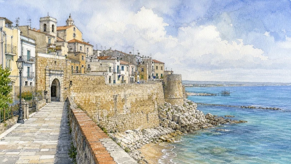
Dense lanes and houses occupy a headland between beaches and the working harbour.

Termoli’s walled borgo: an inhabited promontory

Dense lanes and houses occupy a headland between beaches and the working harbour. The place becomes clearer when surviving fabric, later change and present use are read together.

Today

This is an inhabited place, not a visitor set. Keep doorways, pavements and deliveries clear, and use current municipal mobility information.

History

Medieval defences and later domestic fabric survived beside nineteenth- and twentieth-century urban growth outside the walls.

How to read this place

Keep doors and passages clear, distinguish private homes from visitor routes and read sea exposure in the repaired masonry.

What to notice

  • street width and building materials
  • residential use behind historic facades
  • later infrastructure and adaptation
Italia.it · Termoli
Original documentary watercolour of Termoli’s walled borgo: an inhabited promontory in Termoli and the Adriatic coast · Molise, showing accurate architecture, landscape and present-day use
Termoli’s walled borgo: an inhabited promontoryOriginal Merlintravel documentary watercolour · 2026
02

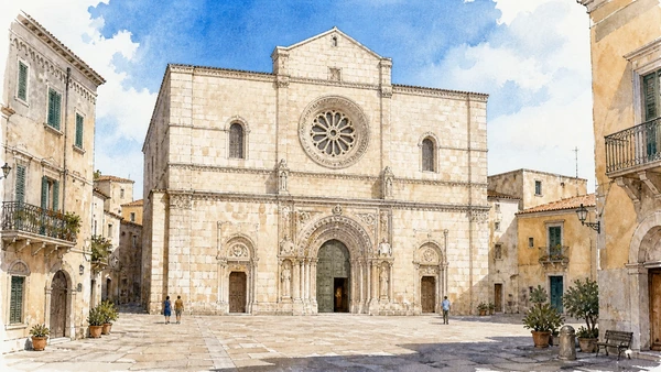
The cathedral’s stone facade and interior stand at the centre of the old borgo and remain active in local devotion.

San Basso Cathedral: Romanesque layers near the cliff

The cathedral’s stone facade and interior stand at the centre of the old borgo and remain active in local devotion. The place becomes clearer when surviving fabric, later change and present use are read together.

Today

This is an active religious place. Services, ceremonies and conservation can interrupt tourist access; dress appropriately, remain quiet and verify the official notice.

History

Medieval construction, crypt discoveries and later restoration shaped a building associated with the relics of San Basso and San Timoteo.

How to read this place

Separate medieval carving, later repair and present liturgy; services and feast preparations can alter access.

What to notice

  • the relationship between worship and visitor circulation
  • older fabric and later rebuilding
  • objects still used in liturgy
Italia.it · Molise coast
Original documentary watercolour of San Basso Cathedral: Romanesque layers near the cliff in Termoli and the Adriatic coast · Molise, showing accurate architecture, landscape and present-day use
San Basso Cathedral: Romanesque layers near the cliffOriginal Merlintravel documentary watercolour · 2026
03

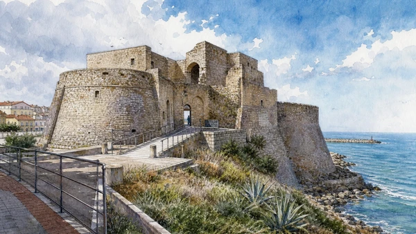
A square keep with corner towers controls the junction between old town, beach and modern waterfront.

The Swabian Castle: a compact machine at the town edge

A square keep with corner towers controls the junction between old town, beach and modern waterfront. The place becomes clearer when surviving fabric, later change and present use are read together.

Today

Interior routes, exhibitions and controlled areas can change. Check the managing institution, respect barriers and distinguish surviving fabric from restoration.

History

Medieval fortification was rebuilt and repaired through later military and civic phases, including modern reuse.

How to read this place

Observe scarp, towers and changing ground levels without inventing an intact imperial residence; verify interior opening.

What to notice

  • defensive geometry and controlled approaches
  • different masonry phases
  • present cultural or civic use
Italia.it · Termoli
Original documentary watercolour of The Swabian Castle: a compact machine at the town edge in Termoli and the Adriatic coast · Molise, showing accurate architecture, landscape and present-day use
The Swabian Castle: a compact machine at the town edgeOriginal Merlintravel documentary watercolour · 2026
04

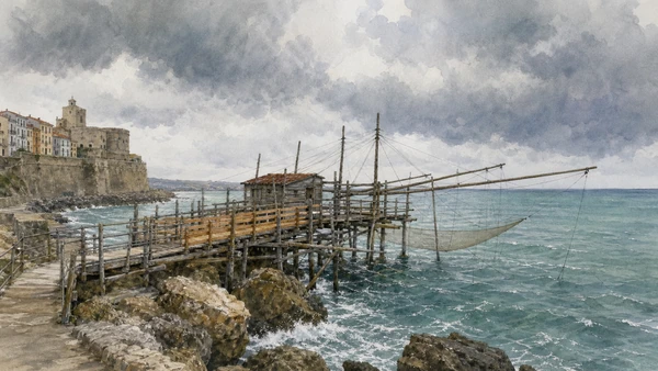
Timber arms, nets and platforms extend from the rocks below the walls as working or restored maritime structures.

The trabucco: fishing architecture under weather

Timber arms, nets and platforms extend from the rocks below the walls as working or restored maritime structures. The place becomes clearer when surviving fabric, later change and present use are read together.

Today

Public use, traffic, events and works can change circulation. Keep access routes open and verify any controlled interior with the responsible institution.

History

Adriatic fishing systems developed to operate from shore and have been repaired, adapted and interpreted over time.

How to read this place

Respect barriers and private working areas, distinguish replacement timbers from older structure and never enter during unsafe sea conditions.

What to notice

  • the relation between public space and movement
  • historic fabric beside later additions
  • present-day work and residence
Italia.it · Molise coast
Original documentary watercolour of The trabucco: fishing architecture under weather in Termoli and the Adriatic coast · Molise, showing accurate architecture, landscape and present-day use
The trabucco: fishing architecture under weatherOriginal Merlintravel documentary watercolour · 2026
05

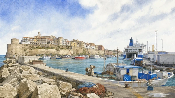
Commercial movement, fishing boats, leisure craft and seasonal passenger services share one operational harbour.

Termoli port: ferries, fishing and logistics

Commercial movement, fishing boats, leisure craft and seasonal passenger services share one operational harbour. The place becomes clearer when surviving fabric, later change and present use are read together.

Today

Public use, traffic, events and works can change circulation. Keep access routes open and verify any controlled interior with the responsible institution.

History

Modern expansion strengthened Termoli’s maritime role and changed the shoreline below the historic promontory.

How to read this place

Use public viewpoints and keep quays clear; timetables, security and weather take priority over a fixed sightseeing route.

What to notice

  • the relation between public space and movement
  • historic fabric beside later additions
  • present-day work and residence
Comune di Termoli
Original documentary watercolour of Termoli port: ferries, fishing and logistics in Termoli and the Adriatic coast · Molise, showing accurate architecture, landscape and present-day use
Termoli port: ferries, fishing and logisticsOriginal Merlintravel documentary watercolour · 2026
06

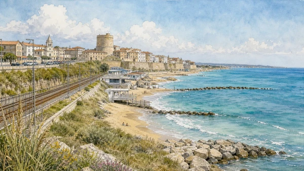
Beaches on opposite sides of the promontory reveal currents, harbour works and the city’s seasonal relationship with the sea.

Rio Vivo and Sant’Antonio: two urban beaches

Beaches on opposite sides of the promontory reveal currents, harbour works and the city’s seasonal relationship with the sea. The place becomes clearer when surviving fabric, later change and present use are read together.

Today

Weather, heat, fire risk, snow, sea state and seasonal restrictions can alter access. Use official park or reserve information and remain on authorised routes.

History

Bathing infrastructure and coastal defence expanded with tourism while sediment and storm exposure continued to reshape the shore.

How to read this place

Check flags and sea conditions, keep dune and service zones clear and include rail and road infrastructure in the modern landscape.

What to notice

  • geology and native vegetation
  • authorised paths and protected habitats
  • working land or water beside conservation zones
Italia.it · Molise coast
Original documentary watercolour of Rio Vivo and Sant’Antonio: two urban beaches in Termoli and the Adriatic coast · Molise, showing accurate architecture, landscape and present-day use
Rio Vivo and Sant’Antonio: two urban beachesOriginal Merlintravel documentary watercolour · 2026
07

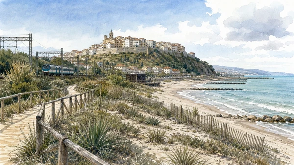
A long beach, pine and dune vegetation lie beneath cultivated slopes and the inland settlement.

Petacciato Marina: dune edge below the hill town

A long beach, pine and dune vegetation lie beneath cultivated slopes and the inland settlement. The place becomes clearer when surviving fabric, later change and present use are read together.

Today

Weather, heat, fire risk, snow, sea state and seasonal restrictions can alter access. Use official park or reserve information and remain on authorised routes.

History

Roads, rail, tourism and coastal management changed access to a shore still affected by erosion and river systems.

How to read this place

Use marked entries, protect vegetation and read stabilisation works honestly rather than presenting an untouched wilderness.

What to notice

  • geology and native vegetation
  • authorised paths and protected habitats
  • working land or water beside conservation zones
Italia.it · Molise coast
Original documentary watercolour of Petacciato Marina: dune edge below the hill town in Termoli and the Adriatic coast · Molise, showing accurate architecture, landscape and present-day use
Petacciato Marina: dune edge below the hill townOriginal Merlintravel documentary watercolour · 2026
08

The inland historic centre and coastal district preserve different identities within one municipality.

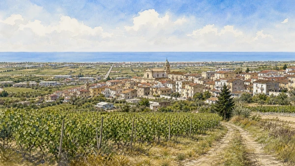
Campomarino: Arbëreshë memory between vines and sea

The inland historic centre and coastal district preserve different identities within one municipality. The place becomes clearer when surviving fabric, later change and present use are read together.

Today

This is an inhabited place, not a visitor set. Keep doorways, pavements and deliveries clear, and use current municipal mobility information.

History

Albanian-speaking communities settled in the lower Molise after medieval population loss, while vineyards and modern tourism shaped later development.

How to read this place

Keep language, ritual and architecture tied to living residents; do not turn Arbëreshë identity into costume or confuse the hill town with the lido.

What to notice

  • street width and building materials
  • residential use behind historic facades
  • later infrastructure and adaptation
Italia.it · Adriatic coast itinerary
Original documentary watercolour of Campomarino: Arbëreshë memory between vines and sea in Termoli and the Adriatic coast · Molise, showing accurate architecture, landscape and present-day use
Campomarino: Arbëreshë memory between vines and seaOriginal Merlintravel documentary watercolour · 2026
09

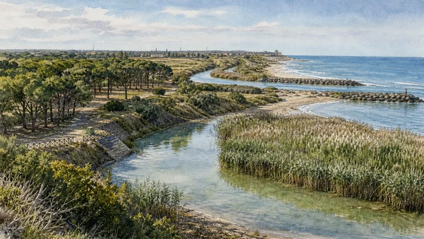
Woodland, wet areas and cultivated land survive near transport corridors and the river’s approach to the sea.

Ramitelli wood and the Biferno mouth: a fragile coastal margin

Woodland, wet areas and cultivated land survive near transport corridors and the river’s approach to the sea. The place becomes clearer when surviving fabric, later change and present use are read together.

Today

Weather, heat, fire risk, snow, sea state and seasonal restrictions can alter access. Use official park or reserve information and remain on authorised routes.

History

Natural processes and reclamation, agriculture and infrastructure repeatedly altered the lower coastal plain.

How to read this place

Use current protected-area notices, avoid sensitive habitat and distinguish plantations, remnant woodland and engineered drainage.

What to notice

  • geology and native vegetation
  • authorised paths and protected habitats
  • working land or water beside conservation zones
Italia.it · Molise coast
Original documentary watercolour of Ramitelli wood and the Biferno mouth: a fragile coastal margin in Termoli and the Adriatic coast · Molise, showing accurate architecture, landscape and present-day use
Ramitelli wood and the Biferno mouth: a fragile coastal marginOriginal Merlintravel documentary watercolour · 2026
10

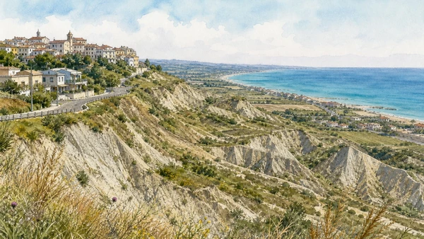
The inland town overlooks badland-like slopes, farmland and the coastal strip near the Trigno boundary.

Montenero di Bisaccia: clay hills above the northern shore

The inland town overlooks badland-like slopes, farmland and the coastal strip near the Trigno boundary. The place becomes clearer when surviving fabric, later change and present use are read together.

Today

This is an inhabited place, not a visitor set. Keep doorways, pavements and deliveries clear, and use current municipal mobility information.

History

Agriculture, erosion, road access and migration shaped a settlement historically connected to both upland Molise and the Adriatic.

How to read this place

Read the changing clay terrain and modern construction together, using safe public viewpoints rather than unstable slopes.

What to notice

  • street width and building materials
  • residential use behind historic facades
  • later infrastructure and adaptation
Italia.it · Molise coast
Original documentary watercolour of Montenero di Bisaccia: clay hills above the northern shore in Termoli and the Adriatic coast · Molise, showing accurate architecture, landscape and present-day use
Montenero di Bisaccia: clay hills above the northern shoreOriginal Merlintravel documentary watercolour · 2026

Molise through time

A short chronology

From Palaeolithic evidence and Samnite sanctuaries to Roman towns, monastic power, pastoral routes, emigration, modern infrastructure and cultural renewal.

  1. Isernia La Pineta preserves evidence of very early human activity and environment in the central Mediterranean.

  2. Bronze and Iron Age communities organise upland settlement, exchange and burial across the Apennine interior.

  3. Samnite and Frentan communities establish sanctuaries, fortified ridges and routes linking mountains, plains and Adriatic approaches.

  4. Wars with Rome transform political control without immediately erasing local institutions and material culture.

  5. Romanisation reshapes Aesernia, Bovianum, Larinum and the pastoral corridor later formalised at Saepinum.

  6. Urban building, roads, amphitheatres, baths, estates and markets connect Molise to wider imperial systems.

  7. Population, worship and authority reorganise after Roman government, with Lombard Benevento becoming a decisive political framework.

  8. San Vincenzo al Volturno grows into a major Benedictine monastery before attack, destruction and later rebuilding.

  9. Monasteries, dioceses, castles and new settlements organise routes between the upper Volturno, Matese, Trigno and Biferno.

  10. Fortresses become noble residences while Albanian-speaking communities settle parts of lower Molise.

  11. Pastoral regulation, churches, craft towns and feudal estates connect the region to Naples, Abruzzo, Campania and Apulia.

  12. A destructive earthquake accelerates rebuilding and the reorganisation of Campobasso and many inland settlements.

  13. Unification, emigration, war damage and rural change precede the creation of the autonomous Molise region in 1963.

  14. Roads, reservoirs, coastal tourism and mountain facilities change access while depopulation reshapes inland communities.

  15. Museum renewal, park management, craft continuity and cultural-route projects expand interpretation under continuing demographic and climate pressure.

Before your visit

Practical information

01

Check the institution again

Opening hours, guided routes, restoration, worship and staffing change. Recheck the linked official notice shortly before departure.

02

Respect mountain time

Short distances can involve slow roads, snow, fog, heat or livestock. Do not compress distant valleys and coasts into one superficial day.

03

Keep inhabited places liveable

Historic centres, Arbëreshë communities, farms, ports and craft towns remain places of work and residence. Keep doors, quays and deliveries clear.

04

Treat archaeology as evidence

Stay behind barriers. Excavated remains and later reconstructions represent different stages of the site’s history.

05

Use current nature notices

Snow, fire risk, storms, caves, forest work, wildlife and sea conditions can alter access. Follow the responsible reserve, park or municipality.

06

Read modern change honestly

Reservoirs, roads, ski lifts, migration, rebuilding and museum reuse are documented parts of Molise rather than visual intrusions to hide.

Method and sources

Sources and image credits

This guide uses official ministry, museum, municipal, diocesan, reserve and national-tourism documentation checked on 1 September 2026. It distinguishes Palaeolithic, Samnite, Frentan, Roman, Lombard, monastic, Norman, early modern and contemporary phases rather than treating Molise as a timeless rural landscape. Every chapter links its principal institutional source; tickets, worship, closures, snow, fire risk, sea conditions and transport must always be verified again on the day of the visit.

All ten images are original Merlintravel editorial watercolours based on documented present-day conditions. They are illustrations, not substitutes for archaeological plans. Opening hours, tickets, accessible routes, temporary exhibitions and conservation work can change; consult the linked official pages shortly before visiting.