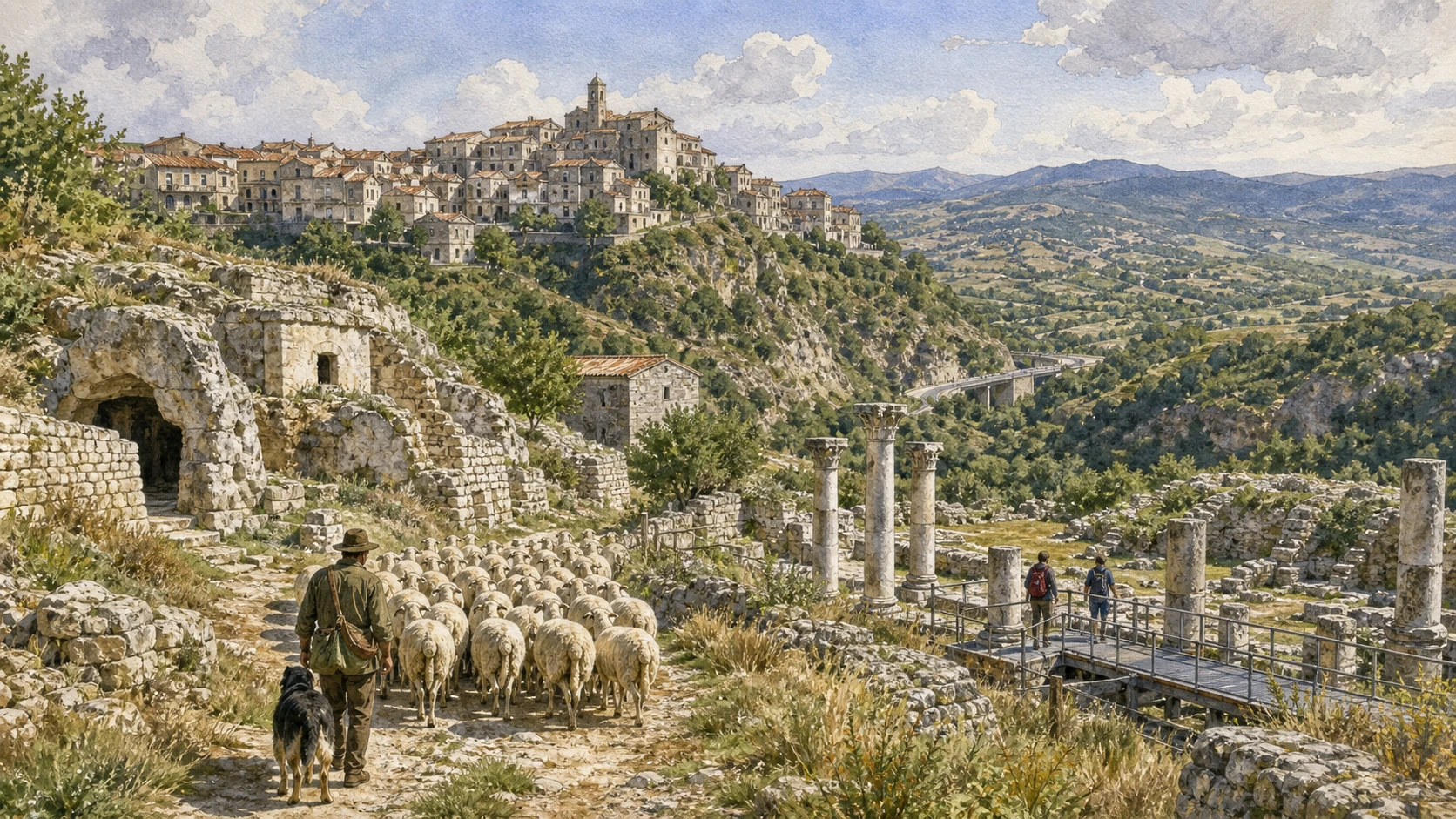
Original documentary watercolour panorama for Tratturi and Samnite Villages: Complete Guide, with accurate Molisian architecture, landscape and lived context

Molise Guide 08 · Archaeology, architecture, working landscapes and contemporary access

The
grass roads still connect

A two-day route following pastoral corridors through Frosolone, Duronia, Trivento and rock villages where craft, archaeology and seasonal movement remain legible.

Plan the route
Tratturi and the central Sannio · Molise10 chapters · one complete route

Why this route must be read in layers

The tratturi are not lines drawn across an empty map: they pass through farms, road junctions, villages, archaeological remains and changing pasture, demanding a route that respects both evidence and present ownership.

The route begins with documented fabric and institutional collections rather than a list of photogenic surfaces. Each chapter separates what survives, what was rebuilt and what remains in use.

Molise’s archaeological parks, forests, villages, religious sites, mountain roads and short coast operate under different access conditions. Current notices therefore belong to the route rather than an appendix.

Each chapter includes an illustration of the place described. The images are watercolours rather than photographs.

A two-day route following pastoral corridors through Frosolone, Duronia, Trivento and rock villages where craft, archaeology and seasonal movement remain legible.

The route

Plan your visit

A two-day route following pastoral corridors through Frosolone, Duronia, Trivento and rock villages where craft, archaeology and seasonal movement remain legible.

Early morning

Pescasseroli–Candela · Frosolone · The cutting-tools museum

Move in the documented order: Pescasseroli–Candela: the royal tratturo as a wide landscape; then Frosolone: blade craft in an inhabited stone town; then The cutting-tools museum: technique, labour and market. Recheck live access, weather and transport before entering a controlled place.

Late morning

The Morge of Frosolone · Duronia and the polygonal walls · Torella del Sannio

Move in the documented order: The Morge of Frosolone: limestone, climbing and pasture; then Duronia and the polygonal walls: a ridge above the tratturo; then Torella del Sannio: castle and houses on a working ridge. Recheck live access, weather and transport before entering a controlled place.

Afternoon

Pietracupa · Bagnoli del Trigno · Trivento Cathedral and crypt

Move in the documented order: Pietracupa: worship and houses inside the rock; then Bagnoli del Trigno: two levels beneath the castle; then Trivento Cathedral and crypt: a diocesan centre above the Trigno. Recheck live access, weather and transport before entering a controlled place.

Late afternoon

Carovilli and Staffoli

Move in the documented order: Carovilli and Staffoli: pasture still in motion. Recheck live access, weather and transport before entering a controlled place.

Ten chapters

Explore the places

The order follows terrain, institutions and present-day movement. Use the index to return to a chapter without reducing the route to isolated monuments.

  1. 01Pescasseroli–Candela: the royal tratturo as a wide landscape
  2. 02Frosolone: blade craft in an inhabited stone town
  3. 03The cutting-tools museum: technique, labour and market
  4. 04The Morge of Frosolone: limestone, climbing and pasture
  5. 05Duronia and the polygonal walls: a ridge above the tratturo
  6. 06Torella del Sannio: castle and houses on a working ridge
  7. 07Pietracupa: worship and houses inside the rock
  8. 08Bagnoli del Trigno: two levels beneath the castle
  9. 09Trivento Cathedral and crypt: a diocesan centre above the Trigno
  10. 10Carovilli and Staffoli: pasture still in motion
01

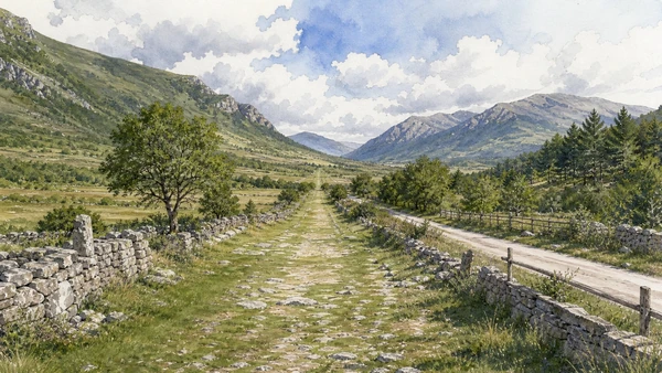
A broad pastoral corridor crosses central Molise between mountain summer grounds and Apulian winter pasture.

Pescasseroli–Candela: the royal tratturo as a wide landscape

A broad pastoral corridor crosses central Molise between mountain summer grounds and Apulian winter pasture. The place becomes clearer when surviving fabric, later change and present use are read together.

Today

Weather, heat, fire risk, snow, sea state and seasonal restrictions can alter access. Use official park or reserve information and remain on authorised routes.

History

Seasonal livestock movement long preceded formal Bourbon administration, which measured and regulated the route within a wider southern network.

How to read this place

Use public sections and current wayfinding, distinguish historic width from later roads and fields and never cross private land without permission.

What to notice

  • geology and native vegetation
  • authorised paths and protected habitats
  • working land or water beside conservation zones
Italia.it · landscapes of Molise
Original documentary watercolour of Pescasseroli–Candela: the royal tratturo as a wide landscape in Tratturi and the central Sannio · Molise, showing accurate architecture, landscape and present-day use
Pescasseroli–Candela: the royal tratturo as a wide landscapeOriginal Merlintravel documentary watercolour · 2026
02

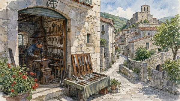
Workshops and collections preserve knowledge of knives and scissors within a high settlement shaped by earthquakes and migration.

Frosolone: blade craft in an inhabited stone town

Workshops and collections preserve knowledge of knives and scissors within a high settlement shaped by earthquakes and migration. The place becomes clearer when surviving fabric, later change and present use are read together.

Today

This is an inhabited place, not a visitor set. Keep doorways, pavements and deliveries clear, and use current municipal mobility information.

History

Metalworking developed as a specialised local economy before industrial competition and changing markets reduced traditional production.

How to read this place

Distinguish active makers, historic tools and souvenir display; the town’s rebuilt fabric is as important as the craft narrative.

What to notice

  • street width and building materials
  • residential use behind historic facades
  • later infrastructure and adaptation
Italia.it · Molise
Original documentary watercolour of Frosolone: blade craft in an inhabited stone town in Tratturi and the central Sannio · Molise, showing accurate architecture, landscape and present-day use
Frosolone: blade craft in an inhabited stone townOriginal Merlintravel documentary watercolour · 2026
03

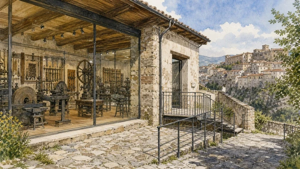
Blades, tools and workshop equipment document production processes rather than presenting metalwork only as decoration.

The cutting-tools museum: technique, labour and market

Blades, tools and workshop equipment document production processes rather than presenting metalwork only as decoration. The place becomes clearer when surviving fabric, later change and present use are read together.

Today

Opening, ticketing, room access and temporary displays can change. Check the museum’s official notice shortly before visiting and allow for security or conservation controls.

History

Collections preserve trades whose organisation changed with mechanisation, emigration and modern safety standards.

How to read this place

Follow tool function and provenance, and never infer that displayed equipment is still used without current workshop evidence.

What to notice

  • the chronological order of the displays
  • finds tied to documented excavation contexts
  • modern conservation and interpretation
Comune di Frosolone
Original documentary watercolour of The cutting-tools museum: technique, labour and market in Tratturi and the central Sannio · Molise, showing accurate architecture, landscape and present-day use
The cutting-tools museum: technique, labour and marketOriginal Merlintravel documentary watercolour · 2026
04

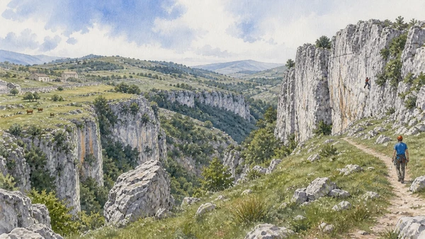
Rock towers rise above fields and woodland in a landscape used by shepherds, walkers and climbers.

The Morge of Frosolone: limestone, climbing and pasture

Rock towers rise above fields and woodland in a landscape used by shepherds, walkers and climbers. The place becomes clearer when surviving fabric, later change and present use are read together.

Today

Weather, heat, fire risk, snow, sea state and seasonal restrictions can alter access. Use official park or reserve information and remain on authorised routes.

History

Erosion shaped the limestone forms while land use and contemporary outdoor sport altered access and perception.

How to read this place

Use recognised paths and climbing guidance, and keep livestock clear. The natural rock forms need to be distinguished from archaeological remains.

What to notice

  • geology and native vegetation
  • authorised paths and protected habitats
  • working land or water beside conservation zones
Italia.it · landscapes of Molise
Original documentary watercolour of The Morge of Frosolone: limestone, climbing and pasture in Tratturi and the central Sannio · Molise, showing accurate architecture, landscape and present-day use
The Morge of Frosolone: limestone, climbing and pastureOriginal Merlintravel documentary watercolour · 2026
05

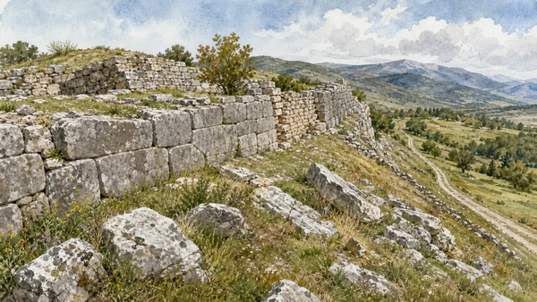
Massive stone courses and later settlement occupy strategic terrain over central Molise.

Duronia and the polygonal walls: a ridge above the tratturo

Massive stone courses and later settlement occupy strategic terrain over central Molise. The place becomes clearer when surviving fabric, later change and present use are read together.

Today

Archaeological access can change because of conservation, excavation, weather or staffing. Stay outside barriers and verify the official opening notice.

History

Ancient fortification belonged to the Samnite landscape, while medieval and modern communities reused the ridge and nearby routes.

How to read this place

Fitted ancient blocks, later walls and fallen stone preserve different phases; the visible circuit is only part of the former settlement.

What to notice

  • original masonry and later support work
  • the relation between excavation and modern surroundings
  • areas intentionally left unexcavated
Comune di Duronia · archaeological site
Original documentary watercolour of Duronia and the polygonal walls: a ridge above the tratturo in Tratturi and the central Sannio · Molise, showing accurate architecture, landscape and present-day use
Duronia and the polygonal walls: a ridge above the tratturoOriginal Merlintravel documentary watercolour · 2026
06

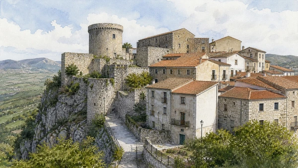
A fortified residence and dense village fabric overlook pasture and cultivated slopes.

Torella del Sannio: castle and houses on a working ridge

A fortified residence and dense village fabric overlook pasture and cultivated slopes. The place becomes clearer when surviving fabric, later change and present use are read together.

Today

This is an inhabited place, not a visitor set. Keep doorways, pavements and deliveries clear, and use current municipal mobility information.

History

Medieval defence was transformed by later noble use, earthquake repair and modern residence.

How to read this place

Respect private areas and read restored roofs, older masonry and ordinary homes together rather than isolating the castle.

What to notice

  • street width and building materials
  • residential use behind historic facades
  • later infrastructure and adaptation
Italia.it · Molise
Original documentary watercolour of Torella del Sannio: castle and houses on a working ridge in Tratturi and the central Sannio · Molise, showing accurate architecture, landscape and present-day use
Torella del Sannio: castle and houses on a working ridgeOriginal Merlintravel documentary watercolour · 2026
07

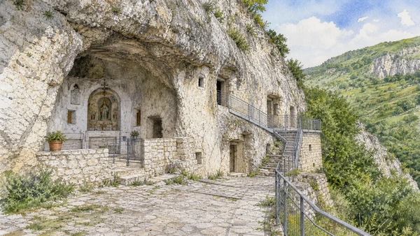
A limestone outcrop contains excavated spaces and a rock church above a small inhabited settlement.

Pietracupa: worship and houses inside the rock

A limestone outcrop contains excavated spaces and a rock church above a small inhabited settlement. The place becomes clearer when surviving fabric, later change and present use are read together.

Today

This is an active religious place. Services, ceremonies and conservation can interrupt tourist access; dress appropriately, remain quiet and verify the official notice.

History

Natural cavities were adapted through religious and domestic use, then restored and interpreted for modern visitors.

How to read this place

Separate geology, cut surfaces, furnishings and later safety work; verify access and keep private openings clear.

What to notice

  • the relationship between worship and visitor circulation
  • older fabric and later rebuilding
  • objects still used in liturgy
Italia.it · Molise
Original documentary watercolour of Pietracupa: worship and houses inside the rock in Tratturi and the central Sannio · Molise, showing accurate architecture, landscape and present-day use
Pietracupa: worship and houses inside the rockOriginal Merlintravel documentary watercolour · 2026
08

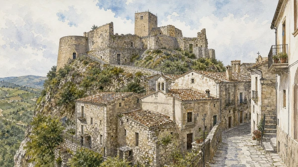
Houses, churches and lanes climb around a rock spur crowned by fortified remains.

Bagnoli del Trigno: two levels beneath the castle

Houses, churches and lanes climb around a rock spur crowned by fortified remains. The place becomes clearer when surviving fabric, later change and present use are read together.

Today

This is an inhabited place, not a visitor set. Keep doorways, pavements and deliveries clear, and use current municipal mobility information.

History

Settlement adapted to steep terrain through medieval and early modern phases before roads and rebuilding connected upper and lower quarters.

How to read this place

Move carefully through inhabited streets and distinguish the Sanfelice castle, churches and later homes by level and date.

What to notice

  • street width and building materials
  • residential use behind historic facades
  • later infrastructure and adaptation
Italia.it · Molise
Original documentary watercolour of Bagnoli del Trigno: two levels beneath the castle in Tratturi and the central Sannio · Molise, showing accurate architecture, landscape and present-day use
Bagnoli del Trigno: two levels beneath the castleOriginal Merlintravel documentary watercolour · 2026
09

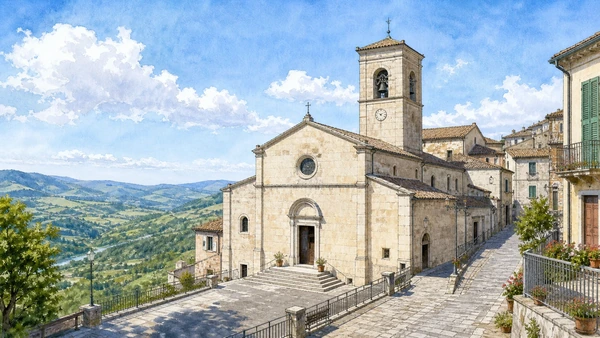
The cathedral complex preserves an important crypt while the town occupies a ridge over the river valley.

Trivento Cathedral and crypt: a diocesan centre above the Trigno

The cathedral complex preserves an important crypt while the town occupies a ridge over the river valley. The place becomes clearer when surviving fabric, later change and present use are read together.

Today

This is an active religious place. Services, ceremonies and conservation can interrupt tourist access; dress appropriately, remain quiet and verify the official notice.

History

Ancient and medieval occupation preceded repeated rebuilding of the episcopal centre and later urban adaptation.

How to read this place

Read crypt columns and spolia separately from the upper church and present liturgy; verify access with the diocese.

What to notice

  • the relationship between worship and visitor circulation
  • older fabric and later rebuilding
  • objects still used in liturgy
Diocese of Trivento
Original documentary watercolour of Trivento Cathedral and crypt: a diocesan centre above the Trigno in Tratturi and the central Sannio · Molise, showing accurate architecture, landscape and present-day use
Trivento Cathedral and crypt: a diocesan centre above the TrignoOriginal Merlintravel documentary watercolour · 2026
10

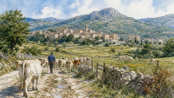
Open grazing land, farm structures and village routes preserve a contemporary pastoral economy near the tratturo network.

Carovilli and Staffoli: pasture still in motion

Open grazing land, farm structures and village routes preserve a contemporary pastoral economy near the tratturo network. The place becomes clearer when surviving fabric, later change and present use are read together.

Today

Weather, heat, fire risk, snow, sea state and seasonal restrictions can alter access. Use official park or reserve information and remain on authorised routes.

History

Seasonal movement, cattle breeding and rural settlement adapted through mechanisation and population decline without disappearing.

How to read this place

Keep herds and farm work undisturbed, use public roads and present transhumance as living labour rather than a costumed survival.

What to notice

  • geology and native vegetation
  • authorised paths and protected habitats
  • working land or water beside conservation zones
Italia.it · landscapes of Molise
Original documentary watercolour of Carovilli and Staffoli: pasture still in motion in Tratturi and the central Sannio · Molise, showing accurate architecture, landscape and present-day use
Carovilli and Staffoli: pasture still in motionOriginal Merlintravel documentary watercolour · 2026

Molise through time

A short chronology

From Palaeolithic evidence and Samnite sanctuaries to Roman towns, monastic power, pastoral routes, emigration, modern infrastructure and cultural renewal.

  1. Isernia La Pineta preserves evidence of very early human activity and environment in the central Mediterranean.

  2. Bronze and Iron Age communities organise upland settlement, exchange and burial across the Apennine interior.

  3. Samnite and Frentan communities establish sanctuaries, fortified ridges and routes linking mountains, plains and Adriatic approaches.

  4. Wars with Rome transform political control without immediately erasing local institutions and material culture.

  5. Romanisation reshapes Aesernia, Bovianum, Larinum and the pastoral corridor later formalised at Saepinum.

  6. Urban building, roads, amphitheatres, baths, estates and markets connect Molise to wider imperial systems.

  7. Population, worship and authority reorganise after Roman government, with Lombard Benevento becoming a decisive political framework.

  8. San Vincenzo al Volturno grows into a major Benedictine monastery before attack, destruction and later rebuilding.

  9. Monasteries, dioceses, castles and new settlements organise routes between the upper Volturno, Matese, Trigno and Biferno.

  10. Fortresses become noble residences while Albanian-speaking communities settle parts of lower Molise.

  11. Pastoral regulation, churches, craft towns and feudal estates connect the region to Naples, Abruzzo, Campania and Apulia.

  12. A destructive earthquake accelerates rebuilding and the reorganisation of Campobasso and many inland settlements.

  13. Unification, emigration, war damage and rural change precede the creation of the autonomous Molise region in 1963.

  14. Roads, reservoirs, coastal tourism and mountain facilities change access while depopulation reshapes inland communities.

  15. Museum renewal, park management, craft continuity and cultural-route projects expand interpretation under continuing demographic and climate pressure.

Before your visit

Practical information

01

Check the institution again

Opening hours, guided routes, restoration, worship and staffing change. Recheck the linked official notice shortly before departure.

02

Respect mountain time

Short distances can involve slow roads, snow, fog, heat or livestock. Do not compress distant valleys and coasts into one superficial day.

03

Keep inhabited places liveable

Historic centres, Arbëreshë communities, farms, ports and craft towns remain places of work and residence. Keep doors, quays and deliveries clear.

04

Treat archaeology as evidence

Stay behind barriers. Excavated remains and later reconstructions represent different stages of the site’s history.

05

Use current nature notices

Snow, fire risk, storms, caves, forest work, wildlife and sea conditions can alter access. Follow the responsible reserve, park or municipality.

06

Read modern change honestly

Reservoirs, roads, ski lifts, migration, rebuilding and museum reuse are documented parts of Molise rather than visual intrusions to hide.

Method and sources

Sources and image credits

This guide uses official ministry, museum, municipal, diocesan, reserve and national-tourism documentation checked on 1 September 2026. It distinguishes Palaeolithic, Samnite, Frentan, Roman, Lombard, monastic, Norman, early modern and contemporary phases rather than treating Molise as a timeless rural landscape. Every chapter links its principal institutional source; tickets, worship, closures, snow, fire risk, sea conditions and transport must always be verified again on the day of the visit.

All ten images are original Merlintravel editorial watercolours based on documented present-day conditions. They are illustrations, not substitutes for archaeological plans. Opening hours, tickets, accessible routes, temporary exhibitions and conservation work can change; consult the linked official pages shortly before visiting.