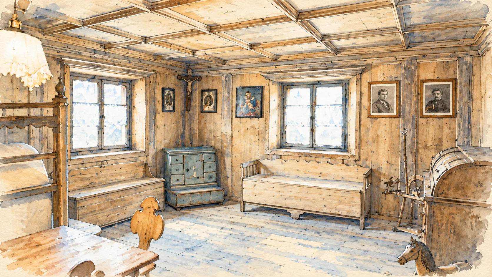
Editorial watercolour: a historic wood-lined Ladin room displayed at Museo Ladin de Fascia.

Trentino-Alto Adige · Guide 03

Val di Fassa

Ladin institutions, village churches, water-powered work and the high Dolomites belong to one inhabited valley, but demand different kinds of visit.

Plan the route
Val di Fassa / Val de Fascia10 chapters · history, culture and landscape

Why this place matters

Read the valley before climbing above it.

The Dolomite skyline is only one part of Fassa. Museum collections, Ladin place names and working village streets explain who inhabits the valley. The mountain chapters are separate options: a lift arrival, a roadside viewpoint and an exposed high route are not equivalent experiences.

The guide separates documented history from suggestions for reading the site. Named buildings and landscape relationships follow institutional sources; the illustrations are editorial interpretations, not measured surveys or records of current access.

Ladin institutions, village churches, water-powered work and the high Dolomites belong to one inhabited valley, but demand different kinds of visit.

The route

Plan your visit

Use the central villages for a cultural day. Give Ciampedie its own suitable-weather outing. Canazei, Pordoi and Fedaia require a separate plan with current transport and mountain information; do not attempt all high stops as one automatic circuit.

Day 1 · culture

Museum, San Giovanni and Santa Giuliana

Use the central villages for a cultural day.

Day 1 or 2 · villages

Pera mill and lower-valley settlements

Separate mountain day

Ciampedie and the Catinaccio outlook

Alternative day trips

Canazei, Pordoi or Fedaia

Ten chapters

Explore the places

The chapters connect history and terrain. Mountain areas and outlying towns are separate options, not a single continuous walking route.

  1. 01Museo Ladin de Fascia
  2. 02Pieve di San Giovanni
  3. 03Santa Giuliana above Vigo
  4. 04L Molin de Pèzol at Pera
  5. 05Vigo and its inhabited streets
  6. 06Moena and the lower-valley approach
  7. 07Ciampedie and the Catinaccio outlook
  8. 08Canazei and the upper Avisio
  9. 09Passo Pordoi and Sass Pordoi
  10. 10Passo Fedaia and the Marmolada outlook
01

Evidence and interpretation

Museo Ladin de Fascia

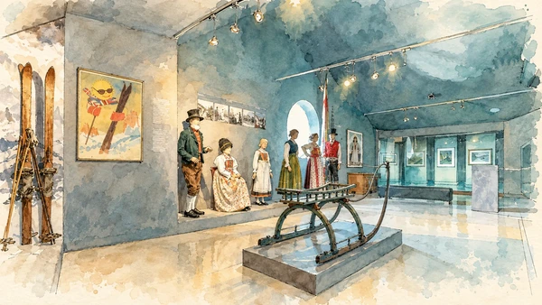
The museum introduces the valley through its own language, material culture and changing everyday life. Begin here to give the mountain panorama a human context.

Today

Check the institution’s current opening, booking arrangements and accessible route. Individual rooms, exhibitions and approaches may have separate conditions.

History

The collection follows local society from earlier settlement through work, custom and modern change. Local museum sections extend that account into historic buildings.

How to read this place

Notice how interpretation uses objects and voices together. Ladin culture remains contemporary and continues beyond the traditions represented in the museum.

What to notice

  • Notice how interpretation uses objects and voices together.
  • The relationship between the site and its surrounding route.
  • The distinction between surviving evidence and modern interpretation.
Val di Fassa Tourist Board · Museo Ladin de Fascia
Watercolour: A sleigh and traditional clothing displays inside Museo Ladin de Fascia.
Museo Ladin de FasciaOriginal Merlintravel documentary watercolour · 2026
02

Worship and memory

Pieve di San Giovanni

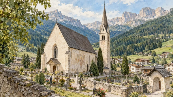
The church and its setting form an important religious focus between the settlements of the central valley. Approach the building as an active place.

Today

Worship and local religious life continue here. Visitor access may pause for services; consult the church or managing institution before planning an interior visit.

History

An early foundation was followed by medieval enlargement and later restoration. The present fabric cannot be reduced to its earliest recorded phase.

How to read this place

Compare the church’s orientation and surrounding settlement. Separate foundation history from the age of the walls visible now.

What to notice

  • Compare the church’s orientation and surrounding settlement.
  • The relationship between the site and its surrounding route.
  • The distinction between surviving evidence and modern interpretation.
Val di Fassa Tourist Board · village walking map
Watercolour: The parish church of San Giovanni with its pointed bell tower.
Pieve di San GiovanniOriginal Merlintravel documentary watercolour · 2026
03

Worship and memory

Santa Giuliana above Vigo

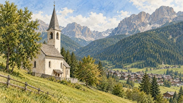
The uphill church places worship against an open mountain setting. The approach is part of the visit, not just a means of reaching a photograph.

Today

Worship and local religious life continue here. Visitor access may pause for services; consult the church or managing institution before planning an interior visit.

History

Decoration and successive interventions preserve the cult of the valley’s patron saint across different historical periods.

How to read this place

Read the relative isolation of the site and the relationship between church, path and valley. Check opening before planning to see the interior.

What to notice

  • Read the relative isolation of the site and the relationship between church, path and valley.
  • The relationship between the site and its surrounding route.
  • The distinction between surviving evidence and modern interpretation.
Municipal cultural inventory · Santa Giuliana
Watercolour: Santa Giuliana church on a grassy hillside above Vigo.
Santa Giuliana above VigoOriginal Merlintravel documentary watercolour · 2026
04

Evidence and interpretation

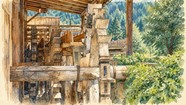
L Molin de Pèzol at Pera

The watermill brings the route down to the practical use of streams and local resources. It offers a different scale from churches and summits.

Today

Check the institution’s current opening, booking arrangements and accessible route. Individual rooms, exhibitions and approaches may have separate conditions.

History

Preserved milling equipment helps interpret production and work in the valley; it belongs to the network of Ladin museum sections.

How to read this place

Follow the relationship between water supply, mechanism and building. A demonstration depends on organised access rather than unrestricted operation.

What to notice

  • Follow the relationship between water supply, mechanism and building.
  • The relationship between the site and its surrounding route.
  • The distinction between surviving evidence and modern interpretation.
Val di Fassa Tourist Board · L Molin de Pèzol
Watercolour: Timber waterwheel machinery at Molin de Pezol.
L Molin de Pèzol at PeraOriginal Merlintravel documentary watercolour · 2026
05

The inhabited landscape

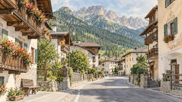
Vigo and its inhabited streets

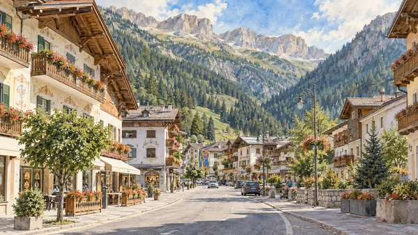
Vigo is a base for cultural visits and mountain access. Walking its streets keeps the route connected to homes, services and ordinary movement.

Today

This remains an inhabited place. Use pedestrian routes, keep entrances clear and check municipal mobility notices for any restricted area.

History

The valley’s settlements developed around religious, agricultural and transport functions before their modern tourism role.

How to read this place

Read Ladin names alongside other signs. Avoid treating domestic entrances and farm spaces as public attractions.

What to notice

  • Read Ladin names alongside other signs.
  • The relationship between the site and its surrounding route.
  • The distinction between surviving evidence and modern interpretation.
Val di Fassa Tourist Board · village walking map
Watercolour: A village street and timber balconies in Vigo di Fassa.
Vigo and its inhabited streetsOriginal Merlintravel documentary watercolour · 2026
06

The inhabited landscape

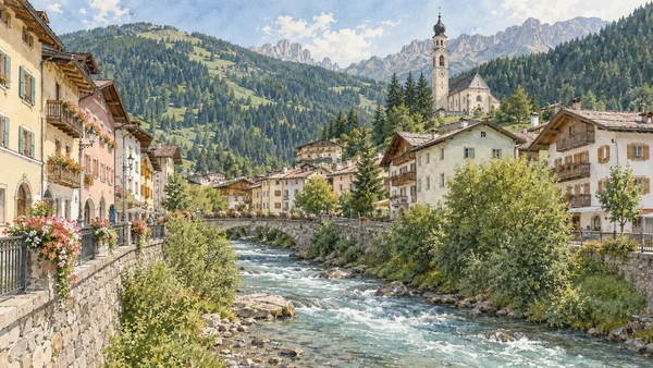
Moena and the lower-valley approach

Moena belongs to the southern approach to Fassa and deserves a separate village walk. River, roads and settlement explain its position within the wider corridor.

Today

This remains an inhabited place. Use pedestrian routes, keep entrances clear and check municipal mobility notices for any restricted area.

History

Religious buildings and older streets survive within a town reshaped by mobility and tourism.

How to read this place

Keep the geography clear: Moena is not Canazei, and a valley itinerary includes real travel between them.

What to notice

  • Keep the geography clear: Moena is not Canazei, and a valley itinerary includes real travel between them.
  • The relationship between the site and its surrounding route.
  • The distinction between surviving evidence and modern interpretation.
Val di Fassa Tourist Board · village walking map
Watercolour: Moena’s houses beside the Avisio watercourse.
Moena and the lower-valley approachOriginal Merlintravel documentary watercolour · 2026
07

Terrain and access

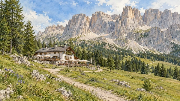
Ciampedie and the Catinaccio outlook

The lifted approach gives access to a mountain balcony and the beginning of several routes. Reaching the station does not remove the need to assess the terrain beyond it.

Today

Conditions depend on the exact route and the day. Check the responsible operator, weather and local access notices; a viewpoint is not the same undertaking as a mountain traverse.

History

The refuge belongs to the history of organised Alpine travel. Modern lift access changes how visitors enter the Catinaccio landscape.

How to read this place

Distinguish a visit near the arrival area from a traverse toward another refuge. Read current route classifications before extending the walk.

What to notice

  • Distinguish a visit near the arrival area from a traverse toward another refuge.
  • The relationship between the site and its surrounding route.
  • The distinction between surviving evidence and modern interpretation.
Società degli Alpinisti Tridentini · Rifugio Ciampedie
Watercolour: A mountain refuge and meadow beneath the Catinaccio rock walls.
Ciampedie and the Catinaccio outlookOriginal Merlintravel documentary watercolour · 2026
08

The inhabited landscape

Canazei and the upper Avisio

The upper-valley village is a transport and visitor base with an inhabited centre. It provides orientation before the road climbs toward the passes.

Today

This remains an inhabited place. Use pedestrian routes, keep entrances clear and check municipal mobility notices for any restricted area.

History

Older settlement and modern tourism infrastructure occupy the same narrow valley floor.

How to read this place

Look for the relationship between stream, village and uphill roads. Use the village as a base rather than assuming every named summit is a short walk away.

What to notice

  • Look for the relationship between stream, village and uphill roads.
  • The relationship between the site and its surrounding route.
  • The distinction between surviving evidence and modern interpretation.
Val di Fassa Tourist Board · village walking map
Watercolour: Alpine houses along a street in Canazei.
Canazei and the upper AvisioOriginal Merlintravel documentary watercolour · 2026
09

Terrain and access

Passo Pordoi and Sass Pordoi

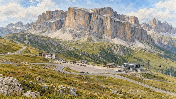
The pass and the cableway arrival are two different places at different elevations. A high viewpoint may be reached mechanically, but the surrounding terrain remains Alpine.

Today

Conditions depend on the exact route and the day. Check the responsible operator, weather and local access notices; a viewpoint is not the same undertaking as a mountain traverse.

History

Road and lift infrastructure made this mountain setting accessible to a much wider public.

How to read this place

Check lift operation, last descent and conditions at altitude. A summit excursion beyond the arrival station requires a separate decision.

What to notice

  • Check lift operation, last descent and conditions at altitude.
  • The relationship between the site and its surrounding route.
  • The distinction between surviving evidence and modern interpretation.
Sass Pordoi cableway · access and operations
Watercolour: The road at Passo Pordoi beneath the Sella rock walls.
Passo Pordoi and Sass PordoiOriginal Merlintravel documentary watercolour · 2026
10

Terrain and access

Passo Fedaia and the Marmolada outlook

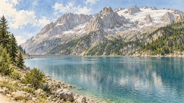
The pass and lake offer a view toward the Marmolada environment at the edge of the valley itinerary. Mountain roads and seasonal conditions govern the visit.

Today

Conditions depend on the exact route and the day. Check the responsible operator, weather and local access notices; a viewpoint is not the same undertaking as a mountain traverse.

History

Infrastructure and tourism are visible parts of this high landscape, alongside rock, snow and changing ice.

How to read this place

Read the present scene rather than expecting an old photograph’s snow cover. A lakeside stop is not permission to approach glacier or closed terrain.

What to notice

  • Read the present scene rather than expecting an old photograph’s snow cover.
  • The relationship between the site and its surrounding route.
  • The distinction between surviving evidence and modern interpretation.
Val di Fassa Tourist Board · webcams and mountain locations
Watercolour: Lake Fedaia and the northern slopes of Marmolada.
Passo Fedaia and the Marmolada outlookOriginal Merlintravel documentary watercolour · 2026

The territory through time

A short chronology

A concise chronology linking the documented sites to the wider story.

  1. Dolomite rock records marine environments, uplift and erosion.

  2. The Ladin museum introduces the valley’s older material history.

  3. Religious foundations and settlements organise local life.

  4. Enlargement and decoration change the valley’s churches over time.

  5. Mills connect streams with everyday production.

  6. Refuges become part of a developing mountain visitor network.

  7. Roads and lifts change the scale and seasonality of tourism.

  8. The Dolomites are inscribed as a serial UNESCO World Heritage property; its boundaries do not cover every nearby valley or summit.

Before your visit

Practical information

01

Plan separate days

Choose a manageable set of visits and allow for transport, booked entries and the return journey.

02

Use the exact place name

Italian, German and Ladin names may differ. Match the actual destination and province when reading signs, booking a visit or checking transport.

03

Check the institution

Opening hours, tickets, exhibitions and religious access change. Use the linked managing institution shortly before visiting.

04

Check the actual terrain

A town walk, gorge walkway, lift arrival and mountain path have different demands. Use current route information, weather and closures for the option you choose.

05

Arrange accessible visits

Historic interiors and mountain approaches can include steps, gradients or uneven surfaces. Ask about the specific route instead of assuming an entire destination is step-free.

06

Respect work and residence

Farms, workshops, churches and historic streets remain in use. Follow signs, keep entrances clear and ask permission before entering private spaces.

Method and sources

Sources and image credits

Prepared on 8 September 2026 from the institutional sources linked below. Historical claims are separated from editorial observations and itinerary suggestions. Older institutional brochures are used for stable cultural context, never as current timetables. Prices, lift schedules, trail status and admission are deliberately left to the responsible operators. Illustrations are not photographs, measured reconstructions or evidence of current conditions.

The eleven images are original Merlintravel editorial watercolours. They interpret named places and are not photographs or substitutes for measured plans. Opening hours, tickets, accessible routes, temporary exhibitions and conservation work can change; consult the linked official pages shortly before visiting.