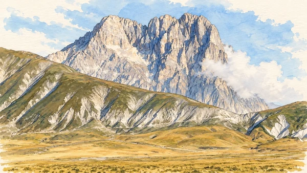
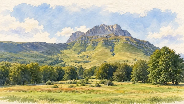
Watercolour: Campo Imperatore’s broad treeless grassland beneath limestone ridges.

Abruzzo · Guide 02

Gran Sasso

A high plateau, fortified villages and ceramic workshops connect Apennine terrain with the work of settled communities.

Plan the route
Gran Sasso and Campo Imperatore10 chapters · history, culture and landscape

Why this place matters

The mountain is also a network of villages.

Campo Imperatore’s breadth can make the human landscape seem almost absent. Yet villages, seasonal grazing, workshops and roads are integral to the massif’s story. The southern plateau and the Teramo side belong to separate travel plans. This guide offers places from which to understand the mountain; it does not turn a summit or a traverse into an automatic sightseeing stop.

The guide separates documented history from suggestions for reading the site. Named buildings and landscape relationships follow institutional sources; the illustrations are editorial interpretations, not measured surveys or records of current access.

A high plateau, fortified villages and ceramic workshops connect Apennine terrain with the work of settled communities.
The route

Plan your visit

Choose a suitable-weather plateau outing, a separate Calascio–Santo Stefano village day, and an independent visit to the Teramo-side communities. Road journeys around the massif are substantial; a line on a map is not a direct connection.

Suitable-weather day

Campo Imperatore and its outlooks

Choose a suitable-weather plateau outing, a separate Calascio–Santo Stefano village day, and an independent visit to the Teramo-side communities.

Village day

Santo Stefano and Calascio

Village extension

Castel del Monte

Separate Teramo-side trip

Castelli, Isola and Prati di Tivo

Ten chapters

Explore the places

The chapters connect history and terrain. Mountain areas and outlying towns are separate options, not a single continuous walking route.

  1. 01Campo Imperatore plateau
  2. 02Corno Grande from the plateau
  3. 03Santo Stefano di Sessanio
  4. 04Rocca Calascio
  5. 05Santa Maria della Pietà
  6. 06Castel del Monte
  7. 07Castelli and ceramic work
  8. 08San Donato at Castelli
  9. 09Isola del Gran Sasso
  10. 10Prati di Tivo
01

Terrain and access

Campo Imperatore plateau

The plateau is best introduced through its open ground and the relationship between grassland, limestone and weather. Stop only where permitted and keep vehicle access separate from walking beyond the road.

Today

Conditions depend on the exact route and the day. Check the responsible operator, weather and local access notices; a viewpoint is not the same undertaking as a mountain traverse.

History

Grazing and movement through the uplands have linked the plateau to the surrounding settlements. The national park protects a landscape with a human history as well as important habitats.

How to read this place

Read the folds of the ground and the absence of continuous woodland at this altitude. A broad view does not imply simple conditions: exposure, fog and seasonal road restrictions change the visit.

What to notice

  • Read the folds of the ground and the absence of continuous woodland at this altitude.
  • The relationship between the site and its surrounding route.
  • The distinction between surviving evidence and modern interpretation.
Gran Sasso and Monti della Laga National Park
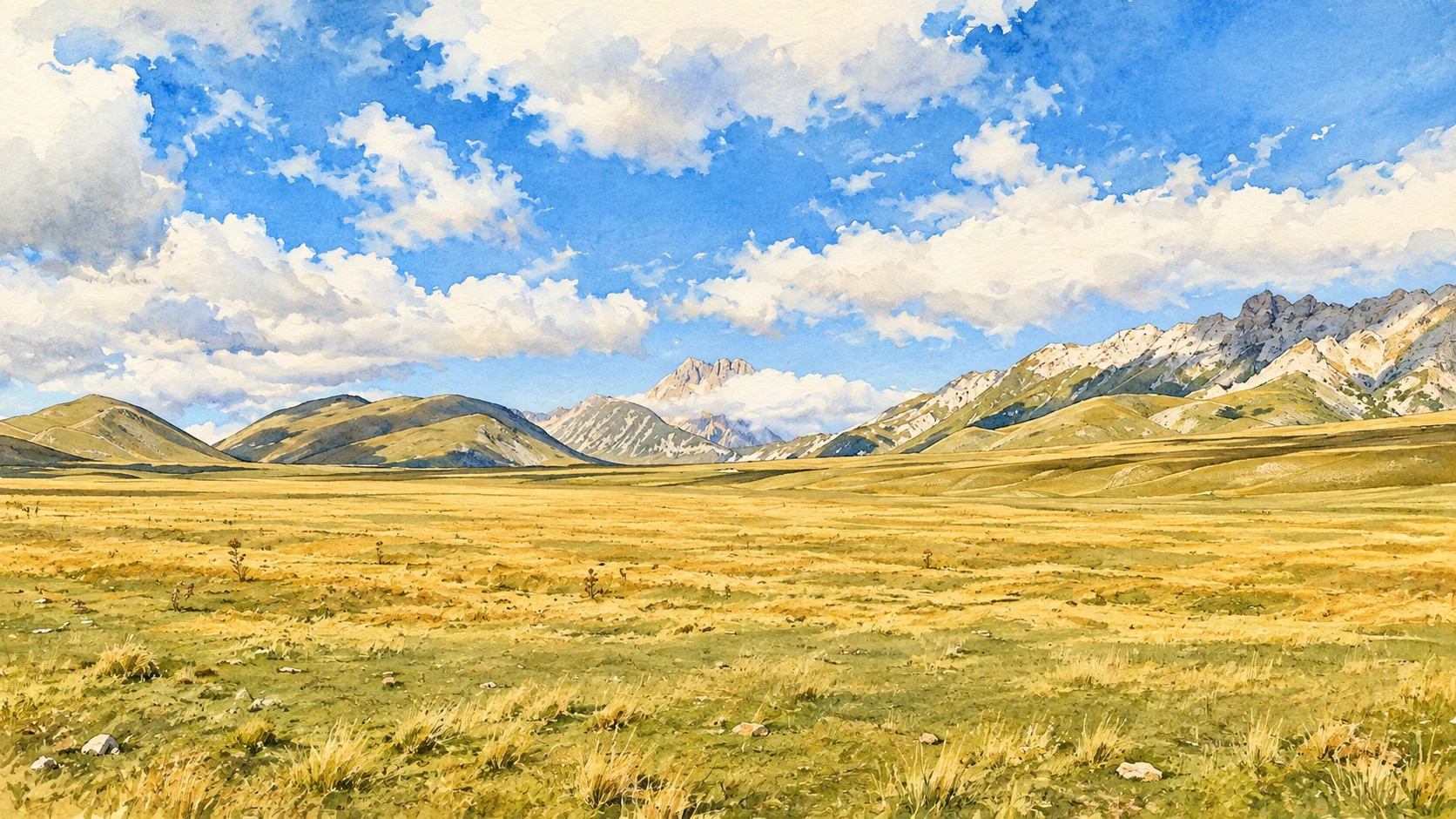
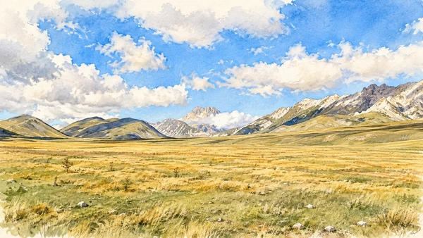
Watercolour: Campo Imperatore’s broad treeless grassland beneath limestone ridges.
Campo Imperatore plateauEditorial watercolour · AI-generated · 2026
02

Terrain and access

Corno Grande from the plateau

A distant reading of the massif can be a complete experience in itself. Identify the mountain from a verified viewpoint without treating its summit as the next step of a casual visit.

Today

Conditions depend on the exact route and the day. Check the responsible operator, weather and local access notices; a viewpoint is not the same undertaking as a mountain traverse.

History

The Gran Sasso contains the highest ground of the Apennines. Rock faces, scree and high basins preserve a history of geological change and mountain travel.

How to read this place

Distinguish what can be seen from where a path actually leads. Summit routes and traverses require specific assessment, appropriate experience and current mountain information.

What to notice

  • Distinguish what can be seen from where a path actually leads.
  • The relationship between the site and its surrounding route.
  • The distinction between surviving evidence and modern interpretation.
Gran Sasso and Monti della Laga National Park
Watercolour: The southern limestone profile of Corno Grande above sparse grass and scree.
Corno Grande from the plateauEditorial watercolour · AI-generated · 2026
03

The inhabited landscape

Santo Stefano di Sessanio

Stone lanes and closely grouped buildings make the village legible on foot. Its small scale calls for slow movement and respect for homes and working entrances.

Today

This remains an inhabited place. Use pedestrian routes, keep entrances clear and check municipal mobility notices for any restricted area.

History

The settlement’s pastoral and trading history connects it to a wider upland economy. Later restoration and tourism reuse are additional layers, not evidence of an unchanged medieval world.

How to read this place

Compare covered passages, steep changes in level and the grouping of houses. Look for the places where contemporary life uses the inherited fabric rather than treating every doorway as a museum object.

What to notice

  • Compare covered passages, steep changes in level and the grouping of houses.
  • The relationship between the site and its surrounding route.
  • The distinction between surviving evidence and modern interpretation.
Regione Abruzzo · Gran Sasso cultural guide
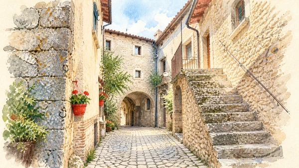
Watercolour: An arched stone passage among the houses of Santo Stefano di Sessanio.
Santo Stefano di SessanioEditorial watercolour · AI-generated · 2026
04

The inhabited landscape

Rocca Calascio

The ruined fortress stands above the village on exposed rocky ground. Its approach, weather and current visitor arrangements are part of the plan, not details to add after arrival.

Today

This remains an inhabited place. Use pedestrian routes, keep entrances clear and check municipal mobility notices for any restricted area.

History

The defensive site belongs to the history of settlement and control of the southern Gran Sasso landscape. Its survival as a ruin differs fundamentally from a fully inhabited castle.

How to read this place

Follow the silhouette of the central structure and corner towers. Keep to permitted routes and distinguish the lower village from the higher fortress.

What to notice

  • Follow the silhouette of the central structure and corner towers.
  • The relationship between the site and its surrounding route.
  • The distinction between surviving evidence and modern interpretation.
Regione Abruzzo · Calascio
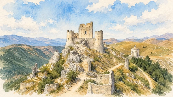
Watercolour: Rocca Calascio’s ruined keep and round corner towers on their rocky ridge.
Rocca CalascioEditorial watercolour · AI-generated · 2026
05

Worship and memory

Santa Maria della Pietà

The small church near the fortress offers a quieter architectural focus than the castle skyline. Its compact geometry is especially clear against open mountain ground.

Today

Worship and local religious life continue here. Visitor access may pause for services; consult the church or managing institution before planning an interior visit.

History

The dedicated regional record places its construction between the sixteenth and seventeenth centuries. Stories of a victory over brigands belong to local tradition.

How to read this place

Keep the tradition separate from dated building history. Compare the church’s centralised plan with the defensive geometry above it; do not assume an open interior.

What to notice

  • Keep the tradition separate from dated building history.
  • The relationship between the site and its surrounding route.
  • The distinction between surviving evidence and modern interpretation.
Regione Abruzzo · Santa Maria della Pietà
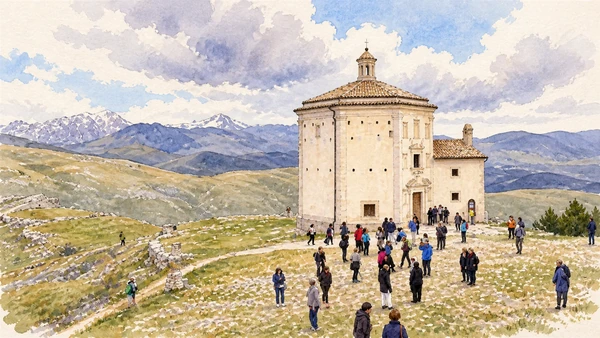
Watercolour: The octagonal church of Santa Maria della Pietà on open upland ground.
Santa Maria della PietàEditorial watercolour · AI-generated · 2026
06

The inhabited landscape

Castel del Monte

The inhabited village introduces streets, food production and the practical life of the uplands. It merits its own stop rather than serving only as an approach to the plateau.

Today

This remains an inhabited place. Use pedestrian routes, keep entrances clear and check municipal mobility notices for any restricted area.

History

Pastoral work and transhumance have shaped local products and cultural memory. The built settlement concentrates activities that are widely dispersed across summer grazing land.

How to read this place

Read the slope through steps, narrow streets and compact house fronts. Ask producers about their work without assuming that a shop visit grants access to private production spaces.

What to notice

  • Read the slope through steps, narrow streets and compact house fronts.
  • The relationship between the site and its surrounding route.
  • The distinction between surviving evidence and modern interpretation.
Regione Abruzzo · Gran Sasso village route
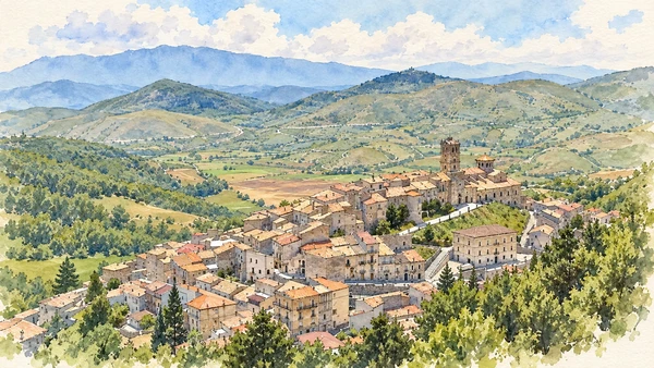
Watercolour: The compact houses and church tower of Castel del Monte on the hillside.
Castel del MonteEditorial watercolour · AI-generated · 2026
07

Materials and work

Castelli and ceramic work

Workshops make material skill visible at the eastern foot of the massif. A ceramic object can connect design, firing, trade and a maker’s decisions in one compact form.

Today

Workshops are places of work. Arrange a visit where offered and ask permission before entering private spaces or photographing a maker.

History

Castelli is a longstanding centre of decorated ceramics. Its workshop culture connects this mountain-side community to markets and collections beyond Abruzzo.

How to read this place

Look at changes in shape and painted surface rather than assuming every object has the same date or technique. Arrange workshop visits when offered and respect working space.

What to notice

  • Look at changes in shape and painted surface rather than assuming every object has the same date or technique.
  • The relationship between the site and its surrounding route.
  • The distinction between surviving evidence and modern interpretation.
Regione Abruzzo · Gran Sasso cultural guide
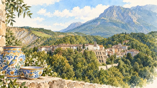
Watercolour: The hillside settlement of Castelli, home to a longstanding ceramic tradition.
Castelli and ceramic workEditorial watercolour · AI-generated · 2026
08

Worship and memory

San Donato at Castelli

The church links religious space to the ceramic culture of the surrounding community. It is a distinct visit from browsing the village’s shops.

Today

Worship and local religious life continue here. Visitor access may pause for services; consult the church or managing institution before planning an interior visit.

History

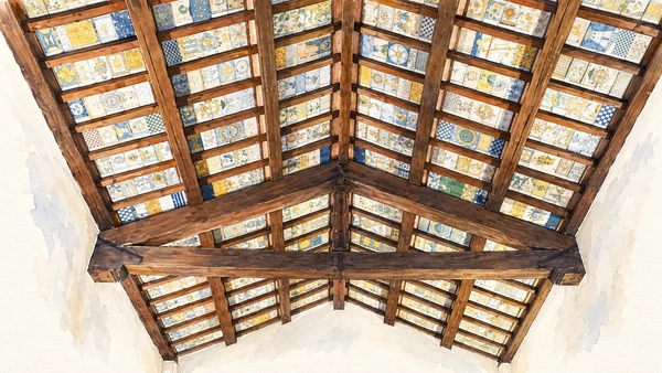
Its celebrated decorated ceramic ceiling is part of Castelli’s artistic heritage. Conservation and earthquake-related work make current access a separate question from historical importance.

How to read this place

A ceiling is an architectural ensemble, not a collection of isolated souvenirs. Check access with the responsible institution; the illustration interprets the decorated ceiling and does not establish that the interior is currently open.

What to notice

  • A ceiling is an architectural ensemble, not a collection of isolated souvenirs.
  • The relationship between the site and its surrounding route.
  • The distinction between surviving evidence and modern interpretation.
Regione Abruzzo · Gran Sasso cultural guide
Watercolour: The painted ceramic ceiling inside San Donato at Castelli.
San Donato at CastelliEditorial watercolour · AI-generated · 2026
09

The inhabited landscape

Isola del Gran Sasso

The valley settlement provides a human scale below the mountain walls. It can be a base for exploring local streets and nearby cultural destinations on the Teramo side.

Today

This remains an inhabited place. Use pedestrian routes, keep entrances clear and check municipal mobility notices for any restricted area.

History

The community belongs to the inhabited eastern approaches to the massif, where settlement, religious life and movement connect valleys with higher terrain.

How to read this place

Keep a village walk distinct from an excursion higher on the mountain. Confirm the exact address of an intended church, museum or trailhead before planning onward travel.

What to notice

  • Keep a village walk distinct from an excursion higher on the mountain.
  • The relationship between the site and its surrounding route.
  • The distinction between surviving evidence and modern interpretation.
Gran Sasso and Monti della Laga National Park
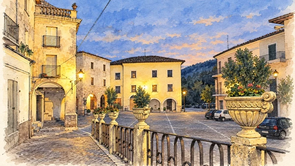
Watercolour: A paved square and historic houses in Isola del Gran Sasso at dusk.
Isola del Gran SassoEditorial watercolour · AI-generated · 2026
10

Terrain and access

Prati di Tivo

This mountain approach presents a different face of the massif from Campo Imperatore. The arrival area can be a viewpoint without committing the visitor to the routes beyond it.

Today

Conditions depend on the exact route and the day. Check the responsible operator, weather and local access notices; a viewpoint is not the same undertaking as a mountain traverse.

History

Tourism and mountain infrastructure have changed how people reach this side of Gran Sasso. The surrounding terrain remains mountainous despite easier access to a starting point.

How to read this place

Assess each onward route independently. Do not infer that a lift operates or that a trail is open from an old photograph, brochure or advertised past excursion.

What to notice

  • Assess each onward route independently.
  • The relationship between the site and its surrounding route.
  • The distinction between surviving evidence and modern interpretation.
Gran Sasso and Monti della Laga National Park
Watercolour: The meadows at Prati di Tivo beneath the rugged profile of Corno Piccolo.
Prati di TivoEditorial watercolour · AI-generated · 2026

The territory through time

A short chronology

A concise chronology linking the documented sites to the wider story.

  1. Limestone ridges and high basins provide the terrain for later human activity.

  2. Seasonal grazing connects Campo Imperatore with settlements and markets.

  3. Rocca Calascio marks the history of defence above the southern approaches.

  4. Santo Stefano di Sessanio and Castel del Monte belong to a wider upland economy.

  5. The regional record dates Santa Maria della Pietà to this period.

  6. Castelli’s workshops and San Donato’s decorated ceiling link craft with religious patronage.

  7. Arrival areas and infrastructure change access to places such as Prati di Tivo.

  8. The national park manages a landscape of habitats, work and inhabited communities.

Before your visit

Practical information

01

Plan separate days

Choose a manageable set of visits and allow for transport, booked entries and the return journey.

02

Use the exact place name

Similar religious names can refer to different sites. Santo Spirito al Morrone near Sulmona and Santo Spirito a Maiella near Roccamorice require separate journeys.

03

Check the institution

Opening hours, tickets, exhibitions and religious access change. Use the linked managing institution shortly before visiting.

04

Check the actual terrain

A town walk, gorge walkway, lift arrival and mountain path have different demands. Use current route information, weather and closures for the option you choose.

05

Arrange accessible visits

Historic interiors and mountain approaches can include steps, gradients or uneven surfaces. Ask about the specific route instead of assuming an entire destination is step-free.

06

Respect work and residence

Farms, workshops, churches and historic streets remain in use. Follow signs, keep entrances clear and ask permission before entering private spaces.

Method and sources

Sources and image credits

Prepared on 8 September 2026 from the institutional sources linked below. Historical claims are separated from editorial observations and itinerary suggestions. Older institutional brochures are used for stable cultural context, never as current timetables. Prices, transport schedules, trail status and admission are deliberately left to the responsible operators. Illustrations are not photographs, measured reconstructions or evidence of current conditions.

The eleven images are AI-generated editorial watercolours guided by photographic references. They interpret named places and are not photographs or substitutes for measured plans. Opening hours, tickets, accessible routes, temporary exhibitions and conservation work can change; consult the linked official pages shortly before visiting.