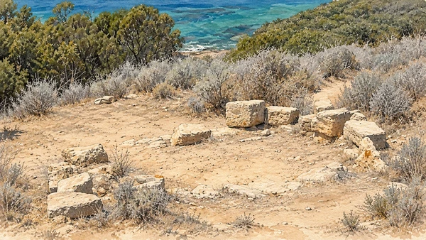
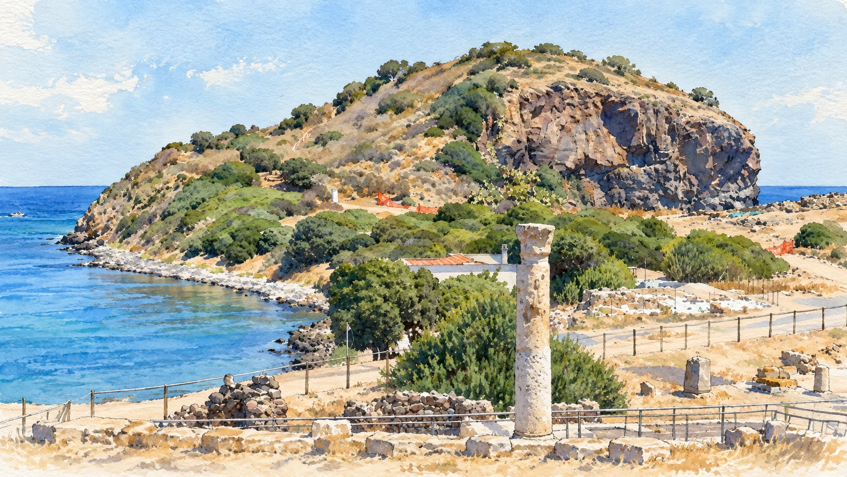
Watercolour: Nora and the southern coast establishing view

Sardinia · Guide 03

Nora

An ancient coastal city, working wetlands and wooded hills reveal the southern shore through archaeology and the changing relationship with the sea.

Plan the route
Nora and the southern coast10 chapters · history, culture and landscape

Why this place matters

Let the coastline connect the layers.

Nora occupies a peninsula where sea views and archaeological remains are inseparable. The surviving city includes houses, public buildings and later structures, each with its own history of change and restoration. Around it, the church of Sant’Efisio and the lagoon extend the visit beyond antiquity. Pixinamanna offers an inland contrast, while Chia and Bithia require another coastal outing. This guide groups related places without turning the southern coast into an unrealistic single-day circuit.

The guide separates documented history from suggestions for reading the site. Named buildings and landscape relationships follow institutional sources; the illustrations are editorial interpretations, not measured surveys or records of current access.

An ancient coastal city, working wetlands and wooded hills reveal the southern shore through archaeology and the changing relationship with the sea.
The route

Plan your visit

The first five chapters belong to the Nora peninsula, though the Coltellazzo tower can have separate access arrangements. Pair the church and lagoon only with enough time for their own visits. Plan Pixinamanna as a distinct excursion and Chia–Bithia as another coastal outing. Use the park operator’s current guided route rather than assuming every excavated building is accessible.

Ancient Nora

City, theatre, house and baths

The first five chapters belong to the Nora peninsula, though the Coltellazzo tower can have separate access arrangements.

Later peninsula

Coltellazzo and Sant’Efisio

Living environments

Laguna di Nora and Pixinamanna

Chia outing

Coastal tower and Bithia

Ten chapters

Explore the places

The chapters connect history and terrain. Use the route notes to choose visits and plan transfers between separate sites.

  1. 01Nora: an ancient city beside the sea
  2. 02The Roman theatre
  3. 03The house of the tetrastyle court
  4. 04Terme a mare: bathing and infrastructure
  5. 05The Coltellazzo tower
  6. 06Sant’Efisio: devotion on the shore
  7. 07Laguna di Nora and Fradis Minoris
  8. 08Pixinamanna: the wooded inland
  9. 09Chia’s coastal watchtower
  10. 10Bithia: reading fragmentary evidence
01

Evidence and interpretation

Nora: an ancient city beside the sea

Low masonry, standing architectural fragments and paths occupy a peninsula whose shores have changed since antiquity. The open view is striking, but the archaeological interest lies in the relationships between streets, houses and public spaces.

Today

Check the institution’s current opening, booking arrangements and accessible route. Individual rooms, exhibitions and approaches may have separate conditions.

History

Phoenician activity preceded Punic and Roman development. Under Roman rule the city acquired monumental civic buildings, while older cultural connections persisted. Nineteenth-century investigations were followed by systematic excavation in the 1950s and continuing university research from 1990. The visible remains reflect a long sequence of building, reuse, abandonment and excavation.

How to read this place

Start with the site plan and follow the authorised route. Distinguish an excavated wall from a restored element and avoid assigning every visible stone to the same century. The illustration is a study of surviving remains beside the sea, not a reconstruction of the entire ancient city.

What to notice

  • Start with the site plan and follow the authorised route.
  • Distinguish an excavated wall from a restored element and avoid assigning every visible stone to the same century.
  • The illustration is a study of surviving remains beside the sea, not a reconstruction of the entire ancient city.
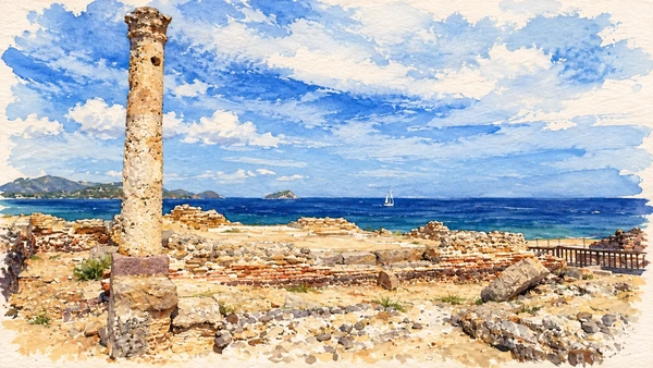
Archaeological area of Nora
Watercolour: Nora archaeological park, standing column and low excavated remains beside the sea
Nora: an ancient city beside the seaEditorial watercolour · AI-generated · 2026
02

Evidence and interpretation

The Roman theatre

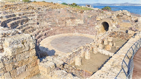
The curved seating and orchestra retain the form of a theatre, although much of its upper structure and monumental stage wall has disappeared. Modern conservation is visible in the surviving entrances and paved areas.

Today

Check the institution’s current opening, booking arrangements and accessible route. Individual rooms, exhibitions and approaches may have separate conditions.

History

The building originated in the early Roman imperial period and underwent later alterations. Gennaro Pesce excavated it in 1952. The lower seating survived better than the upper tiers, while later reuse changed the stage area. Large jars once interpreted as acoustic devices are now associated with later activity.

How to read this place

Read the semicircle as a performance space and imagine the missing stage wall only through the published interpretation. The present open view beyond the stage differs from the enclosed ancient experience. Temporary installations for modern events may change what can be seen, so the reference-based illustration is not a promise of an unobstructed visit.

What to notice

  • Read the semicircle as a performance space and imagine the missing stage wall only through the published interpretation.
  • The present open view beyond the stage differs from the enclosed ancient experience.
  • Temporary installations for modern events may change what can be seen, so the reference-based illustration is not a promise of an unobstructed visit.
Teatro | NORA
Watercolour: Nora Roman theatre, surviving semicircular seating, orchestra and restored side entrance
The Roman theatreEditorial watercolour · AI-generated · 2026
03

Evidence and interpretation

The house of the tetrastyle court

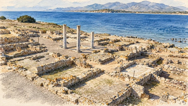
A group of re-erected columns makes this house especially recognisable. Roofless rooms, thresholds and surviving mosaic areas allow the arrangement of domestic space to be studied in relation to the nearby shore.

Today

Check the institution’s current opening, booking arrangements and accessible route. Individual rooms, exhibitions and approaches may have separate conditions.

History

The house was built around the end of the second or beginning of the third century AD and changed over time. Its familiar name refers to a four-column court. The columns are ancient but were repositioned during restoration: they originally belonged to the front portico. Coastal erosion has affected the western side.

How to read this place

The documented view shows three standing columns clearly; the traditional name describes the four-column arrangement. Look beyond the columns to the rooms, circulation and protected mosaics. Treat the displayed arrangement as an interpretive restoration, and do not walk on ancient floors unless the visitor route explicitly allows it.

What to notice

  • The documented view shows three standing columns clearly; the traditional name describes the four-column arrangement.
  • Look beyond the columns to the rooms, circulation and protected mosaics.
  • Treat the displayed arrangement as an interpretive restoration, and do not walk on ancient floors unless the visitor route explicitly allows it.
Casa dell’atrio tetrastilo | NORA
Watercolour: Casa dell’atrio tetrastilo, three columns visible in the reference view above the excavated house
The house of the tetrastyle courtEditorial watercolour · AI-generated · 2026
04

Evidence and interpretation

Terme a mare: bathing and infrastructure

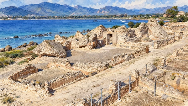
Collapsed vault fragments and substantial wall remains mark the scale of the baths. Their proximity to the water gives them their modern name, though the ancient coastline lay farther out than it does today.

Today

Check the institution’s current opening, booking arrangements and accessible route. Individual rooms, exhibitions and approaches may have separate conditions.

History

The complex was constructed in the late second or early third century AD and altered in later centuries. Cold and heated rooms, service passages and water supplies supported an organised bathing sequence. Excavation in the 1970s clarified its plan, while erosion has removed parts of the western sector.

How to read this place

Use the published plan to connect surviving fragments with rooms and circulation. The largest blocks lying on the ground can belong to collapsed coverings, not freestanding walls. The illustration shows present ruins; it does not recreate the former pools, decoration or complete roof system.

What to notice

  • Use the published plan to connect surviving fragments with rooms and circulation.
  • The largest blocks lying on the ground can belong to collapsed coverings, not freestanding walls.
  • The illustration shows present ruins; it does not recreate the former pools, decoration or complete roof system.
Terme a mare | NORA
Watercolour: Nora Terme a mare, collapsed vault fragments and excavated baths beside the water
Terme a mare: bathing and infrastructureEditorial watercolour · AI-generated · 2026
05

The inhabited landscape

The Coltellazzo tower

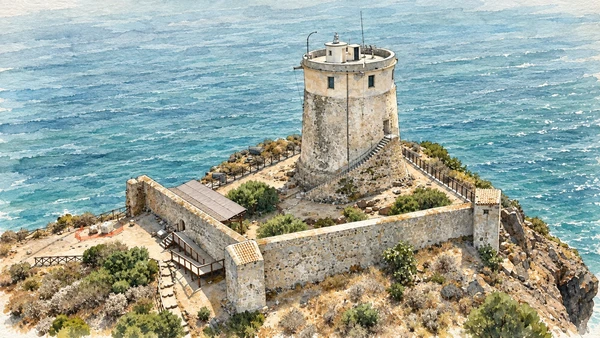
The coastal tower rises above a rocky point within a later defensive enclosure. Its pale upper structure and modern fittings belong to the building’s changing uses, rather than to a single unchanged early modern design.

Today

This remains an inhabited place. Use pedestrian routes, keep entrances clear and check municipal mobility notices for any restricted area.

History

Built in the late sixteenth century within the Spanish coastal defence system, the tower was surrounded by additional fortifications in the early eighteenth century. During the early twentieth century it was heightened and adapted for signalling and lighthouse functions. These changes explain its current silhouette.

How to read this place

Compare the main tower with the surrounding walls and the later upper section. View it from the authorised approach and confirm any separate admission or climb. A photograph of the terrace does not establish that visitors can reach it, and a site ticket should not be assumed to include every tower space.

What to notice

  • Compare the main tower with the surrounding walls and the later upper section.
  • View it from the authorised approach and confirm any separate admission or climb.
  • A photograph of the terrace does not establish that visitors can reach it, and a site ticket should not be assumed to include every tower space.
Torre di Sant’Efisio o del Coltellazzo | NORA
Watercolour: Torre del Coltellazzo, aerial view of the altered coastal tower and enclosing fortifications
The Coltellazzo towerEditorial watercolour · AI-generated · 2026
06

Worship and memory

Sant’Efisio: devotion on the shore

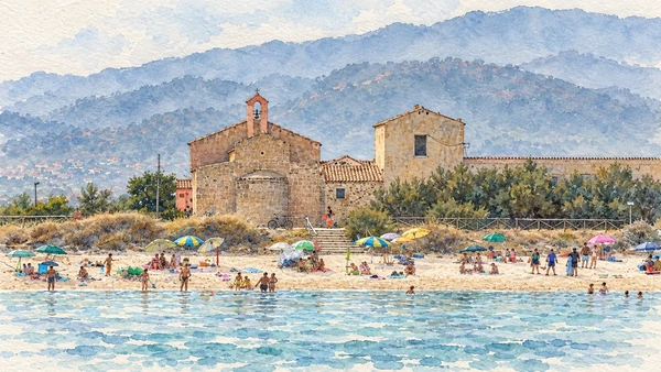
The small church stands close to the beach, linking a busy present-day shoreline with an enduring place of devotion. Its modest scale contrasts with the ancient urban remains nearby.

Today

Worship and local religious life continue here. Visitor access may pause for services; consult the church or managing institution before planning an interior visit.

History

Tradition associates the site with the martyrdom of Efisio. Early Christian funerary evidence gives the area a longer religious context. In 1089 the church was donated to the monks of Saint-Victor of Marseille, who rebuilt it in Romanesque forms. The front porch belongs to a later phase.

How to read this place

Keep the traditional account of the martyr distinct from securely dated building history. The annual procession from Cagliari connects the church with living religious practice. Respect services and the local calendar; a beach visit and access to the church interior are separate matters.

What to notice

  • Keep the traditional account of the martyr distinct from securely dated building history.
  • The annual procession from Cagliari connects the church with living religious practice.
  • Respect services and the local calendar; a beach visit and access to the church interior are separate matters.
Chiesa di Sant’Efisio | NORA
Watercolour: Sant’Efisio at Nora, church and adjoining buildings seen across the beach and shallow water
Sant’Efisio: devotion on the shoreEditorial watercolour · AI-generated · 2026
07

Terrain and access

Laguna di Nora and Fradis Minoris

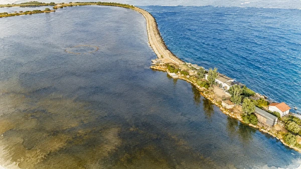
A narrow strip separates lagoon water from the open sea. The visitor centre uses this setting to explain marine and coastal habitats, while the surrounding landscape also records productive work and environmental management.

Today

The operator lists a September 2026 visitor programme. Excursions require booking and guided visits are recommended to be booked; consult the current page for the precise activity and available day.

History

Environmental education has been developed here since the late twentieth century. The centre’s biodiversity route connects interpretation of marine life, cetaceans, coastal vegetation and turtle recovery. Its displays and activities belong to a working educational organisation, not to an untouched landscape outside human influence.

How to read this place

Choose the biodiversity visit or a separately booked excursion from the operator’s current programme. Recovery facilities are places of care, so seeing a particular animal is not guaranteed. The aerial illustration explains the land-and-water relationship, rather than a viewpoint reached on the walking route.

What to notice

  • Choose the biodiversity visit or a separately booked excursion from the operator’s current programme.
  • Recovery facilities are places of care, so seeing a particular animal is not guaranteed.
  • The aerial illustration explains the land-and-water relationship, rather than a viewpoint reached on the walking route.
Il Centro Visite Laguna di Nora: orari e tariffe
Watercolour: Laguna di Nora, aerial relationship between Fradis Minoris, the lagoon and open sea
Laguna di Nora and Fradis MinorisEditorial watercolour · AI-generated · 2026
08

Terrain and access

Pixinamanna: the wooded inland

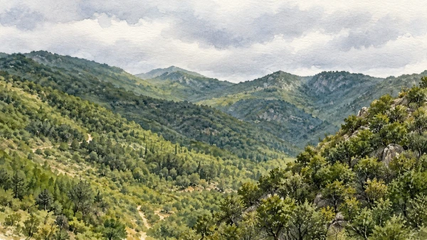
Wooded slopes and shallow ridgelines replace the open coastal horizon. Holm oak, cork oak and Mediterranean scrub form varied habitats, with vegetation responding to water, exposure and the history of land use.

Today

Conditions depend on the exact route and the day. Check the responsible operator, weather and local access notices; use the designated routes and confirm the return journey.

History

The forest was exploited for timber, charcoal and other products before returning to state ownership in 1905. It now belongs to the wider Gutturu Mannu protected landscape. Its appearance records both natural processes and successive management choices.

How to read this place

Select a designated route from the forest authority and assess distance, shade and the return journey. The illustration is a documented wooded-valley view, not a route map or a promise of a waterfall. Wildlife may be present without being visible, and seasonal restrictions can affect access.

What to notice

  • Select a designated route from the forest authority and assess distance, shade and the return journey.
  • The illustration is a documented wooded-valley view, not a route map or a promise of a waterfall.
  • Wildlife may be present without being visible, and seasonal restrictions can affect access.
Pixinamanna | SardegnaForeste
Watercolour: Pixinamanna forest, wooded valley and Mediterranean ridges inland from Pula
Pixinamanna: the wooded inlandEditorial watercolour · AI-generated · 2026
09

The inhabited landscape

Chia’s coastal watchtower

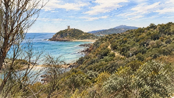
Seen from across the bay, the tower is a small marker on a headland rather than the dominant object in the whole landscape. Scrub, beaches and changing coastal levels explain why observation points mattered here.

Today

This remains an inhabited place. Use pedestrian routes, keep entrances clear and check municipal mobility notices for any restricted area.

History

The heritage authority dates the tower to the sixteenth century. It protected the mouth of the Rio di Chia within the coastal warning system. Later repair and use by the Guardia di Finanza added further phases. The tower stands within the wider archaeological landscape of ancient Bithia.

How to read this place

Begin with the coastal relationship before considering an interior visit. Confirm the current guided-access arrangements locally; an elevated entrance and stairs make this a specific accessibility question. The watercolour deliberately keeps the tower distant, matching the documented landscape view.

What to notice

  • Begin with the coastal relationship before considering an interior visit.
  • Confirm the current guided-access arrangements locally; an elevated entrance and stairs make this a specific accessibility question.
  • The watercolour deliberately keeps the tower distant, matching the documented landscape view.
Torre di Chia
Watercolour: Chia, distant watchtower on its promontory framed by coastal scrub
Chia’s coastal watchtowerEditorial watercolour · AI-generated · 2026
10

Evidence and interpretation

Bithia: reading fragmentary evidence

Scattered blocks and low remains among coastal scrub introduce an ancient settlement whose urban plan is only partly understood. This is a different archaeological experience from the more extensively exposed streets of Nora.

Today

Check the institution’s current opening, booking arrangements and accessible route. Individual rooms, exhibitions and approaches may have separate conditions.

History

The site preserves evidence of Phoenician, Punic and Roman occupation. Storms in the twentieth century exposed funerary remains and helped prompt investigation. An inscription contributed to identifying Bithia, while discoveries from the area entered museum collections. The surviving evidence does not justify a complete reconstruction of the town.

How to read this place

Use the local interpretation and designated approaches to distinguish visible remains from proposed reconstructions. Leave loose material in place and avoid climbing or searching through scrub-covered structures. The close watercolour shows fragmentary masonry only, without inventing a temple or a complete ancient street.

What to notice

  • Use the local interpretation and designated approaches to distinguish visible remains from proposed reconstructions.
  • Leave loose material in place and avoid climbing or searching through scrub-covered structures.
  • The close watercolour shows fragmentary masonry only, without inventing a temple or a complete ancient street.
Antica città di Bithia | SardegnaTurismo – Sito ufficiale del turismo della Regione Sardegna
Watercolour: Bithia at Chia, fragmentary stone remains among coastal scrub above the sea
Bithia: reading fragmentary evidenceEditorial watercolour · AI-generated · 2026

The territory through time

A short chronology

A concise chronology linking the documented sites to the wider story.

  1. Phoenician activity connects Nora with Mediterranean routes.

  2. The coastal settlement develops before Roman rule.

  3. The theatre and civic buildings shape urban life.

  4. The tetrastyle house and the large baths take shape.

  5. Sant’Efisio passes to the monks of Saint-Victor.

  6. The Coltellazzo tower joins the coastal defence system.

  7. Systematic excavation reveals much of the ancient city.

  8. Continuing university research revisits Nora’s buildings and chronology.

Before your visit

Practical information

01

Plan separate days

Choose a manageable set of visits and allow for transport, booked entries and the return journey.

02

Use the exact place name

Sardinia contains separate cities, hill routes and coastal approaches. Confirm the precise locality and route rather than treating nearby names as one destination.

03

Check the institution

Opening hours, tickets, exhibitions and religious access change. Use the linked managing institution shortly before visiting.

04

Check the actual terrain

Steps, gradients and uneven ground vary between the individual sites. Use current route information, weather and closures for the option you choose.

05

Arrange accessible visits

Historic interiors and outdoor approaches can include steps, gradients or uneven surfaces. Ask about the specific route instead of assuming an entire destination is step-free.

06

Respect work and residence

Farms, workshops, churches and historic streets remain in use. Follow signs, keep entrances clear and ask permission before entering private spaces.

Method and sources

Sources and image credits

Prepared on 9 September 2026 from the institutional sources linked below. Historical claims are separated from editorial observations and itinerary suggestions. Older institutional brochures are used for stable cultural context, never as current timetables. Prices, transport schedules, trail status and admission are deliberately left to the responsible operators. Illustrations are not photographs, measured reconstructions or evidence of current conditions.

The eleven images are AI-generated editorial watercolours guided by photographic references. They interpret named places and are not photographs or substitutes for measured plans. Opening hours, tickets, accessible routes, temporary exhibitions and conservation work can change; consult the linked official pages shortly before visiting.

Illustration references and credits