Watercolour: Tharros and the Sinis establishing view

Sardinia · Guide 04

Tharros

Ancient streets, reconstructed stone figures and living wetlands connect the Sinis peninsula with Cabras and Oristano.

Plan the route
Tharros and the Sinis10 chapters · history, culture and landscape

Why this place matters

Read the peninsula through different kinds of evidence.

The Sinis brings archaeology and coastal environments into close contact, but each place asks for a different pace. Tharros rewards a careful walk through its exposed urban fabric. Cabras provides the museum context for discoveries that cannot be understood from ruins alone. Mont’e Prama is an excavation landscape with controlled visits, while quartz beaches and lagoons remain changing natural environments. Oristano adds a separate urban chapter. Together these places form several outings, rather than a checklist for one day.

The guide separates documented history from suggestions for reading the site. Named buildings and landscape relationships follow institutional sources; the illustrations are editorial interpretations, not measured surveys or records of current access.

Ancient streets, reconstructed stone figures and living wetlands connect the Sinis peninsula with Cabras and Oristano.
The route

Plan your visit

Combine Tharros, San Giovanni church and the tower only when their access arrangements align. Give Cabras museum its own time and reserve Mont’e Prama in advance. San Salvatore, Is Arutas and Mistras are separate stops with different environmental conditions. Oristano is an additional city visit, not part of the Tharros walking circuit.

Ancient peninsula

Tharros and its streets

Combine Tharros, San Giovanni church and the tower only when their access arrangements align.

Later landmarks

San Giovanni church and tower

Archaeological context

Cabras museum and Mont’e Prama

Wider Sinis

Quartz coast, village, lagoon and Oristano

Ten chapters

Explore the places

The chapters connect history and terrain. Use the route notes to choose visits and plan transfers between separate sites.

  1. 01Tharros: the city and the sea
  2. 02Basalt streets and urban services
  3. 03San Giovanni di Sinis
  4. 04The tower of San Giovanni
  5. 05Cabras and the Giovanni Marongiu museum
  6. 06Mont’e Prama: an excavation landscape
  7. 07Is Arutas: the quartz shore
  8. 08San Salvatore: a village and its underground sanctuary
  9. 09Mistras lagoon
  10. 10Oristano cathedral: a separate urban chapter
01

Evidence and interpretation

Tharros: the city and the sea

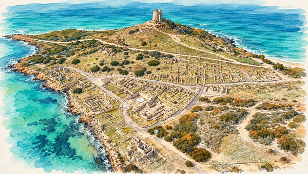
Low walls and paved routes spread across the coastal slope. The relationship between the ancient settlement, its hill and the water is especially clear from an elevated overview, although that aerial perspective is not a visitor viewpoint.

Today

Check the institution’s current opening, booking arrangements and accessible route. Individual rooms, exhibitions and approaches may have separate conditions.

History

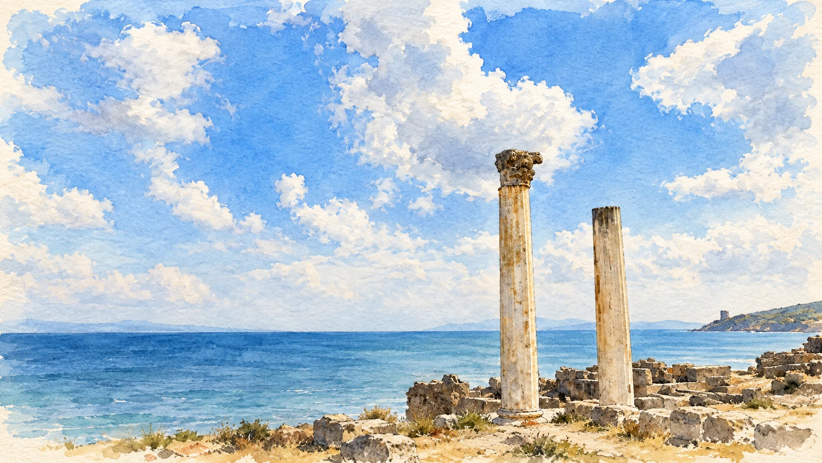
Nuragic occupation preceded the Phoenician and Punic settlement. Roman development added substantial civic infrastructure, followed by Christian transformation and medieval decline. Excavation and restoration created the legible open site seen today. Its familiar pair of standing columns are contemporary reconstructions, not two intact columns that survived in place.

How to read this place

Begin with the official plan and distinguish different phases. The reconstructed columns help suggest an ancient architectural setting, but the precise function of the associated building remains uncertain. The opening watercolour shows the present landmark rather than a reconstruction of the ancient city.

What to notice

  • Begin with the official plan and distinguish different phases.
  • The reconstructed columns help suggest an ancient architectural setting, but the precise function of the associated building remains uncertain.
  • The opening watercolour shows the present landmark rather than a reconstruction of the ancient city.
Tharros – Mont’e Prama
Watercolour: Tharros, aerial study of excavated urban remains, coastal slope and later hilltop tower
Tharros: the city and the seaEditorial watercolour · AI-generated · 2026
02

Evidence and interpretation

Basalt streets and urban services

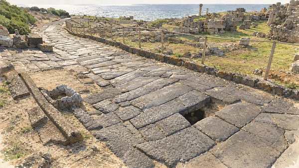
Large dark paving blocks give the streets a distinctive texture. Their surfaces, openings and relationship with adjoining rooms reveal the practical organisation of a dense town.

Today

Check the institution’s current opening, booking arrangements and accessible route. Individual rooms, exhibitions and approaches may have separate conditions.

History

Sardinia came under Roman control in 238 BC. Imperial investment, especially in the second and third centuries AD, reshaped the street network and services at Tharros. Sewers ran beneath paved streets; baths and water infrastructure supported urban life. Later reuse altered both monuments and routes.

How to read this place

Follow the direction of a street and look for changes at thresholds and junctions. Drainage explains a feature that might otherwise appear to be an isolated hole in the pavement. Keep to the authorised route: an exposed ancient surface is not an invitation to explore every room.

What to notice

  • Follow the direction of a street and look for changes at thresholds and junctions.
  • Drainage explains a feature that might otherwise appear to be an isolated hole in the pavement.
  • Keep to the authorised route: an exposed ancient surface is not an invitation to explore every room.
Età romana e paleocristiana – Mont’e Prama
Watercolour: Tharros, close study of basalt street paving and a drainage opening
Basalt streets and urban servicesEditorial watercolour · AI-generated · 2026
03

Worship and memory

San Giovanni di Sinis

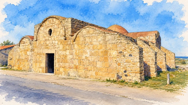
The compact sandstone church stands beyond the excavated city. Its low mass, rounded forms and dome express a building assembled through successive changes rather than a single uniform design.

Today

Worship and local religious life continue here. Visitor access may pause for services; consult the church or managing institution before planning an interior visit.

History

An early Byzantine church of the sixth or seventh century established a cross-shaped core. Between the ninth and eleventh centuries alterations created a three-aisled building with barrel vaults and an apse. Parts of the earlier plan remain legible within the later church.

How to read this place

Compare the dome and projecting volumes before entering. The simple entrance and circular opening are only one face of a more complex plan. Give services priority and avoid treating the church as merely an accessory to the archaeological park.

What to notice

  • Compare the dome and projecting volumes before entering.
  • The simple entrance and circular opening are only one face of a more complex plan.
  • Give services priority and avoid treating the church as merely an accessory to the archaeological park.
Chiesa di San Giovanni di Sinis – Mont’e Prama
Watercolour: San Giovanni di Sinis, sandstone church with low entrance front, circular opening and dome
San Giovanni di SinisEditorial watercolour · AI-generated · 2026
04

The inhabited landscape

The tower of San Giovanni

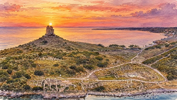
The cylindrical watchtower occupies a hill above Tharros. From the surrounding landscape it reads as a later landmark, clearly separate in date and purpose from the ancient city below.

Today

Tower access depends on favourable weather. Confirm opening and admission with the Tharros ticket office; a view from below remains a different experience from a terrace visit.

History

The tower belonged to the sixteenth-century coastal defence system. Later modifications included nineteenth-century access stairs and additions on the terrace. Restoration in the late twentieth century conserved the structure now used as a visitor landmark.

How to read this place

Read the position first: the tower surveyed sea approaches and neighbouring stretches of coast. Its elevated entrance and later stairs explain why access is a separate practical question. The aerial illustration records the relationship with Tharros, not a walking route or an unrestricted viewpoint.

What to notice

  • Read the position first: the tower surveyed sea approaches and neighbouring stretches of coast.
  • Its elevated entrance and later stairs explain why access is a separate practical question.
  • The aerial illustration records the relationship with Tharros, not a walking route or an unrestricted viewpoint.
Torre di San Giovanni – Mont’e Prama
Watercolour: San Giovanni tower above Tharros, aerial coastal relationship in warm evening light
The tower of San GiovanniEditorial watercolour · AI-generated · 2026
05

Evidence and interpretation

Cabras and the Giovanni Marongiu museum

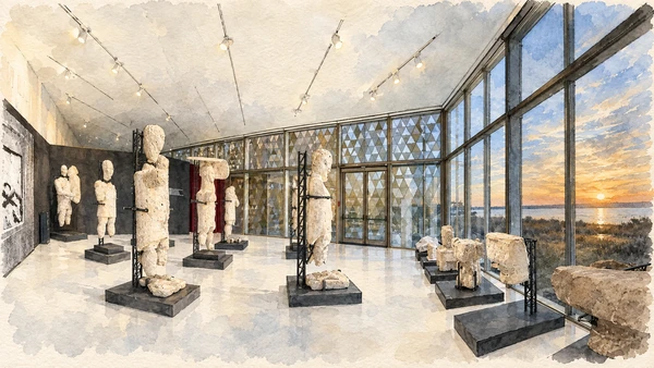
The museum places stone sculpture beside evidence for settlement, exchange and everyday work. Its galleries provide the essential link between the archaeological landscapes outside and objects that require conservation indoors.

Today

Check the institution’s current opening, booking arrangements and accessible route. Individual rooms, exhibitions and approaches may have separate conditions.

History

Opened in 1997, the civic museum presents material from prehistoric communities, Nuragic contexts and Tharros, alongside maritime finds. New galleries inaugurated in 2026 expanded the Mont’e Prama display. The Cagliari museum confirms the transfer of the entire Mont’e Prama sculptural ensemble to Cabras in April 2026.

How to read this place

Use the reconstruction labels to distinguish original fragments, joins and support systems. The watercolour follows the documented Sala Paesaggio, not an imagined ancient assembly of intact statues. Check the museum’s current gallery information because exhibitions and arrangements can change.

What to notice

  • Use the reconstruction labels to distinguish original fragments, joins and support systems.
  • The watercolour follows the documented Sala Paesaggio, not an imagined ancient assembly of intact statues.
  • Check the museum’s current gallery information because exhibitions and arrangements can change.
Museo civico Giovanni Marongiu di Cabras – Mont’e Prama
Watercolour: Cabras museum, Sala Paesaggio with conserved fragmentary sculpture and glass overlooking the landscape
Cabras and the Giovanni Marongiu museumEditorial watercolour · AI-generated · 2026
06

Evidence and interpretation

Mont’e Prama: an excavation landscape

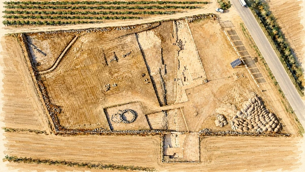
Excavated alignments sit within cultivated land. The contrast with the museum is instructive: the field site preserves spatial relationships, while the reconstructed sculptures are displayed and conserved elsewhere.

Today

The operator’s June–September 2026 programme requires an advance reservation and a guided visit, including for individual visitors. Consult the current booking page for dates and language availability.

History

Agricultural work brought the site to attention in March 1974. Successive excavations revealed burials, sculptural fragments and a complex sequence whose chronology and interpretation continue to be studied. The cemetery belongs to the first millennium BC; assigning every statue and burial to one precise date would conceal the debate.

How to read this place

The illustration follows an aerial photograph taken after the 2022 excavation campaign. It is a dated record, not a current survey of every later intervention. Follow the guide’s explanation and do not expect a field filled with standing statues or a proven temple reconstruction.

What to notice

  • The illustration follows an aerial photograph taken after the 2022 excavation campaign.
  • It is a dated record, not a current survey of every later intervention.
  • Follow the guide’s explanation and do not expect a field filled with standing statues or a proven temple reconstruction.
Mont’e Prama – Mont’e Prama
Watercolour: Mont’e Prama excavation, aerial field layout documented after the 2022 campaign
Mont’e Prama: an excavation landscapeEditorial watercolour · AI-generated · 2026
07

Terrain and access

Is Arutas: the quartz shore

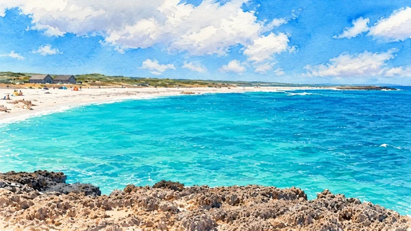
Pale quartz grains give the beach its distinctive texture and colour against blue water. The shoreline belongs to the wider Sinis marine landscape, where exposure and depth can change the character of a visit.

Today

Conditions depend on the exact route and the day. Check the responsible operator, weather and local access notices; use the designated routes and confirm the return journey.

History

The beach records natural erosion, transport and sorting over long periods. Its modern popularity adds another layer: concentrated recreation must share space with a finite coastal environment. The grains are part of that environment, not an inexhaustible souvenir material.

How to read this place

Look at the shore without removing sand or quartz. Keep access to established approaches and assess wind and sea conditions before entering the water; attractive colour does not establish safe depth or calm conditions. The illustration shows one documented coastal view, not a guarantee of an empty beach.

What to notice

  • Look at the shore without removing sand or quartz.
  • Keep access to established approaches and assess wind and sea conditions before entering the water; attractive colour does not establish safe depth or calm conditions.
  • The illustration shows one documented coastal view, not a guarantee of an empty beach.
Is Arutas | SardegnaTurismo – Sito ufficiale del turismo della Regione Sardegna
Watercolour: Is Arutas, pale quartz beach curving beside clear blue sea
Is Arutas: the quartz shoreEditorial watercolour · AI-generated · 2026
08

The inhabited landscape

San Salvatore: a village and its underground sanctuary

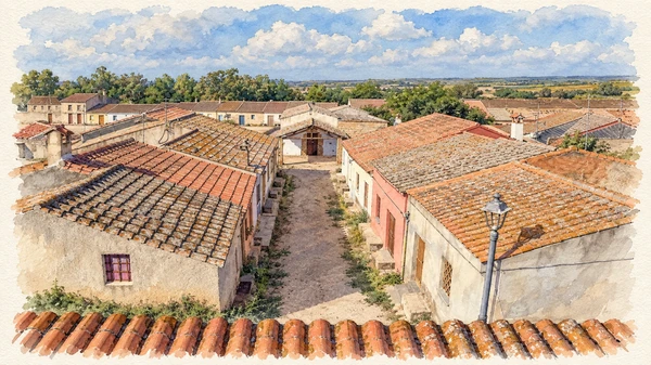
Low houses and quiet lanes surround a religious centre whose most unusual space lies underground. The village can appear still between events, but its identity remains connected with local devotion and community use.

Today

This remains an inhabited place. Use pedestrian routes, keep entrances clear and check municipal mobility notices for any restricted area.

History

A late-seventeenth-century church stands above an underground complex partly cut into rock and partly built in masonry. Its late-antique rooms contain a well, pictures and inscriptions from different phases. Their functions require interpretation. The surrounding cumbessias developed as accommodation associated with religious gatherings.

How to read this place

The watercolour shows village roofs and a lane, not the hypogeum interior. Arrange underground access separately and use the interpretation provided there. The annual September celebration and barefoot procession belong to living practice; avoid reducing the place to an abandoned film set.

What to notice

  • The watercolour shows village roofs and a lane, not the hypogeum interior.
  • Arrange underground access separately and use the interpretation provided there.
  • The annual September celebration and barefoot procession belong to living practice; avoid reducing the place to an abandoned film set.
Ipogeo e chiesa di San Salvatore – Mont’e Prama
Watercolour: San Salvatore di Sinis, low village roofs and a quiet lane between cumbessias
San Salvatore: a village and its underground sanctuaryEditorial watercolour · AI-generated · 2026
09

Terrain and access

Mistras lagoon

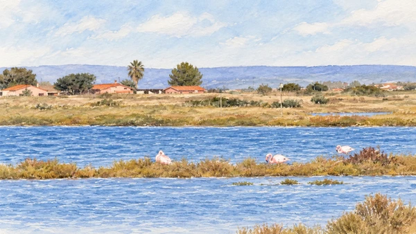
Shallow water, low banks and salt-tolerant vegetation create a broad horizontal landscape. Flamingos may rest or feed here, with fields and buildings visible beyond the wetland.

Today

Conditions depend on the exact route and the day. Check the responsible operator, weather and local access notices; use the designated routes and confirm the return journey.

History

Coastal sediment barriers shaped this lagoon of marine origin. It is distinct from the larger Cabras wetland, despite their geographical proximity. Its ecological importance depends on the relationship between water, vegetation, birds and surrounding land use, rather than on an image of nature without people.

How to read this place

Observe from permitted approaches and keep a respectful distance from birds. The reference-based illustration shows a particular group of flamingos; wildlife sightings cannot be promised. Avoid walking onto low banks or assuming that every visible track is a public visitor route.

What to notice

  • Observe from permitted approaches and keep a respectful distance from birds.
  • The reference-based illustration shows a particular group of flamingos; wildlife sightings cannot be promised.
  • Avoid walking onto low banks or assuming that every visible track is a public visitor route.
Laguna di Mistras
Watercolour: Mistras lagoon, small flamingos on a low grassy bank with fields and roofs beyond
Mistras lagoonEditorial watercolour · AI-generated · 2026
10

Worship and memory

Oristano cathedral: a separate urban chapter

The cathedral’s stone volumes and tall bell tower bring the route into an urban setting. Its present appearance combines older fabric with major later rebuilding.

Today

Worship and local religious life continue here. Visitor access may pause for services; consult the church or managing institution before planning an interior visit.

History

The cathedral is documented in 1131. Medieval rebuilding and Gothic additions preceded the eighteenth-century transformation responsible for much of the current church. Its furnishings include sculptural and marble work from different periods, reflecting the long religious history of Oristano.

How to read this place

The illustration is a side view with the rounded projecting volume, dome and octagonal bell tower; it is not the principal facade. Explore the building in the context of the historic city and its connection with medieval Arborea, allowing a separate visit rather than adding it hurriedly after the peninsula.

What to notice

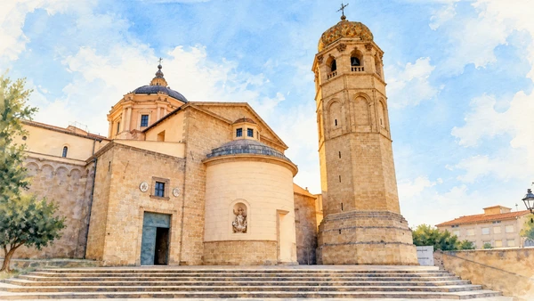
  • The illustration is a side view with the rounded projecting volume, dome and octagonal bell tower; it is not the principal facade.
  • Explore the building in the context of the historic city and its connection with medieval Arborea, allowing a separate visit rather than adding it hurriedly after the peninsula.
Cattedrale di Santa Maria Assunta
Watercolour: Oristano cathedral, side elevation and octagonal bell tower above broad stone steps
Oristano cathedral: a separate urban chapterEditorial watercolour · AI-generated · 2026

The territory through time

A short chronology

A concise chronology linking the documented sites to the wider story.

  1. Nuragic occupation forms an earlier layer at Tharros.

  2. The coastal settlement develops within Mediterranean networks.

  3. Roman rule precedes major imperial urban investment.

  4. The early core of San Giovanni church takes shape.

  5. Medieval change shifts the regional urban and religious balance.

  6. The San Giovanni tower joins coastal defences.

  7. Mont’e Prama comes to archaeological attention.

  8. New Cabras galleries reunite the sculptural ensemble.

Before your visit

Practical information

01

Plan separate days

Choose a manageable set of visits and allow for transport, booked entries and the return journey.

02

Use the exact place name

Sardinia contains separate cities, hill routes and coastal approaches. Confirm the precise locality and route rather than treating nearby names as one destination.

03

Check the institution

Opening hours, tickets, exhibitions and religious access change. Use the linked managing institution shortly before visiting.

04

Check the actual terrain

Steps, gradients and uneven ground vary between the individual sites. Use current route information, weather and closures for the option you choose.

05

Arrange accessible visits

Historic interiors and outdoor approaches can include steps, gradients or uneven surfaces. Ask about the specific route instead of assuming an entire destination is step-free.

06

Respect work and residence

Farms, workshops, churches and historic streets remain in use. Follow signs, keep entrances clear and ask permission before entering private spaces.

Method and sources

Sources and image credits

Prepared on 9 September 2026 from the institutional sources linked below. Historical claims are separated from editorial observations and itinerary suggestions. Older institutional brochures are used for stable cultural context, never as current timetables. Prices, transport schedules, trail status and admission are deliberately left to the responsible operators. Illustrations are not photographs, measured reconstructions or evidence of current conditions.

The eleven images are AI-generated editorial watercolours guided by photographic references. They interpret named places and are not photographs or substitutes for measured plans. Opening hours, tickets, accessible routes, temporary exhibitions and conservation work can change; consult the linked official pages shortly before visiting.

Illustration references and credits