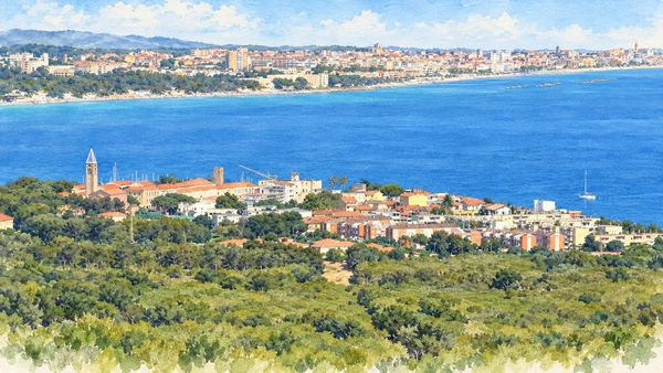
Watercolour: Alghero and the northwest coast establishing view

Sardinia · Guide 05

Alghero

A fortified coastal city opens onto prehistoric monuments, limestone caves and the distinct twentieth-century history of Fertilia.

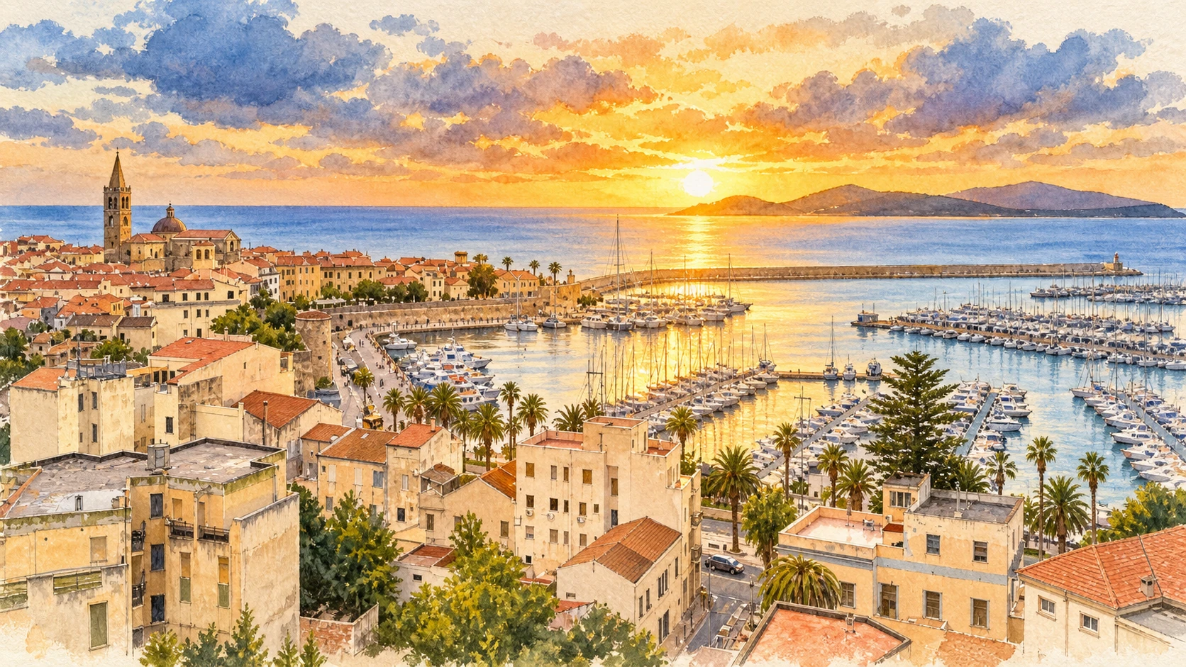
Plan the route
Alghero and the northwest coast10 chapters · history, culture and landscape

Why this place matters

Begin with the city, then give the coast its own time.

Alghero’s seafront walls connect a compact historic centre with a much wider territory. Churches preserve several architectural languages, while museums link local identity to archaeology and the marine environment. Beyond the city, Palmavera and Anghelu Ruju belong to different prehistoric worlds. Capo Caccia and the Grotta di Nettuno ask for weather-aware planning, and Fertilia introduces an entirely different period of urban history. Catalan heritage remains part of Alghero’s living cultural identity; it should be understood through language and history rather than used as a picturesque label alone.

The guide separates documented history from suggestions for reading the site. Named buildings and landscape relationships follow institutional sources; the illustrations are editorial interpretations, not measured surveys or records of current access.

A fortified coastal city opens onto prehistoric monuments, limestone caves and the distinct twentieth-century history of Fertilia.
The route

Plan your visit

The first five chapters form a city visit with museum stops. Allow a separate archaeological outing for Palmavera and Anghelu Ruju, which are not adjoining sites. Plan the cave and Capo Caccia around current weather and booking arrangements. Fertilia can be explored independently on the way around the bay.

Within the walls

Seafront, cathedral and San Francesco

The first five chapters form a city visit with museum stops.

Museum context

Coral and archaeology

Prehistoric territory

Palmavera and Anghelu Ruju

Beyond the city

Nettuno, Capo Caccia and Fertilia

Ten chapters

Explore the places

The chapters connect history and terrain. Use the route notes to choose visits and plan transfers between separate sites.

  1. 01The seafront walls
  2. 02Santa Maria cathedral
  3. 03San Francesco
  4. 04MACOR: the Coral Museum
  5. 05MŪSA: archaeology of the city and territory
  6. 06Palmavera: towers and village life
  7. 07Anghelu Ruju: rock-cut burial chambers
  8. 08Grotta di Nettuno
  9. 09Capo Caccia and the protected coast
  10. 10Fertilia: planned settlement and migration
01

The inhabited landscape

The seafront walls

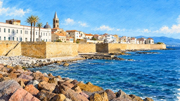
Golden stone walls separate the compact old town from the rocky shore. Their former military walkways now support everyday strolling, conversation and views across the bay.

Today

This remains an inhabited place. Use pedestrian routes, keep entrances clear and check municipal mobility notices for any restricted area.

History

Medieval fortifications were substantially reworked during the sixteenth century. The removal of Alghero from the list of strategic strongholds in 1867 preceded dismantling on the landward side. The surviving seaward defences therefore represent a partial circuit, not a complete untouched medieval enclosure.

How to read this place

Walk between the towers and notice their different shapes. Piazza Sulis, the Marco Polo bastions and the approach to Piazza Civica show how defensive edges became public space. The shore-level illustration is a view toward the walls, not an instruction to walk along the rocks.

What to notice

  • Walk between the towers and notice their different shapes.
  • Piazza Sulis, the Marco Polo bastions and the approach to Piazza Civica show how defensive edges became public space.
  • The shore-level illustration is a view toward the walls, not an instruction to walk along the rocks.
Passeggio e relax sulle antiche mura
Watercolour: Alghero seafront walls viewed across the rocky shore, houses and cathedral spire behind
The seafront wallsEditorial watercolour · AI-generated · 2026
02

Worship and memory

Santa Maria cathedral

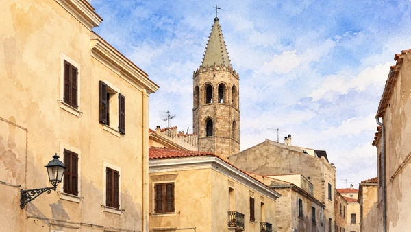
The slender bell tower rises above the close-packed streets. Inside and outside, the cathedral combines Gothic forms with later classical interventions.

Today

Worship and local religious life continue here. Visitor access may pause for services; consult the church or managing institution before planning an interior visit.

History

The creation of Alghero’s diocese in 1503 preceded the long construction of the present cathedral. Work progressed through the sixteenth century, with further completion in the seventeenth. Eighteenth-century marble furnishings and the nineteenth-century neoclassical entrance added conspicuous later layers.

How to read this place

Compare the pointed tower with the classical entrance and the different interior spaces. The watercolour follows the tower seen between houses, not the main facade. Church access and a tower climb are separate visits; confirm the latter through the local heritage ticket service.

What to notice

  • Compare the pointed tower with the classical entrance and the different interior spaces.
  • The watercolour follows the tower seen between houses, not the main facade.
  • Church access and a tower climb are separate visits; confirm the latter through the local heritage ticket service.
Alghero, Cattedrale di Santa Maria
Watercolour: Alghero cathedral, octagonal bell tower and pointed spire seen above old-town houses
Santa Maria cathedralEditorial watercolour · AI-generated · 2026
03

Worship and memory

San Francesco

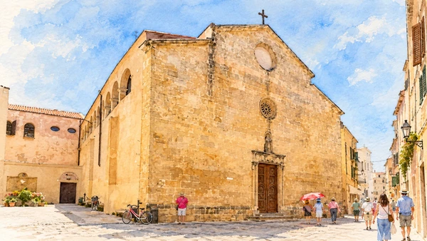
A broad, restrained stone facade conceals a complex of church, cloister and bell tower. Its scale and details offer a quieter counterpoint to the cathedral.

Today

Worship and local religious life continue here. Visitor access may pause for services; consult the church or managing institution before planning an interior visit.

History

The surviving complex developed chiefly in the late fifteenth and sixteenth centuries. Gothic elements remain around the sanctuary, while later rebuilding reshaped the central church and aisles. The cloister preserves rounded arches, and the facade includes a later statue of Saint Francis.

How to read this place

Look closely at the small portal and rose window before considering the larger interior. Do not infer that every part belongs to one construction campaign. The illustration shows the exterior; access to the cloister and tower should be checked with the complex’s operator.

What to notice

  • Look closely at the small portal and rose window before considering the larger interior.
  • Do not infer that every part belongs to one construction campaign.
  • The illustration shows the exterior; access to the cloister and tower should be checked with the complex’s operator.
Chiesa di San Francesco
Watercolour: San Francesco in Alghero, weathered sandstone facade and adjoining urban space
San FrancescoEditorial watercolour · AI-generated · 2026
04

Evidence and interpretation

MACOR: the Coral Museum

The museum connects a highly recognisable local craft with the marine organism from which its material comes. Displays move between natural forms and human workmanship.

Today

Check the institution’s current opening, booking arrangements and accessible route. Individual rooms, exhibitions and approaches may have separate conditions.

History

Housed in a Liberty-style villa, the collection explains the relationship between Alghero and Mediterranean red coral, Corallium rubrum. Its modern presentation places cultural tradition within a wider marine ecosystem, rather than treating coral simply as a decorative mineral.

How to read this place

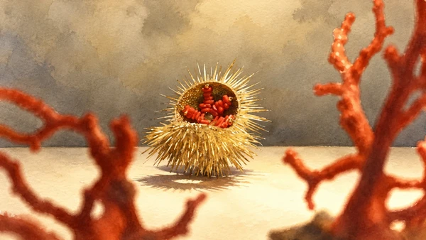
Read the object labels and distinguish biological material from crafted pieces. The watercolour studies a documented display detail with red coral and a spiny decorative form; it is not a live underwater scene. Allow time for the environmental interpretation as well as the finished objects.

What to notice

  • Read the object labels and distinguish biological material from crafted pieces.
  • The watercolour studies a documented display detail with red coral and a spiny decorative form; it is not a live underwater scene.
  • Allow time for the environmental interpretation as well as the finished objects.
Museo del Corallo – Alghero Turismo
Watercolour: Alghero Coral Museum, documented decorative display detail with red coral and a spiny golden form
MACOR: the Coral MuseumEditorial watercolour · AI-generated · 2026
05

Evidence and interpretation

MŪSA: archaeology of the city and territory

Objects from land and sea introduce communities that lived here long before the present streets took shape. The museum offers context that an isolated monument cannot provide.

Today

Check the institution’s current opening, booking arrangements and accessible route. Individual rooms, exhibitions and approaches may have separate conditions.

History

The collection occupies a restored building associated with the former San Michele monastic complex. Its themes connect maritime exchange, ways of living and belief across prehistoric, ancient and later periods. Finds from nearby settlements and burial grounds place the walled city within a much longer regional history.

How to read this place

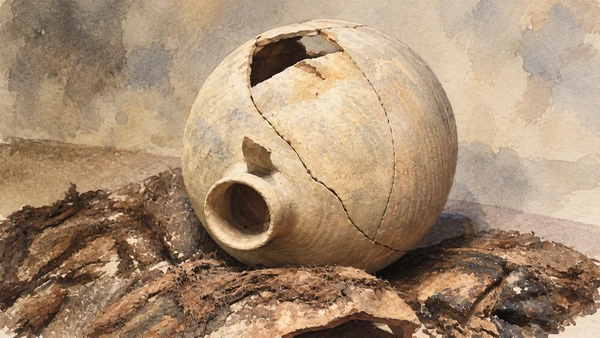
Follow the labels for provenance and date rather than assigning every vessel to the same civilisation. The illustrated ceramic vessel retains its breaks and repaired joins; it is a museum object study, not a reconstruction of its original use. Consult the current museum site for admission, since older tourism pages retain outdated practical notices.

What to notice

  • Follow the labels for provenance and date rather than assigning every vessel to the same civilisation.
  • The illustrated ceramic vessel retains its breaks and repaired joins; it is a museum object study, not a reconstruction of its original use.
  • Consult the current museum site for admission, since older tourism pages retain outdated practical notices.
City Archeological Museum – Alghero Turismo
Watercolour: MŪSA Alghero, damaged and conserved round ceramic vessel in a documented display
MŪSA: archaeology of the city and territoryEditorial watercolour · AI-generated · 2026
06

Evidence and interpretation

Palmavera: towers and village life

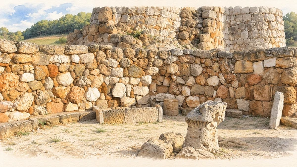
Pale stone distinguishes Palmavera from the dark basalt monuments elsewhere on the island. Towers, connecting structures and round buildings preserve evidence of growth through successive phases.

Today

Check the institution’s current opening, booking arrangements and accessible route. Individual rooms, exhibitions and approaches may have separate conditions.

History

The complex began in the Bronze Age and expanded into the early first millennium BC. Its two-tower core was accompanied by a village and a large meeting building. The stone model of a nuraghe found there is conserved in Sassari; the version displayed at Palmavera is a copy.

How to read this place

Compare the tower masonry with the lower circular rooms and perimeter seating. The illustration follows a detail of the meeting-building display, including the model, rather than recreating a roofed ancient village. Use the authorised route and ask the guide to distinguish original fabric, conservation and copies.

What to notice

  • Compare the tower masonry with the lower circular rooms and perimeter seating.
  • The illustration follows a detail of the meeting-building display, including the model, rather than recreating a roofed ancient village.
  • Use the authorised route and ask the guide to distinguish original fabric, conservation and copies.
Nuraghe Palmavera | SardegnaTurismo – Sito ufficiale del turismo della Regione Sardegna
Watercolour: Palmavera, stone meeting-building remains and displayed nuraghe model
Palmavera: towers and village lifeEditorial watercolour · AI-generated · 2026
07

Evidence and interpretation

Anghelu Ruju: rock-cut burial chambers

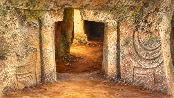
Low openings lead into chambers cut from sandstone. Their small scale and carved details create a very different experience from Palmavera’s built towers.

Today

Check the institution’s current opening, booking arrangements and accessible route. Individual rooms, exhibitions and approaches may have separate conditions.

History

Discovered in 1903, the necropolis contains thirty-eight tombs with origins in the later Neolithic and use extending into subsequent periods. Corridors and shaft-like entrances lead to varied chamber plans. Carved motifs and false doors have funerary significance, although detailed beliefs must be interpreted rather than treated as directly recorded testimony.

How to read this place

Keep the archaeological tombs distinct from the later folk name domus de janas, or fairy houses. Examine carvings without touching or tracing them. Low openings and uneven surfaces mean that a general admission ticket does not establish easy access to every chamber.

What to notice

  • Keep the archaeological tombs distinct from the later folk name domus de janas, or fairy houses.
  • Examine carvings without touching or tracing them.
  • Low openings and uneven surfaces mean that a general admission ticket does not establish easy access to every chamber.
Necropoli di Anghelu Ruju | SardegnaTurismo – Sito ufficiale del turismo della Regione Sardegna
Watercolour: Anghelu Ruju, rock-cut chamber openings and carved sandstone relief detail
Anghelu Ruju: rock-cut burial chambersEditorial watercolour · AI-generated · 2026
08

Terrain and access

Grotta di Nettuno

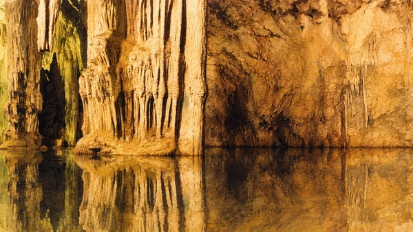
Limestone formations descend toward still water within Capo Caccia. Artificial illumination reveals shapes and reflections that differ greatly from the bright coast outside.

Today

Land-arrival visitors must reserve through the official platform. Boat passengers should contact their operator; transport and cave admission are separate. Both approaches depend on sea and weather conditions, which can close the cave.

History

The cave formed through geological processes acting on limestone over long periods. Its saline lake and mineral deposits belong to a system larger than the managed visitor route. Modern stairs, guided access and boat services made part of that underground environment accessible to visitors.

How to read this place

Choose the approach before travelling. The land route includes a substantial descent and return climb on the Escala del Cabirol. The watercolour follows a documented cave interior; it does not imply that visitors can leave the walkway or explore the water.

What to notice

  • Choose the approach before travelling.
  • The land route includes a substantial descent and return climb on the Escala del Cabirol.
  • The watercolour follows a documented cave interior; it does not imply that visitors can leave the walkway or explore the water.
Grotta di Nettuno – Alghero Turismo
Watercolour: Grotta di Nettuno, limestone formations reflected in the saline lake
Grotta di NettunoEditorial watercolour · AI-generated · 2026
09

Terrain and access

Capo Caccia and the protected coast

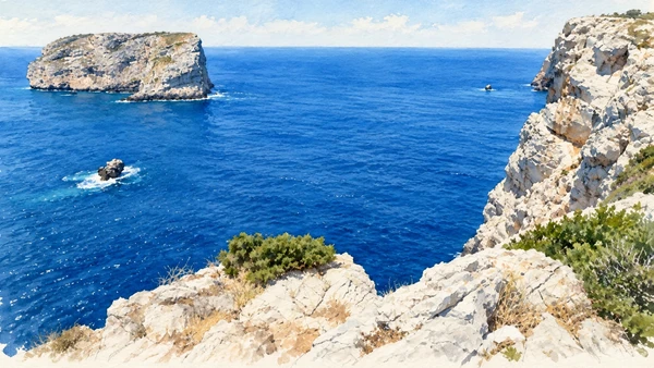
Pale limestone cliffs and offshore rock contrast with deep blue water. Vegetation follows the cracks and more sheltered surfaces of an exposed coastal landscape.

Today

Conditions depend on the exact route and the day. Check the responsible operator, weather and local access notices; use the designated routes and confirm the return journey.

History

Erosion and the dissolution of limestone produced cliffs, cavities and underground systems. Modern protection links the marine area with the Porto Conte landscape, recognising habitats above and below the water. These protections do not turn every headland or cave into an unrestricted visitor destination.

How to read this place

Choose a designated viewpoint or an authorised activity through the park. The illustrated ledge is a photographic perspective, not a marked route. Keep back from cliff edges and check the relevant rules for any boat or diving excursion; a scenic sea view alone cannot establish suitable conditions.

What to notice

  • Choose a designated viewpoint or an authorised activity through the park.
  • The illustrated ledge is a photographic perspective, not a marked route.
  • Keep back from cliff edges and check the relevant rules for any boat or diving excursion; a scenic sea view alone cannot establish suitable conditions.
Capo Caccia – Isola Piana | SardegnaTurismo – Sito ufficiale del turismo della Regione Sardegna
Watercolour: Capo Caccia, limestone foreground and offshore rock above the blue sea
Capo Caccia and the protected coastEditorial watercolour · AI-generated · 2026
10

The inhabited landscape

Fertilia: planned settlement and migration

Low buildings and a regular urban layout mark a twentieth-century settlement across the bay from Alghero. The landscape includes reclaimed land and the nearby Calich water system.

Today

This remains an inhabited place. Use pedestrian routes, keep entrances clear and check municipal mobility notices for any restricted area.

History

Fertilia developed under the Fascist regime through reclamation and settlement schemes involving families from the Ferrara area. Planning in the 1930s produced a new town deliberately distinct from Alghero. Subsequent migration and community life added other cultural layers, visible in place names, memorials and the dedication of San Marco.

How to read this place

Read the public spaces as evidence of political planning and later adaptation. The panoramic illustration explains Fertilia’s relationship with the bay and distant Alghero; it does not present the settlement as medieval. Allow time for the local account of migration, which gives the architecture a human context.

What to notice

  • Read the public spaces as evidence of political planning and later adaptation.
  • The panoramic illustration explains Fertilia’s relationship with the bay and distant Alghero; it does not present the settlement as medieval.
  • Allow time for the local account of migration, which gives the architecture a human context.
Fertilia | SardegnaTurismo – Sito ufficiale del turismo della Regione Sardegna
Watercolour: Fertilia, low settlement and bell tower across the bay from Alghero
Fertilia: planned settlement and migrationEditorial watercolour · AI-generated · 2026

The territory through time

A short chronology

A concise chronology linking the documented sites to the wider story.

  1. Rock-cut tombs develop at Anghelu Ruju.

  2. Palmavera begins its long sequence of construction.

  3. Alghero develops as a fortified coastal town.

  4. The new diocese establishes Alghero’s cathedral role.

  5. Church building and defensive reconstruction reshape the city.

  6. Alghero loses its strategic-fortress designation.

  7. Anghelu Ruju is discovered and investigated.

  8. Fertilia introduces planned settlement and later migration histories.

Before your visit

Practical information

01

Plan separate days

Choose a manageable set of visits and allow for transport, booked entries and the return journey.

02

Use the exact place name

Sardinia contains separate cities, hill routes and coastal approaches. Confirm the precise locality and route rather than treating nearby names as one destination.

03

Check the institution

Opening hours, tickets, exhibitions and religious access change. Use the linked managing institution shortly before visiting.

04

Check the actual terrain

Steps, gradients and uneven ground vary between the individual sites. Use current route information, weather and closures for the option you choose.

05

Arrange accessible visits

Historic interiors and outdoor approaches can include steps, gradients or uneven surfaces. Ask about the specific route instead of assuming an entire destination is step-free.

06

Respect work and residence

Farms, workshops, churches and historic streets remain in use. Follow signs, keep entrances clear and ask permission before entering private spaces.

Method and sources

Sources and image credits

Prepared on 9 September 2026 from the institutional sources linked below. Historical claims are separated from editorial observations and itinerary suggestions. Older institutional brochures are used for stable cultural context, never as current timetables. Prices, transport schedules, trail status and admission are deliberately left to the responsible operators. Illustrations are not photographs, measured reconstructions or evidence of current conditions.

The eleven images are AI-generated editorial watercolours guided by photographic references. They interpret named places and are not photographs or substitutes for measured plans. Opening hours, tickets, accessible routes, temporary exhibitions and conservation work can change; consult the linked official pages shortly before visiting.

Illustration references and credits