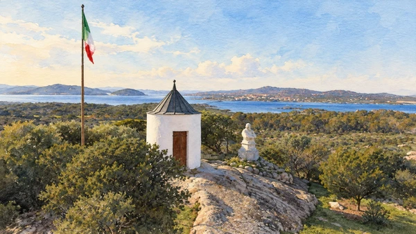
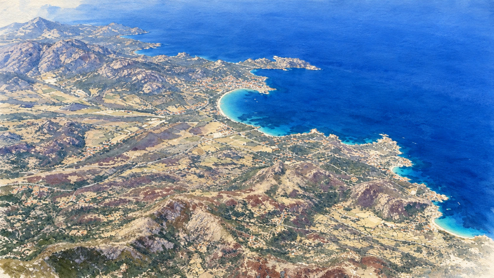
Watercolour: Gallura and the Northeast establishing view

Sardinia · Guide 08

Gallura

Granite towns, Nuragic architecture and island histories give the northeast a depth that extends beyond its beaches.

Plan the route
Gallura and the Northeast10 chapters · history, culture and landscape

Why this place matters

Connect the coast with the communities behind it.

Olbia is both an arrival point and a city with its own long history. From there, the northeast opens into the archaeological landscape of Arzachena, the granite streets of Tempio and Aggius, and the headlands facing the archipelago. La Maddalena and Caprera add maritime, military and personal histories. These places belong to different kinds of outings: allow substantial time for museums and inland towns, and treat island transport and protected-area access as separate arrangements.

The guide separates documented history from suggestions for reading the site. Named buildings and landscape relationships follow institutional sources; the illustrations are editorial interpretations, not measured surveys or records of current access.

Granite towns, Nuragic architecture and island histories give the northeast a depth that extends beyond its beaches.
The route

Plan your visit

Pair San Simplicio with the archaeological museum when current opening arrangements allow. Visit La Prisgiona and Coddu Vecchiu together, leaving time for both. Tempio and Aggius form a separate inland excursion. Capo Testa and the Roccia dell’Orso require their own coastal stops. Use La Maddalena as the starting point for Caprera, allowing time for ferries, onward travel and the reserved museum visit.

Olbia

Romanesque architecture and port archaeology

Pair San Simplicio with the archaeological museum when current opening arrangements allow.

Arzachena

Nuraghe and collective tomb

Inland Gallura

Tempio and Aggius

Coasts and islands

Capo Testa, Palau, La Maddalena and Caprera

Ten chapters

Explore the places

The chapters connect history and terrain. Use the route notes to choose visits and plan transfers between separate sites.

  1. 01San Simplicio in Olbia
  2. 02Olbia’s Archaeological Museum
  3. 03La Prisgiona: tower and settlement
  4. 04Coddu Vecchiu: a collective tomb
  5. 05Tempio Pausania: a granite town
  6. 06Aggius: stone, weaving and local memory
  7. 07Capo Testa: reading the old quarries
  8. 08The Roccia dell’Orso above Palau
  9. 09La Maddalena: harbour town and island life
  10. 10Caprera and the Compendio Garibaldino
01

Worship and memory

San Simplicio in Olbia

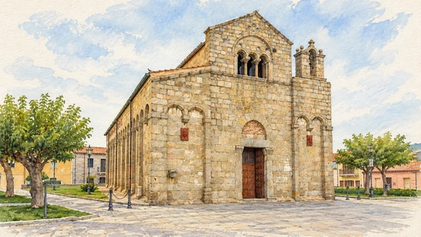
Granite blocks, a high central gable and a three-light window give the church a restrained but distinctive presence. The side arcading makes a slow circuit of the exterior worthwhile.

Today

Worship and local religious life continue here. Visitor access may pause for services; consult the church or managing institution before planning an interior visit.

History

The Romanesque building took shape in successive phases around the late eleventh and twelfth centuries. It occupies an area associated with an older necropolis, connecting medieval worship with a much longer funerary landscape. Its dedication and the celebrations for Olbia’s patron saint remain important to the city.

How to read this place

Compare the central nave’s height with the lower aisles and notice the alternation of supports inside when worship and opening arrangements permit. The bellcote and different masonry details deserve individual attention. The church and its surrounding archaeology form part of the island’s wider Christian history.

What to notice

  • Compare the central nave’s height with the lower aisles and notice the alternation of supports inside when worship and opening arrangements permit.
  • The bellcote and different masonry details deserve individual attention.
  • The church and its surrounding archaeology form part of the island’s wider Christian history.
San Simplicio – Olbia | SardegnaTurismo – Sito ufficiale del turismo della Regione Sardegna
Watercolour: San Simplicio Olbia, granite facade with three-light window and small right-hand bellcote
San Simplicio in OlbiaEditorial watercolour · AI-generated · 2026
02

Evidence and interpretation

Olbia’s Archaeological Museum

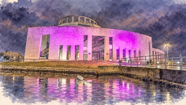
A modern waterfront building on the small island of Peddone places the museum beside the harbour landscape it helps explain. Its architecture uses references to ships and maritime movement.

Today

Check the institution’s current opening, booking arrangements and accessible route. Individual rooms, exhibitions and approaches may have separate conditions.

History

The collections address Olbia and its territory through successive periods, with port discoveries playing an important role. Ancient ship remains, objects recovered from excavations and interpretive reconstructions illuminate trade and the changing city. A model or reconstructed hull must be distinguished from the original surviving material.

How to read this place

Check current municipal information before planning the interior visit, including which rooms are accessible. The illustration follows a documented night view with coloured illumination; it does not promise that lighting or evening opening. Begin outside by relating the building to the old port and the town.

What to notice

  • Check current municipal information before planning the interior visit, including which rooms are accessible.
  • The illustration follows a documented night view with coloured illumination; it does not promise that lighting or evening opening.
  • Begin outside by relating the building to the old port and the town.
Museo Archeologico di Olbia | SardegnaTurismo – Sito ufficiale del turismo della Regione Sardegna
Watercolour: Olbia Archaeological Museum, waterfront exterior under documented coloured night illumination
Olbia’s Archaeological MuseumEditorial watercolour · AI-generated · 2026
03

Evidence and interpretation

La Prisgiona: tower and settlement

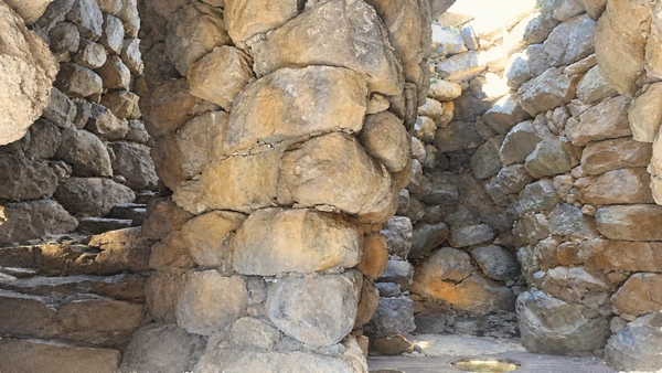
Heavy granite masonry encloses narrow passages and the central tower’s chamber. Outside, the surviving village spaces reveal a community larger than the tower alone.

Today

Check the institution’s current opening, booking arrangements and accessible route. Individual rooms, exhibitions and approaches may have separate conditions.

History

The complex was occupied from approximately the fourteenth to the early eighth century BC, with later reuse in Roman times. Three towers form the core, accompanied by a settlement where excavations document production, water supply and communal activity. The corbelled chamber shows how progressively smaller stone courses could enclose a high space.

How to read this place

Follow the managed route to compare the central chamber with houses, courts and working areas outside. The image is an interior masonry detail, not a complete reconstruction of the tower. Descriptions of meetings and rituals depend on interpretation of architecture and finds; they do not identify every participant with certainty.

What to notice

  • Follow the managed route to compare the central chamber with houses, courts and working areas outside.
  • The image is an interior masonry detail, not a complete reconstruction of the tower.
  • Descriptions of meetings and rituals depend on interpretation of architecture and finds; they do not identify every participant with certainty.
Complesso nuragico La Prisgiona – GE.SE.CO. Arzachena S.U.R.L.
Watercolour: La Prisgiona, central tower interior with massive granite masonry and narrow passages
La Prisgiona: tower and settlementEditorial watercolour · AI-generated · 2026
04

Evidence and interpretation

Coddu Vecchiu: a collective tomb

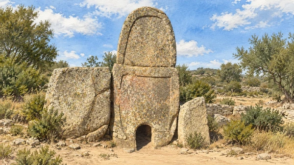
A tall rounded stele rises above a very small opening, with upright slabs extending to either side. Its scale and form give the funerary monument a clear focus.

Today

Check the institution’s current opening, booking arrangements and accessible route. Individual rooms, exhibitions and approaches may have separate conditions.

History

The Bronze Age tomb developed in more than one construction phase, with a gallery and a later monumental frontage defining the ceremonial space. It served collective burial; the popular name “giants’ tomb” refers to the monument type, not evidence for unusually large people. A connection with nearby settlement is probable rather than a complete identification of those buried.

How to read this place

Look at the stele’s raised border, stone joints and relationship with the curved frontage. Continue around only where the visitor route allows. The small opening is not an invitation to crawl inside, and the surviving structure lacks the full original covering mound.

What to notice

  • Look at the stele’s raised border, stone joints and relationship with the curved frontage.
  • Continue around only where the visitor route allows.
  • The small opening is not an invitation to crawl inside, and the surviving structure lacks the full original covering mound.
Tomba di Giganti Coddu ‘Ecchju – GE.SE.CO. Arzachena S.U.R.L.
Watercolour: Coddu Vecchiu, rounded central stele with raised border and small basal opening
Coddu Vecchiu: a collective tombEditorial watercolour · AI-generated · 2026
05

The inhabited landscape

Tempio Pausania: a granite town

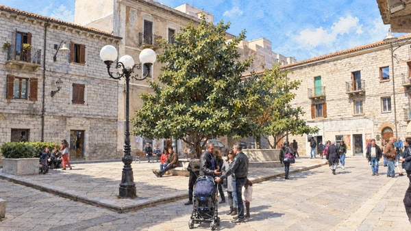
Stone facades, paved squares and shaded meeting places give the centre a consistent material character. Piazza Italia offers one view of a town still used for everyday work and conversation.

Today

This remains an inhabited place. Use pedestrian routes, keep entrances clear and check municipal mobility notices for any restricted area.

History

Known as Templo in the medieval period, the town later became a major administrative and religious centre of inland Gallura. Its built fabric includes churches, civic buildings and houses from several periods. Granite working, cork production and local food traditions connect the urban centre with the surrounding countryside.

How to read this place

Walk between the principal squares and the cathedral complex, comparing stonework, doorways and later additions. The image follows Piazza Italia rather than presenting a composite of several squares. Festivals and performances belong to specific dates; the ordinary town is worth visiting in its own right.

What to notice

  • Walk between the principal squares and the cathedral complex, comparing stonework, doorways and later additions.
  • The image follows Piazza Italia rather than presenting a composite of several squares.
  • Festivals and performances belong to specific dates; the ordinary town is worth visiting in its own right.
Tempio Pausania | SardegnaTurismo – Sito ufficiale del turismo della Regione Sardegna
Watercolour: Tempio Pausania, Piazza Italia with granite facades, central tree and pedestrians
Tempio Pausania: a granite townEditorial watercolour · AI-generated · 2026
06

The inhabited landscape

Aggius: stone, weaving and local memory

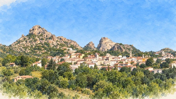
The village sits below rounded granite hills, with houses gathered along the lower slopes. Landscape and building material remain closely connected.

Today

This remains an inhabited place. Use pedestrian routes, keep entrances clear and check municipal mobility notices for any restricted area.

History

Granite extraction and working have shaped local livelihoods, while weaving and carpet making preserve another body of skilled knowledge. The ethnographic museum named for Oliva Carta Cannas interprets objects, work and domestic life. Choral and religious traditions add forms of heritage that cannot be reduced to a single museum display.

How to read this place

Begin with the inhabited streets, then use museums and named makers to understand the work behind buildings and textiles. Ask about current visits or demonstrations rather than assuming that production is always on show. The panorama describes the setting of the village, not a marked route through the hills.

What to notice

  • Begin with the inhabited streets, then use museums and named makers to understand the work behind buildings and textiles.
  • Ask about current visits or demonstrations rather than assuming that production is always on show.
  • The panorama describes the setting of the village, not a marked route through the hills.
Aggius | SardegnaTurismo – Sito ufficiale del turismo della Regione Sardegna
Watercolour: Aggius, village panorama beneath distinctive granite hills
Aggius: stone, weaving and local memoryEditorial watercolour · AI-generated · 2026
07

Terrain and access

Capo Testa: reading the old quarries

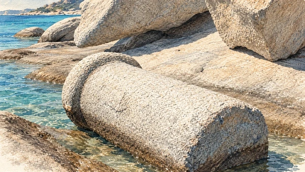
Worked stone lies among naturally rounded granite blocks beside the sea. The contrast makes human intervention visible within a landscape often described only in geological terms.

Today

Conditions depend on the exact route and the day. Check the responsible operator, weather and local access notices; use the designated routes and confirm the return journey.

History

Quarrying supplied granite during Roman times, when proximity to the shore helped move heavy stone toward maritime transport. Cut faces, wedge marks and unfinished elements record different stages of work. Extraction and attempted quarrying also occurred in later periods, so not every worked surface can automatically be labelled Roman.

How to read this place

Look for evidence of cutting and shaping without climbing on or moving archaeological material. The illustration follows a documented worked column fragment in the coastal quarry setting. Use local interpretation to separate dated evidence from visual resemblance, and respect current access and marine-protection notices.

What to notice

  • Look for evidence of cutting and shaping without climbing on or moving archaeological material.
  • The illustration follows a documented worked column fragment in the coastal quarry setting.
  • Use local interpretation to separate dated evidence from visual resemblance, and respect current access and marine-protection notices.
Le cave di Capo Testa
Watercolour: Capo Testa, worked granite column fragment among coastal quarry blocks
Capo Testa: reading the old quarriesEditorial watercolour · AI-generated · 2026
08

Terrain and access

The Roccia dell’Orso above Palau

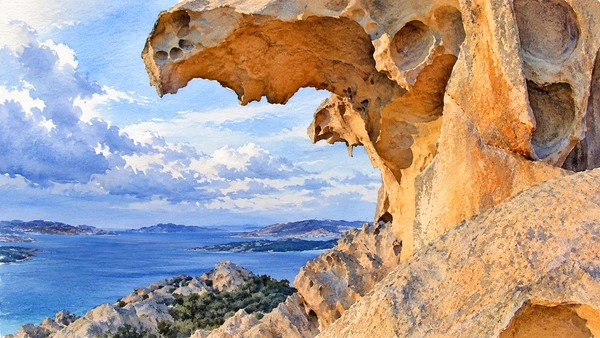
Weathered granite forms a projecting profile with cavities and overhangs. The resemblance that gives the rock its name becomes more or less apparent as the viewpoint changes.

Today

Conditions depend on the exact route and the day. Check the responsible operator, weather and local access notices; use the designated routes and confirm the return journey.

History

Long-term weathering created the formation, which also became a recognisable coastal landmark. The wider promontory contains traces of different human uses, including military installations from the modern period. Literary attempts to connect this coast with Homer belong to interpretation and legend rather than proof of an epic itinerary.

How to read this place

Use the visitor path and keep to the permitted areas around exposed rock. Wind can change the experience substantially, so check conditions before the ascent. The illustration records one close view with the archipelago beyond; it is a natural formation, not a carved animal.

What to notice

  • Use the visitor path and keep to the permitted areas around exposed rock.
  • Wind can change the experience substantially, so check conditions before the ascent.
  • The illustration records one close view with the archipelago beyond; it is a natural formation, not a carved animal.
Roccia dell’Orso | SardegnaTurismo – Sito ufficiale del turismo della Regione Sardegna
Watercolour: Roccia dell’Orso Palau, weathered granite overhang above the blue archipelago
The Roccia dell’Orso above PalauEditorial watercolour · AI-generated · 2026
09

The inhabited landscape

La Maddalena: harbour town and island life

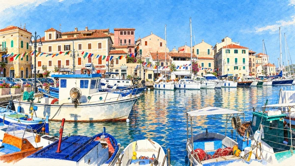
Boats, waterfront houses and reflections fill Cala Gavetta. The harbour is a useful introduction to an inhabited island whose history extends beyond scenic excursions.

Today

This remains an inhabited place. Use pedestrian routes, keep entrances clear and check municipal mobility notices for any restricted area.

History

The modern community grew through settlement, navigation and strategic military importance. Streets and buildings reflect those changing roles, while the surrounding archipelago now forms a protected landscape. The island town and the wider group of islands share a name but do not share one unrestricted form of access.

How to read this place

Allow time for the town after the ferry crossing from Palau. Check the actual itinerary and permissions for any separate boat trip. Spiaggia Rosa is protected from beach access and bathing; the protected Cala Coticcio and Cala Brigantina routes require an authorised guide. Follow the Park’s current instructions rather than treating every photographed cove as freely accessible.

What to notice

  • Allow time for the town after the ferry crossing from Palau.
  • Check the actual itinerary and permissions for any separate boat trip.
  • Spiaggia Rosa is protected from beach access and bathing; the protected Cala Coticcio and Cala Brigantina routes require an authorised guide.
La Maddalena | SardegnaTurismo – Sito ufficiale del turismo della Regione Sardegna
Watercolour: La Maddalena, Cala Gavetta harbour with boats and pastel waterfront houses
La Maddalena: harbour town and island lifeEditorial watercolour · AI-generated · 2026
10

Evidence and interpretation

Caprera and the Compendio Garibaldino

The small former mill and surrounding scrub place Garibaldi’s home within a worked island landscape. The property was a household and agricultural enterprise as well as a place of memory.

Today

The Ministry lists advance reservation as mandatory. Check the museum’s current booking arrangements and allow for travel from La Maddalena to Caprera.

History

The main white house was built in 1856–57 and later enlarged. Garibaldi lived here between journeys and campaigns and died on Caprera in 1882. The Compendio opened as a museum in 1976, preserving buildings, personal objects and family graves. These domestic and agricultural traces broaden the story beyond military commemoration.

How to read this place

Reserve the visit using the museum’s current arrangements. Distinguish the Compendio from the separate Memoriale at Forte Arbuticci when choosing tickets and planning travel. The illustration shows the former mill in the estate landscape, not the main house; visit the rooms and grounds as directed by museum staff.

What to notice

  • Reserve the visit using the museum’s current arrangements.
  • Distinguish the Compendio from the separate Memoriale at Forte Arbuticci when choosing tickets and planning travel.
  • The illustration shows the former mill in the estate landscape, not the main house; visit the rooms and grounds as directed by museum staff.
Compendio garibaldino di Caprera – Ministero della cultura
Watercolour: Compendio Garibaldino Caprera, small former mill and flag above the island landscape
Caprera and the Compendio GaribaldinoEditorial watercolour · AI-generated · 2026

The territory through time

A short chronology

A concise chronology linking the documented sites to the wider story.

  1. Nuragic settlements and collective tombs shape the archaeological landscape.

  2. La Prisgiona develops through successive phases.

  3. Quarrying and maritime exchange connect the granite coast with wider markets.

  4. San Simplicio takes shape in Olbia.

  5. Inland towns develop religious, civic and craft institutions.

  6. The main white house is built at Garibaldi’s Caprera property.

  7. Garibaldi dies on Caprera.

  8. The Compendio Garibaldino opens as a museum.

Before your visit

Practical information

01

Plan separate days

Choose a manageable set of visits and allow for transport, booked entries and the return journey.

02

Use the exact place name

Sardinia contains separate cities, hill routes and coastal approaches. Confirm the precise locality and route rather than treating nearby names as one destination.

03

Check the institution

Opening hours, tickets, exhibitions and religious access change. Use the linked managing institution shortly before visiting.

04

Check the actual terrain

Steps, gradients and uneven ground vary between the individual sites. Use current route information, weather and closures for the option you choose.

05

Arrange accessible visits

Historic interiors and outdoor approaches can include steps, gradients or uneven surfaces. Ask about the specific route instead of assuming an entire destination is step-free.

06

Respect work and residence

Farms, workshops, churches and historic streets remain in use. Follow signs, keep entrances clear and ask permission before entering private spaces.

Method and sources

Sources and image credits

Prepared on 9 September 2026 from the institutional sources linked below. Historical claims are separated from editorial observations and itinerary suggestions. Older institutional brochures are used for stable cultural context, never as current timetables. Prices, transport schedules, trail status and admission are deliberately left to the responsible operators. Illustrations are not photographs, measured reconstructions or evidence of current conditions.

The eleven images are AI-generated editorial watercolours guided by photographic references. They interpret named places and are not photographs or substitutes for measured plans. Opening hours, tickets, accessible routes, temporary exhibitions and conservation work can change; consult the linked official pages shortly before visiting.

Illustration references and credits