Illustrated guide · Sicily
One ancient Aci,
many towns by the sea
Twelve places through which to read a coast shaped by submarine volcanism, maritime work, Norman power, Baroque rebuilding, literature, protected sea and the gradual division of old Jaci.
Explore the placesThe plural in the name is the beginning of the journey
The Riviera dei Ciclopi is often reduced to three black rocks and one photograph from the seafront.
The rocks matter, but they belong to a much larger system. Submarine lava, uplifted clay, fishing harbours, thermal springs, coastal towers, churches rebuilt after earthquakes and paths descending a fault scarp all occupy a narrow band between Etna and the Ionian Sea.
The repeated name Aci is not a decorative regional label. Aci Castello, Aci Catena, Aci Sant'Antonio and Aci Bonaccorsi, together with Acireale and the sea villages, preserve fragments of a territory once understood as Jaci. Its later divisions created distinct municipalities, devotions, economies and urban forms.
A complete guide must therefore move town by town. Myth can open the door, but geology, archives, material culture and living communities must decide what is actually seen.

One destination
A coast where myth, lava and civic history overlap.
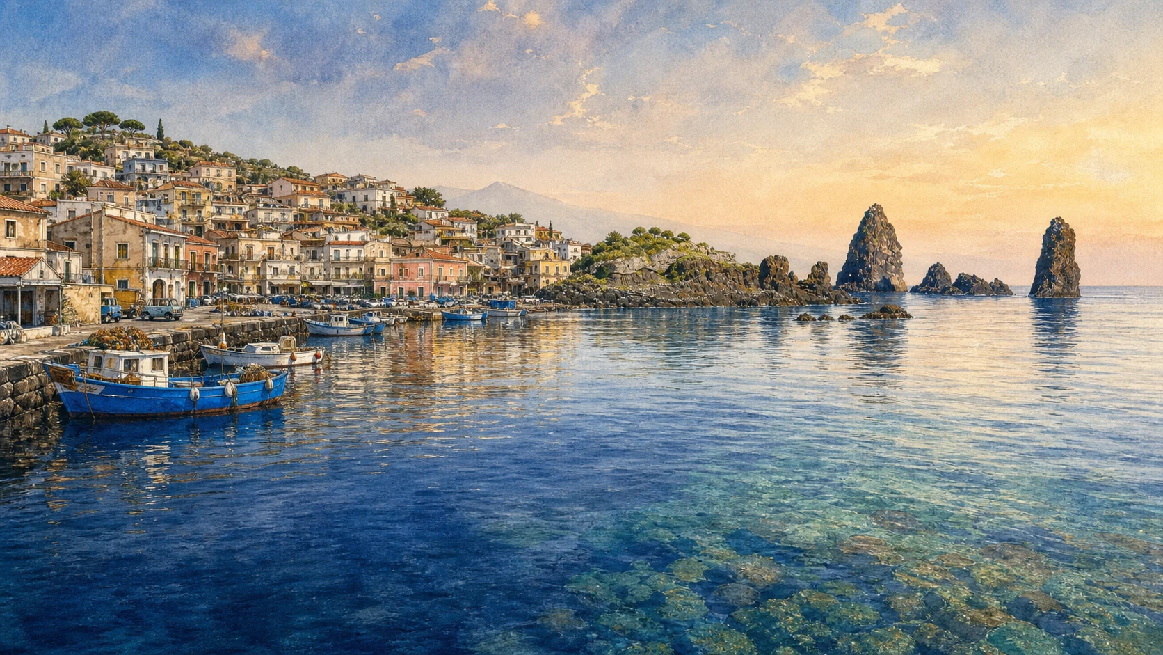
The oldest volcanic evidence on the coast predates the familiar upper cone of Etna. Around Aci Trezza, submarine eruptions and magma intrusions entered Pleistocene seabed sediments. Erosion later exposed pillow lavas, columnar bodies, Isola Lachea and the Faraglioni. Their shapes encouraged stories of Polyphemus hurling stones at Odysseus and of the shepherd Acis, Galatea and the jealous Cyclops; these myths are cultural readings of the coast, not geological explanations.
Human settlement followed different resources at different levels. The sea offered landing places and traffic; the castle rock controlled navigation; the Reitana springs supported Roman baths; hill villages used fertile volcanic soils; Acireale developed as the principal urban centre and rebuilt its churches and palaces after the 1693 earthquake. Today the marine protected area and La Timpa reserve protect two connected but different environments: submerged habitats around the Cyclops archipelago and the lava fault scarp north of the city.
The selection
Twelve places, from submarine rock to the hill towns
The sequence begins with the geology and myths of the archipelago, follows the coast through Aci Castello, Aci Trezza and Capo Mulini, rises to Acireale and La Timpa, and then restores the inland Aci centres and the Roman spring landscape at Reitana.
- 01The Lava Archipelago and the Myths of the Cyclops
- 02Aci Castello and the Norman-Swabian Fortress
- 03Aci Trezza: Harbour, Church and Fishing Streets
- 04Casa del Nespolo, Verga and La terra trema
- 05Isola Lachea and the Isole Ciclopi Marine Protected Area
- 06Capo Mulini and the Ancient Maritime Corridor
- 07Acireale: Piazza del Duomo and the Civic Centre
- 08San Sebastiano, Pietro Paolo Vasta and the Zelantea Collections
- 09La Timpa, the Chiazzette and Santa Maria La Scala
- 10Aci Catena, Reitana and Santa Venera al Pozzo
- 11Aci Sant'Antonio and the Painted Sicilian Cart
- 12Aci Bonaccorsi and the Four Historic Quarters
AN ANCIENT SUBMARINE LANDSCAPE LATER READ THROUGH EPIC AND LOCAL MYTH
The Lava Archipelago and the Myths of the Cyclops
The Faraglioni are geological witnesses first and literary symbols second; both histories deserve to be kept visible.

The place today
From the Aci Trezza waterfront, Isola Lachea and the Faraglioni form a broken line rather than a symmetrical group. Dark columnar faces rise above pale remnants of altered clay, while smaller rocks appear or disappear with viewpoint and sea state. The archipelago is part of a protected system: landing, navigation, diving and access are governed by current reserve and marine-area rules, not by the apparent nearness of the rocks.
The historical chapter
University documentation connects Lachea to submarine volcanic activity roughly half a million years ago. Magma interacted with seabed sediments; uplift and erosion exposed complex basaltic bodies rather than blocks thrown from land. Greek and Roman literary traditions later made the coast a stage for Polyphemus, Odysseus, Acis and Galatea. Those stories explain how generations imagined dangerous rock and water. They should not be used to replace the measurable volcanic sequence.
What to notice
- Use the waterfront to compare rock forms from several angles. Treat every landing or boat trip as access to a protected area and verify authorisations before departure.
A BLACK VOLCANIC ROCK THAT CONTROLLED SEA TRAFFIC AND CHANGED WITH EARTHQUAKES
Aci Castello and the Norman-Swabian Fortress
Castle, rock and town form one defensive landscape, but the surviving fabric belongs to several periods.

The place today
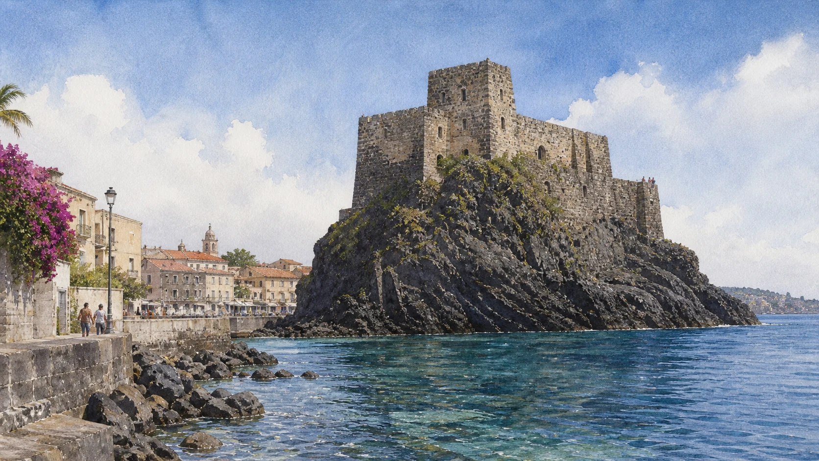
The castle rises directly from a volcanic promontory above the main square. Stairs lead through surviving gates and rooms to terraces that reveal the coast toward Catania and Aci Trezza. The civic museum uses archaeological, mineralogical and palaeontological material to reconnect the fortress with the rock beneath it and the sea routes around it. The building should be read as a layered stronghold, not a complete Norman residence frozen in one date.
The historical chapter
The municipal account records ancient occupation of the strategic rock, destruction during the Arab conquest and the construction of the surviving Norman fortress between 1071 and 1081. It later passed between bishops, royal power and competing aristocratic factions, including the Alagona resistance to Martin of Aragon. Earthquake and lava altered the relation between rock and shore, while military technology gradually reduced the value of its steep isolation. In the nineteenth century the castle also entered Verga's literary landscape.
What to notice
- The climb includes many steps, exposed edges and changing opening hours. Check the municipal museum information rather than relying on old ticket timetables.

A SEVENTEENTH-CENTURY MARITIME FOUNDATION THAT BECAME A LIVED COASTAL COMMUNITY
Aci Trezza: Harbour, Church and Fishing Streets
The famous view only makes sense when the harbour's planned origins and working streets are restored.

The place today
Aci Trezza gathers around the harbour, the church of San Giovanni Battista and narrow lanes that rise behind the waterfront. Boats, fish trade, seasonal tourism and daily traffic share limited space. The surviving urban scale makes it possible to move from quay to church, small courtyards and older defence traces without imagining the village as an untouched nineteenth-century set.
The historical chapter
The municipality dates the organised birth of Trezza to the late seventeenth century, when the Riggio princes created a maritime outlet for Aci Sant'Antonio and San Filippo. Houses were offered to fishing families; a mole, church, warehouses, towers, inn and local administration followed, formalised in 1691. By the mid-eighteenth century it had become an important landing place. Verga and later Visconti made the village internationally recognisable, but literary fame came after a long history of planned settlement and maritime labour.
What to notice
- Walk early or late enough to separate the working harbour from peak visitor pressure. Do not photograph crews or private work at close range without permission.
A SMALL HOUSE THAT CONNECTS A NOVEL, FISHING MATERIAL CULTURE AND POSTWAR CINEMA
Casa del Nespolo, Verga and La terra trema
The museum is valuable when treated as interpretation, not as proof that one fictional family occupied one exact house.

The place today
The museum occupies a nineteenth-century house near San Giovanni Battista, with a lava-stone arch, courtyard and small garden. One room addresses the fishing world associated with I Malavoglia; another preserves photographs, posters and testimony connected with Luchino Visconti's La terra trema, filmed in Aci Trezza with local non-professional performers. Tools, domestic objects and images make work and representation visible together.
The historical chapter
Giovanni Verga published I Malavoglia in 1881 and set the novel within the economic and social pressures of a fishing community. Visconti returned to Aci Trezza after the Second World War, filming La terra trema in 1947–48 and using the village and its residents to create a different political and cinematic reading. The museum links those two works with local memory; its name evokes the novel rather than authenticating a single surviving fictional dwelling.
What to notice
- Current opening information has varied across public listings. Confirm directly before planning the visit and distinguish museum interpretation from the novel's fictional geography.
PROTECTION EXTENDS BELOW THE WATERLINE, WHERE BASALT, POSIDONIA AND ARCHAEOLOGY MEET
Isola Lachea and the Isole Ciclopi Marine Protected Area
The archipelago is not scenery in front of the village; it is a regulated ecological and archaeological space.

The place today
The protected sea extends along the Aci Castello coast from Punta Aguzza toward Capo Mulini. Basalt walls, sand, seagrass meadows, shallow channels and deeper routes support different communities. The integral reserve on Lachea also safeguards terrestrial and shore habitats, including the endemic local lizard population. Mooring, fishing, diving, swimming routes and landings do not all follow the same rules.
The historical chapter
The marine protected area was first established in 1989, modified in 1996 and comprehensively redefined in 2004. The integral nature reserve of Lachea and the Faraglioni was established in 1998. Protection responded to ecological value, geological rarity and the density of ancient maritime evidence in the surrounding waters. Anchors, amphora fragments and other remains document repeated navigation and landing rather than one isolated shipwreck story.
What to notice
- Consult the managing consortium for the current zoning map and permitted activities. Never infer permission from the presence of other boats or swimmers.
A HEADLAND WHERE FISHING, ROMAN-AGE TRAFFIC, SPRINGS AND MODERN COASTAL USE OVERLAP
Capo Mulini and the Ancient Maritime Corridor
Capo Mulini connects the Cyclops coast to the Reitana thermal landscape and the longer sea route north.

The place today
The harbour and headland at Capo Mulini mark the northern reach of the protected marine corridor. Fishing craft, restaurants, coastal roads and remains of older waterfront use occupy a compressed edge. Offshore archaeological routes and the changing seabed point to centuries of traffic, while inland roads lead toward Santa Venera al Pozzo and the thermal spring system. The modern shoreline should not be mistaken for the exact ancient coastline.
The historical chapter
Archaeological work identifies the bay as a long-used landing and exchange zone. The regional archaeological park records a small Roman temple podium near the spring at Capo Mulini and connects it with the sacred and therapeutic landscape of Santa Venera al Pozzo. Ancient ships moved through a coast where natural rock shelter and fresh or thermal water mattered. Later harbour use, coastal construction and erosion altered the evidence now visible.
What to notice
- Much of the archaeological evidence is submerged, fragmentary or in protected areas. Use authorised interpretation and avoid treating every masonry trace as Roman.
CATHEDRAL, BASILICA AND PALACE DEFINE A CITY THAT REBUILT WITHOUT ERASING ITS EARLIER PLAN
Acireale: Piazza del Duomo and the Civic Centre
Acireale's central square is a civic ensemble, not a single façade isolated from streets and institutions.

The place today
Piazza del Duomo brings together the Cathedral of Maria Santissima Annunziata, the Basilica of Saints Peter and Paul, the eighteenth-century municipal palace and Palazzo Modò. Their materials, towers and façades were produced in different campaigns. Corso Umberto and surrounding streets extend the urban reading beyond the square toward shops, palaces, churches and the edge above La Timpa.
The historical chapter
The cathedral preserves origins before the 1693 earthquake even though its present appearance reflects later rebuilding and façade work. Saints Peter and Paul developed between the sixteenth and seventeenth centuries, while the municipal palace belongs to the city's post-earthquake civic image. The square therefore records continuity, catastrophe and redesign. Its modern concentric paving, completed in 2009, is a contemporary layer inspired by the cathedral rose window rather than historic Baroque paving.
What to notice
- Religious buildings remain active. Check access around services and observe the ensemble from several streets before focusing on the main façades.
BAROQUE STONE, PAINTED INTERIORS AND CIVIC COLLECTING SHOW HOW ACIREALE PRODUCED MEMORY
San Sebastiano, Pietro Paolo Vasta and the Zelantea Collections
The basilica and the Zelantea collections reveal both the public spectacle and the archival labour of the city.

The place today
The Basilica of San Sebastiano stands behind a sculpted balustrade in Piazza Leonardo Vigo. Its multi-order façade, interior frescoes and processional life make it one of Acireale's central monuments. Nearby, the Biblioteca e Pinacoteca Zelantea represents a different form of civic memory: books, art and documentation assembled and studied rather than displayed in the street. Together they prevent Baroque Acireale from becoming architecture without authors or archives.
The historical chapter
The first San Sebastiano church was built from 1609 to 1644 and substantially reconstructed after the 1693 earthquake. Pietro Paolo Vasta painted major interior cycles between 1732 and 1736; other artists and stoneworkers completed the layered programme. The building became a minor basilica in 1990. Acireale's learned academies and civic collections developed through a different chronology, preserving material essential to the study of local art and history.
What to notice
- The basilica is an active place of worship and January processions change access. Verify Zelantea opening arrangements separately; library access is not identical to a permanent gallery timetable.

A LAVA FAULT SCARP SEPARATES THE HIGH CITY FROM SPRINGS, VEGETATION AND A SEA VILLAGE
La Timpa, the Chiazzette and Santa Maria La Scala
The descent from Acireale to the shore is a geological section, historic route and fragile living landscape.

The place today
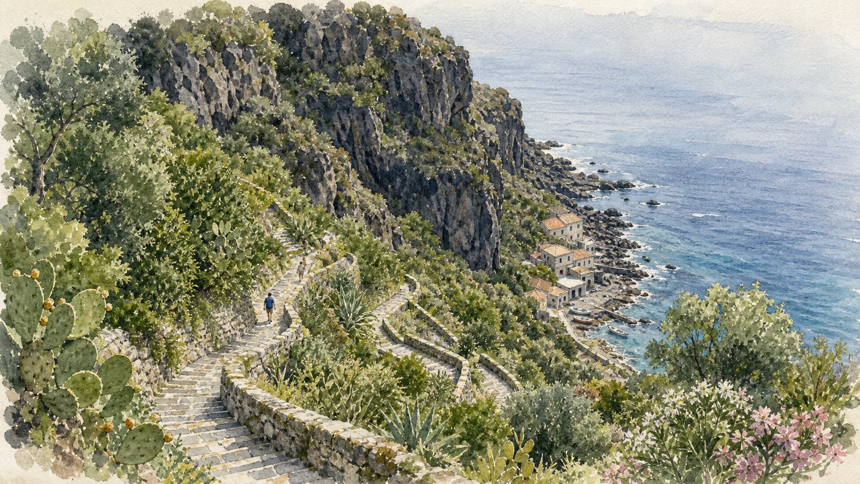
La Timpa forms a steep coastal escarpment north of Acireale, reaching roughly eighty metres and carrying remnant low-altitude vegetation above pebble coves and springs. The Chiazzette path descends through walls and turns toward Santa Maria La Scala, a fishing village compressed between cliff and sea. Columnar basalt, lava caves and the old railway corridor belong to the reserve, but path condition and rockfall risk can change access at short notice.
The historical chapter
Successive lava bodies and fault movement built the scarp between about 220,000 and 110,000 years ago. The reserve protects geological structures, Mediterranean vegetation and a surviving fragment of the former Bosco di Aci. Historic descent routes connected the plateau city with shore work and landing places. Modern roads, railway works, urban growth and slope stabilisation have altered that connection without eliminating the geological boundary.
What to notice
- Check official closure, weather and landslide information before using any descent. Do not assume the Chiazzette or every coastal path is open because the upper viewpoint is accessible.
ROMAN BATHS, SPRINGS AND A HILL TOWN RESTORE THE INLAND HALF OF THE ACI STORY
Aci Catena, Reitana and Santa Venera al Pozzo
The ancient Aci landscape cannot be located only on the modern seafront; springs and settlement extended inland.

The place today
Aci Catena occupies the hill zone above Capo Mulini and preserves the Sanctuary of Maria Santissima della Catena, older quarters and routes toward Reitana. At Santa Venera al Pozzo, the regional archaeological area includes substantial remains of Roman baths, water structures, a villa and later production rooms. The visible ruins are distributed across a working landscape, so the site reads differently from a compact urban monument.
The historical chapter
The archaeological park identifies at least three principal phases in the baths between the first and fourth centuries AD. A nearby villa reused earlier Greek-Hellenistic structures, and from the late third century part of the complex became an industrial establishment with numerous rooms and kilns producing pottery and building material into the fifth century. Medieval cult traditions associated Saint Venera with the spring. Early-modern disputes over the fair and the later division of the Aci territory connected water, devotion and civic autonomy.
What to notice
- Verify archaeological-area opening and guided-access arrangements. Springs, bath remains and later devotional structures belong to related but distinct periods.
A HILL TOWN TURNS TRANSPORT, WOODWORK AND STORYTELLING INTO A DISTINCT CIVIC LANGUAGE
Aci Sant'Antonio and the Painted Sicilian Cart
The cart is not a generic souvenir here; it joins specialised craft, mobility and painted narrative.

The place today
Aci Sant'Antonio lies between Etna and the sea within the upper Aci settlement band. Churches, lava-stone streets and surviving workshop traditions frame the Museo del Carretto Siciliano. Painted carts combine carpentry, metalwork, carving and narrative panels; studying wheels, chassis and working wear is as important as admiring their colour. The museum gives the town a cultural focus separate from coastal Aci Trezza and monumental Acireale.
The historical chapter
The municipality's history was shaped by the division of the older Aci territory, eruptions, earthquakes and nineteenth-century administrative autonomy. Carts served agricultural and commercial transport before becoming strongly coded vehicles of family identity and public display. Their painted scenes drew from epic, religious, chivalric and historical stories. As motor transport displaced daily use, collecting and museum interpretation preserved a craft system that otherwise risked being reduced to decoration.
What to notice
- Confirm current museum access with the municipality. Look for evidence of use, construction and repair as well as the most colourful painted panels.
THE SMALLEST ACI MUNICIPALITY PRESERVES THE SHAPE OF DISPERSED VOLCANIC HILL SETTLEMENT
Aci Bonaccorsi and the Four Historic Quarters
Bonaccorsi explains how separate clusters, gardens and a central church gradually became one municipality.

The place today
Aci Bonaccorsi occupies only about 170 hectares on the coastal hill at roughly 362 metres. The historic form can still be read through Piazza, Sciara-Lavina, Pauloti and Battiati, once distinct clusters on modest rises. The mother church and central square linked them without completely erasing their topographic identities. Citrus gardens, vineyards and remaining green spaces show why the hill towns cannot be understood only as suburbs of Catania.
The historical chapter
Municipal research traces the community to several small nuclei and records the name 'Quartiero delli Bonaccursi di Jaci' in seventeenth-century pastoral documents. Construction of the mother church in the late sixteenth century helped stabilise a common centre. Autonomy developed within the progressive fragmentation of feudal Jaci, while the names of families and lava-ground quarters remained embedded in the town plan.
What to notice
- This is a lived small town rather than a monument park. Walk respectfully, avoid blocking narrow residential streets and use the quarter names to read topography rather than to hunt for formal attractions.
The city through time
Ten thresholds in a territory divided by lava and law
The chronology keeps geological time, ancient settlement, medieval power, municipal division, literature and modern protection on different scales.
Submarine eruptions and magma intrusions around the future Aci Trezza coast form the volcanic bodies later exposed as Lachea, Faraglioni and related rocks.
Maritime traffic, settlements, springs and later thermal structures occupy the coast and Reitana landscape; myths of Cyclopes, Acis and Galatea become cultural maps of the region.
The Santa Venera al Pozzo thermal complex develops through several phases; parts of the neighbouring villa later become a pottery and building-material workshop.
The surviving fortress on the Aci Castello rock is constructed during the Norman conquest and becomes a key stronghold in the coastal territory.
A major earthquake and associated volcanic disruption damage the dispersed Aci settlements and help redirect population and cultivation across the hill zone.
A decisive administrative division separates Aquilia, the future Acireale, from the city of Saints Antonio and Filippo, accelerating the political fragmentation of old Jaci.
Aci Trezza's maritime foundation is formally organised in 1691; two years later the eastern Sicily earthquake forces extensive rebuilding across the Aci towns.
Giovanni Verga publishes I Malavoglia, giving Aci Trezza a literary afterlife inseparable from debates about labour, debt, family and social change.
Luchino Visconti films La terra trema in Aci Trezza with local performers, creating a postwar cinematic reading of the fishing community.
The Isole Ciclopi marine protected area begins in 1989, Lachea's integral reserve follows in 1998, La Timpa reserve in 1999, and marine zoning is comprehensively redefined in 2004.
Before your visit
Practical information,
without turning it into promises
Divide coast and hill towns
Aci Castello, Trezza and Capo Mulini form one coastal sequence; Acireale and La Timpa require another; Catena, Sant'Antonio and Bonaccorsi need dedicated inland time. Do not compress all twelve places into one afternoon.
Check two different protected areas
Marine zoning around Lachea and terrestrial rules at La Timpa are not interchangeable. Verify boats, diving, landing and path access with the responsible bodies shortly before the visit.
Treat descents as conditions, not promises
The Chiazzette, cliff paths and some shore approaches can close for rockfall, works or weather. An open viewpoint above does not prove an open descent below.
Separate literature from evidence
Read Verga and the myths before travelling, then distinguish fictional houses and Cyclops stones from museum interpretation, harbour history, archaeology and measured geology.
Sources
This guide cross-checks municipal records for Aci Castello, Acireale, Aci Catena, Aci Sant'Antonio and Aci Bonaccorsi with the University of Catania, the regional protected-area portal, the regional archaeological park and the Ministry of Culture. It treats the plural Aci towns as separate civic places, distinguishes myth from geology and literature from documentary material, and avoids promising access within protected or geologically fragile areas.
- University of Catania CUTGANA · Lachea and Faraglioni ↗
- Sicilian Region ORBS · Isole Ciclopi marine protected area ↗
- Municipality of Aci Castello · Town and castle history ↗
- Italian Ministry of Culture · Museo Casa del Nespolo ↗
- Municipality of Acireale · Piazza del Duomo and San Sebastiano ↗
- Sicilian Region ORBS · La Timpa Nature Reserve ↗
- Regional Archaeological Park · Santa Venera al Pozzo ↗
- Municipal histories · Aci Catena, Sant'Antonio and Bonaccorsi ↗
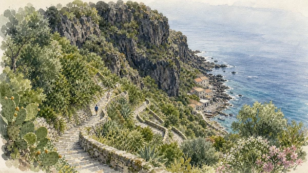
The hero image is an illustration, not a photograph. Marine zoning, boat authorisations, museum openings, church access, path closures, cliff stability and archaeological-area visits can change. Consult the linked managing authorities shortly before travel; never land on protected rocks or use a closed descent because another visitor appears to do so.