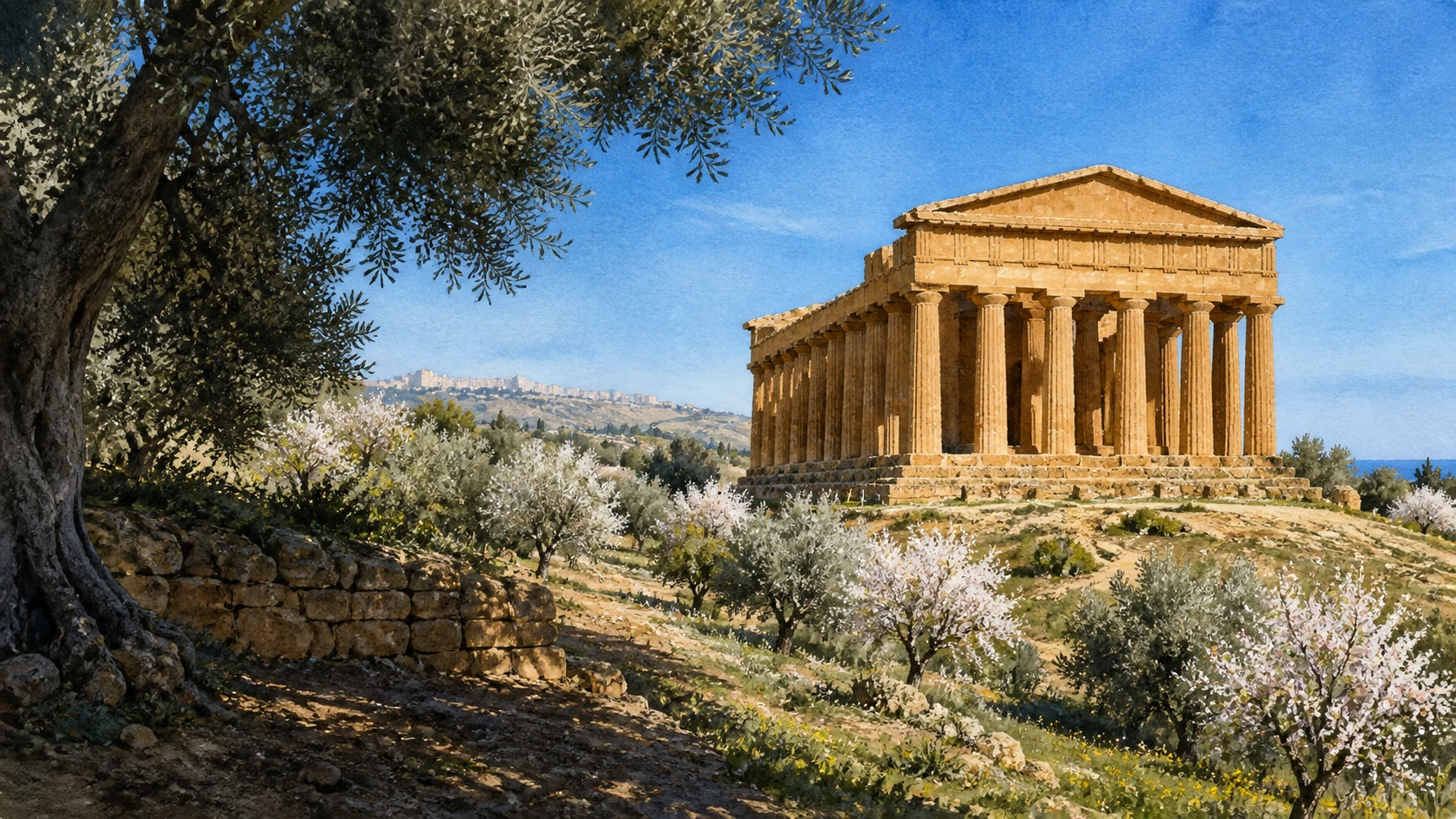
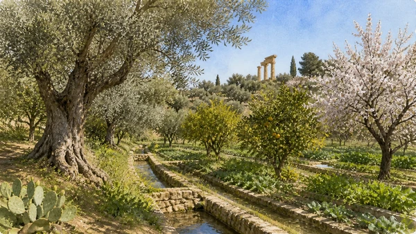
Documentary watercolour of Agrigento's temple ridge among flowering almond trees with the inhabited city visible beyond the ancient landscape

Illustrated guide · Sicily

Between the ridge,
the temples
and the sea

Twenty-five focused chapters join the inhabited ridge to the whole city of Akragas: temples, walls, homes, water, cemeteries, museums, cultivated land and the sea.

Explore the places
Agrigento · city, archaeological landscape and sea

The Valley is an ancient city, and modern Agrigento is not its entrance hall

Agrigento is often reduced to a Doric temple against the sea. That image is powerful, but it leaves out the inhabited ridge and most of Akragas: streets, houses, institutions, water systems, cemeteries and working land.

Via Atenea, the cathedral hill, Santa Maria dei Greci, the Rabato, Santo Spirito, the Lucchesiana and Teatro Pirandello form a living city above the archaeological plateau, not an optional appendix to the temples.

The guide keeps familiar names while marking uncertainty: Juno's dedication is unknown, Concordia takes its name from an unrelated inscription, and the four-column Dioscuri image is a nineteenth-century recomposition. It then follows the territory outward to orchards, Pirandello's Caos and San Leone.

One destination

Twenty-five chapters across the living ridge and the full city of Akragas

Agrigento occupies two principal heights: the medieval and modern city climbs the Colle di Girgenti, while ancient Akragas spread across the plateau to the south between the Akragas and Hypsas rivers. The sacred ridge was one edge of a much larger city.

Founded in 580 BC by settlers connected with Gela and Rhodes, Akragas passed through Carthaginian attack, Roman conquest, Christian transformation and the gradual concentration of settlement on the higher Girgenti hill.

The UNESCO property and regional Park include unexcavated quarters, water systems, cemeteries and agricultural landscape as well as temples. Allow separate time for the historic centre, main Park route, museum and places with their own access conditions.

The selection

Twenty-five chapters from the upper city to the sea

The sequence keeps monuments inside the urban, religious, domestic and agricultural systems that gave them meaning, while distinguishing ancient fabric from later reuse and restoration.

  1. 01Agrigento on Two Heights
  2. 02Via Atenea, Porta di Ponte and Piazza Pirandello
  3. 03The Cathedral of San Gerlando and the Duomo Hill
  4. 04Santa Maria dei Greci and the Temple Beneath It
  5. 05The Lucchesiana and the Diocesan Collections
  6. 06Santo Spirito and the Chiaramonte City
  7. 07The Rabato and the Western Medieval Slope
  8. 08Teatro Pirandello and the Civic City
  9. 09The Plateau, Walls and Gates of Akragas
  10. 10The So-Called Temple of Juno on the Eastern Ridge
  11. 11The Temple of Concordia and Its Christian Life
  12. 12The Palaeochristian Necropolis, Fragapane and Villa Aurea
  13. 13The Temple of Heracles and the History of Restoration
  14. 14The So-Called Tomb of Theron and the Asklepieion
  15. 15The Olympieion and the Telamones
  16. 16Porta V, the Chthonic Sanctuaries and the Dioscuri Reconstruction
  17. 17Kolymbethra, the Temple of Vulcan and the Water Landscape
  18. 18The Pietro Griffo Archaeological Museum
  19. 19The Upper Agora, Ekklesiasterion and Bouleuterion
  20. 20The Hellenistic-Roman Quarter
  21. 21The Theatre, Gymnasium and Hellenistic-Roman Sanctuary
  22. 22Rupe Atenea, the Demeter Sanctuary and San Biagio
  23. 23Almonds, Olives and the Agricultural Park
  24. 24Pirandello's House and the Caos Landscape
  25. 25San Leone and the Route of the Ancient Emporion
01

THE INHABITED RIDGE AND THE ANCIENT PLATEAU ARE SEPARATE IN ELEVATION BUT CONTINUOUS IN HISTORY

Agrigento on Two Heights

Agrigento makes sense only when the upper city and the broad territory of Akragas are read together.

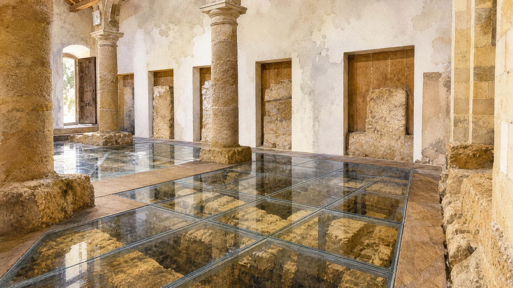
Documentary watercolour inside Santa Maria dei Greci in Agrigento, with glass floor panels revealing ochre Doric foundations beneath the medieval church
THE LIVING CITY ABOVE AKRAGAS

The place today

The contemporary city stretches along a high ridge north of the archaeological Park. Via Atenea crosses the commercial centre below the cathedral quarter, while steep lanes descend through older neighbourhoods. Southward, roads and open slopes reveal the plateau of ancient Akragas and the temple ridge, with San Leone and the Mediterranean beyond.

The historical chapter

The Greek city was laid out on the lower plateau between natural ridges and rivers. During the early medieval centuries, settlement contracted and consolidated on the defensible Colle di Girgenti. Norman, Chiaramonte, ecclesiastical and later civic development enlarged that hill town, while the former urban plain became agricultural ground, quarry, cemetery, archaeological field and eventually protected landscape. The name Girgenti remained official until Agrigento was adopted in 1927.

What to notice

  • Do not plan the historic centre as a short extension of the temple visit. The change in elevation, street grain and historical period deserves a separate walking session.
  • Views can make the two heights appear close, but pedestrian routes, traffic and heat enlarge the practical distance. Use current local transport information.
Municipality of Agrigento · Historical-archaeological report for the old city
02

THE MAIN CIVIC SPINE FOLLOWS THE RIDGE FROM A LOST GATE TO THE MUNICIPAL AND THEATRICAL CENTRE

Via Atenea, Porta di Ponte and Piazza Pirandello

Via Atenea is not simply a shopping street but the longitudinal key to the modern historic centre.

Documentary watercolour inside Santa Maria dei Greci in Agrigento, with glass floor panels revealing ochre Doric foundations beneath the medieval church
THE LIVING CITY ABOVE AKRAGAS

The place today

The eastern approach at Porta di Ponte opens into Via Atenea, a gently changing line of shops, churches, balconies, side stairs and glimpses toward the lower slopes. Westward it reaches Piazza Pirandello, where the municipal palace and theatre create a formal civic enclosure. Lanes climbing north lead toward the cathedral; routes descending south enter Santo Spirito or connect visually with the Valley.

The historical chapter

The historic road condensed urban movement after settlement stabilised on the Girgenti hill. Porta di Ponte marked an entrance through the former walls, while successive noble residences, religious institutions and commercial fronts reorganised the route. Nineteenth-century civic projects turned the western area into a municipal and theatrical centre.

What to notice

  • Walk at least one side lane uphill and one downhill; remaining on Via Atenea alone hides the vertical structure of the city.
  • Porta di Ponte is a place-name and threshold, not an intact monumental gate. Avoid mentally reconstructing complete walls from the present street opening.
Municipality of Agrigento · Historic-centre planning documents
Documentary watercolour inside Santa Maria dei Greci in Agrigento, with glass floor panels revealing ochre Doric foundations beneath the medieval church
THE LIVING CITY ABOVE AKRAGASAt Santa Maria dei Greci, a medieval church incorporates and reveals parts of a Greek temple platform without turning reuse into a seamless reconstruction.
03

A NORMAN FOUNDATION, A DEFENSIVE RIDGE AND CENTURIES OF REPAIR SHAPE THE ECCLESIASTICAL ACROPOLIS

The Cathedral of San Gerlando and the Duomo Hill

The cathedral crowns a working religious quarter whose architecture records instability, patronage and rebuilding.

Documentary watercolour inside Santa Maria dei Greci in Agrigento, with glass floor panels revealing ochre Doric foundations beneath the medieval church
THE LIVING CITY ABOVE AKRAGAS

The place today

The cathedral stands at the upper end of Via Duomo, above steep streets and retaining walls. Its exterior combines a broad stair, unfinished and rebuilt surfaces, bell-tower mass and changing views over the city. Inside, nave, chapels, painted and carved furnishings and the cult of San Gerlando belong to several campaigns.

The historical chapter

The diocese connects the cathedral's medieval development with Bishop Gerlando after the Norman conquest and with Bishop Gualtiero's fortified tower in the twelfth century. Conflict, landslides, earthquakes, structural danger and changing taste repeatedly altered the building. Later Baroque and modern interventions sit within that long sequence.

What to notice

  • Read visible irregularity as evidence of multiple construction and repair phases, not as proof that the church belongs to one single Norman or Baroque moment.
  • Confirm liturgical access and any structural restrictions on the cathedral's official channels. The upper quarter also includes steep slopes and steps.
BeWeB, Italian Episcopal Conference · Cathedral of San Gerlando
04

A MEDIEVAL CHURCH PRESERVES VISIBLE PARTS OF A CLASSICAL TEMPLE ON THE HILL OF GIRGENTI

Santa Maria dei Greci and the Temple Beneath It

Here the ancient and medieval cities physically overlap rather than merely facing one another across the valley.

Documentary watercolour inside Santa Maria dei Greci in Agrigento, with glass floor panels revealing ochre Doric foundations beneath the medieval church
THE LIVING CITY ABOVE AKRAGAS

The place today

Santa Maria dei Greci occupies a narrow precinct below the cathedral. Inside the church, sections of Doric columns and foundations can be seen within and beneath the medieval fabric. A restricted passage reveals part of the stepped base. Crypts, ossuaries and later floors complicate the archaeological reading, while the surrounding lanes show how closely houses and churches grew around the inherited platform.

The historical chapter

The visible temple belongs to the first half of the fifth century BC and probably had six columns on its short sides and fourteen on the long sides. An identification with Athena has been proposed from ancient texts, but remains an interpretation rather than an inscribed dedication. The Norman-origin church incorporated and also spoliated parts of the earlier building. Christian reuse preserved fragments while changing their structure and meaning.

What to notice

  • Use the name Temple of Athena as a reasoned hypothesis, not a certainty. The Park itself describes the identification as recent.
  • The archaeological remains are inside an active and spatially constrained church. Check access and do not expect an open-air temple below the cathedral.
Valley of the Temples Park · Temple traditionally linked to Athena and Santa Maria dei Greci
05

BOOKS, MANUSCRIPTS AND SACRED ART TURN VIA DUOMO INTO A CORRIDOR OF INSTITUTIONAL MEMORY

The Lucchesiana and the Diocesan Collections

Agrigento's cathedral quarter preserves intellectual history as well as architecture and worship.

Documentary watercolour inside Santa Maria dei Greci in Agrigento, with glass floor panels revealing ochre Doric foundations beneath the medieval church
THE LIVING CITY ABOVE AKRAGAS

The place today

The Biblioteca Lucchesiana occupies a monumental building on Via Duomo, close to the cathedral and diocesan museum. Its historic rooms preserve manuscripts, early printed books, maps, archives and a collection shaped by Bishop Andrea Lucchesi Palli. The diocesan collections interpret art, liturgical objects and the long history of the local church.

The historical chapter

Lucchesi Palli founded the library in 1765 with an explicitly public educational purpose. Its collections grew through ecclesiastical, scholarly and local networks and survived neglect, transfer, restoration and cataloguing. The building and books show Enlightenment ambition inside an ecclesiastical city often described too simply as isolated.

What to notice

  • A conservation library is not a drop-in display room in the same way as a museum. Check current visiting, research and event arrangements directly.
  • Do not merge the Lucchesiana and diocesan museum into one institution merely because they are close. Their collections, management and access differ.
Biblioteca Lucchesiana · Institutional history and collections
06

FORTRESS-LIKE MASONRY, A CISTERCIAN HOUSE AND LATER STUCCO LINK MEDIEVAL POWER WITH LIVING DEVOTION

Santo Spirito and the Chiaramonte City

Santo Spirito is both a medieval architectural complex and a site whose present access depends on ongoing civic work.

Documentary watercolour inside Santa Maria dei Greci in Agrigento, with glass floor panels revealing ochre Doric foundations beneath the medieval church
THE LIVING CITY ABOVE AKRAGAS

The place today

The church and former monastery stand on the southern side of the centre, below Via Atenea. Heavy stone walls, pointed openings, cloistered rooms and carved portals retain the character of a fortified religious house. The church interior adds later decoration associated with the Serpotta tradition. Municipal cultural functions and the proposed civic museum occupy parts of the complex, so church, monument and museum status should be checked separately.

The historical chapter

The Cistercian foundation developed at the end of the thirteenth century within the political world of the Chiaramonte family and is locally known as the Bataranni, or great abbey. Suppression of religious orders altered the monastery's uses, while restoration recovered medieval spaces and adapted rooms for civic collections. In April 2026 the Municipality reported that the future civic museum was still moving through installation, safety and reopening procedures.

What to notice

  • Do not interpret the entire interior as medieval: the complex joins Chiaramonte architecture, later stucco, restoration and modern reuse.
  • The Municipality reported active museum-reopening work in 2026. Verify what is actually open rather than relying on older descriptions of completed displays.
Municipality of Agrigento · Santo Spirito and civic museum status
07

DENSE LANES AND STEEP CONTOURS PRESERVE THE GEOGRAPHY OF A CITY FORMED AFTER THE MOVE FROM THE ANCIENT PLAIN

The Rabato and the Western Medieval Slope

The Rabato is a lived urban fabric, not a stage set labelled simply Arab.

Documentary watercolour inside Santa Maria dei Greci in Agrigento, with glass floor panels revealing ochre Doric foundations beneath the medieval church
THE LIVING CITY ABOVE AKRAGAS

The place today

West of the main civic centre, narrow lanes, stairways, irregular plots and fragments of religious and domestic architecture descend along a steep slope. The neighbourhood's condition varies from restored fronts to vacancy and fragile buildings. Views outward reveal the defensive logic of the hill and the distance from the archaeological plateau.

The historical chapter

The name is connected with the Arabic rabad, a suburb beyond or beside a fortified core, and the neighbourhood belongs to the reorganisation of settlement on the Girgenti hill. Islamic, Norman and later medieval phases cannot be assigned street by street without evidence. Chiaramonte building, churches, later houses and modern interventions repeatedly rewrote the fabric while the topography endured.

What to notice

  • Use the Arabic place-name as evidence of an urban layer, not as permission to label every surviving wall or lane Saracen.
  • Respect private life and unsafe structures. Do not enter abandoned houses or blocked passages for photographs.
Municipality of Agrigento · Historical-archaeological report for the old city
08

A NINETEENTH-CENTURY THEATRE GIVES THE MUNICIPAL CENTRE A PUBLIC INTERIOR OF ITS OWN

Teatro Pirandello and the Civic City

The theatre connects civic ambition, performance and Pirandello's later place in Agrigento's public identity.

Documentary watercolour inside Santa Maria dei Greci in Agrigento, with glass floor panels revealing ochre Doric foundations beneath the medieval church
THE LIVING CITY ABOVE AKRAGAS

The place today

The theatre opens from Piazza Pirandello beside the municipal palace. Its horseshoe auditorium, tiers of boxes, decorated ceiling and foyers belong to the representative culture of the late nineteenth-century city. The programme and possibility of visits depend on performances and building works. In May 2026 the Municipality delivered roof-maintenance works covering the stage tower, auditorium and service areas.

The historical chapter

Opened in 1880, the building was first associated with Queen Margherita. After the Second World War, civic commemoration of Luigi Pirandello led to its present name in 1946. Adaptation as a cinema, closure, restoration and reopening changed its technical life.

What to notice

  • Do not describe the theatre as originally dedicated to Pirandello. The name dates from 1946, decades after the 1880 opening.
  • Because maintenance works were formally delivered in May 2026, confirm current performances, tours and accessible areas directly with the theatre.
Municipality of Agrigento · Teatro Pirandello and current maintenance
09

TWELVE KILOMETRES OF DEFENCE ENCLOSED FAR MORE THAN THE MODERN PROCESSIONAL ROUTE PAST THE TEMPLES

The Plateau, Walls and Gates of Akragas

The scale of ancient Akragas emerges through terrain, rivers, walls and gates rather than through columns alone.

Documentary watercolour inside Santa Maria dei Greci in Agrigento, with glass floor panels revealing ochre Doric foundations beneath the medieval church
THE LIVING CITY ABOVE AKRAGAS

The place today

The ancient city occupied an extensive plateau protected by the Rupe Atenea and Girgenti hill to the north, the temple ridge to the south and river valleys to east and west. Sections of wall reuse natural rock and contain tombs cut into later phases. Gate zones organise movement through the archaeological landscape. Much of the street grid and urban ground remains under fields and orchards rather than fully excavated.

The historical chapter

The Park dates the foundation to 580 BC by colonists connected with Gela and Rhodes. A major fortification system approximately twelve kilometres long and entered through nine gates framed expansion during the sixth and fifth centuries BC. Destruction, rebuilding, Roman planning, late-antique burial and medieval agriculture successively changed the perimeter. UNESCO protection includes unexcavated areas because absence of visible ruins does not mean absence of the city.

What to notice

  • Do not use the visible line of temples as the boundary of Akragas. It was a monumental southern edge within a much larger polis.
  • Stay on authorised paths. Unexcavated ground and rock-cut features are archaeological fabric, not empty picnic space.
Valley of the Temples Park · Archaeological area of Agrigento
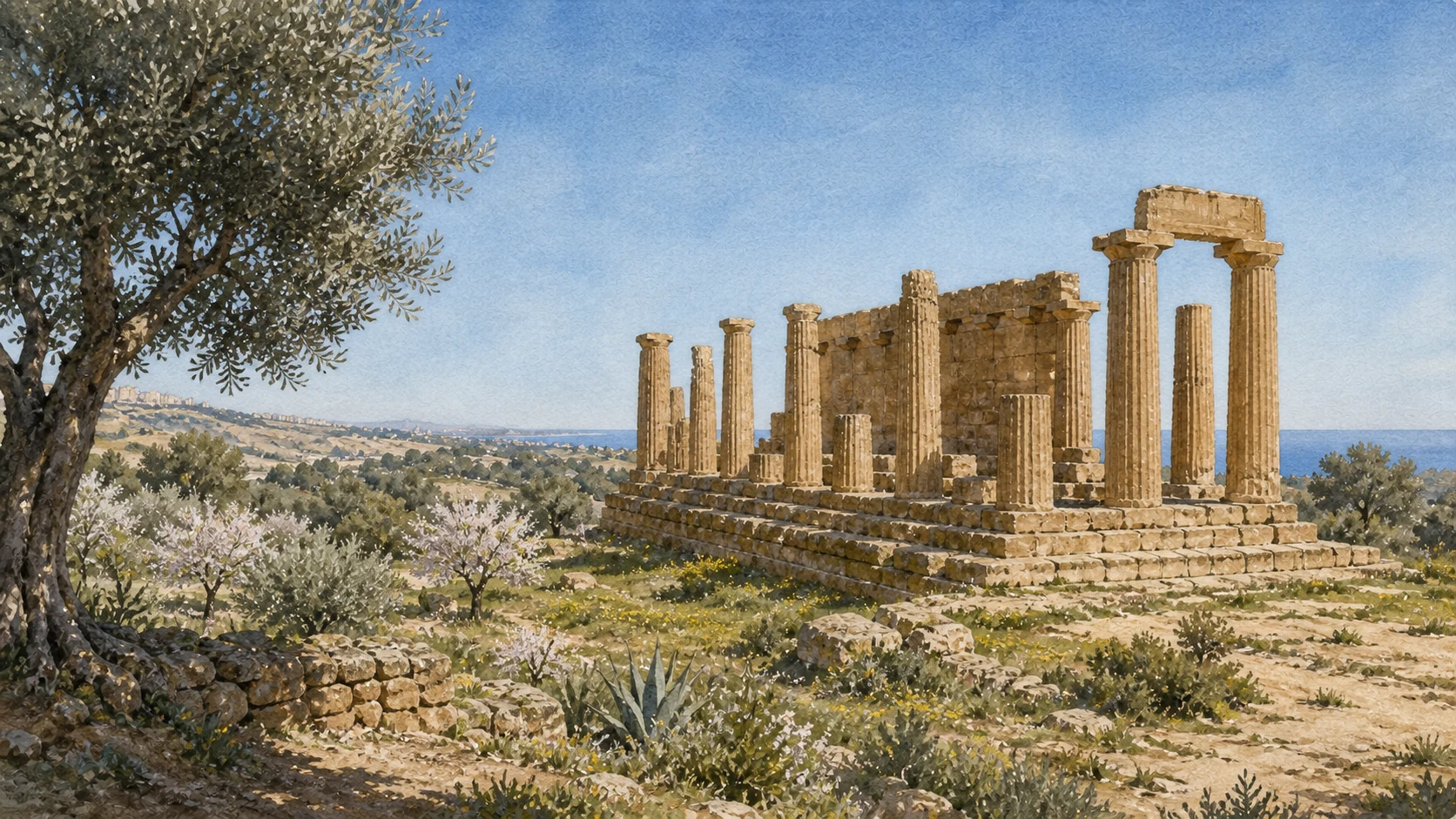
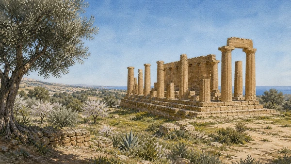
Documentary watercolour of the weathered Temple of Juno at Agrigento on the eastern ridge, with monumental altar, cultivated slopes and distant Mediterranean
THE EASTERN SACRED RIDGEThe Temple conventionally called Juno rises above altar, fortification edge and open landscape; weathering and restoration remain visible.
10

THE HIGHEST TEMPLE PLATFORM OPENS THE SACRED HILL BUT ITS DIVINE DEDICATION REMAINS UNKNOWN

The So-Called Temple of Juno on the Eastern Ridge

The conventional name helps visitors navigate, while archaeology requires a more cautious identification.

Documentary watercolour of the weathered Temple of Juno at Agrigento on the eastern ridge, with monumental altar, cultivated slopes and distant Mediterranean
THE EASTERN SACRED RIDGE

The place today

At the eastern end of the main visitor route, standing columns and the cella walls rise above a monumental altar and wide views toward sea, hills and the rest of the temple ridge. The ascent reveals the relationship between sanctuary, defensive edge and approach to the city. Fire traces, restored masonry and lifted columns make the building a record of damage and conservation as well as classical design.

The historical chapter

The Doric temple dates to around the middle of the fifth century BC, with six columns on the short sides and thirteen on the long sides. Its attribution to Juno derives from a mistaken reading of Pliny concerning a different sanctuary at Croton. The Park notes possible fire damage during the Carthaginian capture of 406 BC, later Roman repair and repeated restoration from the late eighteenth century onward.

What to notice

  • Retain the familiar name for orientation but state clearly that the original deity is unknown.
  • The standing profile is partly the result of modern restoration. Do not treat every upright column as continuously preserved since antiquity.
Valley of the Temples Park · So-called Temple of Juno
11

EXCEPTIONAL PRESERVATION DEPENDS ON ARCHITECTURE, REUSE AND THE OPENING OF A CHURCH WITHIN THE CELLA

The Temple of Concordia and Its Christian Life

Agrigento's best-preserved temple survives not outside later history but because later history entered it.

Documentary watercolour of the weathered Temple of Juno at Agrigento on the eastern ridge, with monumental altar, cultivated slopes and distant Mediterranean
THE EASTERN SACRED RIDGE

The place today

The building retains its six-by-thirteen Doric colonnade, entablature and pediments to an exceptional degree. From different sides, visitors can distinguish the outer peristyle, cella walls and twelve arches cut through those walls during Christian use. Contemporary artworks or events may temporarily occupy nearby ground, but they are not ancient components of the sanctuary.

The historical chapter

The temple dates to the second half of the fifth century BC. Its current name comes from a mid-first-century AD Latin inscription dedicated to civic concord that Tommaso Fazello incorrectly linked to the building in the sixteenth century. The original deity is unknown. Tradition associates conversion to a church of Saints Peter and Paul with Bishop Gregory around the late sixth century. That reuse helped preserve the structure.

What to notice

  • The name Concordia does not identify the ancient cult. Separate the Roman inscription, sixteenth-century attribution and Greek building.
  • Explain the wall arches as Christian adaptation rather than damage to be visually ignored; they are central to the survival story.
Valley of the Temples Park · Temple of Concordia
12

TOMBS CUT INTO ROCK AND WALLS TURN THE CLASSICAL RIDGE INTO A LATE-ANTIQUE LANDSCAPE OF THE DEAD

The Palaeochristian Necropolis, Fragapane and Villa Aurea

Christian Agrigento transformed abandoned sacred and defensive ground into an extensive cemetery.

Documentary watercolour of the weathered Temple of Juno at Agrigento on the eastern ridge, with monumental altar, cultivated slopes and distant Mediterranean
THE EASTERN SACRED RIDGE

The place today

Rock-cut graves appear beside the main route and within the line of the ancient fortifications. The Fragapane complex extends underground, while other burials remain open to the sky. Villa Aurea, associated with Alexander Hardcastle, stands near the necropolis and preserves gardens and a modern chapter of excavation history. Not every subterranean area is included in ordinary admission.

The historical chapter

From the late Roman period, contraction of settlement and abandonment of major pagan buildings allowed an extramural and then increasingly central Christian cemetery to spread across the ridge. Existing cisterns and rock faces were adapted into hypogea and arcosolia. Twentieth-century excavation and conservation, including Hardcastle's residence and support, created new routes through this layered funerary landscape.

What to notice

  • Do not describe all visible cavities as Greek tombs or aqueducts. Function and date vary across cisterns, graves and hypogea.
  • Underground routes may require separate booking, guides or temporary closure. Use only the Park's authorised access.
Valley of the Temples Park · Palaeochristian necropolis
13

EIGHT RE-ERECTED COLUMNS MAKE CONSERVATION ITSELF VISIBLE ON THE OLDEST GREAT DORIC TEMPLE OF THE RIDGE

The Temple of Heracles and the History of Restoration

The celebrated silhouette combines late-archaic architecture with a documented twentieth-century intervention.

Documentary watercolour of the weathered Temple of Juno at Agrigento on the eastern ridge, with monumental altar, cultivated slopes and distant Mediterranean
THE EASTERN SACRED RIDGE

The place today

Eight columns rise in a line above fallen blocks near the central section of the route. The elongated plan, stair passages beside the cella entrance, monumental altar and nearby archaic shrine can be reconstructed from foundations more clearly than from the standing colonnade alone. The contrast between upright columns and scattered stone is one of the Valley's clearest lessons in restoration.

The historical chapter

Built around the end of the sixth century BC, it is the oldest of Agrigento's major Doric temples. A passage in Cicero makes the traditional attribution to Heracles more plausible than many other local temple names. Roof drains with lion heads and later internal alteration record successive phases. Between 1922 and 1924, Alexander Hardcastle financed the re-erection of eight southern columns.

What to notice

  • Do not present the eight-column profile as an untouched ancient survival. Its modern anastylosis is a documented part of the monument.
  • The attribution to Heracles is supported by literary and topographic evidence but still belongs to scholarly identification, not a surviving dedication.
Valley of the Temples Park · Temple of Heracles
14

A ROMAN-AGE TOWER TOMB AND A HEALING SANCTUARY CORRECT TWO DIFFERENT SIMPLIFICATIONS OF THE VALLEY

The So-Called Tomb of Theron and the Asklepieion

Neither a famous tyrant's grave nor a minor outlying temple should be accepted at face value.

Documentary watercolour of the weathered Temple of Juno at Agrigento on the eastern ridge, with monumental altar, cultivated slopes and distant Mediterranean
THE EASTERN SACRED RIDGE

The place today

The tower-shaped funerary monument known as the Tomb of Theron is visible from outside its immediate enclosure near the central route. Farther across the plain, the sanctuary of Asklepios lies outside the walls and may be viewed from the temple ridge or visited under specific arrangements. Their separation from the main temples reveals funerary roads and extra-urban sacred space.

The historical chapter

The so-called Tomb of Theron is a late-Hellenistic funerary building, centuries later than the fifth-century tyrant whose name tradition attached to it. The Asklepieion's importance is known from ancient texts, including the history of a celebrated statue seized and later returned before Roman conquest. Excavation identifies a sanctuary complex rather than just one picturesque small temple.

What to notice

  • The tower tomb is not the proven grave of Theron. Use the conventional name only with its late-Hellenistic date.
  • The Asklepieion is outside the ordinary linear route and the Park lists access by reservation. Do not cross fields or roads informally.
Valley of the Temples Park · Asklepieion
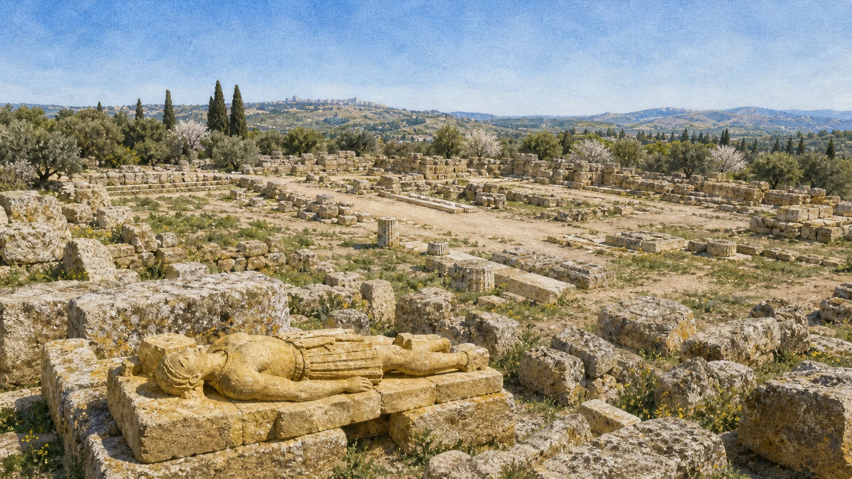
Documentary watercolour of Agrigento's Olympieion archaeological field with enormous fallen calcarenite blocks, column drums and a recumbent telamon reconstruction
THE SCALE OF THE OLYMPIEIONFallen drums, wall blocks and a recumbent telamon convey monumental scale while the unfinished temple is left as an archaeological field, not rebuilt in fantasy.
15

AN UNFINISHED COLOSSAL TEMPLE SURVIVES AS A FIELD OF BLOCKS, ARCHITECTURAL PROBLEMS AND GIANT STONE BODIES

The Olympieion and the Telamones

The Temple of Olympian Zeus is best understood through scale and construction, not through imaginary completion.

Documentary watercolour of Agrigento's Olympieion archaeological field with enormous fallen calcarenite blocks, column drums and a recumbent telamon reconstruction
THE SCALE OF THE OLYMPIEION

The place today

A vast rectangular platform, wall fragments, drums, capitals and fallen architectural pieces occupy the western sanctuary. A recumbent telamon reconstruction helps visitors grasp the size of the human-shaped supports; the museum preserves a vertical reconstruction and original heads. The enormous altar east of the temple belongs to the same monumental programme.

The historical chapter

Diodorus associated construction with the victory over Carthage at Himera in 480 BC and described the temple as unfinished when Akragas fell in 406 BC. The building used engaged half-columns and internal pilasters rather than a free-standing peristyle. Telamones approximately eight metres high occupied the upper wall system. Earthquakes, long abandonment and quarrying for medieval buildings and the eighteenth-century harbour dispersed the remains.

What to notice

  • Do not reconstruct a roofed, complete temple as fact. Ancient description and archaeological study leave questions about the open central area and final state.
  • Distinguish original blocks, modern display reconstructions and museum models. The famous lying figure is interpretive, not an ancient body found intact in that pose.
Valley of the Temples Park · Temple of Olympian Zeus
16

GATE, ALTARS AND SMALL TEMPLES REVEAL RITUAL MOVEMENT MORE CLEARLY THAN THE FOUR MOST PHOTOGRAPHED COLUMNS

Porta V, the Chthonic Sanctuaries and the Dioscuri Reconstruction

The western sacred complex was a network devoted largely to Demeter and Persephone, not one isolated temple.

Documentary watercolour of Agrigento's Olympieion archaeological field with enormous fallen calcarenite blocks, column drums and a recumbent telamon reconstruction
THE SCALE OF THE OLYMPIEION

The place today

Porta V opens through the fortification beside a dense field of foundations, rectangular and circular altars, wells, enclosures and small temples. Four columns and a corner of entablature form the familiar monument called the Temple of the Dioscuri. Seen in context, that nineteenth-century recomposition is only one element within a much older and more complex sanctuary landscape.

The historical chapter

Ritual buildings developed from the sixth century BC around cults connected with the earth, fertility, Demeter and Persephone. The building conventionally called the Dioscuri temple dates to the second half of the fifth century BC, but its dedication is not established and Demeter or Persephone may be more likely. Between 1836 and 1852, the Sicilian antiquities commission assembled its present four-column corner from elements of varied date and origin.

What to notice

  • Do not crop the sanctuary into four columns. The altars, wells, gates and multiple small buildings carry the strongest evidence for cult practice.
  • State that the Dioscuri corner is a nineteenth-century recomposition. It is a historic emblem of Agrigento, not an untouched temple fragment.
Valley of the Temples Park · Chthonic sanctuary and so-called Temple of the Dioscuri
17

AN ANCIENT BASIN BECAME A MEDIEVAL AND MODERN GARDEN BETWEEN AQUEDUCTS, CITRUS AND A RUINED TEMPLE

Kolymbethra, the Temple of Vulcan and the Water Landscape

The valley's celebrated garden is a history of water management and cultivation rather than untouched nature.

Documentary watercolour of Agrigento's Olympieion archaeological field with enormous fallen calcarenite blocks, column drums and a recumbent telamon reconstruction
THE SCALE OF THE OLYMPIEION

The place today

Kolymbethra occupies a sheltered depression west of the Chthonic sanctuary. Citrus, olives, ancient fruit varieties, irrigation channels and steep paths form a cooler agricultural micro-landscape. The remains of the so-called Temple of Vulcan stand on the western height and are reached through the garden route. Management and admission differ from the main Park because the garden is operated by FAI under concession.

The historical chapter

Ancient sources associate a large water basin with works after the Battle of Himera, while underground channels known as the Feace aqueducts fed the area. Over centuries the depression became productive garden ground, especially after citrus cultivation expanded. Abandonment and later environmental recovery created the present visitor landscape. The conventional Vulcan dedication of the temple is not secured by a surviving inscription.

What to notice

  • Treat Kolymbethra as a cultivated historical ecosystem. Citrus groves, channels and paths are human work, not a surviving Greek garden frozen in time.
  • Check separate FAI hours, ticket conditions, path accessibility and any underground route. The garden terrain is steeper and more humid than the temple ridge.
Valley of the Temples Park · Kolymbethra and landscape
18

THE MUSEUM RECONNECTS STONE MONUMENTS WITH CERAMICS, CULT, DOMESTIC LIFE, INSCRIPTIONS AND THE TERRITORY

The Pietro Griffo Archaeological Museum

Without the Griffo, the Valley remains monumental but historically incomplete.

Documentary watercolour of Agrigento's Olympieion archaeological field with enormous fallen calcarenite blocks, column drums and a recumbent telamon reconstruction
THE SCALE OF THE OLYMPIEION

The place today

The museum joins Franco Minissi's 1960s architecture to the restored medieval convent of San Nicola on the upper agora. Seventeen rooms follow Akragas and its wider territory from prehistory to late antiquity. Major works include architectural terracottas, votive objects, painted ceramics, the Agrigento kouros, inscriptions, mosaics and the vertical telamon reconstruction. The church, cloister and surrounding public buildings extend the visit outside the galleries.

The historical chapter

State and civic collections were reorganised with material from systematic excavations beginning especially in the twentieth century. Minissi's museum arrangement is itself an important work of modern museography. The displays distinguish the ancient city from the broader provinces of Agrigento, Enna and Caltanissetta, showing Greek expansion as encounter and regional process rather than a self-contained temple civilisation.

What to notice

  • Visit before or after the western sanctuary if possible; the telamon, roof elements and votive material make otherwise fragmentary sites legible.
  • Check museum hours separately from the Park route. A ticket or late opening for the Valley does not automatically extend to the museum.
Valley of the Temples Park · Pietro Griffo Archaeological Museum
19

ASSEMBLY, COUNCIL AND LATER ROMAN MONUMENTS RECOVER THE POLITICAL CITY BEHIND THE SACRED SKYLINE

The Upper Agora, Ekklesiasterion and Bouleuterion

San Nicola preserves the institutions through which citizens met, decided and later monumentalised Roman Agrigentum.

Documentary watercolour of Agrigento's Olympieion archaeological field with enormous fallen calcarenite blocks, column drums and a recumbent telamon reconstruction
THE SCALE OF THE OLYMPIEION

The place today

South of the museum, the semicircular ekklesiasterion is cut into the slope beside the small building traditionally called the Oratory of Phalaris. On the northern terrace, the bouleuterion and Hellenistic-Roman sanctuary are partly visible externally or through specific access arrangements. The medieval church and convent of San Nicola overlay the ancient public centre.

The historical chapter

The assembly space belongs to the Hellenistic reorganisation of the upper agora. In the Roman period, a small temple-like building occupied part of it and the surrounding civic zone gained new monumental forms. The bouleuterion, built between the late fourth and early third centuries BC, housed the council. Medieval religious construction later reused the same commanding terrace, preserving and obscuring earlier structures.

What to notice

  • The so-called Oratory of Phalaris is not a proved monument of the sixth-century tyrant. Its name is an antiquarian convention.
  • The Park lists some upper-agora buildings as externally visible or available by reservation. Confirm the route rather than entering fenced excavation areas.
Valley of the Temples Park · Ekklesiasterion and Oratory of Phalaris
20

HOUSES, COURTYARDS, MOSAICS AND STREET DRAINAGE RETURN ORDINARY URBAN LIFE TO AGRIGENTUM

The Hellenistic-Roman Quarter

The residential quarter corrects a landscape dominated visually by temples and tombs.

Documentary watercolour of Agrigento's Olympieion archaeological field with enormous fallen calcarenite blocks, column drums and a recumbent telamon reconstruction
THE SCALE OF THE OLYMPIEION

The place today

A regular street grid frames excavated houses arranged around courtyards. Thresholds, cisterns, drains, wall plaster and mosaic floors reveal differences in wealth and repeated rebuilding. Named houses such as the House of the Gazelle are modern archaeological labels. Ongoing conservation and excavation can limit ordinary entry, and parts may be viewed from perimeter routes.

The historical chapter

The district follows earlier Greek planning but the visible houses developed especially from the Hellenistic period through Roman rule. Opulent rooms, service areas and repaired surfaces record households rather than one frozen construction date. Occupation and transformation continued into late antiquity and the early medieval centuries. Detached mosaics and painted fragments now in the Griffo museum must be mentally returned to these domestic settings.

What to notice

  • Do not describe every visible wall as Roman. Street alignment, Hellenistic building, imperial refurbishment and late reuse overlap.
  • Check current entry and conservation work. Viewing from outside is still useful when paired with the museum's mosaics and stratigraphic displays.
Valley of the Temples Park · Hellenistic-Roman Quarter
21

RECENT EXCAVATION REVEALS PERFORMANCE, TRAINING AND IMPERIAL MONUMENTALISATION IN THE LOWER PUBLIC CITY

The Theatre, Gymnasium and Hellenistic-Roman Sanctuary

Agrigento's civic centre extended beyond the monuments known to early travellers and remains an active field of research.

Documentary watercolour of Agrigento's Olympieion archaeological field with enormous fallen calcarenite blocks, column drums and a recumbent telamon reconstruction
THE SCALE OF THE OLYMPIEION

The place today

The theatre lies near the public centre and may be seen externally or through arranged visits while excavation and conservation continue. The gymnasium occupies terraces farther south-west, and the Hellenistic-Roman sanctuary stands north of San Nicola. Their incomplete visibility makes plans, museum objects and elevated viewpoints essential to reading the ensemble.

The historical chapter

The theatre's identification followed long archaeological search and adds performance architecture to the map of Akragas and Agrigentum. The gymnasium includes athletic and civic spaces later monumentalised under Roman rule; a stone seat now in the museum carries a dedication to Hermes and Heracles. The porticoed sanctuary expresses Roman reworking of an older Hellenistic urban centre rather than a wholly new city.

What to notice

  • Do not promise a complete theatre comparable with Syracuse. The discovery is important precisely because the building remains under investigation.
  • Access conditions differ among theatre, gymnasium and sanctuary. The Park lists several as externally visible or reservation-based.
Valley of the Temples Park · Theatre of Agrigento
22

THE NORTHERN HEIGHT PRESERVES FORTIFICATION, ROCK-CUT CULT AND A CHURCH BUILT ABOVE A CLASSICAL TEMPLE

Rupe Atenea, the Demeter Sanctuary and San Biagio

The city's sacred and defensive geography continues far beyond the main southern temple path.

Documentary watercolour of Agrigento's Olympieion archaeological field with enormous fallen calcarenite blocks, column drums and a recumbent telamon reconstruction
THE SCALE OF THE OLYMPIEION

The place today

Rupe Atenea rises at the north-eastern edge of the ancient city and offers wide views across the plateau. On its eastern slopes, the church of San Biagio incorporates the remains of a temple associated with Demeter. Below, rock-cut fountain sanctuaries and channels exploit the cliff and water. Ordinary access is often external or reservation-based and paths can be exposed.

The historical chapter

A temple around 470 BC formed part of a sanctuary whose terracotta votives connect strongly with Demeter and Kore. The later church reused its platform and masonry. Rock-cut chambers, water systems and fortifications show repeated control of the ridge. The Park's documentation is careful to distinguish the archaeological complex from legends that identify every cave or spring through one mythic narrative.

What to notice

  • Do not assume the church merely sits beside a lost temple; its fabric and platform participate in long material reuse.
  • Check path and access conditions, especially in heat or wind. Do not enter rock-cut chambers or channels outside authorised visits.
Valley of the Temples Park · Temple of Demeter and San Biagio
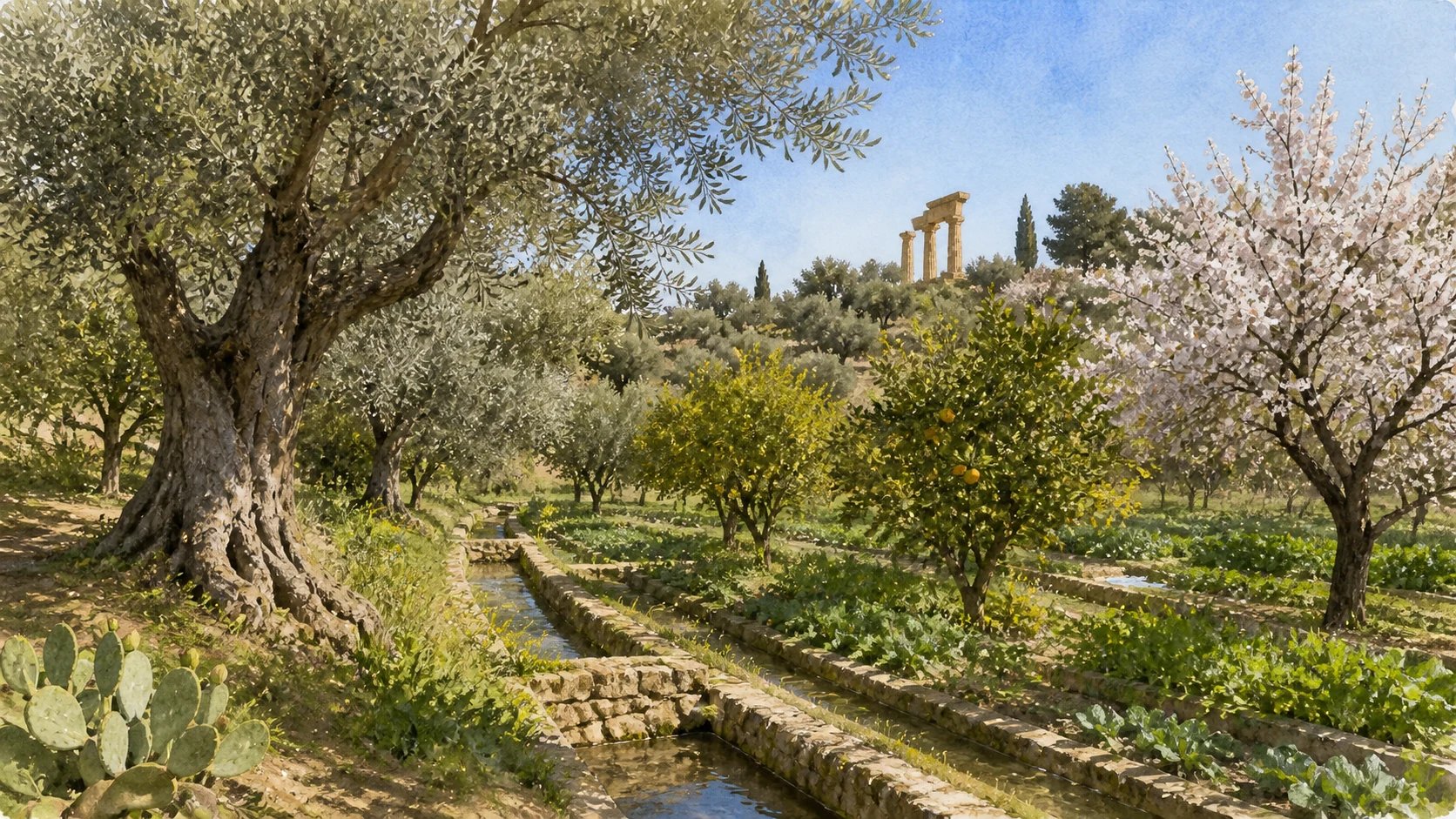
Documentary watercolour of Kolymbethra garden at Agrigento with irrigated citrus, old olive trees, stone channels and temple remains glimpsed through the cultivated valley
WATER, ORCHARDS AND CONTINUITYKolymbethra's irrigated citrus, olives and ancient fruit varieties turn water history and cultivation into a living part of the protected archaeological landscape.
23

FLOWERING TREES, VINES AND GARDENS ARE A PROTECTED WORKING LANDSCAPE, NOT DECORATION AROUND THE RUINS

Almonds, Olives and the Agricultural Park

Agriculture explains how the ancient city remained open, legible and inhabited by production after urban settlement moved uphill.

Documentary watercolour of Kolymbethra garden at Agrigento with irrigated citrus, old olive trees, stone channels and temple remains glimpsed through the cultivated valley
WATER, ORCHARDS AND CONTINUITY

The place today

Olive groves, almond orchards, vines, citrus, pistachios, carobs, dry-stone edges and Mediterranean scrub fill the Park. The Living Almond Museum conserves hundreds of traditional varieties, while Diodoros links protected land with local agricultural production. The Mandorlo in Fiore festival brings international folklore and civic events into both centre and Valley, but dates, routes and installations change each year.

The historical chapter

Grain, vines and olives belonged to the ancient economy, while medieval and modern cultivation introduced and reorganised other species and irrigation systems. Centuries of agriculture limited dense construction across much of the ancient plateau while also altering archaeological deposits. Modern landscape projects treat biodiversity, social use and production as active conservation rather than as a return to an imagined untouched Greek scenery.

What to notice

  • Flowering varies with cultivar and weather; do not promise peak almond blossom on a fixed annual date.
  • Fields and harvests are managed workspaces. Remain on visitor routes and distinguish festival installations from permanent heritage.
Valley of the Temples Park · Agricultural and natural landscape
24

A RURAL HOUSE, A SEA-FACING PLATEAU AND THE WRITER'S TOMB CONNECT FAMILY MEMORY WITH A WORLD LITERARY ARCHIVE

Pirandello's House and the Caos Landscape

Pirandello belongs to a cultivated and industrial edge of Agrigento, not only to the theatre that bears his name.

Documentary watercolour of Kolymbethra garden at Agrigento with irrigated citrus, old olive trees, stone channels and temple remains glimpsed through the cultivated valley
WATER, ORCHARDS AND CONTINUITY

The place today

The late-eighteenth-century rural house stands in Contrada Caos, several kilometres from the centre on the road toward Porto Empedocle. Rooms display photographs, editions, manuscripts, honours and theatre material. A path through Mediterranean vegetation leads toward the writer's tomb and the sea-facing landscape. The house, tomb route and separate Luigi Pirandello library follow different schedules.

The historical chapter

Luigi Pirandello was born here in 1867 after his family had moved to the country during a cholera epidemic. Wartime explosion damaged the property in 1944; it became a national monument in 1949 and was acquired by the Sicilian Region in 1952. Since 1987, the house and Pirandello library have formed one institutional museum service, while the landscape remains essential to the place's literary meaning.

What to notice

  • The Teatro Pirandello in the city and the birthplace at Caos are separate sites with different histories, management and access.
  • Check current house and tomb-path hours individually. The outdoor route can close earlier than the museum and offers limited shade.
Italian Ministry of Culture · Casa di Pirandello
25

THE RIVERS AND COAST RETURN AKRAGAS TO THE MEDITERRANEAN NETWORK THAT SUSTAINED ITS POWER

San Leone and the Route of the Ancient Emporion

The sea visible beyond the temples was an economic route connected to an harbour zone, not a scenic backdrop.

Documentary watercolour of Kolymbethra garden at Agrigento with irrigated citrus, old olive trees, stone channels and temple remains glimpsed through the cultivated valley
WATER, ORCHARDS AND CONTINUITY

The place today

San Leone is Agrigento's coastal settlement, with beaches, harbour activity, restaurants, traffic and seasonal nightlife. Near the mouths and lower courses of the Akragas and Hypsas rivers, the modern coast preserves the geographical logic of the ancient emporion even though shoreline, sediment and construction have changed. The urban seafront should not be confused with a fully excavated Greek harbour.

The historical chapter

The Park places the ancient port zone at the river mouths near modern San Leone. Through it Akragas exchanged grain, oil, wine, ceramics, people and ideas across the Mediterranean. Roman and later use continued the coastal connection, while changing river courses and sediment altered the harbour landscape. Modern San Leone developed as a maritime suburb rather than as an intact continuation of one classical port settlement.

What to notice

  • Do not point to a modern marina basin and identify it directly as the Greek harbour. The ancient emporion is a wider archaeological and geomorphological problem.
  • Treat San Leone as a separate contemporary district. Summer traffic, parking, bathing conditions and waterfront access require current checks.
Valley of the Temples Park · Akragas, its rivers and ancient emporion

The city through time

Ten passages through colony, city, reuse and rediscovery

The chronology follows changes in settlement and institutions rather than treating the fifth-century temples as the whole history of Agrigento.

  1. Settlements, cemeteries and exchange along the southern coast precede the Greek colony; later Akragas grows within a landscape already inhabited and connected.

  2. Settlers linked with Gela and Rhodes found Akragas; walls, streets, sanctuaries and political institutions expand across the plateau.

  3. Victory over Carthage at Himera is followed by monumental building, including the Olympieion, while temples and civic spaces reshape the city's ridges.

  4. Carthaginian attack devastates Akragas; restricted recovery and later Timoleontic resettlement reorganise the city and its population.

  5. The Punic Wars make the city a contested stronghold before Rome captures it definitively and Agrigentum enters a new political system.

  6. Public terraces, theatre, gymnasium, sanctuaries and houses are built or refurbished as Roman Agrigentum prospers through agriculture, trade and sulphur.

  7. Christian cemeteries and churches transform the sacred ridge; settlement contracts and gradually consolidates on the defensible Girgenti hill during late-antique and Islamic rule.

  8. Norman diocesan reorganisation, cathedral building, Santa Maria dei Greci, Santo Spirito and Chiaramonte power form the medieval city above the former classical plain.

  9. Travellers, antiquarians, excavators and restorers reshape understanding of the temples; civic Agrigento builds theatres and institutions, and the official name changes from Girgenti to Agrigento.

  10. Pirandello's birthplace becomes protected heritage, the archaeological museum opens, the UNESCO property is inscribed in 1997, the regional Park is established in 2000 and conservation expands from monuments to the agricultural landscape.

Before your visit

Practical information,
without turning it into promises

01

Give the city and the Valley separate half-days at minimum

Via Atenea, the Duomo hill, Santa Maria dei Greci, Santo Spirito and the Rabato require their own walking time. The temple ridge, western sanctuary and museum form a second demanding sequence.

02

Plan the Valley as a long, exposed and partly linear route

Check entrances, current shuttles, return transport, water and shade. Summer heat, evening extensions and event closures change the practical route more than a map suggests.

03

Verify each access rather than transferring the main Park hours

Museum, Kolymbethra, underground routes, theatre, Hellenistic-Roman quarter, Asklepieion, San Biagio and upper-agora buildings can have separate booking, closure or external-view conditions.

04

Treat Agrigento as a living city under conservation

Church services, theatre works, civic-museum installation, festivals, traffic orders and archaeological conservation all affect access. Use official updates and preserve residential, liturgical and excavation space.

Sources

This guide cross-checks the UNESCO World Heritage Centre, the Archaeological and Landscape Park of the Valley of the Temples, the Municipality of Agrigento, the Italian Ministry of Culture, the Italian Episcopal Conference and the Biblioteca Lucchesiana. It distinguishes conventional temple names from demonstrated dedications, ancient fabric from anastylosis and nineteenth-century recomposition, the sacred ridge from the full polis, Greek planning from Roman reuse, medieval continuity from invented stylistic purity, a working agricultural landscape from decorative nature, and published opening information from access that must be confirmed on the day.

The hero image is an illustration, not a photograph. Official reference photographs remain archived locally for visual verification. Park schedules, evening openings, ticket combinations, museum access, Kolymbethra conditions, underground routes, excavation areas, church hours, theatre works, civic-museum installation, festival routes, transport and coastal conditions can change; consult the linked institutions before visiting.