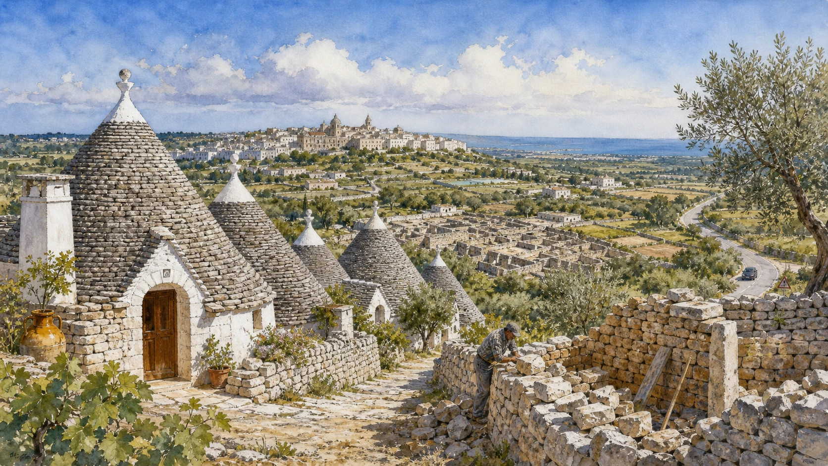
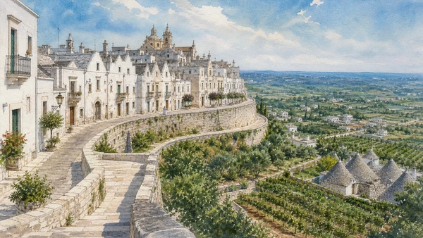
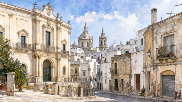
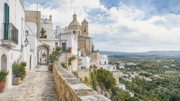
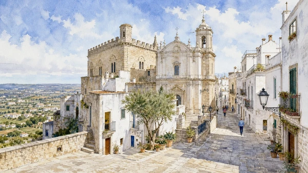
Original documentary watercolour panorama for Alberobello and Valle d'Itria: Complete Guide, with accurate Puglian architecture, landscape and lived context

Puglia Guide 03 · Archaeology, architecture, working landscapes and contemporary access

Dry
stone builds a landscape

A two-day route through trulli, compact hill towns, caves, masserie and archaeological landscapes, treating dry stone as a working system rather than a decorative symbol.

Plan the route
Valle d’Itria · Puglia10 chapters · one complete route

Why this route must be read in layers

The Valle d’Itria is a cultivated and inhabited limestone landscape; Alberobello is its densest trulli centre, not the whole story.

The route begins with documented fabric and institutional collections rather than a list of photogenic surfaces. Each chapter separates what survives, what was rebuilt and what remains in use.

Puglia’s ports, pilgrimage sites, farms, forests, archaeological parks and inhabited centres operate under different access conditions. Current notices therefore belong to the route rather than an appendix.

Each chapter includes an illustration of the place described. The images are watercolours rather than photographs.

A two-day route through trulli, compact hill towns, caves, masserie and archaeological landscapes, treating dry stone as a working system rather than a decorative symbol.

The route

Plan your visit

A two-day route through trulli, compact hill towns, caves, masserie and archaeological landscapes, treating dry stone as a working system rather than a decorative symbol.

Early morning

Aia Piccola · Rione Monti · Trullo Sovrano

Move in the documented order: Aia Piccola: the residential trulli quarter; then Rione Monti: conservation under tourism pressure; then Trullo Sovrano: scale and domestic adaptation. Recheck live access and transport before entering a controlled site.

Late morning

Locorotondo · Martina Franca · Cisternino

Move in the documented order: Locorotondo: circular streets above the valley; then Martina Franca: Baroque institutions within a working town; then Cisternino: houses, lanes and valley views. Recheck live access and transport before entering a controlled site.

Afternoon

Ceglie Messapica · Egnazia · Masserie and the cultivated plain

Move in the documented order: Ceglie Messapica: Messapian memory and later urban fabric; then Egnazia: thirty centuries beside the Adriatic; then Masserie and the cultivated plain. Recheck live access and transport before entering a controlled site.

Late afternoon

Castellana Grotte

Move in the documented order: Castellana Grotte: karst below the plateau. Recheck live access and transport before entering a controlled site.

Ten chapters

Explore the places

The order follows terrain, institutions and present-day movement. Use the index to return to a chapter without reducing the route to isolated monuments.

  1. 01Aia Piccola: the residential trulli quarter
  2. 02Rione Monti: conservation under tourism pressure
  3. 03Trullo Sovrano: scale and domestic adaptation
  4. 04Locorotondo: circular streets above the valley
  5. 05Martina Franca: Baroque institutions within a working town
  6. 06Cisternino: houses, lanes and valley views
  7. 07Ceglie Messapica: Messapian memory and later urban fabric
  8. 08Egnazia: thirty centuries beside the Adriatic
  9. 09Masserie and the cultivated plain
  10. 10Castellana Grotte: karst below the plateau
01

A dense protected district retains a stronger residential character than the more commercial Rione Monti.

Aia Piccola: the residential trulli quarter

A dense protected district retains a stronger residential character than the more commercial Rione Monti. The place becomes clearer when surviving fabric, later change and present use are read together.

Today

This is an inhabited place, not a visitor set. Keep doorways, pavements and deliveries clear, and use current municipal mobility information.

History

Trulli developed from dry-stone rural building traditions and became a coherent urban fabric through early modern and nineteenth-century growth.

How to read this place

Observe how homes, small streets and shared space function; respect residents and distinguish lived buildings from tourist conversions.

What to notice

  • street width and building materials
  • residential use behind historic facades
  • later infrastructure and adaptation
UNESCO · The Trulli of Alberobello
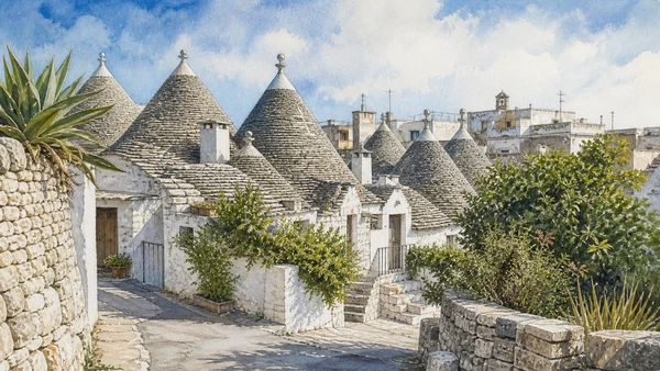
Original documentary watercolour of Aia Piccola: the residential trulli quarter in Valle d'Itria · Puglia, showing accurate architecture, landscape and present-day use
Aia Piccola: the residential trulli quarterOriginal Merlintravel documentary watercolour · 2026
02

Hundreds of conical roofs create the best-known view while shops and visitor flows alter how the district functions.

Rione Monti: conservation under tourism pressure

Hundreds of conical roofs create the best-known view while shops and visitor flows alter how the district functions. The place becomes clearer when surviving fabric, later change and present use are read together.

Today

This is an inhabited place, not a visitor set. Keep doorways, pavements and deliveries clear, and use current municipal mobility information.

History

The quarter forms part of the UNESCO property and contains a high concentration of dry-stone buildings repeatedly adapted for modern use.

How to read this place

Compare roof construction and party walls, then notice signage, commercial conversions and crowd pressure as current conservation issues.

What to notice

  • street width and building materials
  • residential use behind historic facades
  • later infrastructure and adaptation
UNESCO · The Trulli of Alberobello
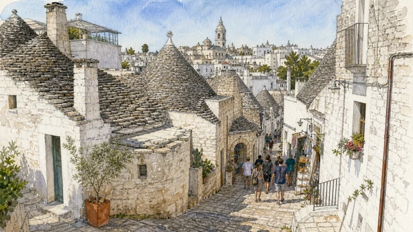
Original documentary watercolour of Rione Monti: conservation under tourism pressure in Valle d'Itria · Puglia, showing accurate architecture, landscape and present-day use
Rione Monti: conservation under tourism pressureOriginal Merlintravel documentary watercolour · 2026
03

A larger two-storey trullo demonstrates how the construction system could be extended beyond a single rural cell.

Trullo Sovrano: scale and domestic adaptation

A larger two-storey trullo demonstrates how the construction system could be extended beyond a single rural cell. The place becomes clearer when surviving fabric, later change and present use are read together.

Today

Opening, ticketing, room access and temporary displays can change. Check the museum’s official notice shortly before visiting and allow for security or conservation controls.

History

The building developed in the eighteenth century and later became a protected monument and house museum.

How to read this place

Read joined cones, stairs, hearth and furnishings as evidence of adaptation, not as a universal model for all trulli.

What to notice

  • the chronological order of the displays
  • finds tied to documented excavation contexts
  • modern conservation and interpretation
Comune di Alberobello
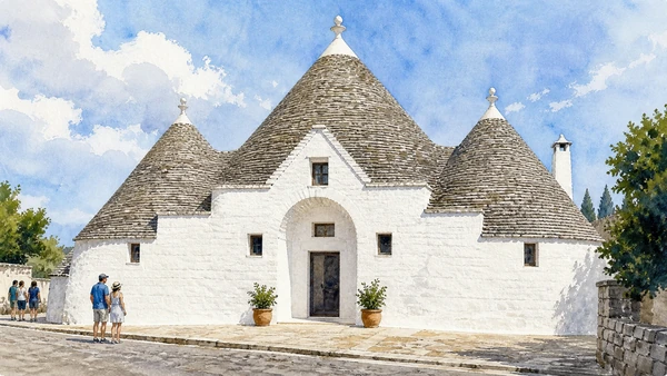
Original documentary watercolour of Trullo Sovrano: scale and domestic adaptation in Valle d'Itria · Puglia, showing accurate architecture, landscape and present-day use
Trullo Sovrano: scale and domestic adaptationOriginal Merlintravel documentary watercolour · 2026
04

White cummerse-roofed houses and a compact ridge town differ materially from Alberobello’s trulli districts.

Locorotondo: circular streets above the valley

White cummerse-roofed houses and a compact ridge town differ materially from Alberobello’s trulli districts. The place becomes clearer when surviving fabric, later change and present use are read together.

Today

This is an inhabited place, not a visitor set. Keep doorways, pavements and deliveries clear, and use current municipal mobility information.

History

The settlement grew through medieval and early modern phases around a hilltop route and agricultural territory.

How to read this place

Follow the curved street pattern and roof forms, then use viewpoints to connect the town with vineyards, trulli and scattered farms.

What to notice

  • street width and building materials
  • residential use behind historic facades
  • later infrastructure and adaptation
Italia.it · Puglia
Original documentary watercolour of Locorotondo: circular streets above the valley in Valle d'Itria · Puglia, showing accurate architecture, landscape and present-day use
Locorotondo: circular streets above the valleyOriginal Merlintravel documentary watercolour · 2026
05

Palaces, churches and narrow streets express an urban centre tied to estates and pastoral routes.

Martina Franca: Baroque institutions within a working town

Palaces, churches and narrow streets express an urban centre tied to estates and pastoral routes. The place becomes clearer when surviving fabric, later change and present use are read together.

Today

This is an inhabited place, not a visitor set. Keep doorways, pavements and deliveries clear, and use current municipal mobility information.

History

The town expanded from medieval origins and acquired much of its monumental character during seventeenth- and eighteenth-century building campaigns.

How to read this place

Compare noble facades with workshops and ordinary housing; the historic centre is larger and socially more varied than a single piazza.

What to notice

  • street width and building materials
  • residential use behind historic facades
  • later infrastructure and adaptation
Comune di Martina Franca
Original documentary watercolour of Martina Franca: Baroque institutions within a working town in Valle d'Itria · Puglia, showing accurate architecture, landscape and present-day use
Martina Franca: Baroque institutions within a working townOriginal Merlintravel documentary watercolour · 2026
06

Compact white streets sit above a countryside of trulli, dry walls, orchards and masserie.

Cisternino: houses, lanes and valley views

Compact white streets sit above a countryside of trulli, dry walls, orchards and masserie. The place becomes clearer when surviving fabric, later change and present use are read together.

Today

This is an inhabited place, not a visitor set. Keep doorways, pavements and deliveries clear, and use current municipal mobility information.

History

The town preserves medieval and early modern fabric while its surrounding agricultural system has repeatedly changed.

How to read this place

Move between residential lanes and public belvederes; do not enter private terraces or mistake whitewash for architectural uniformity.

What to notice

  • street width and building materials
  • residential use behind historic facades
  • later infrastructure and adaptation
Italia.it · Puglia
Original documentary watercolour of Cisternino: houses, lanes and valley views in Valle d'Itria · Puglia, showing accurate architecture, landscape and present-day use
Cisternino: houses, lanes and valley viewsOriginal Merlintravel documentary watercolour · 2026
07

A hill town with archaeological territory, castle and dense historic streets complicates the valley’s purely picturesque image.

Ceglie Messapica: Messapian memory and later urban fabric

A hill town with archaeological territory, castle and dense historic streets complicates the valley’s purely picturesque image. The place becomes clearer when surviving fabric, later change and present use are read together.

Today

This is an inhabited place, not a visitor set. Keep doorways, pavements and deliveries clear, and use current municipal mobility information.

History

Messapian settlement preceded medieval and early modern rebuilding; surviving monuments and museum collections document different phases.

How to read this place

Read topography before facades, and connect museum objects or tomb evidence to the wider plateau rather than one isolated centre.

What to notice

  • street width and building materials
  • residential use behind historic facades
  • later infrastructure and adaptation
Comune di Ceglie Messapica
Original documentary watercolour of Ceglie Messapica: Messapian memory and later urban fabric in Valle d'Itria · Puglia, showing accurate architecture, landscape and present-day use
Ceglie Messapica: Messapian memory and later urban fabricOriginal Merlintravel documentary watercolour · 2026
08

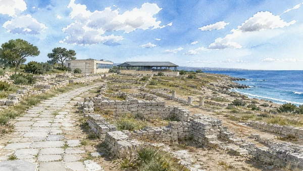
Museum, necropoleis, Messapian walls and Roman streets preserve a long-lived coastal settlement.

Egnazia: thirty centuries beside the Adriatic

Museum, necropoleis, Messapian walls and Roman streets preserve a long-lived coastal settlement. The place becomes clearer when surviving fabric, later change and present use are read together.

Today

Archaeological access can change because of conservation, excavation, weather or staffing. Stay outside barriers and verify the official opening notice.

History

Occupation extends from the Bronze Age through Messapian and Roman Gnathia into late antique and medieval phases.

How to read this place

Begin in the museum, then compare tombs, fortifications, paved routes and the coastal setting without reconstructing missing buildings in imagination.

What to notice

  • original masonry and later support work
  • the relation between excavation and modern surroundings
  • areas intentionally left unexcavated
Direzione regionale Musei Puglia · Egnazia
Original documentary watercolour of Egnazia: thirty centuries beside the Adriatic in Valle d'Itria · Puglia, showing accurate architecture, landscape and present-day use
Egnazia: thirty centuries beside the AdriaticOriginal Merlintravel documentary watercolour · 2026
09

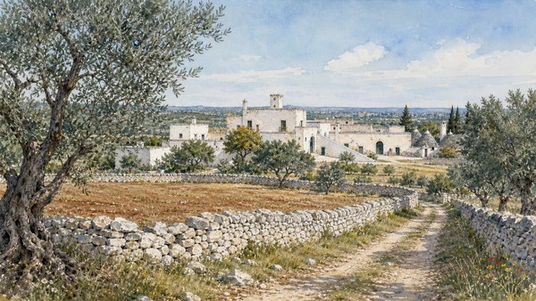
Fortified farm complexes, wells, presses and walls organise land whose production and ownership continue to change.

Masserie and the cultivated plain

Fortified farm complexes, wells, presses and walls organise land whose production and ownership continue to change. The place becomes clearer when surviving fabric, later change and present use are read together.

Today

Weather, heat, fire risk, sea state and seasonal restrictions can alter access. Use official park or reserve information and remain on authorised routes.

History

Masserie accumulated functions across medieval and modern periods and often expanded with olive, grain, livestock and later tourism economies.

How to read this place

View only from public routes or authorised visits; distinguish productive buildings from hospitality conversions and decorative imitation.

What to notice

  • geology and native vegetation
  • authorised paths and protected habitats
  • working land or water beside conservation zones
Puglia tourism · official regional agency
Original documentary watercolour of Masserie and the cultivated plain in Valle d'Itria · Puglia, showing accurate architecture, landscape and present-day use
Masserie and the cultivated plainOriginal Merlintravel documentary watercolour · 2026
10

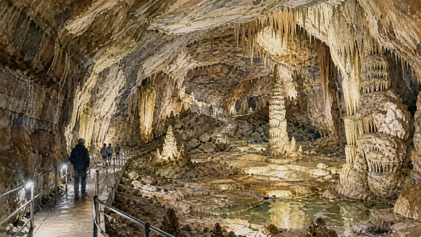
A major cave system reveals the limestone geology underlying trulli, cisterns and dry-stone agriculture.

Castellana Grotte: karst below the plateau

A major cave system reveals the limestone geology underlying trulli, cisterns and dry-stone agriculture. The place becomes clearer when surviving fabric, later change and present use are read together.

Today

Weather, heat, fire risk, sea state and seasonal restrictions can alter access. Use official park or reserve information and remain on authorised routes.

History

The caves formed through long karst processes and entered modern scientific and visitor history after exploration in the twentieth century.

How to read this place

Use the authorised route to compare chambers, speleothems and engineered access; lighting and paths are modern interpretation systems.

What to notice

  • geology and native vegetation
  • authorised paths and protected habitats
  • working land or water beside conservation zones
Grotte di Castellana · official site
Original documentary watercolour of Castellana Grotte: karst below the plateau in Valle d'Itria · Puglia, showing accurate architecture, landscape and present-day use
Castellana Grotte: karst below the plateauOriginal Merlintravel documentary watercolour · 2026

Puglia through time

A short chronology

From Daunian, Peucetian and Messapian landscapes to Greek Taras, Roman roads, medieval ports, modern cities, protected parks and contemporary cultural recovery.

  1. Coastal landings, cave occupation and Bronze Age communities connect Adriatic, Ionian and inland routes.

  2. Daunian, Peucetian and Messapian societies develop distinct settlements, funerary customs and material cultures.

  3. Greek Taras expands on the Ionian coast while Indigenous centres negotiate trade and conflict across the region.

  4. Fortified towns, sanctuaries and rural systems change under pressure from Taranto, neighbouring peoples and Roman expansion.

  5. Roman colonies, estates, ports and the Via Appia and Via Traiana reorganise Apulia’s movement and production.

  6. Byzantine, Lombard and local powers contest a frontier shaped by ports, cave settlements, bishoprics and monastic networks.

  7. Norman rule, pilgrimage and maritime commerce support cathedrals, castles and new Latin institutions.

  8. Frederick II and his administration reshape castles, towns and royal landscapes across the region.

  9. Angevin and Aragonese power changes fortified towns, estates and relations with the Adriatic and Balkan coasts.

  10. The Ottoman capture of Otranto and its aftermath become a lasting element of Salento’s civic and religious memory.

  11. Coastal towers, masserie, olive estates and urban rebuilding respond to insecurity, trade and landholding systems.

  12. Feudal abolition, Bourbon reforms and Italian unification alter institutions without resolving rural inequality.

  13. Ports, railways, industry, war and migration transform cities while archaeology and heritage protection acquire new public roles.

  14. Land reform, industrial development, tourism and mass mobility reshape plains, coastlines and historic centres.

  15. UNESCO sites, national parks and museum networks expand while overtourism, industrial transition, olive disease and climate risk demand new care.

Before your visit

Practical information

01

Check the live page

Opening hours, reservations, restoration, worship and seasonal services can change. Recheck the linked institution shortly before departure.

02

Plan the long geography

Puglia is a long region. Do not compress distant cities, headlands and archaeological parks into an unsafe or superficial day.

03

Separate worship and tourism

Basilicas, cathedrals, sanctuaries and chapels remain religious places. Services and community use take priority.

04

Protect inhabited centres

Old towns, trulli districts, fishing quarters and working ports are not stage sets. Keep access, homes and deliveries clear.

05

Use current environmental notices

Heat, fire risk, sea state, coastal erosion, forest restrictions and protected habitats can alter a route at short notice.

06

Read reconstruction honestly

Restoration, adaptive reuse, modern infrastructure and contemporary art are part of the documented landscape, not defects to hide.

Method and sources

Sources and image credits

This guide uses official museum, ministry, municipal, park, UNESCO and regional-tourism documentation checked on 1 September 2026. It distinguishes Daunian, Peucetian, Messapian, Greek, Roman, Byzantine, Lombard, Norman, Swabian and later phases rather than treating Puglia as one timeless Mediterranean image. Every chapter links its principal institutional source; tickets, services, worship, closures, heat, fire risk, sea conditions and transport must always be verified again on the day of the visit.

All ten images are original Merlintravel editorial watercolours based on documented present-day conditions. They are illustrations, not substitutes for archaeological plans. Opening hours, tickets, accessible routes, temporary exhibitions and conservation work can change; consult the linked official pages shortly before visiting.