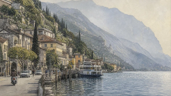
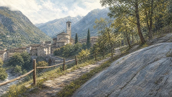
Original documentary watercolour panorama for Brescia, Lake Iseo, Western Garda and Valcamonica: Complete Guide, with accurate Lombardy architecture, landscape and lived context

Lombardy Guide 03 · Roman Brixia, Lombard heritage, civic art, lake systems, viticulture and prehistoric rock imagery

Brescia, the Lakes
& Valcamonica

A multi-day guide connecting Roman and Lombard Brescia to Lake Iseo and Monte Isola, Franciacorta, Sirmione and the western Garda shore, then north into Valcamonica’s protected rock-art landscapes.

Plan the route
Brescia, the lakes and Valcamonica · Lombardy10 chapters · one complete route

Why this route must be read in layers

Eastern Lombardy is linked by routes and water but cannot be compressed into one scenic loop: city archaeology, living lakes, wine production and Alpine rock art each require their own time and access logic.

Brescia preserves an exceptional sequence from Roman Brixia to the monastery of San Salvatore-Santa Giulia, medieval civic spaces and Venetian-era art. Museum interpretation is essential because objects and structures cross institutional boundaries.

Iseo and Garda are inhabited water systems shaped by navigation, fishing, tourism, roads and ecological limits. Sirmione’s Roman site belongs to this wider lake landscape rather than existing only as a famous peninsula image.

Valcamonica’s engraved rocks extend across parks and millennia. Routes must follow official park access, weather and conservation rules; photographs never replace the relationship between markings, rock surfaces and terrain.

Use one full day for Brescia and separate days for Iseo, Garda and Valcamonica; choose rather than rush when transport, weather or seasonal crowding makes the complete sequence unrealistic.

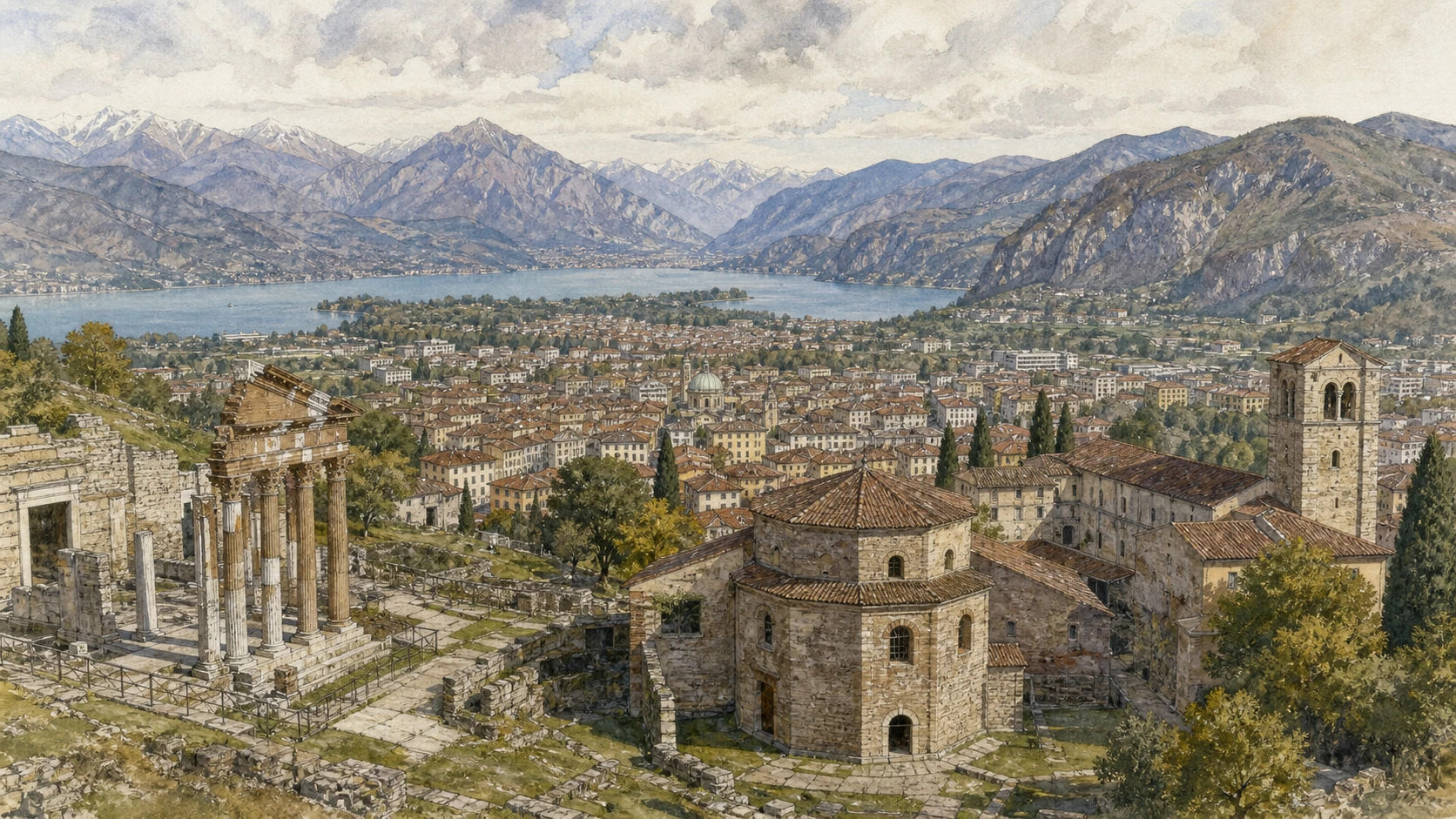
The route

Plan your visit

Begin with Brescia’s archaeological and monastic core, then treat Iseo, Franciacorta, Garda and Valcamonica as separate landscape days linked by verified transport.

Early morning

Capitolium and Roman Brixia · Santa Giulia Museum · San Salvatore

Move in the documented order: Capitolium and Roman Brixia: public architecture below the city; then Santa Giulia Museum: monastery and city history; then San Salvatore: Lombard church within the UNESCO complex. Recheck live access and transport before entering a controlled site.

Late morning

Piazza della Loggia · Pinacoteca Tosio Martinengo · Lake Iseo and Monte Isola

Move in the documented order: Piazza della Loggia: Venetian civic representation and memory; then Pinacoteca Tosio Martinengo: Brescia’s school and civic collecting; then Lake Iseo and Monte Isola: navigation to an inhabited island. Recheck live access and transport before entering a controlled site.

Afternoon

Franciacorta · Sirmione and the Grotte di Catullo · Western Garda shore

Move in the documented order: Franciacorta: regulated wine landscape, not generic countryside; then Sirmione and the Grotte di Catullo: Roman villa on a lake promontory; then Western Garda shore: towns, citrus structures and constrained movement. Recheck live access and transport before entering a controlled site.

Late afternoon

Valcamonica rock art

Move in the documented order: Valcamonica rock art: millennia of marks in landscape. Recheck live access and transport before entering a controlled site.

Ten chapters

Explore the places

The order follows terrain, institutions and present-day movement. Use the index to return to a chapter without reducing the route to isolated monuments.

  1. 01Capitolium and Roman Brixia: public architecture below the city
  2. 02Santa Giulia Museum: monastery and city history
  3. 03San Salvatore: Lombard church within the UNESCO complex
  4. 04Piazza della Loggia: Venetian civic representation and memory
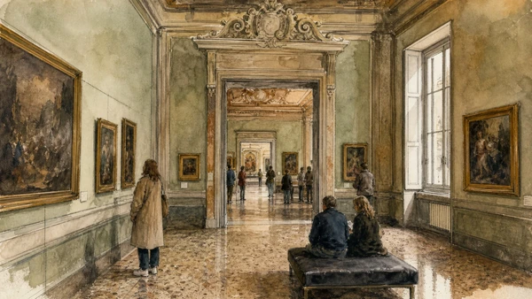
  5. 05Pinacoteca Tosio Martinengo: Brescia’s school and civic collecting
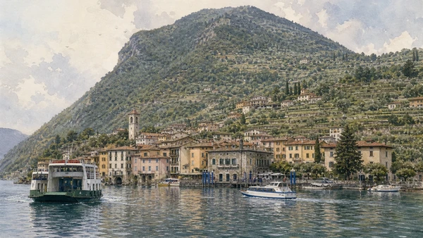
  6. 06Lake Iseo and Monte Isola: navigation to an inhabited island
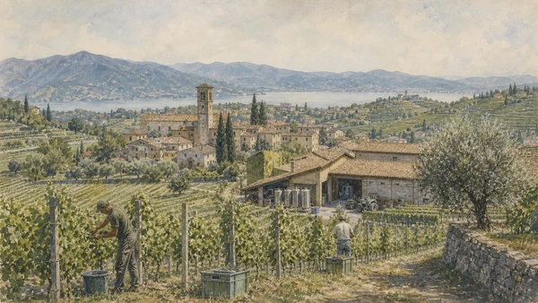
  7. 07Franciacorta: regulated wine landscape, not generic countryside
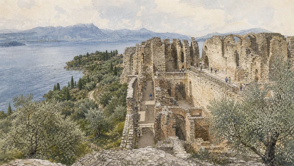
  8. 08Sirmione and the Grotte di Catullo: Roman villa on a lake promontory
  9. 09Western Garda shore: towns, citrus structures and constrained movement
  10. 10Valcamonica rock art: millennia of marks in landscape
01

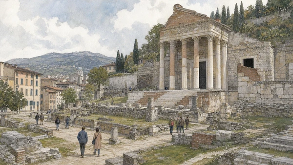
Temple, theatre and forum remains preserve a monumental Roman centre integrated into a modern archaeological park.

Capitolium and Roman Brixia: public architecture below the city

Temple, theatre and forum remains preserve a monumental Roman centre integrated into a modern archaeological park. The site becomes clearer when its surviving fabric, later alterations and present use are read together.

Today

Archaeological access may be limited to protected viewpoints, scheduled openings or guided routes. Stay outside barriers, distinguish original material from supports and reconstruction, and verify the official opening notice.

History

Brixia developed as a Roman city with major civic buildings; excavation and conservation gradually reconnected separated remains along Via dei Musei.

How to read this place

Begin with temple podium and reconstructed elevation. Then compare the theatre’s relation to the slope with modern streets bordering the forum zone; the differences are evidence, not visual noise.

What to notice

  • temple podium and reconstructed elevation
  • the theatre’s relation to the slope
  • modern streets bordering the forum zone
Fondazione Brescia Musei · Official site
Original documentary watercolour of Capitolium and Roman Brixia: public architecture below the city in Brescia, the lakes and Valcamonica · Lombardy, showing accurate architecture, landscape, people and present-day use
Capitolium and Roman Brixia: public architecture below the cityOriginal Merlintravel documentary watercolour · 2026
02

A layered monastic complex holds archaeological, artistic and architectural evidence from prehistory through modern Brescia.

Santa Giulia Museum: monastery and city history

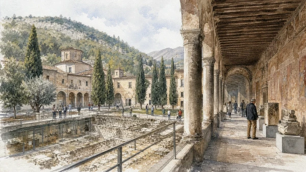
A layered monastic complex holds archaeological, artistic and architectural evidence from prehistory through modern Brescia. The site becomes clearer when its surviving fabric, later alterations and present use are read together.

Today

Opening, ticketing, room access and temporary displays can change. Check the institution’s official notice shortly before visiting, use the designated entrance and allow for security or conservation controls.

History

The Lombard foundation of San Salvatore developed into a major female monastery, later secularised and eventually transformed into the city’s principal museum.

How to read this place

Begin with churches and cloisters in sequence. Then compare objects tied to precise city contexts with museum interventions within historic rooms; the differences are evidence, not visual noise.

What to notice

  • churches and cloisters in sequence
  • objects tied to precise city contexts
  • museum interventions within historic rooms
Fondazione Brescia Musei · Museo di Santa Giulia
Original documentary watercolour of Santa Giulia Museum: monastery and city history in Brescia, the lakes and Valcamonica · Lombardy, showing accurate architecture, landscape, people and present-day use
Santa Giulia Museum: monastery and city historyOriginal Merlintravel documentary watercolour · 2026
03

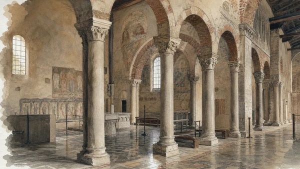
Columns, reused material and liturgical space preserve a central element of Lombard elite patronage.

San Salvatore: Lombard church within the UNESCO complex

Columns, reused material and liturgical space preserve a central element of Lombard elite patronage. The site becomes clearer when its surviving fabric, later alterations and present use are read together.

Today

Opening, ticketing, room access and temporary displays can change. Check the institution’s official notice shortly before visiting, use the designated entrance and allow for security or conservation controls.

History

Founded in the eighth century by the Lombard royal family, the church and monastery changed through medieval and later campaigns while retaining exceptional early fabric.

How to read this place

Begin with reused columns and capitals. Then compare liturgical divisions and wall surfaces with later monastic spaces around the church; the differences are evidence, not visual noise.

What to notice

  • reused columns and capitals
  • liturgical divisions and wall surfaces
  • later monastic spaces around the church
UNESCO · Longobards in Italy
Original documentary watercolour of San Salvatore: Lombard church within the UNESCO complex in Brescia, the lakes and Valcamonica · Lombardy, showing accurate architecture, landscape, people and present-day use
San Salvatore: Lombard church within the UNESCO complexOriginal Merlintravel documentary watercolour · 2026
04

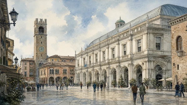
Renaissance civic buildings and arcades define a square also marked by the 1974 terrorist bombing.

Piazza della Loggia: Venetian civic representation and memory

Renaissance civic buildings and arcades define a square also marked by the 1974 terrorist bombing. The site becomes clearer when its surviving fabric, later alterations and present use are read together.

Today

The exterior can usually be read from public space, but events, works and crowd management may change circulation. Keep access routes open and verify any interior visit with the responsible institution.

History

Venetian rule sponsored the Loggia and urban ensemble; on 28 May 1974 a bomb killed demonstrators, adding a continuing democratic memorial layer.

How to read this place

Begin with the loggia’s classical façade. Then compare arcaded edges and clock tower with the memorial to victims within active civic space; the differences are evidence, not visual noise.

What to notice

  • the Loggia’s classical façade
  • arcaded edges and clock tower
  • the memorial to victims within active civic space
Fondazione Brescia Musei · Official site
Original documentary watercolour of Piazza della Loggia: Venetian civic representation and memory in Brescia, the lakes and Valcamonica · Lombardy, showing accurate architecture, landscape, people and present-day use
Piazza della Loggia: Venetian civic representation and memoryOriginal Merlintravel documentary watercolour · 2026
05

Paintings by local and wider Italian artists connect Renaissance production to nineteenth-century collecting and public museum formation.

Pinacoteca Tosio Martinengo: Brescia’s school and civic collecting

Paintings by local and wider Italian artists connect Renaissance production to nineteenth-century collecting and public museum formation. The site becomes clearer when its surviving fabric, later alterations and present use are read together.

Today

Opening, ticketing, room access and temporary displays can change. Check the institution’s official notice shortly before visiting, use the designated entrance and allow for security or conservation controls.

History

Collections associated with Paolo Tosio and other donors helped establish the civic gallery, later reorganised in Palazzo Martinengo da Barco.

How to read this place

Begin with moretto, romanino and savoldo in context. Then compare donor and acquisition histories with palace rooms adapted for display; the differences are evidence, not visual noise.

What to notice

  • Moretto, Romanino and Savoldo in context
  • donor and acquisition histories
  • palace rooms adapted for display
Fondazione Brescia Musei · Official site
Original documentary watercolour of Pinacoteca Tosio Martinengo: Brescia's school and civic collecting in Brescia, the lakes and Valcamonica · Lombardy, showing accurate architecture, landscape, people and present-day use
Pinacoteca Tosio Martinengo: Brescia’s school and civic collectingOriginal Merlintravel documentary watercolour · 2026
06

Public boats connect shore towns and island settlements within a working lake of fishing, residence and tourism.

Lake Iseo and Monte Isola: navigation to an inhabited island

Public boats connect shore towns and island settlements within a working lake of fishing, residence and tourism. The site becomes clearer when its surviving fabric, later alterations and present use are read together.

Today

Weather, water levels, trail conditions and seasonal services can alter the route. Use official transport and park information, remain on authorised paths and do not enter farms, vineyards or private gardens without permission.

History

Lake routes supported movement and exchange long before modern tourism; Monte Isola retained boat-linked communities while road and visitor systems changed access.

How to read this place

Begin with landing stages and scheduled boats. Then compare settlements rising from the shore with working craft and resident routes; the differences are evidence, not visual noise.

What to notice

  • landing stages and scheduled boats
  • settlements rising from the shore
  • working craft and resident routes
Navigazione Laghi · Official service
Original documentary watercolour of Lake Iseo and Monte Isola: navigation to an inhabited island in Brescia, the lakes and Valcamonica · Lombardy, showing accurate architecture, landscape, people and present-day use
Lake Iseo and Monte Isola: navigation to an inhabited islandOriginal Merlintravel documentary watercolour · 2026
07

Vineyards, villages, cellars and moraine terrain form a productive zone governed by appellation rules and private work.

Franciacorta: regulated wine landscape, not generic countryside

Vineyards, villages, cellars and moraine terrain form a productive zone governed by appellation rules and private work. The site becomes clearer when its surviving fabric, later alterations and present use are read together.

Today

Weather, water levels, trail conditions and seasonal services can alter the route. Use official transport and park information, remain on authorised paths and do not enter farms, vineyards or private gardens without permission.

History

Long agricultural use was reorganised through modern sparkling-wine production and the Franciacorta denomination, altering land value and visitor economies.

How to read this place

Begin with moraine slopes and vineyard orientation. Then compare working cellar architecture with village and field boundaries; the differences are evidence, not visual noise.

What to notice

  • moraine slopes and vineyard orientation
  • working cellar architecture
  • village and field boundaries
Consorzio Franciacorta · Official site
Original documentary watercolour of Franciacorta: regulated wine landscape, not generic countryside in Brescia, the lakes and Valcamonica · Lombardy, showing accurate architecture, landscape, people and present-day use
Franciacorta: regulated wine landscape, not generic countrysideOriginal Merlintravel documentary watercolour · 2026
08

Extensive villa remains occupy the northern peninsula within an archaeological and olive landscape exposed to heavy tourism.

Sirmione and the Grotte di Catullo: Roman villa on a lake promontory

Extensive villa remains occupy the northern peninsula within an archaeological and olive landscape exposed to heavy tourism. The site becomes clearer when its surviving fabric, later alterations and present use are read together.

Today

Archaeological access may be limited to protected viewpoints, scheduled openings or guided routes. Stay outside barriers, distinguish original material from supports and reconstruction, and verify the official opening notice.

History

The elite Roman complex developed in the early imperial period and later became ruin, quarry and archaeological site; its traditional name does not prove ownership by the poet Catullus.

How to read this place

Begin with terraces adapted to the promontory. Then compare lake views integrated with architecture with museum evidence separating tradition from attribution; the differences are evidence, not visual noise.

What to notice

  • terraces adapted to the promontory
  • lake views integrated with architecture
  • museum evidence separating tradition from attribution
Direzione regionale Musei Lombardia · Grotte di Catullo
Original documentary watercolour of Sirmione and the Grotte di Catullo: Roman villa on a lake promontory in Brescia, the lakes and Valcamonica · Lombardy, showing accurate architecture, landscape, people and present-day use
Sirmione and the Grotte di Catullo: Roman villa on a lake promontoryOriginal Merlintravel documentary watercolour · 2026
09

Salò, Gardone and smaller settlements occupy a narrow edge between water and mountain shaped by roads, boats, gardens and tourism.

Western Garda shore: towns, citrus structures and constrained movement

Salò, Gardone and smaller settlements occupy a narrow edge between water and mountain shaped by roads, boats, gardens and tourism. The site becomes clearer when its surviving fabric, later alterations and present use are read together.

Today

Weather, water levels, trail conditions and seasonal services can alter the route. Use official transport and park information, remain on authorised paths and do not enter farms, vineyards or private gardens without permission.

History

Venetian-era institutions, agricultural specialisation, elite villas and modern tourism produced different shore identities; twentieth-century political memory is especially sensitive around Salò and Gardone.

How to read this place

Begin with historic lakefront settlement patterns. Then compare terraces and former citrus houses with roads and boat landings sharing limited shore space; the differences are evidence, not visual noise.

What to notice

  • historic lakefront settlement patterns
  • terraces and former citrus houses
  • roads and boat landings sharing limited shore space
Visit Brescia · Lake Garda
Original documentary watercolour of Western Garda shore: towns, citrus structures and constrained movement in Brescia, the lakes and Valcamonica · Lombardy, showing accurate architecture, landscape, people and present-day use
Western Garda shore: towns, citrus structures and constrained movementOriginal Merlintravel documentary watercolour · 2026
10

Engravings across multiple parks document changing symbols, activities and communities from prehistory into historic periods.

Valcamonica rock art: millennia of marks in landscape

Engravings across multiple parks document changing symbols, activities and communities from prehistory into historic periods. The site becomes clearer when its surviving fabric, later alterations and present use are read together.

Today

Weather, water levels, trail conditions and seasonal services can alter the route. Use official transport and park information, remain on authorised paths and do not enter farms, vineyards or private gardens without permission.

History

The valley’s rock-art corpus was the first Italian property inscribed by UNESCO. Research continues to refine chronology and interpretation across many sites.

How to read this place

Begin with engraving technique and weathered surface. Then compare figures related to one another on the panel with the rock’s position within valley terrain; the differences are evidence, not visual noise.

What to notice

  • engraving technique and weathered surface
  • figures related to one another on the panel
  • the rock’s position within valley terrain
UNESCO · Rock Drawings in Valcamonica
Original documentary watercolour of Valcamonica rock art: millennia of marks in landscape in Brescia, the lakes and Valcamonica · Lombardy, showing accurate architecture, landscape, people and present-day use
Valcamonica rock art: millennia of marks in landscapeOriginal Merlintravel documentary watercolour · 2026

Lombardy through time

A short chronology

From prehistoric settlement and Roman routes to communes, regional states, industrial transformation, heritage protection and climate-sensitive mobility.

  1. Settlements, ritual places and rock imagery document long human occupation from Alpine valleys to the Po plain.

  2. Camuni, Celts, Etruscan networks and other communities develop distinct territories before Roman expansion.

  3. Roman roads, colonies and municipia integrate the region while retaining different local settlement patterns.

  4. Cities, villas, farms, sanctuaries and Alpine routes connect the Po basin to transalpine and imperial systems.

  5. Christian institutions, new burial landscapes and political change reshape Roman urban centres.

  6. Lombard rule establishes courts, duchies and monasteries whose material traces survive unevenly across the region.

  7. Castles, monasteries, parishes and landed powers organise countryside, lakes and mountain routes.

  8. Communal cities expand public buildings, cathedrals, walls, trade and conflict across the Lombard plain.

  9. Visconti and then Sforza power links Milan to fortified towns, courts, canals and agricultural territories.

  10. Venetian expansion incorporates much of eastern Lombardy, creating a durable political and architectural frontier.

  11. The Peace of Lodi stabilises a territorial balance whose borders continue to shape cities and landscapes.

  12. Spanish and Austrian governments reorganise defence, taxation, institutions and infrastructure in different parts of Lombardy.

  13. Napoleonic and Austrian administrations alter civic institutions, roads, collections and territorial government before unification.

  14. Railways, factories, hydropower, migration, tourism, war and resistance transform urban and Alpine societies.

  15. Reconstruction, industrial growth, deindustrialisation, heritage protection, mass mobility and climate pressure repeatedly reshape the region.

Before your visit

Practical information

01

Check the live page

Opening hours, reservation systems, restoration, exhibitions and transport can change. Recheck the linked official institution shortly before departure.

02

Separate worship and tourism

Churches and sanctuaries remain religious spaces. Services, funerals and community use take priority over visitor itineraries.

03

Plan real distances

Brescia, the lakes and Valcamonica · Lombardy combines dense urban routes with lakes, valleys and dispersed towns. Do not compress distant chapters into an unsafe or superficial day.

04

Keep thresholds open

Arcades, station halls, markets, courtyards, workshops and residential streets must continue to function while you observe or photograph them.

05

Use current mobility data

Check the responsible rail, navigation, bus, road or park operator on the day; replacement services and weather can change an otherwise sound route.

06

Read change honestly

Restoration, reconstruction, adaptive reuse and new development have all shaped the landscape visible today.

Method and sources

Sources and image credits

This guide uses official museum, ministry, municipal, transport, park and UNESCO documentation checked on 29 August 2026. It separates durable historical interpretation from access details that can change, distinguishes surviving fabric from restoration or reconstruction, and treats worship, work, residence and public movement as part of the evidence. Every chapter links its principal institutional source; tickets, closures, weather and transport must always be verified again on the day of the visit.

All ten images are original Merlintravel editorial watercolours based on documented present-day conditions. They are illustrations, not substitutes for archaeological plans. Opening hours, tickets, accessible routes, temporary exhibitions and conservation work can change; consult the linked official pages shortly before visiting.