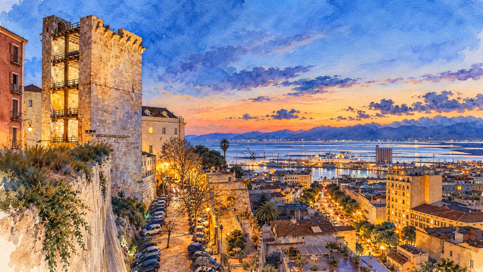
Watercolour: Cagliari establishing view

Sardinia · Guide 01

Cagliari

Limestone heights, archaeological landscapes and a working harbour reveal the many layers of Sardinia’s capital.

Plan the route
Cagliari10 chapters · history, culture and landscape

Why this place matters

Read the city through its changes of level.

Cagliari joins a fortified upper quarter to streets, gardens and waterfront districts below. The climb towards Castello changes the scale of the view: a carved doorway gives way to a wide harbour horizon. Archaeology survives in museums and in the exposed rock of the city itself, while religious buildings preserve transformations across many centuries. The wetlands add another history, where salt production and bird habitats meet the modern urban edge. These chapters form several manageable visits, not a promise to cover the whole city in one day.

The guide separates documented history from suggestions for reading the site. Named buildings and landscape relationships follow institutional sources; the illustrations are editorial interpretations, not measured surveys or records of current access.

Limestone heights, archaeological landscapes and a working harbour reveal the many layers of Sardinia’s capital.
The route

Plan your visit

Group Saint Remy, the cathedral, Torre dell’Elefante and the museum around Castello, allowing for slopes. Pair the amphitheatre and botanical garden separately; Tuvixeddu requires another transfer. San Saturnino, Bonaria and Molentargius form further outings. The Elefante tower is an exterior stop because the municipal page reports temporary closure. The Archaeological Museum has partial closures.

Upper city

Castello and the museum

Group Saint Remy, the cathedral, Torre dell’Elefante and the museum around Castello, allowing for slopes.

Western slope

Amphitheatre and botanical garden

Separate visits

Tuvixeddu, San Saturnino and Bonaria

Wetland outing

Molentargius and the salt landscape

Ten chapters

Explore the places

The chapters connect history and terrain. Use the route notes to choose visits and plan transfers between separate sites.

  1. 01Bastione di Saint Remy
  2. 02Santa Maria: a cathedral transformed
  3. 03Torre dell’Elefante
  4. 04The Archaeological Museum and its precinct
  5. 05The Roman amphitheatre
  6. 06Tuvixeddu: a city of burial shafts
  7. 07San Saturnino: survival and reconstruction
  8. 08Bonaria: sanctuary and basilica
  9. 09Molentargius: salt water and living habitat
  10. 10The university botanical garden
01

The inhabited landscape

Bastione di Saint Remy

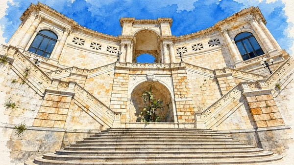
Stairs, arcades and an elevated terrace turn an old defensive edge into a monumental public approach. From Piazza Costituzione, the pale stone frontage makes the ascent towards Castello part of the architectural experience.

Today

This remains an inhabited place. Use pedestrian routes, keep entrances clear and check municipal mobility notices for any restricted area.

History

Designed in 1896 by Giuseppe Costa and Fulgenzio Setti, the complex opened in 1902. It stands above earlier fortifications. Bombing in 1943 damaged the staircase and triumphal arch, which were subsequently reconstructed. The covered promenade has served several public uses.

How to read this place

Compare the lower stair flights with the central arch and terrace above. Their classical language belongs to a modern transformation of the city. The outdoor terrace and the covered exhibition spaces have different access arrangements; plan any interior visit separately.

What to notice

  • Compare the lower stair flights with the central arch and terrace above.
  • Their classical language belongs to a modern transformation of the city.
  • The outdoor terrace and the covered exhibition spaces have different access arrangements; plan any interior visit separately.
Bastione di Saint Remy
Watercolour: Bastione di Saint Remy, low frontal study of the stairs and central arches
Bastione di Saint RemyEditorial watercolour · AI-generated · 2026
02

Worship and memory

Santa Maria: a cathedral transformed

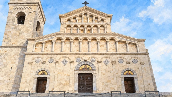
The cathedral gathers different periods behind a unified pale frontage. Its small arcades suggest Romanesque precedent, but the visible entrance facade is a twentieth-century work. The adjoining bell tower preserves a different relationship with the medieval city.

Today

Worship and local religious life continue here. Visitor access may pause for services; consult the church or managing institution before planning an interior visit.

History

The Pisan church dates to the thirteenth century and was repeatedly altered. After removal of a later Baroque front failed to reveal the expected medieval facade, a new one was completed in 1933. Inside, the sculpted pulpit made for Pisa and transferred to Cagliari in 1312 records a much older connection.

How to read this place

Read the exterior as evidence of restoration choices, then compare it with the richly changed interior. Separate the date of an object from its present setting. Worship and the bell-tower visit have distinct arrangements; an open church does not automatically mean access to the tower.

What to notice

  • Read the exterior as evidence of restoration choices, then compare it with the richly changed interior.
  • Separate the date of an object from its present setting.
  • Worship and the bell-tower visit have distinct arrangements; an open church does not automatically mean access to the tower.
Cattedrale di Santa Maria e Torre Campanaria
Watercolour: Cagliari Cathedral, close view of the twentieth-century facade and adjoining bell tower
Santa Maria: a cathedral transformedEditorial watercolour · AI-generated · 2026
03

The inhabited landscape

Torre dell’Elefante

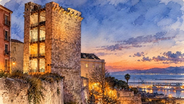
The square limestone tower rises above the south-western edge of Castello. The open rear face exposes levels and timber structures, contrasting with the mass of the outer wall. The illustration frames this relationship from the city side.

Today

Exterior stop. Checked on 9 September 2026, the municipal page reports temporary closure despite retaining older text about visits. Confirm a reopening directly before planning entry.

History

Designed by Giovanni Capula and completed in 1307, the tower belonged to the strengthening of Pisan defences. It later served other uses, including storage and imprisonment. Its name refers to a small marble elephant on another face of the building, not visible in this illustration.

How to read this place

Examine the tower from the public streets and compare its height with the wall and descending city. Do not plan a climb on the basis of older descriptions: the municipal visitor page currently carries a temporary-closure notice. Exterior observation is the route proposed here.

What to notice

  • Examine the tower from the public streets and compare its height with the wall and descending city.
  • Do not plan a climb on the basis of older descriptions: the municipal visitor page currently carries a temporary-closure notice.
  • Exterior observation is the route proposed here.
Torre dell’Elefante
Watercolour: Torre dell’Elefante, limestone tower and exposed rear floors above the harbour
Torre dell’ElefanteEditorial watercolour · AI-generated · 2026
04

Evidence and interpretation

The Archaeological Museum and its precinct

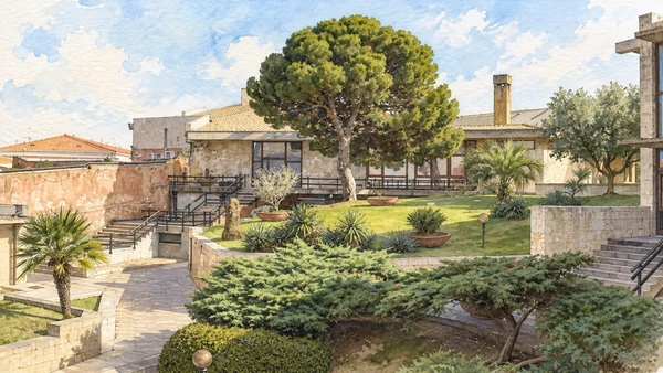
The Cittadella dei Musei provides an introduction to the island through objects from many different territories. Its courts and modern museum buildings occupy an area associated with earlier fortifications and the royal arsenal. The illustration shows the outdoor precinct, not a current gallery display.

Today

The museum reports closure of the third floor and part of the ground floor for redisplay. Check the route actually available. Since April 2026 the Mont’e Prama sculptural ensemble has been displayed at Museo Civico Giovanni Marongiu in Cabras.

History

The collection’s public history began in the early nineteenth century. It moved through several homes before the present museum opened in 1993. The wider Cittadella project brought museum architecture into dialogue with the surviving defensive setting.

How to read this place

Use labels to connect objects to their findspots rather than treating the museum as a single local excavation. The third floor and part of the ground floor are closed for redisplay. The Mont’e Prama statues have been at the Cabras museum since April 2026; this guide does not promise them in Cagliari.

What to notice

  • Use labels to connect objects to their findspots rather than treating the museum as a single local excavation.
  • The third floor and part of the ground floor are closed for redisplay.
  • The Mont’e Prama statues have been at the Cabras museum since April 2026; this guide does not promise them in Cagliari.
Museo Archeologico Nazionale
Watercolour: Cittadella dei Musei, courtyard and museum precinct beneath a broad pine tree
The Archaeological Museum and its precinctEditorial watercolour · AI-generated · 2026
05

Evidence and interpretation

The Roman amphitheatre

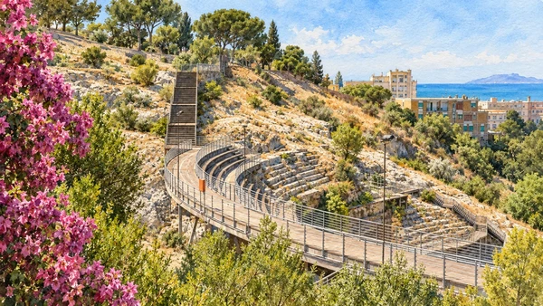
The amphitheatre is inseparable from its limestone slope. Surviving rock-cut seating, cavities and later interventions allow the terrain itself to carry part of the building. Modern barriers and paths mark how a fragile archaeological site is managed.

Today

Check the institution’s current opening, booking arrangements and accessible route. Individual rooms, exhibitions and approaches may have separate conditions.

History

The monument belongs to Roman imperial Cagliari. Its seating reflected social distinctions within the audience. Later removal of material changed the structure, and nineteenth-century investigation helped establish its place in the city’s archaeological history.

How to read this place

Follow the authorised route and compare the surviving curved seating with the exposed rock around it. The watercolour is based on a documented view with modern walkways; it is not evidence that every path or underground space is currently open. Ask the municipal operator about the available visit.

What to notice

  • Follow the authorised route and compare the surviving curved seating with the exposed rock around it.
  • The watercolour is based on a documented view with modern walkways; it is not evidence that every path or underground space is currently open.
  • Ask the municipal operator about the available visit.
SardegnaTurismo · Anfiteatro romano di Cagliari
Watercolour: Cagliari Roman amphitheatre, surviving rock-cut seating and modern visitor walkway
The Roman amphitheatreEditorial watercolour · AI-generated · 2026
06

Terrain and access

Tuvixeddu: a city of burial shafts

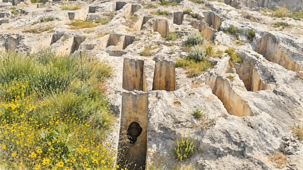
Rectangular openings cut into pale limestone give the hill its distinctive surface. Around them, vegetation and the surrounding city make clear that the necropolis is also part of a modern urban landscape. The illustration concentrates on the excavated rock.

Today

Conditions depend on the exact route and the day. Check the responsible operator, weather and local access notices; use the designated routes and confirm the return journey.

History

The Punic necropolis developed principally between the sixth and third centuries BC. Later Roman burials extended the funerary landscape. Industrial use, building and uneven archaeological investigation have also shaped what survives and what can be understood.

How to read this place

Use the designated park paths and look across the rock cuts from protected positions. A public park visit does not imply entry into shafts or painted tombs. The site has separate routes and can close during heat alerts; check municipal notices before setting out.

What to notice

  • Use the designated park paths and look across the rock cuts from protected positions.
  • A public park visit does not imply entry into shafts or painted tombs.
  • The site has separate routes and can close during heat alerts; check municipal notices before setting out.
Necropoli di Tuvixeddu
Watercolour: Tuvixeddu necropolis, rectangular rock-cut burial shafts among limestone and spring flowers
Tuvixeddu: a city of burial shaftsEditorial watercolour · AI-generated · 2026
07

Worship and memory

San Saturnino: survival and reconstruction

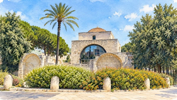
The surviving central mass of San Saturnino introduces early Christian Cagliari through a building that is visibly incomplete. Ancient masonry and modern glazed closures belong to different phases of its preservation. The church stands within a wider funerary area.

Today

Worship and local religious life continue here. Visitor access may pause for services; consult the church or managing institution before planning an interior visit.

History

The early building is dated to the fifth or sixth century and is traditionally associated with the tomb of the city’s patron. After its donation to the monks of Saint-Victor in 1089, it was transformed in Romanesque forms. Later damage, dismantling and restoration reduced and reshaped the original plan.

How to read this place

Compare the preserved volumes with the institution’s explanation of the earlier cross-shaped church. Do not mentally turn every absent arm into a surviving interior. Religious use, archaeological work and opening arrangements determine which parts can be visited.

What to notice

  • Compare the preserved volumes with the institution’s explanation of the earlier cross-shaped church.
  • Do not mentally turn every absent arm into a surviving interior.
  • Religious use, archaeological work and opening arrangements determine which parts can be visited.
Ministero della Cultura · Basilica di San Saturnino
Watercolour: San Saturnino, surviving central church volume and modern glazed arch behind the garden
San Saturnino: survival and reconstructionEditorial watercolour · AI-generated · 2026
08

Worship and memory

Bonaria: sanctuary and basilica

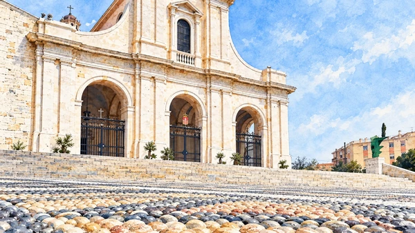
The hillside complex contains two different church scales. The smaller medieval sanctuary and the larger basilica stand beside one another, while the broad forecourt and approach give the religious ensemble a strong relationship with the city below.

Today

Worship and local religious life continue here. Visitor access may pause for services; consult the church or managing institution before planning an interior visit.

History

The sanctuary was built in the first half of the fourteenth century. Work on the larger basilica began in the early eighteenth century, with later changes giving it a Neoclassical character. The two buildings should not be assigned a single date or architectural style.

How to read this place

The illustration studies the basilica’s three-arched entrance and cobbled forecourt. On site, compare that front with the adjoining sanctuary before entering. This remains an important place of devotion; treat access and services as part of the visit rather than obstacles to it.

What to notice

  • The illustration studies the basilica’s three-arched entrance and cobbled forecourt.
  • On site, compare that front with the adjoining sanctuary before entering.
  • This remains an important place of devotion; treat access and services as part of the visit rather than obstacles to it.
Basilica e santuario di Nostra Signora di Bonaria
Watercolour: Bonaria basilica, low view of the three-arched entrance and patterned forecourt
Bonaria: sanctuary and basilicaEditorial watercolour · AI-generated · 2026
09

Terrain and access

Molentargius: salt water and living habitat

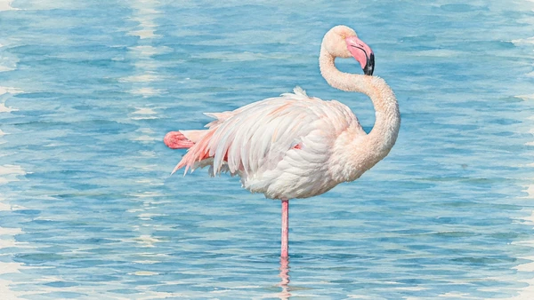
The wetland system beside Cagliari and Quartu Sant’Elena brings different water conditions into a landscape shaped by work. Flamingos are a prominent part of its birdlife, but water management, channels and former salt-production areas are equally important to understanding it.

Today

Conditions depend on the exact route and the day. Check the responsible operator, weather and local access notices; use the designated routes and confirm the return journey.

History

The regional park was established in 1999, following earlier international recognition of the wetland. Salt extraction had shaped this territory for centuries before industrial production stopped in 1985. Freshwater basins and saline areas support different ecological relationships.

How to read this place

Choose a permitted route from the park’s current information and observe birds at a distance. The close flamingo illustration is an interpretive wildlife study, not a promise of proximity or a sighting. Use binoculars, respect restricted areas and allow for sun exposure and the return journey.

What to notice

  • Choose a permitted route from the park’s current information and observe birds at a distance.
  • The close flamingo illustration is an interpretive wildlife study, not a promise of proximity or a sighting.
  • Use binoculars, respect restricted areas and allow for sun exposure and the return journey.
Parco Naturale Regionale Molentargius-Saline
Watercolour: Greater flamingo in the waters of Molentargius, a reference-based wildlife study
Molentargius: salt water and living habitatEditorial watercolour · AI-generated · 2026
10

Terrain and access

The university botanical garden

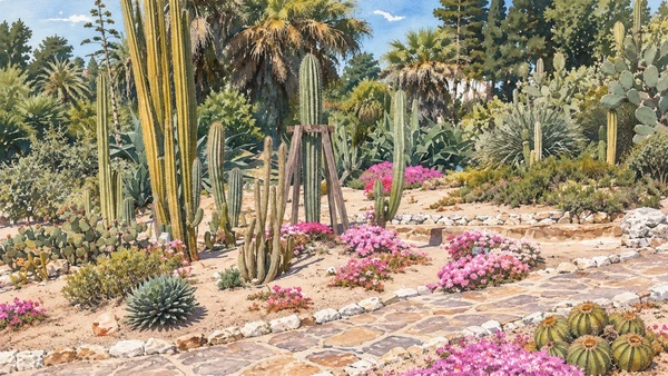
Paths connect planted collections within the valley below the upper city. Succulents, palms and Mediterranean plants create contrasting textures. The cactus beds in the illustration belong to a cultivated collection, not to a native Sardinian desert landscape.

Today

Conditions depend on the exact route and the day. Check the responsible operator, weather and local access notices; use the designated routes and confirm the return journey.

History

Opened in 1866 under Patrizio Gennari, the botanical garden combines scientific collections with a site containing older water-related remains. Its plants come from different parts of the world, allowing environmental adaptation to be studied through living examples.

How to read this place

Use the garden’s labels to distinguish origins and habitats instead of identifying every plant as local. Compare the stone-edged beds and shaded paths with the larger landscape outside. Follow the institution’s open routes and avoid handling plants or entering planted beds.

What to notice

  • Use the garden’s labels to distinguish origins and habitats instead of identifying every plant as local.
  • Compare the stone-edged beds and shaded paths with the larger landscape outside.
  • Follow the institution’s open routes and avoid handling plants or entering planted beds.
Orto Botanico
Watercolour: Cagliari Orto Botanico, cultivated desert-plant beds with columnar cacti and pink flowers
The university botanical gardenEditorial watercolour · AI-generated · 2026

The territory through time

A short chronology

A concise chronology linking the documented sites to the wider story.

  1. Punic burial shafts develop across Tuvixeddu.

  2. The amphitheatre occupies a limestone slope.

  3. The early church of San Saturnino takes shape.

  4. Pisan Cagliari develops its cathedral and fortified upper quarter.

  5. Torre dell’Elefante is completed.

  6. The botanical garden opens.

  7. Saint Remy opens; three decades later the cathedral receives its present facade.

  8. Molentargius-Saline becomes a regional park.

Before your visit

Practical information

01

Plan separate days

Choose a manageable set of visits and allow for transport, booked entries and the return journey.

02

Use the exact place name

Sardinia contains separate cities, hill routes and coastal approaches. Confirm the precise locality and route rather than treating nearby names as one destination.

03

Check the institution

Opening hours, tickets, exhibitions and religious access change. Use the linked managing institution shortly before visiting.

04

Check the actual terrain

Steps, gradients and uneven ground vary between the individual sites. Use current route information, weather and closures for the option you choose.

05

Arrange accessible visits

Historic interiors and outdoor approaches can include steps, gradients or uneven surfaces. Ask about the specific route instead of assuming an entire destination is step-free.

06

Respect work and residence

Farms, workshops, churches and historic streets remain in use. Follow signs, keep entrances clear and ask permission before entering private spaces.

Method and sources

Sources and image credits

Prepared on 9 September 2026 from the institutional sources linked below. Historical claims are separated from editorial observations and itinerary suggestions. Older institutional brochures are used for stable cultural context, never as current timetables. Prices, transport schedules, trail status and admission are deliberately left to the responsible operators. Illustrations are not photographs, measured reconstructions or evidence of current conditions.

The eleven images are AI-generated editorial watercolours guided by photographic references. They interpret named places and are not photographs or substitutes for measured plans. Opening hours, tickets, accessible routes, temporary exhibitions and conservation work can change; consult the linked official pages shortly before visiting.

Illustration references and credits