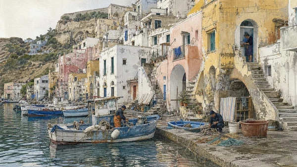
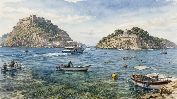
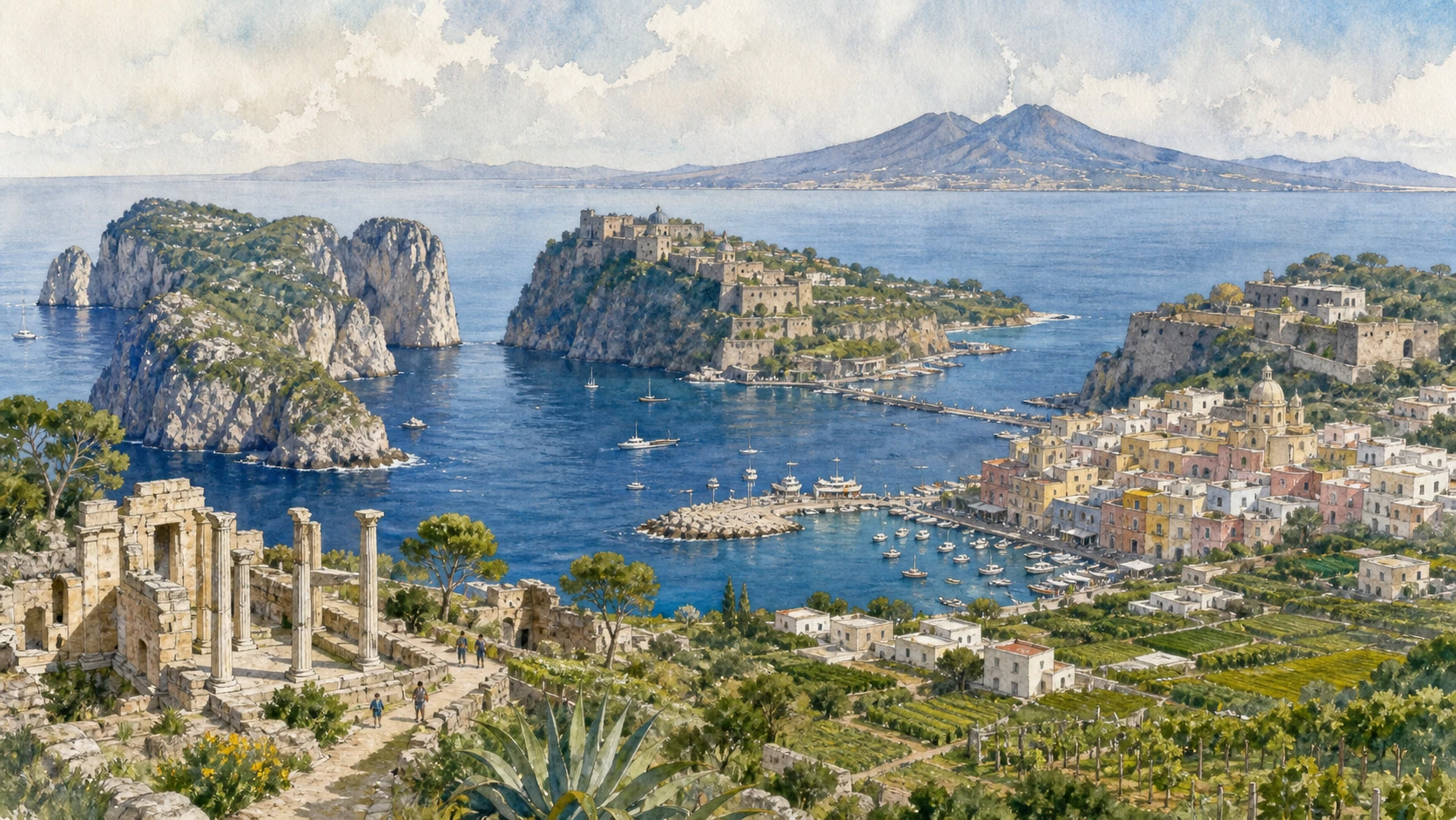
Original documentary watercolour panorama for Capri, Ischia and Procida: Three Islands of the Bay of Naples — Complete Guide, showing landscape, heritage and present-day use

Campania Guide 07 · Roman villas, volcanic geology, fortified towns, gardens, marine protection and ferry limits

Capri, Ischia
& Procida

A comparative island guide that treats Capri, Ischia and Procida as three distinct landscapes, joining Roman archaeology, volcanic terrain, fortified settlements, gardens, ports, agriculture and the marine protected areas of the Bay of Naples.

Plan the route
Campania · Italy10 chapters · one to three days

Why this Campania landscape must be read in layers

The three islands share a bay but not one identity: Capri is largely limestone, Ischia is volcanic and Procida is a small volcanic island whose dense settlements and maritime work create a different rhythm.

Capri’s Roman villas and cliff paths record imperial occupation and later international tourism, but the island remains an inhabited municipality with scarce space, water, transport capacity and protected natural areas.

Ischia’s geology supports thermal systems, steep landscapes, agriculture and continuing seismic and volcanic monitoring. Castles, ports and gardens sit within an active geological field rather than on a generic resort island.

Procida’s Terra Murata, Corricella and harbours preserve dense architecture and maritime traditions under strong seasonal pressure. Ferries and sea state govern all three islands, so they should be visited on separate days rather than combined into a race.

Choose one island per day, verify the exact ferry and return sailing, then use local buses or walking routes within current capacity and weather; never treat the bay as a guaranteed timetable.

The route

Plan your visit

Read Capri through cliff archaeology, Ischia through volcanic and fortified landscapes and Procida through settlement and maritime work, using separate travel days and current marine rules.

Early morning

Capri town and the funicular threshold · Villa Jovis · Anacapri

Follow the documented sequence: Capri town and the funicular threshold; then Villa Jovis: imperial residence above the cliffs; then Anacapri: high settlement, stairs and separate civic life. Recheck current access, transport and weather before departure.

Late morning

Blue Grotto · Castello Aragonese · Ischia geology and thermal systems

Follow the documented sequence: Blue Grotto: sea cave under strict natural limits; then Castello Aragonese: fortified islet and layered settlement; then Ischia geology and thermal systems: heat within an active island. Recheck current access, transport and weather before departure.

Afternoon

La Mortella · Terra Murata · Marina Corricella

Follow the documented sequence: La Mortella: a modern garden built from rock, water and collecting; then Terra Murata: fortified Procida on the ridge; then Marina Corricella: inhabited harbour, not a painted façade. Recheck current access, transport and weather before departure.

Late afternoon

Regno di Nettuno and island mobility

Follow the documented sequence: Regno di Nettuno and island mobility: one protected sea, many pressures. Recheck current access, transport and weather before departure.

Ten chapters

Explore the places

The order follows terrain, chronology and current movement. Use the index without detaching monuments from the living landscape and infrastructure that sustain them.

  1. 01Capri town and the funicular threshold
  2. 02Villa Jovis: imperial residence above the cliffs
  3. 03Anacapri: high settlement, stairs and separate civic life
  4. 04Blue Grotto: sea cave under strict natural limits
  5. 05Castello Aragonese: fortified islet and layered settlement
  6. 06Ischia geology and thermal systems: heat within an active island
  7. 07La Mortella: a modern garden built from rock, water and collecting
  8. 08Terra Murata: fortified Procida on the ridge
  9. 09Marina Corricella: inhabited harbour, not a painted façade
  10. 10Regno di Nettuno and island mobility: one protected sea, many pressures
01

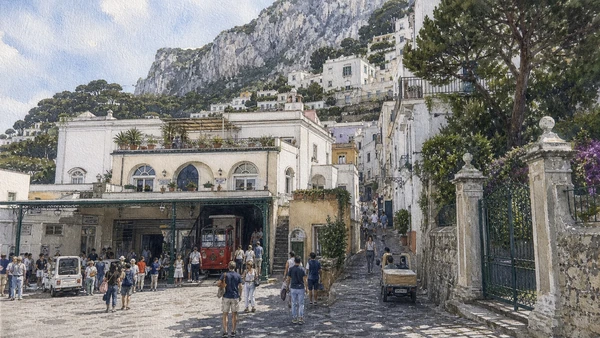
Piazzetta, lanes and transport concentrate arrivals on limited urban ground

Capri town and the funicular threshold

The celebrated centre is also a municipal interchange and residential place.

Today

Funicular, bus and pedestrian flows can queue heavily. Keep station exits, lanes and shop deliveries open.

History

The settlement developed beyond ancient villas and was transformed by travellers, artists, hospitality and twentieth-century tourism. Urban space remained tightly constrained by terrain.

How to read this place

Move away from the Piazzetta and compare public lanes with private gates and service routes. Arrival infrastructure explains crowd concentration.

What to notice

  • Small civic square serving as island interchange
  • Narrow lanes distributing residents and visitors
  • Steep terrain limiting expansion
Italia.it · Capri
Original documentary watercolour of Capri town and the funicular threshold in Campania, showing accurate heritage, terrain and present-day use
Capri town and the funicular thresholdOriginal Merlintravel documentary watercolour · 2026
02

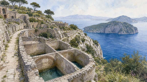
A large Roman complex occupies the eastern height of Capri with cisterns, courts and long maritime views

Villa Jovis: imperial residence above the cliffs

The route and water system matter more than sensational stories about Tiberius.

Today

The state site requires a substantial exposed walk and can close for weather or maintenance. Carry water and check MiC access.

History

The villa belongs to the imperial building programme associated with Tiberius on Capri. Its hilltop position required water storage, supply and controlled approach.

How to read this place

Trace cisterns, service spaces and terraces before the cliff view. Treat ancient literary anecdotes critically.

What to notice

  • Roman terraces fitted to a high limestone ridge
  • Large cisterns sustaining an isolated residence
  • Bay views expressing surveillance and status
Direzione regionale Musei nazionali Campania · Villa Jovis
Original documentary watercolour of Villa Jovis: imperial residence above the cliffs in Campania, showing accurate heritage, terrain and present-day use
Villa Jovis: imperial residence above the cliffsOriginal Merlintravel documentary watercolour · 2026
03

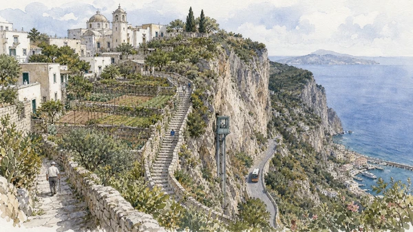
The upper municipality developed behind the island’s steep western escarpment

Anacapri: high settlement, stairs and separate civic life

Its churches, lanes and agricultural traces resist a Capri-town-only itinerary.

Today

Buses and chairlift areas can congest. Walk residential lanes quietly and verify any exposed path before departure.

History

Settlement used the higher plateau and routes such as the Scala Fenicia long before modern roads and lifts changed access. Farming and craft supported local life.

How to read this place

Compare stair, road and lift as three transport eras. Look for gardens and productive land beyond visitor streets.

What to notice

  • High plateau separated from Marina Grande by cliff
  • Historic stair route crossing the escarpment
  • Agricultural plots surviving around the town
Italia.it · Capri
Original documentary watercolour of Anacapri: high settlement, stairs and separate civic life in Campania, showing accurate heritage, terrain and present-day use
Anacapri: high settlement, stairs and separate civic lifeOriginal Merlintravel documentary watercolour · 2026
04

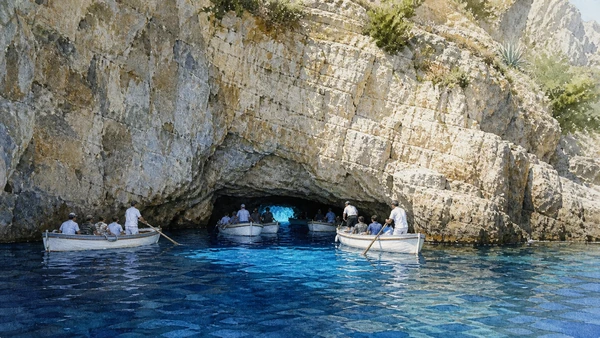
Light enters a partly submerged opening whose accessibility depends entirely on sea state and authorised small boats

Blue Grotto: sea cave under strict natural limits

Colour does not justify unsafe entry or guaranteed schedules.

Today

Access can stop without notice for waves, wind or tide. Follow official boatmen and harbour authority instructions; swimming into the cave is prohibited.

History

The cave was known in antiquity and incorporated into modern Capri tourism after nineteenth-century promotion. Geological form and changing sea level created the present entrance.

How to read this place

Observe boat procedure and opening height before colour. Cancellation is a safety decision, not a service failure.

What to notice

  • Low entrance requiring controlled small boats
  • Underwater light producing the blue effect
  • Sea state governing all access
Comune di Anacapri · Grotta Azzurra
Original documentary watercolour of Blue Grotto: sea cave under strict natural limits in Campania, showing accurate heritage, terrain and present-day use
Blue Grotto: sea cave under strict natural limitsOriginal Merlintravel documentary watercolour · 2026
05

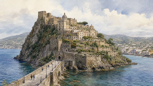
A causeway links Ischia Ponte to a volcanic rock carrying churches, convents, defences and residences

Castello Aragonese: fortified islet and layered settlement

The complex is a vertical town, not one castle building.

Today

The private museum route is steep and includes stairs, tunnels and exposed terraces. Check current access and accessibility.

History

Ancient occupation preceded medieval fortification, while Alfonso of Aragon reshaped defences and connection in the fifteenth century. Religious communities and residents occupied the rock for centuries.

How to read this place

Follow the route by level and function: defence, worship, burial, dwelling and agriculture. The causeway makes control of entry visible.

What to notice

  • Fortified volcanic islet joined by causeway
  • Churches and dwellings distributed vertically
  • Terraces opening across Ischia Ponte
Castello Aragonese d’Ischia · Official site
Original documentary watercolour of Castello Aragonese: fortified islet and layered settlement in Campania, showing accurate heritage, terrain and present-day use
Castello Aragonese: fortified islet and layered settlementOriginal Merlintravel documentary watercolour · 2026
06

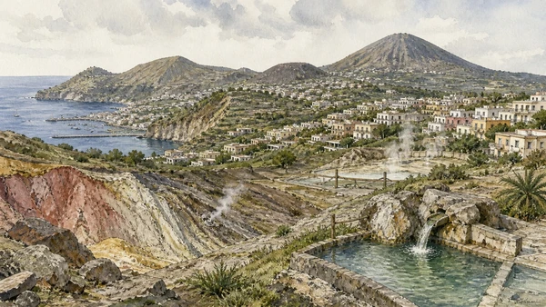
Volcanic rocks, faults, uplift and hydrothermal circulation shape springs, slopes and settlement

Ischia geology and thermal systems: heat within an active island

Thermal use does not make volcanic risk harmless or predictable.

Today

Use official monitoring and civil-protection sources for current conditions. Wild bathing sites can have burn, gas, cliff and sea hazards.

History

Ischia formed through complex volcanic activity and deformation rather than one cone. Human communities exploited thermal waters while earthquakes and slope instability repeatedly affected settlement.

How to read this place

Compare rock units, fumarolic areas and water use without approaching restricted emissions. Separate wellness claims from geologic evidence.

What to notice

  • Volcanic relief formed by several centres
  • Thermal water linked to subsurface circulation
  • Dense settlements occupying active terrain
INGV Osservatorio Vesuviano · Ischia
Original documentary watercolour of Ischia geology and thermal systems: heat within an active island in Campania, showing accurate heritage, terrain and present-day use
Ischia geology and thermal systems: heat within an active islandOriginal Merlintravel documentary watercolour · 2026
07

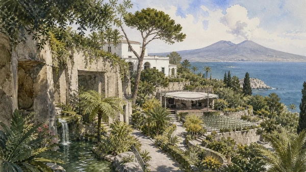
A steep former quarry landscape became a highly designed botanical and musical environment

La Mortella: a modern garden built from rock, water and collecting

The garden is twentieth-century cultural work rather than an ancient island tradition.

Today

Entry is ticketed and opening is seasonal; concerts and garden visits have separate rules. Stay on paths and protect collections.

History

Susana Walton and landscape architect Russell Page developed the garden around William Walton’s home, using microclimates, water and international plant collections.

How to read this place

Compare lower humid garden with upper Mediterranean terraces. Music, house and planting form one modern patronage project.

What to notice

  • Quarry-like lower garden using shade and water
  • Upper terraces opening toward sea and volcano
  • Performance spaces integrated with botanical design
La Mortella · William Walton Foundation
Original documentary watercolour of La Mortella: a modern garden built from rock, water and collecting in Campania, showing accurate heritage, terrain and present-day use
La Mortella: a modern garden built from rock, water and collectingOriginal Merlintravel documentary watercolour · 2026
08

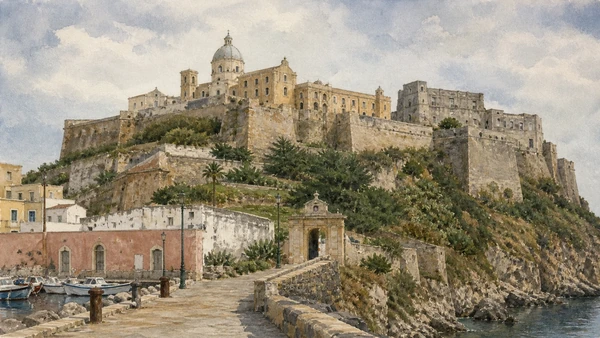
Palace, abbey, former prison and dense houses occupy the island’s defensible high point

Terra Murata: fortified Procida on the ridge

The skyline records institutions with sharply different histories.

Today

Some interiors use guided or scheduled access and the former prison has controlled routes. Steep approaches require time.

History

The fortified settlement developed around religious and seigneurial power. Palazzo d’Avalos later served royal and prison functions before closure and cultural reuse.

How to read this place

Approach from lower marinas and track gates, walls and views. Separate abbey, palace and prison chronologies.

What to notice

  • Ridge walls controlling access to the high town
  • Abbey and palace sharing a compact precinct
  • Former prison requiring careful memorial interpretation
Comune di Procida · Official site
Original documentary watercolour of Terra Murata: fortified Procida on the ridge in Campania, showing accurate heritage, terrain and present-day use
Terra Murata: fortified Procida on the ridgeOriginal Merlintravel documentary watercolour · 2026
09

Layered houses face a small fishing basin through stairs, arches and shared working space

Marina Corricella: inhabited harbour, not a painted façade

Colour and form should not obscure maritime labour and private life.

Today

Keep nets, moorings and delivery routes open. Do not enter stairs or terraces that are private and ask before photographing workers.

History

The settlement grew around fishing and island transport, adapting buildings vertically to limited ground. Tourism and screen imagery increased attention without ending local use.

How to read this place

Observe boat types, shore work and stair connections before photographing façades. The harbour’s scale depends on continuing restraint.

What to notice

  • Layered houses adapted to a steep harbour edge
  • Small fishing boats retaining working access
  • Public stairs interlaced with private thresholds
Italia.it · Procida
Original documentary watercolour of Marina Corricella: inhabited harbour, not a painted façade in Campania, showing accurate heritage, terrain and present-day use
Marina Corricella: inhabited harbour, not a painted façadeOriginal Merlintravel documentary watercolour · 2026
10

Marine zoning around Ischia and Procida protects habitats while ferries, fishing, diving and leisure share limited waters

Regno di Nettuno and island mobility: one protected sea, many pressures

Rules differ by zone and activity.

Today

Check the marine authority before anchoring, fishing or diving. Use established moorings and never collect marine life.

History

The protected area formalised conservation across a sea long used by island communities. High seasonal traffic and climate pressures require monitoring and cooperation.

How to read this place

Look for seagrass protection, harbour rules and vessel routes. Compare public ferry necessity with recreational pressure.

What to notice

  • Protected sea connecting two inhabited islands
  • Zoning governing anchoring and fishing
  • Ferries and small craft sharing constrained channels
Area Marina Protetta Regno di Nettuno · Official site
Original documentary watercolour of Regno di Nettuno and island mobility: one protected sea, many pressures in Campania, showing accurate heritage, terrain and present-day use
Regno di Nettuno and island mobility: one protected sea, many pressuresOriginal Merlintravel documentary watercolour · 2026

The landscape through time

A short chronology

A documented sequence from ancient settlement and environmental formation to modern conservation, mobility and resident life.

  1. Human occupation develops on islands within the Bay of Naples.

  2. Settlements and maritime routes connect the islands to Cumae, Neapolis and wider Mediterranean exchange.

  3. Elite villas and imperial residences transform Capri and other coastal sites.

  4. Christian institutions, raids and shifting authority reshape island settlement.

  5. Fortified high places develop on Ischia and Procida.

  6. Alfonso of Aragon strengthens the Ischia castle complex and its causeway.

  7. Maritime work, agriculture, religious communities and thermal use support island societies.

  8. Travel writing, archaeology and modern spa culture increase outside attention.

  9. Modern promotion of Capri’s Blue Grotto accelerates its tourist fame.

  10. A destructive earthquake strikes Casamicciola and northern Ischia.

  11. Artists, writers and international residents reshape Capri and Ischia’s cultural economies.

  12. Mass tourism, ferries, roads and new building transform island access.

  13. The Regno di Nettuno marine protected area is established around Ischia and Procida.

  14. Procida serves as Italian Capital of Culture, expanding cultural reuse and visitor attention.

  15. Ferry capacity, marine protection, water, waste, seismic awareness and resident housing remain linked island challenges.

Before your visit

Practical information

01

Use only official tickets

Avoid resellers and verify timed-entry, named-ticket or same-day rules on the managing institution’s current site.

02

Keep a weather alternative

Heat, wind, sea state, volcanic conditions and heavy rain can change exposed archaeological, coastal and mountain routes.

03

Respect protected land

Stay on open paths, do not remove stone, plants or archaeological material and follow marine or park zoning.

04

Plan realistic transport

Rail, bus, ferry and road congestion vary sharply by season; do not combine distant chapters without a live connection check.

05

Protect resident access

Homes, farms, markets and working harbours are not sets; keep gates, lanes and deliveries clear and photograph people only with consent.

06

Separate fact from tradition

Legends and local narratives are identified as cultural evidence and are not substituted for archaeological, geological or archival proof.

Method and sources

Sources and image credits

This guide uses current documentation from the managing archaeological park, museum, ministry, UNESCO property, civil-protection authority, protected-area body or transport institution, checked on 29 August 2026. Claims are cross-checked against at least one second primary or institutional source where available. The guide separates current access from durable history and distinguishes surviving fabric from reconstruction, restoration, legend and promotional simplification.

All ten images are original Merlintravel editorial watercolours based on documented present-day conditions. They are illustrations, not substitutes for archaeological plans. Opening hours, tickets, accessible routes, temporary exhibitions and conservation work can change; consult the linked official pages shortly before visiting.