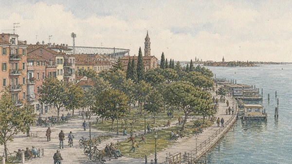
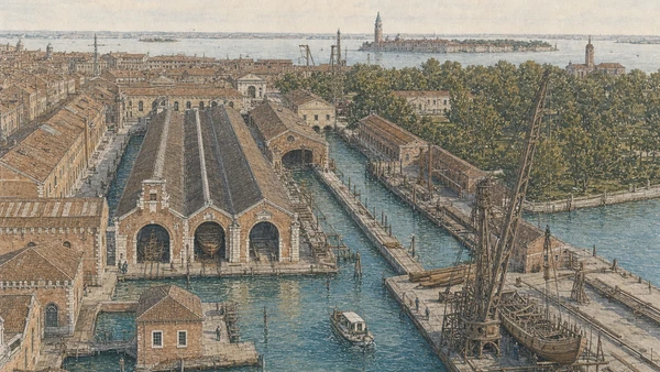
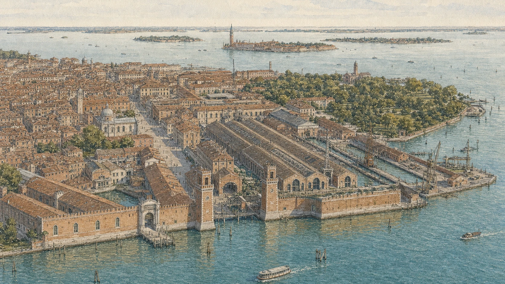
Original documentary watercolour panorama of Castello, the Arsenale basins, Giardini and eastern Venetian lagoon

Venice Guide 07 · Shipbuilding, exhibition architecture, markets and the eastern lagoon

Castello,
Arsenale & Biennale

A documented route across eastern Venice, separating the Republic’s controlled shipyard from its naval museum and Biennale venues before continuing through Via Garibaldi, the Giardini, San Pietro and resident Sant’Elena.

Plan the route
Arsenale · Giardini · Sant’Elena10 chapters · one long day

Why this eastern sestiere matters

Castello is not a cultural annex to central Venice: it is the district where naval production, religious authority, modern exhibition institutions and ordinary housing occupy one continuous eastern landscape.

The Arsenale was a controlled industrial city within the city. Timber, hemp, iron, labour and administrative knowledge converged behind walls to build and maintain fleets on a scale unusual in pre-industrial Europe. Its monumental gate represented state power, while rope walks, ship sheds and water basins organised production. Parts remain under military control; others have become museum, civic or Biennale spaces. A visitor therefore never enters one completely open monument.

The Biennale adds a different geography. The Giardini originated in Napoleonic urban change before the first International Art Exhibition opened there in 1895. National pavilions gradually turned the park into an architectural and geopolitical archive. From 1980, exhibition use expanded through the Arsenale’s industrial volumes. Installations are temporary; columns, roofs, basins and circulation systems belong to the longer building history.

Via Garibaldi, San Pietro and Sant’Elena prevent the district from being reduced to those institutions. Market stalls, schools, sports facilities, parish life, housing, boats and green space persist beside seasonal exhibition crowds. San Pietro was Venice’s cathedral and patriarchal seat before San Marco assumed the title in 1807. Sant’Elena developed substantially in the twentieth century. Read together, these areas show a city that repeatedly reallocates land and buildings without erasing their previous functions.

Treat boundaries as evidence: every gate, ticket line, naval wall, bridge and resident threshold explains who may enter, for what purpose and under whose authority.

The route

Plan your visit

Use either a full Biennale day or a district day; combining both in depth is unrealistic. On a district day, move from the Arsenale gate and museum through Via Garibaldi, Giardini, San Pietro and Sant’Elena.

Early morning

Arsenale gate and Naval Museum

Read the controlled threshold before selecting technical objects in the museum; check its Monday closure.

Late morning

Corderie and basins—or exterior circuit

Enter only with current Biennale or event access; otherwise follow the walls and public campo without inventing a complete visit.

Afternoon

Via Garibaldi and Giardini

Give market and resident movement priority, then read park structure before national pavilions.

Late afternoon

San Pietro and Sant’Elena

Finish at the former cathedral and modern green edge, returning by vaporetto if bridge fatigue is a concern.

Ten chapters

Explore the places

The route separates naval enclosure, rope production, museum collection and Biennale adaptation before following Via Garibaldi, the exhibition gardens, San Pietro’s former cathedral and the inhabited eastern edge.

  1. 01Arsenale gate: power at a controlled threshold
  2. 02Corderie: production measured in length
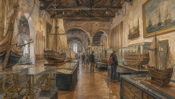
  3. 03Museo Storico Navale: collection is not shipyard
  4. 04Biennale at the Arsenale: installation inside infrastructure
  5. 05Via Garibaldi: public life on a former canal
  6. 06Giardini: park before pavilion sequence
  7. 07National pavilions: architecture is part of the exhibition
  8. 08San Pietro di Castello: cathedral away from San Marco
  9. 09Sant’Elena: modern neighbourhood at the lagoon edge
  10. 10Gaggiandre and basins: architecture built for launching
01

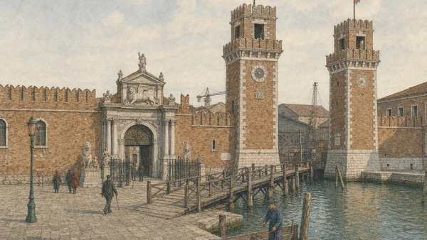
A Renaissance state portal placed against medieval brick walls transformed an industrial entrance into an explicit image of Venetian authority

Arsenale gate: power at a controlled threshold

The bridge, towers, lions and portal announce the shipyard without making the working enclosure publicly accessible as a whole.

Today

Campo dell’Arsenale gives a direct exterior view of the monumental land gate and adjacent water entrance. Beyond them, access is divided among military areas, Biennale venues, the Naval Museum and event-specific routes. An open exhibition entrance does not imply that every basin or workshop can be visited. Security barriers and operational closures are part of the present site.

History

The Arsenale developed from the early twelfth century and expanded repeatedly as Venice’s maritime system grew. The marble land gate, built in the fifteenth century and altered with later trophies and lions, is often described as an early Renaissance public monument in Venice. It converted a fortified production boundary into a ceremonial statement linking naval capacity, classical language and the Republic.

How to read this place

Stand back in the campo to compare brick wall, pale portal and towers. The contrast is intentional. Study the bridge as a controlled approach and the water gate as a separate logistical entrance. Later sculpture and military additions should not be collapsed into one foundation date. The ensemble is a sequence of claims made by different governments about an enduring strategic site.

What to notice

  • Pale classical portal set into the brick industrial perimeter
  • Separate land and water approaches
  • Later lions and trophies layered onto the Renaissance threshold
Comune di Venezia · History of the Arsenale
Original documentary watercolour of the monumental land and water entrances to the Venetian Arsenale
Arsenale gate: power at a controlled thresholdOriginal Merlintravel documentary watercolour · 2026
02

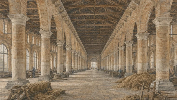
The immense rope walk converted imported hemp, repetitive labour and linear architecture into essential rigging for the Republic’s fleets

Corderie: production measured in length

The hall’s extreme perspective is not theatrical design; it follows the physical process of making long, consistent naval rope.

Today

The Corderie are principally encountered as part of the Biennale’s Arsenale venue. Exhibition lighting, partitions and artworks change with each edition, while masonry columns, roof and linear volume remain the durable framework. Access follows Biennale dates, ticketing and security rather than a separate industrial-monument schedule.

History

Venice required enormous quantities of rope for rigging, mooring and naval supply. Between 1579 and 1585, the Teza Longa della Tana was built to organise hemp storage and rope production in a hall long enough for repeated twisting and laying. The term Tana recalled the Black Sea source associated with valued hemp. Labour, material inspection and fire risk were managed within the larger Arsenal system.

How to read this place

Look down the central axis before looking at any installation. Column spacing, side light and uninterrupted length explain production. Note where contemporary tracks, screens and services touch the old fabric lightly or stand independently. If rope-making equipment is evoked, treat it as interpretation unless clearly identified as original. The building itself remains the strongest machine on view.

What to notice

  • Long uninterrupted axis required by rope making
  • Massive masonry columns supporting the roof
  • Reversible exhibition systems distinct from historic fabric
Comune di Venezia · Cordami and Corderie history
Original documentary watercolour of the Corderie as a historic hemp-rope production hall
Corderie: production measured in lengthOriginal Merlintravel documentary watercolour · 2026
04

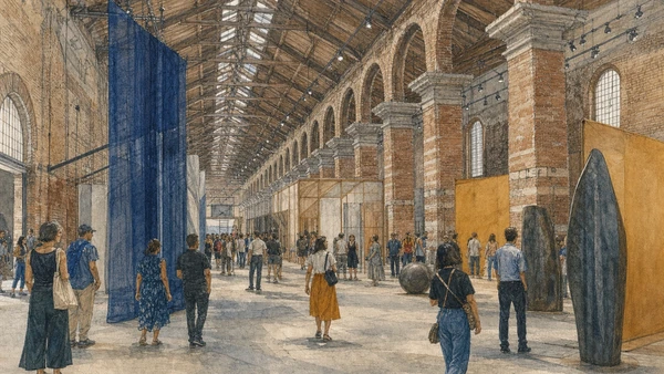
Contemporary art occupies former production halls through temporary systems whose reversibility allows industrial scale to remain legible

Biennale at the Arsenale: installation inside infrastructure

The correct visit reads each artwork and the route designed around it while preserving a second view of columns, roof, doors and water access.

Today

Biennale Arte 2026 uses Corderie, Artiglierie, Sale d’Armi, Tese, Giardino delle Vergini and other Arsenale areas. Two public entrances operate at Campo della Tana and Ponte dei Pensieri. The official ticket combines one Arsenale and one Giardini admission. Bags, performances, accessibility services and pavilion hours follow current Biennale rules, which can change during the exhibition.

History

The Arsenale became a major Biennale venue with the first International Architecture Exhibition in 1980. A broader recovery programme from 1999 opened additional theatres, gardens and halls. This process did not turn the entire Arsenal into a cultural campus: naval, municipal and restricted functions remain. Exhibition use is one chapter in a complex ownership and access history.

How to read this place

At every transition, identify what belongs to the current exhibition and what belongs to the hall. Temporary floors, fabric, lighting and partitions may deliberately transform perception. Then find the historic bay spacing, roof structure and doors behind them. Curatorial circulation changes how the industrial site is experienced, even when its fabric is preserved.

What to notice

  • Temporary partitions standing within permanent structural bays
  • Historic doors and rooflines surviving behind exhibition lighting
  • Two public entrances serving a much larger controlled complex
La Biennale di Venezia · Arsenale venue history
Original documentary watercolour of reversible Biennale installations within the historic Corderie
Biennale at the Arsenale: installation inside infrastructureOriginal Merlintravel documentary watercolour · 2026
05

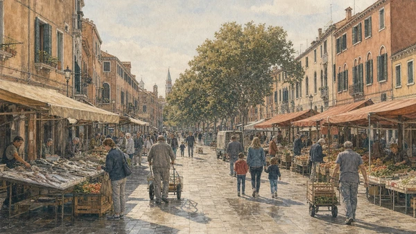
A canal filled during Napoleonic redevelopment became one of Venice’s widest streets and remains an essential resident commercial corridor

Via Garibaldi: public life on a former canal

Market stalls, food shops, schools and deliveries matter more to the street’s identity than its convenient route between Arsenale and Giardini.

Today

Via Garibaldi is broad by Venetian standards and supports produce and fish sales, cafes, shops, benches, homes and civic movement. Exhibition periods increase foot traffic sharply. Stalls and deliveries use working space rather than decorative scenery. Visitors should keep the central route and residential entrances clear and avoid treating the market as a photo set.

History

The street was created as Via Eugenia through the filling of a canal during early nineteenth-century changes associated with the Napoleonic gardens. Its unusual width connected the new landscape works to existing Castello fabric. Later renamed for Giuseppe Garibaldi, it accumulated monuments, commerce and neighbourhood functions while retaining traces of the filled water axis in its straight geometry.

How to read this place

Walk one side first and look for building thresholds, surviving side canals and the alignment toward the garden esedra. Market canopies alter the section daily. Compare the permanent width with temporary occupation by stalls, tables and crowds. The most useful photograph is not an empty vista but an image of how shared street space is negotiated.

What to notice

  • Straight, unusually wide alignment produced by canal filling
  • Resident market and delivery infrastructure
  • Tree-lined connection toward the Napoleonic gardens
Comune di Venezia · Castello Est itinerary
Original documentary watercolour of Via Garibaldi as a resident market and public corridor
Via Garibaldi: public life on a former canalOriginal Merlintravel documentary watercolour · 2026
06

The Biennale’s best-known venue began as an early nineteenth-century urban landscape project before it became an exhibition precinct

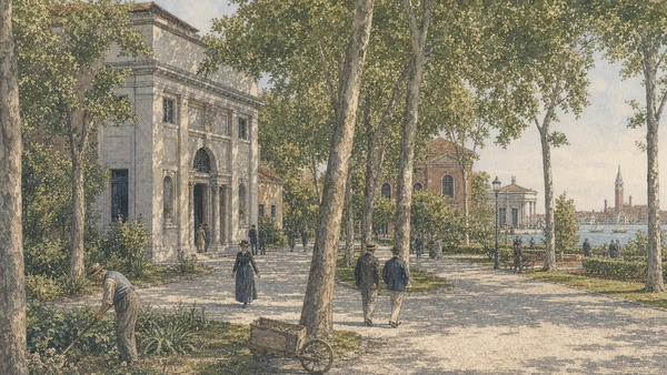
Giardini: park before pavilion sequence

Trees, paths, lagoon edge and civic access form the environmental structure within which exhibition buildings were later placed.

Today

During Biennale Arte, controlled entrances, ticket checks, services and exhibition circulation dominate much of the Giardini venue. Outside event periods, public landscape and surrounding park areas follow different access arrangements. Mature trees provide shade but also require protection and maintenance. The Sant’Elena entrance can reduce pressure on the main approach during the 2026 exhibition.

History

Napoleonic authorities reshaped eastern Castello in the early nineteenth century, creating gardens and new routes under Giannantonio Selva. The first International Art Exhibition opened in 1895 in a central building. Its success drove expansion, yet the underlying landscape geometry—avenues, planted zones, water edges and connections to Via Garibaldi—predates the national pavilion network.

How to read this place

Before entering a building, map the principal paths and tree canopy. Notice how pavilions interrupt or frame longer views. Compare formal axes with informal shaded movement. The park is neither untouched nature nor a blank site for architecture: planting, drainage, crowd control and changing boundaries are part of its designed history.

What to notice

  • Napoleonic path and planting structure beneath the exhibition plan
  • Mature tree canopy shaping movement and microclimate
  • Multiple entrances connecting Via Garibaldi and Sant’Elena
La Biennale di Venezia · Giardini venue history
Original documentary watercolour of the tree-lined Giardini, Central Pavilion and lagoon edge
Giardini: park before pavilion sequenceOriginal Merlintravel documentary watercolour · 2026
07

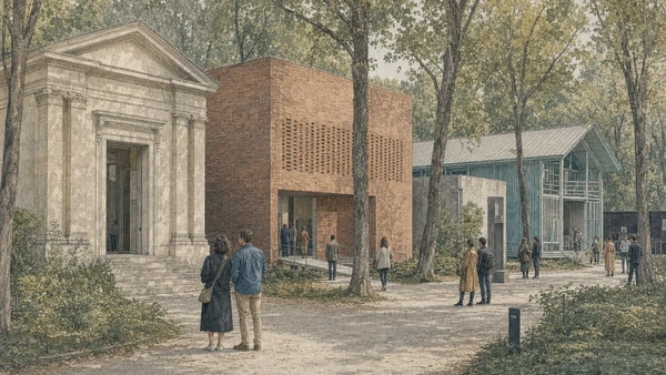
Twenty-nine permanent national pavilions turn the garden into an uneven archive of architecture, diplomacy and changing cultural representation

National pavilions: architecture is part of the exhibition

The buildings record different political moments and design ideologies even when their current installations attempt to transform or resist them.

Today

The Giardini contain 29 national pavilions alongside the Central Pavilion. Each may have its own queue, performance rhythm, accessibility condition or temporary closure within the main event schedule. The 2026 information page lists current exceptions. A complete circuit is unrealistic in one hurried visit; selecting a few buildings from different periods produces a stronger architectural reading.

History

Permanent foreign pavilions began appearing after 1907. Their architects and patrons turned national representation into built form, from historicist fronts to modernist and post-war experiments. Borders, governments and curatorial practices changed while buildings persisted. The resulting map is not a neutral list of countries and does not represent the world evenly.

How to read this place

Choose three pavilions separated by date. Compare approach, threshold, daylight and relation to trees before entering the current show. Ask how temporary installation cooperates with or suppresses the building. Avoid ranking nations by architectural grandeur; the instructive contrast lies in how permanent state representation meets a changing international exhibition.

What to notice

  • Different architectural periods sharing one planted ground
  • Permanent national buildings hosting temporary curatorial programmes
  • Absences and unequal representation embedded in the map
La Biennale di Venezia · Giardini and national pavilions
Original documentary watercolour study of contrasting national pavilion architectures in the Giardini
National pavilions: architecture is part of the exhibitionOriginal Merlintravel documentary watercolour · 2026
08

Venice’s former cathedral stands on a quiet island beyond the Arsenal, exposing the historical separation between episcopal and ducal authority

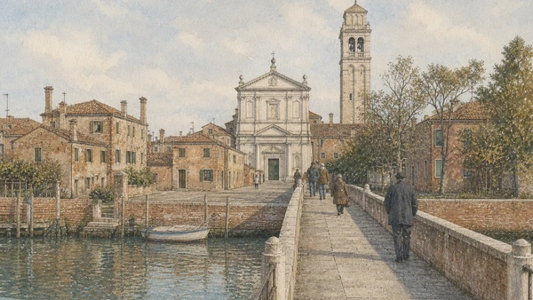
San Pietro di Castello: cathedral away from San Marco

Its bridge, parish setting, Palladian project and former patriarchal role correct the assumption that Saint Mark’s was always the city’s cathedral.

Today

San Pietro remains an active concatedral basilica and neighbourhood church. Regular cultural access is less predictable than at major museum-circuit churches, so visitors should verify locally and never assume entry. The campo and bridge remain publicly legible even when the church is closed. Services and the annual feast demonstrate that the island is not an abandoned ecclesiastical precinct.

History

A church existed on Olivolo by the early medieval period. San Pietro became the seat of the bishop of Castello and, from 1451, the patriarch of Venice. The present church reflects late sixteenth- and early seventeenth-century work based on an Andrea Palladio project and completed by others. In 1807 the cathedral title moved to San Marco, formerly the doge’s chapel.

How to read this place

Approach across the long bridge to experience institutional distance. Compare the pale facade with the separate campanile and low domestic surroundings. Inside, if open, distinguish the building’s architectural phases and the complex history of its reputed chair. The essential lesson is spatial: religious authority once stood apart from the political centre at San Marco.

What to notice

  • Bridge approach making the island’s separation visible
  • Palladian facade project completed through later work
  • Former cathedral and patriarchal seat within a living parish
Comune di Venezia · San Pietro di Castello history
Original documentary watercolour of the bridge, basilica and campanile of San Pietro di Castello
San Pietro di Castello: cathedral away from San MarcoOriginal Merlintravel documentary watercolour · 2026
09

Twentieth-century housing and the city’s broadest green spaces extend Castello beyond the historic fabric most visitors recognise

Sant’Elena: modern neighbourhood at the lagoon edge

Apartment buildings, park, stadium, school routes and vaporetto stops reveal a planned residential extension rather than a leftover fringe.

Today

Sant’Elena combines housing with Parco delle Rimembranze, sports facilities, vaporetto access and long lagoon views. The Comune’s accessible Castello Est route begins here and crosses much of the area without bridges. Event days at the stadium or Biennale alter movement. Residents use the park for ordinary recreation, so quieter paths should not become overflow picnic or luggage areas.

History

Eastern land and infrastructure were reshaped during the nineteenth and especially twentieth centuries. Reclamation and planned housing gave Sant’Elena a different scale from medieval Castello, with wider paths, apartment blocks and substantial public green space. The park’s commemorative origins and later civic use overlap. This is modern Venice built on lagoon geography, not an exception to it.

How to read this place

Compare block height, setbacks and tree canopy with Via Garibaldi and San Pietro. Follow a lagoon path to understand transport and exposure, then turn inland toward housing entrances and local services. The absence of a major monument is the point: urban value here depends on residence, shade, play, access and open water.

What to notice

  • Twentieth-century apartment fabric unlike central calli
  • Large connected park and lagoon-side paths
  • Vaporetto, sport and resident circulation sharing the eastern edge
Comune di Venezia · Accessible Castello Est route
Original documentary watercolour of Sant'Elena housing, park, bicycles and lagoon-side transport
Sant’Elena: modern neighbourhood at the lagoon edgeOriginal Merlintravel documentary watercolour · 2026
10

Roofed ship sheds meeting protected water basins make the Arsenal’s production sequence visible at the scale of hulls rather than facades

Gaggiandre and basins: architecture built for launching

Water, covered slips, workshops and cranes formed an integrated system for construction, fitting, storage and repair.

Today

Views of the internal basins and Gaggiandre depend on the portion of the Arsenal opened by the Biennale, special events or authorised routes. Other areas remain under naval or controlled use. The Giardino delle Vergini and exhibition paths reveal selected edges, but visitors must follow barriers and cannot assume that an apparent quay is public.

History

Repeated Arsenal expansions added basins, wet docks, ship sheds and specialised workshops. The Gaggiandre, monumental roofed water structures associated with sixteenth-century building campaigns, allowed vessels to be worked under cover at the waterline. Later industrial equipment, military adaptations and restoration changed the system while preserving its fundamental relationship between building and basin.

How to read this place

Look across water before isolating a roof. Align slip opening, basin depth, quay and service route as one production chain. Distinguish historic masonry from later cranes or reinforcements. Reflections can make the scene picturesque, but the crucial evidence is operational geometry: a vessel had to move from material supply to covered work and navigable water efficiently.

What to notice

  • Roofed slips descending directly to protected water
  • Basins linking workshops, quays and navigation
  • Later cranes and adaptations layered onto earlier masonry
La Biennale di Venezia · Arsenale spaces and recovery
Original documentary watercolour of the Gaggiandre, internal basins and working edges of the Venetian Arsenale
Gaggiandre and basins: architecture built for launchingOriginal Merlintravel documentary watercolour · 2026

Castello through time

A short chronology

From the first cathedral and medieval shipyard to Napoleonic urban works, the Biennale, modern housing and contemporary cultural reuse.

  1. A church on Olivolo becomes an early seat of episcopal authority at San Pietro.

  2. The first Arsenal develops in a protected area between San Marco and the Castello episcopal island.

  3. The Arsenale Nuovo expansion greatly enlarges production and storage capacity.

  4. San Pietro di Castello becomes the cathedral seat of the newly established Patriarchate of Venice.

  5. The Arsenale’s marble land gate gives the industrial enclosure a monumental Renaissance threshold.

  6. The long Tana ropeworks are built to organise hemp preparation and naval cordage production.

  7. San Pietro is rebuilt from a Palladian project completed by later architects.

  8. The cathedral title transfers from San Pietro di Castello to Saint Mark’s.

  9. Napoleonic works create the eastern gardens and Via Eugenia, later Via Garibaldi.

  10. The first International Art Exhibition opens in the Giardini.

  11. Permanent foreign pavilions begin transforming the Giardini into an architectural-diplomatic landscape.

  12. Reclamation, housing and public green space consolidate modern Sant’Elena.

  13. The first International Architecture Exhibition establishes the Arsenale as a major Biennale venue.

  14. A long recovery programme opens additional Arsenale halls, theatres and gardens to cultural use.

  15. The 61st Biennale Arte occupies Giardini, Arsenale and Forte Marghera under a time-specific programme.

Before your visit

Practical information

01

Choose district day or Biennale day

Each Biennale venue averages about three hours; adding the museum, San Pietro and resident Castello produces an exhausted rather than informed visit.

02

Check the correct institution

MUNAV, Biennale, naval Arsenal and churches have separate access systems. A closure in one does not describe the others.

03

Enter the 2026 exhibition with current rules

Reserve tickets, verify Monday exceptions, pavilion changes and performance schedules on the official Biennale page.

04

Keep Via Garibaldi usable

Market stalls, deliveries and home entrances need space; do not stop a group across the full street or narrow side bridges.

05

Treat San Pietro as a parish

Opening can be irregular and worship comes first. The bridge, campo and former cathedral history remain worthwhile if doors are closed.

06

Use Sant’Elena for accessible routing

The vaporetto and bridge-light public paths can reduce fatigue; confirm current ACTV capacity and temporary Biennale ramps.

Method and sources

Sources and image credits

This guide uses current official information from the Comune di Venezia, La Biennale di Venezia, MUNAV, Marina Militare and Patriarchate of Venice, checked on 28 August 2026. It distinguishes public campo from controlled Arsenal; industrial fabric from naval museum collection; rope-production architecture from exhibition scenography; Biennale venue from the entire military complex; temporary installation from permanent structure; Giardini landscape from pavilion architecture; market street from visitor corridor; former cathedral from doge’s chapel; and modern Sant’Elena from the assumption that authentic Venice must be medieval.

All ten images are original Merlintravel editorial watercolours based on documented present-day conditions. They are illustrations, not substitutes for archaeological plans. Opening hours, tickets, accessible routes, temporary exhibitions and conservation work can change; consult the linked official pages shortly before visiting.