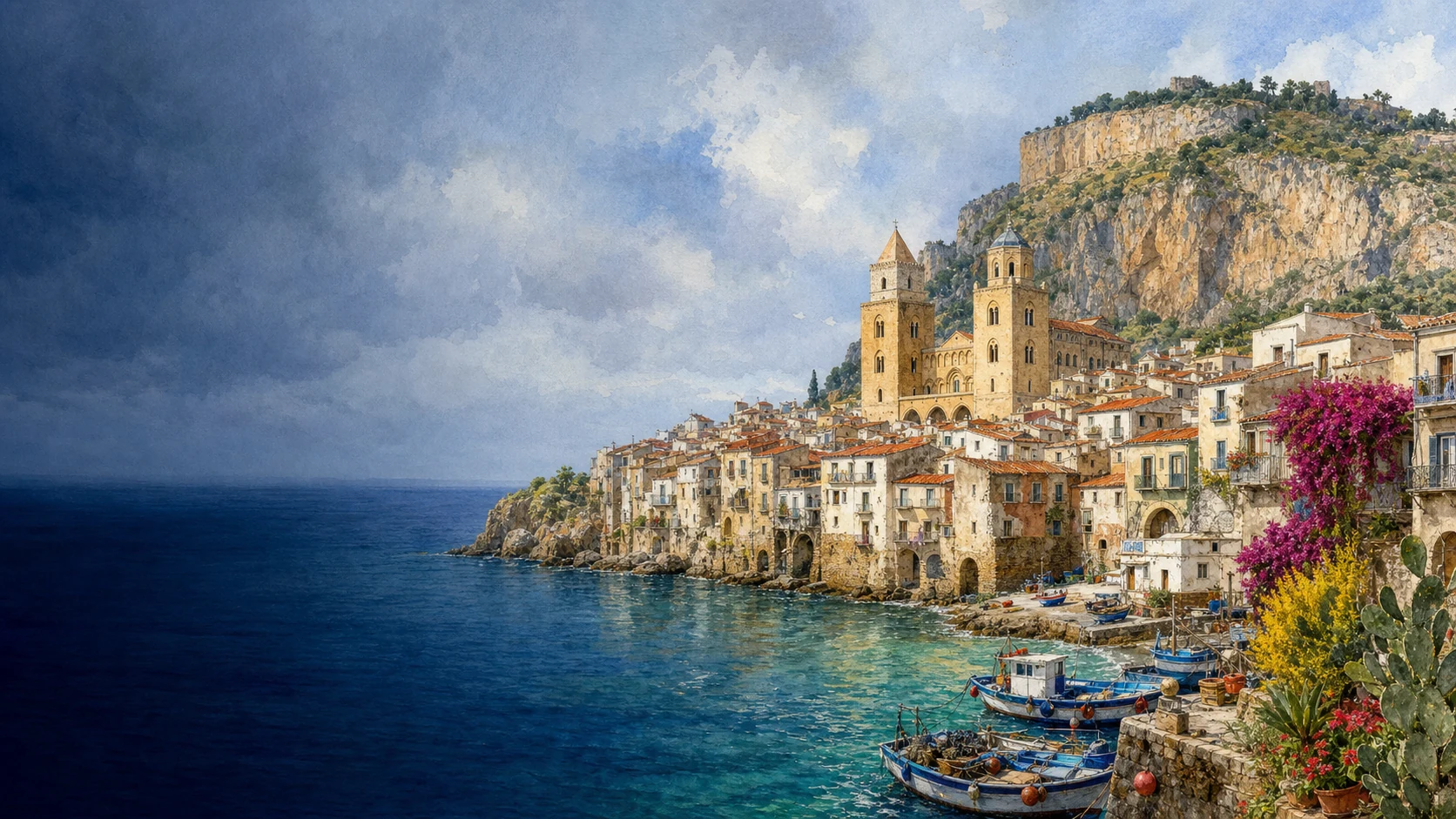
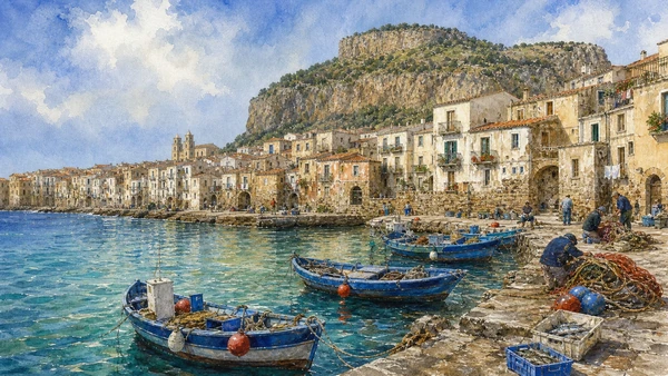
Documentary spring watercolour of Cefalù with its real Norman cathedral, compact seaside town, limestone Rocca, old harbour and Tyrrhenian coast

ILLUSTRATED GUIDE · SICILY

A stone headland,
a Norman cathedral
and a town facing the sea

Twenty-three substantial chapters follow Cefalu from the Rocca and ancient walls through the Norman cathedral, lived waterfront, Mandralisca collections, varied coast and Madonie hinterland.

Explore the places
CEFALÙ · ANCIENT CITY, CATHEDRAL, ROCCA, SEA AND MADONIE

A SEASIDE TOWN THAT CANNOT BE REDUCED TO A BEACH AND A FACADE

Cefalù is one of Sicily's most recognisable views: two cathedral towers, ochre roofs, a blue bay and the great limestone Rocca rising almost vertically behind them.

That perfect composition can make the town appear self-explanatory. It is not. Streets preserve an ancient grid; walls climb into the rock; a royal mausoleum project was begun and abandoned; Byzantine mosaicists worked inside a Latin cathedral whose roof also carries Islamic-derived painting.

The sea is equally complex. It brought trade, conquest, pilgrims, travellers and modern tourism, but it was also a place of fishing, washing, defence and everyday risk. The old harbour, surviving gate, washhouse and reopened fish market keep that working history visible.

This guide therefore moves between monument and community. It climbs the Rocca, reads the cathedral slowly, follows water through the town, enters Mandralisca's civic collections and leaves the postcard centre for Sant'Ambrogio, Gibilmanna and the Madonie woods.

One destination

Twenty-three chapters from the Rocca to the coast and Madonie

The old town stands between the Tyrrhenian Sea and a 270-metre limestone promontory. That setting created a defensible landing place, a visible coastal marker and a constrained urban site where ancient, medieval and modern routes repeatedly reused the same corridors.

Kephaloidion was an indigenous centre connected to Greek, Punic, Syracusan and Roman networks. Its megalithic walls and regular streets should not be used to invent a purely Greek colony; the surviving evidence points to exchange, conquest and adaptation across several political systems.

After high-medieval occupation concentrated on the Rocca, Norman rule brought settlement and power back to the lower town. Roger II founded the diocese and cathedral in 1131. Its western massing, Byzantine mosaics, Latin basilical space, painted timber and cloister make cultural collaboration visible, while royal authority and conquest remain part of the story.

Later centuries added palaces, bastions, churches, theatres, collections and new neighbourhoods. The municipal territory reaches beyond the famous bay to cliffs, beaches, agricultural slopes, Sant'Ambrogio, protected woodland and Gibilmanna: Cefalù is a small city with a much larger landscape.

The selection

Twenty-three chapters,
one compact headland city

The route consolidates connected structures and histories while keeping archaeology, cathedral, lived town, maritime spaces, museum collections, beaches and hinterland visible at their proper scales.

  1. 01The Limestone Headland: A City with a Stone Head
  2. 02Prehistoric Caves and the So-Called Temple of Diana
  3. 03Kephaloidion and Its Megalithic Walls
  4. 04From Carthaginian Alliance to Roman Cephaloedium
  5. 05From Byzantine Refuge to Gafludi and Norman Cefalu
  6. 06Roger II's Vow, Royal Strategy and the Cathedral of 1131
  7. 07An Unfinished Royal Design and the Making of Piazza Duomo
  8. 08Twin Towers and Fortress Apses
  9. 09Columns, Spolia and the Painted Timber Roof
  10. 10The Mosaic Campaign and Christ Pantocrator
  11. 11Virgin, Archangels, Apostles, Prophets and Saints
  12. 12The Lost Royal Mausoleum and the Living Sanctuary
  13. 13Treasury, Chapter Rooms, Towers and Roofs
  14. 14The Canons' Cloister and Its Paired Capitals
  15. 15Osterio Magno and Corso Ruggero
  16. 16The Cefalino Washhouse and Porta Pescara
  17. 17Porta Giudecca, the Rock Path and Bastione Marchiafava
  18. 18The Old Harbour and the Reopened Fish Market
  19. 19Mandralisca's Civic Museum and Antonello's Unknown Man
  20. 20Krater, Shells, Coins and Birds: Mandralisca's Other Worlds
  21. 21The Rocca's Three Defensive Systems
  22. 22Kalura, Caldura, Lungomare and Capo Playa
  23. 23Sant'Ambrogio, Gibilmanna and the Madonie
01

ROCCA, LOW TOWN AND TYRRHENIAN WATER FORM ONE COMPACT GEOGRAPHIC SYSTEM

The Limestone Headland: A City with a Stone Head

Cefalu's identity begins with the steep limestone mass immediately behind a dense coastal town, not with one isolated cathedral view.

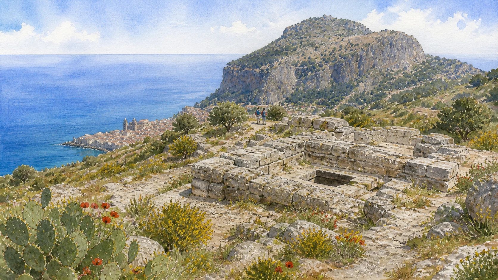
Documentary watercolour of the so-called Temple of Diana as low megalithic limestone walls and a cistern within the spring landscape of Cefalu's Rocca
THE ROCCA · BEFORE THE CATHEDRAL

The place today

The Rocca dominates every arrival, but its apparent simplicity is deceptive. Cliffs, vegetated slopes, archaeological terraces, fortifications and summit ruins form a protected cultural and natural landscape. The lower town is compressed between rock and sea, while rail, roads, harbour works and modern neighbourhoods extend the urban system west and east.

The historical chapter

The promontory offered observation over the Tyrrhenian routes, defensible ground, caves and places to collect water. Names recorded for the settlement changed under Greek, Punic, Roman and Arabic use, but several connect the town to the head-shaped rock. Geological form did not determine one fixed city: inhabitants alternated between the coast and the higher refuge according to security, water and political power.

What to notice

  • Do not treat the Rocca as a detached hiking attraction; it contains evidence from prehistory through the medieval castle.
  • The panorama compresses the municipality; Gibilmanna, Sant'Ambrogio and the wider Madonie territory require separate travel.
Municipality of Cefalù · Rocca history, archaeology and current access
Documentary watercolour of the so-called Temple of Diana as low megalithic limestone walls and a cistern within the spring landscape of Cefalu's Rocca
THE ROCCA · BEFORE THE CATHEDRALLow megalithic walls and a cistern survive on the summit without proving a complete temple or a secure dedication to Diana.
02

EARLY HUMAN PRESENCE AND A MEGALITHIC BUILDING PRECEDE THE WALLED CITY BUT RESIST SIMPLE CULT LABELS

Prehistoric Caves and the So-Called Temple of Diana

Caves, cistern and massive stone construction reveal long use of the Rocca while leaving chronology and dedication deliberately qualified.

Documentary watercolour of the so-called Temple of Diana as low megalithic limestone walls and a cistern within the spring landscape of Cefalu's Rocca
THE ROCCA · BEFORE THE CATHEDRAL

The place today

The caves belong to a steep archaeological and ecological landscape rather than a conventional museum circuit. Their significance is easy to miss when attention moves directly to the so-called Temple of Diana or summit castle. Access, excavation status and safety can vary, and sensitive deposits should never be entered or disturbed without authorisation. The building is one of the first major remains reached on the ascent.

The historical chapter

Municipal historical accounts identify prehistoric traces in two northern caves. Such evidence demonstrates early use of the promontory but does not prove the city's later mythic foundations by giants, Sicani or named heroes. Long gaps, changing settlement forms and incomplete excavation separate prehistoric occupation from the fortified community visible by the late fifth century BC. The official Rocca account dates the cistern's earliest phase to around the ninth century BC and proposes a possible connection with water cult, followed by classical-period transformations and Byzantine conversion into a church.

What to notice

  • Keep archaeological evidence separate from local foundation myths; both can be discussed without giving them equal factual status.
  • The cistern and the walls belong to several phases; do not assign the entire visible structure to one century.
Municipality of Cefalù · official historical account
03

AN INDIGENOUS CENTRE PARTICIPATED IN GREEK AND PUNIC SICILY BEHIND A FORTIFIED COASTAL PERIMETER

Kephaloidion and Its Megalithic Walls

Urban identity, external contact, walls and the postierla belong to one ancient landscape without turning Cefalu into a Greek colony.

Documentary watercolour of the so-called Temple of Diana as low megalithic limestone walls and a cistern within the spring landscape of Cefalu's Rocca
THE ROCCA · BEFORE THE CATHEDRAL

The place today

The classical city is not a separate archaeological park. Its grid, walls, road surfaces, necropolis finds and reused alignments survive beneath and within the later town. Reading it requires combining scattered visible fragments with municipal planning studies and museum collections rather than expecting temples and theatres standing in isolation. Sections of large-block walling survive along the northern edge and near the Postierla, while later towers, houses and bastions reuse or overlie the ancient circuit.

The historical chapter

Municipal sources describe Kephaloidion as an indigenous centre prospering through contact with peoples moving around Sicily. Greek forms, trade and political alliances linked it to the wider Hellenic world, while Punic influence and Carthaginian strategy remained powerful on the north coast. The evidence supports cultural and economic connection more securely than a simple colony narrative. The fortification belongs to the urban consolidation of Kephaloidion around the end of the fifth century BC.

What to notice

  • Avoid calling Cefalù a Greek colony unless a source specifies the claim and its evidence.
  • The Postierla is a small secondary passage; it is not the same monument as the surviving Porta Pescara.
Municipality of Cefalù · city history and ancient settlement
04

POLITICAL CHANGE REUSED A STREET GRID WHOSE MOST VISIBLE ANCIENT TRACES SURVIVE BELOW THE MODERN TOWN

From Carthaginian Alliance to Roman Cephaloedium

Punic, Syracusan and Roman phases become legible through roads, burial space and urban continuity rather than monumental ruins alone.

Documentary watercolour of the so-called Temple of Diana as low megalithic limestone walls and a cistern within the spring landscape of Cefalu's Rocca
THE ROCCA · BEFORE THE CATHEDRAL

The place today

Coins, ceramics, street surfaces and funerary objects in local collections make these political shifts more tangible than the picturesque old town alone. The coastline and Rocca explain why outside powers valued the site, but ordinary inhabitants experienced continuity as well as regime change through farming, fishing, craft and regional exchange. A protected section of ancient road can be visited near Corso Ruggero, while other pavements remain beneath buildings and the cathedral area.

The historical chapter

The municipal chronology records alliance with the Carthaginian general Himilco in 396 BC, Syracusan conquest in 307 BC and Roman capture in 254 BC. Under Rome, Cephaloedium became a decuman city owing grain obligations. Exact episodes derive from ancient and later textual traditions and should be read alongside material evidence, not treated as a complete year-by-year civic record. Municipal planning documents identify regular street organisation, fourth-century BC cobbled surfaces and richer Roman-period paving, including Augustan evidence near the cathedral.

What to notice

  • Political control did not replace the whole population or material culture overnight.
  • The necropolis survives mainly as excavated evidence and collections, not as one continuously open cemetery park.
Municipality of Cefalù · official historical chronology
05

THE CITY MOVED UPHILL FOR SECURITY AND LATER RETURNED TO THE LOWER COAST UNDER NEW POWERS

From Byzantine Refuge to Gafludi and Norman Cefalu

Byzantine, Islamic and Norman chapters form a continuous urban transformation even where surviving monuments are uneven.

Documentary watercolour of the so-called Temple of Diana as low megalithic limestone walls and a cistern within the spring landscape of Cefalu's Rocca
THE ROCCA · BEFORE THE CATHEDRAL

The place today

Terraces above the so-called Temple of Diana preserve walls, storage areas, ovens, water systems and the remains of a small church. Visitors will not find an intact Islamic quarter labelled for easy consumption. The relationship is visible from the Rocca: Piazza Duomo, Corso Ruggero, walls and harbour occupy a compact platform beneath the former high settlement.

The historical chapter

Municipal interpretation associates the uphill shift with defensive pressures after the fall of the Western Roman Empire. The municipality dates the conquest to 858. Roger I took Cefalù in the eleventh century; Roger II established the bishopric and cathedral in 1131.

What to notice

  • Do not label every wall on the upper terraces Byzantine; Norman and Renaissance phases are also present.
  • Norman refoundation reused older streets, walls, materials and inhabitants while changing institutions and sacred topography.
Municipality of Cefalù · high-medieval settlement on the Rocca
06

DEVOTIONAL LEGEND AND KINGSHIP TOGETHER EXPLAIN A NEW DIOCESE AND MONUMENTAL SACRED CENTRE

Roger II's Vow, Royal Strategy and the Cathedral of 1131

The storm vow remains part of Cefalu's memory while foundation, burial ambition and royal politics provide the documented architectural context.

Documentary watercolour of the so-called Temple of Diana as low megalithic limestone walls and a cistern within the spring landscape of Cefalu's Rocca
THE ROCCA · BEFORE THE CATHEDRAL

The place today

The vow remains central to local religious identity and the feast of the Santissimo Salvatore. It deserves respectful retelling with an explicit label: legend or tradition. The historical guide can then ask why a new king selected this strategic coastal town for a bishopric, cathedral and intended family mausoleum. The basilica remains the cathedral of a living diocese.

The historical chapter

The official cathedral account separates the storm narrative from political interpretation. Roger II founded the cathedral in 1131 and later ordered porphyry sarcophagi for himself and a cenotaph. The project proclaimed sacred kingship along the Tyrrhenian route. Roger was instead buried in Palermo, and Frederick II transferred the sarcophagi there in 1215. Work began in 1131, the year associated with the new bishopric and a decisive phase in Roger II's kingship.

What to notice

  • Do not quote the vow as a contemporary logbook entry; it belongs to a devotional narrative tradition.
  • Foundation, mosaic dates, facade completion and consecration belong to different stages.
Official Cathedral of Cefalù · history and legend
07

CHANGES IN THE CATHEDRAL FABRIC FACE A SQUARE THAT MOVED FROM CEMETERY TERRACE TO CIVIC STAGE

An Unfinished Royal Design and the Making of Piazza Duomo

Building phases and urban space should be read together rather than forcing the monument into one completed Norman blueprint.

Documentary watercolour of the so-called Temple of Diana as low megalithic limestone walls and a cistern within the spring landscape of Cefalu's Rocca
THE ROCCA · BEFORE THE CATHEDRAL

The place today

The long nave, high eastern block, massive towers and later western front do not form a perfectly uniform campaign. Differences are evidence, not defects to be visually corrected. Roof routes and side views help reveal blocked intentions, construction joints and the relationship between church, cloister and episcopal spaces. Cafés, the municipal palace, religious processions, residents and tour groups share the square.

The historical chapter

The official cathedral history explicitly describes a complex building process and an unfinished initial plan. Work continued after Roger's death under altered political and financial conditions. The facade is associated with Giovanni Panittera in 1240, while the western portico dates to 1471. Consecration in 1267 confirmed a functioning cathedral whose fabric remained open to later intervention. The cathedral was established on an elevated platform whose forecourt served as a cemetery.

What to notice

  • Do not call every asymmetry damage or restoration; some differences belong to medieval changes of plan.
  • During processions and worship, the square is active religious space rather than a neutral photographic set.
Official Cathedral of Cefalù · architecture and construction history
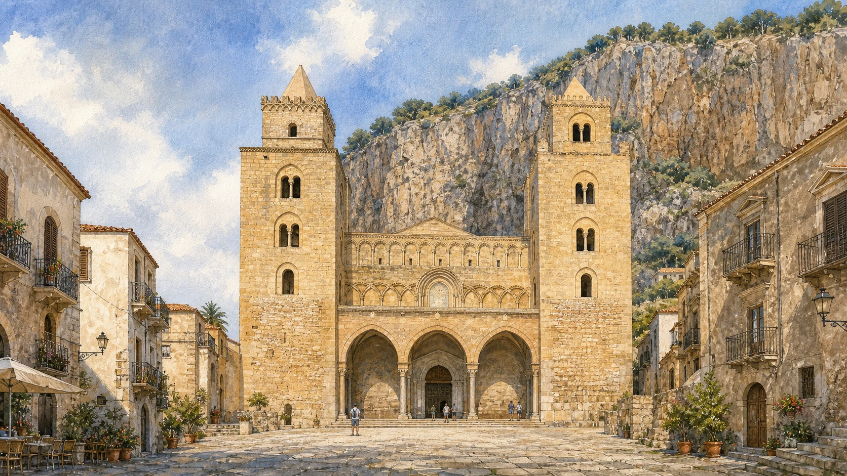
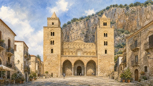
Documentary watercolour of Cefalu Cathedral's pale stone western facade in Piazza Duomo with its two heavy square towers, different upper crowns and the Rocca behind
THE NORMAN CATHEDRALThe western facade belongs to a lived piazza, with two heavy towers whose crowns are similar but deliberately different.
08

THE WESTERN FRONT AND EASTERN TERMINATION ANSWER THE TOWN AND THE ROCCA WITH DIFFERENT ARCHITECTURAL LANGUAGES

Twin Towers and Fortress Apses

Unequal tower crowns, portico, blind arches and massive apses make the cathedral recognisable without turning it into a military fortress.

Documentary watercolour of Cefalu Cathedral's pale stone western facade in Piazza Duomo with its two heavy square towers, different upper crowns and the Rocca behind
THE NORMAN CATHEDRAL

The place today

From the square, blind arches, bifore, monofore and tower crowns become clearer as light moves across the stone. The southern crown is square and the northern one octagonal. Official interpretation links them symbolically to episcopal and royal power, but that reading should remain interpretation rather than a surviving medieval label. Side streets and elevated viewpoints reveal the cathedral's vertical east end better than the famous facade view.

The historical chapter

The facade is attributed by the official cathedral account to Giovanni Panittera around 1240. Ambrogio and Antonio da Como added the three-arched portico in 1471. The towers preserve the earlier monumental conception while later completions and repairs created the front now seen, demonstrating how Cefalù's Norman identity depends on post-Norman work as well. The fortified character supported the cathedral's role in royal strategy and its visual command of the coast.

What to notice

  • Do not force exact symmetry in photographs or illustration; the crowns, openings and construction histories differ.
  • The fortress-like appearance signals authority but does not mean the cathedral functioned simply as a secular castle.
Official Cathedral of Cefalù · facade, towers and portico
09

A LONG LATIN BASILICA ROUTE RISES BENEATH AN ISLAMIC-DERIVED WORKSHOP TRADITION

Columns, Spolia and the Painted Timber Roof

Stone supports and painted wood preserve different material histories within the same nave while their exact origins and makers remain cautious.

Documentary watercolour of Cefalu Cathedral's pale stone western facade in Piazza Duomo with its two heavy square towers, different upper crowns and the Rocca behind
THE NORMAN CATHEDRAL

The place today

The interior feels more austere than Monreale until the eye reaches the apse. Sixteen columns, eight on each side, carry pointed arches with double rings. Variations in shafts and Corinthian capitals reward close looking, while barriers and services may restrict movement near the sanctuary. The roof is high and unevenly visible from the floor; surviving colour can disappear in shadow.

The historical chapter

The basilical Latin-cross plan incorporated ancient spolia within a twelfth-century structure. Reuse connected the new kingdom to the material authority of antiquity and required practical coordination of unequal shafts and capitals. The arrangement leads worshippers from a relatively restrained nave into a concentrated mosaic programme rather than covering every surface in gold. Official cathedral interpretation attributes surviving floral and vegetal decoration to Islamic craftsmen.

What to notice

  • Do not describe reused columns as proof that an intact ancient temple stood on the exact site.
  • Low light and height make binoculars more useful than flash photography.
Official Cathedral of Cefalù · basilical plan and columns
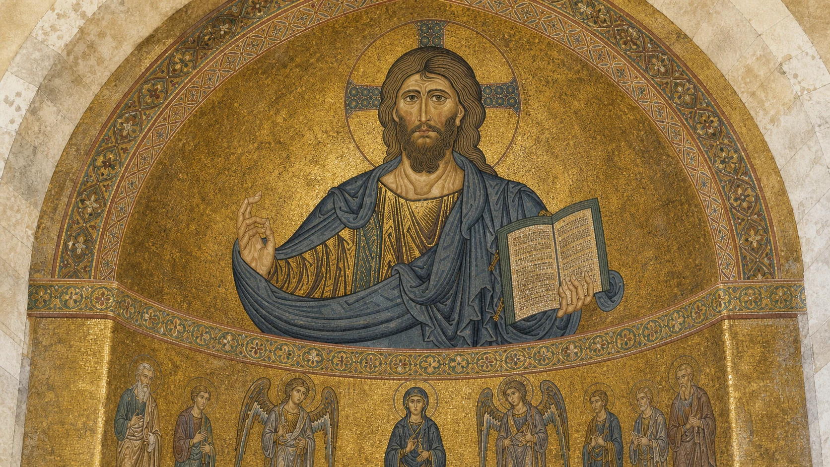
Documentary watercolour of Cefalu Cathedral's apse mosaic with the frontal Christ Pantocrator on gold, blessing hand, book and smaller ordered figures below
THE EASTERN MOSAICSChrist Pantocrator presides over an ordered gold-ground hierarchy; invented lettering has been excluded from the illustration.
10

GOLD, GESTURE AND INSCRIPTION CONCENTRATE ROYAL THEOLOGY IN THE EASTERN SANCTUARY

The Mosaic Campaign and Christ Pantocrator

The famous face belongs to a larger campaign begun by 1148 and extended through changing workshops, not to an isolated icon.

Documentary watercolour of Cefalu Cathedral's apse mosaic with the frontal Christ Pantocrator on gold, blessing hand, book and smaller ordered figures below
THE EASTERN MOSAICS

The place today

Gold mosaics occupy the sanctuary rather than the entire basilica. Their height, curvature and liturgical distance require slow observation. The official route beneath the mosaics can improve detail, but access pauses during celebrations and current ticket arrangements must be checked shortly before a visit. From the nave the Pantocrator appears calm and immediate, yet every feature is calculated for a distant, curved surface.

The historical chapter

The cathedral source assigns the earliest eastern mosaics to 1148 and Byzantine masters called from Constantinople, with wall campaigns continuing broadly between 1154 and 1166. Greek and Latin inscriptions accompany figures. Differences of execution and programme reflect changing teams and patronage rather than a perfectly unified decoration completed in one season. The figure belongs to the earliest mosaic campaign under Roger II.

What to notice

  • Do not date all 650 square metres to 1148; the official chronology distinguishes several campaigns.
  • The gesture is a blessing and theological sign, not a generic command for silence.
Official Cathedral of Cefalù · mosaic history and iconography
11

A VERTICAL COMMUNITY OF WITNESSES ORDERS THE SANCTUARY BENEATH CHRIST

Virgin, Archangels, Apostles, Prophets and Saints

Figures and inscriptions create a theological hierarchy whose positions, languages and later restorations matter as much as individual portraits.

Documentary watercolour of Cefalu Cathedral's apse mosaic with the frontal Christ Pantocrator on gold, blessing hand, book and smaller ordered figures below
THE EASTERN MOSAICS

The place today

The central Virgin is flanked by Michael, Gabriel, Raphael and Uriel; apostles occupy the register below. Greek and Latin names make the figures legible across linguistic traditions. Optical aids help distinguish gestures and inscriptions without turning active sanctuary space into a prolonged photographic station. Many figures are difficult to identify from the public nave because distance compresses attributes and inscriptions.

The historical chapter

Hierarchical arrangement derived from Byzantine programmes but was selected for Cefalù's royal and episcopal setting. Mary mediates beneath Christ; angels mark the heavenly court; apostles root the visible church in sacred history. The composition aligned eastern artistic knowledge with western liturgical authority rather than simply copying a Constantinopolitan apse. Successive campaigns filled the eastern zone with witnesses appropriate to salvation history and episcopal authority.

What to notice

  • Follow the registers from top to bottom before isolating individual saints.
  • A partially completed programme is historically meaningful; missing coverage should not be digitally filled.
Official Cathedral of Cefalù · apse hierarchy
12

ROYAL SARCOPHAGI LEFT CEFALU WHILE MODERN LITURGY CONTINUES BESIDE TWELFTH-CENTURY ART

The Lost Royal Mausoleum and the Living Sanctuary

The abandoned burial project and the 2026 liturgical additions show the cathedral as a changing institution rather than a sealed medieval interior.

Documentary watercolour of Cefalu Cathedral's apse mosaic with the frontal Christ Pantocrator on gold, blessing hand, book and smaller ordered figures below
THE EASTERN MOSAICS

The place today

No visitor should search the Cefalù transept for Roger's surviving porphyry tomb. The missing monuments are now part of the explanation: royal plans changed, the king was buried in Palermo and Frederick II moved the two sarcophagi in 1215. Their story links the two cathedrals within a competition of dynastic memory. The ambon and cathedra now belong to the active sanctuary.

The historical chapter

The official cathedral history states that Roger ordered two porphyry sarcophagi in 1145, one for his body and one as a cenotaph. After his burial in Palermo, they remained empty at Cefalù until Frederick II appropriated them for himself and Henry VI. The intended mausoleum helps explain the building's ambition even though it was never realised as planned. The Diocese describes a six-year liturgical adaptation approved with ecclesiastical and heritage consultation.

What to notice

  • Describe this as an intended and abandoned mausoleum programme, not a surviving royal burial at Cefalù.
  • The medieval eagle is reused within a twenty-first-century ambon; object date and present ensemble date are different.
Official Cathedral of Cefalù · royal sarcophagi and transfer
13

COLLECTIONS AND ELEVATED ROUTES REVEAL THE CATHEDRAL AS WORKING COMPLEX AND CONSTRUCTION SITE

Treasury, Chapter Rooms, Towers and Roofs

Objects, service spaces and upper masonry broaden the visit beyond nave and mosaics while access remains operationally variable.

Documentary watercolour of Cefalu Cathedral's apse mosaic with the frontal Christ Pantocrator on gold, blessing hand, book and smaller ordered figures below
THE EASTERN MOSAICS

The place today

The current green and red routes include the sacristy, chapter room, Sansoni Hall, episcopal chapel and treasury according to ticket choice. A reliquary of the True Cross and objects connected to Roger II are highlighted by the official operator. Displays and routes can change, so the linked itinerary is a present access source, not a permanent catalogue. The complete route involves roughly eighty tower steps according to the operator and offers only partial mobility access.

The historical chapter

Cathedral treasuries accumulated gifts and working liturgical equipment rather than modern art collections assembled only for exhibition. Precious metals, embroidered textiles and reliquaries reveal relationships among bishops, workshops, donors and ritual. Later rooms and display systems add their own chronology to objects that survived because they remained institutionally valued. Towers served symbolic, defensive-looking and practical functions and were completed through different phases.

What to notice

  • Check which paid itinerary includes the desired spaces; labels such as red, blue and green are operational and may change.
  • Observe barriers and do not lean out for an unobstructed photograph of the square or coast.
Official Cathedral of Cefalù · museum and treasury itinerary
14

AN ASYMMETRICAL GARDEN JOINS ARCHITECTURE, SCRIPTURE, LABOUR AND IMAGINED CREATURES

The Canons' Cloister and Its Paired Capitals

Plan, paired columns and carved cycles require close looking without assigning every capital to a securely known workshop.

Documentary watercolour of Cefalu Cathedral's apse mosaic with the frontal Christ Pantocrator on gold, blessing hand, book and smaller ordered figures below
THE EASTERN MOSAICS

The place today

The cloister is reached through managed cathedral itineraries and may be experienced separately from the free basilica. Restoration, missing sections and different elevations make its present form more complex than a complete four-sided postcard. Light changes rapidly across capitals, so one circuit in a hurry conceals the sculpture's variety. Walk each surviving side slowly and compare how figures fit the block, how leaves become architecture and how adjacent capitals speak across a pair.

The historical chapter

Built within the Norman cathedral complex, the cloister organised movement, contemplation and communal life. Its colonnettes, corner groups and pointed arches create a measured rhythm, while sculpted capitals draw on biblical, animal, vegetal and human subjects. Workshop connections extend across Norman Sicily, but individual hands and exact sequences require qualified attribution. The sculpture belongs to the cathedral's wider twelfth-century artistic network and shares motifs with other Norman centres without becoming a copy of Monreale.

What to notice

  • Do not call it a Benedictine cloister; Cefalù's was associated with the cathedral's canons.
  • Avoid touching the stone or placing equipment against columns; surface wear destroys the details being studied.
Official Cathedral of Cefalù · canonical cloister route
15

PALACE FRAGMENTS AND THE MAIN URBAN AXIS REVEAL MEDIEVAL CEFALU BENEATH ROYAL LEGEND

Osterio Magno and Corso Ruggero

The Ventimiglia residence and the old cassaro organise a town of contours and lanes whose fabric outlasted changing owners.

Documentary watercolour of Cefalu Cathedral's apse mosaic with the frontal Christ Pantocrator on gold, blessing hand, book and smaller ordered figures below
THE EASTERN MOSAICS

The place today

The Osterio Magno has re-entered managed visitor routes and can be included with selected cathedral tickets. Its tower, bifora, courtyard relationships and interior traces are more informative than the single label 'royal palace'. Nearby streets preserve memories of a larger Ventimiglia complex, including the Osterio Piccolo and connected service spaces. The Corso links Piazza Garibaldi, the Roman road, Osterio Magno, Piazza Duomo and civic buildings.

The historical chapter

The official cathedral account states that tradition identifies the building as Roger II's Domus Regia but dates the principal surviving palace to the thirteenth-century Ventimiglia family. Earlier structures may underlie it, and later alterations changed the ensemble. The name derives from hosterium, a fortified residence, not a modern inn for travellers. Municipal analysis distinguishes parallel streets descending from the upper Cassaro, contour-following routes beneath the Rocca and the cathedral complex as a third organising system.

What to notice

  • Say 'traditionally considered Roger II's residence' rather than presenting royal occupation as certain.
  • Look for changes in slope, width and termination to understand how walls, sea and cathedral shaped movement.
Official Cathedral of Cefalù · Osterio Magno history
16

FRESH WATER DESCENDS BENEATH THE STREET BEFORE A SURVIVING GATE OPENS DIRECTLY TO THE SEA

The Cefalino Washhouse and Porta Pescara

Two compact monuments connect infrastructure, domestic labour, fortification and waterfront movement without becoming a timeless picturesque scene.

Documentary watercolour of Cefalu Cathedral's apse mosaic with the frontal Christ Pantocrator on gold, blessing hand, book and smaller ordered figures below
THE EASTERN MOSAICS

The place today

A stair in lumachella stone descends from Via Vittorio Emanuele to basins and twenty-two spouts. The rushing water and low vaulted space make the site unusually sensory. Current opening conditions can change, and a crowded visit can hide the fact that this was infrastructure used within living memory rather than a decorative fountain. The arch frames a small beach, fishing boats and the Tyrrhenian horizon, making it one of Cefalù's most photographed thresholds.

The historical chapter

Municipal interpretation cautiously describes a structure perhaps of Arab-Norman origin, rebuilt in the sixteenth century; planning documents note that the medieval attribution is not proved with certainty. Later fittings and maintenance enabled washing and water management over generations. Local stories about the river's source enrich the site but do not replace hydraulic history. Municipal sources identify four medieval gates continuing or adapting ancient access: Porta Terra, Porta d'Arena or Ossuna, Porta Giudecca and Porta Marina/Pescara.

What to notice

  • Retain uncertainty about an Arab or medieval origin and distinguish the visible cast-iron spouts from older water channels.
  • Tides and waves affect the beach beyond the arch; a picturesque opening is not a guarantee of safe access.
Municipality of Cefalù · Medieval Washhouse
17

A COASTAL ROUTE LINKS LOST GATE, POSTIERLA, OPEN ROCK AND A SEVENTEENTH-CENTURY DEFENSIVE TERRACE

Porta Giudecca, the Rock Path and Bastione Marchiafava

Walking the eastern edge exposes several phases of walls and sea access whose conditions change with weather and maintenance.

Documentary watercolour of Cefalu Cathedral's apse mosaic with the frontal Christ Pantocrator on gold, blessing hand, book and smaller ordered figures below
THE EASTERN MOSAICS

The place today

The northern waterfront is rougher than the sandy lungomare. The path on the rocks offers close views of walls, water and the underside of the old town, while traces associated with Porta Giudecca and secondary openings require careful interpretation. Sea state, maintenance and closures determine whether the route is usable. The broad platform overlooks cliffs, roofs and the horizon.

The historical chapter

The Giudecca name recalls a former Jewish presence and one of the lost gates, but the surviving fabric has passed through repeated rebuilding. Small posterns allowed controlled local movement without the scale of a main gate. Early modern coastal defence strengthened vulnerable edges as artillery and maritime threats changed. The municipality dates the powerful bastion to the seventeenth century.

What to notice

  • A place name is evidence of memory and urban geography, not a complete map of a vanished Jewish quarter.
  • The digital museum is a present service; verify access rather than promising a permanent operating schedule.
Municipality of Cefalù · Giudecca gate and coastal path
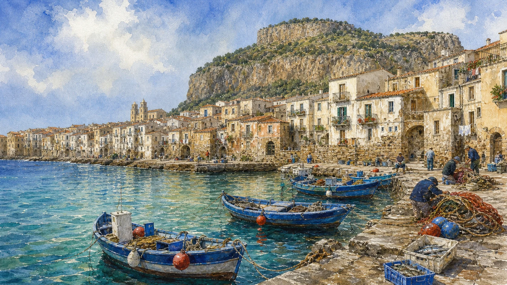
Documentary watercolour of Cefalu's old harbour with small blue fishing boats, nets, a low stone pier, dense lived houses and the limestone Rocca above
THE LIVED WATERFRONTSmall boats, nets and the low stone pier restore working memory to a harbour often reduced to a cinematic view.
18

A CINEMATIC WATERFRONT STILL CARRIES MEMORIES OF LANDING, SALE, REPAIR AND CIVIC REUSE

The Old Harbour and the Reopened Fish Market

Piazza Marina, pier and market connect maritime labour to a contemporary public space rather than an empty postcard bay.

Documentary watercolour of Cefalu's old harbour with small blue fishing boats, nets, a low stone pier, dense lived houses and the limestone Rocca above
THE LIVED WATERFRONT

The place today

Fishing boats still give the cove a working presence, but restaurants, beach use and photography now dominate many hours. Scenes associated with Cinema Paradiso add another layer of recognition. The best reading joins the pier to Porta Pescara, fish market and wall rather than treating each as an isolated photo point. Inaugurated in November 2025, the renewed structure combines stalls and public programming connected to local catch and gastronomy.

The historical chapter

Cefalù's protected landing enabled coastal exchange and local fishing without becoming a major deep-water port. Boats, catch, repair, storage and sale linked sea to household economy. Storms, silting and later harbour construction changed maritime use, while modern tourism transformed the same shore into a national and international image. The market embodied the transfer of catch from boat to town and was remembered as a symbol of Cefalù's productive past.

What to notice

  • Do not romanticise fishing as an unchanged costume; fleet, regulation, species and market channels have changed.
  • Support transparent local catch information rather than treating every seafood display as automatically Cefaludese.
Municipality of Cefalù · Piazza Marina and old pier
19

A PRIVATE COLLECTION BECAME PUBLIC EDUCATION AROUND A PORTRAIT WHOSE SITTER REMAINS UNKNOWN

Mandralisca's Civic Museum and Antonello's Unknown Man

Founder, school and painting explain why one famous face belongs inside a wider civic project rather than a celebrity anecdote.

Documentary watercolour of Cefalu's old harbour with small blue fishing boats, nets, a low stone pier, dense lived houses and the limestone Rocca above
THE LIVED WATERFRONT

The place today

The interdisciplinary museum remains in Via Mandralisca and combines art, archaeology, natural history, books, coins and furnishings. Its scale invites a slow visit rather than a dash to Antonello's portrait. The library continues the founder's public-education purpose and preserves around seven thousand volumes along with nautical charts and chapter documents. The portrait rewards direct viewing because scale, glazing, light and the sitter's concentrated gaze differ from reproductions.

The historical chapter

Baron Enrico Pirajno di Mandralisca, born in 1809, collected, excavated, studied natural history and entered public life. His 1853 will provided for a high school and evening school supported by his property and cabinet. The institution began functioning after the death of his widow, making the museum the material residue of a broader educational project. Antonello's mastery of oil technique and psychological presence placed the work among the defining portraits of the Italian fifteenth century.

What to notice

  • Use the founder's full civic programme; he was not merely a wealthy collector of curiosities.
  • Check photography rules and allow others space in the small gallery.
Municipality of Cefalù · Mandralisca Museum and foundation
20

ARCHAEOLOGY AND NATURAL HISTORY PREVENT THE MUSEUM FROM COLLAPSING INTO ONE MASTERPIECE

Krater, Shells, Coins and Birds: Mandralisca's Other Worlds

A tuna-seller scene and scientific collections reveal nineteenth-century systems of collecting whose provenances and classifications require context.

Documentary watercolour of Cefalu's old harbour with small blue fishing boats, nets, a low stone pier, dense lived houses and the limestone Rocca above
THE LIVED WATERFRONT

The place today

A Siceliot red-figure krater known for its tuna-selling scene connects ancient commerce to Cefalù's maritime identity without proving it was made for this town. Finds from local and Lipari excavations, coins grouped by mint, shells from Sicily and abroad, and approximately one hundred birds reveal nineteenth-century practices of collection and classification.

The historical chapter

Mandralisca excavated in the southern Cefalù necropolis and at Lipari, exchanged specimens with researchers and assembled collections before modern archaeological and biodiversity standards. Their scholarly value coexists with questions about provenance, old excavation methods and changing taxonomy. The objects document both ancient/natural worlds and the history of knowledge.

What to notice

  • Do not label every archaeological object as found in Cefalù; the collection includes Lipari and other provenances.
  • Historic natural-history specimens should be read within the ethics and methods of nineteenth-century collecting.
Municipality of Cefalù · Mandralisca archaeology and natural history
21

ANCIENT WALLS, BYZANTINE STRUCTURES AND MEDIEVAL CASTLE OCCUPY DIFFERENT HEIGHTS OF ONE DEMANDING ASCENT

The Rocca's Three Defensive Systems

The summit route returns to the stone headland as an archaeological landscape whose exposure and access require planning.

Documentary watercolour of Cefalu's old harbour with small blue fishing boats, nets, a low stone pier, dense lived houses and the limestone Rocca above
THE LIVED WATERFRONT

The place today

The official route rises past the megalithic building, large cistern, settlement remains, crenellated walls and summit ruins. Heat, wind, steep stone and limited shade make the climb a planned excursion. Footwear rules and seasonal last-entry times are safety measures, not minor administrative details.

The historical chapter

Municipal archaeology distinguishes a high-medieval fortification around 130–135 metres, a Norman phase lower on the pass and Renaissance interventions dated 1553–1554. The summit castle belongs principally to the twelfth and thirteenth centuries and was further fortified. A 1238 document records Frederick II's assertion of royal control over the stronghold.

What to notice

  • Do not assign the entire wall circuit to the Normans or call the summit ruin purely 'Frederician'.
  • Check the official Rocca page on the day of ascent; fire risk, weather and maintenance can alter access.
Municipality of Cefalù · Rocca fortifications, castle and safety
22

ONE MUNICIPAL COAST CONTAINS ROCKY COVES, URBAN SAND AND LONGER OPEN BEACHES

Kalura, Caldura, Lungomare and Capo Playa

Cefalu's sea cannot be reduced to the old harbour: several coastal geographies differ in access, exposure and urban pressure.

Documentary watercolour of Cefalu's old harbour with small blue fishing boats, nets, a low stone pier, dense lived houses and the limestone Rocca above
THE LIVED WATERFRONT

The place today

Caldura and Kalura sit among rock, vegetation and deeper water; the lungomare borders the accessible urban beach; Capo Playa and Salinelle continue west beyond the centre. Ports, railway, roads, seasonal facilities and private concessions interrupt continuity. Sea conditions, currents and beach services vary, so a single generic beach recommendation is inadequate.

The historical chapter

Coastal form shaped landing, fishing, defence and later tourism. The old walled city occupied the most protected relationship between headland and bay, while modern transport and accommodation expanded along the western sands. Cliffs and habitats remain part of protected or sensitive landscapes, and erosion or development pressure can alter access over time.

What to notice

  • Choose a beach by exposure, mobility, transport and sea conditions rather than distance alone.
  • Do not promise untouched nature: the coast combines protected habitat, infrastructure, concessions and densely used urban shore.
Municipality of Cefalù · beaches and coastal territory
23

VILLAGE, SANCTUARY AND MOUNTAINS EXTEND CEFALU FAR BEYOND ITS FAMOUS BAY

Sant'Ambrogio, Gibilmanna and the Madonie

The final route moves from coast to interior without absorbing these distinct communities and protected landscapes into the old town.

Documentary watercolour of Cefalu's old harbour with small blue fishing boats, nets, a low stone pier, dense lived houses and the limestone Rocca above
THE LIVED WATERFRONT

The place today

Sant'Ambrogio, about six kilometres east, preserves steep paved lanes and sea views from a seventeenth-century agricultural settlement. Serra Guarneri protects evergreen oak woodland. Fifteen kilometres inland, the Gibilmanna sanctuary stands around 800 metres high among Madonie woods and remains a pilgrimage centre for Mary, patroness of the diocese.

The historical chapter

Tradition connects Gibilmanna's first religious foundation to Gregory the Great, while the present sanctuary and marble Virgin attributed to Antonello Gagini belong to later histories. Old trazzere and pilgrimage routes linked coast, farms, forest and sacred mountain. Natura 2000 recognises the Rocca and Boschi di Gibilmanna e Cefalù as distinct protected sites within the wider Madonie system.

What to notice

  • Treat the Gregorian foundation as tradition unless using a source that establishes the documentary sequence.
  • Sant'Ambrogio, Serra Guarneri and Gibilmanna are separate journeys; verify transport, trail and sanctuary access.
Municipality of Cefalù · Gibilmanna, Sant'Ambrogio and Serra Guarneri

The city through time

Ten dates that connect the headland, cathedral and living town

The dates orient a long urban history without pretending every phase has equal documentary or archaeological visibility.

  1. Caves preserve early human traces; a cistern later enclosed by the so-called Temple of Diana belongs to the Rocca's protohistoric water history.

  2. A fortified, Hellenised indigenous Kephaloidion develops behind large-block walls and a regular urban plan.

  3. Carthaginian alliance, Syracusan control and Roman conquest connect Cefalù to competing powers around Sicily.

  4. Byzantine insecurity favours settlement on the Rocca; Islamic conquest in 858 incorporates Gafludi into Muslim Sicily.

  5. Norman control is established; Roger II returns political and ecclesiastical weight to the lower town and founds the cathedral and diocese.

  6. Roger plans a royal mausoleum, the earliest mosaics are dated to 1148 and further sanctuary campaigns continue after his death.

  7. Frederick II transfers Cefalù's porphyry sarcophagi to Palermo; the facade develops and the cathedral is consecrated in 1267.

  8. The western portico, palatial transformations, wall repairs and Marchiafava Bastion add late-medieval and early-modern layers.

  9. Mandralisca's educational foundation, Grand Tour imagery, railway, coastal growth, modern tourism and postwar expansion reshape the city.

  10. UNESCO inscription, restoration, new visitor routes, the reopened fish market and the 2026 liturgical furnishings continue the city's active history.

Before your visit

Practical information,
without turning it into promises

01

Give the cathedral more than one layer of time

Separate free worship access from ticketed towers, roofs, mosaics, museum, chapel, cloister and Osterio Magno. A careful exterior and nave visit plus one managed route normally needs a generous half-day, and liturgy always has priority.

02

Treat the Rocca as an archaeological mountain

Wear closed, grippy footwear, carry water, avoid peak heat and check the municipal page for last entry, fire risk and closures. The Temple of Diana, settlement, cisterns, walls and castle deserve separate pauses rather than one summit race.

03

Walk the town as water, walls and work

Link Corso Ruggero to the Roman road, washhouse, Porta Pescara, old pier, fish market, Marchiafava Bastion and Mandralisca. Early morning or late afternoon makes the compact streets easier to read without treating residents as scenery.

04

Plan the wider territory as additional journeys

Caldura, Sant'Ambrogio, Serra Guarneri and Gibilmanna are not casual extensions of the cathedral visit. Check transport, trail, sanctuary and sea conditions, and allow the Madonie landscape to remain a distinct chapter of Cefalù.

Sources

This guide cross-checks the UNESCO World Heritage Centre and Italian National Commission, the official Cathedral visitor service, the Diocese of Cefalù, the Municipality's institutional and digital heritage platforms, municipal planning documents, the Mandralisca Museum record, the Sicilian Region and the Madonie Park. It separates foundation legend from political history, indigenous Hellenisation from automatic Greek-colony language, the popular name Temple of Diana from an uncertain function, Norman foundation from later completion, Byzantine mosaic from a generic golden style, Islamic-derived craft from fantasy reconstruction, royal intention from the lost mausoleum, historic fishing from staged nostalgia, the old town from the wider municipal and protected territory, and current access from permanent promises.

The hero is an original documentary illustration, not an official photograph, a reconstruction of Roger II's court or an image of the cathedral interior. Cathedral worship, ticketed routes, towers, roofs, mosaics, museum, cloister and Osterio Magno can have separate conditions. Rocca hours, footwear rules, fire closures, coastal paths, sea conditions, fish-market programming, museum access, sanctuary services, woodland trails and transport can change; consult the linked institutions shortly before travelling. The storm vow, Temple of Diana function, precise workshop identities, Osterio Magno royal association, early Gibilmanna foundation and several local etymologies remain qualified where evidence does not permit certainty.