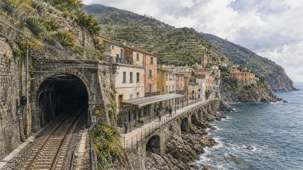
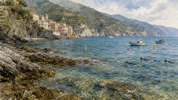
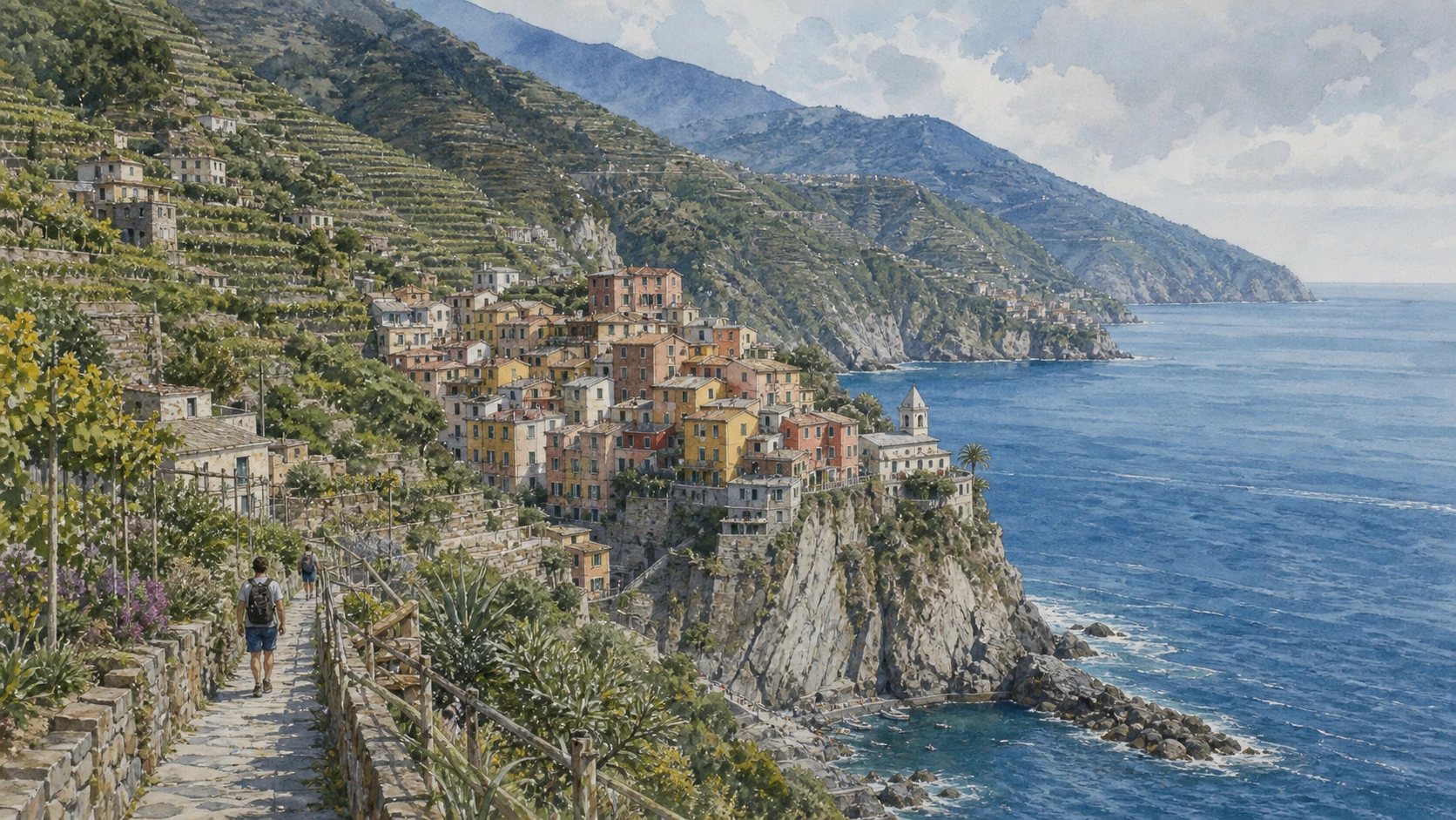
Original documentary watercolour panorama for Cinque Terre: Complete Guide, with accurate Ligurian architecture, landscape and lived context

Liguria Guide 02 · Five villages, dry-stone terraces, railway mobility, protected coast and living agriculture

Cinque Terre
beyond the view

A multi-day guide that treats Monterosso, Vernazza, Corniglia, Manarola and Riomaggiore as distinct settlements within a fragile worked landscape.

Plan the route
Cinque Terre · Liguria10 chapters · one complete route

Why this route must be read in layers

The Cinque Terre are five inhabited villages supported by terraces, paths, railways and continual maintenance.

UNESCO recognises an evolved cultural landscape shaped over centuries on steep and irregular ground. The dry-stone walls, drainage systems, vines and olive groves are not decoration around the villages; they are part of the property’s substance.

Each village has a different relation to water, slope and transport. Corniglia sits above the sea, Vernazza retains a compact harbour, Monterosso has the broadest coastal ground, and Manarola and Riomaggiore occupy narrow valleys.

Trails can close because of landslides, weather or maintenance. Rail and boat services are also variable. A responsible itinerary accepts limits and does not treat every famous path as permanently available.

Use several days, travel outside peak pressure when possible, and let official trail notices determine the route rather than social-media expectations.

The route

Plan your visit

Move west to east or in shorter rail-linked pairs, allowing time in cultivated slopes and sanctuaries while keeping resident circulation and emergency access clear.

Early morning

Monterosso old town · Fegina and the railway coast · Vernazza

Move in the documented order: Monterosso old town: church, convent and compact lanes; then Fegina and the railway coast: modern access on constrained ground; then Vernazza: harbour, church and defensive ridge. Recheck live access and transport before entering a controlled site.

Late morning

Corniglia · Manarola · Riomaggiore

Move in the documented order: Corniglia: a village above the sea; then Manarola: valley settlement and working marina; then Riomaggiore: two steep sides of one valley. Recheck live access and transport before entering a controlled site.

Afternoon

Dry-stone terraces · The sanctuary circuit · The coastal railway

Move in the documented order: Dry-stone terraces: infrastructure of cultivation; then The sanctuary circuit: villages connected above; then The coastal railway: access, engineering and dependence. Recheck live access and transport before entering a controlled site.

Late afternoon

Marine protected area

Move in the documented order: Marine protected area: habitat beyond the village edge. Recheck live access and transport before entering a controlled site.

Ten chapters

Explore the places

The order follows terrain, institutions and present-day movement. Use the index to return to a chapter without reducing the route to isolated monuments.

  1. 01Monterosso old town: church, convent and compact lanes
  2. 02Fegina and the railway coast: modern access on constrained ground
  3. 03Vernazza: harbour, church and defensive ridge
  4. 04Corniglia: a village above the sea
  5. 05Manarola: valley settlement and working marina
  6. 06Riomaggiore: two steep sides of one valley
  7. 07Dry-stone terraces: infrastructure of cultivation
  8. 08The sanctuary circuit: villages connected above
  9. 09The coastal railway: access, engineering and dependence
  10. 10Marine protected area: habitat beyond the village edge
01

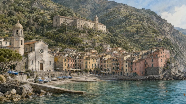
San Giovanni Battista, the Oratorio and Capuchin hill show a historic nucleus distinct from the resort shore.

Monterosso old town: church, convent and compact lanes

San Giovanni Battista, the Oratorio and Capuchin hill show a historic nucleus distinct from the resort shore. The site becomes clearer when its surviving fabric, later alterations and present use are read together.

Today

The area is inhabited and worked, not staged for visitors. Keep doorways, pavements, cycle lanes and deliveries clear, ask before photographing people and use current municipal mobility information.

History

The settlement developed around medieval religious and defensive structures before railway and tourism expanded the coastal plain toward Fegina.

How to read this place

Begin with striped church façade. Then compare lane pattern behind the waterfront with convent position above the village; the differences are evidence, not visual noise.

What to notice

  • striped church façade
  • lane pattern behind the waterfront
  • convent position above the village
Cinque Terre National Park · Official site
Original documentary watercolour of Monterosso old town: church, convent and compact lanes in Cinque Terre · Liguria, showing accurate architecture, landscape, people and present-day use
Monterosso old town: church, convent and compact lanesOriginal Merlintravel documentary watercolour · 2026
02

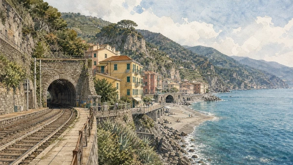
Beach, station, road tunnel and twentieth-century buildings reveal how modern mobility reshaped the western village.

Fegina and the railway coast: modern access on constrained ground

Beach, station, road tunnel and twentieth-century buildings reveal how modern mobility reshaped the western village. The site becomes clearer when its surviving fabric, later alterations and present use are read together.

Today

Timetables, engineering works, capacity and accessibility arrangements can change. Check the operator on the day, leave a realistic connection margin and never enter tracks, depots or restricted infrastructure.

History

The Genoa–La Spezia railway and later tourism produced new coastal space and connections while separating parts of Monterosso through infrastructure.

How to read this place

Begin with railway against the shore. Then compare tunnel connections with differences between old town and fegina; the differences are evidence, not visual noise.

What to notice

  • railway against the shore
  • tunnel connections
  • differences between old town and Fegina
Cinque Terre National Park · Official site
Original documentary watercolour of Fegina and the railway coast: modern access on constrained ground in Cinque Terre · Liguria, showing accurate architecture, landscape, people and present-day use
Fegina and the railway coast: modern access on constrained groundOriginal Merlintravel documentary watercolour · 2026
03

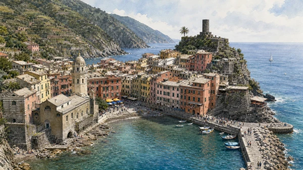
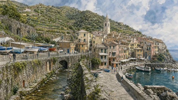
A small natural landing, Santa Margherita d’Antiochia and Doria Castle organise one of the coast’s most compressed settlements.

Vernazza: harbour, church and defensive ridge

A small natural landing, Santa Margherita d’Antiochia and Doria Castle organise one of the coast’s most compressed settlements. The site becomes clearer when its surviving fabric, later alterations and present use are read together.

Today

The area is inhabited and worked, not staged for visitors. Keep doorways, pavements, cycle lanes and deliveries clear, ask before photographing people and use current municipal mobility information.

History

Medieval harbour activity and Genoese defence shaped the village; floods and slope instability remain essential to understanding its vulnerability.

How to read this place

Begin with harbour geometry. Then compare church built against the water with tower and terraced slopes above; the differences are evidence, not visual noise.

What to notice

  • harbour geometry
  • church built against the water
  • tower and terraced slopes above
Cinque Terre National Park · Official site
Original documentary watercolour of Vernazza: harbour, church and defensive ridge in Cinque Terre · Liguria, showing accurate architecture, landscape, people and present-day use
Vernazza: harbour, church and defensive ridgeOriginal Merlintravel documentary watercolour · 2026
04

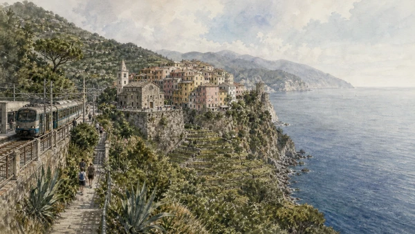
Streets, church and cultivated terraces occupy a promontory reached from the station by a long ascent.

Corniglia: a village above the sea

Streets, church and cultivated terraces occupy a promontory reached from the station by a long ascent. The site becomes clearer when its surviving fabric, later alterations and present use are read together.

Today

The area is inhabited and worked, not staged for visitors. Keep doorways, pavements, cycle lanes and deliveries clear, ask before photographing people and use current municipal mobility information.

History

Unlike the other villages, Corniglia lacks a conventional harbour; its agricultural position and steep access produced a distinct settlement form.

How to read this place

Begin with distance between station and village. Then compare san pietro’s stone façade with terraces descending toward the water; the differences are evidence, not visual noise.

What to notice

  • distance between station and village
  • San Pietro’s stone façade
  • terraces descending toward the water
Cinque Terre National Park · Official site
Original documentary watercolour of Corniglia: a village above the sea in Cinque Terre · Liguria, showing accurate architecture, landscape, people and present-day use
Corniglia: a village above the seaOriginal Merlintravel documentary watercolour · 2026
05

Houses, boats, drainage and terraced slopes converge at a narrow rocky inlet.

Manarola: valley settlement and working marina

Houses, boats, drainage and terraced slopes converge at a narrow rocky inlet. The site becomes clearer when its surviving fabric, later alterations and present use are read together.

Today

The area is inhabited and worked, not staged for visitors. Keep doorways, pavements, cycle lanes and deliveries clear, ask before photographing people and use current municipal mobility information.

History

The village developed along a watercourse and route inland; modern rail access and tourism altered movement without removing the constraints of the valley.

How to read this place

Begin with covered stream alignment. Then compare boat storage with vineyard walls immediately above houses; the differences are evidence, not visual noise.

What to notice

  • covered stream alignment
  • boat storage
  • vineyard walls immediately above houses
Cinque Terre National Park · Official site
Original documentary watercolour of Manarola: valley settlement and working marina in Cinque Terre · Liguria, showing accurate architecture, landscape, people and present-day use
Manarola: valley settlement and working marinaOriginal Merlintravel documentary watercolour · 2026
06

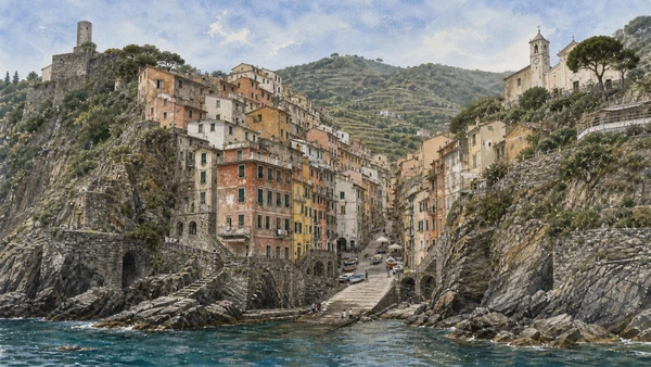
The marina, main street, church and castle occupy different levels joined by stairs and tunnelled transport.

Riomaggiore: two steep sides of one valley

The marina, main street, church and castle occupy different levels joined by stairs and tunnelled transport. The site becomes clearer when its surviving fabric, later alterations and present use are read together.

Today

The area is inhabited and worked, not staged for visitors. Keep doorways, pavements, cycle lanes and deliveries clear, ask before photographing people and use current municipal mobility information.

History

Medieval settlement expanded along the Rio Maggiore; railway works and later visitor infrastructure changed the lower village and its links to Manarola.

How to read this place

Begin with vertical street sections. Then compare harbour slipway with castle and church on opposite slopes; the differences are evidence, not visual noise.

What to notice

  • vertical street sections
  • harbour slipway
  • castle and church on opposite slopes
Cinque Terre National Park · Official site
Original documentary watercolour of Riomaggiore: two steep sides of one valley in Cinque Terre · Liguria, showing accurate architecture, landscape, people and present-day use
Riomaggiore: two steep sides of one valleyOriginal Merlintravel documentary watercolour · 2026
07

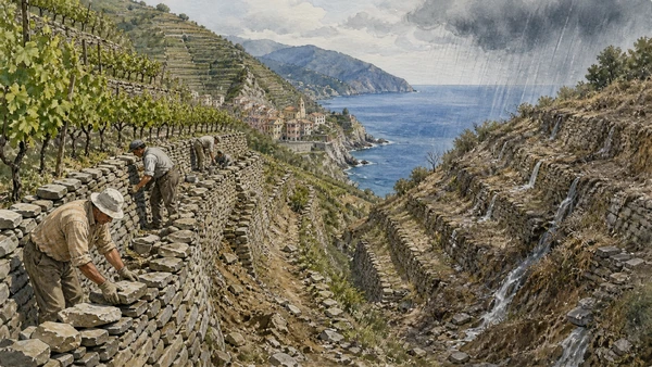
Walls, narrow plots, stairs and water management make viticulture possible on extreme gradients.

Dry-stone terraces: infrastructure of cultivation

Walls, narrow plots, stairs and water management make viticulture possible on extreme gradients. The site becomes clearer when its surviving fabric, later alterations and present use are read together.

Today

Weather, water levels, trail conditions and seasonal services can alter the route. Use official transport and park information, remain on authorised paths and do not enter farms, vineyards or private gardens without permission.

History

Generations of labour built and repaired terrace systems; abandonment, intense rain and economic pressure threaten both agriculture and slope stability.

How to read this place

Begin with wall construction without mortar. Then compare drainage paths with active vines compared with abandoned plots; the differences are evidence, not visual noise.

What to notice

  • wall construction without mortar
  • drainage paths
  • active vines compared with abandoned plots
UNESCO · Portovenere, Cinque Terre and the Islands
Original documentary watercolour of Dry-stone terraces: infrastructure of cultivation in Cinque Terre · Liguria, showing accurate architecture, landscape, people and present-day use
Dry-stone terraces: infrastructure of cultivationOriginal Merlintravel documentary watercolour · 2026
08

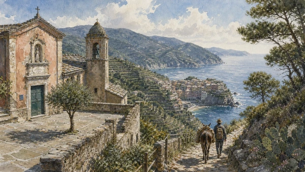
Soviore, Reggio, San Bernardino, Volastra and Montenero mark older routes at higher elevations.

The sanctuary circuit: villages connected above

Soviore, Reggio, San Bernardino, Volastra and Montenero mark older routes at higher elevations. The site becomes clearer when its surviving fabric, later alterations and present use are read together.

Today

This is an active religious place as well as a historic building. Services, ceremonies and conservation can interrupt tourist access; dress appropriately, remain quiet and never treat a booked visit as priority over worship.

History

Religious sites and mule paths connected dispersed communities before the coastal railway concentrated movement at sea level.

How to read this place

Begin with sanctuary forecourts. Then compare historic mule paths with views that reveal settlement and cultivated slope together; the differences are evidence, not visual noise.

What to notice

  • sanctuary forecourts
  • historic mule paths
  • views that reveal settlement and cultivated slope together
Cinque Terre National Park · Official site
Original documentary watercolour of The sanctuary circuit: villages connected above in Cinque Terre · Liguria, showing accurate architecture, landscape, people and present-day use
The sanctuary circuit: villages connected aboveOriginal Merlintravel documentary watercolour · 2026
09

Stations, tunnels and short exposed sections support residents and visitors on a coast with little road capacity.

The coastal railway: access, engineering and dependence

Stations, tunnels and short exposed sections support residents and visitors on a coast with little road capacity. The site becomes clearer when its surviving fabric, later alterations and present use are read together.

Today

Timetables, engineering works, capacity and accessibility arrangements can change. Check the operator on the day, leave a realistic connection margin and never enter tracks, depots or restricted infrastructure.

History

The railway built in the 1870s transformed isolation and markets; repeated engineering keeps it operating through unstable terrain.

How to read this place

Begin with tunnel portals. Then compare station platforms inside villages with how rail infrastructure occupies the narrow coast; the differences are evidence, not visual noise.

What to notice

  • tunnel portals
  • station platforms inside villages
  • how rail infrastructure occupies the narrow coast
Cinque Terre National Park · Official site
Original documentary watercolour of The coastal railway: access, engineering and dependence in Cinque Terre · Liguria, showing accurate architecture, landscape, people and present-day use
The coastal railway: access, engineering and dependenceOriginal Merlintravel documentary watercolour · 2026
10

Rocky coast, seagrass, fishing rules and boat access make the sea part of the protected system.

Marine protected area: habitat beyond the village edge

Rocky coast, seagrass, fishing rules and boat access make the sea part of the protected system. The site becomes clearer when its surviving fabric, later alterations and present use are read together.

Today

Weather, water levels, trail conditions and seasonal services can alter the route. Use official transport and park information, remain on authorised paths and do not enter farms, vineyards or private gardens without permission.

History

The marine protected area complements terrestrial park management and limits activities differently by zone; conditions and regulations require current checks.

How to read this place

Begin with rocky intertidal habitat. Then compare official zone markers with working boats and regulated visitor use; the differences are evidence, not visual noise.

What to notice

  • rocky intertidal habitat
  • official zone markers
  • working boats and regulated visitor use
Cinque Terre National Park · Official site
Original documentary watercolour of Marine protected area: habitat beyond the village edge in Cinque Terre · Liguria, showing accurate architecture, landscape, people and present-day use
Marine protected area: habitat beyond the village edgeOriginal Merlintravel documentary watercolour · 2026

Liguria through time

A short chronology

From prehistoric caves and Roman roads to the maritime republic, railways, port industry, protected landscapes and climate-sensitive travel.

  1. Caves and open sites in western Liguria preserve exceptionally long evidence of human occupation and environmental change.

  2. Ligurian communities occupy coastal and inland territories connected to Etruscan, Greek and Celtic exchange networks.

  3. Roman conquest and road building integrate ports, plains and passes into wider Mediterranean and Po-basin systems.

  4. Albingaunum, Genua, Luna and smaller centres develop through harbours, agriculture, Christianity and regional roads.

  5. Byzantine, Lombard and Carolingian powers reorganise settlements, bishoprics, monasteries and coastal defence.

  6. Genoa grows as a maritime commune while castles, churches and village territories consolidate along both Rivieras.

  7. Commercial expansion, crusading routes, colonies and banking enrich Genoa while factional conflict reshapes its government.

  8. Doge government, foreign interventions and powerful families contest control of the republic and its maritime system.

  9. The aristocratic Republic of Genoa develops the Rolli palace system, finance, naval infrastructure and territorial fortifications.

  10. Coastal defence, olive and wine landscapes, ports and inland routes continue to connect specialised local economies.

  11. French and Napoleonic rule ends the old republic before Liguria is incorporated into the Kingdom of Sardinia.

  12. Roads, railways, port works and unification transform mobility; the Genoa–La Spezia railway changes the eastern coast.

  13. Industry, emigration, resort culture, naval bases, war and resistance create sharply different modern landscapes.

  14. Port expansion, reconstruction, mass tourism, motorway infrastructure and deindustrialisation alter coast and cities.

  15. UNESCO recognition, park management, climate risk and overtourism intensify the need to maintain terraces, paths and living communities.

Before your visit

Practical information

01

Check the live page

Opening hours, reservation systems, restoration, exhibitions and transport can change. Recheck the linked official institution shortly before departure.

02

Separate worship and tourism

Churches and sanctuaries remain religious spaces. Services, funerals and community use take priority over visitor itineraries.

03

Plan real distances

Cinque Terre · Liguria combines dense urban routes with lakes, valleys and dispersed towns. Do not compress distant chapters into an unsafe or superficial day.

04

Keep thresholds open

Arcades, station halls, markets, courtyards, workshops and residential streets must continue to function while you observe or photograph them.

05

Use current mobility data

Check the responsible rail, navigation, bus, road or park operator on the day; replacement services and weather can change an otherwise sound route.

06

Read change honestly

Restoration, reconstruction, adaptive reuse and new development have all shaped the landscape visible today.

Method and sources

Sources and image credits

This guide uses official museum, ministry, municipal, transport, park and UNESCO documentation checked on 31 August 2026. It separates durable historical interpretation from access details that can change, distinguishes surviving fabric from restoration or reconstruction, and treats worship, port work, residence, farming, fishing and public movement as part of the evidence. Every chapter links its principal institutional source; tickets, closures, weather, sea conditions, trails and transport must always be verified again on the day of the visit.

All ten images are original Merlintravel editorial watercolours based on documented present-day conditions. They are illustrations, not substitutes for archaeological plans. Opening hours, tickets, accessible routes, temporary exhibitions and conservation work can change; consult the linked official pages shortly before visiting.