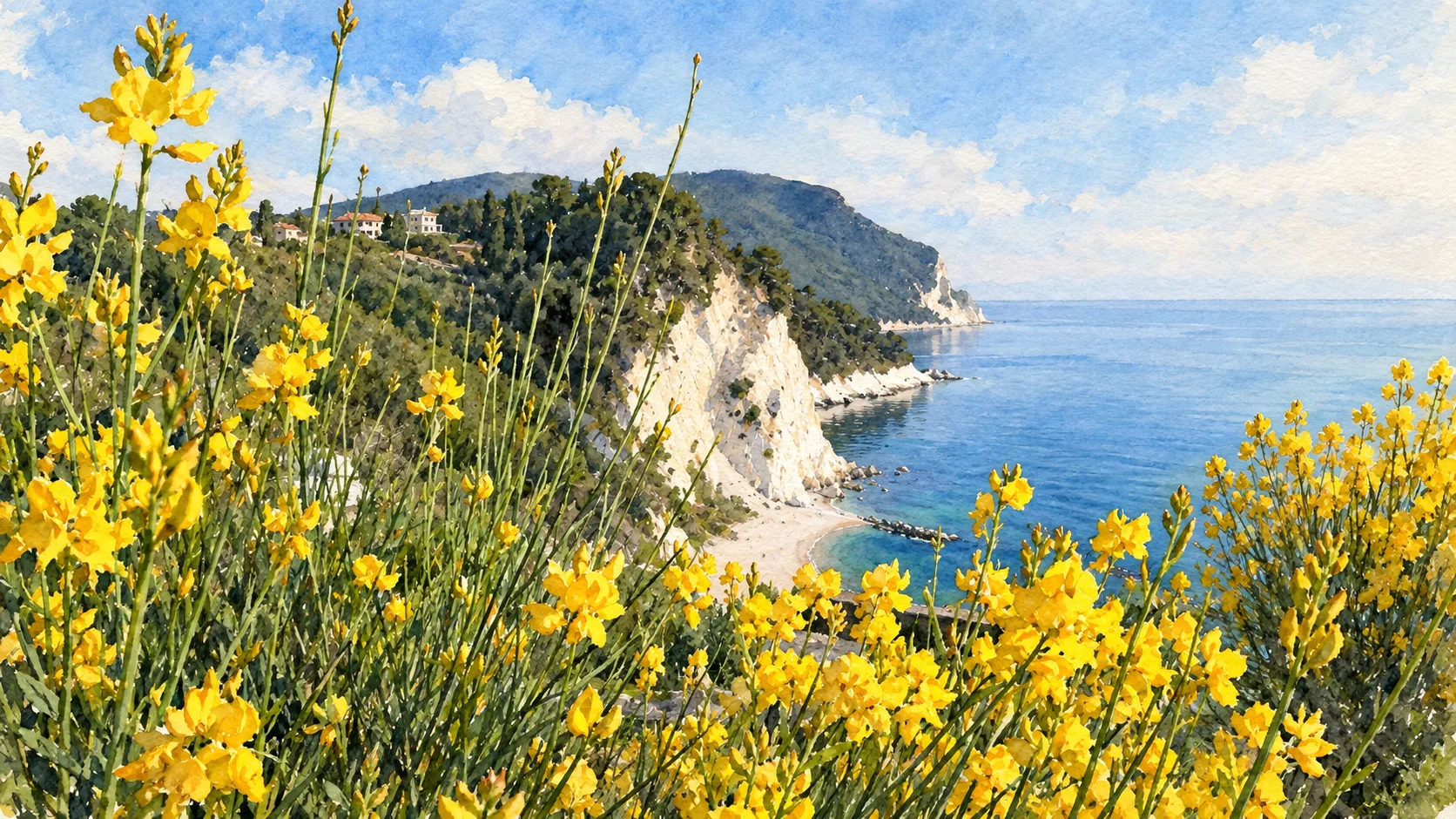
Watercolour: Conero and Sirolo establishing view

Marche · Guide 07

Conero
& Sirolo

A wooded promontory, white cliffs, monastic churches and Picene archaeology give this Adriatic coast a history deeper than its beaches.

Plan the route
Conero and Sirolo10 chapters · history, culture and landscape

Why this place matters

Look beyond the first glimpse of blue water.

The Conero changes the profile of the Adriatic coast. Here wooded slopes meet cliffs, small bays and settlements with ancient connections. Sirolo and Numana provide different bases for understanding the landscape; Portonovo belongs to another approach around the promontory. Plan beach access, cultural visits and trails separately. The park explicitly prohibits continuing down from Passo del Lupo to the Due Sorelle beach.

The guide separates documented history from suggestions for reading the site. Named buildings and landscape relationships follow institutional sources; the illustrations are editorial interpretations, not measured surveys or records of current access.

A wooded promontory, white cliffs, monastic churches and Picene archaeology give this Adriatic coast a history deeper than its beaches.

The route

Plan your visit

Combine the two town centres with the Antiquarium if opening allows. Give the upper mountain and Portonovo their own outing. Use current beach and trail arrangements; do not treat a cliff viewpoint as a pedestrian beach entrance.

Town walk

Sirolo and its outlooks

Combine the two town centres with the Antiquarium if opening allows. Give the upper mountain and Portonovo their own outing. Use current beach and trail arrangements; do not treat a cliff viewpoint as a pedestrian beach entrance.

Cultural visit

Numana and the Antiquarium

Suitable trail day

The wooded promontory and San Pietro

Separate bay visit

Portonovo, abbey and lagoons

Ten chapters

Explore the places

The chapters connect history and terrain. Mountain areas and outlying towns are separate options, not a single continuous walking route.

  1. 01Sirolo above the sea
  2. 02Numana: upper town and waterfront
  3. 03Antiquarium Statale di Numana
  4. 04The so-called Tomb of the Queen
  5. 05The wooded Monte Conero
  6. 06San Pietro al Conero
  7. 07Due Sorelle and the limit of the viewpoint
  8. 08Portonovo bay
  9. 09Santa Maria di Portonovo
  10. 10Portonovo’s coastal lagoons
01

The inhabited landscape

Sirolo above the sea

The compact centre and public outlooks reveal the coast from above. Streets, homes and the square remain a lived setting around the view.

Today

This remains an inhabited place. Use pedestrian routes, keep entrances clear and check municipal mobility notices for any restricted area.

History

Sirolo’s story extends beyond modern seaside tourism. Nearby Picene discoveries show a much older landscape of settlement and exchange.

How to read this place

Read the drop between the town and the beaches. A short distance on a map can include substantial steps or a restricted descent.

What to notice

  • Read the drop between the town and the beaches.
  • The relationship between the site and its surrounding route.
  • The distinction between surviving evidence and modern interpretation.
Regione Marche · Sirolo
Watercolour: Sirolo above the sea
Sirolo above the seaEditorial watercolour · AI-generated · 2026
02

The inhabited landscape

Numana: upper town and waterfront

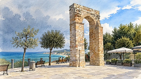
The relationship between the older upper settlement and the lower shore is central to understanding Numana. Give both their own pace and approach.

Today

This remains an inhabited place. Use pedestrian routes, keep entrances clear and check municipal mobility notices for any restricted area.

History

Ancient Numana participated in extensive exchange networks. The present town and its museum preserve different kinds of evidence for that history.

How to read this place

Distinguish a town walk from movement through the working harbour. Confirm the route back uphill before committing to a descent.

What to notice

  • Distinguish a town walk from movement through the working harbour.
  • The relationship between the site and its surrounding route.
  • The distinction between surviving evidence and modern interpretation.
Regione Marche · Conero and its inland towns
Watercolour: The surviving stone arch at Numana’s belvedere
Numana: upper town and waterfrontEditorial watercolour · AI-generated · 2026
03

Evidence and interpretation

Antiquarium Statale di Numana

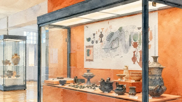
The museum turns a coastal visit into an encounter with ancient connections. Objects from local excavations help explain relationships with other Mediterranean communities.

Today

Check the institution’s current opening, booking arrangements and accessible route. Individual rooms, exhibitions and approaches may have separate conditions.

History

Established as a state museum in 1974, the Antiquarium collects material from Numana, Sirolo and nearby areas. Its collections cover more than one archaeological period.

How to read this place

Read findspots and dates carefully. Imported objects reveal contact and exchange, but should not automatically be taken as proof that their owners came from the place of manufacture.

What to notice

  • Read findspots and dates carefully.
  • The relationship between the site and its surrounding route.
  • The distinction between surviving evidence and modern interpretation.
Antiquarium Statale di Numana · museum
Watercolour: Antiquarium Statale di Numana
Antiquarium Statale di NumanaEditorial watercolour · AI-generated · 2026
04

Evidence and interpretation

The so-called Tomb of the Queen

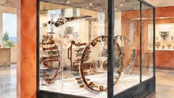
An exceptionally rich burial offers evidence for status, ritual and networks of exchange. Its modern name is memorable but needs explanation.

Today

Check the institution’s current opening, booking arrangements and accessible route. Individual rooms, exhibitions and approaches may have separate conditions.

History

Discovered at I Pini in Sirolo in 1989, the burial belonged to a high-ranking woman of the late sixth century BCE. The title “Queen” is conventional, not a securely documented personal identity.

How to read this place

Distinguish original finds, restored elements and display reconstructions. The archaeological site and the museum presentation are separate destinations with separate access arrangements.

What to notice

  • Distinguish original finds, restored elements and display reconstructions.
  • The relationship between the site and its surrounding route.
  • The distinction between surviving evidence and modern interpretation.
Antiquarium Statale di Numana · Tomba della Regina
Watercolour: The so-called Tomb of the Queen
The so-called Tomb of the QueenEditorial watercolour · AI-generated · 2026
05

Terrain and access

The wooded Monte Conero

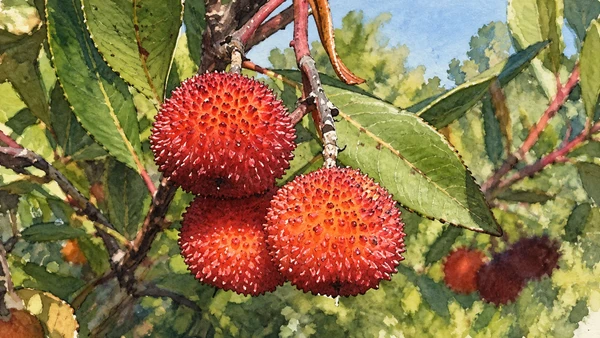
A woodland walk can offer shade and a close reading of vegetation without needing to reach a beach or cliff edge. The park’s numbered routes provide the starting framework.

Today

Conditions depend on the exact route and the day. Check the responsible operator, weather and local access notices; a viewpoint is not the same undertaking as a mountain traverse.

History

The protected promontory contains contrasting habitats shaped by geology, exposure and human use. Its wooded character differs from the open shore below.

How to read this place

Select an actual route appropriate to the day and your ability. Carry a current map and follow closures rather than joining trails from unrelated descriptions.

What to notice

  • Select an actual route appropriate to the day and your ability.
  • The relationship between the site and its surrounding route.
  • The distinction between surviving evidence and modern interpretation.
Conero Regional Park · official trail information
Watercolour: Strawberry-tree fruit and leaves, a botanical detail of Conero vegetation
The wooded Monte ConeroEditorial watercolour · AI-generated · 2026
06

Worship and memory

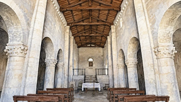
San Pietro al Conero

The church near the upper mountain gives a cultural focus to an inland outing. Its solid stonework belongs to a different atmosphere from the busy coastal squares.

Today

Worship and local religious life continue here. Visitor access may pause for services; consult the church or managing institution before planning an interior visit.

History

The Benedictine church’s history reaches back to the medieval period. Monastic presence is one of the human layers of the wooded promontory.

How to read this place

Look at the masonry and simple volumes before seeking an interior visit. Check current religious and visitor arrangements instead of assuming a permanently open church.

What to notice

  • Look at the masonry and simple volumes before seeking an interior visit.
  • The relationship between the site and its surrounding route.
  • The distinction between surviving evidence and modern interpretation.
Regione Marche · Sirolo
Watercolour: Stone nave and timber roof of San Pietro al Conero
San Pietro al ConeroEditorial watercolour · AI-generated · 2026
07

Terrain and access

Due Sorelle and the limit of the viewpoint

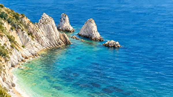
The two pale offshore rocks give the bay its name. Their familiar image should never obscure the practical distinction between seeing the beach and reaching it.

Today

Do not continue down from Passo del Lupo to the Due Sorelle beach: the park explicitly prohibits that descent. Check the current status of the approach and any sea-access service separately.

History

The park’s trail information explicitly prohibits the continuation from Passo del Lupo down to the Due Sorelle beach. Older walking accounts are not evidence of permission.

How to read this place

Use only the currently authorised part of a viewpoint route. For a sea visit, consult the responsible operator and current coastal conditions; do not attempt the prohibited descent.

What to notice

  • Use only the currently authorised part of a viewpoint route.
  • The relationship between the site and its surrounding route.
  • The distinction between surviving evidence and modern interpretation.
Conero Regional Park · official trail information
Watercolour: Due Sorelle and the limit of the viewpoint
Due Sorelle and the limit of the viewpointEditorial watercolour · AI-generated · 2026
08

The inhabited landscape

Portonovo bay

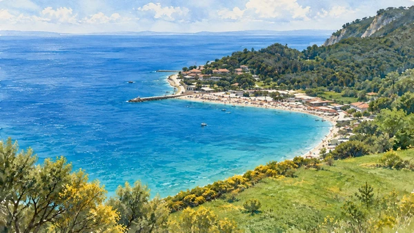
The bay offers another approach to the promontory, with pebbles, wooded slopes and buildings close to the shore. Its access arrangements can differ sharply by season.

Today

This remains an inhabited place. Use pedestrian routes, keep entrances clear and check municipal mobility notices for any restricted area.

History

Fishing, religious life, coastal defence and later tourism all form part of Portonovo’s history. The bay is more than a single beach facility.

How to read this place

Confirm transport and parking arrangements before arrival. Respect working premises and use signed public shore routes.

What to notice

  • Confirm transport and parking arrangements before arrival.
  • The relationship between the site and its surrounding route.
  • The distinction between surviving evidence and modern interpretation.
Conero Regional Park · current visitor notices
Watercolour: Portonovo bay
Portonovo bayEditorial watercolour · AI-generated · 2026
09

Worship and memory

Santa Maria di Portonovo

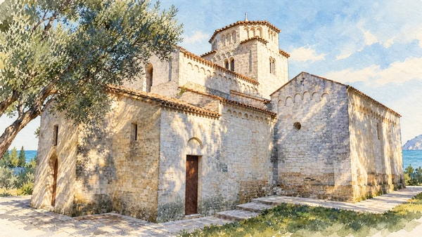
The small Romanesque church sits close to the sea beneath the wooded promontory. Its architectural character is especially clear when read with that setting.

Today

Worship and local religious life continue here. Visitor access may pause for services; consult the church or managing institution before planning an interior visit.

History

The medieval abbey church is one of the important religious monuments of the Conero coast. Its compact form differs from the larger urban churches of Ancona.

How to read this place

Compare the small apses, roof levels and pale masonry. Opening is managed separately from beach access, so verify the intended visit with the church’s custodian.

What to notice

  • Compare the small apses, roof levels and pale masonry.
  • The relationship between the site and its surrounding route.
  • The distinction between surviving evidence and modern interpretation.
Regione Marche · Conero and its inland towns
Watercolour: Santa Maria di Portonovo
Santa Maria di PortonovoEditorial watercolour · AI-generated · 2026
10

Terrain and access

Portonovo’s coastal lagoons

The small bodies of water behind the shore reveal a habitat that a beach-only visit can easily miss. Their quiet edges deserve a slower and less intrusive approach.

Today

Conditions depend on the exact route and the day. Check the responsible operator, weather and local access notices; a viewpoint is not the same undertaking as a mountain traverse.

History

The lagoons form part of the protected coastal landscape. Their ecological role differs from the sea only a short distance away.

How to read this place

Stay on permitted paths and avoid disturbing vegetation or wildlife. Treat these as sensitive habitats, not alternative bathing pools.

What to notice

  • Stay on permitted paths and avoid disturbing vegetation or wildlife.
  • The relationship between the site and its surrounding route.
  • The distinction between surviving evidence and modern interpretation.
Conero Regional Park · current visitor notices
Watercolour: Portonovo’s coastal lagoons
Portonovo’s coastal lagoonsEditorial watercolour · AI-generated · 2026

The territory through time

A short chronology

A concise chronology linking the documented sites to the wider story.

  1. Archaeological finds preserve evidence older than the coastal towns seen today.

  2. The high-status burial conventionally called the Queen’s Tomb is created.

  3. Numana and the surrounding area participate in Mediterranean networks.

  4. San Pietro and Santa Maria di Portonovo express monastic presence on the promontory.

  5. Fishing, settlement and travel continue to shape the shore.

  6. The Antiquarium is established as a state museum.

  7. The Queen’s Tomb is discovered at I Pini in Sirolo.

  8. Park management distinguishes protected habitats, authorised routes and prohibited descents.

Before your visit

Practical information

01

Plan separate days

Choose a manageable set of visits and allow for transport, booked entries and the return journey.

02

Use the exact place name

The Marche contain separate valleys, towns and coastal approaches. Confirm the precise locality and route rather than treating nearby names as one destination.

03

Check the institution

Opening hours, tickets, exhibitions and religious access change. Use the linked managing institution shortly before visiting.

04

Check the actual terrain

A town walk, gorge walkway, lift arrival and mountain path have different demands. Use current route information, weather and closures for the option you choose.

05

Arrange accessible visits

Historic interiors and mountain approaches can include steps, gradients or uneven surfaces. Ask about the specific route instead of assuming an entire destination is step-free.

06

Respect work and residence

Farms, workshops, churches and historic streets remain in use. Follow signs, keep entrances clear and ask permission before entering private spaces.

Method and sources

Sources and image credits

Prepared on 9 September 2026 from the institutional sources linked below. Historical claims are separated from editorial observations and itinerary suggestions. Older institutional brochures are used for stable cultural context, never as current timetables. Prices, transport schedules, trail status and admission are deliberately left to the responsible operators. Illustrations are not photographs, measured reconstructions or evidence of current conditions.

The eleven images are AI-generated editorial watercolours guided by photographic references. They interpret named places and are not photographs or substitutes for measured plans. Opening hours, tickets, accessible routes, temporary exhibitions and conservation work can change; consult the linked official pages shortly before visiting.

Illustration references and credits
  • Opening image — reference: www.parcodelconero.org. Transformed into an AI-generated watercolour.
  • Antiquarium Statale di Numana — reference: antiquariumnumana.cultura.gov.it. Transformed into an AI-generated watercolour.
  • The so-called Tomb of the Queen — reference: antiquariumnumana.cultura.gov.it. Transformed into an AI-generated watercolour.
  • Portonovo bay — reference: backoffice.turismo.marche.it. Transformed into an AI-generated watercolour.
  • Santa Maria di Portonovo — reference: anconatourism.it. Transformed into an AI-generated watercolour.
  • Sirolo above the sea — reference: Alessandro Vecchi · CC BY-SA 3.0; this watercolour adaptation is offered under the same licence. Transformed into an AI-generated watercolour.
  • Numana: upper town and waterfront — reference: Beta16 · CC BY-SA 2.5 it; this watercolour adaptation is offered under the same licence. Transformed into an AI-generated watercolour.
  • The wooded Monte Conero — reference: Lucarelli · CC BY-SA 3.0; this watercolour adaptation is offered under the same licence. Transformed into an AI-generated watercolour.
  • San Pietro al Conero — reference: Parsifall · CC BY-SA 4.0; this watercolour adaptation is offered under the same licence. Transformed into an AI-generated watercolour.
  • Portonovo’s coastal lagoons — reference: Enrico Matteucci · CC BY 2.0; this watercolour adaptation is offered under the same licence. Transformed into an AI-generated watercolour.
  • Due Sorelle and the limit of the viewpoint — reference: backoffice.turismo.marche.it. Transformed into an AI-generated watercolour.