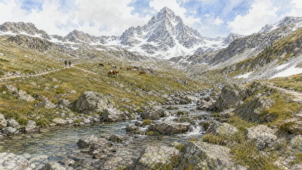
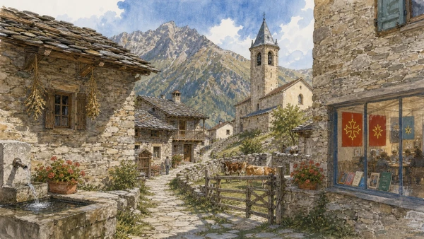
Original documentary watercolour panorama for Cuneo, Saluzzo and the Occitan Valleys: Complete Guide, with accurate Piedmont architecture, landscape and lived context

Piedmont Guide 07 · Planned plateau city, marquisate capital, abbey, court estates, Monviso and minority-language valleys

Cuneo, Saluzzo
& the Occitan Valleys

A multi-day guide from Cuneo’s river-bound plateau and arcaded civic centre to the former Marquisate of Saluzzo, Manta, Staffarda and Racconigi, then west through Monviso, Po headwaters and Occitan valleys.

Plan the route
Cuneo, Saluzzo and the Occitan valleys · Piedmont10 chapters · one complete route

Why this route must be read in layers

South-western Piedmont joins urban planning, a former territorial state, court agriculture and Alpine communities. The valleys are not an empty outdoor extension: language, seasonal work, depopulation and cross-border routes shape every landscape.

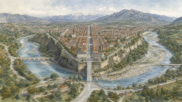
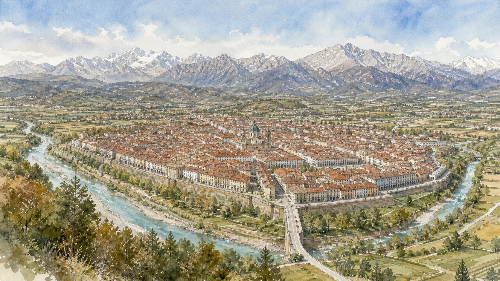
Cuneo was founded and rebuilt in a defensible position between the Gesso and Stura. Its broad modern avenues coexist with older arcades and the memory of a fortress mostly removed.

Saluzzo and Manta preserve the court culture of a marquisate distinct from Savoy. Staffarda and Racconigi show religious and royal institutions reorganising productive land.

Occitan culture spans several valleys and the national border. Language and architecture vary locally, while weather, avalanches and road conditions make high access a live safety question.

Use Cuneo and Saluzzo as separate bases, then choose one valley per day; verify park, road and refuge information and never use a cultural label as permission to enter private farms or hamlets.

The route

Plan your visit

Begin in Cuneo, move north-west through Saluzzo’s court territory, then follow the Po or one Occitan valley through official roads and marked paths rather than attempting a single sweeping loop.

Early morning

Cuneo between Gesso and Stura · Via Roma and Piazza Galimberti · Cuneo and the Resistance

Move in the documented order: Cuneo between Gesso and Stura: terrain before street plan; then Via Roma and Piazza Galimberti: arcades from old centre to modern city; then Cuneo and the Resistance: civic memory in streets and archives. Recheck live access and transport before entering a controlled site.

Late morning

Saluzzo’s upper town · La Castiglia and Casa Cavassa · Manta Castle

Move in the documented order: Saluzzo’s upper town: marquisate streets and civic ascent; then La Castiglia and Casa Cavassa: power, prison and museum reconstruction; then Manta Castle: courtly frescoes above agricultural land. Recheck live access and transport before entering a controlled site.

Afternoon

Staffarda Abbey · Racconigi Castle and estate · Monviso and the Po headwaters

Move in the documented order: Staffarda Abbey: Cistercian institution and productive plain; then Racconigi Castle and estate: royal residence, farms and wetland edge; then Monviso and the Po headwaters: national river, local mountain. Recheck live access and transport before entering a controlled site.

Late afternoon

Occitan valleys

Move in the documented order: Occitan valleys: language, villages and cross-border routes. Recheck live access and transport before entering a controlled site.

Ten chapters

Explore the places

The order follows terrain, institutions and present-day movement. Use the index to return to a chapter without reducing the route to isolated monuments.

  1. 01Cuneo between Gesso and Stura: terrain before street plan
  2. 02Via Roma and Piazza Galimberti: arcades from old centre to modern city
  3. 03Cuneo and the Resistance: civic memory in streets and archives
  4. 04Saluzzo’s upper town: marquisate streets and civic ascent
  5. 05La Castiglia and Casa Cavassa: power, prison and museum reconstruction
  6. 06Manta Castle: courtly frescoes above agricultural land
  7. 07Staffarda Abbey: Cistercian institution and productive plain
  8. 08Racconigi Castle and estate: royal residence, farms and wetland edge
  9. 09Monviso and the Po headwaters: national river, local mountain
  10. 10Occitan valleys: language, villages and cross-border routes
01

A triangular plateau at two river confluences explains the city’s defensive position, bridges and long central axis.

Cuneo between Gesso and Stura: terrain before street plan

A triangular plateau at two river confluences explains the city’s defensive position, bridges and long central axis. The site becomes clearer when its surviving fabric, later alterations and present use are read together.

Today

Weather, water levels, trail conditions and seasonal services can alter the route. Use official transport and park information, remain on authorised paths and do not enter farms, vineyards or private gardens without permission.

History

Cuneo was founded in the medieval period and repeatedly fortified and contested before modern expansion spread along the plateau after major defences were removed.

How to read this place

Begin with escarpments toward both rivers. Then compare bridges and approach roads with the central axis following the plateau; the differences are evidence, not visual noise.

What to notice

  • escarpments toward both rivers
  • bridges and approach roads
  • the central axis following the plateau
ATL del Cuneese · Official destination site
Original documentary watercolour of Cuneo between Gesso and Stura: terrain before street plan in Cuneo, Saluzzo and the Occitan valleys · Piedmont, showing accurate architecture, landscape, people and present-day use
Cuneo between Gesso and Stura: terrain before street planOriginal Merlintravel documentary watercolour · 2026
02

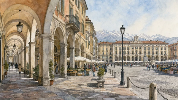
A long sheltered street opens into a vast nineteenth-century square connecting older civic fabric to planned expansion.

Via Roma and Piazza Galimberti: arcades from old centre to modern city

A long sheltered street opens into a vast nineteenth-century square connecting older civic fabric to planned expansion. The site becomes clearer when its surviving fabric, later alterations and present use are read together.

Today

The area is inhabited and worked, not staged for visitors. Keep doorways, pavements, cycle lanes and deliveries clear, ask before photographing people and use current municipal mobility information.

History

The medieval-commercial axis was remodelled over time, while Piazza Galimberti developed after demolition of fortifications as the centre of the new city.

How to read this place

Begin with arcade variations along via roma. Then compare change in scale at the square with market and civic use today; the differences are evidence, not visual noise.

What to notice

  • arcade variations along Via Roma
  • change in scale at the square
  • market and civic use today
ATL del Cuneese · Official destination site
Original documentary watercolour of Via Roma and Piazza Galimberti: arcades from old centre to modern city in Cuneo, Saluzzo and the Occitan valleys · Piedmont, showing accurate architecture, landscape, people and present-day use
Via Roma and Piazza Galimberti: arcades from old centre to modern cityOriginal Merlintravel documentary watercolour · 2026
03

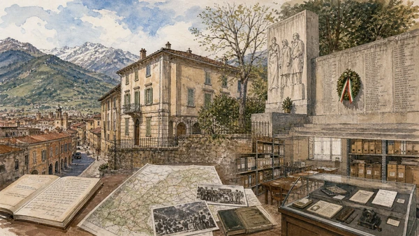
Monuments, Casa Galimberti and mountain approaches connect anti-Fascist organisation to later public commemoration.

Cuneo and the Resistance: civic memory in streets and archives

Monuments, Casa Galimberti and mountain approaches connect anti-Fascist organisation to later public commemoration. The site becomes clearer when its surviving fabric, later alterations and present use are read together.

Today

Opening, ticketing, room access and temporary displays can change. Check the institution’s official notice shortly before visiting, use the designated entrance and allow for security or conservation controls.

History

Cuneo and surrounding valleys were important in the 1943–1945 resistance; Duccio Galimberti became a central local figure but represents only part of a broad and divided history.

How to read this place

Begin with documented rooms and archival objects. Then compare memorial inscriptions and their dates with valley terrain connected to actual events; the differences are evidence, not visual noise.

What to notice

  • documented rooms and archival objects
  • memorial inscriptions and their dates
  • valley terrain connected to actual events
Museo Casa Galimberti · Comune di Cuneo
Original documentary watercolour of Cuneo and the Resistance: civic memory in streets and archives in Cuneo, Saluzzo and the Occitan valleys · Piedmont, showing accurate architecture, landscape, people and present-day use
Cuneo and the Resistance: civic memory in streets and archivesOriginal Merlintravel documentary watercolour · 2026
04

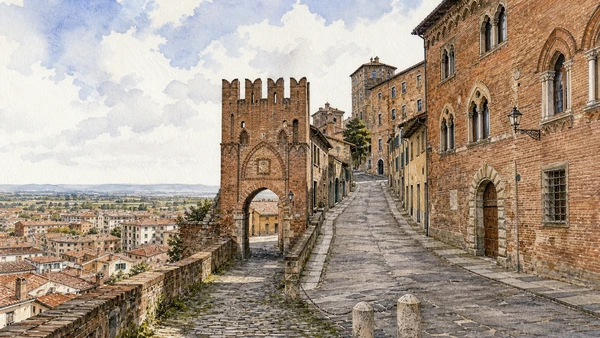
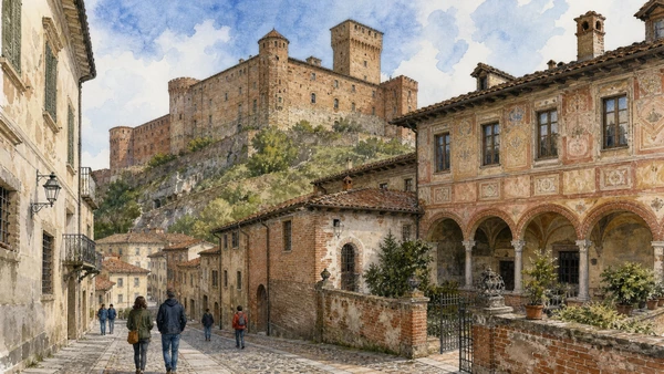
Porta Santa Maria, Salita al Castello and brick palaces preserve the topography of a small territorial capital.

Saluzzo’s upper town: marquisate streets and civic ascent

Porta Santa Maria, Salita al Castello and brick palaces preserve the topography of a small territorial capital. The site becomes clearer when its surviving fabric, later alterations and present use are read together.

Today

The area is inhabited and worked, not staged for visitors. Keep doorways, pavements, cycle lanes and deliveries clear, ask before photographing people and use current municipal mobility information.

History

The Marquisate of Saluzzo developed an autonomous court and urban institutions before French and Savoy incorporation altered government and defence.

How to read this place

Begin with street gradient toward castiglia. Then compare gothic and renaissance brick fronts with lower modern town visible beyond the walls; the differences are evidence, not visual noise.

What to notice

  • street gradient toward Castiglia
  • Gothic and Renaissance brick fronts
  • lower modern town visible beyond the walls
Comune di Saluzzo · Official tourism service
Original documentary watercolour of Saluzzo's upper town: marquisate streets and civic ascent in Cuneo, Saluzzo and the Occitan valleys · Piedmont, showing accurate architecture, landscape, people and present-day use
Saluzzo’s upper town: marquisate streets and civic ascentOriginal Merlintravel documentary watercolour · 2026
05

A former fortified residence later used as prison contrasts with a restored Renaissance house assembled as a civic museum.

La Castiglia and Casa Cavassa: power, prison and museum reconstruction

A former fortified residence later used as prison contrasts with a restored Renaissance house assembled as a civic museum. The site becomes clearer when its surviving fabric, later alterations and present use are read together.

Today

Opening, ticketing, room access and temporary displays can change. Check the institution’s official notice shortly before visiting, use the designated entrance and allow for security or conservation controls.

History

The marquises’ castle changed functions after annexation, while Casa Cavassa’s modern restoration selected and recomposed material to present court culture.

How to read this place

Begin with castle mass and institutional adaptations. Then compare casa cavassa’s decorated rooms with labels identifying original, moved and restored elements; the differences are evidence, not visual noise.

What to notice

  • castle mass and institutional adaptations
  • Casa Cavassa’s decorated rooms
  • labels identifying original, moved and restored elements
Comune di Saluzzo · Official tourism service
Original documentary watercolour of La Castiglia and Casa Cavassa: power, prison and museum reconstruction in Cuneo, Saluzzo and the Occitan valleys · Piedmont, showing accurate architecture, landscape, people and present-day use
La Castiglia and Casa Cavassa: power, prison and museum reconstructionOriginal Merlintravel documentary watercolour · 2026
06

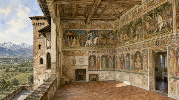
A fortified residence contains an exceptional painted hall whose heroes and heroines articulate late-medieval elite culture.

Manta Castle: courtly frescoes above agricultural land

A fortified residence contains an exceptional painted hall whose heroes and heroines articulate late-medieval elite culture. The site becomes clearer when its surviving fabric, later alterations and present use are read together.

Today

Opening, ticketing, room access and temporary displays can change. Check the institution’s official notice shortly before visiting, use the designated entrance and allow for security or conservation controls.

History

The Saluzzo della Manta transformed the castle in the fifteenth century, commissioning the celebrated fresco cycle before later domestic alteration and modern conservation.

How to read this place

Begin with hall paintings as a complete programme. Then compare castle phases around the room with view connecting residence to former territory; the differences are evidence, not visual noise.

What to notice

  • hall paintings as a complete programme
  • castle phases around the room
  • view connecting residence to former territory
FAI · Castello della Manta
Original documentary watercolour of Manta Castle: courtly frescoes above agricultural land in Cuneo, Saluzzo and the Occitan valleys · Piedmont, showing accurate architecture, landscape, people and present-day use
Manta Castle: courtly frescoes above agricultural landOriginal Merlintravel documentary watercolour · 2026
07

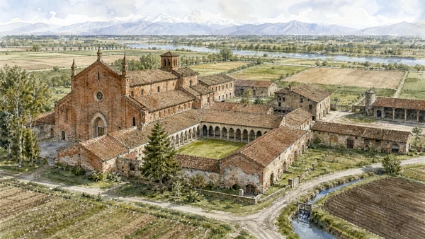
Church, cloister, farm buildings and settlement show religious life integrated with land management near the Po.

Staffarda Abbey: Cistercian institution and productive plain

Church, cloister, farm buildings and settlement show religious life integrated with land management near the Po. The site becomes clearer when its surviving fabric, later alterations and present use are read together.

Today

This is an active religious place as well as a historic building. Services, ceremonies and conservation can interrupt tourist access; dress appropriately, remain quiet and never treat a booked visit as priority over worship.

History

Founded in the twelfth century, the abbey accumulated agricultural functions and later suffered war damage and changing administration before Mauriziano stewardship.

How to read this place

Begin with brick church and cloister. Then compare farm courts and storage buildings with fields and water management around the complex; the differences are evidence, not visual noise.

What to notice

  • brick church and cloister
  • farm courts and storage buildings
  • fields and water management around the complex
Ordine Mauriziano · Staffarda Abbey
Original documentary watercolour of Staffarda Abbey: Cistercian institution and productive plain in Cuneo, Saluzzo and the Occitan valleys · Piedmont, showing accurate architecture, landscape, people and present-day use
Staffarda Abbey: Cistercian institution and productive plainOriginal Merlintravel documentary watercolour · 2026
08

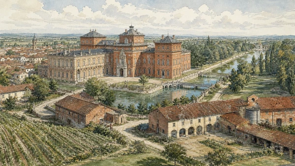
Palace, park, canals and agricultural buildings connect Savoy court use to an extensive managed landscape.

Racconigi Castle and estate: royal residence, farms and wetland edge

Palace, park, canals and agricultural buildings connect Savoy court use to an extensive managed landscape. The site becomes clearer when its surviving fabric, later alterations and present use are read together.

Today

Opening, ticketing, room access and temporary displays can change. Check the institution’s official notice shortly before visiting, use the designated entrance and allow for security or conservation controls.

History

An older fortress was transformed through Guarini, later architects and nineteenth-century royal campaigns; estate management continued beyond the ceremonial rooms.

How to read this place

Begin with palace fronts from different periods. Then compare park water and long views with service farms and town relationship; the differences are evidence, not visual noise.

What to notice

  • palace fronts from different periods
  • park water and long views
  • service farms and town relationship
Regional Directorate National Museums Piedmont · Racconigi
Original documentary watercolour of Racconigi Castle and estate: royal residence, farms and wetland edge in Cuneo, Saluzzo and the Occitan valleys · Piedmont, showing accurate architecture, landscape, people and present-day use
Racconigi Castle and estate: royal residence, farms and wetland edgeOriginal Merlintravel documentary watercolour · 2026
09

High valleys, springs, pasture and glacial landforms surround the source area of the Po beneath a distinctive pyramid peak.

Monviso and the Po headwaters: national river, local mountain

High valleys, springs, pasture and glacial landforms surround the source area of the Po beneath a distinctive pyramid peak. The site becomes clearer when its surviving fabric, later alterations and present use are read together.

Today

Weather, water levels, trail conditions and seasonal services can alter the route. Use official transport and park information, remain on authorised paths and do not enter farms, vineyards or private gardens without permission.

History

Routes across the Cottian Alps long supported pastoral and transalpine movement; modern park protection and climate change alter water, habitat and safe access.

How to read this place

Begin with headwater channels rather than symbolic marker alone. Then compare pasture and geological structure with snow and trail conditions verified live; the differences are evidence, not visual noise.

What to notice

  • headwater channels rather than symbolic marker alone
  • pasture and geological structure
  • snow and trail conditions verified live
Parco del Monviso · Official site
Original documentary watercolour of Monviso and the Po headwaters: national river, local mountain in Cuneo, Saluzzo and the Occitan valleys · Piedmont, showing accurate architecture, landscape, people and present-day use
Monviso and the Po headwaters: national river, local mountainOriginal Merlintravel documentary watercolour · 2026
10

Stone houses, churches, paths and cultural institutions preserve varied local forms across Maira, Varaita, Grana and other valleys.

Occitan valleys: language, villages and cross-border routes

Stone houses, churches, paths and cultural institutions preserve varied local forms across Maira, Varaita, Grana and other valleys. The site becomes clearer when its surviving fabric, later alterations and present use are read together.

Today

The area is inhabited and worked, not staged for visitors. Keep doorways, pavements, cycle lanes and deliveries clear, ask before photographing people and use current municipal mobility information.

History

Occitan speech and traditions developed within a transalpine cultural area, then faced state borders, schooling, outmigration and selective revival; no single village represents the whole.

How to read this place

Begin with local building details tied to altitude. Then compare language used in signs and institutions with working farms and homes respected as private; the differences are evidence, not visual noise.

What to notice

  • local building details tied to altitude
  • language used in signs and institutions
  • working farms and homes respected as private
Espaci Occitan · Official cultural institute
Original documentary watercolour of Occitan valleys: language, villages and cross-border routes in Cuneo, Saluzzo and the Occitan valleys · Piedmont, showing accurate architecture, landscape, people and present-day use
Occitan valleys: language, villages and cross-border routesOriginal Merlintravel documentary watercolour · 2026

Piedmont through time

A short chronology

From pre-Roman routes and Roman towns to communes, marquisates, Savoy government, industrialisation, heritage protection and climate-sensitive access.

  1. Alpine, lake, hill and plain communities leave settlements, tools, rock art and long-lived route systems.

  2. Ligurians, Celts, Salassi and other communities organise territories later drawn into Roman expansion.

  3. Roman colonies, municipia and roads connect the Po plain to Alpine passes and Ligurian approaches.

  4. Cities, farms, river transport and mountain routes integrate the region into imperial networks.

  5. Christian institutions, Lombard and Frankish powers, monasteries and fortified sites reshape late-Roman territories.

  6. Communes, bishoprics and marquisates develop distinct cities, markets, castles and religious landscapes.

  7. Savoy, Monferrato, Saluzzo, Milanese and local powers contest routes while towns expand civic institutions.

  8. The transfer of the Savoy capital to Turin accelerates centralisation, court construction and territorial administration.

  9. Baroque residences, sanctuaries, planned roads and fortified frontiers reorganise cities and countryside.

  10. French and Napoleonic rule suppresses institutions, reforms government and changes military and transport systems.

  11. Constitutional politics and wars led from Piedmont-Sardinia contribute decisively to Italian unification.

  12. Railways, canals, factories, wine markets and Alpine tourism connect previously separated economies.

  13. World wars, Fascism, resistance and civilian loss leave difficult evidence across towns, hills and valleys.

  14. Industrial expansion, migration, mechanised agriculture and mass tourism transform cities and working landscapes.

  15. Deindustrialisation, heritage recognition, rural reinvestment and climate pressure repeatedly alter access and identity.

Before your visit

Practical information

01

Check the live page

Opening hours, reservation systems, restoration, exhibitions and transport can change. Recheck the linked official institution shortly before departure.

02

Separate worship and tourism

Churches and sanctuaries remain religious spaces. Services, funerals and community use take priority over visitor itineraries.

03

Plan real distances

Cuneo, Saluzzo and the Occitan valleys · Piedmont combines dense urban routes with lakes, valleys and dispersed towns. Do not compress distant chapters into an unsafe or superficial day.

04

Keep thresholds open

Arcades, station halls, markets, courtyards, workshops and residential streets must continue to function while you observe or photograph them.

05

Use current mobility data

Check the responsible rail, navigation, bus, road or park operator on the day; replacement services and weather can change an otherwise sound route.

06

Read change honestly

Restoration, reconstruction, adaptive reuse and new development have all shaped the landscape visible today.

Method and sources

Sources and image credits

This guide uses official museum, ministry, municipal, transport, park and UNESCO documentation checked on 29 August 2026. It separates durable historical interpretation from access details that can change, distinguishes surviving fabric from restoration or reconstruction, and treats worship, work, residence and public movement as part of the evidence. Every chapter links its principal institutional source; tickets, closures, weather and transport must always be verified again on the day of the visit.

All ten images are original Merlintravel editorial watercolours based on documented present-day conditions. They are illustrations, not substitutes for archaeological plans. Opening hours, tickets, accessible routes, temporary exhibitions and conservation work can change; consult the linked official pages shortly before visiting.