ILLUSTRATED GUIDE · SICILY
Three islands,
one sea of memory,
and stories cut in stone
A complete journey through tuna culture, prehistoric art, Punic and Roman archaeology, calcarenite quarries, mountain paths, marine habitats and the living communities of Sicily's western archipelago.
Explore the placesAN ARCHIPELAGO THAT REFUSES TO BECOME A DAY-TRIP LIST
The Egadi Islands are often sold through three images: Cala Rossa, a white village and a boat beneath a cliff. Those images are beautiful, but they leave almost the entire archipelago outside the frame.
Favignana is a landscape made by stonecutters, tuna workers, farmers, merchants and families as much as by the sea. Levanzo preserves two different prehistoric image traditions, a Roman wreck and the deep-water battlefield that ended the First Punic War. Marettimo is not an empty wilderness: its village, paths, Roman station, medieval church, fortress, fishermen and migrants give the mountain a human history.
The islands also demand geographical precision. The naval battle of 241 BC was identified north-west of Levanzo, not at Cala Rossa. Favignana and Levanzo once belonged to a broader coastal plain during lower sea levels, while Marettimo remained separated by a deep channel. The marine protected area is divided into zones whose rules are not interchangeable.
This guide therefore moves slowly. It gives every island its own sequence, connects archaeology to the museum collections, treats the tonnara as labour and industry rather than folklore, and keeps present-day access subordinate to sea conditions, local regulations and the needs of resident communities.
One destination
An archipelago where stone, tuna and deep water keep the evidence
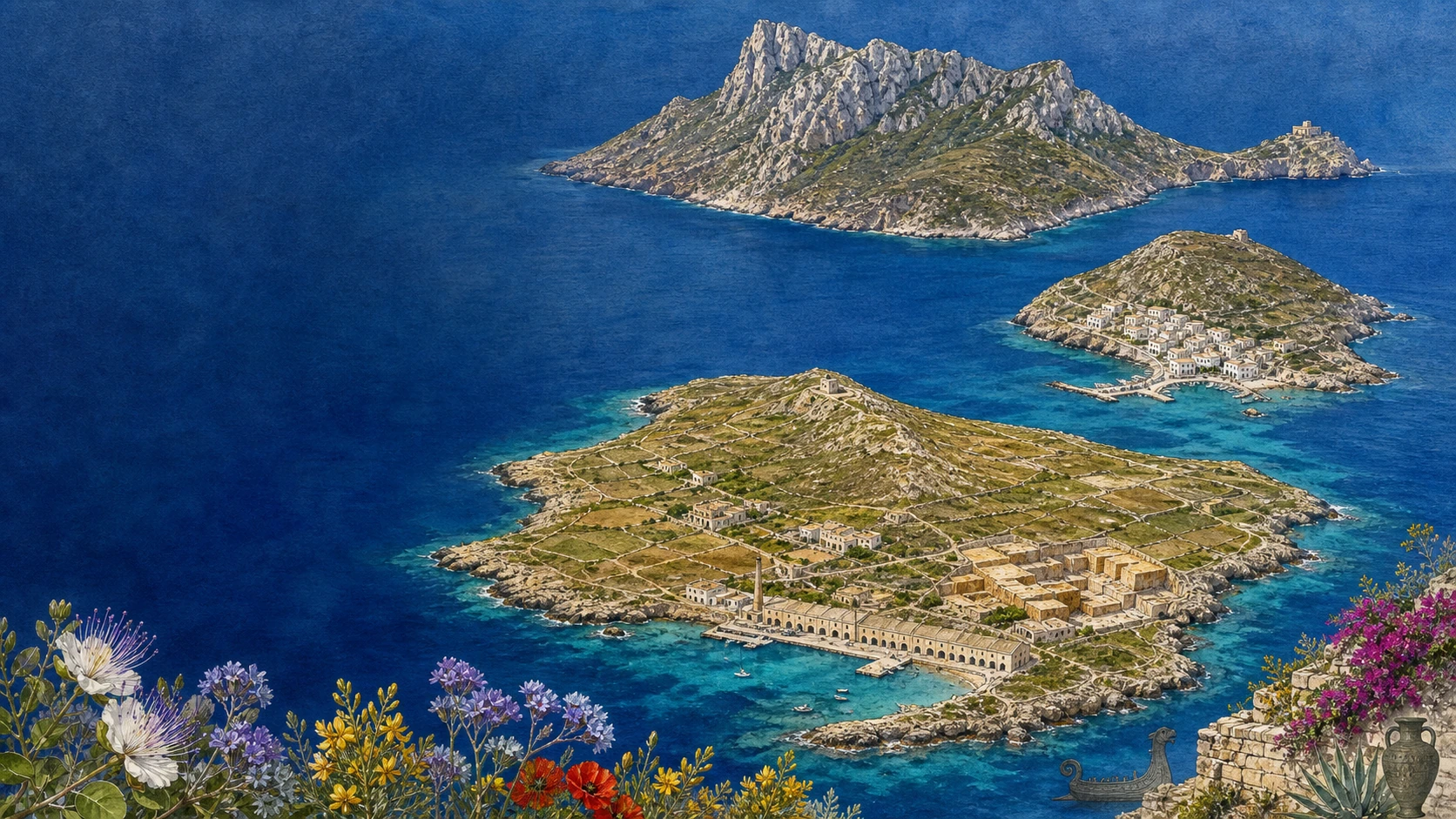
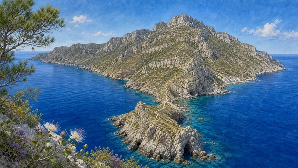
The opening chapters establish the Egadi as a western Sicilian archipelago formed by Favignana, Levanzo and Marettimo together with Formica, Maraone and smaller rocks. The seabed is part of the story: submerged cliffs, palaeobeaches, caves, Posidonia meadows and a 350-metre-deep channel explain why islands that appear close have very different geological and ecological histories.
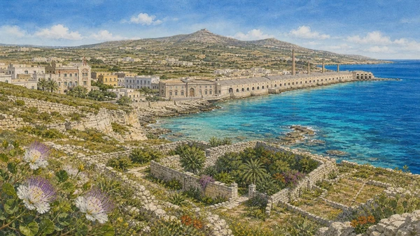
Favignana receives the longest sequence because its apparent ease conceals a layered cultural landscape. The town, Palazzo Florio and the former tuna works are linked to earlier fishing rights, industrial processing, the mattanza workforce and museum collections. The eastern plain is read through calcarenite quarries, cave gardens and rural walls; the western half through Monte Santa Caterina, the fort and a rougher coast.
Levanzo is organised around evidence rather than size. Cala Dogana leads to the Grotta del Genovese, where Upper Palaeolithic engravings must be distinguished from later black and red paintings. Cala Minnola preserves a Roman cargo and fish-processing context, while Capo Grosso and the deep field to the north-west locate the Battle of the Egadi with anchors, helmets, amphorae and bronze rams.
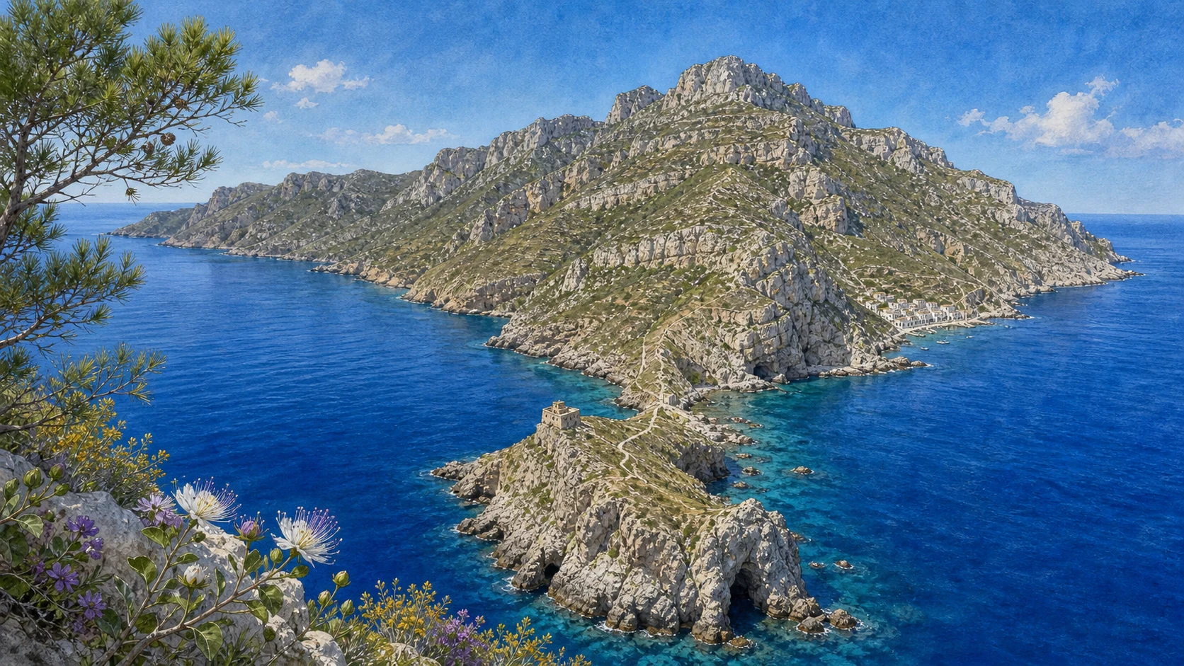
Marettimo is treated as a lived mountain. Its white village, migration museum, Roman complex, medieval church, Punta Troia fortress, lighthouse, high paths, sea caves and fishing knowledge form one connected system. All operational information was checked on 24 August 2026 and remains subject to weather, seasonal opening, municipal notices and the current rules of the marine protected area.

The selection
Twenty-four chapters,
three island worlds
The route is organised by archipelago and island, grouping nearby places and connected histories into substantial chapters rather than isolated micro-sections.
- 01The Egadi Archipelago: Geography, Names and a Working Sea
- 02The Marine Protected Area: Habitats, Caves and Four Different Zones
- 03The Battle of the Egadi: 10 March 241 BC and an Underwater Battlefield
- 04Favignana Town: Harbour, Piazza Matrice and the Florio Presence
- 05The Tonnara and the Factory: Fishing, Canning and Invisible Labour
- 06Ancient Favignana: Cala San Nicola, Grotta del Pozzo and Contrada Badia
- 07Monte Santa Caterina: Fortress, Ridge and the Island's Two Halves
- 08The Quarried Island: Calcarenite, Sunken Gardens and Rural Architecture
- 09Favignana's Eastern Coast: Bue Marino, Cala Rossa and Scalo Cavallo
- 10Favignana's Southern and Western Coast: Beaches, Settlements and Protected Water
- 11Levanzo: Cala Dogana, the Broken Plateau and a Resident Community
- 12Grotta del Genovese: Ice-Age Landscape, Engravings and Later Paintings
- 13Beyond the Genovese: Western Coves, Other Caves and Protected Terrain
- 14Cala Minnola: Punic Traces, Roman Fish Processing and a Wreck in Place
- 15Capo Grosso and the Northern Coves: Along the Ancient Battle Route
- 16Marettimo: Mountain, Village and the Memory of the Sea
- 17The Case Romane and the Medieval Church: A High Station above the Routes
- 18The Mountain Paths and Pizzo Falcone
- 19Punta Troia: The Approach, Fortress, Prison and Scalo Maestro
- 20The Western Coast: Cala Bianca, Punta Libeccio and Integral Protection
- 21Sea Caves and Fishing Knowledge: Reading the Safe Side of the Island
- 22Marettimo's Living and Submerged Heritage
- 23Formica and Maraone: Work Buildings, Reefs and Strong Protection
- 24A Complete Egadi Journey: Museum First, Islands Separately, Weather Always
THREE INHABITED ISLANDS SHARE A NAME, NOT A SINGLE LANDSCAPE
The Egadi Archipelago: Geography, Names and a Working Sea
Favignana, Levanzo and Marettimo form the inhabited core; Formica, Maraone and smaller rocks extend the system towards the Sicilian coast.

The place today
Favignana is the largest and administrative centre, Levanzo the smallest inhabited island, and Marettimo the highest and most distant. Ferries connect them, but wind, harbour exposure and seasonal frequency decide whether a combination is realistic. Ancient names — Aegusa, Phorbantia and Hieronesos — remind us that these waters were routes of work and exchange long before the modern tourist map.
The historical chapter
Favignana and Levanzo emerged from the shallow continental platform, while Marettimo remained isolated beyond a channel more than 350 metres deep. During lower Pleistocene sea levels the eastern islands belonged to a broader coastal plain; rising water then separated landscapes, people and animals. Geological difference helps explain why the three islands have distinct relief, vegetation and settlement histories.
What to notice
- Plan the islands separately: distance and harbour exposure matter more than their shared administrative name.
- Formica and Maraone belong to the archipelago's history and ecology even though they are not ordinary visitor stops.
A PROTECTED SEA IS NOT A UNIFORMLY OPEN PLAYGROUND
The Marine Protected Area: Habitats, Caves and Four Different Zones
The reserve protects a large marine system of Posidonia meadows, coralligenous walls, carbonate caves, reefs and deep channels.

The place today
The protected area is divided into zones A, B, C and D, each with different rules for navigation, anchoring, bathing, fishing and diving. Western Marettimo and small sectors around other islands receive the strongest protection, while broader areas allow regulated uses. Conditions and authorisations must be checked with the managing authority rather than inferred from a beach map or from the presence of boats.
The historical chapter
The submerged landscape joins geology to human history. Posidonia stabilises sediment and supports marine life; coralligenous formations and caves shelter specialised communities; reefs and channels also preserve anchors, amphorae and wrecks. Protection therefore concerns habitats, archaeological deposits and the continuity of resident maritime knowledge, not merely scenic water.
What to notice
- Never describe all four zones as if they had the same access rules.
- Use moorings and authorised services where required; a clear cove is not evidence that anchoring is permitted.

THE DECISIVE BATTLE LIES NORTH-WEST OF LEVANZO, NOT AT CALA ROSSA
The Battle of the Egadi: 10 March 241 BC and an Underwater Battlefield
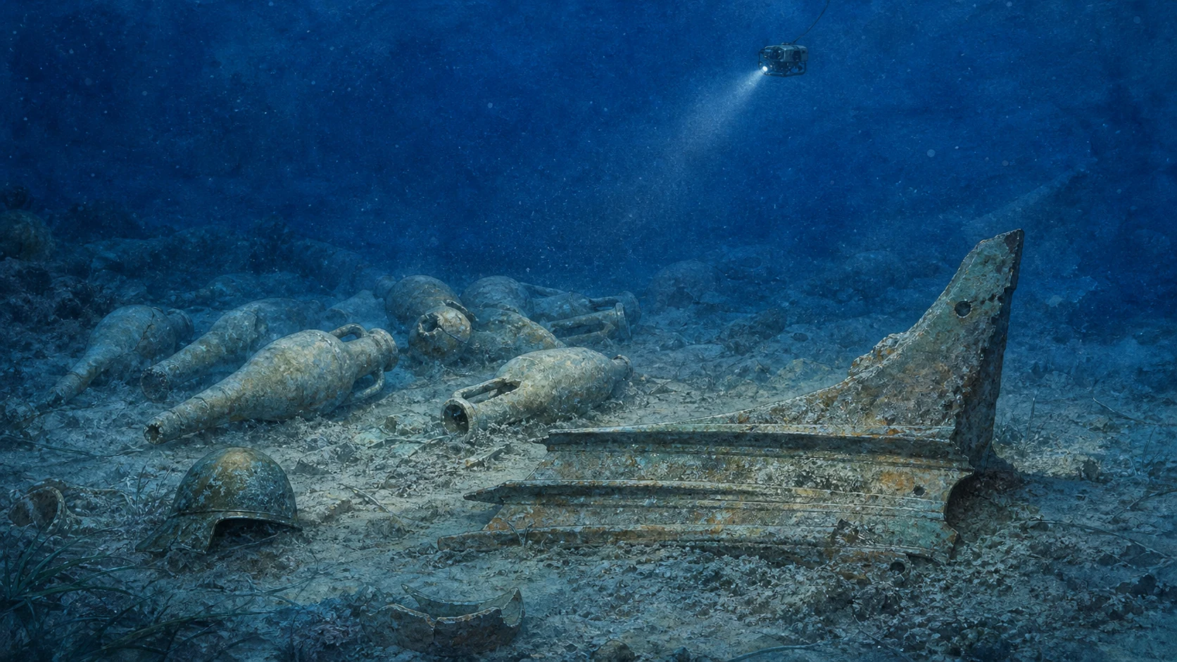
Bronze rams, helmets and amphorae have turned a literary event into one of the Mediterranean's most important deep-water archaeological landscapes.

The place today
The finds are recovered from water around eighty metres deep and are studied through survey vessels, sonar, remotely operated vehicles and conservation laboratories. The official regional update of 23 August 2023 recorded twenty-four recovered rams; catalogue numbers such as Egadi 26 and Egadi 27 are object identifiers, not a new total. Selected rams and helmets can be seen in the former Florio tuna works on Favignana, although displays may change.
The historical chapter
On 10 March 241 BC the Roman fleet intercepted Carthaginian ships approaching western Sicily. The Roman victory ended the First Punic War. The archaeological concentration north-west of Levanzo includes rams from both sides, helmets and transport amphorae, revealing collision, equipment and supply rather than a picturesque battle tableau. Cala Rossa belongs to Favignana's quarry coast and should not be presented as the battlefield.
What to notice
- Keep the official dated count separate from catalogue numbers assigned to individual rams.
- The site is a protected deep-water research area, not a recreational dive promised to visitors.

THE ISLAND'S CIVIC CENTRE GREW BETWEEN LANDING PLACE, CHURCH AND INDUSTRY
Favignana Town: Harbour, Piazza Matrice and the Florio Presence
Favignana town is not simply the place where the ferry arrives: harbour, piazza, palace and factory explain how the island was governed and worked.

The place today
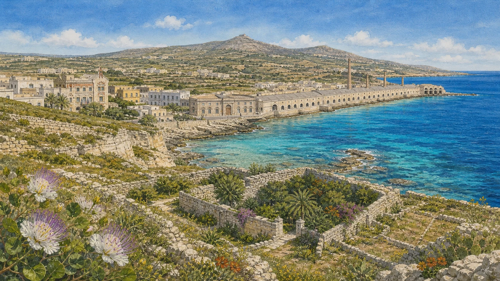
Piazza Matrice remains the social hinge between the port and the streets of the settlement. Palazzo Florio stands near the harbour on the site of Fort San Leonardo; its hybrid architecture and position express the public presence of an industrial family. The long former tuna works occupies the waterfront as museum, archive and major civic monument rather than as a decorative ruin.
The historical chapter
The town took its modern form through maritime administration, fishing rights and nineteenth-century investment. The Florios bought the Favignana and Formica complex in 1874 after an earlier Pallavicino phase, but the tonnara was centuries older. Palace and factory must therefore be read as a powerful industrial chapter imposed upon an existing island economy, not as the beginning of Favignana's history.
What to notice
- Read the harbour, Palazzo Florio and the former factory together; each explains a different form of power.
- The museum is an active institution, so rooms, displays and access can change.
THE FLORIO BRAND DEPENDED ON OLDER RIGHTS AND COLLECTIVE SKILL
The Tonnara and the Factory: Fishing, Canning and Invisible Labour
The tonnara joined seasonal tuna migration to a complex organisation of nets, boats, authority, processing and distribution.

The place today
Museum rooms and workers' testimony help recover the labour behind the famous brand: the rais coordinated knowledge of currents and fish movement; crews handled heavy nets and dangerous collective operations; women carried out essential cleaning, cooking, canning and packing inside the factory. The mattanza was one stage within a much longer production cycle and should not become the only image of the industry.
The historical chapter
Fishing rights around Favignana can be traced through medieval and early modern proprietors before the Pallavicino and Florio periods. The Florios industrialised preservation, expanded distribution and reorganised the island's seasonal economy. Canning converted a perishable catch into a commodity, but profitability depended on accumulated local knowledge and a workforce whose individual lives are less visible than the architecture.
What to notice
- Treat historic tuna fishing as labour history, not as a spectacle detached from danger and animal life.
- Do not credit the Florios with inventing a tonnara that already had a long institutional history.
THE ISLAND'S ARCHAEOLOGY EXTENDS WELL BEYOND THE MUSEUM CASES
Ancient Favignana: Cala San Nicola, Grotta del Pozzo and Contrada Badia
Punic chambers, inscriptions and Roman water structures survive as a dispersed archaeological landscape within later fields, quarries and settlement.

The place today
Cala San Nicola preserves evidence of Phoenician-Punic use on the north-eastern coast. Nearby, Grotta del Pozzo contains a chamber with inscriptions and a long history of reinterpretation and reuse. At Contrada Badia, fragmentary Roman remains include water and bathing structures. These places require restrained description because preservation, access and interpretation are not uniform.
The historical chapter
Favignana stood inside the sea routes between western Sicily, North Africa and the wider Mediterranean. Its ancient occupation was not a single city comparable to Motya, but a network of coastal landing, cult, burial, production and rural activity. Later extraction and construction altered the ground, so isolated remains must be connected cautiously rather than forced into a complete urban plan.
What to notice
- Do not enter closed or unstable cavities; archaeological interest does not imply public access.
- Treat the remains at Badia as fragmentary evidence, not as a fully reconstructed Roman complex.
ONE MOUNTAIN EXPLAINS FAVIGNANA'S SHAPE
Monte Santa Caterina: Fortress, Ridge and the Island's Two Halves
The central ridge divides a low, quarried eastern plain from the rougher western half and gives Favignana its butterfly outline.

The place today
Monte Santa Caterina is the island's principal landmark and viewpoint, but the climb is exposed and the condition or accessibility of the fort cannot be assumed. The western side below it carries garigue, dry-stone boundaries and a coast less perforated by extraction; the eastern side is lower, more settled and deeply marked by calcarenite quarries.
The historical chapter
The summit's defensive position attracted successive installations. The present fort records medieval and later military phases rather than one unaltered building. From this height the relation between geology and land use becomes legible: ridge, plain, harbour, fields, quarries and anchorages form one system, while defensive architecture occupied the point from which that system could be watched.
What to notice
- Check access and weather before climbing; exposure and heat can matter more than distance.
- The fort is a layered defensive structure, not a single-period castle frozen in time.
EXTRACTION CUT THE EASTERN PLAIN AND THEN MADE NEW SHELTER
The Quarried Island: Calcarenite, Sunken Gardens and Rural Architecture
Favignana's pale stone was removed through open pits and galleries, leaving geometric voids that later became gardens, yards and wind-protected spaces.

The place today
Quarry faces, tool marks, ramps and loading edges reveal an industrial landscape spread through town, countryside and coast. Abandoned cuts accumulated soil and offered shelter from wind, allowing citrus, vines and ornamentals to grow below ground level. Dry-stone walls, courtyards and modest rural houses connect extraction to farming rather than dividing the island into separate scenic themes.
The historical chapter
Calcarenite formed in marine conditions and became a building material exported across western Sicily. Generations of stonecutters transformed the eastern plain; later families adapted excavated spaces to cultivation and domestic use. The result is neither untouched nature nor an exhausted industrial site, but a cultural landscape where geology, labour and reuse remain visible together.
What to notice
- Do not enter unstable galleries or private quarry gardens without permission.
- Read vegetation inside the cuts as adaptive reuse, not as proof that extraction left no social or environmental cost.
THREE FAMOUS SHORES ARE ALSO THREE CHAPTERS OF STONE
Favignana's Eastern Coast: Bue Marino, Cala Rossa and Scalo Cavallo
Bue Marino, Cala Rossa and Scalo Cavallo combine water, cut rock, loading terraces and the hazards of an excavated coast.

The place today
Bue Marino is a quarry edge rather than a conventional sandy beach; access to the water can be difficult and sea conditions change quickly. Cala Rossa places a celebrated cove inside a heavily worked stone landscape. Scalo Cavallo preserves terraces and edges connected to extraction and loading. Their beauty comes from the encounter of geology and labour, not from an untouched-coast myth.
The historical chapter
The eastern calcarenite plain was cut close to the sea because blocks could be moved towards landing places. Traditional explanations connecting the name Cala Rossa to blood from the Roman-Carthaginian battle cannot relocate the securely identified battlefield north-west of Levanzo. Place-name stories may remain part of local memory, but archaeology provides a different map.
What to notice
- Evaluate entries and exits before swimming; quarry platforms are not designed bathing infrastructure.
- Do not use Cala Rossa as the geographic setting for the battle of 241 BC.
A CIRCUIT CHANGES FROM LOW SANDY SHORES TO EXPOSED WESTERN ROCK
Favignana's Southern and Western Coast: Beaches, Settlements and Protected Water
Cala Azzurra, Lido Burrone, Punta Lunga, Preveto, Cala Rotonda and the Faraglione show how quickly Favignana changes around its perimeter.

The place today
The south-east offers low shorelines and some of the island's most familiar bathing places. Punta Lunga and Preveto add small settlements, working boats and views towards offshore rocks. Cala Rotonda opens to a western shelter beneath a natural arch, while the Faraglione sector lies within stronger marine protection. Wind direction can make one coast calm and the opposite side unsafe on the same day.
The historical chapter
These shores supported fishing, small-scale landing, agriculture and movement between scattered houses before becoming a leisure circuit. Modern cycling makes distances appear simple, but summer heat, traffic, limited shade and water supply remain part of island life. Coastal enjoyment should therefore be planned around resident infrastructure and protected-area rules rather than treated as unlimited access.
What to notice
- Choose the coast according to wind and sea, not only according to a fixed list of famous coves.
- Carry water and respect settlements, working boats and the stronger protection around the Faraglione.

THE SMALLEST INHABITED ISLAND IS MORE THAN A QUIET HARBOUR
Levanzo: Cala Dogana, the Broken Plateau and a Resident Community
A steep coast, one compact village, former agricultural ground and limited transport give Levanzo a scale very different from Favignana.

The place today
Cala Dogana compresses harbour, houses and paths between water and slope. Above it, Pizzo del Monaco and La Fossa belong to a broken plateau where vines and other cultivation once occupied more ground before scrub returned. There is no road circuit comparable to Favignana's; supplies, waste, water, medical needs and travel remain tied to maritime connections.
The historical chapter
Levanzo's settlement pattern grew from small landing places, fishing, agriculture and movement across a rugged island. Modern descriptions often equate low visitor numbers with emptiness, but quietness is produced by a living community with constrained infrastructure. The correct scale of a visit begins by recognising Cala Dogana as home and port, not as a stage set.
What to notice
- Keep harbour operations and residents' access clear when ferries or service boats arrive.
- Do not confuse limited infrastructure with an island without social history or present-day needs.
ONE CAVE PRESERVES TWO DISTINCT IMAGE TRADITIONS
Grotta del Genovese: Ice-Age Landscape, Engravings and Later Paintings
The cave records human presence beside a coastline very different from today's and preserves both Upper Palaeolithic engravings and much later painted figures.

The place today
Access is controlled because the interior and its surfaces are fragile; visits depend on authorised arrangements and conditions. The older engraved cycle includes animals and three human figures. The painted cycle is mainly black, with a red-ochre example, and belongs to a Neolithic-Eneolithic symbolic world. Presenting both as one undated prehistoric style erases thousands of years of change.
The historical chapter
At the end of the Ice Age, lower sea levels connected Levanzo to a wider plain inhabited by people and animals. Rising water gradually created the island environment familiar today. The cave's images therefore belong to environmental transition as well as artistic history. Discovery in the twentieth century opened a major research chapter, but protection now matters more than unrestricted access.
What to notice
- Reserve authorised access in advance and accept that conservation or weather may prevent a visit.
- Keep the engraved Palaeolithic cycle distinct from the later painted cycle.
THE FAMOUS CAVE BELONGS TO A WIDER ARCHAEOLOGICAL COAST
Beyond the Genovese: Western Coves, Other Caves and Protected Terrain
Cala del Genovese, other cavities and scattered stone-tool evidence place the celebrated images inside a broader landscape of movement and shelter.

The place today
The western shore is rugged and partly subject to stronger marine protection. Boat access, landing and walking conditions are not interchangeable, and the cave itself cannot be detached from cliff, exposure and the route used to reach it. Other deposits are less visually dramatic but expand the evidence for prehistoric occupation beyond one decorated chamber.
The historical chapter
Caves preserved material because they offered shelter and because later sediment protected traces unevenly. Archaeological absence in an exposed area does not prove that people ignored it; preservation and research history shape what is known. Reading the whole western coast prevents Grotta del Genovese from becoming an isolated masterpiece without environmental or human context.
What to notice
- Do not enter unregulated cavities or assume that a boat can land wherever the coast appears calm.
- Leave archaeological material in place and report discoveries to the competent authorities.
ONE SMALL BAY CONNECTS LAND INSTALLATIONS TO UNDERWATER CARGO
Cala Minnola: Punic Traces, Roman Fish Processing and a Wreck in Place
Cala Minnola and Punta Altarella preserve evidence of later ancient occupation, fish processing and a Roman-period wreck whose amphora cargo remains the principal visible element.

The place today
The underwater itinerary was developed to interpret material in situ through moorings, monitoring and controlled access. Conditions, visibility and authorisation determine whether it can be experienced. On land, processing installations connect the bay to the production of fish products; elsewhere on Levanzo, Phoenician-Punic and Hellenistic traces show continued use after prehistory.
The historical chapter
The wreck carried wine amphorae, but it should not be described as an intact ship resting theatrically on the seabed. Timber survival is limited and archaeological meaning comes from the relationship among cargo, route, anchorage and coastal production. In-situ musealisation tries to balance public interpretation with conservation rather than removing every object to a museum.
What to notice
- Describe the wreck primarily through its cargo and archaeological context, not as a complete preserved vessel.
- Underwater access is conditional; never promise a dive without checking the authorised operator and current rules.
ANCHORS AND AMPHORAE LEAD FROM COASTAL SHELTER TO THE DEEP BATTLEFIELD
Capo Grosso and the Northern Coves: Along the Ancient Battle Route
Capo Grosso, Cala Fredda and Cala Tramontana show the different exposures of Levanzo's north and east while pointing towards the battlefield farther offshore.

The place today
Cala Fredda and Cala Tramontana offer different shelter according to wind. Capo Grosso marks a strategic northern edge where anchors and maritime finds reflect repeated passage. The concentration of rams lies farther north-west in deep water, so the land route should orient the visitor without pretending that the battle can be seen from a single scenic overlook.
The historical chapter
Ancient fleets depended on winds, supply and coastal knowledge just as smaller craft did. The battlefield is understandable only through a chain of ports, anchorages and sea lanes extending beyond Levanzo. This wider geography explains why scattered finds near Capo Grosso matter without turning every anchor into evidence from the battle of 241 BC.
What to notice
- Choose coves according to exposure; names on a map do not describe current safety.
- Do not assign every underwater object in northern Levanzo to the First Punic War.

THE MOST DISTANT ISLAND IS BOTH GEOLOGICALLY DISTINCT AND DEEPLY INHABITED
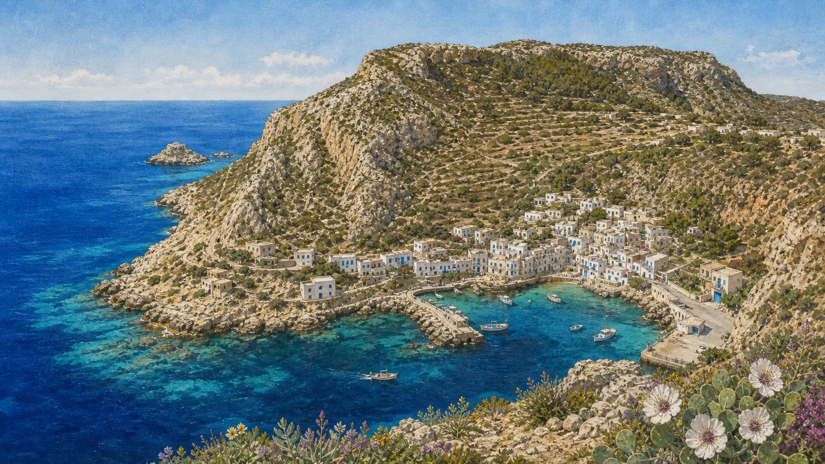
Marettimo: Mountain, Village and the Memory of the Sea
Marettimo rises sharply beyond a deep channel; its village, two landings and museum prevent the mountain from being mistaken for empty wilderness.

The place today
White terraced houses gather between Scalo Vecchio and Scalo Nuovo, whose usefulness changes with wind and sea. The local museum preserves fishing tools, family photographs and emigration histories. These modest records are essential: they connect caves, paths and boats to people who navigated, repaired, migrated and returned rather than reducing the island to trekking and excursions.
The historical chapter
Long geological isolation contributed to Marettimo's distinctive terrain and flora. Ancient Hieronesos, the 'sacred island', occupied a western position useful to maritime routes and refuge. Later settlement concentrated near workable landings while paths linked fields, springs, lookout points and distant coastal facilities. The village is therefore the organising centre of a mountain-sea system.
What to notice
- Treat both landings as working infrastructure and allow room for residents and service vessels.
- Do not describe Marettimo as uninhabited nature; the cultural landscape depends on resident memory.
ROMAN INFRASTRUCTURE AND A LATER CHURCH SHARE ONE STRATEGIC TERRACE
The Case Romane and the Medieval Church: A High Station above the Routes
Above the village, the so-called Case Romane and the small church beside them preserve successive uses of a commanding point over the western Mediterranean.

The place today
The climb reveals cisterns, masonry and the relation between the complex, slopes and sea. The Roman structure is generally connected to a late-Republican military or maritime station, while the adjacent church belongs to a later medieval phase. Their proximity should not collapse the two buildings into one period or one function.
The historical chapter
Marettimo's height offered observation and control over routes linking Sicily, North Africa and the Tyrrhenian world. Water storage was essential on an exposed terrace. In subsequent centuries the site acquired a Christian building and new meanings without losing the strategic geography that first made it useful. The surviving ensemble is best read as continuity of place through changing institutions.
What to notice
- Carry water and allow for heat and exposure on the climb from the village.
- Keep the Roman station and the medieval church chronologically and functionally distinct.
TREKKING ROUTES BEGAN AS THE ISLAND'S LAND INFRASTRUCTURE
The Mountain Paths and Pizzo Falcone
A network of paths climbs from the village towards high ridges, agricultural terraces and Pizzo Falcone at 686 metres.

The place today
Routes vary greatly in exposure, gradient and maintenance. Pizzo Falcone offers a remarkable position above open water, but cloud, heat and wind can alter an apparently short island walk. The paths also connect to Case Romane and to branches leading towards Punta Troia, the western coast and Punta Libeccio; not every combination is suitable for every walker or season.
The historical chapter
Before hiking became a visitor activity, these paths moved people, animals, produce, fuel and messages across terrain without roads. Their alignments reflect springs, slopes and access to fishing points. Reading them as inherited infrastructure restores labour to the landscape and explains why maintenance and local guidance matter as much as scenic appeal.
What to notice
- Check route condition locally and carry more water than the map distance alone suggests.
- Do not combine exposed branches automatically; elevation and return time are decisive.
A REMOTE PROMONTORY HOLDS DEFENCE, WATER STORAGE AND CONFINEMENT
Punta Troia: The Approach, Fortress, Prison and Scalo Maestro
The path or boat approach to Punta Troia culminates in a fortress whose watchtower, Spanish works, cistern and prison record several centuries of strategic use.

The place today
Walking routes include exposed traverses and a final ascent; boat landing depends on sea conditions. Scalo Maestro is a small landing below the fortress, not guaranteed access. Inside the complex, defensive structures and the great cistern preceded the conversion of part of the site into a punitive space; later military communication added another layer.
The historical chapter
The promontory commanded the channel between Marettimo and the western routes. A medieval watch point was enlarged under Spanish rule, while confinement transformed the cistern into the infamous penal pit associated with political prisoners. The later semaphore continued the logic of surveillance. These phases should be read together without romanticising isolation or imprisonment.
What to notice
- Confirm opening and approach conditions before committing to the route.
- Do not treat Scalo Maestro as an all-weather harbour or the prison as a picturesque anecdote.
THE WILDEST FACADE OF MARETTIMO IS ALSO THE MOST REGULATED
The Western Coast: Cala Bianca, Punta Libeccio and Integral Protection
White dolomite cliffs, the south-western lighthouse and exposed water define a coast where landscape and protection cannot be separated.

The place today
Cala Bianca lies within the strongest protection sector and is exposed to conditions that can change quickly. Punta Libeccio and its lighthouse mark the south-western limit of the island's maritime geography. Boat excursions may reveal the coast, but route, approach and activity depend on weather, authorised operation and the exact marine zone.
The historical chapter
Marettimo's western limestone and dolomite create cliffs, caves and submarine habitats unlike the low quarry shores of Favignana. The lighthouse belongs to the modern safety network of the Mediterranean, while zone A protects ecosystems through integral restrictions with defined exceptions. Protection is therefore an active legal regime, not a poetic synonym for remoteness.
What to notice
- Zone A does not mean ordinary free access; verify the activity and authorisation required.
- Do not promise Cala Bianca or the lighthouse on a fixed itinerary when sea conditions decide the approach.
CAVES ARE GEOLOGY, BUT REACHING THEM DEPENDS ON HUMAN JUDGEMENT
Sea Caves and Fishing Knowledge: Reading the Safe Side of the Island
Cammello, Presepe, Tuono and Bombarda belong to a varied cave coast interpreted through names, light and local maritime practice.

The place today
Excursions often present the caves as a circuit, yet wind and swell determine which side of Marettimo is navigable. Experienced boat operators read currents, rebound from cliffs and the relation between entrance and wave direction. Names and stories help retain local knowledge, but they do not guarantee that every cave will be entered on every trip.
The historical chapter
Karst processes and marine erosion opened cavities along structurally varied rock. Generations of fishers learned how these forms altered sound, shelter and current, making geomorphology part of everyday navigation. Tourism can support transmission of that knowledge when it respects operational decisions instead of demanding a checklist of entrances.
What to notice
- Accept route changes made for safety; a complete cave circuit is never an entitlement.
- Avoid touching cave surfaces or disturbing resting wildlife in confined spaces.
LONG ISOLATION PROTECTED ENDEMIC PLANTS AND A DENSE MARITIME RECORD
Marettimo's Living and Submerged Heritage
Cliff flora, reef habitats, anchors, amphorae and later wrecks make Marettimo a layered archive above and below the waterline.

The place today
Botanical distinctiveness is most visible in specialised plants adapted to cliffs, wind and limestone; it should be observed without collecting. Underwater heritage ranges from isolated anchors and amphorae to later wreck sites, each requiring archaeological context. Protected status and depth mean that many places are documented through research rather than ordinary visitor access.
The historical chapter
Geological separation gave species and communities time to diverge, while the island's strategic position concentrated maritime traffic around its coasts. Natural and archaeological records therefore overlap: the same reefs that shelter marine life could endanger ships, and the same channels that carried trade preserve material evidence. Conservation must address both systems together.
What to notice
- Do not collect plants, shells or archaeological objects, even when they appear detached.
- A named wreck or anchor field is not automatically an accessible dive site.
THE SMALLEST ISLANDS MATTER WITHOUT BECOMING VISITOR PRODUCTS
Formica and Maraone: Work Buildings, Reefs and Strong Protection
Formica preserves buildings associated with the tuna-fishing complex, while Maraone is a low reef-like presence within a highly sensitive marine area.

The place today
They are best understood from the water, museum interpretation and protected-area information rather than promoted as casual landings. Formica connects the archipelago's industrial network to Favignana's tonnara; Maraone contributes reef habitat and navigational presence. Current regulations, private or operational uses and sea conditions determine what can be approached.
The historical chapter
Fishing installations spread across more than one island because capture, storage, observation and movement formed a maritime system. Later abandonment or new use did not erase that relationship. Ecologically, small rocks can support disproportionately important habitats. Their significance therefore does not depend on visitor infrastructure or a promise of access.
What to notice
- Do not advertise Formica or Maraone as ordinary independent destinations.
- Observe exclusion distances and the exact rules of the surrounding marine zone.
A GOOD ROUTE CONNECTS HISTORY WITHOUT TREATING THE ARCHIPELAGO AS A CHECKLIST
A Complete Egadi Journey: Museum First, Islands Separately, Weather Always
The most coherent journey begins with Favignana's museum and working landscapes, then gives Levanzo and Marettimo enough time to remain distinct.

The place today
Use Favignana to understand the tuna industry, quarries and recovered battle objects. Give Levanzo a separate day for Cala Dogana, controlled access to the Genovese context and, where possible, Cala Minnola or the northern coast. Treat Marettimo as a mountain island whose paths, village, Punta Troia and sea circuit require their own weather window. Formica and Maraone belong to the story without requiring a landing.
The historical chapter
The archipelago's history is distributed across land and deep water: prehistoric images, Punic and Roman routes, medieval rights, industrial labour, migration and marine conservation. No single excursion can contain it all. A slower structure protects the islands from being reduced to famous coves and also makes cancellations, wind and changing transport part of responsible planning rather than failure.
What to notice
- Recheck ferry timetables, cave access, museum openings and marine rules shortly before travel.
- Build spare time into the route; weather can cancel the very crossing on which a compressed itinerary depends.
The city through time
Fourteen turning points in the Egadi story
The chronology connects environmental change, settlement, conflict, production and protection without pretending that every island followed the same sequence.
Upper Palaeolithic artists engrave 29 animals and three human figures in the Grotta del Genovese while Levanzo belongs to a very different coastal landscape.
Later communities return to the cave and create about one hundred mainly black painted anthropomorphic, zoomorphic and symbolic figures, with one recorded in red ochre.
Evidence at Cala San Nicola documents Semitic settlement on Favignana, followed by wider Phoenician-Punic use of the archipelago.
Rome defeats the Carthaginian fleet north-west of Levanzo; the Battle of the Egadi ends the First Punic War and opens a new political phase for Sicily.
Roman strategic and productive landscapes include the Case Romane on Marettimo, fish processing on Favignana and Levanzo, and the Cala Minnola merchant wreck.
A small church associated with Byzantine or Basilian tradition is built beside the older Roman complex on Marettimo.
Concessions and fixed rights document organised tuna fishing around Favignana long before nineteenth-century industrialisation.
The early modern fortress of Punta Troia is constructed above earlier lookout phases on Marettimo's north-eastern headland.
Punta Troia becomes a prison; its rock-cut cistern is emptied and transformed into a punitive detention space.
The penal function at Punta Troia is abolished; later the fort serves as a military semaphore before post-war abandonment.
Ignazio Florio senior acquires the Egadi, commissions Palazzo Florio and begins the architectural and industrial phase most visible around Favignana harbour.
Industrial tuna processing declines, while migration reshapes island families; the former factory later passes through more than two decades of abandonment.
The Egadi Islands Marine Protected Area is established; later zoning and regulations define different levels of conservation and permitted use.
Deep-water campaigns document the Battle of the Egadi; the Sicilian Region reports 24 recovered bronze rams as of 23 August 2023, while investigation continues.
Before your visit
Practical information,
without turning it into promises
Connections and weather
Check the carrier and harbour notice the day before and again on the day. Wind can delay, redirect or cancel services, especially to Marettimo. Keep a buffer day and never build an irreversible onward connection around the last expected boat.
Museums, cave and archaeology
Confirm current opening for the former Florio works, Palazzo Florio and Punta Troia. The Grotta del Genovese requires authorised, advance arrangements. Underwater archaeological sites require qualified, authorised operators; never enter or collect from an unstaffed site.
Paths, boats and the protected sea
Choose Marettimo and Levanzo routes according to heat, wind and local path condition. Use the current AMP map for zones A, B, C and D, and verify navigation, anchoring, diving and fishing permissions before departure. A commercial booking does not override an ordinance.
Island time and resident resources
Give each inhabited island its own day and Marettimo more than one night when possible. Carry water, sun protection and appropriate footwear; reduce waste and water use; keep harbours, working boats, homes and narrow streets clear. Limited services are part of resident reality.
Sources
This guide was built from the Egadi Islands Marine Protected Area, Comune di Favignana, Sicilian Region, Soprintendenza del Mare, Ministry of Culture tourism portal and the operating carrier's official service pages. Archaeological claims distinguish surface evidence, excavated structures, submerged finds and later interpretation. The Upper Palaeolithic engravings are separated from the later painted cycle; the Battle of the Egadi is located north-west of Levanzo rather than at Cala Rossa; the dated 2023 total of recovered rams is separated from object catalogue numbers; Florio industrialisation is placed after the older tonnara; and marine protection is described zone by zone. Operational information was checked on 24 August 2026 and is deliberately qualified because sea connections, site openings, path conditions, authorisations and annual AMP measures can change.
- AMP Isole Egadi · geology and geomorphology ↗
- AMP Isole Egadi · current zoning ↗
- AMP Isole Egadi · protected species and habitats ↗
- AMP Isole Egadi · institutional profile ↗
- AMP Isole Egadi · 2025 integrative regulations ↗
- AMP Isole Egadi · reserve regulations ↗
- AMP Isole Egadi · protected seabed guide ↗
- AMP Isole Egadi · anti-trawling project ↗
- Regione Siciliana · 2002 Egadi landscape decree ↗
- Regione Siciliana · 2023 Battle of the Egadi discoveries ↗
- Soprintendenza del Mare · research news ↗
- Soprintendenza del Mare · Battle of the Egadi research ↗
- Soprintendenza del Mare · Il mare delle Egadi ↗
- Soprintendenza del Mare · Cala Minnola itinerary ↗
- Soprintendenza del Mare · underwater itinerary guide ↗
- Soprintendenza del Mare · ARCHAEOMAP Egadi ↗
- Comune di Favignana · places index ↗
- Comune di Favignana · Palazzo Florio ↗
- Comune di Favignana · former Florio tuna works ↗
- Comune di Favignana · Battle Room reopening ↗
- Comune di Favignana · Castello di Punta Troia ↗
- Comune di Favignana · Egadi museum access ↗
- Italia.it · Favignana ↗
- Italia.it · Marettimo ↗
- Italia.it · Egadi Marine Protected Area ↗
- Italia.it · Trapani and Egadi Islands ↗
- Liberty Lines · Egadi ticket offices ↗
- Sicilian Region · historic former Florio museum page ↗
- Soprintendenza di Trapani · former Florio works historical report ↗
- Soprintendenza del Mare · ARROWS underwater documentation ↗
- Italian cultural heritage underwater portal · national overview ↗
Operational information, opening hours, fares, routes, authorisations and marine rules can change. Every practical decision must be checked again with the responsible authority or operator. Dates and quantities from ongoing archaeological research are explicitly attributed to the most recent institutional source used in this guide.