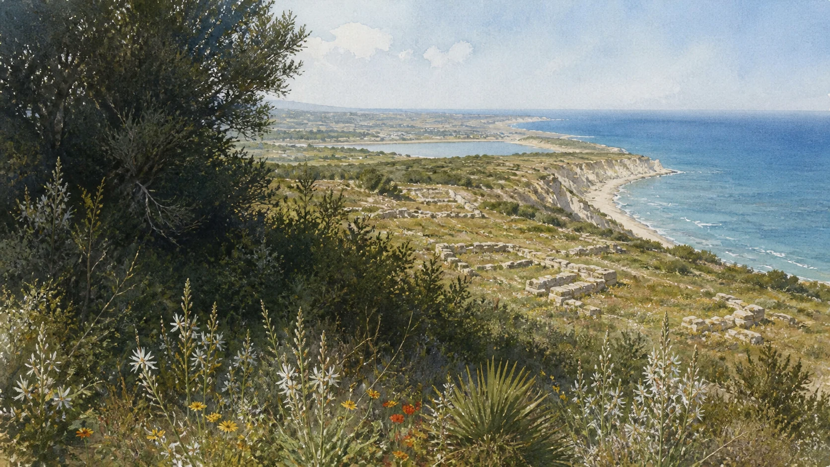
Documentary watercolour of the white Capo Bianco promontory, low ruins of Eraclea Minoa, Mediterranean vegetation and the sea

Illustrated guide · Sicily

A white promontory,
a frontier city
and a moving sea

Twenty chapters follow a frontier city from myth and river politics through walls, houses, theatre, rediscovery and the changing white coast of Capo Bianco and the Platani.

Explore the places
Eraclea Minoa · archaeology, white marl, river reserve and changing coast

A small excavated area can contain an entire Mediterranean frontier

Eraclea Minoa is memorable because archaeology and geography cannot be separated. Low walls and a vulnerable theatre occupy a pale plateau above Capo Bianco, while the Platani river and a moving shoreline keep the frontier landscape visibly unfinished.

Ancient names connect Minos, Daedalus and Heracles to a city contested between Selinunte, Akragas and Carthage. The myths matter, but settlement, fortification and domestic evidence must decide what can be stated as history.

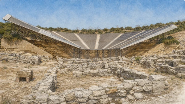
The coast adds a present responsibility. Soft marl erodes, dunes and river habitat shift, the beach has retreated and the theatre remains under a provisional canopy. A truthful guide treats conservation and coastal engineering as part of the place rather than hiding them.

One destination

Twenty chapters across a frontier city and a coast still changing

The city stood near the ancient Halykos, a political boundary and route between western and central Sicily. Its wide plateau controlled sea, river plain and coast without becoming a city of standing monumental temples.

Selinuntine foundation, Carthaginian influence, Greek warfare and Roman settlement created successive phases before dense occupation ended. Houses later crossed the disused theatre, and late-antique burials returned to parts of the plateau.

Today's visit joins low archaeological remains, an antiquarium, a covered theatre and exposed coastal paths. Access, canopy work, erosion projects and reserve conditions require current checks rather than fixed promises.

The selection

Twenty chapters from the Halykos frontier to the Platani mouth

The route consolidates houses, theatre structure and coastal change while preserving the site's historical uncertainties and present conservation limits.

  1. 01The Plateau, Capo Bianco and the Open Sea
  2. 02Minos, Daedalus and the Problem of the Name Minoa
  3. 03Euryleon, Heracles and the Name Eraclea
  4. 04The Selinuntine Colony on the Halykos
  5. 05The Halykos Frontier between Akragas and Carthage
  6. 06Carthage, Dionysius, Agathocles and Pyrrhus
  7. 07Rome, Rupilius and the Final Urban Settlement
  8. 08The Six-Kilometre Defensive Circuit
  9. 09The Orthogonal Streets and Two Superimposed Cities
  10. 10Houses A and B: Courts, Water and an Upper Floor
  11. 11The Later Houses, Hearths and Agricultural Colony
  12. 12The Theatre, Its Cavea and the Sea
  13. 13Orchestra, Lost Stage and Later Houses
  14. 14The Summit Sanctuary of a Female Deity
  15. 15The Necropolis and the Late-Antique Funerary Return
  16. 16The Antiquarium and the Portable City
  17. 17From Salinas to Griffo and De Miro
  18. 18Minissi's Perspex Shells and the Provisional Canopy
  19. 19The Platani Mouth, Dunes and Migratory Birds
  20. 20Capo Bianco, Beach Erosion and Coastal Defence
01

A WHITE MARLY HEADLAND TURNED A RIVER MOUTH, COASTAL ROUTE AND DEFENSIBLE HEIGHT INTO ONE STRATEGIC LANDSCAPE

The Plateau, Capo Bianco and the Open Sea

The city begins with topography: plateau above, Halykos below, Mediterranean routes in front and unstable stone underfoot.

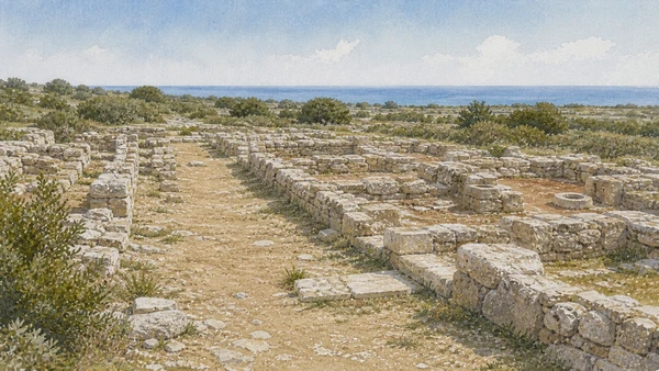
Documentary watercolour of Eraclea Minoa's low urban foundations on the pale plateau, with orthogonal paths, house courts, cistern openings and the distant sea
A LOW CITY ON THE PLATEAU

The place today

The archaeological entrance lies on the plateau above the white cliff of Capo Bianco. From the theatre and southern edge, the sea occupies the horizon; westward, the Platani valley opens into the protected river mouth. The visible site is only a fraction of the ancient enclosure.

The historical chapter

The promontory controlled passage along Sicily's southern coast and movement into the Halykos valley. Its natural defensibility encouraged a wall circuit across the plateau, but the white geology was never immutable. Ancient builders used local marl and gypsum-rich stone for theatre, houses and fortifications, accepting materials that could be worked easily but weather rapidly.

What to notice

  • Remain behind cliff-edge barriers and avoid approaching unstable marly faces. Pale rock can fracture or powder even when it appears solid.
  • Do not use the present beach line or river mouth as an exact map of the ancient harbour landscape; sediment and erosion have repeatedly changed them.
Valley of the Temples Park · Eraclea Minoa archaeological area
02

A CRETAN FOUNDATION STORY CONNECTED THE HEADLAND TO A WIDER MYTH OF FLIGHT, PURSUIT, DEATH AND MEDITERRANEAN CONTACT

Minos, Daedalus and the Problem of the Name Minoa

The legend explains how ancient communities imagined connection; it does not replace archaeological foundation evidence.

Documentary watercolour of Eraclea Minoa's low urban foundations on the pale plateau, with orthogonal paths, house courts, cistern openings and the distant sea
A LOW CITY ON THE PLATEAU

The place today

No labyrinth, palace of Kokalos or tomb of Minos is visible at the site. The myth survives through the name and through interpretation linking Eraclea Minoa with the Sican interior, especially traditions around Kamikos. From Capo Bianco, the sea makes the narrative of long-distance contact geographically plausible without turning each literary episode into a located monument.

The historical chapter

Diodorus recounts Minos pursuing Daedalus to Sicily, where King Kokalos protected the craftsman and Minos died. The Cretan followers were said to have founded Minoa after losing their ships. The Park interprets this story as a cultural memory of eastern-western contacts attested in the broader Mycenaean world.

What to notice

  • Keep Diodorus' narrative, Mycenaean contact and the sixth-century Selinuntine foundation in separate sentences; they belong to different evidence categories.
  • Avoid illustrating the site with an invented Cretan palace, bronze-age harbour or flying Daedalus as if any had been found on Capo Bianco.
Valley of the Temples Park · Foundation myths of Minoa
03

A SURVIVOR OF THE SPARTAN DORIEUS EXPEDITION RECAST THE SETTLEMENT THROUGH HERACLEAN GENEALOGY

Euryleon, Heracles and the Name Eraclea

The compound name records contested memory as much as a single act of renaming.

Documentary watercolour of Eraclea Minoa's low urban foundations on the pale plateau, with orthogonal paths, house courts, cistern openings and the distant sea
A LOW CITY ON THE PLATEAU

The place today

The name Eraclea Minoa appears on signs, tickets and maps as though it had always been stable. In antiquity, authors explained its elements through separate stories. The absence of a securely identified monumental Heracles sanctuary on the standard route makes the literary tradition especially important, but also demands caution.

The historical chapter

Herodotus associates Euryleon with the failed western expedition of the Spartan prince Dorieus at the end of the sixth century BC. According to the Park's synthesis, Euryleon imposed a name honouring Heracles, ancestor of Dorieus' line. Scholarship has debated whether Eraclea or Minoa was the earlier civic name and how the compound developed.

What to notice

  • Do not convert a disputed naming sequence into an exact foundation chronology. Ancient authors and modern scholars do not all organise the names identically.
  • A Heraclean name does not prove a mass Spartan population replacement; Euryleon's episode belongs within an existing Selinuntine settlement.
University of Palermo · Study on the foundation and name of Eraclea Minoa
04

SELINUNTE EXTENDED EASTWARD ALONG THE COAST AND CREATED A SETTLEMENT AT A RIVER THAT WOULD BECOME A FRONTIER

The Selinuntine Colony on the Halykos

Eraclea Minoa belongs to the same network as Selinunte but developed its own exposed political geography.

Documentary watercolour of Eraclea Minoa's low urban foundations on the pale plateau, with orthogonal paths, house courts, cistern openings and the distant sea
A LOW CITY ON THE PLATEAU

The place today

From Capo Bianco, Selinunte lies west along the coast and Akragas east. The ancient road and maritime routes are not preserved as one continuous visitor trail, yet the position makes the colonial relationship legible. Early burials and wall phases preserve evidence earlier than the theatre and excavated houses that dominate the current visit.

The historical chapter

The Park attributes the foundation to Selinuntines during the sixth century BC. Establishing a dependent settlement strengthened agricultural territory, coastal exchange and control of the Halykos corridor. The new community occupied land already embedded in Sican and wider Mediterranean relations.

What to notice

  • Do not call Eraclea Minoa a fully independent polis throughout its history. Its autonomy and controlling power changed repeatedly.
  • The Selinuntine connection does not make every sixth-century find ethnically uniform; frontier communities moved goods, people and practices.
Valley of the Temples Park · Historical synthesis of Eraclea Minoa
05

THE PLATANI WAS A RIVER, A ROUTE AND AT TIMES A DIPLOMATIC LINE BETWEEN COMPETING TERRITORIES

The Halykos Frontier between Akragas and Carthage

Political borders changed around the river without turning the landscape into a permanent wall between cultures.

Documentary watercolour of Eraclea Minoa's low urban foundations on the pale plateau, with orthogonal paths, house courts, cistern openings and the distant sea
A LOW CITY ON THE PLATEAU

The place today

The Platani descends from central Sicily to the sea west of Capo Bianco. Its lower valley belongs to a nature reserve, but the river also explains why the ancient city mattered far beyond its size. Looking inland connects the site with Sican centres and agricultural routes; looking along the coast reveals the corridor between Selinunte and Akragas.

The historical chapter

During the sixth and fifth centuries BC the Halykos marked shifting relations between Selinuntine and Akragantine territories. In the fourth century it could serve as a recognised boundary between Carthaginian-controlled western Sicily and Greek-Siceliot spheres. Eraclea Minoa repeatedly passed between powers because a frontier settlement could be harbour, garrison, refuge and bargaining position.

What to notice

  • A treaty boundary is not an impermeable modern border. Trade, travel and cultural exchange continued across the Halykos.
  • Do not assign every Punic coin or construction technique to a single conquest event; frontier material can circulate across political phases.
Treccani · Ernesto De Miro on Eraclea Minoa as a border city
06

THE CITY CHANGED HANDS AS WESTERN SICILY BECAME A THEATRE OF WAR, TREATY AND TEMPORARY RECOVERY

Carthage, Dionysius, Agathocles and Pyrrhus

A sequence of rulers should be read through frontier function, not as a list detached from the plateau.

Documentary watercolour of Eraclea Minoa's low urban foundations on the pale plateau, with orthogonal paths, house courts, cistern openings and the distant sea
A LOW CITY ON THE PLATEAU

The place today

Fortification phases and imported material preserve the consequences of repeated insecurity better than any royal monument. Visitors encounter a city whose most substantial investment was its defensive circuit and whose urban phases were rebuilt within earlier lines. The archaeological remains rarely carry labels for each named war, so political chronology must not be forced onto every wall.

The historical chapter

Carthaginian campaigns of 409–406 BC brought Eraclea Minoa under Punic control. Ancient accounts place it in later struggles involving Dionysius I, Carthage, Agathocles and Pyrrhus. Control could be recovered and lost as treaties moved the frontier.

What to notice

  • Avoid attaching an exact ruler to a wall sector without excavation evidence. Literary control and construction phase are different datasets.
  • Use 'Punic control' as a political term, not as a claim that every inhabitant or object became culturally homogeneous.
Treccani · Historical and archaeological profile of Eraclea Minoa
07

A ROMAN REPUBLICAN RECOLONISATION REUSED THE HELLENISTIC PLAN BEFORE DENSE URBAN LIFE ENDED

Rome, Rupilius and the Final Urban Settlement

Roman rule produced another city phase rather than an instant architectural replacement.

Documentary watercolour of Eraclea Minoa's low urban foundations on the pale plateau, with orthogonal paths, house courts, cistern openings and the distant sea
A LOW CITY ON THE PLATEAU

The place today

The later houses occupy parts of the earlier urban grid south of the theatre. Modest rooms, hearths and mixed stone-and-mudbrick walls contrast with the older peristyle houses beneath them. The differences are clearest through plans and protected excavated sectors rather than through monumental façades.

The historical chapter

Rome gained the city during the Punic wars and treated it as a tribute-paying community. After the First Servile War, Publius Rupilius is associated with a new settlement in 132 BC. Archaeology records a later residential phase during the second and first centuries BC, less continuous across the plateau and often interpreted as an agricultural colonisation.

What to notice

  • Do not call the later layer a Roman city built on empty ground. It reused Hellenistic streets, materials and parts of the earlier settlement.
  • Rupilius' recolonisation is a historical interpretation linked with archaeology; individual houses cannot all be assigned to named colonists.
Valley of the Temples Park · Roman recolonisation and abandonment
Documentary watercolour of Eraclea Minoa's low urban foundations on the pale plateau, with orthogonal paths, house courts, cistern openings and the distant sea
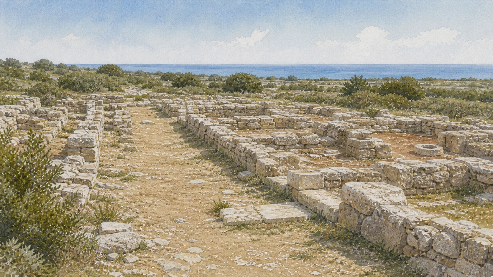
A LOW CITY ON THE PLATEAUStreet lines, house foundations and cistern mouths recover domestic scale without reconstructing a complete hilltop settlement.
08

WALLS ENCLOSED THE ENTIRE PLATEAU FROM THE COASTAL HEIGHT TOWARD THE HALYKOS VALLEY

The Six-Kilometre Defensive Circuit

The fortifications reveal the scale of the city more clearly than the small excavated centre.

Documentary watercolour of Eraclea Minoa's low urban foundations on the pale plateau, with orthogonal paths, house courts, cistern openings and the distant sea
A LOW CITY ON THE PLATEAU

The place today

Visible wall sectors occur around the plateau, but not every part of the roughly six-kilometre line is an ordinary visitor route. Masonry, towers, terraces and earth-covered traces respond to different terrain. Some sections use gypsum-rich blocks and later reinforcement.

The historical chapter

Successive fortification phases developed from the archaic settlement through Hellenistic and Roman Republican insecurity. Walls controlled roads and the river approach while using the natural cliff where possible. Later builders strengthened parts of the circuit with additional mass and earthen or rubble fills, a response sometimes associated with the Servile War period.

What to notice

  • Do not leave marked archaeological routes to trace a wall across private, vegetated or cliff-edge ground.
  • The published six-kilometre figure describes the ancient enclosure, not six kilometres of continuously visible standing masonry.
Valley of the Temples Park · Fortified plateau of Eraclea Minoa
09

PARALLEL AND CROSSING ROADS ORGANISED HOUSES BEFORE LATER SETTLERS REUSED THE SAME FRAME WITH LOWER DENSITY

The Orthogonal Streets and Two Superimposed Cities

Eraclea Minoa's urban history is visible vertically as well as across the plateau.

Documentary watercolour of Eraclea Minoa's low urban foundations on the pale plateau, with orthogonal paths, house courts, cistern openings and the distant sea
A LOW CITY ON THE PLATEAU

The place today

South of the theatre, roads divide excavated blocks into an ordered layout. Protective roofs and low walls make it necessary to compare ground remains with plans. The deeper Hellenistic phase belongs mainly to the fourth and third centuries BC; the upper Roman Republican phase dates to the second and first.

The historical chapter

The Hellenistic city used a regular network of north-south and east-west streets. Compact houses centred on courts filled the blocks. Rupilian-era settlers approximately retained the earlier alignments while building more modest and discontinuous units.

What to notice

  • Do not treat every wall visible at one height as contemporary. Upper and lower houses overlap within the same block.
  • Protective architecture may obscure the grid; use the official plan without entering covered ruins or crossing low wall lines.
Treccani · Ernesto De Miro on the Hellenistic and Roman Republican settlement
10

TWO ADJACENT HOUSES REVEAL COURTYARDS, STORAGE, WATER AND THE COLLAPSE OF DOMESTIC SPACE

Houses A and B: Courts, Water and an Upper Floor

Houses A and B belong to one residential reading while their plans and preservation remain distinct.

Documentary watercolour of Eraclea Minoa's low urban foundations on the pale plateau, with orthogonal paths, house courts, cistern openings and the distant sea
A LOW CITY ON THE PLATEAU

The place today

The protected remains outline rooms around a small central court. House B is read through protected walls and the recorded contents of its collapse.

The historical chapter

The house belongs to the Hellenistic phase contemporary with the theatre. Built within the Hellenistic street system, House B demonstrates local use of perishable earth construction alongside gypsum-rich stone.

What to notice

  • Do not enter the covered house or step onto cocciopesto. Seemingly plain reddish floors preserve fragile decoration and use history.
  • Mudbrick is archaeological fabric, not soil to brush away. Keep away from wall tops and protected interiors.
University of Palermo · Official research repository, Eraclea Minoa houses
11

SMALLER ROOMS REUSED THE OLD GRID AFTER 132 BC WITHOUT RECREATING THE EARLIER CITY AT THE SAME DENSITY

The Later Houses, Hearths and Agricultural Colony

The Roman Republican layer records settlement continuity with a changed demographic and economic scale.

Documentary watercolour of Eraclea Minoa's low urban foundations on the pale plateau, with orthogonal paths, house courts, cistern openings and the distant sea
A LOW CITY ON THE PLATEAU

The place today

Later houses generally consist of two or more rooms arranged around a court with a hearth. Gypsum-stone bases and mudbrick elevations continued local building habits. Their walls cross or sit above Hellenistic rooms, making the visible plan complex.

The historical chapter

After the First Servile War, recolonisation associated with Rupilius brought agricultural settlers into Eraclea Minoa. They reused streets and available structures but built smaller, more irregular units. Domestic material and coins extend occupation through much of the first century BC before abandonment.

What to notice

  • Do not equate modest houses with a culturally simple population. Scale, legal status, agriculture and reuse all shaped the later settlement.
  • Hearths and courts are archaeological features; keep them distinct from modern burn marks, vegetation clearance or conservation fill.
Treccani · Roman Republican settlement at Eraclea Minoa
Documentary watercolour of Eraclea Minoa's theatre beneath its angular modern protective canopy, with vulnerable stone seating and low archaeological rooms in front
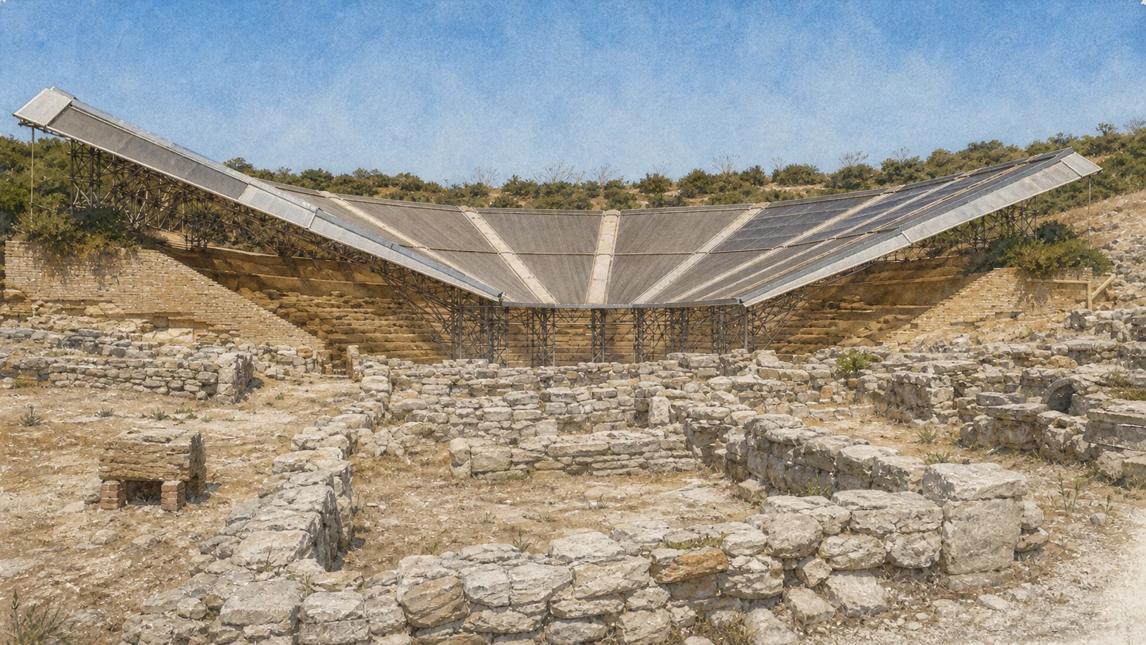
THEATRE AND CONSERVATION IN ONE VIEWThe modern protective canopy is part of the theatre's present condition; surviving seats and low rooms remain visible without borrowing a proposed future design.
12

NINE WEDGES, HONORIFIC SEATING AND AN OPEN HORIZON DEFINE A FRAGILE MONUMENT UNDER COVER

The Theatre, Its Cavea and the Sea

Landscape, seating and circulation form one theatre whose current canopy and conservation condition must remain visible.

Documentary watercolour of Eraclea Minoa's theatre beneath its angular modern protective canopy, with vulnerable stone seating and low archaeological rooms in front
THEATRE AND CONSERVATION IN ONE VIEW

The place today

The cavea rests against the slope below the summit terrace and opens toward the Mediterranean. Stairways divide the seating into nine wedge-shaped sectors.

The historical chapter

The Park dates the theatre to the fourth century BC, contemporary with the deeper residential phase. Greek theatres coordinated audience movement through radial stairs and horizontal passages while distinguishing privileged seats closest to ritual and performance.

What to notice

  • Do not publish an uncovered current view by digitally deleting the canopy. Historic photographs and present condition must be labelled separately.
  • Avoid claiming a fixed seating capacity without citing a measured study; preservation and reconstruction of the upper cavea remain incomplete.
Valley of the Temples Park · Theatre of Eraclea Minoa
13

THE PERFORMANCE BUILDING DISAPPEARED BEFORE DOMESTIC ROOMS CROSSED ITS FORMER STAGE AREA

Orchestra, Lost Stage and Later Houses

The orchestra and drainage system explain performance, while later houses reveal how the abandoned theatre returned to urban use.

Documentary watercolour of Eraclea Minoa's theatre beneath its angular modern protective canopy, with vulnerable stone seating and low archaeological rooms in front
THEATRE AND CONSERVATION IN ONE VIEW

The place today

A drainage channel, the euripos, runs around the orchestra. Walls from later domestic structures intersect the stage zone where visitors might expect theatrical architecture.

The historical chapter

The orchestra hosted choral movement within a theatre whose early form did not require the monumental masonry stage façades familiar from Roman examples. The Park dates occupation of the stage area by houses to the second century BC and regards the theatre as probably disused by then.

What to notice

  • Do not reconstruct a permanent stone stage façade merely because other Sicilian theatres acquired one in later phases.
  • The precise end of performances is inferred from archaeology; use 'probably disused' rather than asserting a documented closing date.
Valley of the Temples Park · Orchestra, drainage and stage interpretation
14

A SACRED TERRACE ABOVE THE THEATRE CONNECTED CULT WITH THE CITY'S HIGHEST GROUND

The Summit Sanctuary of a Female Deity

The deity's gender can be approached through finds, but a specific divine name requires caution.

Documentary watercolour of Eraclea Minoa's theatre beneath its angular modern protective canopy, with vulnerable stone seating and low archaeological rooms in front
THEATRE AND CONSERVATION IN ONE VIEW

The place today

On the summit terrace above the theatre, foundations and deposits mark a sanctuary associated with a female divinity. It does not survive as a standing temple and can be difficult to separate visually from the plateau. Finds in the Antiquarium help reconstruct cult activity, while the elevated relation with theatre and sea supplies the topographic context.

The historical chapter

Sanctuary use developed within the Hellenistic city and produced votive material connected with a female cult. Earlier scholarship has explored possible identities, but the Park retains the broader designation rather than assigning an unquestioned goddess. Sacred space above the theatre could structure procession, gathering and civic protection.

What to notice

  • Use 'female deity' unless a specific study and find context justify a more precise attribution.
  • Do not climb to closed terrace edges or move votive-looking fragments; portable material belongs to the archaeological record.
Valley of the Temples Park · Sanctuary above the theatre
15

BURIALS OUTSIDE THE WALLS PRECEDED THE THEATRE, WHILE CHRISTIAN FUNERARY USE RETURNED AFTER A LONG URBAN SILENCE

The Necropolis and the Late-Antique Funerary Return

Death landscapes extend the chronology on both sides of the excavated city.

Documentary watercolour of Eraclea Minoa's theatre beneath its angular modern protective canopy, with vulnerable stone seating and low archaeological rooms in front
THEATRE AND CONSERVATION IN ONE VIEW

The place today

Necropolis areas lie beyond the defensive circuit and are not all part of a straightforward independent route. The Antiquarium preserves objects recovered from graves, providing chronology and ritual evidence absent from empty tombs. The Park also records a funerary basilica built in the fifth or sixth century AD after centuries without dense urban occupation.

The historical chapter

The ancient necropolis produced evidence from the sixth through fourth centuries BC, covering foundation, frontier growth and the period before the surviving Hellenistic houses. After urban life faded in the late first century BC, the plateau and extra-urban zone did not remain completely unused. Late-antique Christian burial and basilical construction created a new sacred geography without restoring Eraclea Minoa as a classical city.

What to notice

  • Confirm access before seeking grave sectors outside the main route and never enter unstable tomb cuts or private land.
  • Do not describe the late-antique basilica as uninterrupted continuation of the female sanctuary; a long occupational break separates them.
Valley of the Temples Park · Necropolis and late-antique basilica
16

CERAMICS, TERRACOTTAS AND HOUSEHOLD OBJECTS RESTORE COLOUR, RITUAL AND EXCHANGE TO LOW MARLY RUINS

The Antiquarium and the Portable City

The small museum is not an optional appendix; it holds the evidence that prevents architecture from becoming abstract.

Documentary watercolour of Eraclea Minoa's theatre beneath its angular modern protective canopy, with vulnerable stone seating and low archaeological rooms in front
THEATRE AND CONSERVATION IN ONE VIEW

The place today

Near the archaeological entrance, the Antiquarium displays a selected group of figured pottery, terracotta statuettes, domestic objects and material from the city and graves. Its scale is compact enough for careful viewing before or after the outdoor route. Exhibition arrangements, conservation loans and opening conditions can change, so current Park information takes precedence over old photographs.

The historical chapter

Excavations from the mid-twentieth century onward moved vulnerable and portable material into protected collections. Ceramics reveal trade and chronology; figurines help interpret sanctuaries; household objects define activities rarely visible from walls. The museum also records the methods and priorities of excavation.

What to notice

  • Check museum photography rules and do not assume every object on older guides remains in the same case.
  • Museum labels can preserve earlier terminology; compare them with current Park and research publications when an attribution is debated.
Valley of the Temples Park · Antiquarium of Eraclea Minoa
17

SURVEY, STATE ACQUISITION AND STRATIGRAPHIC EXCAVATION TURNED A KNOWN HEADLAND INTO AN ARCHAEOLOGICAL CITY

From Salinas to Griffo and De Miro

The visible route is the result of research choices, not the complete ancient settlement uncovered all at once.

Documentary watercolour of Eraclea Minoa's theatre beneath its angular modern protective canopy, with vulnerable stone seating and low archaeological rooms in front
THEATRE AND CONSERVATION IN ONE VIEW

The place today

Excavated theatre, houses and wall sectors occupy selected zones within a much larger plateau. Old trenches, protective buildings and filled areas show how archaeological work advanced by campaigns. Plans are essential for understanding what remains buried or was re-covered for protection.

The historical chapter

Antonino Salinas studied the theatre area in 1907, and partial excavation followed in 1941 under Pietro Griffo. The site entered state ownership in 1942. Systematic stratigraphic campaigns began in 1950 with Griffo and Ernesto De Miro, exposing the theatre, fortifications and later residential sectors.

What to notice

  • Do not interpret unexcavated ground as empty or assume that all six kilometres of wall have been exposed.
  • Historic photographs show different conservation states; date them before using them to describe what a visitor sees today.
University of Palermo · Discovery and conservation history of the theatre
18

TWO MODERN PROTECTIVE SYSTEMS BECAME PART OF THE MONUMENT'S HISTORY WITHOUT SOLVING ITS MATERIAL DECAY

Minissi's Perspex Shells and the Provisional Canopy

Conservation at Eraclea Minoa is a sequence of experiments, consequences and renewed design rather than one successful shelter.

Documentary watercolour of Eraclea Minoa's theatre beneath its angular modern protective canopy, with vulnerable stone seating and low archaeological rooms in front
THEATRE AND CONSERVATION IN ONE VIEW

The place today

The cavea now lies beneath a broad later canopy. It replaced Franco Minissi's celebrated transparent Perspex shells, installed in the 1960s to protect and visually suggest the seating volume. The shells aged, maintenance failed and they were removed; the later cover also acquired a prolonged provisional status.

The historical chapter

Immediately after excavation, the marl disintegrated under wind, salt, rain and runoff. Experiments with acrylic and vinyl consolidants began in the 1950s, followed by Minissi's innovative shaped covering. Research from the University of Palermo documents damaging long-term effects, inadequate monitoring and continued deterioration.

What to notice

  • Do not reproduce the Perspex shells as the current cover or render the 2024 winning design as already built without official completion evidence.
  • The shelter is architecture under evaluation, but visitor restrictions around it protect ancient material; never cross barriers to inspect joints or seats.
Sicilian Region · 2024 winning design for theatre conservation
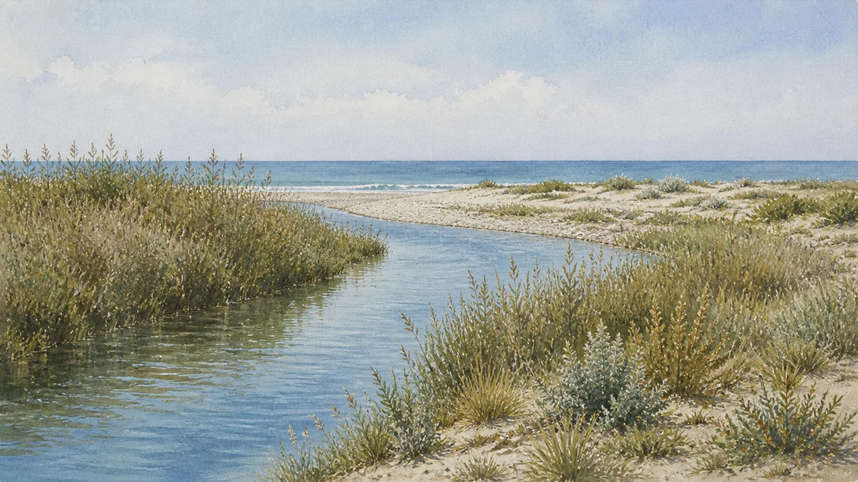
Documentary watercolour of the Platani river mouth near Eraclea Minoa with calm reed-lined water, pale shingle bar, low dunes and the Mediterranean beyond
RIVER, DUNES AND A MOVING SHOREThe Platani reaches the sea through reed beds, shingle, dunes and low maquis, a protected transition whose channels and shoreline continue to change.
19

RIVER, SAND, SCRUB AND COAST FORM A 206-HECTARE RESERVE AT THE FIRST SICILIAN LANDFALL FOR MANY MIGRANTS

The Platani Mouth, Dunes and Migratory Birds

The protected landscape is ecologically valuable because habitats meet here, not because it is free of human alteration.

Documentary watercolour of the Platani river mouth near Eraclea Minoa with calm reed-lined water, pale shingle bar, low dunes and the Mediterranean beyond
RIVER, DUNES AND A MOVING SHORE

The place today

The Foce del Fiume Platani reserve covers 206.88 hectares in Cattolica Eraclea and Ribera. River water, sandy beach, dune ridges, Mediterranean scrub, planted woodland and clay terrain create varied habitats. The Region identifies the coast as an important first landing area for birds arriving from Africa.

The historical chapter

The reserve was established in 1984 and later refined, with goals including bird conservation and recovery of Mediterranean scrub and dunes. It also forms part of the Natura 2000 site linking the Magazzolo and Platani mouths, Capo Bianco and Torre Salsa. Planting, forestry and erosion altered the natural mosaic; management now includes gradual conversion of artificial conifer stands toward more appropriate native vegetation where possible.

What to notice

  • Use marked paths, keep dogs under the applicable rules, remain distant from birds and never use playback or drones to force wildlife encounters.
  • Do not walk over foredune plants for a shorter beach route. Low vegetation traps sand and is easily destroyed by repeated footprints.
Sicilian Region ORBS · Foce del Fiume Platani Nature Reserve
20

SOFT MARL, RETREATING SHORE AND DEFENCE PROJECTS MAKE CHANGE PART OF THE LANDSCAPE

Capo Bianco, Beach Erosion and Coastal Defence

Geology and coastal intervention belong to one dynamic system whose future shape should never be presented as fixed.

Documentary watercolour of the Platani river mouth near Eraclea Minoa with calm reed-lined water, pale shingle bar, low dunes and the Mediterranean beyond
RIVER, DUNES AND A MOVING SHORE

The place today

Capo Bianco appears luminous white above the blue sea, with softer rounded or gullied surfaces beside harder layers. East of Capo Bianco, the beach, pinewood, roads and seasonal facilities form the modern marine settlement of Eraclea Minoa.

The historical chapter

Marine sediments consolidated into the pale formations that later supplied workable building stone and shaped the promontory. Coastal currents, river sediment, storms and human interventions jointly shape the littoral.

What to notice

  • Do not confuse Capo Bianco with Scala dei Turchi. They share a broader pale geological character but are distinct places with different forms and access.
  • Avoid before-and-after claims based on one photograph or season. Beach nourishment redistributes sediment and requires monitoring; it does not freeze the coast.
Sicilian Region ORBS · Geology of the Platani mouth and Capo Bianco

The city through time

Ten passages through foundation, frontier, urban reuse and conservation

The chronology continues beyond the ancient city into the modern exposure of marl, protective architecture and coastal intervention.

  1. Later myth links Minos, Daedalus and Kokalos to the region; archaeological evidence of wider Mycenaean contact gives the story a Mediterranean context but not a literal local foundation date.

  2. Selinuntines establish a settlement on the Capo Bianco plateau near the Halykos; early walls and graves precede the surviving theatre and houses.

  3. Euryleon, survivor of Dorieus' expedition, becomes associated with the Heraclean name, while the sequence and meaning of Eraclea and Minoa remain debated.

  4. Akragas, Carthage and Greek rulers contest the frontier; the Halykos serves at times as a political boundary without ending exchange across it.

  5. The Hellenistic city builds the theatre, sanctuary, orthogonal streets and compact courtyard houses; fortifications respond to repeated insecurity.

  6. Roman and Carthaginian warfare affects the city; the theatre falls out of use and domestic structures occupy the former stage area.

  7. Recolonisation associated with Publius Rupilius creates a more dispersed Roman Republican settlement that reuses earlier roads before dense urban occupation ends.

  8. A funerary basilica and cemetery mark renewed late-antique Christian use after a long break from the classical city.

  9. Salinas, Griffo and De Miro investigate the site; excavation exposes fragile marl, followed by chemical treatments, Minissi's Perspex shells and a later provisional canopy.

  10. A new theatre-conservation design process and continuing nourishment, monitoring and coastal-finance procedures show that both monument and shoreline remain active public responsibilities.

Before your visit

Practical information,
without turning it into promises

01

Separate the archaeological visit from the reserve walk

Use the official entrance for the Antiquarium, theatre, houses and accessible walls. Plan the Platani mouth and dunes as a second route with different surfaces, conservation rules and weather exposure; do not attempt to connect them by improvised cliff paths.

02

Check current Park hours and route restrictions

The current official page lists daily opening from 9:00 to 17:30 with ticket office closing at 17:00, but conservation work, heat, wind, events or staffing can change access to covered ruins and wall sectors.

03

Treat marl, cliffs and dunes as fragile surfaces

Wear stable footwear, carry water and sun protection, stay behind barriers, never sit on theatre seats, avoid cliff bases and edges, and use marked dune paths. Conditions can deteriorate after rain, wind or rough sea.

04

Read every modern intervention by its date and status

Minissi's shells, the present canopy, the 2024 winning theatre design, groynes, nourishment and later monitoring belong to different projects. A design award, authorisation, financed act, construction phase and completed conservation outcome are not interchangeable.

Sources

This guide cross-checks the current Valley of the Temples Archaeological Park, the Sicilian Region's ORBS protected-area portal and environmental and cultural-heritage acts, research by the University of Palermo, and Ernesto De Miro's archaeological syntheses. It distinguishes foundation myth from excavation, a disputed name sequence from settled chronology, Selinuntine origin from later Akragantine and Punic control, political authority from cultural uniformity, Hellenistic houses from Rupilian reuse, ancient theatre from later stage-area dwellings, current canopy from Minissi's removed Perspex shells, a winning conservation design from completed work, protected status from unrestricted access, and authorised nourishment from a permanently stabilised coast.

The hero image is an illustration, not a photograph. Official visual references remain archived locally for verification. Park hours, ticketing, theatre and house access, protective covers, new conservation works, reserve paths, fire restrictions, river conditions, bird-sensitive areas, cliff safety, road access, nourishment works, groynes, beach width, water quality, services and sea state can change; consult the linked institutions before visiting.