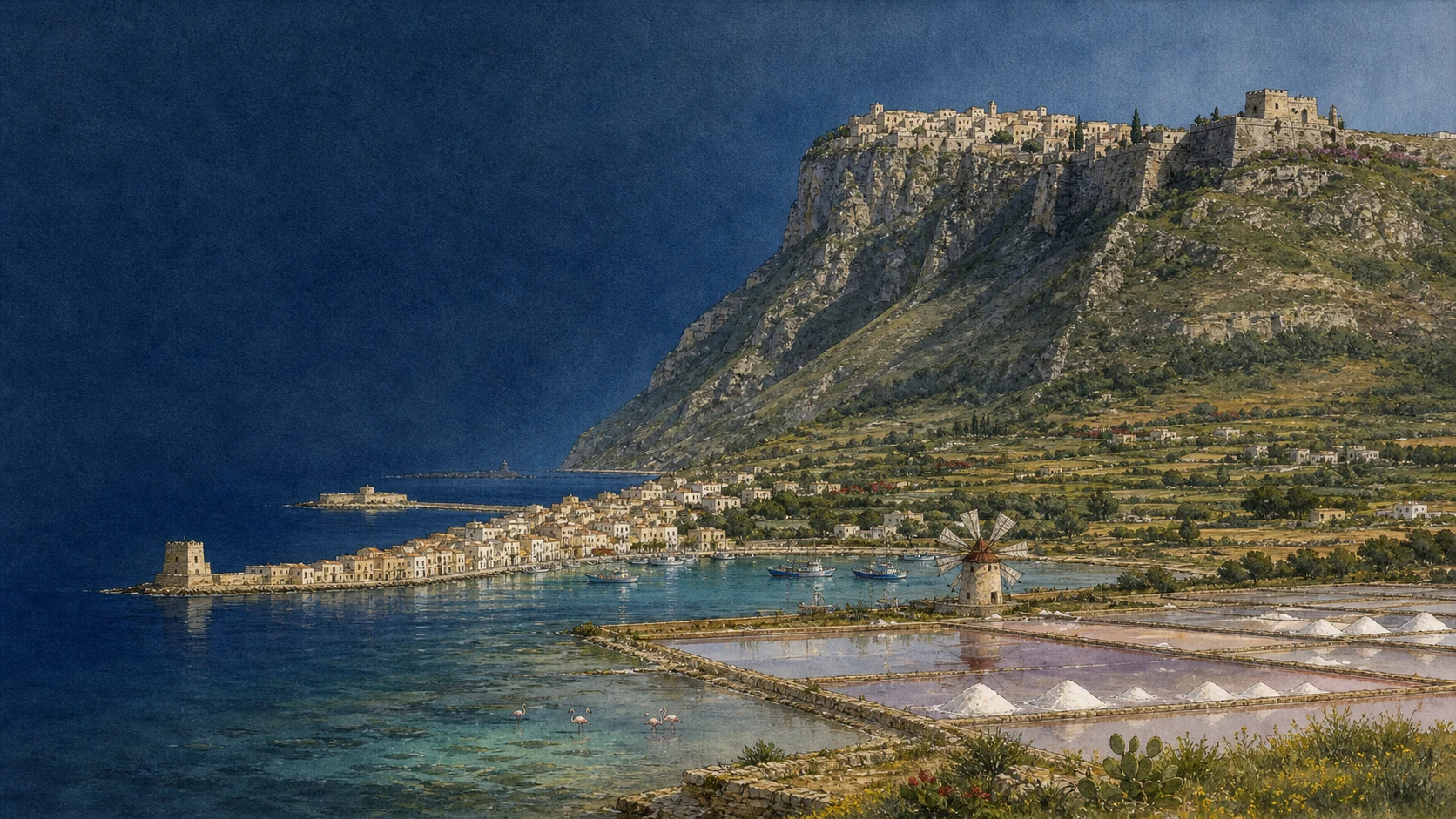
Documentary spring watercolour linking Erice on its real mountain with Trapani's sickle-shaped coast, Torre di Ligny, harbour, salt pans and windmills

ILLUSTRATED GUIDE · SICILY

A mountain sanctuary,
a harbour shaped like a sickle
and a landscape made by salt

Twenty-six substantial chapters move between Erice's sanctuary mountain, Trapani's sickle-shaped port and the working salt wetland, preserving distinct landscapes, histories and living practices.

Explore the places
ERICE & TRAPANI · MOUNTAIN, PORT, CORAL, DEVOTION AND SALT

TWO CITIES THAT SHARE A HORIZON BUT NOT A SINGLE STORY

From Trapani, Erice appears to float above the plain. From Erice, the port, the Egadi Islands and the salt pans become one immense map of sea routes, basins, roads and settlements.

The view is so complete that it can flatten the places below into scenery. Yet the mountain and the harbour grew through different forms of power: sanctuary and fortified summit above; emporium, naval base, fishing port and commercial city below.

They were never isolated. Eryx needed its maritime approaches; Drepanon was tied to the mountain, the western routes and the productive salt coast. Roads, processions, pilgrimages, trade and, today, the cableway keep joining the two levels.

This guide therefore treats Erice and Trapani as one connected territory without confusing them. It moves slowly through archaeology, churches, streets, workshops, waters and living traditions, and it marks uncertainty whenever legend, later memory and material evidence do not say the same thing.

One destination

Twenty-six chapters across mountain, harbour and salt plain

Erice occupies the summit of Monte San Giuliano, about 751 metres above the western Sicilian coast. Its walls, gates and sanctuary landscape preserve an urban history associated with the Elymians, then reshaped by Punic, Roman, Islamic, Norman and later Sicilian powers.

Trapani stands on the low, wind-exposed peninsula whose curved form was compared in antiquity to a sickle. The natural harbour gave the settlement its strategic value and linked it to Eryx, Carthage, Rome, North Africa, the Italian peninsula and the islands offshore.

Between the summit and the harbour lies a modern conurbation. Erice's municipality includes the populous lower area of Casa Santa as well as the historic mountain town, while Trapani extends eastward from its ancient peninsula. The postcard separation between isolated borgo and compact port is therefore only part of the present geography.

The wider landscape is productive as well as beautiful. Salt pans remain working environments and protected wetlands; the port remains an infrastructure; religious images still move through streets and across water; coral, sculpture, pastry and ceramics survive through skills, institutions and changing markets rather than as frozen folklore.

The selection

Twenty-six chapters,
three landscapes kept distinct

The route consolidates nearby monuments and connected histories while preserving Erice's summit, Trapani's peninsula and the salt pans as independent places joined by movement and exchange.

  1. 01Mountain, Sickle and Salt Plain: The Geography That Organises the Journey
  2. 02Eryx before the Classical Labels: An Elymian Centre
  3. 03The Summit Goddess from Astarte and Aphrodite to Venus Erycina
  4. 04Elymian-Punic Walls and the Three Gates of Erice
  5. 05From the Ancient Sanctuary to Gebel Hamed and Monte San Giuliano
  6. 06Castle of Venus and the Sanctuary beneath It
  7. 07Real Duomo, Frederick's Tower and San Giuliano
  8. 08Churches, Stone Streets, Courtyards and Convents
  9. 09Spanish Quarter and Cordici Museum
  10. 10Balio Gardens, Towers and Torretta Pepoli
  11. 11International Science, Ceramics, Wax and Pastry
  12. 12The Summit, Casa Santa and the Modern Municipality
  13. 13Drepanon: Sickle Harbour and Phoenician-Punic Emporium
  14. 14Drepana 249 and the Egadi Battle of 241 BC
  15. 15Roman, Byzantine and Islamic Trapani
  16. 16From Norman Duty-Free Port to Spanish Fortified City
  17. 17The Old-City Axes, Palazzo Senatorio and Astronomical Clock
  18. 18San Lorenzo Cathedral and the Jesuit Church
  19. 19Sant'Agostino, the Fountain of Saturn and the Annunziata Sanctuary
  20. 20Museo Pepoli, Coral Workshops and the Treasure of the Madonna
  21. 21The Purgatory Church and the Procession of the Misteri
  22. 22Saint Albert and the Madonna of Trapani
  23. 23Torre di Ligny, Colombaia, Lazzaretto and Villa Nasi
  24. 24Mura di Tramontana, Bastione Conca and the Former Fish Market
  25. 25The Working Salt Pans and Their Wetland Biodiversity
  26. 26Bombing, Reconstruction and the Modern Port
01

ERICE, TRAPANI AND THE SALT BASINS OCCUPY THREE DIFFERENT LEVELS OF ONE WESTERN LANDSCAPE

Mountain, Sickle and Salt Plain: The Geography That Organises the Journey

A meaningful route begins by separating summit town, harbour peninsula and productive wetland before tracing the movement between them.

Documentary watercolour of Erice's Elymian-Punic wall with massive weathered horizontal stone courses, a narrow path and spring wildflowers
ERICE · THE FORTIFIED MOUNTAIN

The place today

From the Balio gardens, Trapani's peninsula points toward Torre di Ligny, the Egadi Islands sit offshore and the salt pans spread southward in geometric basins. At ground level those distances are substantial: the historic centres, cableway stations, port, museum quarter and reserve cannot be treated as one walk.

The historical chapter

The mountain offered defence, visibility and a prestigious sanctuary site. The curved peninsula offered sheltered water and access to maritime routes. The flat coast permitted salt production by guiding seawater through successive evaporation basins. Political powers repeatedly joined these advantages without eliminating their separate urban identities.

What to notice

  • Plan the territory by level and travel time, not by how close landmarks appear from the summit.
  • The name Drepanon refers to the sickle-like form, but ancient etymology should not be mistaken for a precise modern shoreline map.
Municipalities of Erice and Trapani · institutional histories and territorial descriptions
02

THE MOUNTAIN WAS A WESTERN SICILIAN POLITICAL AND SACRED PLACE BEFORE GREEK OR ROMAN FAME

Eryx before the Classical Labels: An Elymian Centre

Elymian identity and Mediterranean contact provide the necessary starting point without turning Eryx into a Greek colonial town.

Documentary watercolour of Erice's Elymian-Punic wall with massive weathered horizontal stone courses, a narrow path and spring wildflowers
ERICE · THE FORTIFIED MOUNTAIN

The place today

The strongest visible evidence is not a reconstructed Elymian city but the relationship between summit, wall circuit, gates, sanctuary area and objects now held in museums. Archaeology remains fragmentary, and later construction covers much of the ancient settlement.

The historical chapter

Greek authors offered different origin stories for the Elymians, including Trojan refugees and peninsular migrants. These accounts are historically important as ancient identity narratives, not simple modern proof of ethnicity. Material and linguistic evidence instead places Eryx within a western Sicilian world shaped by indigenous communities and sustained contact with Phoenician, Punic and Greek networks.

What to notice

  • Use Elymian as the safest cultural frame; do not call Erice a securely founded Greek colony.
  • Ancient myths belong in the guide because they influenced later identity, but they must remain labelled as myths and literary traditions.
Municipality of Erice · city history
03

CHANGING NAMES REVEAL TRANSLATION, POWER AND CULT CONNECTIONS RATHER THAN ONE TIMELESS DEITY

The Summit Goddess from Astarte and Aphrodite to Venus Erycina

The famous sanctuary crossed Punic, Greek and Roman interpretive worlds while its exact architecture and rituals remain incomplete.

Documentary watercolour of Erice's Elymian-Punic wall with massive weathered horizontal stone courses, a narrow path and spring wildflowers
ERICE · THE FORTIFIED MOUNTAIN

The place today

The sanctuary no longer survives as an intact temple. Its importance is read through the site beneath and around the later castle, architectural fragments, votive material, inscriptions, ancient texts and objects dispersed between archaeological contexts and museums. The Roman phase is less visible in standing architecture than the medieval city.

The historical chapter

Sources connect the cult with Astarte, Aphrodite and Roman Venus Erycina, but these names should not imply a neat sequence in which one complete religion simply replaced another. The sanctuary's Mediterranean prestige grew through translation and political appropriation. Roman cults of Venus Erycina also developed beyond Sicily, extending the mountain's religious reputation into imperial networks. Rome took control after the First Punic War.

What to notice

  • No standing Greek temple should be imagined on the present skyline.
  • Avoid presenting literary accounts of sacred prostitution as an uncontested description of everyday practice.
Fondazione Erice Arte · Castle of Venus and sanctuary history
Documentary watercolour of Erice's Elymian-Punic wall with massive weathered horizontal stone courses, a narrow path and spring wildflowers
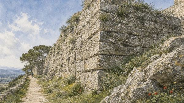
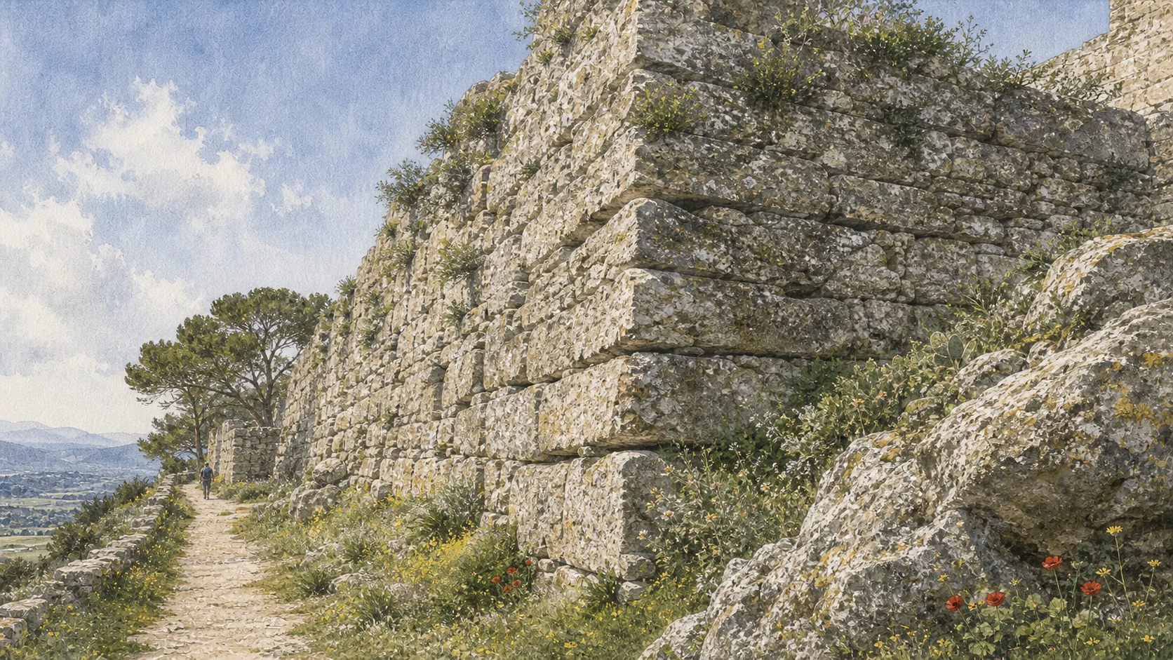
ERICE · THE FORTIFIED MOUNTAINMassive horizontal stone courses follow the summit edge and make Erice legible as a defended Elymian-Punic city.
04

FORTIFICATIONS AND ENTRANCES MAKE THE MOUNTAIN TOWN LEGIBLE AS A DEFENDED URBAN SYSTEM

Elymian-Punic Walls and the Three Gates of Erice

Stone courses, towers, masons' marks and three different approaches should be read together rather than as isolated postcard fragments.

Documentary watercolour of Erice's Elymian-Punic wall with massive weathered horizontal stone courses, a narrow path and spring wildflowers
ERICE · THE FORTIFIED MOUNTAIN

The place today

Large lower stone blocks, smaller upper masonry, towers and altered sections can be followed between the principal gates. Punic letters cut into blocks are among the most distinctive details, although they are easier to understand with careful observation or interpretation. Porta Trapani receives the principal road and visitor flow.

The historical chapter

The municipality dates the earliest defensive formation broadly between the eighth and sixth centuries BC and associates later strengthening with Punic power. The letters are generally placed around the sixth to fifth centuries BC and may relate to quarrying or construction marks. Roman, medieval and modern rebuilding changed the circuit, while restorations in 1877 and 1922 further shaped what visitors see. Each entrance was altered across medieval and later periods.

What to notice

  • The common name Punic walls is useful but incomplete; parts predate Punic reinforcement and many sections are later repairs.
  • Porta Trapani's present dominance reflects modern arrival patterns as much as ancient hierarchy.
Municipality of Erice Virtual Tour · Elymian-Punic walls
05

THE SUMMIT CHANGED RELIGION, LANGUAGE AND POLITICAL CONTROL WITHOUT LEAVING HISTORY

From the Ancient Sanctuary to Gebel Hamed and Monte San Giuliano

Late-antique, Islamic and Norman chapters demand a continuous sequence that neither invents missing monuments nor erases Muslim Erice.

Documentary watercolour of Erice's Elymian-Punic wall with massive weathered horizontal stone courses, a narrow path and spring wildflowers
ERICE · THE FORTIFIED MOUNTAIN

The place today

The visitor encounters fragments rather than a complete phase: reused stone, altered defences, Christian sites, museum objects and place names. The name survives in modern cultural uses, including the municipal theatre, while the built summit appears predominantly medieval and later. Churches attributed by tradition to Count Roger, the castle, gateways and later medieval fabric define the visitor's sense of Norman Erice.

The historical chapter

Political authority changed through late Roman, Vandal, Ostrogothic, Byzantine and Islamic periods in Sicily. Muslim rule transformed western Sicily's agriculture, taxation, settlement and connections with North Africa. Norman power converted the former sanctuary zone into a fortified royal site and promoted Latin Christian institutions.

What to notice

  • Treat this period as archaeologically complex, not as an empty interval between famous civilisations.
  • Traditional church foundations by Roger should be introduced as tradition where building evidence is later.
Municipality of Erice · city history
Documentary watercolour of the low broad Castle of Venus on Erice's rocky summit with its stone approach and the western Sicilian landscape far below
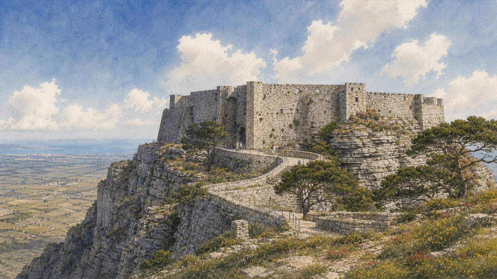
ERICE · CASTLE OF VENUSThe low Norman fortress occupies the sacred summit edge without reconstructing the ancient sanctuary beneath it.
06

A NORMAN FORTRESS OCCUPIES A SACRED EDGE WHOSE ANCIENT BUILDING CANNOT BE RECONSTRUCTED FROM FRAGMENTS ALONE

Castle of Venus and the Sanctuary beneath It

Castle, rock, reused blocks and the so-called Well of Venus preserve overlapping histories without forming a complete classical temple.

Documentary watercolour of the low broad Castle of Venus on Erice's rocky summit with its stone approach and the western Sicilian landscape far below
ERICE · CASTLE OF VENUS

The place today

Curtain walls, towers, rock, fragments and steep views create one of Sicily's most theatrical sites. Access routes and internal levels are difficult for some visitors, and restoration or event conditions can alter which spaces are open. The site rewards close reading of masonry, carved fragments and changes in level.

The historical chapter

The Norman monarchy established a fortified centre over an area already monumentalised for many centuries. The castle passed through royal and administrative uses and later served as a prison into the early twentieth century. This sequence explains why ancient fragments and medieval military architecture coexist without forming one building campaign. Later communities reused stone and reorganised the sanctuary platform.

What to notice

  • Call it the Castle of Venus only as the established place name; the standing structure is principally medieval.
  • Fragments confirm earlier monumental use, but they do not reveal the complete elevation of the ancient sanctuary.
Municipality of Erice Virtual Tour · Castle of Venus
07

CHURCHES AND FORTIFIED FORMS TURNED CONQUEST MEMORY INTO A NEW CHRISTIAN TOPOGRAPHY

Real Duomo, Frederick's Tower and San Giuliano

The cathedral complex and San Giuliano show different medieval foundations and later rebuildings within the town once renamed Monte San Giuliano.

Documentary watercolour of the low broad Castle of Venus on Erice's rocky summit with its stone approach and the western Sicilian landscape far below
ERICE · CASTLE OF VENUS

The place today

The crenellated exterior, rose window and powerful tower establish the medieval entrance to Erice. Inside, the spatial impression reflects major nineteenth-century reconstruction after structural failure, so the visitor should not expect an untouched medieval interior. The restrained exterior, 1770 bell tower with pagoda-like spire, rounded dome and bright three-aisled interior create a landmark distinct from the Duomo.

The historical chapter

Traditional historiography dates the royal foundation to 1314 under Frederick of Aragon, whose regnal numbering appears differently in sources. The church's royal origin produced the titles Real Duomo and Regia Matrice. A damaging nineteenth-century collapse led to extensive rebuilding; the reopening belongs to the modern history of the monument, not a minor repair. Tradition places the foundation in 1076 and credits Saint Julian with aiding Roger's siege.

What to notice

  • Explain the Frederick II or III numbering issue instead of silently choosing one version.
  • Current admission may be linked to the Erice Card or seasonal church circuit, so verify locally.
Diocese of Trapani · Real Duomo restoration history
08

RELIGIOUS FOUNDATIONS BELONG TO A DENSE URBAN FABRIC SHAPED BY WATER, WIND AND DAILY MOVEMENT

Churches, Stone Streets, Courtyards and Convents

San Martino, San Pietro, lanes, courtyards and convents become meaningful as one lived system rather than a checklist of facades.

Documentary watercolour of the low broad Castle of Venus on Erice's rocky summit with its stone approach and the western Sicilian landscape far below
ERICE · CASTLE OF VENUS

The place today

San Martino combines a simple façade, Baroque portal and three-aisled interior with a richly decorated confraternity room. San Pietro is often included in managed cultural circuits and has hosted exhibitions and displays connected with local artistic traditions. Polished stone can become slippery in rain and mist.

The historical chapter

Local tradition again associates San Martino with Roger. The church later received sovereigns and civic magistrates, while the 1517 union of the San Martino and Purgatory congregations shaped its institutional life. The Congrega preserves stucco, frescoes by the Manno brothers and a carved seventeenth-century wooden altar. The present fabric is not purely medieval.

What to notice

  • Treat the church network as civic and social history, not only as a list of façades.
  • Respect residential courtyards and distinguish public passages from private entrances.
Fondazione Erice Arte · San Martino and San Pietro
09

AN UNFINISHED GARRISON AND A CIVIC COLLECTION REVEAL BOTH IMPERIAL AMBITION AND LOCAL MEMORY

Spanish Quarter and Cordici Museum

Architecture, archaeology and art explain how Erice documented itself across incomplete projects and changing museum practices.

Documentary watercolour of the low broad Castle of Venus on Erice's rocky summit with its stone approach and the western Sicilian landscape far below
ERICE · CASTLE OF VENUS

The place today

Its exposed position gives broad views over the northern countryside and coast. The displays help visitors identify objects that walls and streets alone cannot explain. Placed within the Cordici collections, the works encourage two different kinds of looking: archaeological identification for the ancient head and artistic authorship, material and devotional setting for the Renaissance sculpture.

The historical chapter

Construction began in the seventeenth century in the context of Spanish military administration. The museum grew from civic efforts to gather inscriptions, antiquities and artworks formerly dispersed through churches, corporations and public spaces. The museum presents the female head through the long civic association with Venus Erycina but does not turn the popular name into absolute proof of identity.

What to notice

  • Do not present Quartiere Spagnolo as a completed barracks or a residential Spanish neighbourhood.
  • Do not merge an ancient cult object and a Renaissance Christian sculpture into a generic story of timeless beauty.
Municipality of Erice Virtual Tour · Spanish Quarter
10

DEFENCE WAS REFRAMED AS PROMENADE, PANORAMA AND CULTURAL RETREAT

Balio Gardens, Towers and Torretta Pepoli

The gardens and Moorish-Revival tower are nineteenth-century interventions beside medieval remains, not survivals of an Islamic palace landscape.

Documentary watercolour of the low broad Castle of Venus on Erice's rocky summit with its stone approach and the western Sicilian landscape far below
ERICE · CASTLE OF VENUS

The place today

Paths move between mature planting, towers, the castle approach and overlooks toward Trapani, Mozia, the Egadi Islands, Monte Cofano and the salt pans. Wind, cloud and visibility can change the experience within minutes. Restored in 2014, the building functions as an interpretive museum and peace observatory.

The historical chapter

Count Agostino Pepoli developed an English-style garden in the nineteenth century and helped transform the castle precinct into a place of culture and contemplation. The result is not a surviving medieval garden but a later aesthetic intervention around much older fortifications. The Moorish-revival design belongs to nineteenth-century historicism, when patrons assembled imagined medieval and Islamic visual languages for modern cultural life.

What to notice

  • Label the gardens as nineteenth-century landscape design rather than a Norman setting.
  • Interior access and multimedia operation should be checked with the current municipal cultural circuit.
Municipality of Erice Virtual Tour · Balio gardens and towers
11

MONASTERIES AND WORKSHOPS KEEP THE SUMMIT PRODUCTIVE BEYOND HERITAGE DISPLAY

International Science, Ceramics, Wax and Pastry

The Majorana Centre and living crafts show contemporary Erice through institutions and makers whose practices require continuity, not nostalgia alone.

Documentary watercolour of the low broad Castle of Venus on Erice's rocky summit with its stone approach and the western Sicilian landscape far below
ERICE · CASTLE OF VENUS

The place today

Lecture rooms, courtyards and former monastic buildings remain part of an active institutional network rather than a conventional museum. Public access depends on programmes, conferences and the policies of individual sites. Workshops and food businesses vary widely in scale and method.

The historical chapter

The first course followed in 1963. Over subsequent decades, the centre expanded across restored buildings and hosted researchers from many countries. The 1982 Erice Manifesto connected scientific responsibility with nuclear risk and peace; later updates continue that public mission. Convents, confraternities and family workshops preserved specialised recipes and techniques.

What to notice

  • Institutional participant and Nobel-laureate totals change and should be attributed if quoted.
  • Genovesi and other pastries are living foods with multiple recipes, so avoid claims of one unchanged medieval formula.
Ettore Majorana Foundation and Centre for Scientific Culture · official history
12

THE CABLEWAY CONNECTS A FAMOUS HISTORIC CORE TO THE MUCH LARGER TOWN BELOW

The Summit, Casa Santa and the Modern Municipality

Modern neighbourhoods, transport and weather expose the limits of treating Erice as an isolated stone village above the clouds.

Documentary watercolour of the low broad Castle of Venus on Erice's rocky summit with its stone approach and the western Sicilian landscape far below
ERICE · CASTLE OF VENUS

The place today

Casa Santa contains homes, schools, services, sports facilities and the valley cableway station. The cableway makes the vertical relationship visible, but weather, wind, weekly maintenance and seasonal timetables affect operation.

The historical chapter

Twentieth-century expansion moved population and services down the mountain while the historic summit became increasingly dependent on conservation and tourism. The cableway, rebuilt and modernised across different phases, links this contemporary city with the old centre rather than simply delivering visitors to a detached medieval stage.

What to notice

  • Check Funierice on the day of travel; published timetables do not guarantee operation in high wind or during maintenance.
  • A complete social geography should acknowledge lower Erice instead of treating the municipality as an uninhabited mountain monument.
Funierice · current operations and timetable
13

A PROTECTED MARITIME SHAPE TURNED ERYX'S LANDING PLACE INTO A STRATEGIC PORT

Drepanon: Sickle Harbour and Phoenician-Punic Emporium

Trapani's ancient history begins with harbour geography and exchange rather than with a fully known monumental city plan.

Documentary watercolour of the low broad Castle of Venus on Erice's rocky summit with its stone approach and the western Sicilian landscape far below
ERICE · CASTLE OF VENUS

The place today

The port still touches the historic centre. Ferries, fishing activity, passenger terminals, quays, coastguard functions and urban promenades overlap, so the waterfront cannot be understood as one continuous leisure zone. Little of the Punic port appears as a complete monument.

The historical chapter

The harbour served Eryx and western maritime networks before developing as a Punic emporium and naval position. Shorelines, quays and defensive works changed repeatedly, meaning the modern sickle is a powerful geographical image but not an untouched ancient outline. Phoenician merchants and later Carthaginian power used the harbour as an emporium and strategic base.

What to notice

  • Remain outside operational port areas and follow current pedestrian routes.
  • Phoenician and Carthaginian are related historical terms but should not be used interchangeably for every century.
Municipality of Trapani · city history
14

TWO NAVAL BATTLES MUST BE KEPT DISTINCT IN PLACE, EVIDENCE AND CONSEQUENCE

Drepana 249 and the Egadi Battle of 241 BC

A Roman defeat off Trapani and the later battle near the Egadi frame the end of the First Punic War without collapsing into one local legend.

Documentary watercolour of the low broad Castle of Venus on Erice's rocky summit with its stone approach and the western Sicilian landscape far below
ERICE · CASTLE OF VENUS

The place today

No single viewpoint reproduces the battle. Torre di Ligny and the western waterfront help explain sea room and harbour approach, while museum interpretation and regional underwater archaeology give the conflict its material context. Rams, helmets and other finds recovered through underwater archaeology are preserved and studied within regional museum networks.

The historical chapter

The Roman consul Publius Claudius Pulcher attempted to surprise the Carthaginian fleet. Adherbal brought his ships out and used manoeuvring space more effectively, trapping Roman vessels against the coast. Later anecdotes about sacred chickens are part of Roman literary memory and political blame, not a complete tactical explanation. In 241 BC the Roman fleet intercepted Carthaginian ships attempting to reach western Sicilian positions.

What to notice

  • Separate the 249 BC battle at Drepana from the decisive 241 BC Battle of the Egadi Islands.
  • Underwater objects are protected cultural property; rely on museums and authorised research rather than souvenir narratives.
Municipality of Trapani · city history
15

PORT CONTINUITY OUTLASTED THE SPARSE MONUMENTAL RECORD AND PRODUCED NEW QUARTERS AND NAMES

Roman, Byzantine and Islamic Trapani

Archaeology, street patterns and written sources reveal long urban use while limiting claims about precise buildings now lost.

Documentary watercolour of the low broad Castle of Venus on Erice's rocky summit with its stone approach and the western Sicilian landscape far below
ERICE · CASTLE OF VENUS

The place today

The visitor sees the long-term urban consequences more readily than individual Roman buildings: street directions, harbour logic, reused materials and objects in collections. Later churches and fortifications occupy many ancient areas. No single Arab quarter survives intact.

The historical chapter

Under Rome, Trapani belonged to Sicily's provincial economy and maritime communications. After the western empire fragmented, Byzantine authority maintained strategic coastal links. Sparse visible remains should not be equated with disappearance; ports often preserve function while rebuilding erases architectural phases. Municipal history attributes enlargement of the port, new quarters, hydraulic works and strengthened fishing activity to the Islamic period.

What to notice

  • Avoid attaching an ancient date to every surviving tower in the absence of stratigraphic evidence.
  • Couscous and other living foods have layered histories; do not claim one recipe has remained unchanged since conquest.
Municipality of Trapani · historical profile
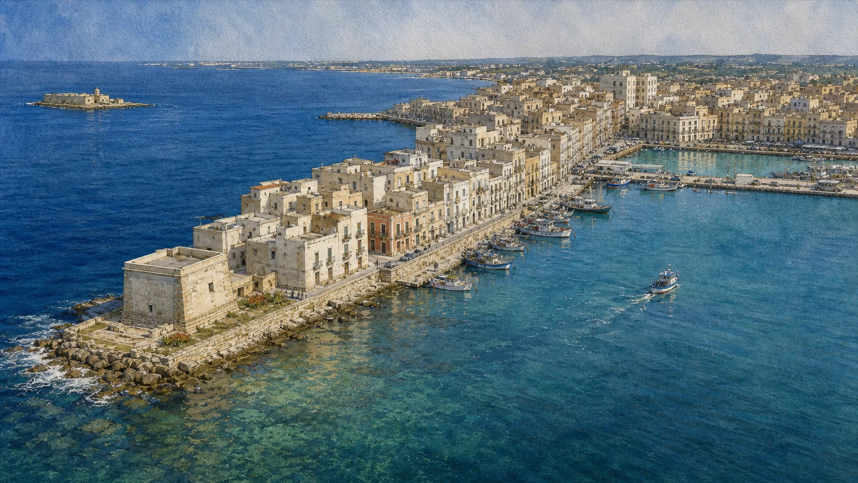
Documentary watercolour aerial of Trapani's long low peninsula with square Torre di Ligny, pale old-city buildings, harbour quays and a separate Colombaia islet
TRAPANI · THE SICKLE PORTTorre di Ligny marks the end of a low urban peninsula between open sea and the working harbour.
16

TRADE PRIVILEGES, FOREIGN COMMUNITIES AND BASTIONS EXPANDED THE PENINSULA'S URBAN ROLE

From Norman Duty-Free Port to Spanish Fortified City

Norman-Swabian port policy and Aragonese-Spanish defence belong to a connected transformation of harbour, walls and civic fabric.

Documentary watercolour aerial of Trapani's long low peninsula with square Torre di Ligny, pale old-city buildings, harbour quays and a separate Colombaia islet
TRAPANI · THE SICKLE PORT

The place today

The medieval city is visible through church foundations, street corridors, surviving gates and later buildings that incorporated older fabric. Commercial geography remains clearer than any single Norman palace. Porta Oscura, surviving bastions, wall fragments and the distinction between Castello di Terra and Castello di Mare help reconstruct the fortified system.

The historical chapter

The port received fiscal privileges and hosted foreign merchant communities and consular representation. Norman and Swabian governments depended on maritime revenues and communication, while religious institutions multiplied within the city. The harbour connected royal Sicily with North Africa, Italy and crusading routes. Aragonese rulers enlarged the circuit and reorganised urban access.

What to notice

  • A medieval foundation does not mean a church's visible façade is medieval; most were rebuilt.
  • Later demolitions mean the present waterfront cannot be read as a complete defensive circuit.
Municipality of Trapani · Norman and medieval port history
17

THREE STREETS CONVERGE ON A CIVIC FACADE, A MEDIEVAL GATE AND MEASURED URBAN TIME

The Old-City Axes, Palazzo Senatorio and Astronomical Clock

Corso Vittorio Emanuele, Torrearsa and Garibaldi orient a walk whose monuments record several building phases rather than one Baroque scene.

Documentary watercolour aerial of Trapani's long low peninsula with square Torre di Ligny, pale old-city buildings, harbour quays and a separate Colombaia islet
TRAPANI · THE SICKLE PORT

The place today

Corso Vittorio Emanuele links major churches and palaces; Via Torrearsa passes the municipal façade and clock; Via Garibaldi records later aristocratic and civic display. Side streets lead quickly toward port water, the northern walls and former craft quarters. The three-order façade of Palazzo Senatorio carries statues of the Madonna of Trapani, Saint John the Baptist and Saint Albert.

The historical chapter

The medieval Rua Grande became a ceremonial axis as noble houses, religious institutions and government buildings were rebuilt. Street names and functions changed after unification, bombing, traffic modernisation and pedestrianisation. The result is a layered public space rather than one preserved Baroque avenue. The palace occupied the site of the Loggia dei Pisani, was built from the fifteenth century and renewed in the later seventeenth century.

What to notice

  • Walk the axes at different times: service traffic, worship and evening activity change their character.
  • Public-office access is not the same as unrestricted monument visiting.
Municipality of Trapani · city and visitor geography
18

GENOESE PATRONAGE, DIOCESAN STATUS AND JESUIT EDUCATION SHAPED TWO DIFFERENT BAROQUE INTERIORS

San Lorenzo Cathedral and the Jesuit Church

The adjacent religious institutions reward comparison while their foundations, materials and later restorations remain distinct.

Documentary watercolour aerial of Trapani's long low peninsula with square Torre di Ligny, pale old-city buildings, harbour quays and a separate Colombaia islet
TRAPANI · THE SICKLE PORT

The place today

Its broad façade and domed profile anchor Corso Vittorio Emanuele. Interior chapels, artworks and liturgical space require a slower visit than a façade photograph, while services and ceremonies govern access. A disciplined façade opens to a three-aisled interior rich in mixed marble, stucco and a major marble icon.

The historical chapter

Municipal interpretation dates the initial chapel to 1102, major enlargement to the fifteenth century, a complete renewal under Bonaventura Certo in 1639 and the present animated façade to Giovanni Biagio Amico in 1743. Cathedral status belongs to the later diocesan history of Trapani. The design is dated to 1613 and probably associated with the Messinese architect Natale Masuccio.

What to notice

  • Separate the medieval origin from the largely seventeenth- and eighteenth-century architectural appearance.
  • Mixed marble is a specialised decorative technique, not a generic label for colourful interiors.
Municipality of Trapani Tourism · Cathedral of San Lorenzo
19

A MERCHANT CHURCH, CIVIC WATER MONUMENT AND MARIAN SANCTUARY LINK OLD CENTRE TO EASTERN EXPANSION

Sant'Agostino, the Fountain of Saturn and the Annunziata Sanctuary

Rose window, fountain and sanctuary belong to separate contexts that together reveal medieval, civic and devotional Trapani.

Documentary watercolour aerial of Trapani's long low peninsula with square Torre di Ligny, pale old-city buildings, harbour quays and a separate Colombaia islet
TRAPANI · THE SICKLE PORT

The place today

The splayed portal and rose window converge on the central Agnus Dei. Nearby, the Fountain of Saturn gives the small square a civic rather than purely religious character and recalls the legendary founder used in Trapani's urban imagery. The Gothic Chiaramonte portal and rose window survive beside a strong Baroque bell tower, while the church interior reflects Giovanni Biagio Amico's eighteenth-century transformation.

The historical chapter

The church was associated first with the Templars and was granted to Augustinians by Frederick III in 1313. It was severely damaged during the Second World War; painted medieval roof panels survive in part at Museo Pepoli. The fountain belongs to Trapani's historical water and civic-symbolic system and was altered across later centuries. Frederick III of Aragon supported the fourteenth-century church.

What to notice

  • The surviving façade should not conceal the extent of wartime loss to the church interior.
  • The sanctuary is active; feast preparations and liturgy may restrict ordinary visiting.
Municipality of Trapani Tourism · Sant'Agostino
20

A PORT'S LUXURY CRAFTS BECOME LEGIBLE THROUGH MATERIALS, TOOLS, PATRONAGE AND MUSEUM CONTEXT

Museo Pepoli, Coral Workshops and the Treasure of the Madonna

Coral, gold, silver, sculpture and textiles reveal specialised production without reducing Trapani's economy to souvenir craft.

Documentary watercolour aerial of Trapani's long low peninsula with square Torre di Ligny, pale old-city buildings, harbour quays and a separate Colombaia islet
TRAPANI · THE SICKLE PORT

The place today

Its collections range from sculpture and painting to coral, goldsmith work, nativity figures, manuscripts, decorative arts and objects connected with the city's religious institutions. It is the best place to replace picturesque craft labels with close study of materials and technique. Museo Pepoli preserves coral sculptures, liturgical objects, jewellery and the Treasure of the Madonna of Trapani.

The historical chapter

The museum developed through civic, ecclesiastical and private collections associated especially with Agostino Pepoli. Objects displaced from churches, suppressed institutions and old collections were reorganised into a public narrative of western Sicilian art and Trapani's specialised workshops. Divers and merchants supplied coral that workshops combined with copper, gilded metal, enamel, pearls and precious stones.

What to notice

  • Gallery closures and object rotations are normal; verify current access with the regional museum service.
  • Distinguish coral fishing, raw-material commerce, metal framework and carving as different forms of labour.
Sicilian Region · Museo Regionale Agostino Pepoli service
21

TWENTY SCULPTURAL GROUPS DEPEND ON MAESTRANZE, MUSIC, MAINTENANCE AND A MOVING URBAN ROUTE

The Purgatory Church and the Procession of the Misteri

The church and Good Friday procession must be read together while dates, access and the living devotional meaning remain current matters to verify.

Documentary watercolour aerial of Trapani's long low peninsula with square Torre di Ligny, pale old-city buildings, harbour quays and a separate Colombaia islet
TRAPANI · THE SICKLE PORT

The place today

Visitors can study figures and construction at rest inside the church, then understand how carrying, music, flowers, lighting and street movement transform them during the procession. The building itself has a tower-like façade by Giovanni Biagio Amico. The procession unfolds from Friday into Saturday through the city, supported by bearers, bands, organisers, families and large crowds.

The historical chapter

Pietro Castro built the three-aisled church in 1688; Amico completed the façade in 1714. The groups were made in Trapani workshops between the seventeenth and eighteenth centuries using wood, canvas and glue, with later repairs and replacements. Their care became tied to craft corporations and then modern associations. The exact origin is not securely dateable.

What to notice

  • The twenty groups are not twenty stone statues; their composite technique is central to both movement and conservation.
  • Treat the event as religious and communal practice; photography must respect worship, bearers and crowd control.
Municipality of Trapani Tourism · Church of the Purgatory
22

PATRONAL RITUAL CONNECTS SANCTUARY, CATHEDRAL, STREETS AND SEA WITHOUT ONE FIXED ITINERARY

Saint Albert and the Madonna of Trapani

Trapani's devotional calendar expands beyond the Misteri and shows the port city's institutions negotiating land and maritime identity.

Documentary watercolour aerial of Trapani's long low peninsula with square Torre di Ligny, pale old-city buildings, harbour quays and a separate Colombaia islet
TRAPANI · THE SICKLE PORT

The place today

The 2026 programme includes street processions, the symbolic delivery of city keys and a sea procession involving a fishing vessel and other boats near the Lazzaretto and Villa Nasi. Future programmes may alter dates, routes and access.

The historical chapter

Saint Albert, associated with Trapani and the Carmelite order, and the Madonna became central patrons through distinct devotional histories. Their images moving between sanctuary and cathedral make civic space part of worship, while the sea procession expresses the continuing identity of sailors and fishing families.

What to notice

  • Use the linked year only as evidence of a living tradition, not as a permanent timetable.
  • Sea-procession viewing depends on port rules, weather and official safety arrangements.
Municipality of Trapani · 2026 patronal celebrations
23

THE OUTER PENINSULA AND HARBOUR ENTRANCE FORM A CHAIN OF WATCHING, QUARANTINE AND DEFENCE

Torre di Ligny, Colombaia, Lazzaretto and Villa Nasi

Four landmarks must retain their actual separation across land and water rather than becoming one invented fortified complex.

Documentary watercolour aerial of Trapani's long low peninsula with square Torre di Ligny, pale old-city buildings, harbour quays and a separate Colombaia islet
TRAPANI · THE SICKLE PORT

The place today

The square, tapering tower occupies the extreme western point beyond the old city and offers the clearest ground-level understanding of Trapani's narrow peninsula. Restoration planning means interior museum access must be checked rather than promised. The ensemble is best understood from authorised shore viewpoints and boat routes.

The historical chapter

Four corner sentry boxes and signalling lights supported surveillance and communication with other coastal towers. The building remained an armed fort until 1862 and later served as a semaphore station. Its commanding view embraced the coast, Egadi Islands and Monte Erice. Tradition gives the central tower a Punic origin associated with Hamilcar, but the standing fortress was repeatedly rebuilt, particularly under Aragonese and early modern rule.

What to notice

  • The outdoor point and the tower interior have different access conditions.
  • Do not enter restricted harbour works or promise castle access while the regional restoration project proceeds.
Municipality of Trapani Tourism · Torre di Ligny
24

THE NORTHERN EDGE JOINS SURVIVING DEFENCE, SEA EXPOSURE AND A CHANGING CIVIC MARKET SPACE

Mura di Tramontana, Bastione Conca and the Former Fish Market

Walking the walls and market area reveals how fortifications were opened, reused and integrated with the modern waterfront.

Documentary watercolour aerial of Trapani's long low peninsula with square Torre di Ligny, pale old-city buildings, harbour quays and a separate Colombaia islet
TRAPANI · THE SICKLE PORT

The place today

The Tramontana walk, small urban beach and Bastione Conca offer a different coast from the protected harbour. The reopened or programmed market spaces can host events and cultural activity, but their present function is not identical to the historic wholesale trade.

The historical chapter

Fortifications protected the exposed north side and were strengthened across Aragonese and Spanish periods. Fishing and fish selling occupied nearby streets and waterfront spaces, linking boats, auction, preservation, kitchens and neighbourhood labour. War damage and later redevelopment altered this relationship.

What to notice

  • Sea conditions can make the northern waterfront unsafe even when the harbour side is calm.
  • A restored market building should not be staged as proof that historic fish trade continues there unchanged.
Municipality of Trapani · cultural guide to walls, economy and traditions
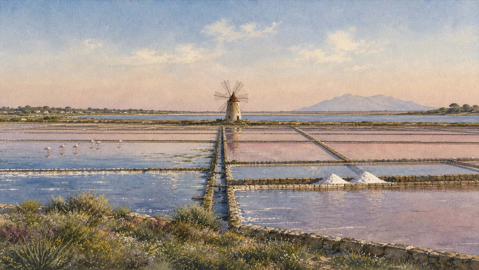
Documentary watercolour of Trapani's geometric salt basins with narrow embankments, one traditional six-sail mill, small salt piles and distant flamingos
TRAPANI · THE WORKING SALT LANDSCAPEEvaporation basins, sluices, one traditional mill and distant birds share a productive protected wetland.
25

ENGINEERED BASINS PRODUCE SALT WHILE ALSO SUPPORTING HALOPHYTES AND MIGRATORY BIRDS

The Working Salt Pans and Their Wetland Biodiversity

Windmills, sluices, evaporation ponds and seasonal wildlife form a productive protected landscape rather than untouched nature or an abandoned museum.

Documentary watercolour of Trapani's geometric salt basins with narrow embankments, one traditional six-sail mill, small salt piles and distant flamingos
TRAPANI · THE WORKING SALT LANDSCAPE

The place today

Within the Saline di Trapani and Paceco reserve, industrial work, historic windmills, embankments, canals, piles of salt, visitor routes and bird habitat coexist. Productive areas are not automatically public paths, and operations vary with season and weather. WWF records more than 240 bird species and around 450 halophytic plant species.

The historical chapter

Salt production used the flat coast, sun and wind and connected Trapani with food preservation and long-distance commerce. Techniques changed through mechanisation, but the sequence of evaporation basins remains fundamental. The recognised Sale Marino di Trapani IGP covers production in Trapani, Paceco and Marsala. Human maintenance of embankments and water circulation helped create habitats used by migratory and resident species.

What to notice

  • Never cross basin banks or enter production areas without permission.
  • Flamingos are possible, not promised, and ethical wildlife viewing matters more than a close photograph.
WWF Italy · Saline di Trapani reserve and production landscape
26

THE CITY REBUILT AFTER 1943 WHILE HARBOUR WORK, FERRIES AND FISHING CONTINUED TO CHANGE

Bombing, Reconstruction and the Modern Port

War damage and reconstruction close the historical sequence without turning the active port into a backdrop to the old centre.

Documentary watercolour of Trapani's geometric salt basins with narrow embankments, one traditional six-sail mill, small salt piles and distant flamingos
TRAPANI · THE WORKING SALT LANDSCAPE

The place today

Post-war housing, reconstructed streets, gaps in the historic fabric and surviving monuments coexist with an active port. The harbour is now governed within the Western Sicilian Sea Port Authority and remains the principal gateway to the Egadi Islands, alongside fishing, passenger and commercial functions.

The historical chapter

Bombing destroyed much of San Pietro and the Teatro Garibaldi, among many civilian losses. Reconstruction altered the city, while later migration and the 1968 Belice earthquake added new pressures. Modern port investment, ferries and tourism continue Trapani's maritime role without simply reproducing its pre-war economy.

What to notice

  • Do not end the guide in a picturesque pre-modern past; residents live with reconstruction, infrastructure and seasonal pressure.
  • Ferry schedules, terminals and security routes change, so verify with operators and port authorities shortly before travel.
Municipality of Trapani and Western Sicilian Sea Port Authority · war history and present port

The city through time

Ten dates that connect sanctuary, fortress, port and living landscape

These dates orient the long history without forcing uncertain origins, legends and later reconstructions into false precision.

  1. The early wall circuit at Eryx takes shape; later Punic reinforcement and inscribed construction marks alter it.

  2. Carthaginian forces defeat the Roman fleet at the Battle of Drepana.

  3. The Roman victory near the Egadi Islands ends the First Punic War and changes control of western Sicily.

  4. Norman conquest brings Trapani and the mountain into a new royal and Latin Christian order.

  5. Frederick of Aragon grants Sant'Agostino to its order and is traditionally credited with the Real Duomo at Erice.

  6. Charles V's stop after the Tunis campaign is followed by renewed attention to Trapani's artillery fortifications.

  7. The earliest surviving notarial concession cited for a Misteri group documents the craft-corporation system.

  8. Torre di Ligny is built to strengthen surveillance and defence at the tip of Trapani's peninsula.

  9. Repeated bombing devastates Trapani; Allied forces arrive on 22 July and reconstruction begins after the war.

  10. The Majorana scientific centre gives Erice a new international role while the port, salt pans and traditions continue to change.

Before your visit

Practical information,
without turning it into promises

01

Give the connected territory at least two full days

Use one day for Erice's gates, walls, churches, castle precinct, Cordici Museum and Balio; use another for Trapani's old-city axes, Pepoli Museum, sanctuary, northern walls, Torre di Ligny and port edge. Add a separate late afternoon or morning for the salt reserve rather than squeezing it into a sunset stop.

02

Build a weather-proof mountain plan

Check the cableway on the day, especially for wind and weekly maintenance. Carry a layer even in warm weather, use shoes with grip on polished stone and keep a road or bus alternative. Mist can enrich Erice, but it can also remove the famous view entirely.

03

Treat churches and processions as living institutions

Confirm seasonal church circuits, worship times and event routes. During Holy Week or August patronal festivities, plan around crowds, barriers and religious priorities; do not expect a normal museum-style visit or unrestricted close photography.

04

Verify every coastal and restored site shortly before travel

Torre di Ligny and the Colombaia have restoration histories, port areas have security limits, salt pans contain protected and productive zones, and boats depend on weather. Use the linked municipality, Region, reserve, port authority and transport operators for current conditions.

Sources

This guide cross-checks the municipalities of Erice and Trapani, their institutional heritage platforms, Fondazione Erice Arte, the Diocese of Trapani, the Ettore Majorana Foundation, Funierice, the Sicilian Region, Museo Pepoli, WWF Italy, MASAF and EUR-Lex, Unione Maestranze and the Western Sicilian Sea Port Authority. It separates Elymian evidence from Trojan foundation myth, the long sanctuary history from the standing Norman castle, ancient fragments from romantic reconstruction, the so-called Well of Venus from its probable granary function, traditional Norman church foundations from later visible fabric, the summit borgo from modern Casa Santa, Punic Drepana from the present shoreline, the battles of 249 and 241 BC, early documents from a claimed founding date for the Misteri, historic coral from unverified modern provenance, productive salt pans from scenery, protected wetland from guaranteed wildlife, and restoration programmes from promises of access.

The hero is an original documentary illustration, not an official photograph, a reconstruction of the sanctuary of Venus, the Battle of Drepana or a current map of port access. Elymian origins, Trojan stories, changing names of the goddess, precise ancient sanctuary form, traditional Norman church foundations, the Well of Venus, Punic attribution of the Colombaia core and several monument dates remain qualified where evidence is incomplete or later rebuilding dominates. Church circuits, Erice Card conditions, museums, cableway service, castle paths, Torre di Ligny, Colombaia works, processions, port security, ferry terminals, salt production, reserve visits, bird presence and coastal access can change; consult the linked institutions shortly before travel.