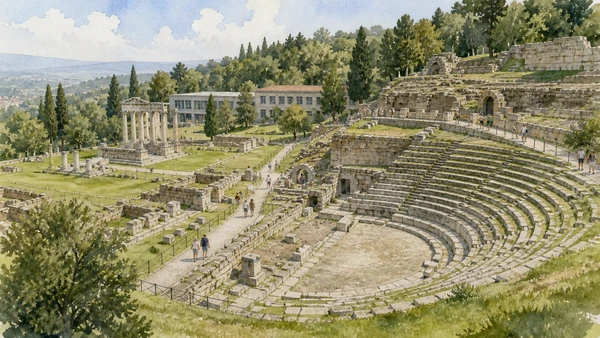
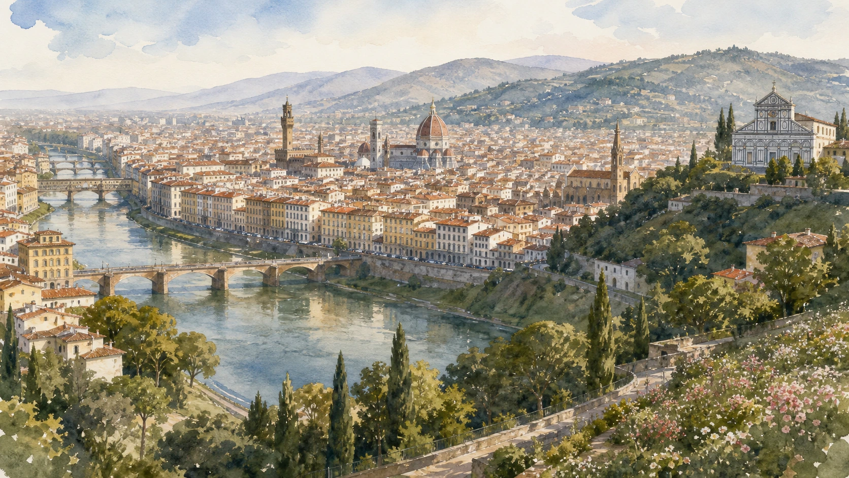
Original documentary watercolour panorama joining the Arno, San Miniato hill and Fiesole

Florence Guide 10 · River, landscape infrastructure, abbey and archaeological hill town

The Arno, San Miniato,
the Hills & Fiesole

A two-part guide that reads Florence from its river and southern belvederes, then continues to Fiesole, where Etruscan, Roman, medieval and modern landscapes make the city below intelligible from another height.

Plan the route
Lungarni to San Miniato · Fiesole10 chapters · two half-days

Why the river and hills complete Florence

Florence is not only a level museum city between walls: it is a river settlement repeatedly damaged and rebuilt, a nineteenth-century capital shaped by roads and planted slopes, a monastic hill, a cemetery of civic memory and an older Etruscan-Roman centre still occupied above the basin.

The Arno explains trade, water power, bridges, defensive geography and repeated disaster. Its lungarni are not one intact Renaissance composition: they contain retaining walls, later embankments, traffic engineering, post-war reconstruction and public paths. Crossing south at San Niccolò reveals a surviving gate tower and the ramps of Giuseppe Poggi, whose Viale dei Colli transformed the hillside when Florence briefly became capital of Italy.

Above those ramps, the Rose Garden and Piazzale Michelangelo are public landscapes with distinct purposes. The piazzale was an urban project completed in 1875, not an accidental panoramic terrace. San Miniato al Monte is older and still governed by Benedictine worship; its façade, pavement, crypt and choir should be read through their many campaigns. The adjacent Porte Sante cemetery extends the hill into nineteenth- and twentieth-century family, artistic and political memory.

Fiesole requires its own half-day. The archaeological area preserves a theatre, baths, temple evidence and later burials, while the museum interprets objects from Etruscan, Roman and Longobard contexts. The present town, cathedral, convent hill, former quarries, paths and bus connection prevent the site from becoming a detached archaeological park. Looking back toward Florence completes the route without reducing Fiesole to a viewpoint.

Use one morning or late afternoon for the Arno and San Miniato hill, then a separate half-day for Fiesole. Check worship, cemetery seasons, museum hours and current bus service before setting out.

The route

Plan your visit

Part one follows the river east to San Niccolò, climbs through Poggi’s ramps and gardens to Piazzale Michelangelo, San Miniato and Porte Sante. Part two uses the current line 7 connection to Fiesole, where archaeology, civic centre and the San Francesco hill form a compact but steep circuit.

Half-day 1 · Early

Arno and bridges

Walk the lungarni before traffic peaks, compare bridge functions and identify flood and reconstruction layers rather than seeking one timeless riverscape.

Half-day 1 · Midday

San Niccolò and Poggi’s ascent

Read the medieval gate, nineteenth-century ramps, Rose Garden and piazzale as a sequence of defensive, horticultural and capital-era public works.

Half-day 1 · Late

San Miniato and Porte Sante

Enter outside liturgy, leave time for crypt and pavement, and match the cemetery’s seasonal closing hour before descending.

Half-day 2

Fiesole above Florence

Begin with the archaeological area and museum, then cross the civic centre and climb toward San Francesco for geology, settlement and the view back across the basin.

Ten chapters

Explore the places

This guide links a river corridor, nineteenth-century landscape works, a living abbey, a monumental cemetery and an archaeological hill town. Their distances and access systems differ: use two connected half-days rather than forcing them into a rushed single circuit.

  1. 01The Arno and lungarni: Florence built with risk
  2. 02Florence’s bridges: connection, destruction and rebuilding
  3. 03San Niccolò and Poggi’s ramps: from defence to capital
  4. 04The Rose Garden: cultivation on the hillside
  5. 05Piazzale Michelangelo: a viewpoint deliberately made
  6. 06San Miniato al Monte: façade, threshold and city
  7. 07Inside San Miniato: worship across levels
  8. 08Porte Sante: Florence remembered above the city
  9. 09Fiesole’s archaeological area: layers under the town
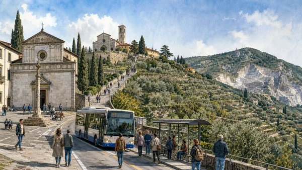
  10. 10Fiesole beyond the ruins: town, stone and view
01

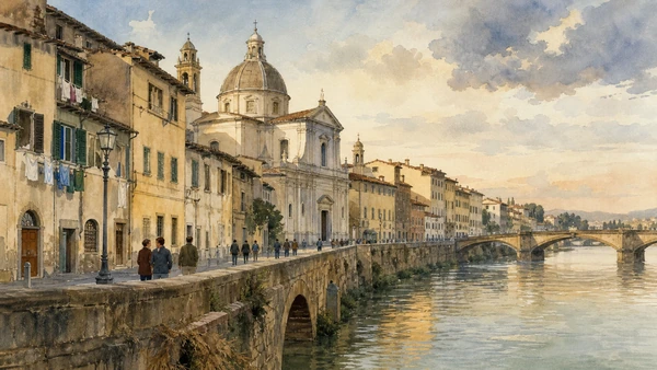
A working river of mills, trade, flood risk, embankment and memory resists the postcard fiction of an unchanged Renaissance waterway

The Arno and lungarni: Florence built with risk

The river made urban wealth and circulation possible while repeatedly exposing the city to destruction, most famously in 1966.

Today

The central Arno is held between masonry embankments, roads, bridges and intermittent lower paths. Rowers, pedestrians, traffic, birds and maintenance crews occupy different levels. Water colour and speed change rapidly after rain upstream. Barriers, hydrometric marks and civil-protection information belong to the landscape as much as palace fronts, and closed lower paths should never be bypassed.

History

Florence concentrated around a ford and later crossings while channels and mills supplied power to productive districts. Documented floods recur from the Middle Ages; embankments and hydraulic works were repeatedly enlarged rather than solved once. On 4 November 1966, the Arno inundated streets, homes, workshops, libraries and churches, killing people and damaging vast quantities of cultural material. Recovery became both civic labour and an international conservation story.

How to read this place

Walk eastward on one bank and return briefly on the other. Compare water level with doors, arches and retaining walls; look for the difference between buildings designed to meet the river and later roads inserted beside them. Flood plaques are evidence, not decorative curiosities. In wet weather, consult current warnings instead of inferring safety from the calm appearance of the centre.

What to notice

  • Retaining walls separating road level from the active river
  • Flood plaques and infrastructure recording recurring risk
  • Palace, workshop and service elevations built for different relations to water
Comune di Firenze · Historical Arno floods
Original documentary watercolour of the Arno and Florence lungarni with flood markers
The Arno and lungarni: Florence built with riskOriginal Merlintravel documentary watercolour · 2026
02

Each crossing is infrastructure before it is a viewpoint, and the sequence preserves medieval continuity, wartime rupture and post-war choices

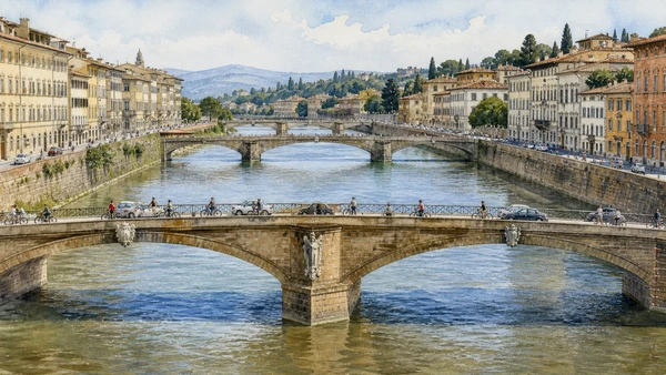
Florence’s bridges: connection, destruction and rebuilding

Ponte Vecchio survived the wartime demolitions that destroyed the other central bridges, making comparison more useful than isolated admiration.

Today

Central bridges carry very different loads: shops and dense pedestrians at Ponte Vecchio, vehicles and buses elsewhere, service access, cyclists and river observation. Their piers alter the current and their ramps connect uneven street levels. The best reading comes from the bank, where spans, abutments and rebuilt approaches can be compared without blocking pedestrian flow at the bridge centre.

History

Crossings moved or were rebuilt after floods throughout Florence’s history. Ponte Vecchio took its present stone form in the fourteenth century and later acquired the elevated corridor above its shops. In August 1944 German forces destroyed the other bridges while the old bridge itself remained, though surrounding streets were devastated. Post-war replacements combined reconstruction, modern engineering and debate over historical continuity.

How to read this place

View at least three bridges obliquely from the lungarno. Count spans and observe how the roadway meets each bank. Separate the date of a bridge’s first foundation from the date of its present fabric. The 1944 story should include the destroyed urban approaches and rebuilt crossings, not become a single heroic anecdote about one surviving monument.

What to notice

  • Different span structures and pier profiles changing the current
  • Post-war fabric beside older abutments and street lines
  • Pedestrian, retail and traffic uses competing across limited widths
FeelFlorence · Along the rivers
Original documentary watercolour comparing Florence bridges and their rebuilt river approaches
Florence’s bridges: connection, destruction and rebuildingOriginal Merlintravel documentary watercolour · 2026
03

A fourteenth-century gate and capital-era boulevard engineering meet at the point where the walled city opens toward a designed hillside

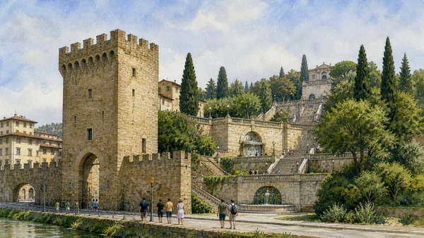
San Niccolò and Poggi’s ramps: from defence to capital

The surviving tower and planted ascent reveal two incompatible but legible systems: medieval enclosure and nineteenth-century expansion.

Today

Porta San Niccolò rises above Piazza Poggi near the river. It is the only principal gate tower left at full height, while nearby walls survive in fragments. Curving ramps and terraces carry pedestrians toward the hill through planted slopes, retaining walls and changing views. Stone steps, inclines and summer exposure make pace and footwear more important than the short map distance suggests.

History

The gate was built in 1324 as part of the last communal wall circuit. Unlike other towers later reduced in height, it escaped the same truncation. When Florence became the capital of the Kingdom of Italy in 1865, Giuseppe Poggi planned boulevards, demolitions and the Viale dei Colli. His ramps reorganised the former defensive edge as scenic circulation linking river, new neighbourhoods and hill roads.

How to read this place

Begin at ground level and distinguish the gate opening, tower masonry, wall remnants and later road alignments. On the ascent, pause where retaining structures frame a view rather than treating every terrace as spontaneous. Poggi’s landscape created access and spectacle while also participating in demolitions and urban displacement; the panorama has a political construction history.

What to notice

  • Full-height gate tower marking the former wall circuit
  • Curving ramps engineered into a steep urban slope
  • Framed views produced by nineteenth-century circulation rather than chance
FeelFlorence · Towers, gates and fortresses
Original documentary watercolour of Porta San Niccolò and Poggi's ascending ramps
San Niccolò and Poggi’s ramps: from defence to capitalOriginal Merlintravel documentary watercolour · 2026
04

A municipal garden layers seasonal horticulture, city views and contemporary sculpture on the ascent rather than serving as a decorative pause

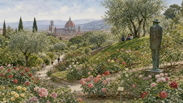
The Rose Garden: cultivation on the hillside

More than 350 varieties, a Japanese garden and Folon’s sculptures make the planted terraces worth reading in their own right.

Today

The Giardino delle Rose is a free public garden below Piazzale Michelangelo and is currently open throughout the year. Rose flowering is strongest seasonally, while trees, paths, views and the Japanese garden retain interest beyond peak bloom. Bronze works by Jean-Michel Folon are distributed through the slopes. Some paths are steep, and visitors should protect planting beds rather than stepping into them for photographs.

History

The garden was created in 1865 within the wider transformation associated with Florence’s years as capital. It developed as a specialised collection and later expanded its public and cultural roles. A Japanese garden and Folon’s sculptures added new layers without turning the site into a conventional open-air museum. Horticultural cycles remain more important than a fixed architectural composition.

How to read this place

Enter from the lower approach when possible and let the city appear gradually between hedges and trees. Read labels and compare habit, leaf and scent rather than judging the garden only by flower count. The celebrated view is one element among drainage, maintenance, shade and seasonal work. In hot months, carry water and do not expect the spring display.

What to notice

  • Terraced planting responding to slope and exposure
  • Folon sculptures placed as encounters within vegetation
  • Seasonal growth changing the relation between paths and panorama
FeelFlorence · Three gardens on the hill
Original documentary watercolour of paths, roses and sculpture in Florence's Rose Garden
The Rose Garden: cultivation on the hillsideOriginal Merlintravel documentary watercolour · 2026
05

The famous panorama is a planned nineteenth-century urban room whose unfinished museum project belongs to the history of the view

Piazzale Michelangelo: a viewpoint deliberately made

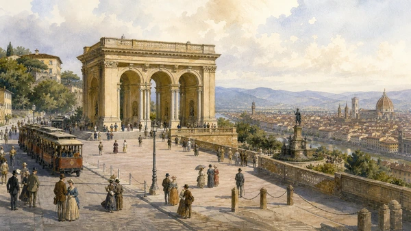
Poggi completed the terrace in 1875 as part of the Viale dei Colli, using replicas and a loggia to frame Florence as the new capital’s heritage.

Today

The broad terrace receives buses, cars, vendors, walkers and large sunset crowds. Bronze replicas occupy the centre and the loggia defines the uphill edge. The panorama aligns the Arno, bridges, cathedral mass, civic tower and northern hills, but crowd movement and traffic lanes require attention. Dawn and morning distribute pressure better than the concentrated evening peak.

History

Giuseppe Poggi designed the piazzale within the capital-era Viale dei Colli and completed it in 1875. The loggia was intended to house a museum devoted to Michelangelo but never fulfilled that function as planned. Bronze copies of major sculptures established a civic display above the city. The terrace therefore presented Florence’s historical image through modern roads, engineering and cultural politics.

How to read this place

Stand first beside the loggia and inspect the terrace as architecture: edges, access roads, centre and planted continuations. Then map monuments across the basin. The replicas are part of the nineteenth-century programme, not substitutes requiring embarrassment. Avoid occupying walls or traffic margins for a photograph; the safest view is also the one that reveals the piazzale itself.

What to notice

  • Loggia recording an unrealised museum intention
  • Central replicas making heritage part of a modern civic programme
  • Road, terrace and planted boulevard composing the panorama
FeelFlorence · Piazzale Michelangiolo
Original documentary watercolour of Poggi's Piazzale Michelangelo terrace and loggia
Piazzale Michelangelo: a viewpoint deliberately madeOriginal Merlintravel documentary watercolour · 2026
06

Marble geometry, mosaic, roofline and forecourt announce a monastic complex whose famous façade is only one phase in a much longer hilltop history

San Miniato al Monte: façade, threshold and city

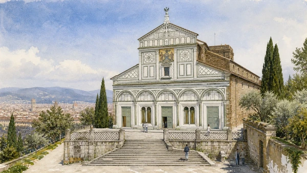
The basilica’s patterned front should be read from the forecourt and then tested against the darker, multi-level interior beyond it.

Today

San Miniato remains a Benedictine Olivetan abbey and an active place of worship. Entry is free and no booking is required, but visits are not permitted during liturgy. The forecourt opens a wide city view; the façade combines white and green marble pattern with an upper mosaic. The approach from the piazzale continues uphill, while visitors with reduced mobility can arrange a closer vehicle approach by Via delle Porte Sante.

History

Tradition associates the site with the martyr Minias and an early shrine. The present basilica developed from the eleventh century, with later façade, mosaic, bell tower, monastic and defensive additions. Its elevated location tied worship to the city’s visual and protective geography. During the 1529–1530 siege, Michelangelo is traditionally linked to defensive measures around the hill and bell tower.

How to read this place

Cross the forecourt far enough to see the façade’s complete proportional field. Compare lower blind arcades with the upper temple-like form and note that geometry, material and mosaic belong to different construction campaigns. Turn toward Florence before entering: the relationship between sacred threshold and city view is designed, but the forecourt is also an active access space, not a stationary photo platform.

What to notice

  • Green-and-white marble pattern controlling the broad façade
  • Upper mosaic marking the sacred threshold from a distance
  • Forecourt binding basilica, cemetery, approach and city view
Abbazia di San Miniato al Monte · Official access
Original documentary watercolour of San Miniato al Monte's marble façade and forecourt
San Miniato al Monte: façade, threshold and cityOriginal Merlintravel documentary watercolour · 2026
07

Crypt, raised presbytery, patterned pavement, choir and monastic sound create a vertically layered interior that cannot be understood from the central aisle alone

Inside San Miniato: worship across levels

The basilica joins Romanesque structure with later chapels, tombs and furnishings while the monks’ liturgical timetable still governs access.

Today

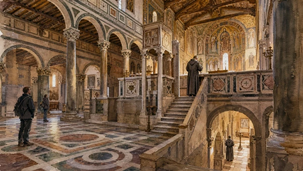
The interior descends to a columned crypt and rises toward choir and presbytery. A marble pavement, timber roof, screen, pulpit and later chapels divide attention across floor, wall and upper level. Weekday liturgy currently includes an evening Latin Mass with Gregorian chant and daily vespers; Sunday has several Masses. Visitors must stop sightseeing during services and should treat chant as worship, not scheduled performance.

History

The eleventh-century basilica incorporated a shrine tradition and grew through multiple medieval campaigns. The raised sanctuary and crypt organise relic, clergy and congregation. The sacristy received a major fresco cycle by Spinello Aretino; the Chapel of the Cardinal of Portugal added a distinct fifteenth-century funerary ensemble. Monastic continuity and later restoration preserved the building while also changing how its Romanesque identity is perceived.

How to read this place

Let your eyes adapt before moving. Begin with the pavement axis, then compare nave columns with the crypt supports and raised sanctuary. Identify later chapels as intentional additions rather than interruptions. If vespers or Mass begins, sit in the appropriate area or leave quietly. Do not record chant or move through the choir without explicit permission.

What to notice

  • Raised presbytery and lowered crypt creating a three-level section
  • Marble pavement directing movement before the eye reaches the apse
  • Living monastic timetable controlling the use of historic space
FeelFlorence · San Miniato al Monte
Original documentary watercolour of San Miniato's nave, crypt and monastic evening office
Inside San Miniato: worship across levelsOriginal Merlintravel documentary watercolour · 2026
08

Family chapels, sculpture, changing taste and named lives extend the hilltop from sacred monument into a difficult open-air archive

Porte Sante: Florence remembered above the city

The cemetery is neither a shortcut nor a generic sculpture garden; it remains a burial place with seasonal hours and uneven access.

Today

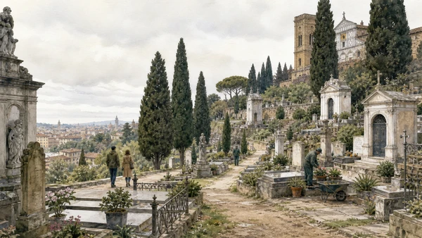
Porte Sante surrounds San Miniato with terraces, avenues, tombs and family chapels. As checked for summer 2026, the cemetery closes earlier than the basilica: in July and August it is listed daily from 08:00 to 13:00, with longer weekday hours in September and cooler months. The official accessibility listing marks the site as inaccessible, reflecting slopes, steps and uneven routes. Funerals and mourners always take precedence.

History

The monumental cemetery developed in the nineteenth century within and beyond the fortified enclosure around San Miniato. Elite families, artists, writers, politicians and other Florentines commissioned works in successive historicist, Liberty and modern languages. Expansion transformed the hill into a record of civic identity while older defensive and monastic structures remained embedded in its boundaries.

How to read this place

Enter only during the official window and choose a limited circuit rather than searching for a checklist of famous graves. Read dates, materials, repeated family names and changing symbols. Do not photograph mourners, ceremonies or recent graves. Weathered surfaces and repairs are evidence of continuing care, exposure and inequality in memorial scale.

What to notice

  • Terraced burial routes adapting to a steep fortified site
  • Chapels and sculpture recording changing architectural taste
  • Active mourning coexisting with historical and artistic interest
FeelFlorence · Cemetery of Porte Sante
Original documentary watercolour of the terraced Porte Sante cemetery beside San Miniato
Porte Sante: Florence remembered above the cityOriginal Merlintravel documentary watercolour · 2026
09

Theatre, baths, temple evidence, Longobard burials and museum objects show a hill centre repeatedly occupied rather than a single Roman ruin

Fiesole’s archaeological area: layers under the town

The civic museum and open-air remains must be read together: structures establish scale while objects recover bodies, exchange and chronology.

Today

The archaeological area lies close to Fiesole’s main square and includes the Roman theatre, baths, temple remains and later evidence. The museum displays Etruscan, Roman and Longobard material. From April through September the official 2026 schedule lists daily opening 09:00–19:00, with the ticket office closing at 18:30; seasons outside summer have shorter hours. Combined and single-site tickets are available, and accessible paths and lifts serve much of the complex.

History

Etruscan Fiesole occupied a defensible height overlooking routes and the Arno basin before Roman control. Monumental areas changed under Rome, including theatre, baths and temple precinct. Settlement continued after antiquity, and Longobard burials add evidence of early medieval occupation. Excavation, restoration and museum display later separated archaeological remains from the living fabric that had grown above and around them.

How to read this place

Start in the museum when heat or rain is strongest, then match objects to outdoor spaces. In the theatre, distinguish restored seating from ancient fabric; in the baths, follow water, service rooms and circulation instead of seeing only low walls. The label ‘Etruscan-Roman’ is a sequence, not a blended style, and the Longobard finds prevent the story from ending with imperial decline.

What to notice

  • Theatre geometry fitted to the hillside
  • Bath and temple remains revealing civic infrastructure and ritual
  • Museum collections reconnecting structures with objects and burials
Musei di Fiesole · Collections
Original documentary watercolour of Fiesole's Roman theatre, baths and archaeological museum
Fiesole’s archaeological area: layers under the townOriginal Merlintravel documentary watercolour · 2026
10

Cathedral square, convent ascent, former quarries, woodland paths and a public bus keep Fiesole connected to ordinary metropolitan life

Fiesole beyond the ruins: town, stone and view

The final climb places archaeological evidence inside a living hill settlement rather than using Fiesole as Florence’s panoramic balcony.

Today

Piazza Mino concentrates bus stops, cafés, civic buildings and the cathedral near the archaeological entrance. From there steep streets and steps climb toward San Francesco and viewpoints over Florence. Trails reach wooded and quarry landscapes, but surfaces and gradients vary. The current visitor material identifies bus line 7 as the main connection from Florence; travellers should still check live operator information because stops and timetables change.

History

Fiesole’s commanding position shaped Etruscan settlement, Roman reorganisation, medieval conflict and religious foundations. Stone extracted from the hills supplied buildings and supported specialised labour. The cathedral and San Francesco complex represent later Christian occupation, while villas and twentieth-century metropolitan growth changed the surrounding slopes. Florence’s expansion below never eliminated Fiesole’s separate municipality and civic centre.

How to read this place

Pause in Piazza Mino before climbing and identify which routes serve residents rather than sights. From San Francesco, read the basin topographically: river corridor, urban plain, southern and northern hills. Do not describe Florence as the only subject of the view. On quarry or woodland paths, respect closures, weather and private boundaries, and allow enough time to return to the bus stop without rushing downhill.

What to notice

  • Civic square joining transport, worship and museum access
  • Steep settlement pattern responding to rock and defensive height
  • Florence panorama revealing a shared basin without erasing Fiesole
FeelFlorence · Fiesole hill town
Original documentary watercolour of Fiesole's civic square, San Francesco hill and bus connection
Fiesole beyond the ruins: town, stone and viewOriginal Merlintravel documentary watercolour · 2026

The Arno, southern hill and Fiesole through time

A short chronology

From Etruscan Fiesole and Roman infrastructure to medieval worship, capital-era boulevards, flood memory and contemporary public landscapes.

  1. Etruscan Fiesole develops as a fortified hill centre overlooking the Arno basin.

  2. Roman Fiesole receives monumental theatre, baths and reorganised sacred spaces.

  3. A documented foundation phase begins for the present San Miniato al Monte complex.

  4. San Miniato’s basilica, façade and monastic setting take their recognisable medieval form through successive campaigns.

  5. Porta San Niccolò is built within Florence’s last communal wall circuit.

  6. A catastrophic Arno flood destroys bridges and damages large parts of Florence.

  7. Ponte Vecchio is rebuilt in the form that still structures the central crossing.

  8. The siege of Florence militarises the San Miniato hill and surrounding defences.

  9. Another major Arno flood inundates the city before modern embankment works.

  10. Florence becomes capital of Italy and Poggi’s Viale dei Colli and Rose Garden projects begin reshaping the slopes.

  11. Piazzale Michelangelo is completed as a planned civic panorama and cultural display.

  12. Porte Sante expands into a monumental cemetery of Florentine civic memory.

  13. Wartime demolitions destroy Florence’s central bridges except Ponte Vecchio and devastate their approaches.

  14. The Arno flood kills residents and causes immense damage to homes, businesses and cultural heritage.

  15. River safety, worship, public gardens, burial, archaeology and metropolitan transport still govern this connected landscape.

Before your visit

Practical information

01

Split the route into two half-days

The San Miniato hill and Fiesole are linked conceptually, but combining them with the full river walk produces unnecessary rushing.

02

Treat the Arno as live infrastructure

Check current weather and civil-protection notices, obey lower-path closures and never approach the water during elevated flow.

03

Enter San Miniato outside liturgy

The abbey suspends tourist visits during services; chant belongs to worship and should not be recorded as a performance.

04

Reach Porte Sante early

Summer closing at 13:00 is much earlier than basilica closing, and steep or stepped routes make the cemetery inaccessible for many visitors.

05

Use official Fiesole tickets and hours

Seasonal hours vary, the last ticket precedes closing and different combinations include archaeology, museum and Bandini collection.

06

Check the live line 7 service

Public information identifies the main bus link, but operator timetables, stops and disruption notices should be verified on the day.

Method and sources

Sources and image credits

This guide uses current official material from the Comune di Firenze, Abbazia di San Miniato al Monte, FeelFlorence and Musei di Fiesole checked on 28 August 2026. It distinguishes river beauty from flood infrastructure; original bridge foundation from present fabric; medieval defence from capital-era landscaping; horticultural cycle from panoramic backdrop; nineteenth-century viewpoint from spontaneous terrace; basilica visit from monastic worship; cemetery heritage from active mourning; Etruscan, Roman and Longobard evidence from a generic ancient past; and public-transport proximity from realistic walking time on steep ground.

All ten images are original Merlintravel editorial watercolours based on documented present-day conditions. They are illustrations, not substitutes for archaeological plans. Opening hours, tickets, accessible routes, temporary exhibitions and conservation work can change; consult the linked official pages shortly before visiting.