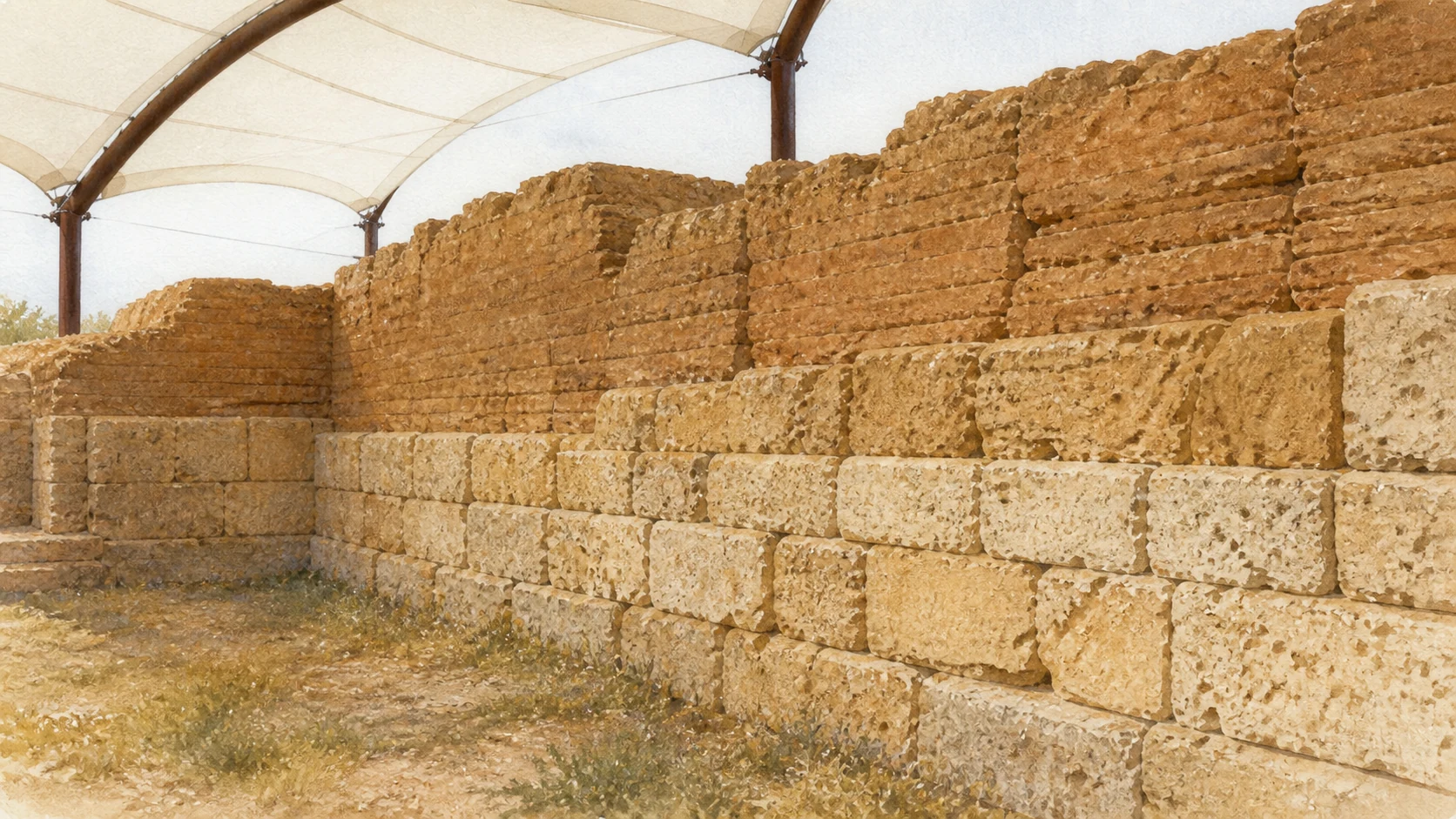
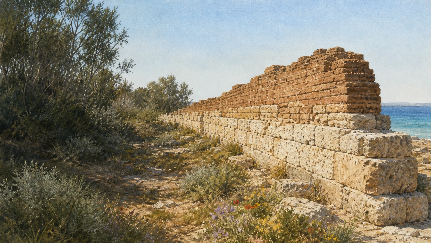
Documentary watercolour of Gela's Timoleontean mudbrick walls above coastal vegetation and the Mediterranean

Illustrated guide · Sicily

Between clay walls,
buried ships
and a changing sea

Twenty-four focused chapters cross Gela's ridge and gulf through fragile archaeology, medieval Terranova, Greek wrecks, wartime coast, wetland and industrial transformation.

Explore the places
Gela · archaeology, living city, wetland and industrial coast

Gela is not the interval between Agrigento and the south-east

Gela is often introduced through absence: temples reduced to foundations, ships long in conservation and raw-earth walls protected because their material is fragile. Yet the city joins an archaic emporion, Greek cargo vessels, a medieval refoundation and a Ramsar wetland within one coastal field.

Its defining monument is not a marble colonnade but a fortification of stone below and sun-dried earth above. Dunes also preserved commercial walls and shallow water preserved ship timbers: Gela teaches how accidental burial and patient conservation make archaeology public.

Modern Gela belongs to the same account. Frederick II refounded the ridge, the 1943 landings made the gulf a battlefield, and petrochemical development transformed work, housing and the shoreline. This guide keeps archaeology, devotion, nature and industry together while clearly distinguishing heritage evidence, company history and unresolved environmental remediation.

One destination

Twenty-four chapters across a ridge where archaeology, wetland and industry meet

Gela occupies a wide south-Sicilian gulf. The ancient city followed a long ridge parallel to the sea from Molino a Vento toward Capo Soprano, while river plains, the Biviere and dune systems connected agriculture, inland routes and maritime exchange.

Rhodian and Cretan settlers founded Gela in 689–688 BC. The colony founded Akragas, expanded inland and later passed through Carthaginian destruction, Timoleontean resettlement and the forced transfer of inhabitants to Phintias near modern Licata.

Frederick II founded Heraclea on the ridge in 1233; Terranova remained the name until Gela was restored in 1927. A visit now connects the living centre with separate archaeological areas, the Museum of Greek Wrecks, limited-access sites, the Biviere and an industrial zone whose environmental procedures remain active.

The selection

Twenty-four chapters from the ancient ridge to the Biviere

The route keeps sites in geographical sequence and distinguishes surviving material, modern conservation, historical reconstruction and present access conditions.

  1. 01The Long Ridge, the Gulf and the Rivers
  2. 02Corso Vittorio Emanuele, Piazza Umberto I and Terranova
  3. 03The Mother Church of Maria Santissima Assunta
  4. 04Frederick II's Heraclea and the Lost Castle
  5. 05Castelluccio in the Plain
  6. 06The Acropolis of Molino a Vento
  7. 07Temples A and B and Athena Lindia
  8. 08Temple C and the Deinomenid City
  9. 09The Regional Archaeological Museum
  10. 10The Greek Baths in Via Europa
  11. 11Bosco Littorio and the Archaic Emporion
  12. 12The Museum of Greek Wrecks
  13. 13Gela I: the Cargo Ship and Its Load
  14. 14Gela II: a Second Ship Still Under Restoration
  15. 15Capo Soprano and the Timoleontean Expansion
  16. 16The Mudbrick Wall and Its Two Gates
  17. 17Bitalemi and Demeter Thesmophoros
  18. 18Manfria: the Prehistoric Village and Greek Farms
  19. 19The Tower of Manfria and the Western Coast
  20. 20The July 1943 Landings and the Coastal Bunkers
  21. 21The Biviere di Gela Wetland
  22. 22The Macconi, Dunes and Cultivated Coast
  23. 23Macchitella and the Planned Industrial City
  24. 24The Petrochemical Complex, the SIN and the Biorefinery
01

ANCIENT AND MODERN GELA SHARE A NARROW HEIGHT BETWEEN A FERTILE PLAIN AND AN OPEN SOUTHERN SEA

The Long Ridge, the Gulf and the Rivers

The city's shape becomes legible only when ridge, coast, river routes and plain are read together.

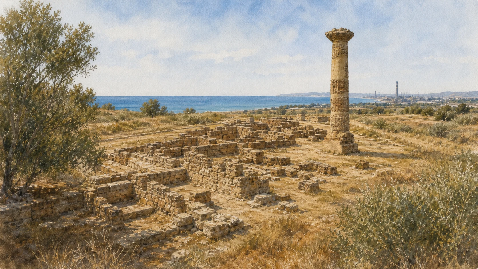
Documentary watercolour of Gela's Molino a Vento acropolis with one surviving ochre Doric column, low archaeological foundations and the gulf beyond
THE ACROPOLIS ABOVE THE GULF

The place today

From the seafront, Gela rises along a low but elongated hill rather than around one monumental summit. The historic centre occupies the eastern and central ridge; modern districts continue west toward Capo Soprano and Macchitella. South lies a sandy coast exposed to wind and changing sediment.

The historical chapter

The regional archaeological account describes an ancient city approximately four kilometres long and at most about six hundred metres wide, with Molino a Vento forming its eastern acropolis and Capo Soprano marking the western expansion. The Gela River and the ancient Himeras-Salso helped connect coastal exchange with grain-producing territory and inland settlements. Greek colonisation intensified control of a landscape already occupied in prehistory.

What to notice

  • Do not plan Gela as a compact archaeological centre. Molino a Vento, Capo Soprano, Bosco Littorio, Bitalemi, Manfria and the Biviere require separate movements and current access checks.
  • The coast is a working and environmentally changing boundary. Old maps, ancient shoreline hypotheses and the modern beach are not interchangeable.
Sicilian Region · Topography and history of ancient Gela
02

THE LIVING CENTRE PRESERVES THE MEDIEVAL REFOUNDATION BENEATH A LATER CIVIC AND COMMERCIAL CITY

Corso Vittorio Emanuele, Piazza Umberto I and Terranova

The streets of Terranova are not a modern interruption in the archaeological map but another occupation of the ancient ridge.

Documentary watercolour of Gela's Molino a Vento acropolis with one surviving ochre Doric column, low archaeological foundations and the gulf beyond
THE ACROPOLIS ABOVE THE GULF

The place today

Corso Vittorio Emanuele crosses the centre through shops, churches, municipal functions and residential streets before reaching Piazza Umberto I and the Mother Church. The surrounding grid is more regular than the lanes of many hill towns, yet side streets still reveal changes in level toward the sea and the northern plain. Twentieth-century rebuilding, traffic and commercial signs can obscure older structures, but the axis remains the best way to understand how the inhabited city sits directly above ancient and medieval ground.

The historical chapter

After the destruction attributed to Phintias around 282 BC, dense urban life on the ridge diminished for centuries. In 1233 Frederick II established Heraclea on the site, a planned coastal refoundation later known as Terranova. The medieval castle at Molino a Vento and the first Mother Church anchored the settlement, whose stones often came from ancient ruins.

What to notice

  • Avoid describing the present centre as a surviving thirteenth-century town. Medieval foundation, later rebuilding and twentieth-century change occupy the same plan.
  • Many archaeological layers lie below streets or buildings and are not visitor sites. Respect residential space and do not treat every reused block as securely identified ancient masonry.
Sicilian Region · Ancient Gela and the 1233 refoundation
03

A LATE-BAROQUE AND NEOCLASSICAL CHURCH OCCUPIES THE CROSSING THAT ORGANISED MEDIEVAL TERRANOVA

The Mother Church of Maria Santissima Assunta

The Mother Church joins the city's thirteenth-century religious centre with an eighteenth- and nineteenth-century monumental rebuilding.

Documentary watercolour of Gela's Molino a Vento acropolis with one surviving ochre Doric column, low archaeological foundations and the gulf beyond
THE ACROPOLIS ABOVE THE GULF

The place today

The church fills an entire block on Piazza Umberto I and stands at the meeting of the centre's principal axes. Its three-nave interior, transept, cupola, chapels and layered decoration differ from the restrained two-order façade. Worship, processions and the devotion to Maria Santissima dell'Alemanna keep it within the living religious calendar.

The historical chapter

The Italian diocesan census records a first Mother Church, Santa Maria de Platea, founded in the second half of the thirteenth century at the same urban crossing. The present building replaced it during the second half of the eighteenth century. Giuseppe Di Bartolo Morselli designed the main façade, while Emanuele Di Bartolo is associated with the bell tower.

What to notice

  • Do not transfer proposed ancient-temple identifications beneath the church into certainty. The documented medieval and modern building sequence is already substantial.
  • This is an active parish. Check liturgical times, dress and photography rules, and allow processions or services to take precedence over sightseeing.
Italian Episcopal Conference · Church census for Maria Santissima Assunta in Gela
04

THE MEDIEVAL CITY REOCCUPIED THE ACROPOLIS AND BUILT DIRECTLY ACROSS THE MATERIAL OF ANCIENT GELA

Frederick II's Heraclea and the Lost Castle

At Molino a Vento, absence of a standing castle is itself evidence of centuries of reuse, excavation and urban change.

Documentary watercolour of Gela's Molino a Vento acropolis with one surviving ochre Doric column, low archaeological foundations and the gulf beyond
THE ACROPOLIS ABOVE THE GULF

The place today

The eastern ridge now combines the acropolis, archaeological museum, streets, houses and broad views toward the port and industrial coast. Visitors should not expect a complete Frederick II castle beside the Greek temples. Medieval fortification and settlement occupied this height, but later demolition, spoliation, excavation and construction have reduced or absorbed their fabric.

The historical chapter

The regional Park dates the repopulation of the hill to Frederick II's foundation in 1233 and states that the castle was set over ancient remains. Terranova's builders exploited the abundant ruins of Gela, erasing parts of temples and fortifications while giving their stone new defensive, religious and domestic uses. This was not simply destruction: it was the creation of a new coastal city after a long discontinuity.

What to notice

  • Do not illustrate Frederick II's Gela with a generic intact Swabian castle. The local fortification is fragmentary and archaeologically entangled with the acropolis.
  • The medieval phase should not be treated as a brief gap between antiquity and the modern city. It created the settlement that became Terranova and then present Gela.
Gela Archaeological Park · Acropolis of Molino a Vento and its later occupation
05

A SEVERE MEDIEVAL FORTRESS CONTROLLED AGRICULTURAL LAND AND ROUTES FAR FROM THE URBAN RIDGE

Castelluccio in the Plain

Castelluccio expands the guide beyond the coast and shows how Terranova governed its inland territory.

Documentary watercolour of Gela's Molino a Vento acropolis with one surviving ochre Doric column, low archaeological foundations and the gulf beyond
THE ACROPOLIS ABOVE THE GULF

The place today

The ruined fortified building stands in open country north of Gela, isolated enough for its rectangular mass and flanking towers to remain legible. Rough masonry, blocked openings, collapse and traces of later alteration reveal a structure shaped by defence, residence and abandonment. Its setting matters: this was not a picturesque city castle but a territorial strongpoint overlooking routes and cultivated land.

The historical chapter

Regional landscape documentation records Castelluccio as royal property already granted in fief during the thirteenth century, then passing through late-medieval holders and eventually to the Aragona of Terranova and the Pignatelli. Its masonry includes white limestone and yellow calcarenite, some linked in the regional account to material reused from the Capo Soprano wall. Fires, an attempted transformation into a palace, structural failure, abandonment and Allied shelling on 11 July 1943 all altered the building.

What to notice

  • Do not enter unstable rooms or cross barriers. A visible ruin in open country is not automatically an unrestricted visitor site.
  • Reused ancient stone does not make Castelluccio a Greek monument. Its form, documented ownership and successive alterations belong primarily to the medieval and later territory.
Sicilian Region · Caltanissetta landscape plan, Castelluccio analytical record
Documentary watercolour of Gela's Molino a Vento acropolis with one surviving ochre Doric column, low archaeological foundations and the gulf beyond
THE ACROPOLIS ABOVE THE GULFAt Molino a Vento, one standing Doric column and low excavated rooms recover the scale of an acropolis whose buildings survive mostly through foundations.
06

PREHISTORY, THE FIRST COLONIAL SETTLEMENT, SACRED BUILDINGS AND LATER WORKSHOPS OCCUPY ONE EASTERN HEIGHT

The Acropolis of Molino a Vento

Molino a Vento is the stratigraphic beginning of Greek Gela, not a single temple enclosure.

Documentary watercolour of Gela's Molino a Vento acropolis with one surviving ochre Doric column, low archaeological foundations and the gulf beyond
THE ACROPOLIS ABOVE THE GULF

The place today

The archaeological area lies at the eastern end of the ridge beside the museum. Foundations, cuttings, blocks, column fragments and changes in ground level require patient reading; the sea and the modern city provide the scale that standing architecture no longer supplies. Current Park information lists weekday morning opening and weekend access by reservation, but the schedule should be checked directly because maintenance and staffing can alter entry.

The historical chapter

Occupation began before the Greek colony. Protocorinthian pottery from the last quarter of the eighth century BC has been connected with an early settlement called Lindioi. During the seventh and sixth centuries, sacred buildings and a northern retaining or defensive wall transformed the height.

What to notice

  • Treat Lindioi as an early settlement interpretation supported by material and ancient testimony, not as a fully excavated separate city visible on the ground.
  • Confirm the Park's current timetable and reservation instructions. The hours of the nearby Museum of Greek Wrecks do not apply automatically to the acropolis.
Gela Archaeological Park · Acropolis of Molino a Vento
07

ONE SMALL SHRINE WAS ABSORBED BY A LARGER TEMPLE AS THE COLONY REDEFINED ITS PROTECTIVE DEITY

Temples A and B and Athena Lindia

The foundations at Molino a Vento record changing scale and continuity of cult rather than one finished sanctuary.

Documentary watercolour of Gela's Molino a Vento acropolis with one surviving ochre Doric column, low archaeological foundations and the gulf beyond
THE ACROPOLIS ABOVE THE GULF

The place today

The remains of the early buildings are low and partly superimposed, so plans and museum material are essential. Temple A was a small shrine in antis; Temple B incorporated its foundations and enlarged the sacred presence during the sixth century BC. Architectural terracottas and ornaments removed from the acropolis are preserved in the regional museum collections, although the main Archaeological Museum is currently closed for restoration and expansion.

The historical chapter

The Park attributes Temple A, built in the first half of the seventh century BC, to Athena Lindia, whose name linked the colony with Lindos on Rhodes. Temple B followed during the sixth century and maintained the dedication. The sequence shows how identity, imported cult and local power were materially rebuilt.

What to notice

  • Do not combine Temples A, B and C into one reconstructed colonnade. They belong to different phases and partly different plans.
  • Important objects from the acropolis may be inaccessible while the Archaeological Museum remains closed. Check official reopening information rather than assuming a collection is on view.
Gela Archaeological Park · Acropolis and Athena temples
08

A MONUMENTAL TEMPLE CELEBRATED THE POWER OF A CITY WHOSE RULERS HAD EXPANDED TOWARD SYRACUSE

Temple C and the Deinomenid City

Temple C belongs to the political remaking of Gela after Himera, even though only fragments survive above the ridge.

Documentary watercolour of Gela's Molino a Vento acropolis with one surviving ochre Doric column, low archaeological foundations and the gulf beyond
THE ACROPOLIS ABOVE THE GULF

The place today

A standing column and dispersed architectural elements signal the scale of Temple C, but most of the building is lost. Its position on the northern side of the acropolis and the commanding marine view make it a landmark within the archaeological zone. The monument should be read with the street plan, defensive works and museum terracottas rather than presented as a miniature Valley of the Temples.

The historical chapter

The Park places construction in the first half of the fifth century BC under the Deinomenids, the ruling family that included Gelon. The project celebrated the Greek victory over Carthage at Himera in 480 BC and belonged to a broader urban programme. Gela had already founded Akragas and extended its influence across eastern Sicily; Gelon moved his political centre to Syracuse in 485 BC.

What to notice

  • A single surviving column cannot establish the complete appearance of Temple C. Use archaeological plans and original architectural material when available.
  • Do not turn the Greek victory narrative into a simple ethnic confrontation. Armies, alliances, forced movement and political control in Sicily were more complex than a civic commemorative programme.
Sicilian Region · Gela Park overview and Temple C
09

CERAMICS, BRONZES, COINS AND ARCHITECTURAL MATERIAL RECONNECT LOW FOUNDATIONS WITH THE MEDITERRANEAN CITY

The Regional Archaeological Museum

The closed museum remains central to understanding Gela, but a guide must not describe its collections as presently accessible.

Documentary watercolour of Gela's Molino a Vento acropolis with one surviving ochre Doric column, low archaeological foundations and the gulf beyond
THE ACROPOLIS ABOVE THE GULF

The place today

The museum stands beside Molino a Vento and historically presents material from the city and territory. Its collections include the Navarra and Nocera groups, Corinthian and Attic pottery, works attributed to major vase painters, bronzes, coins and architectural decoration. The Park's current hours page states that the building is temporarily closed for restoration and expansion.

The historical chapter

The museum's collections grew from private collecting, excavation and state protection. Vases acquired from nineteenth-century clandestine digging preserve important art but also embody the loss of archaeological context. Systematic research later linked imported ceramics, local production, sanctuaries, cemeteries and trade.

What to notice

  • The Archaeological Museum is officially listed as temporarily closed. Do not promise entry or imply that all major finds have moved to the Museum of Greek Wrecks.
  • When it reopens, confirm the actual display. Collection descriptions on institutional pages can predate a new installation and do not guarantee that every object is exhibited.
Gela Archaeological Park · Regional Archaeological Museum and current hours
10

THIRTY-SIX SMALL TUBS AND A HEATED ROOM REVEAL COLLECTIVE CARE IN THE HELLENISTIC CITY

The Greek Baths in Via Europa

The baths correct an image of Gela made only from rulers, temples and defensive walls.

Documentary watercolour of Gela's Molino a Vento acropolis with one surviving ochre Doric column, low archaeological foundations and the gulf beyond
THE ACROPOLIS ABOVE THE GULF

The place today

The archaeological area lies within the modern city in the Via Europa zone. Two groups of tubs occupy one part of the complex: fourteen form a horseshoe and twenty-two follow a circular arrangement around a floor. A second sector preserves evidence of heating and a chamber often described as sauna-like.

The historical chapter

Excavations discovered the baths in 1957. The structure belongs to the Hellenistic city rebuilt and expanded after Timoleon's intervention. Mudbrick divided the principal spaces, while terracotta, sandstone and composite materials formed the tubs.

What to notice

  • Do not call the complex Roman merely because it is a bath. Its plan and chronology belong to Hellenistic Gela.
  • The site is embedded in the modern urban fabric and can be visually modest. Confirm current access and avoid crossing protective edges for a clearer photograph.
Gela Archaeological Park · Greek Baths
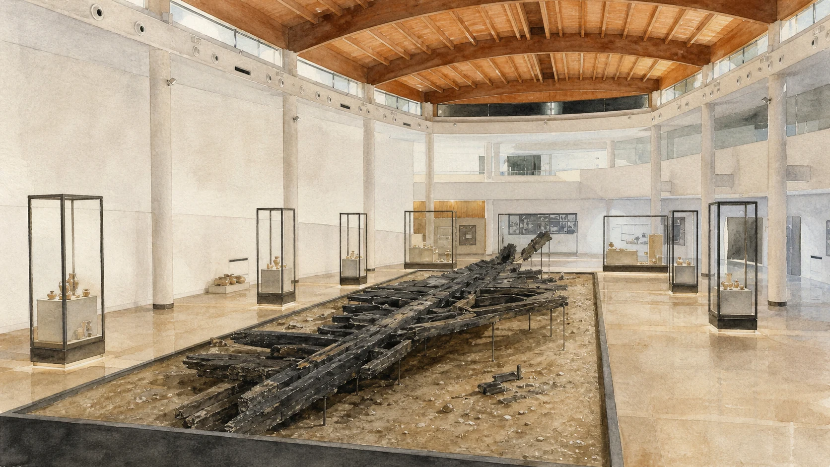
Documentary watercolour inside Gela's Museum of Greek Wrecks with conserved dark hull timbers displayed at floor level beneath a broad curved wooden ceiling
SHIPS REASSEMBLED FROM THE SEABEDThe new museum displays conserved hull timbers at full scale and surrounds them with cargo and excavation evidence rather than imagining an intact ancient vessel at sea.
11

DUNES BURIED A COMMERCIAL QUARTER WHOSE RAW-EARTH WALLS STILL RISE MORE THAN TWO METRES

Bosco Littorio and the Archaic Emporion

The emporion is one of the clearest places in Sicily to understand how fragile architecture and long-distance trade met at a beach.

Documentary watercolour inside Gela's Museum of Greek Wrecks with conserved dark hull timbers displayed at floor level beneath a broad curved wooden ceiling
SHIPS REASSEMBLED FROM THE SEABED

The place today

Near the shore at Bosco Littorio, rectangular rooms preserve pale plaster, door and window openings and sockets for roof beams. Their height is exceptional because rapid burial by sand protected unfired brick that would normally erode. The site is close to the Museum of Greek Wrecks but remains a distinct archaeological area.

The historical chapter

The commercial installation developed at the beginning of the sixth century BC on the south-eastern slope of the city. Finds include local and imported ceramics from Corinth, Athens, Chios, Samos, Laconia and the western Greek world, along with transport containers and terracotta relief altars. The rooms collected, stored and exchanged goods arriving by sea.

What to notice

  • Bosco Littorio is officially listed as temporarily closed for maintenance and safety. View only through authorised arrangements and check for an updated notice.
  • Do not describe the preserved walls as stone warehouses. Their raw-earth construction and protective burial are the main reasons the site is exceptional and vulnerable.
Gela Archaeological Park · Bosco Littorio emporion
12

A NEW MUSEUM AT BOSCO LITTORIO RETURNS A FIFTH-CENTURY CARGO VESSEL TO THE COAST IT WAS APPROACHING

The Museum of Greek Wrecks

Opened in February 2026, the museum is now Gela's principal accessible archaeological interior but follows its own capacity and timetable.

Documentary watercolour inside Gela's Museum of Greek Wrecks with conserved dark hull timbers displayed at floor level beneath a broad curved wooden ceiling
SHIPS REASSEMBLED FROM THE SEABED

The place today

The museum occupies more than four thousand square metres and centres its route on Gela I, with cargo, shipboard objects and immersive interpretation around the conserved hull. Its timber roof evokes an inverted keel without pretending to be the ancient ship. The museum opened to the public on 25 February 2026.

The historical chapter

The building was conceived over a long period while the recovered timbers underwent treatment abroad and the Sicilian authorities developed a permanent display. Locating the museum at Bosco Littorio reconnects the vessel with the archaic emporion and the shallow coastal waters in which it sank. The installation turns conservation history into part of the story: discovery, underwater recording, staged recovery, desalination, polyethylene-glycol treatment, reconstruction and public interpretation are visible chapters of the object.

What to notice

  • Use the current Park timetable, not the opening-day schedule or an old search snippet. Weekend afternoons and exceptional closures have already been revised during 2026.
  • Groups and schools require booking, and capacity can affect entry. The emporion outside may remain closed even when the museum itself is open.
Gela Archaeological Park · Opening and access for the Museum of Greek Wrecks
13

PINE PLANKS, STONE BALLAST AND EVERYDAY OBJECTS TURN A SHIPWRECK INTO A CROSS-SECTION OF MEDITERRANEAN EXCHANGE

Gela I: the Cargo Ship and Its Load

The vessel is valuable not as buried treasure but as a structure, working environment and commercial event.

Documentary watercolour inside Gela's Museum of Greek Wrecks with conserved dark hull timbers displayed at floor level beneath a broad curved wooden ceiling
SHIPS REASSEMBLED FROM THE SEABED

The place today

The reassembled hull dominates the new museum. Around it, wine and oil amphorae, Attic ceramics, lamps, bowls, fishing hooks, writing equipment and devotional objects restore the scale of a voyage. Immersive media can explain navigation, but the surviving timber and the distribution of cargo remain the primary evidence.

The historical chapter

A local diver's long search led to discovery in 1988, approximately eight hundred metres offshore. The merchant ship, about twenty metres long and seven metres wide, belongs to the fifth century BC. Its pine planks were assembled in the shell-first tradition, in which the outer hull was constructed before much of the internal framing.

What to notice

  • Do not describe Gela I as a complete ship lifted intact from the seabed. Excavation, phased recovery, treatment and modern support were necessary to make the surviving timbers legible.
  • The cargo represents one voyage and a network of origins. It should not be used as proof that every displayed object was made in Gela or that the ship had one certain home port.
Gela Archaeological Park · Gela I recovery, conservation and museum display
14

THE SECOND WRECK EXTENDS THE MARITIME STORY BUT IS NOT YET ANOTHER FINISHED MUSEUM DISPLAY

Gela II: a Second Ship Still Under Restoration

Gela II must be described as an active conservation project whose future exhibition remains ahead.

Documentary watercolour inside Gela's Museum of Greek Wrecks with conserved dark hull timbers displayed at floor level beneath a broad curved wooden ceiling
SHIPS REASSEMBLED FROM THE SEABED

The place today

Gela II is not presently a second reconstructed vessel beside Gela I. Restoration began on 13 April 2026 in a purpose-equipped space and is expected to require roughly nine hundred days. The process includes study, cleaning, consolidation, structural work and preparation for eventual display.

The historical chapter

The cargo ship was identified in 1990 by local diver Gianni Occhipinti about one kilometre from the first wreck. Stone ballast and ceramic fragments signalled a vessel beneath shallow coastal sediment. The regional Park dates it to the fifth century BC and gives approximate dimensions of fifteen by five metres.

What to notice

  • Do not state that Gela II is already on display. The Park announced the beginning of a restoration lasting about nine hundred days in April 2026.
  • Avoid treating the two vessels as identical sister ships. Their chronology is close, but construction, cargo and archaeological condition require separate analysis.
Gela Archaeological Park · Start of restoration for Gela II
Documentary watercolour close view of Gela's Timoleontean fortification beneath its light protective canopy, showing pale stone courses below and weathered mudbrick above
STONE BELOW, EARTH ABOVEA close view of the Timoleontean wall makes stone courses and sun-dried earthen lifts legible as distinct materials, with the modern canopy acknowledged but not monumentalised.
15

RESETTLEMENT IN THE FOURTH CENTURY BC MOVED THE MONUMENTAL CITY WESTWARD AND ENCLOSED NEW NEIGHBOURHOODS

Capo Soprano and the Timoleontean Expansion

The famous wall belongs to a rebuilt Gela, not to the colony's first seventh-century boundary.

Documentary watercolour close view of Gela's Timoleontean fortification beneath its light protective canopy, showing pale stone courses below and weathered mudbrick above
STONE BELOW, EARTH ABOVE

The place today

Capo Soprano lies within the western modern city, where a protected archaeological area preserves the fortification, nearby urban traces and the relation between ridge, plain and sea. The wall's low profile can initially seem modest, but its material preservation is exceptional. Access follows limited monthly dates and mandatory reservation rather than a permanent daily schedule; the Park publishes current bulletins, so old calendar dates should never be carried into a future visit.

The historical chapter

After the Carthaginian destruction of 405 BC, Timoleon's programme repopulated Gela around 338 BC with new settlers and enlarged the city westward. Streets, houses, baths and fortifications transformed Capo Soprano into the principal quarter. Later conflict under Agathocles and the final destruction by Phintias changed or sealed entrances.

What to notice

  • The wall is not reliably open every day. Consult the latest monthly Park notice and reserve through the official address when required.
  • Do not call every fourth-century structure Timoleontean without qualification. Resettlement initiated a phase that continued through later political and military events.
Gela Archaeological Park · Timoleontean walls and current access
16

CUT STONE BELOW AND SUN-DRIED EARTH ABOVE FORM A RARE SURVIVING DEFENCE WHOSE FRAGILITY IS PART OF THE MONUMENT

The Mudbrick Wall and Its Two Gates

Material, blocked entrances and protective management explain more than a generic label such as Greek walls.

Documentary watercolour close view of Gela's Timoleontean fortification beneath its light protective canopy, showing pale stone courses below and weathered mudbrick above
STONE BELOW, EARTH ABOVE

The place today

The exposed section combines a lower stone foundation with substantial upper courses of unfired brick. Differences in colour, surface and erosion reveal the construction clearly, while modern drainage, sheltering and visitor control protect it from rain, wind and foot contact. One entrance has a pointed profile and was later blocked with raw brick; another western gate has straight jambs and an architrave and was also closed in successive phases.

The historical chapter

The fortification controlled the northern plain and turned around the western ridge toward the steep sea slope before connecting with earlier defensive lines. Earth construction allowed large walls to be raised with local materials over a stone base. When entrances no longer served military or urban movement, builders sealed them rather than rebuilding the whole circuit.

What to notice

  • Never touch, climb or test the earthen surface. A footprint, brushed edge or attempt to remove loose material can damage fabric that survived only under protective burial.
  • The pointed gate should not automatically be labelled medieval or Gothic. Its profile belongs to the ancient fortification sequence and later blocking documented by the Park.
Gela Archaeological Park · Construction and gates of the Timoleontean wall
17

A SUBURBAN SANCTUARY CONNECTED WOMEN, AGRICULTURAL FERTILITY AND THE RIVER LANDSCAPE BEYOND THE WALLS

Bitalemi and Demeter Thesmophoros

Bitalemi returns female ritual and the cultivated plain to a history often dominated by male rulers and monumental temples.

Documentary watercolour close view of Gela's Timoleontean fortification beneath its light protective canopy, showing pale stone courses below and weathered mudbrick above
STONE BELOW, EARTH ABOVE

The place today

The sanctuary lies on a low height near the eastern river and industrial edge rather than within the ordinary acropolis route. Its archaeological visibility and public access are limited, so the site is best understood through official landscape documentation and museum finds when available. A later Marian chapel in the same locality records a different devotional history that regional studies discuss beside, but do not simply equate with, the ancient cult.

The historical chapter

Paolo Orsi first connected the sanctuary with Demeter and Kore. Excavations in 1963–67 found a graffito dedicating a vessel to the Thesmophoros, Demeter in the context of the Thesmophoria. Large quantities of terracotta figures, vessels and offerings point to ritual focused particularly on women, fertility and agriculture.

What to notice

  • Do not promise entrance to Bitalemi without current authorisation. It is an archaeological landscape, not a routinely staffed museum stop.
  • Avoid claiming that Christian devotion is a direct survival of the Greek rite. Continuity of place and comparable gestures can coexist with profound changes in belief and meaning.
Sicilian Region · Caltanissetta landscape plan, Bitalemi sanctuary
18

BRONZE-AGE SETTLEMENT, CLASSICAL AGRICULTURE AND LATER BURIAL SHOW THAT THE WESTERN COAST WAS NEVER EMPTY COUNTRYSIDE

Manfria: the Prehistoric Village and Greek Farms

Manfria extends Gela's history before the colony and beyond the city walls.

Documentary watercolour close view of Gela's Timoleontean fortification beneath its light protective canopy, showing pale stone courses below and weathered mudbrick above
STONE BELOW, EARTH ABOVE

The place today

West of the city, the Manfria hills rise above beaches, holiday housing, fields and the protected coastal zone. Archaeological remains are dispersed rather than organised as one monumental circuit. The landscape includes prehistoric occupation, Greek rural installations and later evidence, while modern development has changed visibility and access.

The historical chapter

Regional documentation places an Early Bronze Age settlement of the Castelluccio cultural horizon at Manfria Monumenti. Paolo Orsi began investigation, Piero Orlandini excavated part of the village in the twentieth century and Dinu Adamesteanu identified a farm-workshop connected with Greek occupation between the archaic and Hellenistic periods. Roman imperial and palaeochristian-Byzantine traces add further phases.

What to notice

  • Do not remove pottery, stone or shell from archaeological ground. Isolated surface material loses meaning when separated from its context and may be legally protected.
  • Manfria is a large inhabited and cultivated coastal district. Distinguish the protected archaeological locations from beaches, private properties and holiday roads.
Sicilian Region · Caltanissetta landscape plan, Manfria Monumenti
19

A SPANISH-PERIOD WATCHTOWER READ THE HORIZON AS A NETWORK OF SIGNALS RATHER THAN AS A BEACH VIEW

The Tower of Manfria and the Western Coast

The tower converts the western shore into a history of warning, administration and coastal vulnerability.

Documentary watercolour close view of Gela's Timoleontean fortification beneath its light protective canopy, showing pale stone courses below and weathered mudbrick above
STONE BELOW, EARTH ABOVE

The place today

The square tower stands on a hill close to the sea, visible across a protected coastal sector and modern settlement. Its battered lower body, upper volume and projecting lookout elements give it a compact silhouette. Condition and authorised access should be checked from current local or regional information; historic documents have described periods of structural danger and abandonment, so visibility from public ground does not justify entry.

The historical chapter

Sicily's government developed a chain of coastal towers during the sixteenth century in response to corsair and military threats. Guards used fire and smoke signals to warn neighbouring posts and inland authorities. Regional planning documentation associates the Manfria tower with this network and also records the name Torre d'Ossuna, connected with a later viceroy.

What to notice

  • Do not enter the tower or climb surrounding unstable slopes unless an official opening specifically permits it. External viewing is the default safe assumption.
  • The tower is early modern, not Greek. Its value lies in the long coastal-defence network and its relation to the visible horizon.
Sicilian Region · Landscape and architectural protection records for Torre Manfria
20

BEACHES, AIRFIELDS, ROADS AND THE GULF BECAME A BATTLEFIELD DURING THE OPENING OF THE ALLIED INVASION OF SICILY

The July 1943 Landings and the Coastal Bunkers

The modern coast holds military memory that should not be absorbed into a generic liberation narrative.

Documentary watercolour close view of Gela's Timoleontean fortification beneath its light protective canopy, showing pale stone courses below and weathered mudbrick above
STONE BELOW, EARTH ABOVE

The place today

Bunkers, shelters, altered earthworks and memorial references survive across parts of the Gela coast and plain, often outside formal museums and sometimes on difficult or private ground. Their condition varies widely. The ordinary seafront gives little sense of the scale of naval fire, airborne operations, armoured counterattacks and civilian danger in July 1943.

The historical chapter

In the night of 9–10 July 1943, Allied forces landed around Gela and Scoglitti during Operation Husky. United States troops met Italian and German resistance, while naval artillery, aircraft and armoured units fought across the coastal approaches. The battle opened the campaign that led to the occupation of Sicily but caused military and civilian losses and damaged buildings including Castelluccio.

What to notice

  • Do not enter abandoned bunkers: collapse, metal, water, contamination and private ownership can make them dangerous even when an opening is visible.
  • Avoid reducing the battle to one national viewpoint. Italian, German, American and civilian experiences overlap, and local sites need precise identification.
U.S. Naval History and Heritage Command · Operation Husky records for the Gulf of Gela
Documentary watercolour of the Biviere di Gela with reed-fringed shallow water, low Mediterranean vegetation and a purple swamphen moving through the wetland
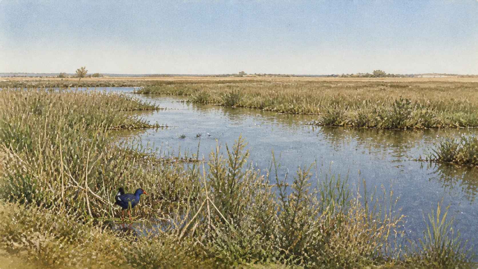
A COASTAL WETLAND UNDER PRESSUREReed beds, open water and agricultural margins at the Biviere support migratory birds without pretending that the protected lake is an untouched wilderness.
21

A COASTAL LAGOON ON A MAJOR MIGRATION ROUTE SURVIVES BETWEEN AGRICULTURE, RIVER SYSTEMS AND INDUSTRY

The Biviere di Gela Wetland

The Biviere is protected because it is ecologically important and pressured, not because it is untouched.

Documentary watercolour of the Biviere di Gela with reed-fringed shallow water, low Mediterranean vegetation and a purple swamphen moving through the wetland
A COASTAL WETLAND UNDER PRESSURE

The place today

About eight kilometres east of the city, the reserve protects Sicily's largest natural coastal lake and surrounding habitat. Reeds, open water, farmland and observation points support migrant, wintering and nesting birds. The Sicilian Region lists more than two hundred recorded bird species and identifies LIPU as the managing body.

The historical chapter

The lagoon developed behind coastal dunes and was historically connected with salt, fishing and irrigation. It became Ramsar site number 397 in 1988 and a regional oriented nature reserve in 1997; it also forms part of European Natura 2000 designations. Historic intervention changed water and agricultural systems, while modern protection has included species recovery and habitat management.

What to notice

  • Keep distance from birds, nests and reed edges; use hides and marked paths, silence devices and never use playback to attract wildlife.
  • Protected status does not mean constant access or guaranteed water level. Check the reserve's current conditions, weather and seasonal guidance.
Sicilian Region ORBS · Biviere di Gela Nature Reserve
22

SAND RIDGES, SCRUB, GREENHOUSES AND IRRIGATED FIELDS FORM A PRODUCTIVE LANDSCAPE WITH REAL ECOLOGICAL LIMITS

The Macconi, Dunes and Cultivated Coast

The coast beyond the lagoon is neither empty nature nor merely an agricultural service zone.

Documentary watercolour of the Biviere di Gela with reed-fringed shallow water, low Mediterranean vegetation and a purple swamphen moving through the wetland
A COASTAL WETLAND UNDER PRESSURE

The place today

East and west of Gela, sandy beaches and dune ridges alternate with river mouths, coastal scrub, roads, holiday construction, glasshouses and fields. The term macconi identifies prominent dune formations in the local landscape. These low-relief environments are visually easy to underestimate but protect specialised plants, influence water movement and connect habitats used by birds.

The historical chapter

Wind, currents and river sediment built and moved the dunes over long periods; the same sand buried and preserved the Bosco Littorio emporion and parts of the Capo Soprano wall. Agriculture progressively reorganised groundwater, drainage and vegetation, while twentieth-century urban and industrial development fragmented the coastal system. Natura 2000 designations recognise Torre Manfria, the Biviere, the Macconi and the Gela plain as related ecological territory rather than isolated scenic pockets.

What to notice

  • Do not walk or drive across dune vegetation for a shorter beach route. Even low plants stabilise mobile sand and can be damaged by a single track.
  • Greenhouses and fields are working private landscapes. Photograph from public roads and respect irrigation structures, workers and property boundaries.
Sicilian Region · Landscape planning for the coastal plains of Gela
23

A COASTAL RESIDENTIAL DISTRICT GAVE THE PETROCHEMICAL PROJECT A DOMESTIC, LANDSCAPED AND SOCIAL FORM

Macchitella and the Planned Industrial City

Macchitella shows how industry changed not only the skyline and labour market but the architecture of everyday life.

Documentary watercolour of the Biviere di Gela with reed-fringed shallow water, low Mediterranean vegetation and a purple swamphen moving through the wetland
A COASTAL WETLAND UNDER PRESSURE

The place today

West of the historic centre, Macchitella extends parallel to the sandy coast through broad roads, planted verges, schools, services and residential blocks. Later expansion has joined the original settlement to the wider city, but the planned hierarchy of streets and open space remains visible. The former Eni Casa Albergo, now being reused through the Macchitella Lab project, preserves the memory of workers and technicians who arrived from elsewhere in Italy.

The historical chapter

Oil discoveries in the 1950s and construction of the industrial complex created urgent demand for housing and services. The original Macchitella residential village was completed in the early 1960s and formally inaugurated with the petrochemical plant in 1965. It was conceived as a modern district for an industrial workforce, separating some residential life from the plant while remaining socially dependent on it.

What to notice

  • Macchitella is a lived neighbourhood, not an open-air company museum. Observe its plan without photographing residents or entering communal and former industrial properties.
  • Eni's documentation is a primary source for company projects and chronology, but its language about community value should be identified as corporate framing.
Eni · Environmental declaration and historical chronology of the Gela site
24

EMPLOYMENT, ENERGY, CONTAMINATION, DEINDUSTRIALISATION AND CONVERSION REMAIN ONE UNFINISHED HISTORY

The Petrochemical Complex, the SIN and the Biorefinery

The industrial shore must be read through both company transformation and independent environmental procedure.

Documentary watercolour of the Biviere di Gela with reed-fringed shallow water, low Mediterranean vegetation and a purple swamphen moving through the wetland
A COASTAL WETLAND UNDER PRESSURE

The place today

The industrial zone east of Gela contains the biorefinery, energy and storage infrastructure, areas under decommissioning or remediation and the port-facing shoreline. Eni inaugurated the converted biorefinery in 2019 after traditional refinery lines had stopped, and the site has continued to add new fuel and energy projects. At the same time, the Ministry of the Environment identifies roughly 795 hectares on land and 4,583 hectares offshore within the Gela Site of National Interest, where soil and groundwater contamination require formal investigation, containment and clean-up procedures.

The historical chapter

The petrochemical complex was built from 1960 and entered production from 1962, following oil discovery in the Gela plain and gulf. It brought employment, inward migration, housing and public expectations, but also bound the city to volatile industrial cycles and environmental pressure. Gela became a SIN in 1998 and was formally delimited in 2000.

What to notice

  • View industrial infrastructure only from public, safe locations. Do not enter restricted roads, port areas, remediation sites or working plants for photography.
  • Keep sources distinct: Eni documents its investments and operations; the Ministry and ARPA document contamination, monitoring and public procedures. Neither perspective should silently substitute for the other.
Italian Ministry of the Environment · Gela Site of National Interest

The city through time

Ten passages through settlement, destruction, refoundation and industrial change

The chronology follows the entire ridge and coast rather than ending with the destruction of the Greek polis.

  1. Communities occupy Piano Notaro, Molino a Vento, Manfria and the coastal plain during the Copper and Bronze Ages, long before the Greek colony.

  2. Early Greek material appears at Lindioi; Rhodian and Cretan settlers led by Antiphemos and Entimos found Gela in 689–688 BC and establish cults on Molino a Vento.

  3. Gela expands inland, develops the Bosco Littorio emporion, imports Mediterranean goods, founds Akragas in 581–580 BC and rises under the tyrants Cleander, Hippocrates and Gelon.

  4. The victory at Himera is followed by urban and sacred building, including Temple C; commerce continues until Carthage captures and destroys the city in 405 BC.

  5. Timoleon's resettlement enlarges Gela toward Capo Soprano with houses, baths and mixed-technique walls; later conflict ends when Phintias destroys the city and transfers its people.

  6. Frederick II founds Heraclea, later Terranova, on the ancient ridge; a castle, Mother Church, inland fortress and coastal watch system organise the medieval and early-modern territory.

  7. The present Mother Church and later civic buildings reshape Terranova; archaeology recovers the Greek past, and the official name Gela replaces Terranova in 1927.

  8. Allied landings and Italian-German counterattacks turn beaches, roads and the plain into the Battle of Gela, leaving casualties, damaged monuments, bunkers and contested memory.

  9. Oil discovery, the refinery, petrochemical plants and Macchitella transform population and work; the environmental crisis leads to creation of the Gela Site of National Interest in 1998 and delimitation in 2000.

  10. Industrial conversion leads to the 2019 biorefinery; remediation continues, Gela I returns to a museum opened in 2026, Gela II enters restoration and archaeological access remains an evolving public project.

Before your visit

Practical information,
without turning it into promises

01

Divide Gela into at least three separate routes

Use one session for the centre, Molino a Vento and the museums; one for Capo Soprano and the western coast; and one for Bosco Littorio, the Biviere and the eastern landscape. Distances and limited openings make a single continuous walk unrealistic.

02

Build the day around current archaeological access

The Archaeological Museum is closed for works; Capo Soprano follows selected dates and reservation; Bosco Littorio may be closed while the shipwreck museum is open; Molino a Vento and group visits follow their own rules. Check the Park hours page and latest bulletins.

03

Treat coast, wetland and ruins as vulnerable environments

Bring water, sun and wind protection, remain on marked paths, avoid dune vegetation and raw-earth surfaces, observe birds from distance and never enter bunkers, towers, excavations or industrial areas without explicit access.

04

Read industry through more than one institutional voice

Use Eni for plant chronology and its own projects, the Ministry for the SIN and contamination framework, and ARPA for monitoring. A biorefinery opening does not by itself demonstrate completion of remediation, ecological recovery or social transition.

Sources

This guide cross-checks the Gela Archaeological Park, the Sicilian Region's cultural, landscape and protected-area records, the Italian Episcopal Conference, the U.S. Naval History and Heritage Command, the Italian Ministry of the Environment, ARPA Sicilia and Eni's own environmental and industrial publications. It distinguishes early Lindioi from the formal colony, archaic acropolis from Timoleontean expansion, raw-earth walls from stone, an open ship museum from a closed archaeological museum, Gela I on display from Gela II under restoration, Terranova from ancient Gela, a Ramsar wetland from untouched nature, company transition claims from public contamination procedures, and published opening information from access that must be confirmed on the day.

The hero image is an illustration, not a photograph. Official reference photographs remain archived locally for visual verification. Archaeological schedules, reservation rules, the reopening of the Regional Archaeological Museum, access to Bosco Littorio, Museum of Greek Wrecks capacity, restoration of Gela II, church services, protected-area paths, wildlife conditions, tower and bunker safety, remediation work, industrial restrictions, beaches and transport can change; consult the linked institutions before visiting.