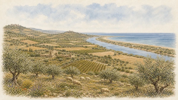
ILLUSTRATED GUIDE · SICILY
A valley broken by earth,
rebuilt through memory
and contemporary art
Twenty-eight substantial chapters across earthquake memory, reconstruction, contemporary art, relocated towns, working landscapes and the river's journey to the Mediterranean.
Explore the placesA SICILIAN JOURNEY THAT MUST INCLUDE LOSS, ARGUMENT AND RECONSTRUCTION
My relationship with Sicily began through family journeys: the island was never an abstract destination but a place where names, roads, meals and stories belonged to people. That personal starting point makes the Belìce especially demanding. Here, a guide cannot turn catastrophe into spectacle or contemporary art into a decorative stop between better-known monuments.
The earthquake of January 1968 fractured homes, work, neighbourhoods and inherited routes across a wide valley. It also exposed the fragility of housing, the weakness of emergency coordination and the distance between national planning and local life. Reconstruction created new towns and extraordinary works, but it also produced long displacement, migration, unfinished spaces and arguments that remain part of the landscape.
Gibellina is the most visible experiment, yet it does not stand for every community. Salaparuta, Poggioreale and Montevago kept different relations with their ruins; Santa Margherita rebuilt around surviving fragments; Partanna and Menfi adapted damaged historic structures. Their choices must be visited separately before the phrase 'the towns of the earthquake' has any real meaning.
This route therefore moves slowly between old and new ground. It listens to archives, residents, architecture, agriculture and ecological systems as carefully as it looks at Burri, Consagra, Venezia, Purini, Thermes, Mendini and Paladino. The result is not a story of simple rebirth. It is a guide to memory made public, contested and still alive.
One destination
Twenty-eight chapters from rupture to reconstruction, art and living territory
The opening chapters establish the Belìce as a large river basin crossing the provinces of Palermo, Trapani and Agrigento, not a compact sightseeing district. They reconstruct the seismic sequence of 14–25 January 1968, explain why official casualty figures differ, examine rescue, temporary shelter, migration, protest and the centralised legislation that shaped reconstruction.
The central section treats Gibellina as three connected but non-interchangeable places: the buried street plan of the old town, the relocated residential city and the cultural landscape extending to Baglio Di Stefano. The Grande Cretto is read through commission, construction, dimensions, completion, conservation and walking ethics. Gibellina Nuova is read through planning, housing, civic buildings, sculpture, museums and performance rather than as an empty catalogue of famous names.
The final section restores the plurality of the valley. Salaparuta, Poggioreale, Montevago, Santa Margherita di Belìce, Partanna and Menfi each receive their own material history, while wine, oil, sheep farming, the Vastedda and the river mouth show that the region cannot be reduced to ruins and monuments.
Current information is dated and qualified. Gibellina's status as Italy's first Capital of Contemporary Art belongs to 2026; museum openings, building access, safety restrictions in ruined towns and events can change. A complete journey requires independent checks with each municipality or institution before departure.

The selection
Twenty-eight chapters,
one valley still changing
The route joins nearby works and connected histories into substantial chapters, then leaves Gibellina to compare the old and new towns, working land and river mouth of the wider Belìce.
- 01The Belìce before 1968: River Basin, Rural Towns and Migration
- 0214–25 January 1968: Sequence, Destruction and Displacement
- 03Rescue, Barracks, Migration and the Struggle for Reconstruction
- 04Law, Relocation and the Uneven Promise of Development
- 05Belìce/EpiCentro: Testimony before Monuments
- 06Gibellina Vecchia and Santa Caterina: Ground, Ruin and Threshold
- 07The Grande Cretto: Burri's Concept, White Blocks and Remembered Streets
- 081985–1989 and 2015: Building, Stopping and Completing the Cretto
- 09Conservation, Visitor Facilities and the Ethics of Walking the Cretto
- 10Gibellina Nuova: Plan, Housing and an Everyday City
- 11Corrao's Cultural Strategy — and the People Who Made It Material
- 12Consagra's Gibellina: Star, Meeting and Unfinished Theatre
- 13Mother Church, Palazzo Comunale and the Civic Centre
- 14The Civic Tower and the System of Squares
- 15Palazzo Di Lorenzo, Secret Gardens and Nanda Vigo's Architecture of Light
- 16The Open-Air Museum and the MAC Ludovico Corrao
- 17Baglio Di Stefano and the Museum of Mediterranean Textures
- 18Montagna di Sale and the Orestiadi: Theatre Becomes Landscape
- 19Gibellina 2026: Italy's First Capital of Contemporary Art
- 20Salaparuta: Old Ruins, New Centre and Wine Territory
- 21Poggioreale: The Photogenic Ruin and the Living Town
- 22Montevago: The Old Grid, the New Town and Villaggio Bergamo
- 23Santa Margherita: Palazzo Filangeri, Literary Memory and the Former Mother Church
- 24Partanna: Castello Grifeo and the Belìce before the Modern Disaster
- 25Menfi: Historic Fragments, Modern Reconstruction and the Coast
- 26Olive Oil, Vastedda and Wine: The Working Valley
- 27The Foce del Belìce: River, Dunes and a Coast in Motion
- 28A Complete Four-Day Route through Memory, Art, Towns and Landscape
THE EARTHQUAKE STRUCK A WORKING TERRITORY, NOT AN EMPTY INTERIOR
The Belìce before 1968: River Basin, Rural Towns and Migration
Ridges, tributaries, vineyards, olive groves and compact hill towns shaped a valley already marked by agricultural labour, inequality and migration.

The place today
The river is not always the dominant visual feature, and a journey among Gibellina, Salaparuta, Poggioreale, Montevago, Santa Margherita, Partanna and Menfi requires substantial road travel. Museums, oral histories and surviving farms reveal domestic and working landscapes that the ruins alone cannot recover.
The historical chapter
Mixed farming, estates, small ownership, craft and pastoral movement supported communities across three present provinces. From the 1950s, campaigns associated with Danilo Dolci and local activists challenged unemployment, water shortages, infrastructure and political exclusion. The disaster intensified these vulnerabilities; it did not create them.
What to notice
- Do not plan the Belìce as a compact circuit around Gibellina; old towns, new towns and fields occupy different geographies.
- Avoid presenting pre-1968 life as timeless rural harmony; poverty, labour conflict and emigration were part of the record.
FOUR TOWNS WERE DESTROYED, BUT DAMAGE AND HOMELESSNESS CROSSED THE VALLEY
14–25 January 1968: Sequence, Destruction and Displacement
The catastrophe unfolded through repeated shocks, different levels of damage and almost 100,000 people left without homes.

The place today
Gibellina Vecchia, Poggioreale Antica, Salaparuta Vecchia and Montevago Vecchia retain different amounts of standing, buried or stabilised fabric. Institutional accounts report different casualty totals: Civil Protection gives 296 deaths and more than 1,000 injured, while an INGV dossier gives 352 deaths and 576 injured. The source and date matter.
The historical chapter
The sequence began on 14 January; INGV records a magnitude 6.4 main event on 15 January and five events between magnitude 5.0 and 5.5 through 25 January, while Civil Protection uses 6.5 in its public history. Vulnerable masonry, roads and rural buildings turned a seismic sequence into a territorial social disaster.
What to notice
- Do not compress the disaster into one midnight shock or silently select the largest casualty total for effect.
- Destroyed, abandoned, relocated and reconstructed describe different conditions and should not be used interchangeably.
THE FIRST TELEVISED NATIONAL DISASTER BECAME A LONG POLITICAL EMERGENCY
Rescue, Barracks, Migration and the Struggle for Reconstruction
Rescue failures, temporary settlements and collective mobilisation shaped the valley long after the first television images disappeared.

The place today
Archive footage must be read beside cold, damaged roads, aftershocks and the labour of local volunteers and responders. Tents gave way to prefabricated settlements and baraccopoli where families built schools, services and campaigns. EpiCentro preserves banners, photographs and testimony that restore residents as political actors rather than passive victims.
The historical chapter
Italy lacked the later integrated Civil Protection system, and fragmented coordination exposed institutional weakness. Delayed planning and construction prolonged temporary housing and accelerated existing migration routes. Demonstrations, including the 2 March 1968 gathering in Rome, demanded that reconstruction include work, infrastructure and participation rather than only replacement dwellings.
What to notice
- Do not treat television visibility as complete documentation or criticism of coordination as criticism of individual rescuers.
- Tents, prefabricated units and long-term barracks had different conditions; residents and political organisations also held different positions.
A TOWN COULD KEEP ITS NAME WHILE LOSING ITS OLD DISTANCES
Law, Relocation and the Uneven Promise of Development
Centralised reconstruction moved several communities, changed their scale and tied new housing to decades of disputed development policy.

The place today
Gibellina Nuova lies far from the old hill; Poggioreale, Salaparuta and Montevago also require separate visits to ruin and replacement centre. Broad roads, low density, incomplete buildings and remote industrial areas should be evaluated with housing, services, employment and maintenance, not used as isolated symbols of total success or failure.
The historical chapter
Law 241/1968 began a centralised framework that evolved through repeated measures and funding cycles. Relocation responded to safety and land availability but broke walking routes between homes, fields and civic life. Large infrastructure and industrial promises were slowed by procedures, fragmented contracts and changing priorities.
What to notice
- Never use an old-town map pin to navigate to present municipal services.
- Do not attribute every later work to one law or claim that celebrated art solved demographic and economic problems.
THE VALLEY'S ARCHIVE BEGINS BEFORE THE EARTHQUAKE AND CONTINUES THROUGH CONTESTED RECONSTRUCTION
Belìce/EpiCentro: Testimony before Monuments
EpiCentro combines museum, archive and social history, making it the most useful first stop for understanding the region.

The place today
Displays join household photographs, oral accounts, political documents, video and records of nonviolent mobilisation. Hours and guided access can vary, especially during changing 2026 programmes, so the institution should be contacted before travel. The archive gives human scale to ruins and unfinished civic spaces encountered later.
The historical chapter
Its narrative links the 1950s and 1960s campaigns for land, water, work and participation with emergency camps, popular struggles and reconstruction. That continuity prevents the disaster from being isolated from the political and economic conditions that shaped both vulnerability and response.
What to notice
- Check current access directly; different institutional pages may not list identical hours.
- An archive preserves competing voices and should not be reduced to one emotional script for every survivor.

THE OLD TOWN REMAINS PRESENT BENEATH ART, BESIDE RUINS AND INSIDE DOCUMENTS
Gibellina Vecchia and Santa Caterina: Ground, Ruin and Threshold
The Cretto covers most of the former centre, while peripheral fabric and the recovered church of Santa Caterina preserve other ways of encountering loss.

The place today
The exposed old-town hill has little shade and access conditions can change. Santa Caterina survives near the approach as an unroofed, rehabilitated exhibition room containing documents on the earthquake and Burri. Its recovered state should not be mistaken for a restoration to the pre-1968 church.
The historical chapter
Gibellina Vecchia was a lived town of houses, churches, shops and routes before residents were relocated. The 1968 shocks left Santa Caterina without its roof; later rehabilitation turned it into a threshold between road, Cretto, surviving ruins and community testimony.
What to notice
- Do not call the old site empty before Burri or describe the Cretto as a house-by-house replica.
- Peripheral walls remain potentially unstable, and exterior visibility does not guarantee that Santa Caterina is open.
A REFUSAL TO PLACE ONE SCULPTURE IN THE NEW TOWN BECAME A TERRITORIAL WORK ON THE OLD ONE
The Grande Cretto: Burri's Concept, White Blocks and Remembered Streets
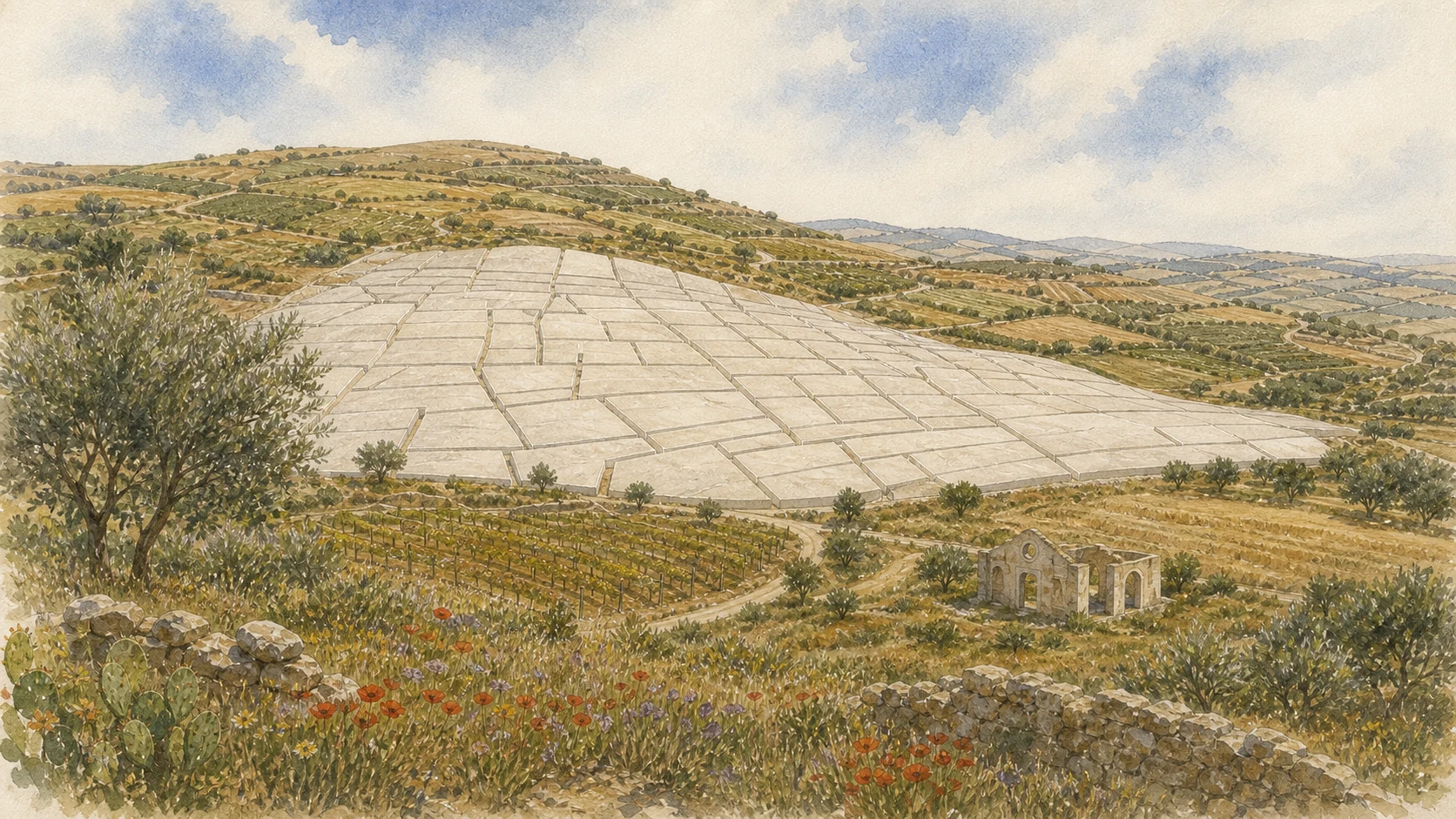
Alberto Burri transformed consolidated rubble and interpreted street traces into approximately 86,000 square metres of pale concrete masses and passages.

The place today
At ground level, walls, turns and gradients limit the horizon; from a distance, the overall cracked geometry becomes legible. Both views are necessary. The blocks are concrete associated with rubble, not marble, salt or snow, and their passages recall circulation without supporting address-by-address claims.
The historical chapter
Invited by Ludovico Corrao in 1981, Burri extended the language of his earlier Cretti from surface to destroyed settlement. Rather than reconstruct buildings, the project compressed heterogeneous remains beneath controlled masses while retaining a transformed memory of routes through the town.
What to notice
- Do not call the passages a complete cadastral survey or the blocks literal casts of former houses.
- The project followed consultation and municipal decisions; it was not an immediate spontaneous response to the earthquake.
THE WORK VISIBLE TODAY BELONGS TO TWO CAMPAIGNS SEPARATED BY DECADES
1985–1989 and 2015: Building, Stopping and Completing the Cretto
A first campaign realised about 6.5 hectares before funding stopped; the full extent of Burri's project was completed after his death.

The place today
Differences in concrete tone, joints, weathering and vegetation belong to the material biography of the site. They should not be read automatically as either original design or simple neglect. Completion in 2015 did not mean that the earlier field was demolished or repoured.
The historical chapter
Construction began in 1985 and stopped in 1989. The incomplete work became famous while maintenance and completion remained debated. The Fondazione Burri later directed the final campaign using the model preserved in Città di Castello, creating the present extent and new conservation obligations.
What to notice
- Do not assign one construction date to the entire visible surface.
- Visual inspection alone cannot distinguish designed joints, ageing and damage or resolve the critical debate around posthumous completion.
A WALKABLE ARTWORK STILL COVERS THE MATERIAL REMAINS OF A DESTROYED TOWN
Conservation, Visitor Facilities and the Ethics of Walking the Cretto
Access, repair, performances and proposed facilities must negotiate public use with artistic integrity, landscape and private memory.

The place today
Visit in safe daylight, carry water and respect closures, repair zones and event arrangements. In July 2025 the Fondazione Burri publicly objected to insufficient involvement in a regional visitor-facility project; that statement is a documented position, not a final judicial ruling. Drone and commercial uses require current checks.
The historical chapter
Burri also conceived the surrounding green setting. Performances associated with the Orestiadi have connected memorial ground and contemporary theatre, but the paths remain above former homes and streets. Tourism infrastructure, drainage, signage and conservation therefore affect both authorship and resident memory.
What to notice
- Do not climb blocks, enter fenced works or use the site for disaster-themed poses.
- Present the Foundation's conservation claim as its stated position and verify current access before every visit.

THE MONUMENTAL MAP SITS INSIDE A RESIDENTIAL TOWN WITH LONG DISTANCES AND ADAPTED HOMES
Gibellina Nuova: Plan, Housing and an Everyday City
The relocated settlement changed density and movement before art and architecture were inserted as new civic identities.

The place today
A car helps connect the Star, central districts, museums, Baglio Di Stefano and the old site, but short walks reveal porches, planted yards, schools, shops and adaptations that an artwork itinerary omits. Broad or empty spaces should be observed across time, climate and use before they are labelled failures.
The historical chapter
National reconstruction planning established larger plots, lower density and new housing types. Later commissions introduced cultural landmarks into that framework. Residents then modified standardised spaces, demonstrating that a master plan and the city actually inhabited are related but not identical objects.
What to notice
- Do not attribute the entire plan to one artist or architect.
- Respect ordinary homes and residents' privacy; Gibellina Nuova is not an abandoned design exhibition.
ART WAS PROPOSED AS CIVIC RECONSTRUCTION, BUT AUTHORS, WORKERS AND RESIDENTS DID NOT HOLD EQUAL ROLES
Corrao's Cultural Strategy — and the People Who Made It Material
Ludovico Corrao connected Gibellina with artists, architects, writers and theatre-makers while local labour and resident use turned commissions into a functioning, contested city.

The place today
The MAC, Orestiadi and Museum of Mediterranean Textures continue parts of this Mediterranean programme. Ceramics, concrete formwork, metalwork, restoration, municipal administration and event production reveal contributors beyond famous signatures. Residents have hosted, criticised, adapted or ignored works rather than responding with one voice.
The historical chapter
Corrao argued that housing alone could not rebuild community identity. Donations, commissions and international relationships created institutions and incomplete experiments, but did not automatically distribute employment, authorship or decision-making equally. Visionary and contested remain compatible descriptions.
What to notice
- Avoid the single-hero story and do not imply that a named artist physically fabricated every component.
- Document community participation project by project rather than assuming it from an artwork's public location.
THRESHOLD, CONVERSATION AND PERFORMANCE TURN SCULPTURE INTO URBAN EXPERIENCE
Consagra's Gibellina: Star, Meeting and Unfinished Theatre
Three works by Pietro Consagra move from a red road gateway to inhabitable civic sculpture and an unfinished architectural landmark.

The place today
The Star should be viewed from a safe stopping point, never from traffic. The white Meeting rewards movement through its open interiors, while access follows current programming. The Theatre is reused for exhibitions and projections but must not be advertised as a completed auditorium with conventional services.
The historical chapter
The Star reimagined the Porta del Belìce as a frontal steel threshold. Meeting, built around 1979–1981, made dialogue into inhabitable sculpture. The theatre grew from a 1973 design but remained incomplete, turning reconstruction delay into part of its later cultural meaning.
What to notice
- The Star belongs to Gibellina Nuova, not to the entrance of the Grande Cretto.
- Event reuse can change circulation but does not erase incompletion, safety controls or conservation needs.
WORSHIP AND GOVERNMENT WERE GIVEN MONUMENTAL FORMS THAT LATER HAD TO ADAPT
Mother Church, Palazzo Comunale and the Civic Centre
Quaroni's spherical church and the porticoed town hall create two powerful civic landmarks with very different functions and material histories.

The place today
The Mother Church remains a place of worship; access follows parish use and its restored condition carries the memory of a partial dome collapse in 1994. The L-shaped town hall opens toward Piazza XV Gennaio, but working interiors and the Agorà are not automatically museum spaces.
The historical chapter
Long construction transformed Quaroni's design, and restoration returned the church to use rather than preserving it as ruin. The town hall, designed in 1970 by the Samonà, Gregotti and Pirrone team, joined administration, council and art; later safety and functional changes occupied some originally open areas.
What to notice
- Do not treat the church sphere as a freestanding sculpture or enter worship space without regard for services.
- Compare current municipal permeability with documented original intentions instead of claiming the building is unchanged.
SOUND, COLOUR, PORTICOES AND STONE TURNED PUBLIC SPACE INTO URBAN THEATRE
The Civic Tower and the System of Squares
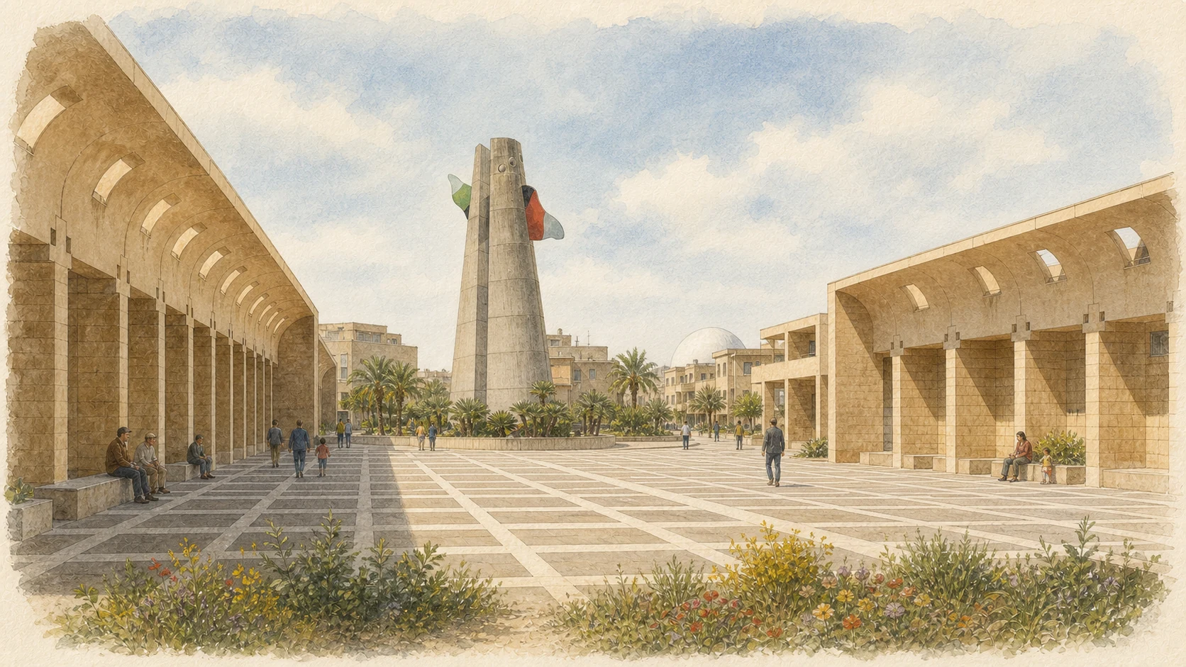
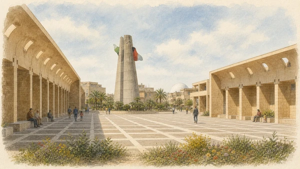
Mendini's broken-cone tower and the Purini–Thermes square sequence organise time, movement and civic memory around the rebuilt centre.

The place today
The tower's designed split is symbolic, not earthquake damage; present operation of its sound system must be verified. Three connected squares use Mazara stone, lava, travertine, red stone and ceramics, changing sharply with sun, shade, maintenance and current programming.
The historical chapter
Built across the late 1980s, both projects resist neutral civic space. The tower combined sculpture, sound and remembrance of old-town voices. The squares recalled labour movements, Sicilian autonomy and Portella della Ginestra, although only part of the larger named sequence was realised.
What to notice
- Do not promise a scheduled sound performance or map unbuilt squares as existing public space.
- A quiet photograph records one moment, not permanent abandonment or absence of civic use.
DISPLACED FRAGMENTS AND ROOFLESS ROOMS MAKE MEMORY SPATIAL WITHOUT REBUILDING OLD STREETS
Palazzo Di Lorenzo, Secret Gardens and Nanda Vigo's Architecture of Light
Three projects use enclosure, historic fragments and changing light to create intimate counterpoints to Gibellina Nuova's broad scale.

The place today
Palazzo Di Lorenzo holds an old facade inside a new roofless court rather than reconstructing the palace. The Secret Gardens frame documented arches, artworks and sky in small public interiors. Nanda Vigo's former church now hosts exhibitions and residencies; current programmes determine access and function.
The historical chapter
Francesco Venezia's projects separated fragments from original structural roles so displacement remained visible. The gardens treated incompletion as design rather than archaeological survival. Vigo's 1986–1992 luminist complex transformed a church commission into reflective architecture whose later cultural reuse did not erase its spatial identity.
What to notice
- Identify documented fragments and keep their old material distinct from new enclosures.
- Do not advertise regular religious services at the former church or assume exhibition interiors are always open.
A CITY-WIDE NETWORK NEEDS A COLLECTION, AN INVENTORY AND CONTINUOUS CARE
The Open-Air Museum and the MAC Ludovico Corrao
Outdoor gateways, sculptures, mosaics and experimental houses are complemented by a civic museum holding art and documentary evidence.

The place today
A useful route groups outdoor works by neighbourhood and access rather than racing between map pins. The renewed MAC displays only part of a collection officially described at about 2,000 works, including Accardi, Schifano, Rotella, Turcato, Melotti, Isgrò and Paladino. Exhibitions and hours must be checked.
The historical chapter
Many works entered Gibellina through donations and relationships formed during reconstruction. Outdoor placement did not remove the need for inventories and restoration, while the MAC preserved national artistic movements and the specific record of integrating art with a relocated city's civic identity.
What to notice
- Do not assume every mapped work is labelled, restored or accessible on the day of travel.
- Keep the MAC distinct from EpiCentro and the Museum of Mediterranean Textures, which have different missions.

A DAMAGED AGRICULTURAL COMPLEX BECAME A CULTURAL CAMPUS WITHOUT PRETENDING TO BE AN EXACT REPLICA
Baglio Di Stefano and the Museum of Mediterranean Textures
Restored courtyards, new additions and collections link Gibellina's rural setting to a wide Mediterranean programme.

The place today
Baglio Di Stefano lies outside the central grid and requires separate travel time. Surviving and reconstructed ranges, the granary, artworks and festival spaces can have changing circulation. Inside the museum, objects from Sicily, North Africa and the Middle East require labels on date, material and provenance before visual similarity is interpreted.
The historical chapter
The municipality acquired the damaged masseria in 1982; a long restoration made old and new fabric legible and created the Fondazione Orestiadi campus. Corrao's collection then challenged divisions among applied art, ethnographic material and contemporary practice without proving a single unified Mediterranean civilisation.
What to notice
- Do not call the whole baglio an exact post-earthquake replica.
- Formal resemblance is not proof of direct influence; comparison must preserve distinct histories and acquisition contexts.
TEMPORARY PERFORMANCE MACHINES ACQUIRED LONG LIVES IN THE REBUILT CITY
Montagna di Sale and the Orestiadi: Theatre Becomes Landscape
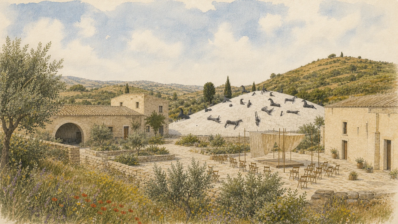
Mimmo Paladino's white mound and the international festival connect stage, myth, visual art and the memorial geography of the Belìce.

The place today
The Montagna di Sale stands outdoors at Baglio Di Stefano and its appearance changes with surface condition, restoration and use. Orestiadi performances move among the baglio, Cretto and other venues; annual dates, transport and weather arrangements must be taken from the current programme.
The historical chapter
Paladino created the work as scenography for the 1990 festival, after an Oresteia in poetic Sicilian had framed exile, violence and civic order during the early reconstruction years. Later editions brought international artists and left stage machines and works that entered local collections.
What to notice
- Do not describe the mound as actual salt or its dark forms as a literal memorial to animals.
- The festival is not an unchanged annual reenactment of one Oresteia, and outdoor access varies by production.
A NATIONAL TITLE RENEWS AN OLDER CULTURAL STRATEGY WITHOUT COMPLETING EVERY PROMISE
Gibellina 2026: Italy's First Capital of Contemporary Art
The 2026 programme brings exhibitions, residencies, performance, education and restoration to Gibellina and partner towns.

The place today
The official calendar determines current event dates, venue access and temporary installations. The title belongs specifically to 2026 and should not be presented as a permanent status. Crowds, closures and cultural production may alter ordinary routes through museums and public space.
The historical chapter
The Ministry proclaimed Gibellina on 31 October 2024 and inaugurated the programme on 15 January 2026. National recognition builds on the city's reconstruction-era art strategy rather than inventing it anew, while promotional objectives around regeneration remain commitments to evaluate, not outcomes already proved.
What to notice
- Always date the Capital title and verify the current programme on official channels.
- Do not treat national attention as proof that every conservation, transport or social problem has been resolved.

RELOCATION MOVED THE TOWN BUT DID NOT MOVE ITS AGRICULTURAL MEMORY INTO A MUSEUM
Salaparuta: Old Ruins, New Centre and Wine Territory
Standing ruins and a functioning replacement centre must be visited together within a landscape where viticulture remained economically important.

The place today
Salaparuta Vecchia retains street and church fragments, but instability and conservation can restrict access. Salaparuta Nuova provides present services and civic life. Cellars and cultural initiatives require separate booking; wine should be read through producers, work and appellation rules, not used as a generic tasting add-on.
The historical chapter
The compact old centre was judged unsafe and uneconomic to restore and was not covered by one artwork like Gibellina. Rebuilding shifted domestic space while vineyards continued to connect families with older land ownership and knowledge across the valley.
What to notice
- Never cross ruin barriers or use old photographs as evidence of current access.
- Do not confuse the municipality with the wider Valle del Belìce production territory or enter working properties without permission.
A LEGIBLE OLD STREET DOES NOT MAKE THE ABANDONED CENTRE FROZEN OR SAFE
Poggioreale: The Photogenic Ruin and the Living Town
Poggioreale Antica preserves substantial vertical fabric, while Poggioreale Nuova carries municipal and domestic continuity farther down the valley.

The place today
The old town attracts photography and film, but restrictions, unstable walls, vegetation and works control access. The new centre supplies services and current advice and deserves observation on its own terms rather than as an annex to the ruin.
The historical chapter
Restoration was judged unsafe and uneconomic, creating a dual geography after relocation. Decades of collapse, demolition and weather changed the apparently intact street perspectives. The living community adapted to a different relationship with fields, routes and the old hill.
What to notice
- Do not enter closed ruins for cinematic images; danger can extend beyond visible cracks.
- Avoid the label ghost town when it erases Poggioreale Nuova and the continuing community.
A LOST MONUMENTAL CENTRE AND MODEST SOLIDARITY BUILDINGS TELL DIFFERENT PARTS OF RECONSTRUCTION
Montevago: The Old Grid, the New Town and Villaggio Bergamo
The ruins of a seventeenth-century planned town stand apart from replacement housing and facilities created through public and charitable initiatives.

The place today
Montevago Vecchia retains the orthogonal layout and vast remains of the former Mother Church; panels and authorised routes should replace climbing or imagined reconstructions. In the new town, Villaggio Bergamo and its church record external solidarity but represent only one part of the replacement settlement.
The historical chapter
The old grid, courtyard houses and later church belonged to Montevago long before 1968. After destruction, municipal projects and donors from outside Sicily helped move families beyond emergency shelter, introducing new forms and names without recreating the lost Piano della Matrice.
What to notice
- Do not attribute the old orthogonal plan to post-earthquake planners.
- Confirm parish and municipal access, and do not collapse all new housing into the Villaggio Bergamo initiative.
RECONSTRUCTION TURNED DAMAGED MONUMENTS INTO CIVIC, LITERARY AND MEMORIAL INSTITUTIONS
Santa Margherita: Palazzo Filangeri, Literary Memory and the Former Mother Church
Palazzo Filangeri Cutò and the Museum of Memory offer complementary readings of aristocratic memory, Tomasi di Lampedusa and the earthquake.

The place today
The palace complex includes the Museo del Gattopardo, theatre and historic garden, but surviving facade and reconstructed volumes must be distinguished. The damaged former Mother Church houses a photographic museum comparing towns before and after 1968. Both institutions require current opening checks.
The historical chapter
Tomasi di Lampedusa transformed childhood summers here into the literary Donnafugata, which combines memory and invention. The earthquake spared mainly the palace facade and gravely damaged the church; later rebuilding gave both sites new public functions without restoring their complete earlier form.
What to notice
- Do not present the palace as the intact residence known by the writer or Donnafugata as measured architectural description.
- Pair the two museums and preserve differences among Belìce towns rather than making one regional memory interchangeable.
A REGIONAL PREHISTORY MUSEUM RESTORES THOUSANDS OF YEARS TO A VALLEY OFTEN NARRATED FROM 1968
Partanna: Castello Grifeo and the Belìce before the Modern Disaster
The well-preserved castle combines medieval defensive form, later adaptations and archaeological collections from the wider Belìce.

The place today
The Regional Museum of Prehistory presents Bronze Age material from documented settlement and burial contexts. Scheduled hours and accessibility should still be rechecked, and objects should not be assumed to originate on the castle site simply because they are displayed there.
The historical chapter
Castello Grifeo reflects centuries of lordship and changing civic functions. Since 2007, its museum has repositioned Partanna as an interpretive centre for communities that inhabited the valley long before modern earthquake memory became the dominant regional narrative.
What to notice
- Do not frame Partanna only as an earthquake town.
- Keep the castle's architectural history distinct from the prehistoric contexts represented by the museum collection.
THE INLAND CENTRE REINTERPRETS DAMAGED BUILDINGS WHILE ITS TERRITORY CONTINUES TO PORTO PALO
Menfi: Historic Fragments, Modern Reconstruction and the Coast
Menfi combines surviving fabric, Gregotti's geometric reconstruction, new civic spaces and a separate Mediterranean coastal horizon.

The place today
The Burgimilluso tower incorporates an old fragment within a modern tuff volume, and the Mother Church rotates its axis while retaining eighteenth-century arcades. The Pergolati di Inycon and Porta del Sole belong to the post-earthquake city; Porto Palo requires another journey toward the sea.
The historical chapter
A settlement ordered by Frederick II at Burgimilluso in 1238 developed later palace and church architecture. Much was damaged or demolished after 1968, and reconstruction negotiated among fragments, modern form and new symbols rather than rebuilding the medieval town stone for stone.
What to notice
- Do not call Gregotti's tower a complete medieval reconstruction.
- Treat the coast as part of Menfi's territory but allow separate travel time and current access checks.
PROTECTED NAMES CONNECT LAND, METHODS AND PRODUCERS; THEY ARE NOT DECORATIVE REGIONAL LABELS
Olive Oil, Vastedda and Wine: The Working Valley
Agriculture sustained the valley before 1968 and remained central to recovery even as homes moved away from fields.

The place today
Farms, dairies, mills and wineries can explain origin, season and certification. Vastedda della Valle del Belìce DOP is a stretched-curd sheep's milk cheese, while the olive-oil specification connects quality to defined cultivars and conditions. Wine routes link several municipalities but do not guarantee unbooked access.
The historical chapter
Relocation changed daily journeys between homes and land without erasing agricultural knowledge. European and national product rules later converted local names into protected systems with defined territories, production methods and controls that are narrower than a general valley identity.
What to notice
- A product served locally is not automatically DOP; certification and traceability matter.
- Working farms and cellars are private, seasonal places and require arrangements and responsible transport.
THE VALLEY ENDS IN AN ACTIVE ECOLOGICAL SYSTEM, NOT AN EMPTY BEACH
The Foce del Belìce: River, Dunes and a Coast in Motion
The reserve protects river mouth, temporary wetlands, riparian habitat, beach and dunes between Selinunte and Porto Palo.

The place today
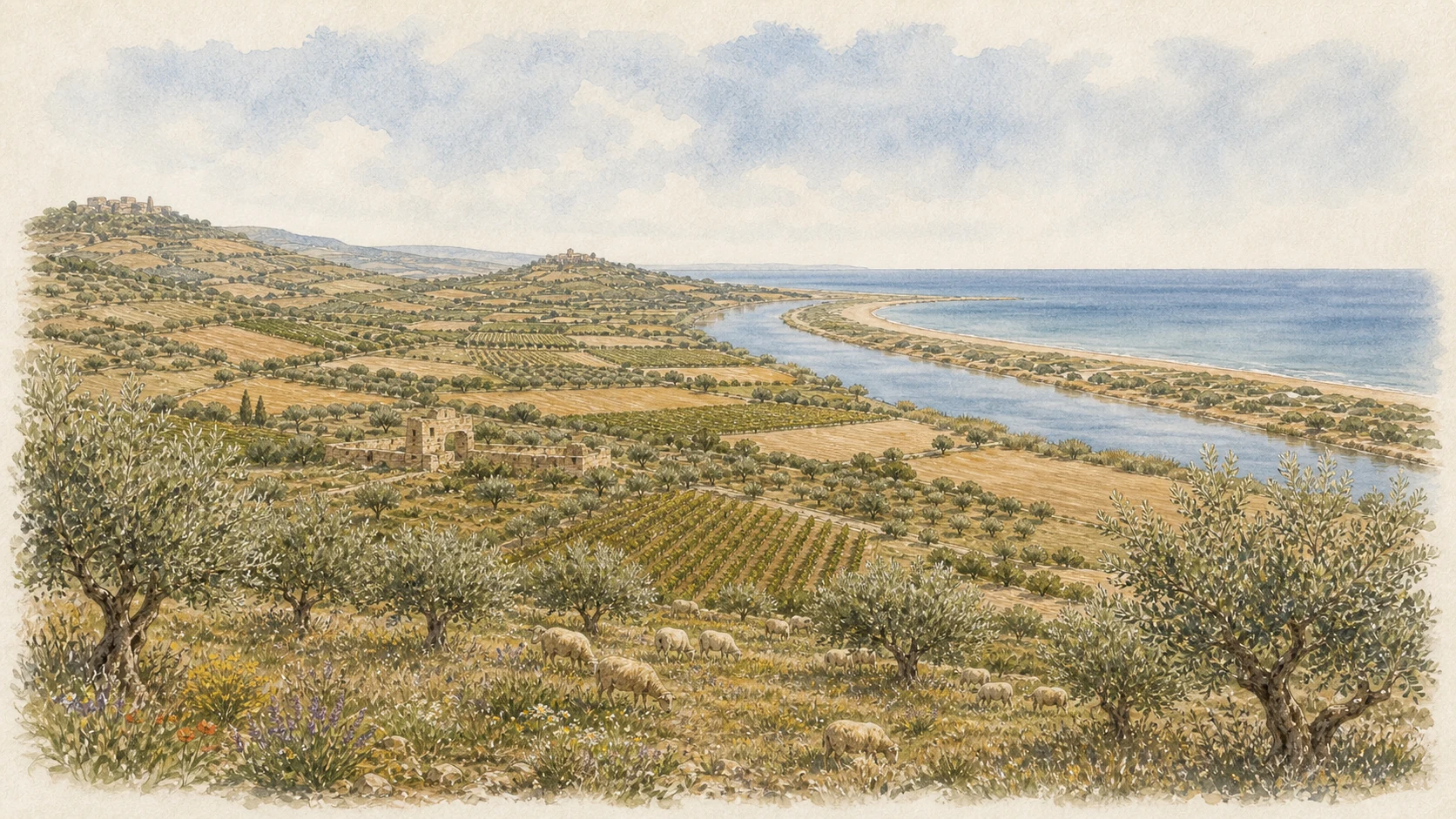
The final river course bends parallel to the shore before reaching the Mediterranean. Pioneer plants, sea daffodils, scrub, birds and occasional turtle nesting depend on fragile sand and seasonal water. Authorised paths, fenced dunes and temporary restrictions must be respected.
The historical chapter
Established in 1984 and linked to the Natura 2000 dune system, the 241.25-hectare reserve protects a coast partly spared from construction. Wind, waves, vegetation and river flow continually reshape the mouth, so map, access and apparent pools can change after storms.
What to notice
- Do not cross dune fencing, remove plants, approach nests or dismiss temporary ponds as expendable.
- Use current reserve guidance because river-mouth form and access change with season, weather and conservation work.
THE CRETTO IS CENTRAL, BUT IT CANNOT CARRY THE WHOLE VALLEY'S STORY ALONE
A Complete Four-Day Route through Memory, Art, Towns and Landscape
A responsible circuit begins with testimony, reads old and new Gibellina together, compares other reconstruction choices and ends with working and coastal landscapes.

The place today
Day one joins EpiCentro, central Gibellina Nuova and the MAC. Day two pairs Baglio Di Stefano with Gibellina Vecchia and the Cretto. Day three follows Salaparuta, Poggioreale and Partanna. Day four connects Montevago, Santa Margherita, Menfi and, when conditions allow, the river mouth. Book producers and small museums separately.
The historical chapter
This order moves from social archive to built experiment, then from distinct town responses to agriculture and ecology. It prevents Burri's work from becoming the only interpretive key and shows how relocation, cultural policy, ordinary housing, memory and production overlap without becoming one uniform reconstruction model.
What to notice
- Confirm every ruin, museum, event and producer separately; regional branding does not create shared access or hours.
- If time is short, remove stops instead of reducing each living town to a drive-by photograph.
The city through time
Ten turning points from civic mobilisation to a living contemporary-art capital
The sequence begins before the earthquake because the Belìce already had organised movements for work and development. Reconstruction, the Cretto and cultural institutions then unfold across decades rather than in one moment of rebirth.
Nonviolent campaigns and local movements confront unemployment, water, infrastructure and democratic participation in western Sicily.
A destructive seismic sequence devastates the Belìce; Gibellina, Montevago, Poggioreale and Salaparuta are razed.
Earthquake survivors and students demonstrate in Rome for reconstruction and a special development law.
Emergency camps, prolonged barracks, migration, centralised planning and relocation reshape communities across the valley.
Major civic architecture and the first contemporary-art collections establish the cultural strategy of Gibellina Nuova.
Corrao commissions Isgrò's Orestea and invites Burri; the Orestiadi become a civic and international theatre project.
The first Grande Cretto campaign covers about 6.5 hectares before work stops for lack of funds.
The Museum of Mediterranean Textures opens at Baglio Di Stefano, extending Gibellina's cultural programme across the Mediterranean.
The Grande Cretto is completed under the direction of the Fondazione Burri according to the artist's project.
Gibellina becomes Italy's first Capital of Contemporary Art, with projects distributed across the city and the Belìce.
Before your visit
Practical information,
without turning it into promises
Reserve at least four days
Use one day for EpiCentro, central Gibellina Nuova and the MAC; one for Baglio Di Stefano, Gibellina Vecchia and the Cretto; one for Salaparuta, Poggioreale and Partanna; and one for Montevago, Santa Margherita, Menfi and the river mouth. Shorter trips should remove stops, not compress interpretation.
Treat ruins as controlled sites
Poggioreale Antica, Salaparuta Vecchia, Montevago Vecchia and peripheral remains at old Gibellina can close because of instability, works or events. Ask each municipality or museum network for current access and never cross barriers based on old photographs.
Check every cultural venue independently
MAC, EpiCentro, Fondazione Orestiadi, Santa Caterina, Palazzo Di Lorenzo, the Consagra buildings and the museums in other towns have separate programmes and hours. The 2026 calendar changes access but does not create one permanent regional timetable.
Prepare for exposure and driving
The Cretto, ruins and coast have little shade; carry water, sun protection and suitable footwear. Old and new towns are separated, public transport is limited for a complete circuit and wine or farm visits require responsible transport and advance booking.
Sources
This guide cross-checks the National Institute of Geophysics and Volcanology, the National Civil Protection Service and Department, municipal and regional sources, the Ministry of Culture's Contemporary Architecture Atlas and 2026 programme, Fondazione Burri, Fondazione Orestiadi, CRESM, Belìce/EpiCentro, the Belìce museum network, municipal histories for Poggioreale, Montevago, Santa Margherita, Partanna and Menfi, MASAF product specifications and the Sicilian Region's protected-area portal. It separates a seismic sequence from a single dramatic instant, different official casualty totals from false precision, four destroyed towns from a uniform valley, emergency shelter from permanent settlement, central legislation from local agency, relocation from community disappearance, the Grande Cretto's artistic street memory from exact reconstruction, initial construction from 2015 completion, a 2025 rights statement from a settled ruling, the new city's master plan from individual architecture, signature authorship from collective fabrication, reused cultural buildings from their original programmes, promotional regeneration goals from proven outcomes, old-town ruins from unrestricted access, literary memory from intact architecture, protected products from generic local food and tourism imagery from the working agricultural and ecological valley.
- INGV · 1968 Belìce earthquake dossier ↗
- National Civil Protection Service · Belìce earthquake ↗
- Department of Civil Protection · history of events and laws ↗
- CRESM · popular struggle and contested reconstruction ↗
- Belìce/EpiCentro della Memoria Viva ↗
- Rete Museale e Naturale Belicina · memory itinerary ↗
- Fondazione Burri · Grande Cretto chronology and conservation statement ↗
- Fondazione Orestiadi · history ↗
- Fondazione Orestiadi · foundation and collections ↗
- Ministry of Culture · official Gibellina 2026 venues ↗
- Ministry of Culture · Gibellina Capital of Contemporary Art 2026 ↗
- Ministry of Culture · 2026 programme hub ↗
- Ministry of Culture · Palazzo Comunale ↗
- Ministry of Culture · Torre Civica ↗
- Ministry of Culture · New System of Squares ↗
- Ministry of Culture · Palazzo Di Lorenzo ↗
- Ministry of Culture · Giardino Segreto I–II ↗
- Ministry of Culture · Baglio Di Stefano restoration ↗
- Gibellina Arte da Vivere · official museums ↗
- Gibellina Arte da Vivere · official public-art catalogue ↗
- MAC Gibellina · official profile ↗
- Municipality of Poggioreale · old and new town ↗
- Municipality of Montevago · historical account ↗
- Municipality of Santa Margherita di Belìce · Palazzo Filangeri ↗
- Municipality of Partanna · Castello Grifeo ↗
- Municipality of Menfi · history and reconstruction ↗
- MASAF · Vastedda della Valle del Belìce DOP ↗
- MASAF · Valle del Belìce DOP olive oil ↗
- Sicilian Region ORBS · Foce del Belìce reserve ↗
Earthquake magnitude and casualty totals vary across institutional accounts and are attributed rather than silently harmonised. Access to unstable ruins, the Grande Cretto, recovered buildings, churches, museums and 2026 events can change independently. Product certification, farm visits, performances, exhibitions and ecological restrictions require direct current confirmation. The guide treats reconstruction as a continuing civic and material process, not a completed promise.