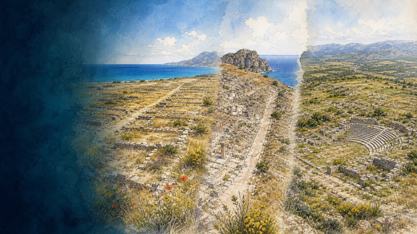
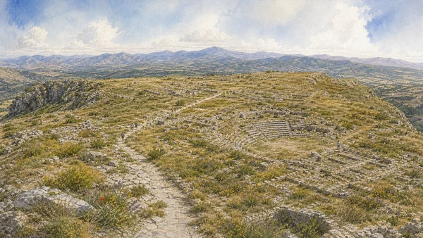
Documentary spring watercolour atlas linking Himera on the coastal plain, Solunto on Monte Catalfano above the sea and Monte Iato on its high inland plateau

ILLUSTRATED GUIDE · SICILY

Three cities,
three landscapes
and no single ancient Sicily

Twenty-six substantial chapters across three ancient cities, preserving Himera's coastal plain, Solunto's maritime terraces and Monte Iato's long indigenous, classical and medieval plateau history.

Explore the places
HIMERA · SOLUNTO · MONTE IATO · COAST, TERRACE AND PLATEAU

A COMPARISON THAT RESTORES DIFFERENCE INSTEAD OF ERASING IT

Himera, Solunto and Monte Iato belong to one regional archaeological park, but they were never one city and they cannot be understood through one itinerary compressed into an afternoon.

Himera occupied a coastal plain and low plateau at the mouth of a river. Solunto rose in terraces above the Tyrrhenian Sea after an earlier Phoenician-Punic settlement on the coast was destroyed. Iato developed on an inland mountain where indigenous communities met Greek material culture and where settlement continued through Roman, Islamic and medieval centuries.

The three sites therefore expose the limits of familiar labels. Greek Himera traded with Punic and indigenous neighbours. Punic Solunto used a regular urban plan and architectural languages shared across the Hellenistic Mediterranean. Indigenous Iato adopted theatres, an agora and elite houses while keeping local practices and later becoming a Muslim stronghold.

This guide gives each place fifteen substantial chapters before bringing them back into comparison. Battles, monuments and ethnic names remain important, but houses, water, food, burial, landscape, research and long afterlives make the history complete.

One destination

Twenty-six chapters across three cities and three different landscapes

The three archaeological areas are dispersed across the province of Palermo. Himera lies near Buonfornello east of Termini Imerese; Solunto occupies the south-eastern slope of Monte Catalfano above Santa Flavia; Monte Iato rises to roughly 850 metres above the inland towns of San Cipirello and San Giuseppe Jato.

Their landscapes shaped different political possibilities. Himera controlled a route between northern coast and interior but remained exposed on a plain. Solunto's terraces combined maritime views with a carefully engineered rainwater system. Iato's broad defended plateau offered land, pasture, visibility and refuge, yet required a demanding ascent and continual management of water and supplies.

Chronology also differs. Himera was founded in the seventh century BC and destroyed in 409 BC. The archaeological Solunto visible today is mainly a Hellenistic-Roman refoundation occupied into the imperial period. Iato began as an indigenous settlement early in the first millennium BC and endured, through profound transformation, until the thirteenth century AD and perhaps briefly beyond the conquest traditionally dated to 1246.

A responsible route must therefore connect without blending. The Temple of Victory does not belong on Monte Iato, Solunto's sea view must not be transferred to Himera, and Iato's medieval Muslim history must not be projected backward onto its archaic houses.

The selection

Twenty-six chapters,
three cities kept distinct

The route consolidates nearby structures and connected histories while preserving the independent geography, chronology and cultural complexity of Himera, Solunto and Monte Iato.

  1. 01Three Cities, Three Landscapes and One Comparative Journey
  2. 02Greek, Punic and Indigenous: Names with Porous Boundaries
  3. 03Himera: River, Northern Sea and the Foundation of 648 BC
  4. 04Himera's Upper City: Streets, Houses and the Sanctuary of Athena
  5. 05Homes and Frontiers: Daily Life, Sican Hinterland and Punic Exchange
  6. 06The Battle of 480 BC: Competing Memories, Soldiers and Horses
  7. 07Temple of Victory, Lower City and the Emerging Agora
  8. 08409 BC and the Cemeteries: Destruction, Abandonment and More than 13,000 Graves
  9. 09The Antiquarium and Himera's Afterlife at Thermai
  10. 10Visiting Himera: A Fragmented Site That Needs an Order
  11. 11Two Soluntos, Two Names and One Difficult Relocation
  12. 12Monte Catalfano: Terraces, Street Grid and Cisterns
  13. 13Main Street, Shops and Peristyle Houses from the House of Leda
  14. 14Agora-Forum, Theatre and Bouleuterion
  15. 15Betyls, Sanctuaries and the North Baths
  16. 16Solunto under Rome and the Campofranco Necropolis
  17. 17The Solunto Antiquarium and the History of Excavation
  18. 18Monte Iato: An Indigenous City on an 850-Metre Plateau
  19. 19Greek Contact, Cohabitation and the Late-Archaic House
  20. 20The Temple of Aphrodite and the Forty-Hectare Walled City
  21. 21Hellenistic Renewal and the Theatre of Iaitas
  22. 22Agora, Bouleuteria and Peristyle House 1
  23. 23From Ietas under Rome to Medieval Giato
  24. 24The Muslim Stronghold, Muhammad ibn Abbad and 1246
  25. 25Case D'Alia Antiquarium and Fifty Years of International Research
  26. 26A Three-Day Route That Preserves the Scale of All Three Cities
01

COASTAL PLAIN, MARITIME TERRACE AND INLAND PLATEAU MUST REMAIN GEOGRAPHICALLY DISTINCT

Three Cities, Three Landscapes and One Comparative Journey

Himera, Solunto and Monte Iato form a comparative route only when each city's terrain, chronology and scale remain visible.

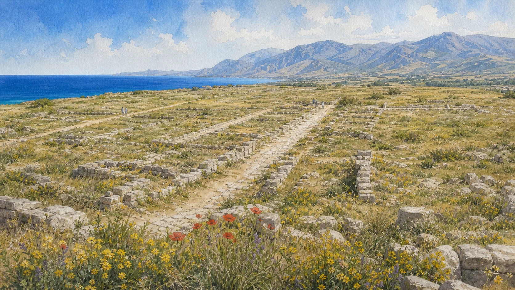
Documentary watercolour of Himera's low upper-city street grid on a broad coastal plateau with spring flowers, sea and mountains
CITY I · HIMERA

The place today

Himera is reached beside the A19 at Buonfornello; Solunto climbs above Santa Flavia; Iato requires an ascent from the Jato valley to a high exposed plateau. They are not neighbouring stops and should not be planned as one compact circuit.

The historical chapter

The coast gave Himera river access, fertile land and maritime contact. Monte Catalfano gave Solunto defence, terraces and a view of sea routes. Iato's upland controlled inland movement and provided a refuge that remained politically relevant long after the ancient public buildings lost their first functions.

What to notice

  • Use separate travel times and weather plans for all three sites; visual proximity on a regional map is misleading.
  • The park's shared ticketing or administration does not imply identical opening hours, access or terrain.
Archaeological Park of Himera, Solunto and Iato · park territory
02

MATERIAL CULTURE CROSSED POLITICAL AND LINGUISTIC FRONTIERS

Greek, Punic and Indigenous: Names with Porous Boundaries

The familiar labels orient the journey but cannot reduce households, cults and trade to sealed ethnic boxes.

Documentary watercolour of Himera's low upper-city street grid on a broad coastal plateau with spring flowers, sea and mountains
CITY I · HIMERA

The place today

Pottery, architecture, inscriptions, cult objects and food remains sit in museums and excavated contexts. None functions as a simple ethnic badge: a Greek vessel in an indigenous house or a Greek-style street in a Punic city records choice, trade and power rather than automatic assimilation.

The historical chapter

Himera's settlers themselves had mixed Chalcidian and Dorian connections. Solunto used Punic and Greek names and later Roman institutions. Iato combined local traditions with Greek settlers or craftsmen, Hellenistic civic forms and medieval Islamic life. Hybrid culture was not the same as political equality.

What to notice

  • Use cultural labels at the scale supported by evidence: object, practice, institution or political community.
  • Do not turn interaction into a peaceful multicultural slogan; conflict and coercion are central to all three histories.
Archaeological Park · historical and cultural profile
Documentary watercolour of Himera's low upper-city street grid on a broad coastal plateau with spring flowers, sea and mountains
CITY I · HIMERAA low street grid on the Piano di Imera keeps the coastal colony tied to plain, sea and inland mountains.
03

A COASTAL COLONY CONNECTED CHALCIDIAN AND DORIAN HISTORIES TO A SICAN HINTERLAND

Himera: River, Northern Sea and the Foundation of 648 BC

The city's position between river, plain and sea explains both its colonial foundation and its long frontier relationships.

Documentary watercolour of Himera's low upper-city street grid on a broad coastal plateau with spring flowers, sea and mountains
CITY I · HIMERA

The place today

The archaeological landscape is divided by modern roads, rail and agricultural land. The Temple of Victory, upper city, necropolis zones and museums require orientation because no continuous ancient skyline ties them together. The date provides a useful chronological anchor, but the settlement's early houses, pottery and sanctuaries reveal gradual construction and contact with existing inland communities rather than a city appearing complete in one year.

The historical chapter

The river corridor linked the Tyrrhenian shore to central Sicily, while the plain offered agricultural resources and landing possibilities. That position supported trade and expansion but also made the city a strategic target in 480 and 409 BC. The colonial group combined Chalcidian language and institutions with Dorian elements associated with the Syracusan exiles.

What to notice

  • The ancient river and shoreline cannot be read directly from the present engineered landscape.
  • Do not call Himera simply Ionian or Dorian without explaining its mixed tradition.
Archaeological Park · Area of Himera
04

AN ORGANISED PLATEAU JOINED URBAN BLOCKS TO A MAJOR SACRED PRECINCT

Himera's Upper City: Streets, Houses and the Sanctuary of Athena

The upper city is best read as a planned relationship among streets, domestic space, Temple A and the wider sanctuary.

Documentary watercolour of Himera's low upper-city street grid on a broad coastal plateau with spring flowers, sea and mountains
CITY I · HIMERA

The place today

Low wall foundations require a plan and patient walking. Changes in alignment and phase become clearer when street axes, house plots and sanctuary boundaries are read together rather than as isolated masonry. Foundations survive on the plateau while key objects are displayed in the Antiquarium: a gold plaque with a running Gorgon and bronze figures of Athena and an offerer are among the most distinctive finds.

The historical chapter

Urban organisation changed as the colony expanded. Houses were rebuilt, lanes adjusted and sacred buildings inserted into a lived neighbourhood, showing civic planning as a sequence rather than one perfectly preserved grid. The sanctuary changed across the archaic and classical periods.

What to notice

  • Low walls are vulnerable and should never be climbed for a better view.
  • Do not reconstruct a standing columned sanctuary from small foundations without the museum evidence and official plan.
Archaeological Park · official Himera guide and maps
05

KITCHENS, CULT OBJECTS AND IMPORTED GOODS REVEAL CONNECTIONS THAT POLITICAL HISTORIES OFTEN FLATTEN

Homes and Frontiers: Daily Life, Sican Hinterland and Punic Exchange

Domestic evidence places Himera inside overlapping indigenous, Greek and Punic networks rather than at the edge of three isolated worlds.

Documentary watercolour of Himera's low upper-city street grid on a broad coastal plateau with spring flowers, sea and mountains
CITY I · HIMERA

The place today

Amphorae, cooking pots, lamps, terracotta busts, figurines, louteria and small altars are displayed by context and type. Their wear and repair often communicate daily life more clearly than rare prestige pieces. Imported amphorae and locally made imitations require scientific fabric analysis to establish origin.

The historical chapter

Households consumed local and imported goods, used courtyards and work areas and maintained domestic cults. Variation between houses warns against describing all colonists as equally prosperous or culturally uniform. Food, containers, craft knowledge and people crossed political boundaries.

What to notice

  • Museum objects may come from different houses and phases; a display case is not one excavated room.
  • Trade continued during periods of competition; exchange and warfare are not mutually exclusive.
Archaeological Park · Himera museum domestic collection
06

A CELEBRATED VICTORY ALSO LEFT HUMAN AND ANIMAL BURIALS IN THE WESTERN NECROPOLIS

The Battle of 480 BC: Competing Memories, Soldiers and Horses

Literary traditions, tyrannical politics and excavated collective graves must be read together without turning archaeology into a simple illustration of one source.

Documentary watercolour of Himera's low upper-city street grid on a broad coastal plateau with spring flowers, sea and mountains
CITY I · HIMERA

The place today

The battlefield is not a marked arena. Mass burials, weapon injuries, horse graves and military objects in the western necropolis provide physical evidence, while the wider action must be reconstructed across the plain. Much of the evidence is known through excavation records, scientific publication and museum interpretation rather than open graves.

The historical chapter

Ancient narratives magnified the victory and linked it chronologically with Greek conflict against Persia. The battle strengthened the prestige of Sicilian tyrants, but the composition of armies and motives of participants were more complex than a simple Greeks-versus-Carthaginians tableau. Individuals in graves associated with 480 show varied geographic origins, supporting the presence of allied or mercenary forces.

What to notice

  • Do not stage the battle as a clash of modern nations or claim exact troop numbers from partisan ancient accounts.
  • Respect all restrictions around human remains and do not photograph sensitive displays against museum rules.
University of Palermo · mass burials and battles of Himera
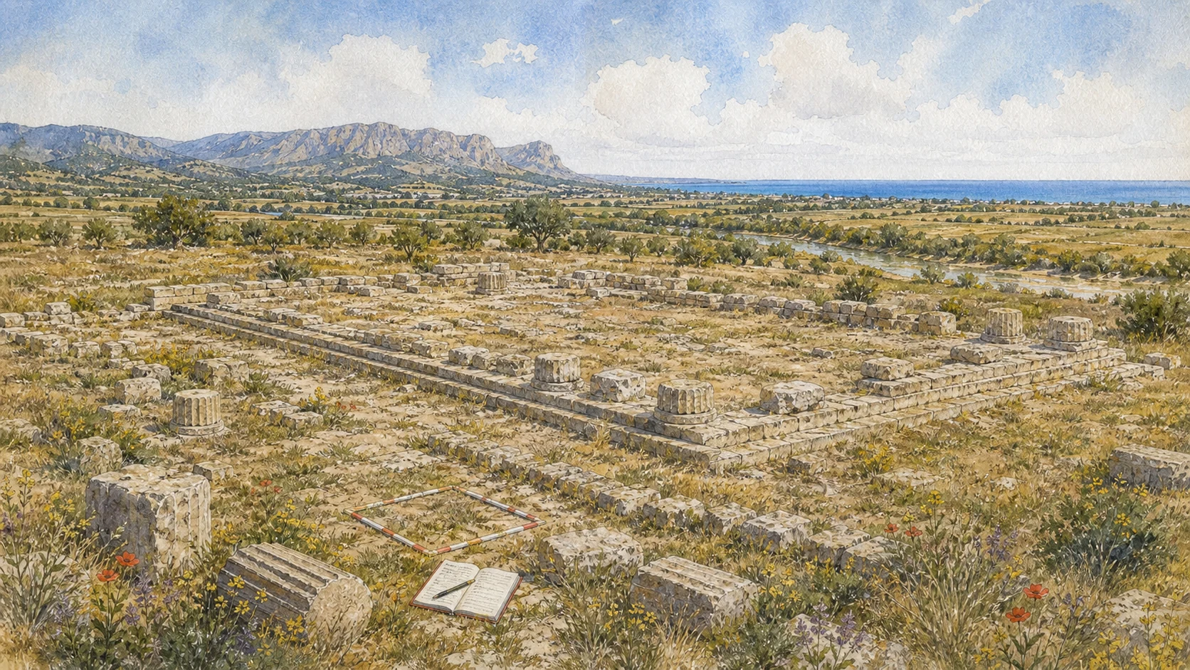
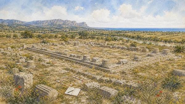
Documentary watercolour of the surviving foundations, column drums and scattered blocks of Himera's Temple of Victory in the lower plain
HIMERA · THE LOWER CITYThe Temple of Victory survives as foundations and architectural fragments, not as a standing classical monument.
07

MONUMENTAL COMMEMORATION STOOD WITHIN A CITY WHOSE LOWER QUARTERS ARE STILL BEING MAPPED

Temple of Victory, Lower City and the Emerging Agora

The great Doric temple and new evidence for public and sacred spaces below the plateau connect victory memory to urban change.

Documentary watercolour of the surviving foundations, column drums and scattered blocks of Himera's Temple of Victory in the lower plain
HIMERA · THE LOWER CITY

The place today

The foundations and architectural fragments communicate scale without a standing colonnade. The building belongs to a sanctuary precinct whose exact boundary and subsidiary structures are incompletely known. Research trenches may be active or reburied, so visitors should not expect every published discovery to be permanently exposed.

The historical chapter

Diodorus linked victory temples with Gelon and Theron, producing the conventional name. The unfamiliar architectural language may also express Akragantine domination under Theron's successors. Athena is a traditional attribution by analogy, not a securely named dedicatee. Earlier houses and a sanctuary preceded the great temple, while an agora and related public spaces reorganised the lower settlement.

What to notice

  • Call it the conventional Temple of Victory and keep the divine dedication qualified.
  • New altar or sacrifice evidence should remain tied to its excavated context and ongoing study.
Archaeological Park · Temple of Victory
08

THE END OF THE POLIS DID NOT ERASE THE SCALE OR DIVERSITY OF ITS BURIED POPULATION

409 BC and the Cemeteries: Destruction, Abandonment and More than 13,000 Graves

Carthaginian destruction ended Himera as a city, while extensive necropolises preserve long histories of health, ritual, family and mobility.

Documentary watercolour of the surviving foundations, column drums and scattered blocks of Himera's Temple of Victory in the lower plain
HIMERA · THE LOWER CITY

The place today

Burned levels, emergency burials, abandoned objects and truncated building sequences give the event archaeological weight. The ruins do not form one continuous destruction horizon visible to an unassisted visitor. Most graves are not an open visitor landscape.

The historical chapter

The campaign was remembered partly as revenge for 480, but Carthaginian strategy also responded to wider Sicilian conflicts. Survivors dispersed, and Punic authority reorganised the northern coast rather than leaving the entire region empty. Cemeteries grew along routes outside the inhabited area.

What to notice

  • Do not treat ancient revenge language as a complete explanation of Carthaginian policy.
  • Funerary objects must be read with age, sex, chronology and grave form rather than ranked as treasure.
Archaeological Park · Himera history and research guide
09

OBJECTS RECONNECT FRAGMENTED EXCAVATION AREAS AND LEAD TOWARD A REORGANISED NORTHERN COAST

The Antiquarium and Himera's Afterlife at Thermai

Museum sequences make the city legible before the story continues through Thermai and later settlement rather than a simple empty aftermath.

Documentary watercolour of the surviving foundations, column drums and scattered blocks of Himera's Temple of Victory in the lower plain
HIMERA · THE LOWER CITY

The place today

The display joins sanctuary finds, household objects, architectural fragments and material from the wider Imerese territory. Its modern museum architecture is part of the visit, not a neutral container. Termini's museums, inscriptions, baths and urban layers belong to a separate city guide, but they explain why Himera's story did not end as an empty archaeological field.

The historical chapter

Built after decades of systematic excavation, the museum reflects twentieth-century ideas about integrating landscape, light and archaeological sequence. Later research and the Pirro Marconi facility expand the interpretive network. Under Punic influence, a new centre developed around the hot springs west of Himera.

What to notice

  • Confirm which museum building and collections are open; Himera has more than one visitor facility.
  • Keep the archaeological site of Himera distinct from the later and modern city of Termini.
Archaeological Park · Antiquarium and Pirro Marconi Museum
10

MUSEUM, UPPER CITY, LOWER PLAIN AND VICTORY TEMPLE ARE NOT ONE CONTIGUOUS WALK

Visiting Himera: A Fragmented Site That Needs an Order

A planned sequence prevents the archaeological park from seeming sparse and keeps roads, distances and separate sectors honest.

Documentary watercolour of the surviving foundations, column drums and scattered blocks of Himera's Temple of Victory in the lower plain
HIMERA · THE LOWER CITY

The place today

Begin with the museum or official plan, then locate upper and lower sectors in relation to river and coast. Heat, shade, road separation and ground conditions determine how much can be covered responsibly.

The historical chapter

Modern infrastructure cut across the ancient territory before current archaeological protection took shape. The resulting fragmentation makes interpretation harder but also exposes the continuing tension between nationally important transport routes and buried heritage.

What to notice

  • Verify the day's opening of each sector and never attempt informal crossings from roadside pull-offs.
  • Carry water and sun protection; the low plain can be hotter and more exposed than the sea breeze suggests.
Archaeological Park · visitor access to Himera
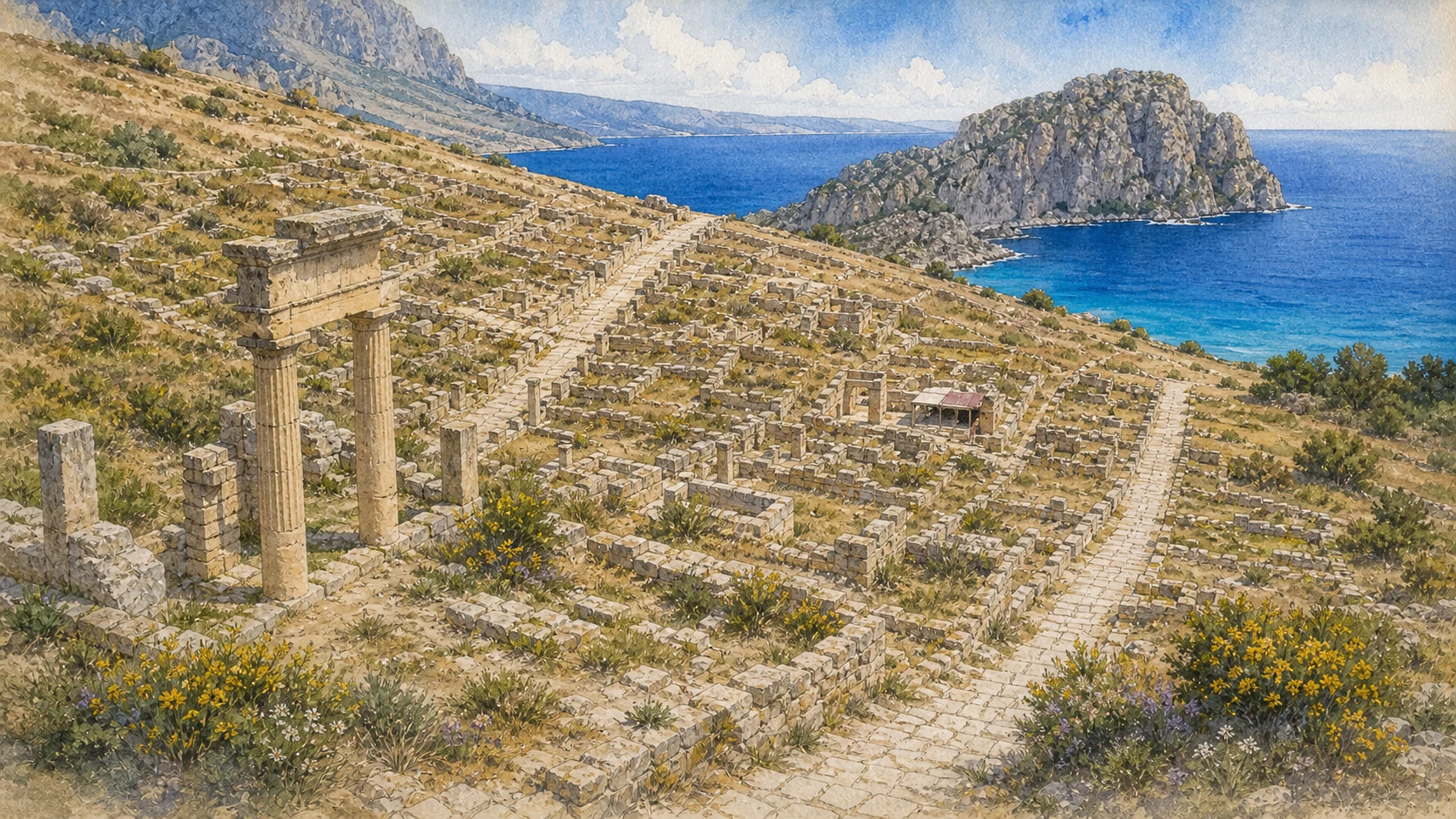
Documentary watercolour of Solunto's terraced street grid and partial Gymnasium house columns above the Tyrrhenian Sea
CITY II · SOLUNTOStreets, houses and cisterns descend Monte Catalfano toward a maritime horizon.
11

THE VISIBLE MOUNTAIN CITY IS NOT THE FIRST COASTAL SETTLEMENT AND KFR DOES NOT ERASE SOLUNTO

Two Soluntos, Two Names and One Difficult Relocation

Lost coastal origins, Punic naming and the later city on Monte Catalfano must be distinguished before interpreting the surviving terraces.

Documentary watercolour of Solunto's terraced street grid and partial Gymnasium house columns above the Tyrrhenian Sea
CITY II · SOLUNTO

The place today

Visitors climb directly into Hellenistic-Roman streets and can easily mistake them for the original Phoenician town. The earlier settlement survives through excavated material, necropolis evidence and topographic research closer to the coast. Greek, Punic and Latin inscriptions belong to different phases and institutions.

The historical chapter

Phoenician settlement favoured a promontory with maritime access and routes inland through the Eleuterio valley. Dionysius I of Syracuse destroyed the coastal centre in the early fourth century BC, after which Solunto was refounded on Monte Catalfano. Punic political traditions endured in a city increasingly shaped by shared Hellenistic architecture.

What to notice

  • Always distinguish coastal archaic Solunto from the terraced city visible today.
  • One inscription documents a specific public act, not the everyday language of every resident.
Archaeological Park · Area of Solunto
12

THE CITY TURNED A STEEP MARITIME SLOPE INTO AN ORDERED WATER-COLLECTING SYSTEM

Monte Catalfano: Terraces, Street Grid and Cisterns

Three main axes, cross streets, retaining walls, roofs and cisterns reveal urban engineering adapted to height and the absence of springs.

Documentary watercolour of Solunto's terraced street grid and partial Gymnasium house columns above the Tyrrhenian Sea
CITY II · SOLUNTO

The place today

The gradient is fundamental: major streets climb or contour the slope, buildings step across levels and the sea enters almost every long view. The ruins require strong footwear and more effort than their elegant photographs imply. The main route exposes shopfronts while side streets reveal domestic entrances, drains and stairs. Open cistern mouths, drains and channels make the water system visible but also create hazards.

The historical chapter

The elevated site improved defence and visibility after destruction of the coast settlement. Retaining walls, stairs and terraced blocks adapted a regular plan to topography instead of imposing a flat ideal grid. The plan is often called Hippodamian, yet it emerged through the broad circulation of regular urban design in the Hellenistic world. The park interprets rainfall collection as the principal water supply.

What to notice

  • The mountain view can distract from low walls and sudden changes in level underfoot.
  • Do not assume every cavity was a cistern without reference to the official plan.
Archaeological Park · Solunto topography
13

PUBLIC MOVEMENT AND ELITE DOMESTIC SPACE SHARED THE SAME STEPPED CITY

Main Street, Shops and Peristyle Houses from the House of Leda

Commercial thresholds, peristyle architecture and the Armillary Sphere mosaic show status and everyday use without representing every Soluntine household.

Documentary watercolour of Solunto's terraced street grid and partial Gymnasium house columns above the Tyrrhenian Sea
CITY II · SOLUNTO

The place today

Thresholds, benches, drains and small rooms can be compared along the route. Their exact functions are not always certain, but repeated openings reveal how movement and business shaped the facade of each block. Column bases and restored elements suggest vertical scale, but upper storeys and roofs are largely lost. The object is protected inside the museum rather than left in the house.

The historical chapter

Retail, craft and storage connected local households with agriculture, ports and regional markets. The street's architecture offered visibility and access while protecting deeper residential areas around courtyards. Household architecture joined Hellenistic Mediterranean fashions with local materials, water storage and sloping plots. The armillary motif may refer to cosmological knowledge, learning or status.

What to notice

  • A small street room is not automatically a named shop; function depends on finds and installations.
  • Do not confuse the museum mosaic with a complete floor still visible outdoors.
Archaeological Park · Solunto streets and houses
14

CIVIC SPACE CHANGED ACROSS HELLENISTIC AND ROMAN POLITICAL LIFE

Agora-Forum, Theatre and Bouleuterion

The public terrace joined assembly, performance, administration and commemoration rather than forming a single frozen classical centre.

Documentary watercolour of Solunto's terraced street grid and partial Gymnasium house columns above the Tyrrhenian Sea
CITY II · SOLUNTO

The place today

Its eccentric position in the plan and terraced relationships are easier to understand from adjoining streets than from the centre alone. Low remains record several construction phases. The cavea survives mainly as low seating and foundations linked to retaining structures.

The historical chapter

The space began within a Hellenistic civic system and continued as a Roman forum. Public honours, council activity, trade and ritual changed across time; the dual name agora-forum signals transformation rather than two separate squares. The theatre belongs to Hellenistic civic culture and later adaptation.

What to notice

  • Avoid assigning every wall to one ideal Hellenistic reconstruction.
  • Do not sit or climb on unmarked ancient seats and walls.
Archaeological Park · Solunto public quarter
15

CULT AND WATER SYSTEMS CARRY PUNIC, HELLENISTIC AND ROMAN HISTORIES WITHOUT SIMPLE REPLACEMENT

Betyls, Sanctuaries and the North Baths

Sacred installations and bathing infrastructure broaden Solunto beyond streets and elite houses while demanding careful chronological attribution.

Documentary watercolour of Solunto's terraced street grid and partial Gymnasium house columns above the Tyrrhenian Sea
CITY II · SOLUNTO

The place today

The betyls are among the clearest signs of Punic religious language at the site, but the surrounding buildings changed across Hellenistic and Roman periods. Recent excavation continues to refine the sequence. Some rooms, mosaics and service structures are visible while other sectors remain active research areas.

The historical chapter

Solunto's cults drew on Phoenician-Punic, Greek and later Roman practices. Aniconic stones were not primitive substitutes for statues; they were meaningful sacred forms within their own traditions. Roman bathing required staged rooms, heat, water and labour.

What to notice

  • Do not assign a deity to every sanctuary without inscriptions or secure cult evidence.
  • Do not identify room temperatures or routes unless the official plan supports them.
Archaeological Park · Solunto sacred quarter
16

CIVIC CONTINUITY ABOVE THE SLOPE COEXISTED WITH HUNDREDS OF ROCK-CUT TOMBS BELOW

Solunto under Rome and the Campofranco Necropolis

Public honours and gradual Roman transformation should be read with the burial landscape rather than as one sudden cultural conversion.

Documentary watercolour of Solunto's terraced street grid and partial Gymnasium house columns above the Tyrrhenian Sea
CITY II · SOLUNTO

The place today

Latin inscriptions, baths and changes in the forum sit among houses and sanctuaries whose forms began earlier. The city appears Roman through institutions and use as much as through wholesale rebuilding. The necropolis is separate from the main mountain route and its accessibility must be checked.

The historical chapter

After the Roman conquest of Sicily, local elites operated within imperial systems of citizenship, honour and taxation. The dedication by the Res Publica Soluntinorum shows a continuing civic identity in the early third century AD. Burial architecture and goods reveal family investment, ritual practice and external connections.

What to notice

  • The inscription gives a latest public date, not a documented day on which the city was abandoned.
  • The tomb count refers to excavated burials in a defined sector, not the entire ancient cemetery.
Archaeological Park · Roman Solunto and Fulvia Plautilla inscription
17

A MUSEUM OF OBJECTS IS ALSO A RECORD OF HOW THE CITY WAS UNCOVERED AND CLASSIFIED

The Solunto Antiquarium and the History of Excavation

Collections, plans and excavation history make a complex sloping site legible while showing how earlier interpretations changed.

Documentary watercolour of Solunto's terraced street grid and partial Gymnasium house columns above the Tyrrhenian Sea
CITY II · SOLUNTO

The place today

Capitals and decoration help reconstruct house interiors, while ceramics connect the lost coastal settlement, mountain city and cemetery. Major early finds such as the Zeus-Baal Hammon statue entered Palermo collections.

The historical chapter

Early excavations often sought sculptures and architectural pieces; systematic work after 1951 exposed streets, agora, theatre, sanctuaries and residential blocks. Current research uses diagnostics, digital survey and virtual reconstruction while large areas remain unexplored.

What to notice

  • A virtual reconstruction is a research hypothesis, not a photograph of the ancient city.
  • Confirm the Antiquarium's current hours separately from access to the outdoor site.
Archaeological Park · history of excavations at Solunto
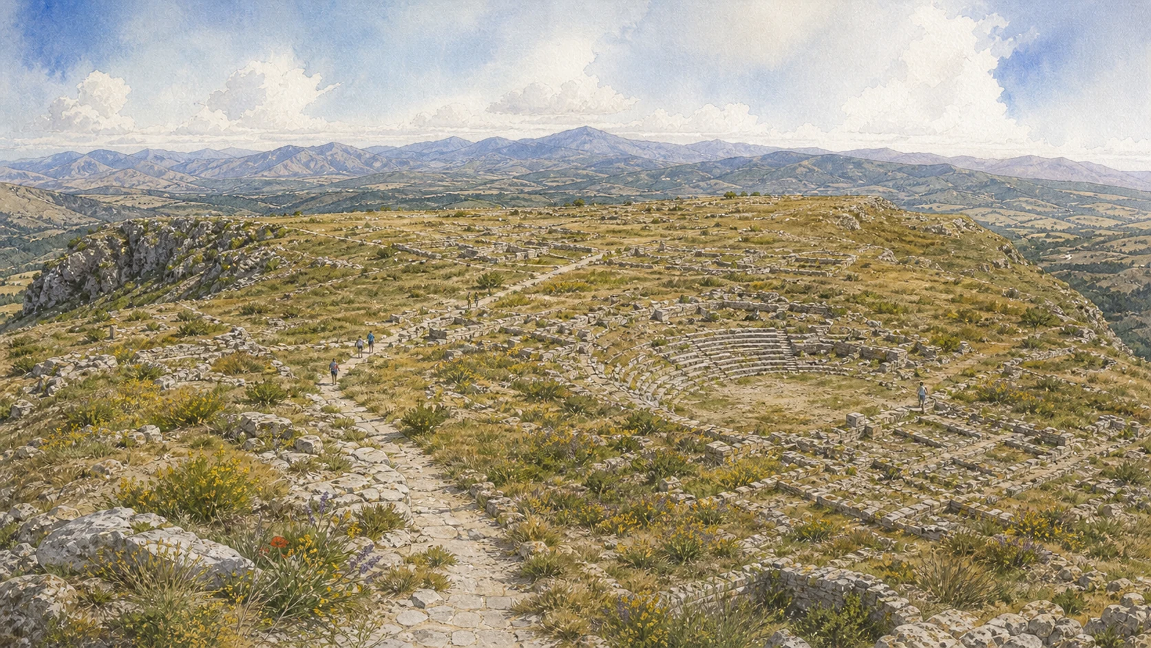
Documentary watercolour of Monte Iato's high archaeological plateau with the low Hellenistic theatre, paths and the inland Belìce mountains
CITY III · MONTE IATOThe Hellenistic theatre is one modest element within a vast inland plateau inhabited across many periods.
18

THE MOUNTAIN WAS A LARGE INHABITED CENTRE BEFORE GREEK MONUMENTAL FORMS ARRIVED

Monte Iato: An Indigenous City on an 850-Metre Plateau

Plateau, springs, walls and earlier settlement place indigenous history at the beginning of Iato rather than in a preface to Greek architecture.

Documentary watercolour of Monte Iato's high archaeological plateau with the low Hellenistic theatre, paths and the inland Belìce mountains
CITY III · MONTE IATO

The place today

The exposed approach and summit differ sharply from Solunto's maritime slope. Weather can change quickly, shade is limited and the archaeological quarter occupies only part of a much larger defended landscape. Early evidence lies beneath and beside later monumental construction.

The historical chapter

Natural scarps, walls and control of access made the plateau defensible. Its upland fields, animals and links to valleys sustained settlement over two millennia, including periods when political pressure drove communities toward strong inland sites. Ancient ethnic categories for western Sicily are incomplete and often transmitted by Greek authors.

What to notice

  • Check the current ascent arrangements, transport and last admission before leaving San Cipirello.
  • Do not rename Iato a Greek colony simply because later public buildings use Greek forms.
Archaeological Park · Area of Monte Iato
19

ARCHITECTURE AND TABLEWARE SHOW SELECTIVE ADOPTION INSIDE A MIXED MOUNTAIN COMMUNITY

Greek Contact, Cohabitation and the Late-Archaic House

Sixth-century contact and a two-storey courtyard house reveal cultural change without proving the replacement of one population by another.

Documentary watercolour of Monte Iato's high archaeological plateau with the low Hellenistic theatre, paths and the inland Belìce mountains
CITY III · MONTE IATO

The place today

Imported and colonial pottery appears beside local wares in houses and sacred contexts. The mixed assemblages are stronger evidence for daily interaction than a story of one population suddenly replacing another. Foundations reveal room organisation while recovered pottery and organic residues help reconstruct use.

The historical chapter

Craftspeople, traders, ritual specialists and families may all have moved through Iato. Greek-style buildings and objects were adopted selectively, while cooking, storage and other practices preserved and transformed local knowledge. The house shows that elite domestic life at Iato could combine local consumption habits with new architectural and material choices.

What to notice

  • Cohabitation is an archaeological interpretation supported by multiple forms of evidence, not a preserved census.
  • Mixed objects reveal practice and access, not necessarily the ancestry of the occupants.
Archaeological Park · Greek contact at Iato
20

A MODEST OIKOS TEMPLE BELONGED TO A LARGE DEFENDED URBAN LANDSCAPE

The Temple of Aphrodite and the Forty-Hectare Walled City

Cult building, plateau edge and fortifications must be read at their actual scales rather than enlarged into a conventional columned sanctuary.

Documentary watercolour of Monte Iato's high archaeological plateau with the low Hellenistic theatre, paths and the inland Belìce mountains
CITY III · MONTE IATO

The place today

The temple survives as low walls rather than a columned ruin. Its relationship with nearby houses and later buildings makes sacred topography more complex than a separate monumental precinct. Only selected wall sectors and approaches are easily legible.

The historical chapter

The oikos form belongs to a broad Greek architectural language but was used in a locally negotiated religious environment. Dedications and later research support the Aphrodite association while leaving ritual detail incomplete. Fortifications were repaired and reinterpreted through ancient and medieval periods.

What to notice

  • Never illustrate the temple as a peripteral Greek building with an external colonnade.
  • The forty-hectare figure describes the ancient urban extent, not the area fully excavated or open.
Archaeological Park · Temple of Aphrodite at Iato
21

A NEW CIVIC CENTRE REORGANISED AN OLD MOUNTAIN WITHOUT ERASING ITS EARLIER LAYERS

Hellenistic Renewal and the Theatre of Iaitas

The theatre connects performance, visibility and political community to a wider phase of Hellenistic urban renewal.

Documentary watercolour of Monte Iato's high archaeological plateau with the low Hellenistic theatre, paths and the inland Belìce mountains
CITY III · MONTE IATO

The place today

The grid bends and steps with the plateau rather than behaving like a flat colonial plan. Earlier buildings, later repairs and Roman additions remain visible within the Hellenistic framework. The cavea, orchestra and stage foundations sit close to the civic centre.

The historical chapter

Theatre, agora, council halls and elite houses aligned Iato with Hellenistic civic culture. Adoption created new political and social spaces, but local elites used these forms to build their own authority. The theatre supported drama, public display and possibly assembly within a city connected to wider Hellenistic performance culture.

What to notice

  • Regular does not mean geometrically perfect; topography required local adaptation.
  • Do not climb fragile seating or stage walls; follow the marked visitor path.
Archaeological Park · Hellenistic Iato
22

PUBLIC ASSEMBLY AND SIXTEEN HUNDRED SQUARE METRES OF ELITE LIFE FACED THE SAME CIVIC CORE

Agora, Bouleuteria and Peristyle House 1

Stoas, two council buildings and a vast residence reveal institutional and social hierarchies without reducing the city to its elite architecture.

Documentary watercolour of Monte Iato's high archaeological plateau with the low Hellenistic theatre, paths and the inland Belìce mountains
CITY III · MONTE IATO

The place today

Long stoa foundations and meeting buildings require a plan to separate phases. Recent research dates parts of the north and west complexes later than earlier reconstructions suggested. Twenty-five excavated ground-floor rooms surround two courtyards.

The historical chapter

The north hall extended about fifty-six metres and was joined by service rooms, a council building and peristyle. Later additions combined Greek council architecture with Roman podium and tribunal forms, showing institutional change within the same square. Banqueting rooms could accommodate more than seventy participants, turning hospitality into political performance.

What to notice

  • Do not present the agora as a single moment frozen in the third century BC.
  • Upper-storey galleries and furnishings are research reconstructions, not surviving complete rooms.
University of Zurich · north hall and agora development at Iato
23

ANCIENT BUILDINGS WERE TRANSFORMED, REUSED AND REFRAMED ACROSS A VERY LONG URBAN LIFE

From Ietas under Rome to Medieval Giato

Roman civic signals and medieval occupation belong to a sequence of continuity and change rather than to an abrupt fall into abandonment.

Documentary watercolour of Monte Iato's high archaeological plateau with the low Hellenistic theatre, paths and the inland Belìce mountains
CITY III · MONTE IATO

The place today

Podium architecture, changes around the agora and imported ceramics mark the phase. Earlier walls remained in use, producing a palimpsest rather than a clearly separated Roman quarter. Medieval walls, houses, ceramics and the Castellazzo fortification are less visually monumental than the theatre but essential to understanding the site's extraordinary duration.

The historical chapter

Local elites continued to inhabit and represent the city inside Roman Sicily. The transition altered law, taxation and public honour while maintaining an urban identity rooted in the mountain and its long-built centre. Evidence for the Byzantine and early Islamic centuries remains uneven.

What to notice

  • Do not treat Roman layers as visually obvious without phasing plans.
  • The sparse evidence for some centuries is a research limit, not proof of total abandonment.
University of Zurich · becoming Roman at Iaitas-Ietas
24

CHRONICLES OF CONQUEST MUST BE TESTED AGAINST A CITY WHOSE MATERIAL AFTERLIFE IS MORE COMPLICATED

The Muslim Stronghold, Muhammad ibn Abbad and 1246

Late Islamic resistance, Frederick II's campaign, deportation and archaeological evidence require careful separation of documented event from later simplification.

Documentary watercolour of Monte Iato's high archaeological plateau with the low Hellenistic theatre, paths and the inland Belìce mountains
CITY III · MONTE IATO

The place today

The defensive landscape, Castellazzo and domestic archaeology carry this history more strongly than a reconstructed emir's palace. Ancient monumental ruins formed part of the medieval terrain but not its political meaning. A modest house complex, repaired ceramics, weapons and a coin later than the conquest reveal post-1246 activity.

The historical chapter

After Norman conquest, Muslim populations remained in Sicily under changing legal and fiscal pressures. Revolt and Hohenstaufen military campaigns turned the plateau into a besieged stronghold within a Christian kingdom. Written sources emphasised complete destruction and deportation to Apulia, especially Lucera.

What to notice

  • Do not project a caliphal palace or mosque skyline onto the summit without evidence.
  • Human remains and weapons from siege contexts require careful, non-sensational interpretation.
University of Innsbruck · medieval stronghold of Giato
25

THE MOUNTAIN'S STORY DEPENDS ON LONG EXCAVATION, CONSERVATION AND COMPARATIVE STUDY

Case D'Alia Antiquarium and Fifty Years of International Research

The antiquarium and research history reconnect finds with architecture and explain why interpretations of indigenous, Greek, Roman and medieval phases continue to evolve.

Documentary watercolour of Monte Iato's high archaeological plateau with the low Hellenistic theatre, paths and the inland Belìce mountains
CITY III · MONTE IATO

The place today

The museum is a necessary first or final stop for pottery, small finds and chronology that the plateau cannot display. Fieldwork now combines architecture, archaeometry, plants, animal bones and organic residues.

The historical chapter

The University of Zurich began annual campaigns in 1971; Innsbruck joined in 2011, alongside the park and local archaeological groups. Changing methods repeatedly revised interpretations of indigenous, Hellenistic, Roman and medieval life.

What to notice

  • Confirm museum and summit access together; they may have different operational conditions.
  • An active trench is a workplace and may be closed even when the wider site is open.
Archaeological Park · Monte Iato research and Antiquarium
26

ONE SITE PER DAY IS THE MINIMUM NEEDED TO KEEP LANDSCAPE, MUSEUM AND ARCHAEOLOGY TOGETHER

A Three-Day Route That Preserves the Scale of All Three Cities

A complete journey gives Himera's divided plain, Solunto's maritime slope and Iato's mountain plateau independent time before drawing comparisons.

Documentary watercolour of Monte Iato's high archaeological plateau with the low Hellenistic theatre, paths and the inland Belìce mountains
CITY III · MONTE IATO

The place today

At Himera combine museum, upper city and Temple of Victory. At Solunto climb streets from houses to agora, theatre and sanctuaries before the Antiquarium. At Iato use Case D'Alia to prepare for the ascent, then allow the plateau, theatre, agora, houses and medieval evidence to unfold slowly.

The historical chapter

The route moves from a colony destroyed in the classical period, to a Punic city thriving in Hellenistic and Roman forms, to an indigenous centre whose last great political chapter was medieval. Difference is the comparative result.

What to notice

  • Check the archaeological park's current notices immediately before each day; wind, heat, works and staffing can change access.
  • Use official maps and never move stones, enter trenches, climb walls or leave marked plateau routes.
Archaeological Park of Himera, Solunto and Iato · current visitor information

The city through time

Ten turning points across three cities and more than two millennia

The sequence is comparative rather than linear: the cities began and ended at different times, and contact never made their political histories identical.

  1. Indigenous communities establish the long-lived settlement on Monte Iato.

  2. Himera is founded by a mixed colonial group connected with Zankle and Syracusan exiles.

  3. The oikos-type Temple of Aphrodite and a major archaic house mark intensified contact at Iato.

  4. Greek forces defeat Carthage at Himera; the Temple of Victory is built soon afterward.

  5. Carthaginian forces destroy Himera and end the polis.

  6. Dionysius destroys coastal Solunto; the city is refounded on Monte Catalfano.

  7. Solunto and Iato develop major Hellenistic streets, houses, theatres and civic spaces.

  8. Solunto's civic dedication to Fulvia Plautilla provides a late marker for its public life under Rome.

  9. Giato becomes a Muslim stronghold resisting Hohenstaufen authority.

  10. Frederick II destroys and deports Giato's population; archaeology indicates limited reuse before final abandonment.

Before your visit

Practical information,
without turning it into promises

01

Reserve three separate days

Himera needs the museum, upper city and lower Temple of Victory sector; Solunto needs a slow uphill circuit and Antiquarium; Iato needs the Case D'Alia museum, ascent and broad summit. Combining two in one day is possible only by sacrificing the detailed reading this guide is designed to protect.

02

Prepare for three different terrains

Himera is low, hot and cut by infrastructure; Solunto is steep and paved with uneven archaeological streets; Iato is high, exposed and physically demanding. Carry water, sun protection, grip footwear and a wind layer, and check accessibility for the exact route.

03

Use each museum as part of the site

Objects restore roofs, rituals, food and household scale to low ruins. Verify the Antiquarium and outdoor-area schedules independently, especially at Himera and Iato where visitor facilities are physically separated.

04

Treat current research as changing knowledge

Himera's lower city, Solunto's sanctuaries and baths, and Iato's agora and post-1246 occupation remain active fields of study. A publication or news report may describe evidence that is reburied, closed or newly reinterpreted.

Sources

This guide cross-checks the Archaeological Park of Himera, Solunto and Iato, current University of Palermo missions and institutional research repositories, the University of Zurich Ietas excavation and the University of Innsbruck Monte Iato project. It separates the three administrative park sites from one false combined city, Himera's mixed colonial foundation from a uniform Greek identity, battle archaeology from partisan ancient numbers, the conventional Temple of Victory and Athena attribution from certainty, destruction of Himera from disappearance of the regional population, coastal archaic Solunto from the visible mountain refoundation, Punic identity from rejection of Greek architectural language, a regular plan from direct authorship by Hippodamus, an inscription dated AD 202–205 from a precise abandonment date, indigenous Iato from a Greek colony, cultural adoption from population replacement, exceptional elite houses from average life, medieval Giato from a camp among ruins, and the 1246 conquest tradition from archaeological evidence of limited later reuse.

Opening hours, tickets, museum rooms, excavation visibility and routes can change independently across the three dispersed sites. Active trenches may be reburied or inaccessible. Dates, capacities, ethnic labels, cult attributions, battle interpretation, Solunto's abandonment and the scale of post-1246 reuse at Iato are stated at the level supported by current institutional research and remain qualified where evidence is incomplete.