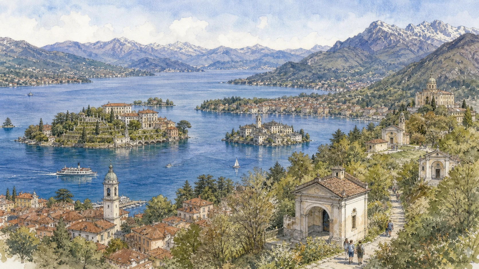
Original documentary watercolour panorama for Lake Maggiore, Lake Orta and the Sacri Monti: Complete Guide, with accurate Piedmont architecture, landscape and lived context

Piedmont Guide 04 · Public navigation, island settlements, gardens, villas and seven Piedmontese devotional landscapes

Lake Maggiore, Lake Orta
& the Sacri Monti

A multi-day guide from Stresa and public lake navigation through the Borromean Islands and Arona, then to Orta San Giulio, its island and Sacro Monte before extending to Ghiffa, Domodossola and Varallo.

Plan the route
Lake Maggiore, Lake Orta and the Sacri Monti · Piedmont10 chapters · one complete route

Why this route must be read in layers

The lake region is a transport and devotional system rather than an inventory of private gardens. Boats, island communities, mountain catchments and pilgrimage routes link water-level movement to carefully staged sacred landscapes.

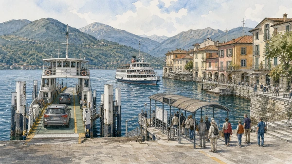
Public navigation has operational value for residents as well as visitors. Private island and garden tickets do not replace official boat timetables or guarantee every landing.

Lake Orta is smaller and topographically distinct from Maggiore. Its island basilica and hillside Sacro Monte remain religious environments embedded in an inhabited town.

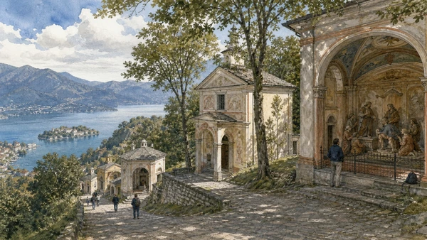
The Sacri Monti form a serial UNESCO property of nine complexes, seven in Piedmont. Each has its own iconography, terrain, worship and conservation rules; this guide samples several without pretending they are interchangeable.

Choose one lake basin per day and one distant Sacro Monte extension at a time; verify boats, weather, worship and park conditions before departure.

The route

Plan your visit

Begin at Stresa with the scheduled boat network, separate private islands from public towns, then move to Orta and devote later days to selected Sacri Monti through their official access.

Early morning

Stresa · Lake Maggiore navigation · Isola Bella

Move in the documented order: Stresa: rail-and-lake gateway of the grand-tour shore; then Lake Maggiore navigation: public service across an international lake; then Isola Bella: palace and terraced garden as a controlled court landscape. Recheck live access and transport before entering a controlled site.

Late morning

Isola Madre and Isola dei Pescatori · Arona and the southern lake threshold · Orta San Giulio

Move in the documented order: Isola Madre and Isola dei Pescatori: two different island histories; then Arona and the southern lake threshold; then Orta San Giulio: an inhabited lakeside borough. Recheck live access and transport before entering a controlled site.

Afternoon

Isola San Giulio · Sacro Monte di Orta · Ghiffa and Domodossola

Move in the documented order: Isola San Giulio: basilica, monastery and settlement; then Sacro Monte di Orta: Franciscan narrative above the lake; then Ghiffa and Domodossola: two Sacri Monti, two landscapes. Recheck live access and transport before entering a controlled site.

Late afternoon

Varallo’s Sacro Monte

Move in the documented order: Varallo’s Sacro Monte: a New Jerusalem in Valsesia. Recheck live access and transport before entering a controlled site.

Ten chapters

Explore the places

The order follows terrain, institutions and present-day movement. Use the index to return to a chapter without reducing the route to isolated monuments.

  1. 01Stresa: rail-and-lake gateway of the grand-tour shore
  2. 02Lake Maggiore navigation: public service across an international lake
  3. 03Isola Bella: palace and terraced garden as a controlled court landscape
  4. 04Isola Madre and Isola dei Pescatori: two different island histories
  5. 05Arona and the southern lake threshold
  6. 06Orta San Giulio: an inhabited lakeside borough
  7. 07Isola San Giulio: basilica, monastery and settlement
  8. 08Sacro Monte di Orta: Franciscan narrative above the lake
  9. 09Ghiffa and Domodossola: two Sacri Monti, two landscapes
  10. 10Varallo’s Sacro Monte: a New Jerusalem in Valsesia
01

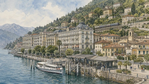
Hotels, villas, landing stages and a compact older centre occupy a narrow strip between water and mountain.

Stresa: rail-and-lake gateway of the grand-tour shore

Hotels, villas, landing stages and a compact older centre occupy a narrow strip between water and mountain. The site becomes clearer when its surviving fabric, later alterations and present use are read together.

Today

The area is inhabited and worked, not staged for visitors. Keep doorways, pavements, cycle lanes and deliveries clear, ask before photographing people and use current municipal mobility information.

History

Stresa developed from lakeside settlement into an international resort through nineteenth-century travel, rail connection and major hospitality investment.

How to read this place

Begin with public landing and lakefront promenade. Then compare older streets behind large hotels with rail and road routes climbing the slope; the differences are evidence, not visual noise.

What to notice

  • public landing and lakefront promenade
  • older streets behind large hotels
  • rail and road routes climbing the slope
Distretto Turistico dei Laghi · Official site
Original documentary watercolour of Stresa: rail-and-lake gateway of the grand-tour shore in Lake Maggiore, Lake Orta and the Sacri Monti · Piedmont, showing accurate architecture, landscape, people and present-day use
Stresa: rail-and-lake gateway of the grand-tour shoreOriginal Merlintravel documentary watercolour · 2026
03

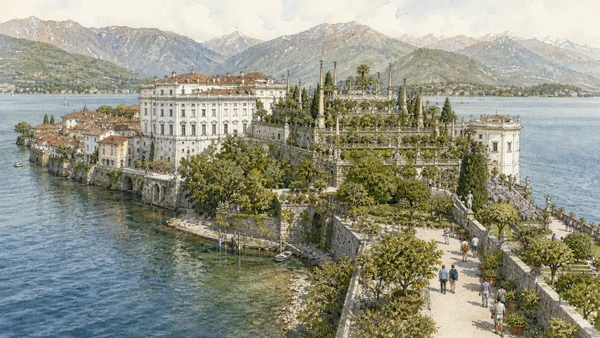
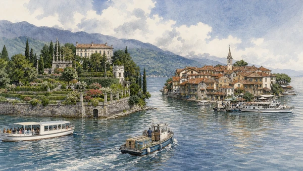
A Baroque palace and rising garden terraces occupy much of a formerly modest island settlement.

Isola Bella: palace and terraced garden as a controlled court landscape

A Baroque palace and rising garden terraces occupy much of a formerly modest island settlement. The site becomes clearer when its surviving fabric, later alterations and present use are read together.

Today

Opening, ticketing, room access and temporary displays can change. Check the institution’s official notice shortly before visiting, use the designated entrance and allow for security or conservation controls.

History

The Borromeo family transformed the island from the seventeenth century, employing architects, gardeners and service communities to create a dynastic residence and theatre of water views.

How to read this place

Begin with palace-to-garden sequence. Then compare terraces engineered above the lake with visitor route separated from remaining settlement; the differences are evidence, not visual noise.

What to notice

  • palace-to-garden sequence
  • terraces engineered above the lake
  • visitor route separated from remaining settlement
Terre Borromeo · Official visitor information
Original documentary watercolour of Isola Bella: palace and terraced garden as a controlled court landscape in Lake Maggiore, Lake Orta and the Sacri Monti · Piedmont, showing accurate architecture, landscape, people and present-day use
Isola Bella: palace and terraced garden as a controlled court landscapeOriginal Merlintravel documentary watercolour · 2026
04

A garden estate and an inhabited fishing settlement demonstrate why the Borromean Islands cannot be treated as one attraction.

Isola Madre and Isola dei Pescatori: two different island histories

A garden estate and an inhabited fishing settlement demonstrate why the Borromean Islands cannot be treated as one attraction. The site becomes clearer when its surviving fabric, later alterations and present use are read together.

Today

Weather, water levels, trail conditions and seasonal services can alter the route. Use official transport and park information, remain on authorised paths and do not enter farms, vineyards or private gardens without permission.

History

Isola Madre developed around elite residence and botanical collections, while Isola dei Pescatori retained dense housing and working community patterns later transformed by tourism.

How to read this place

Begin with garden island and village island compared. Then compare public lanes versus ticketed property with boat access and service deliveries; the differences are evidence, not visual noise.

What to notice

  • garden island and village island compared
  • public lanes versus ticketed property
  • boat access and service deliveries
Terre Borromeo · Official visitor information
Original documentary watercolour of Isola Madre and Isola dei Pescatori: two different island histories in Lake Maggiore, Lake Orta and the Sacri Monti · Piedmont, showing accurate architecture, landscape, people and present-day use
Isola Madre and Isola dei Pescatori: two different island historiesOriginal Merlintravel documentary watercolour · 2026
05

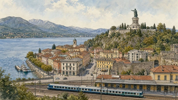
Fortress traces, civic streets, railway and the colossal San Carlo monument mark a strategic approach to Lake Maggiore.

Arona and the southern lake threshold

Fortress traces, civic streets, railway and the colossal San Carlo monument mark a strategic approach to Lake Maggiore. The site becomes clearer when its surviving fabric, later alterations and present use are read together.

Today

The area is inhabited and worked, not staged for visitors. Keep doorways, pavements, cycle lanes and deliveries clear, ask before photographing people and use current municipal mobility information.

History

Arona grew through lake trade and contested routes under Visconti and Borromeo influence; modern transport expanded its gateway role after fortification loss.

How to read this place

Begin with town relationship to lake and station. Then compare remaining rocca landscape with the san carlo monument in its hill setting; the differences are evidence, not visual noise.

What to notice

  • town relationship to lake and station
  • remaining Rocca landscape
  • the San Carlo monument in its hill setting
Distretto Turistico dei Laghi · Official site
Original documentary watercolour of Arona and the southern lake threshold in Lake Maggiore, Lake Orta and the Sacri Monti · Piedmont, showing accurate architecture, landscape, people and present-day use
Arona and the southern lake thresholdOriginal Merlintravel documentary watercolour · 2026
06

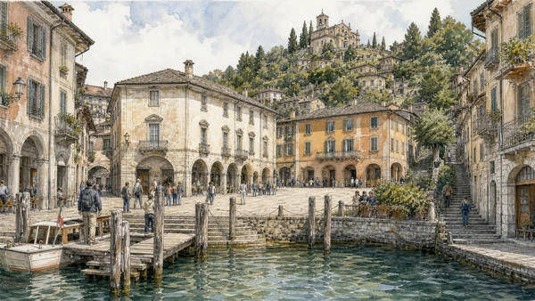
Piazza Motta, narrow lanes, civic buildings and boat landings form a small centre constrained by slope and water.

Orta San Giulio: an inhabited lakeside borough

Piazza Motta, narrow lanes, civic buildings and boat landings form a small centre constrained by slope and water. The site becomes clearer when its surviving fabric, later alterations and present use are read together.

Today

The area is inhabited and worked, not staged for visitors. Keep doorways, pavements, cycle lanes and deliveries clear, ask before photographing people and use current municipal mobility information.

History

Orta developed within the Riviera di San Giulio, a territory long linked to episcopal authority and lake exchange before modern tourism intensified pressure on public space.

How to read this place

Begin with landing-to-square circulation. Then compare civic façades and residential thresholds with steep routes toward the sacro monte; the differences are evidence, not visual noise.

What to notice

  • landing-to-square circulation
  • civic façades and residential thresholds
  • steep routes toward the Sacro Monte
Distretto Turistico dei Laghi · Official site
Original documentary watercolour of Orta San Giulio: an inhabited lakeside borough in Lake Maggiore, Lake Orta and the Sacri Monti · Piedmont, showing accurate architecture, landscape, people and present-day use
Orta San Giulio: an inhabited lakeside boroughOriginal Merlintravel documentary watercolour · 2026
07

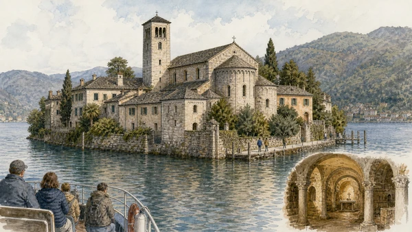
A Romanesque basilica and enclosed monastic presence dominate a small inhabited island reached by controlled boat service.

Isola San Giulio: basilica, monastery and settlement

A Romanesque basilica and enclosed monastic presence dominate a small inhabited island reached by controlled boat service. The site becomes clearer when its surviving fabric, later alterations and present use are read together.

Today

This is an active religious place as well as a historic building. Services, ceremonies and conservation can interrupt tourist access; dress appropriately, remain quiet and never treat a booked visit as priority over worship.

History

Religious traditions connect the island to Saint Julius; the present basilica developed through medieval campaigns while convent and domestic buildings changed over time.

How to read this place

Begin with basilica fabric and crypt. Then compare quiet route around the island with monastic boundaries respected as private; the differences are evidence, not visual noise.

What to notice

  • basilica fabric and crypt
  • quiet route around the island
  • monastic boundaries respected as private
Distretto Turistico dei Laghi · Official site
Original documentary watercolour of Isola San Giulio: basilica, monastery and settlement in Lake Maggiore, Lake Orta and the Sacri Monti · Piedmont, showing accurate architecture, landscape, people and present-day use
Isola San Giulio: basilica, monastery and settlementOriginal Merlintravel documentary watercolour · 2026
08

Chapels arranged through woodland stage episodes from the life of Saint Francis with sculpture, painting and architecture.

Sacro Monte di Orta: Franciscan narrative above the lake

Chapels arranged through woodland stage episodes from the life of Saint Francis with sculpture, painting and architecture. The site becomes clearer when its surviving fabric, later alterations and present use are read together.

Today

This is an active religious place as well as a historic building. Services, ceremonies and conservation can interrupt tourist access; dress appropriately, remain quiet and never treat a booked visit as priority over worship.

History

The complex began at the end of the sixteenth century and developed across later campaigns, forming one component of the UNESCO Sacri Monti property.

How to read this place

Begin with chapel sequence and changing styles. Then compare figures viewed within controlled interiors with lake panorama as part of the devotional route; the differences are evidence, not visual noise.

What to notice

  • chapel sequence and changing styles
  • figures viewed within controlled interiors
  • lake panorama as part of the devotional route
Ente di gestione dei Sacri Monti · Official site
Original documentary watercolour of Sacro Monte di Orta: Franciscan narrative above the lake in Lake Maggiore, Lake Orta and the Sacri Monti · Piedmont, showing accurate architecture, landscape, people and present-day use
Sacro Monte di Orta: Franciscan narrative above the lakeOriginal Merlintravel documentary watercolour · 2026
09

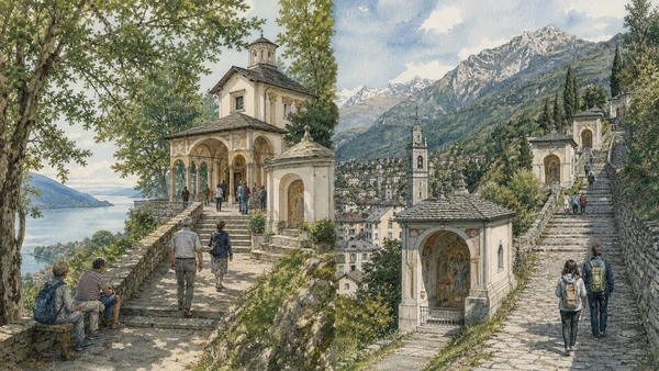
A compact Trinitarian complex above Maggiore differs from Domodossola’s Calvary route between town and Alpine valley.

Ghiffa and Domodossola: two Sacri Monti, two landscapes

A compact Trinitarian complex above Maggiore differs from Domodossola’s Calvary route between town and Alpine valley. The site becomes clearer when its surviving fabric, later alterations and present use are read together.

Today

This is an active religious place as well as a historic building. Services, ceremonies and conservation can interrupt tourist access; dress appropriately, remain quiet and never treat a booked visit as priority over worship.

History

Both sites developed in early modern Catholic devotional culture but use different topography, iconography and relationships to settlement.

How to read this place

Begin with ghiffa’s woodland terrace. Then compare domodossola’s ascending stations with active sanctuary use at each site; the differences are evidence, not visual noise.

What to notice

  • Ghiffa’s woodland terrace
  • Domodossola’s ascending stations
  • active sanctuary use at each site
UNESCO · Sacri Monti of Piedmont and Lombardy
Original documentary watercolour of Ghiffa and Domodossola: two Sacri Monti, two landscapes in Lake Maggiore, Lake Orta and the Sacri Monti · Piedmont, showing accurate architecture, landscape, people and present-day use
Ghiffa and Domodossola: two Sacri Monti, two landscapesOriginal Merlintravel documentary watercolour · 2026
10

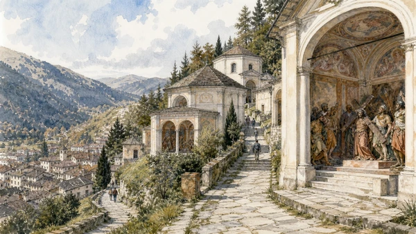
Dozens of chapels combine life-sized sculpture, painting and architecture across a wooded route above the town.

Varallo’s Sacro Monte: a New Jerusalem in Valsesia

Dozens of chapels combine life-sized sculpture, painting and architecture across a wooded route above the town. The site becomes clearer when its surviving fabric, later alterations and present use are read together.

Today

This is an active religious place as well as a historic building. Services, ceremonies and conservation can interrupt tourist access; dress appropriately, remain quiet and never treat a booked visit as priority over worship.

History

Work began around the end of the fifteenth century and expanded for centuries, becoming the earliest and most extensive of the Sacri Monti while remaining a place of pilgrimage.

How to read this place

Begin with urban-like arrangement of chapels. Then compare sculpture and painted space acting together with route topography from varallo to sanctuary; the differences are evidence, not visual noise.

What to notice

  • urban-like arrangement of chapels
  • sculpture and painted space acting together
  • route topography from Varallo to sanctuary
Ente di gestione dei Sacri Monti · Official site
Original documentary watercolour of Varallo's Sacro Monte: a New Jerusalem in Valsesia in Lake Maggiore, Lake Orta and the Sacri Monti · Piedmont, showing accurate architecture, landscape, people and present-day use
Varallo’s Sacro Monte: a New Jerusalem in ValsesiaOriginal Merlintravel documentary watercolour · 2026

Piedmont through time

A short chronology

From pre-Roman routes and Roman towns to communes, marquisates, Savoy government, industrialisation, heritage protection and climate-sensitive access.

  1. Alpine, lake, hill and plain communities leave settlements, tools, rock art and long-lived route systems.

  2. Ligurians, Celts, Salassi and other communities organise territories later drawn into Roman expansion.

  3. Roman colonies, municipia and roads connect the Po plain to Alpine passes and Ligurian approaches.

  4. Cities, farms, river transport and mountain routes integrate the region into imperial networks.

  5. Christian institutions, Lombard and Frankish powers, monasteries and fortified sites reshape late-Roman territories.

  6. Communes, bishoprics and marquisates develop distinct cities, markets, castles and religious landscapes.

  7. Savoy, Monferrato, Saluzzo, Milanese and local powers contest routes while towns expand civic institutions.

  8. The transfer of the Savoy capital to Turin accelerates centralisation, court construction and territorial administration.

  9. Baroque residences, sanctuaries, planned roads and fortified frontiers reorganise cities and countryside.

  10. French and Napoleonic rule suppresses institutions, reforms government and changes military and transport systems.

  11. Constitutional politics and wars led from Piedmont-Sardinia contribute decisively to Italian unification.

  12. Railways, canals, factories, wine markets and Alpine tourism connect previously separated economies.

  13. World wars, Fascism, resistance and civilian loss leave difficult evidence across towns, hills and valleys.

  14. Industrial expansion, migration, mechanised agriculture and mass tourism transform cities and working landscapes.

  15. Deindustrialisation, heritage recognition, rural reinvestment and climate pressure repeatedly alter access and identity.

Before your visit

Practical information

01

Check the live page

Opening hours, reservation systems, restoration, exhibitions and transport can change. Recheck the linked official institution shortly before departure.

02

Separate worship and tourism

Churches and sanctuaries remain religious spaces. Services, funerals and community use take priority over visitor itineraries.

03

Plan real distances

Lake Maggiore, Lake Orta and the Sacri Monti · Piedmont combines dense urban routes with lakes, valleys and dispersed towns. Do not compress distant chapters into an unsafe or superficial day.

04

Keep thresholds open

Arcades, station halls, markets, courtyards, workshops and residential streets must continue to function while you observe or photograph them.

05

Use current mobility data

Check the responsible rail, navigation, bus, road or park operator on the day; replacement services and weather can change an otherwise sound route.

06

Read change honestly

Restoration, reconstruction, adaptive reuse and new development have all shaped the landscape visible today.

Method and sources

Sources and image credits

This guide uses official museum, ministry, municipal, transport, park and UNESCO documentation checked on 29 August 2026. It separates durable historical interpretation from access details that can change, distinguishes surviving fabric from restoration or reconstruction, and treats worship, work, residence and public movement as part of the evidence. Every chapter links its principal institutional source; tickets, closures, weather and transport must always be verified again on the day of the visit.

All ten images are original Merlintravel editorial watercolours based on documented present-day conditions. They are illustrations, not substitutes for archaeological plans. Opening hours, tickets, accessible routes, temporary exhibitions and conservation work can change; consult the linked official pages shortly before visiting.