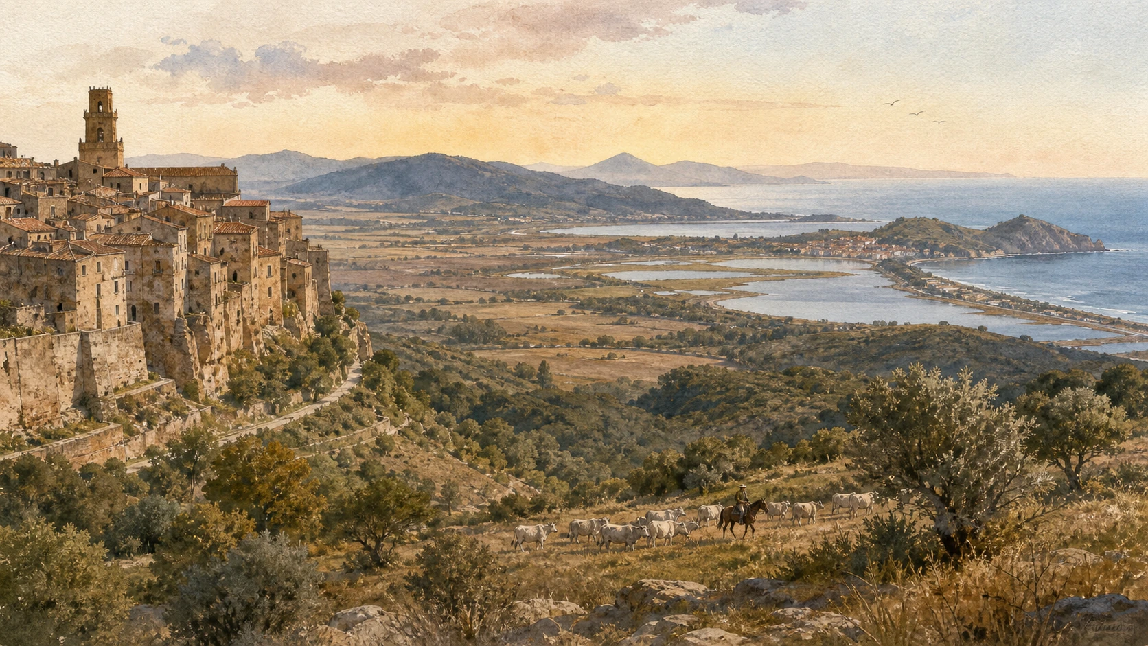
Original documentary watercolour panorama joining a Maremma tuff town, cattle pasture, wetland, lagoon and Tyrrhenian coast

Tuscany Guide 06 · Rock cities, reclaimed plains, pastoral work, protected coast and mineral hills

Maremma:
Land Made and Remade

A documented route from the volcanic tuff towns of the inland to Roselle and Grosseto, then through coastal park, wetland, pasture, thermal water, lagoon settlements and the industrial archaeology of the Metalliferous Hills.

Plan the route
Pitigliano to Massa Marittima · southern and northern Maremma10 chapters · four or five days

Why wild is the wrong shorthand

Maremma is not Tuscany left wild: its celebrated openness was produced by geology, Etruscan excavation, grazing, malaria, hydraulic engineering, mining, farming, war, conservation and coastal work.

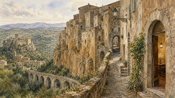
The southern tuff plateau carries three different centres. Pitigliano is a dense town rising from volcanic rock and preserves an unusually visible Jewish history. Sovana joins a small medieval street plan to a major Etruscan necropolis. Sorano occupies a defensive ridge with rock-cut spaces and an Orsini fortress. The Vie Cave tie settlements and burial landscapes together, but their exact ancient functions remain debated; mystery should not be converted into certainty.

Farther west, Roselle shows the movement from Etruscan city to Roman colony across walls, forum, baths and amphitheatre. Grosseto became the civic centre of a plain altered by the contraction of Lake Prile and centuries of drainage. The Maremma Regional Park and Diaccia Botrona are therefore not pieces of untouched coast: both contain historic towers, abbey remains, grazing, water-control structures and active conservation alongside habitats.

The buttero belongs to skilled livestock work, not an imported cowboy fantasy. Saturnia’s thermal water is a geological resource shared by a free outdoor cascade and commercial spa facilities with different rules. Orbetello and Argentario join lagoon ecology, fishing, causeways, ports and Spanish fortifications. In the north, mining and geothermal landscapes made wealth, danger and industrial communities before being re-read through a national park and UNESCO Global Geopark.

Use a vehicle for the full territory, but slow the journey into coherent clusters: two tuff days, one Grosseto–Roselle day, one coastal ecology day and a separate northern mining day. Confirm every park, archaeological and thermal access shortly before travel.

The route

Plan your visit

Distances are moderate on a map but roads, timed sites, heat and ecological access make Maremma a multi-day territory. The route protects depth by grouping places that genuinely belong together.

Days one and two

Tuff towns and thermal water

Base around Pitigliano or Sorano; divide town interiors, Sovana necropolis and one safe Via Cava walk, then use Saturnia as a separate early or late stop.

Day three

Roselle before Grosseto

Read the archaeological hills before the modern capital so walls, water and the transfer of civic weight become visible.

Day four

Choose one coastal ecosystem

Pair the Maremma Park with Alberese, or Diaccia Botrona with Castiglione; add Orbetello only if light, access and driving time remain humane.

Day five

Mineral Maremma

Give the Metalliferous Hills their own day: one booked mining gateway, Massa Marittima and, if conditions permit, a geothermal landscape.

Ten chapters

Explore the places

The guide crosses Maremma from Pitigliano, Sovana and Sorano to Roselle and Grosseto, then reads coastal parks, wetlands, pastoral work, thermal water, lagoon settlements and mining landscapes as one connected but never uniform territory.

  1. 01Pitigliano, Sovana and Sorano: read the plateau in the plural
  2. 02Vie Cave and Sovana necropolis: evidence before mystery
  3. 03Roselle: an ancient city above a changing water landscape
  4. 04Grosseto: the working capital inside and beyond the walls
  5. 05Maremma Regional Park: protected does not mean untouched
  6. 06Diaccia Botrona: marsh, machine and conservation
  7. 07Butteri and cattle: labour before performance
  8. 08Saturnia: thermal geology, free access and shared limits
  9. 09Orbetello and Argentario: engineered water, fortified sea
  10. 10Metalliferous Hills: geology, extraction and recovery
01

Three centres share volcanic rock but not one identity: Pitigliano is a living cliff town, Sovana a small medieval and Etruscan node, Sorano a fortified rock settlement

Pitigliano, Sovana and Sorano: read the plateau in the plural

The tuff towns make sense as a network of water, roads, burial grounds, lordship and refuge rather than three interchangeable viewpoints.

Today

Pitigliano’s central lanes are steep, narrow and residential. The historic Jewish quarter, synagogue and museum follow managed access; quiet conduct matters because memory, worship and local life overlap. Sovana’s village and archaeological park are separated by road and require distinct time. Sorano combines an inhabited centre, fortress and paths with uneven surfaces. Parking outside cores and walking in is usually the least disruptive approach.

History

Etruscan settlement and burial activity preceded Roman rule across the volcanic plateau. Medieval Aldobrandeschi power shaped strongholds; Pitigliano and Sorano later passed to the Orsini before Medici control. A Jewish community settled in Pitigliano from the fifteenth century and developed religious, domestic and food spaces within the town. Sovana preserved its cathedral and compact street while the surrounding necropolis retained monumental rock-cut tombs, including the temple-form Ildebranda Tomb.

How to read this place

Compare houses built into the cliff with excavated cellars and drainage. In Pitigliano, keep the Jewish quarter within the town’s wider political history rather than treating it as a picturesque annex. At Sovana, separate the medieval piazza from the Etruscan burial zone. At Sorano, look for how fortress, gates, ravines and rock rooms organise defence and daily movement.

What to notice

  • Vertical continuities between bedrock, cellars and houses
  • Distinct civic, religious and archaeological spaces
  • Resident routes that continue through monumental fabric
Visit Tuscany · Pitigliano
Original documentary watercolour of Pitigliano on its tuff cliff with Sovana and Sorano set in the surrounding plateau
Pitigliano, Sovana and Sorano: read the plateau in the pluralOriginal Merlintravel documentary watercolour · 2026
02

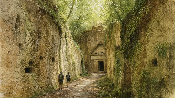
Some rock-cut corridors run for more than a kilometre and rise between walls over twenty metres high, yet their ancient use cannot be reduced to a single ritual explanation

Vie Cave and Sovana necropolis: evidence before mystery

The excavated routes connect geology, movement and funerary landscapes; uncertainty about their original functions is part of the archaeology, not a gap to fill with legend.

Today

Choose an officially indicated route and check weather, closures and ground conditions. Tuff becomes slippery when wet, leaf cover can conceal uneven steps and mobile reception is not a safety system. Do not enter closed tombs, climb cut faces or leave the path. A short well-read route such as San Sebastiano or Cavone is more responsible than collecting every trench in heat or fading light.

History

The Etruscans cut roads, drainage and approaches through the volcanic plateau around Sovana, Sorano and Pitigliano. Monumental tombs were carved into cliff and slope, with the Hellenistic Ildebranda Tomb presenting a temple-like facade. Reuse over centuries deepened or altered some routes. Their functions likely included practical connection and water management; claims of a single sacred system remain interpretations rather than settled fact.

How to read this place

Observe tool marks, changing floor levels, side channels and the relationship between route and tomb entrance. Vegetation and later use can make a corridor feel primordial, but both rock face and walking surface are historical products. Read reconstruction panels at the necropolis, then return to the surviving cut stone rather than imagining missing architecture as intact.

What to notice

  • Drainage lines and later deepening
  • Tomb facades carved rather than assembled
  • Light, moisture and vegetation changing the route
Visit Tuscany · Vie Cave
Original documentary watercolour of hikers inside a deep Etruscan Via Cava approaching a rock-cut tomb near Sovana
Vie Cave and Sovana necropolis: evidence before mysteryOriginal Merlintravel documentary watercolour · 2026
03

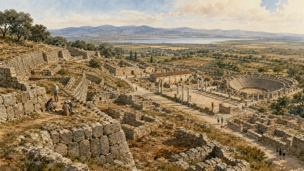
Two hills preserve Etruscan stonework, a Roman forum, baths, houses and an amphitheatre above a plain once connected to Lake Prile

Roselle: an ancient city above a changing water landscape

Roselle’s importance came from routes between inland valleys, the Ombrone and the coast; its ruins record transition rather than a frozen Etruscan moment.

Today

The archaeological circuit is roughly two kilometres and exposed to sun, wind and weather closures. As checked for the 2026 season, state information lists daily opening with different summer and winter times, optional booking and closure in severe weather alerts; verify again before leaving. Carry water and use the supplied multilingual material. Surfaces are archaeological ground, not an urban pavement.

History

Roselle grew as an Etruscan city overlooking Lake Prile and inland trade corridors. Its massive polygonal circuit remains the clearest early layer. Rome conquered the city in 294 BCE; public buildings, baths, houses and amphitheatre reshaped the hills. By the medieval period environmental change, insecurity and altered settlement patterns reduced the centre. The episcopal seat moved to Grosseto in 1138, marking a civic shift rather than one sudden abandonment date.

How to read this place

Begin with the walls to understand the scale of the Etruscan city. At the forum distinguish reused foundations from Roman planning. Look outward: the present dry and cultivated plain makes little sense without reconstructing water and siltation. The amphitheatre is one component, not the site’s only destination.

What to notice

  • Polygonal wall blocks and later masonry
  • Forum, baths and domestic quarters on different levels
  • Views across the former Lake Prile basin
Italian Ministry of Culture · Roselle Archaeological Park
Original documentary watercolour of Roselle's Etruscan walls, Roman forum and amphitheatre above the Maremma plain
Roselle: an ancient city above a changing water landscapeOriginal Merlintravel documentary watercolour · 2026
04

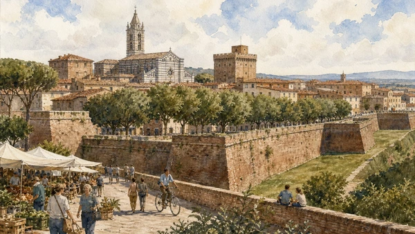
The hexagonal ramparts enclose cathedral, Cassero and civic streets, but the capital’s real history extends into rail, reclamation, agriculture and services

Grosseto: the working capital inside and beyond the walls

Grosseto should be read as the city that absorbed regional functions from Roselle and reorganised life on an engineered plain, not merely as a lunch stop behind bastions.

Today

The rampart walk gives orientation without demanding a ticket and remains part of everyday movement. Pair it with the Archaeology and Art Museum when open, then use the centre’s market, cafés and transport rather than staging it as empty heritage. Cyclists and residents share the bastions. The cathedral and churches retain worship functions; opening is not guaranteed by a tourism listing.

History

Grosseto expanded as Roselle declined and became the episcopal seat in 1138. Sienese and then Medici government shaped the city; the six-sided fortified circuit was rebuilt in the late sixteenth century and later opened as public promenades. Drainage campaigns, especially under the Lorraine state and in the nineteenth and twentieth centuries, transformed the surrounding plain. Rail, farming administration and provincial institutions made modern Grosseto a service centre for a large territory.

How to read this place

Walk the wall geometry, then descend into ordinary streets to see the difference between defensive perimeter and civic fabric. Compare the Cassero’s military mass with the cathedral square and twentieth-century buildings outside the walls. Museum collections reconnect objects to Roselle, Vetulonia and the wider Maremma instead of making the capital the beginning of local history.

What to notice

  • Bastions adapted from defence to promenade
  • Medieval core within a later military geometry
  • Modern city extending decisively beyond the walls
Visit Tuscany · Grosseto
Original documentary watercolour of Grosseto's ramparts, cathedral, Cassero, market and contemporary civic life
Grosseto: the working capital inside and beyond the wallsOriginal Merlintravel documentary watercolour · 2026
05

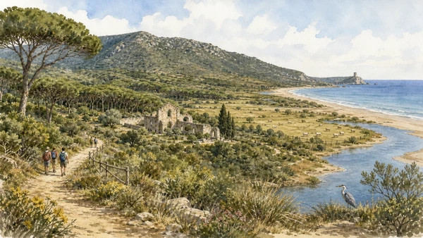
Nine thousand hectares join twenty-five kilometres of coast, Uccellina hills, Ombrone mouth, pinewoods, pasture, towers and the remains of San Rabano

Maremma Regional Park: protected does not mean untouched

The park preserves ecological mosaics and the marks of monks, watch systems, forestry, herding and farming; human history is inside the habitat, not opposite it.

Today

Access is regulated through visitor centres and route conditions that change with season, heat, fire risk, wildlife and conservation. Some itineraries start from Alberese, others from Talamone or Collecchio; do not assume one ticket or parking point covers every trail. The Ombrone route is different from the long Uccellina crossings. Reserve required excursions and carry water, sun protection and a real return-time margin.

History

The coast accumulated watchtowers, religious settlement and agricultural estates across centuries. San Rabano abbey occupies a strategic Uccellina position, while towers monitored maritime approaches. Pinewoods, pasture and drainage shaped the lowlands. The Regional Park was established in 1975, protecting a territory where Mediterranean scrub, river mouth, dunes, cultivated fields and grazing still interact rather than excluding every productive use.

How to read this place

From a hill route, trace forest, pasture, river and sea as connected systems. At San Rabano separate surviving medieval masonry from romantic ruin. Near the Ombrone, observe sediment and water movement rather than treating the river mouth as a stable postcard. Animals need distance; a sighting is not permission to approach.

What to notice

  • Historic towers embedded in coastal ecology
  • Pasture and cultivated land within the protected mosaic
  • River-mouth change visible in sand and vegetation
Visit Tuscany · Maremma Regional Park
Original documentary watercolour of Uccellina hills, San Rabano, the Ombrone mouth, pasture and protected Maremma coast
Maremma Regional Park: protected does not mean untouchedOriginal Merlintravel documentary watercolour · 2026
06

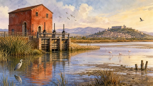
A wetland of international importance survives beside a hydraulic building commissioned in 1765 to regulate a landscape repeatedly targeted for reclamation

Diaccia Botrona: marsh, machine and conservation

Casa Rossa Ximenes makes water engineering visible at the edge of a living wetland where bird habitat and human intervention cannot be separated into simple opposites.

Today

Use the Casa Rossa visitor point and designated tracks or hides; seasonal water levels and bird cycles change what is visible. As checked in August 2026, the museum publishes summer and winter schedules but closes on specified weekdays and can alter access for maintenance or events. Bring binoculars rather than moving closer. Dogs, drones, noise and leaving the path can disrupt nesting and feeding.

History

Diaccia Botrona is a remnant of the wider Lake Prile and marsh system. In 1765 Leonardo Ximenes designed the red hydraulic building and sluices under Grand Duke Pietro Leopoldo, part of a longer effort to manage water and health. Later reclamation reduced wetlands across the plain. Protection reversed the assumption that every marsh was wasted land, while the surviving mechanisms now explain how government, engineering and ecology met at one controlled channel.

How to read this place

Look at sluice gates before scanning the reedbeds: water level is a managed ecological variable. Compare open water, mudflat and reed zones, then locate Castiglione’s hill settlement on the edge. Flamingos may be conspicuous, but smaller waders, seasonal migrants and hydrological evidence tell the fuller story.

What to notice

  • Historic sluices retained inside a conservation landscape
  • Different water depths supporting different birds
  • The medieval town occupying firmer ground beyond the marsh
Diaccia Botrona Nature Reserve · official visitor site
Original documentary watercolour of Casa Rossa Ximenes, sluices, reeds and waterbirds in the Diaccia Botrona reserve
Diaccia Botrona: marsh, machine and conservationOriginal Merlintravel documentary watercolour · 2026
07

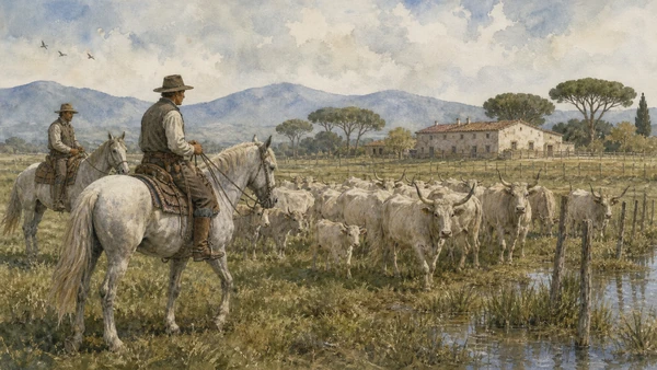
Mounted herders and Maremmana cattle belong to a demanding system of extensive livestock work adapted to wet ground, heat and open pasture

Butteri and cattle: labour before performance

The buttero is a professional and historical figure of Maremma husbandry; public demonstrations can interpret skill but should not replace the conditions of everyday animal work.

Today

Choose farms, park programmes or events that explain breeding, welfare and land management rather than advertising a generic cowboy show. Never enter a herd, feed cattle or stop on a road verge for photographs. Maremmana horns require distance even when animals appear calm. Ask before photographing workers. Products and restaurant narratives are not proof that animals were raised in the landscape being described.

History

Maremmana cattle developed as a robust breed suited to extensive grazing in difficult coastal and marsh environments. Butteri managed herds on horseback across estates and open pasture, combining animal knowledge with long daily labour. Reclamation, mechanisation and specialised breeds reduced the old system. Conservation programmes, breeding associations and selected farms now maintain both genetic stock and skills, while tourism has also turned the buttero into a public image.

How to read this place

Watch spacing rather than spectacle: rider position, herd movement, gates, water and fencing reveal the work. Long horns are functional anatomy, not costume. Distinguish a rehearsed demonstration from routine handling, then ask how grazing affects habitat, fire risk and farm economics.

What to notice

  • Rider position controlling movement without chasing
  • Water, shade and fencing as working infrastructure
  • Differences between mixed herd, breeding stock and staged event
Visit Tuscany · Maremmana cattle
Original documentary watercolour of two butteri guiding Maremmana cattle across working pasture near Alberese
Butteri and cattle: labour before performanceOriginal Merlintravel documentary watercolour · 2026
08

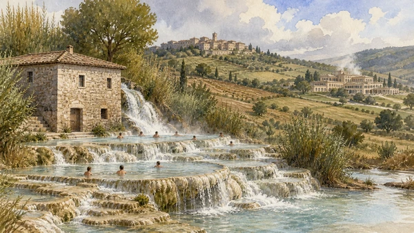
Sulphurous water emerges near Saturnia at about 37.5 degrees Celsius, then enters both an open cascade landscape and managed commercial bathing systems

Saturnia: thermal geology, free access and shared limits

Cascate del Mulino is not the spa and neither is an unlimited private bath; geology, access, hygiene, crowding and downstream water connect every visit.

Today

The outdoor cascades are generally freely accessible, without changing rooms, controlled capacity or the services of a spa. Conditions can change after weather and at peak periods; parking legality, slippery travertine and safeguarding belongings remain the visitor’s responsibility. Avoid soaps, glass and litter. The formal thermal resort follows separate admission and reservation rules. Neither setting guarantees medical benefit.

History

Thermal water has shaped settlement and travel around Saturnia since antiquity, though later legends should not substitute for archaeological evidence. The present cascade passes an old mill and deposits minerals across stepped pools. Modern road access and social media transformed a local open-water place into an international destination, increasing pressure on banks, parking and sanitation while commercial thermal facilities developed their own controlled experience nearby.

How to read this place

Observe mineral deposition and water flow before entering. Distinguish naturally warm spring water from constructed pool edges and maintained channels. The mill gives the place a working history beyond bathing. Visit at a quiet hour, keep the stay proportionate and leave no material in the water.

What to notice

  • Travertine built continuously by mineral deposition
  • Old mill and channels organising the cascade
  • Clear difference between open site and commercial spa
Visit Tuscany · Saturnia
Original documentary watercolour of Saturnia's mineral cascade, old mill, bathers and distant managed spa landscape
Saturnia: thermal geology, free access and shared limitsOriginal Merlintravel documentary watercolour · 2026
09

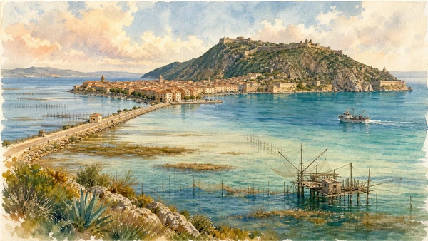
Lagoon, causeways, fishing structures, ports and Spanish fortifications bind Orbetello to a rocky former island rather than to one continuous beach resort

Orbetello and Argentario: engineered water, fortified sea

The lagoon and promontory form a maritime system where protected habitat, fishing, defence, transport and seasonal tourism compete for a narrow physical space.

Today

Walk Orbetello and one port town rather than driving every panoramic road. Lagoon viewpoints and protected areas require distance from birds and working fishing structures. Porto Ercole’s forts, Porto Santo Stefano’s port and Orbetello’s museums follow different access patterns; exterior visibility is not public entry. Ferries use Porto Santo Stefano, but island schedules belong to the separate archipelago guide.

History

Orbetello occupies a narrow peninsula between lagoon basins. A causeway completed in 1841 connected it directly to Monte Argentario, adding to the natural tomboli that bind promontory and mainland. From 1557 the State of the Presidi placed the coast within a Spanish-controlled defensive system, leaving powerful forts around Porto Ercole and Porto Santo Stefano. Fishing and port work continued beside military and later tourism functions.

How to read this place

From Orbetello, compare the geometry of embankment and town with shifting shallow water. Fishing barriers and boats are working equipment, not abandoned folklore. On Argentario, read forts as a network controlling bays and sea routes. Rocky vegetation and scarce flat land explain why roads, ports and settlement concentrate so sharply.

What to notice

  • Causeway cutting across the lagoon system
  • Fishing structures positioned in shallow water
  • Spanish forts controlling separate coves and approaches
Visit Tuscany · Orbetello
Original documentary watercolour of Orbetello lagoon, causeway, fishing structures, Monte Argentario and Porto Ercole forts
Orbetello and Argentario: engineered water, fortified seaOriginal Merlintravel documentary watercolour · 2026
10

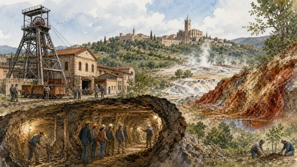
The national park and UNESCO Global Geopark connect thirty-four mining sites, forty-one geosites, geothermal fields, historic towns and post-industrial landscapes

Metalliferous Hills: geology, extraction and recovery

Northern Maremma’s mineral wealth financed communities and exposed workers and environments to risk; the preserved landscape must hold labour history beside geodiversity and tourism.

Today

Select one official gateway—such as Gavorrano, Massa Marittima or Follonica—and book underground or technical visits where required. Never enter unmarked adits, spoil heaps or geothermal ground. At the Biancane, remain on paths: steam and pale mineral crust signal active heat, not a safe surface. Museum interpretation, town architecture and industrial structures together make a fuller day than a mine photograph alone.

History

Minerals were extracted in the Metalliferous Hills from ancient periods through modern industrial mining. Copper, silver, pyrite and iron-related production shaped Massa Marittima, Gavorrano, Follonica and neighbouring communities. Mine closure left buildings, shafts, contaminated or unstable ground and strong worker memory. The national park was established in 2002 and entered the UNESCO Global Geoparks network in 2010; its territory expanded in 2022 to include additional geothermal areas.

How to read this place

Begin with geology, then machinery and labour. A headframe explains vertical access; rail and ore-handling structures reveal the production chain. In Massa Marittima, relate civic and sacred wealth to mineral territory without claiming every artwork was paid directly by one mine. At recovered sites, distinguish conservation, remediation and natural regrowth.

What to notice

  • Headframes, rails and processing buildings as one system
  • Mineral colour and geothermal activity without leaving paths
  • Town institutions connected to, but not reducible to, extraction
Tuscan Mining UNESCO Global Geopark · official site
Original documentary watercolour of a Gavorrano mine, guided gallery, mineral outcrops, geothermal steam and Massa Marittima
Metalliferous Hills: geology, extraction and recoveryOriginal Merlintravel documentary watercolour · 2026

Maremma through settlement, water, labour and protection

A short chronology

From Etruscan rock cities and Roman Roselle to medieval lordships, Spanish forts, Lorraine water engineering, modern reclamation, protected parks and the UNESCO mining geopark.

  1. Roselle develops as a major Etruscan city overlooking routes between interior, Ombrone and Lake Prile.

  2. Monumental tombs and rock-cut routes shape the burial landscapes around Sovana and the tuff plateau.

  3. Rome conquers Roselle; later public and domestic construction transform the two-hill city.

  4. Pitigliano and other tuff settlements appear in medieval documentary and lordship networks.

  5. The episcopal seat moves from Roselle to Grosseto, marking the latter’s growing civic importance.

  6. Orsini power expands in southern Maremma through marriage and inheritance from the Aldobrandeschi.

  7. A Jewish community becomes established in Pitigliano and develops enduring religious and domestic spaces.

  8. Medici victory over Siena brings much of Maremma into the Florentine territorial state.

  9. The State of the Presidi creates a Spanish-controlled defensive system around Orbetello and Argentario.

  10. Grosseto’s medieval defences are rebuilt as a six-sided bastioned circuit.

  11. Leonardo Ximenes constructs the hydraulic building now known as Casa Rossa beside the marsh.

  12. The artificial causeway directly connects Orbetello to Monte Argentario across the lagoon.

  13. The Maremma Regional Park is established across coast, hills, river mouth, pasture and historic sites.

  14. The Metalliferous Hills park is established to connect mining heritage, geology, nature and communities.

  15. The mining territory joins the UNESCO Global Geoparks network, then expands to additional geothermal municipalities.

Before your visit

Practical information

01

Cluster the territory

Treat the tuff plateau, Grosseto–Roselle, central coast and mining north as separate days; road kilometres understate walking and access time.

02

Check weather twice

Heat, rain, wind, fire risk and official alerts can close archaeological areas, park routes, caves and coastal paths even after a plan is made.

03

Respect open water

Free access at Saturnia and lagoon viewpoints does not provide lifeguards, storage, sanitation or unlimited ecological capacity.

04

Book skilled access

Underground mines, some park routes, museums, forts and guided nature experiences require times or reservations that cannot be inferred from exterior access.

05

Keep distance from work and wildlife

Herds, butteri, fishermen, farms and nesting birds are not scenery arranged for photographs; use paths and ask before approaching people.

06

Carry a low-impact kit

Water, sun protection, grippy footwear, binoculars, offline directions and a bag for every item you bring reduce both risk and pressure.

Method and sources

Sources and image credits

This guide uses current official material from the Italian Ministry of Culture, Visit Tuscany, Maremma protected-area and visitor authorities, and the Tuscan Mining UNESCO Global Geopark checked on 28 August 2026. It distinguishes volcanic tuff from generic stone; three towns from one visual brand; documented Jewish history from picturesque shorthand; archaeological route from unproven ritual certainty; Etruscan Roselle from its Roman transformation; former lake from present plain; city wall from whole modern city; protected landscape from untouched wilderness; conservation from exclusion of all work; buttero labour from staged cowboy imagery; free thermal cascade from managed spa; historic water engineering from ecological damage or benefit assumed in advance; lagoon fishery from folklore; fort visibility from public entry; mine heritage from safe access; remediation from simple abandonment; and seasonal official information from a guarantee of future opening.

All ten images are original Merlintravel editorial watercolours based on documented present-day conditions. They are illustrations, not substitutes for archaeological plans. Opening hours, tickets, accessible routes, temporary exhibitions and conservation work can change; consult the linked official pages shortly before visiting.